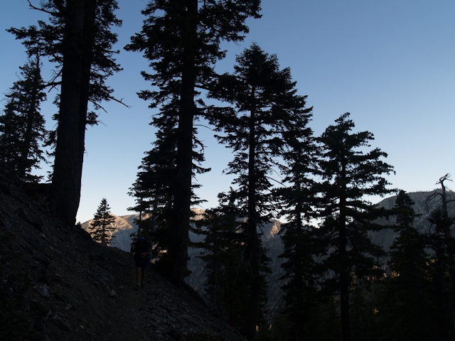
We backpacked a section of the Pacific Crest Trail from I-15 to Wrightwood in the San Gabriel Mountains
Click on the PHOTO to read the complete Trip Report
Mostly True Stories of My Hiking Trips, a PhotoJournal
We backpacked a section of the Pacific Crest Trail from I-15 to Wrightwood in the San Gabriel Mountains
Click on the PHOTO to read the complete Trip Report
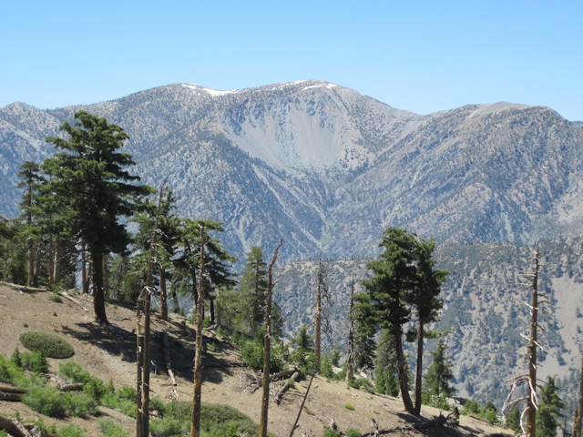
My son and I joined up with members of the San Gabriel Mountains Discussion Forum for a fun day-hike to the 10064-foot summit of Mount Baldy (aka Mount San Antonio) via the Devils Backbone Trail. We were lazy and took the ski lift up to Baldy Notch, then climbed the remaining 2300 feet to the summit. So we weren’t utterly lazy. Not content with bagging only one peak, my son and I headed off for a quick visit to West Baldy, topping out at 9988 feet. After rejoining our partners on Baldy, we headed back down the way we’d come, with the exception of taking a side trip to bag a third peak, Mount Harwood. My son was feeling rather stoked as we headed into the Top of the Notch restaurant, where we ate our well-deserved burgers and beer. With full bellies, there was no complaining when we took the ski lift back down to the cars. All in all, it had been a great day on the mountain!

Click on the photo to read the complete Trip Report
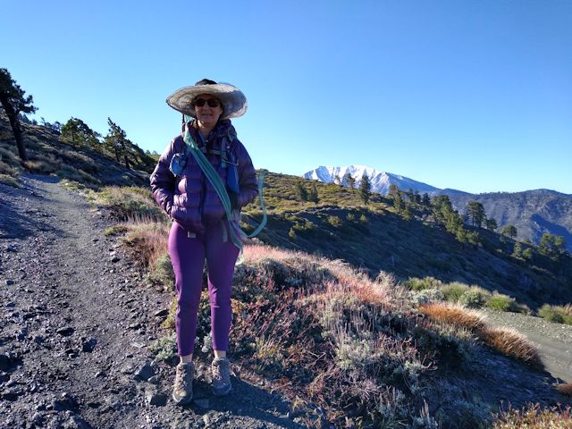
For our first summer hike this year we decided to visit the San Gabriel Mountains. Of course, there wasn’t much water flowing in the Southern California Wilderness after two years of drought, so our choices were limited. Unless we carried our own water. But that is also limiting, as water is heavy. Still, it seemed like an idea worth trying.
So we stared at some maps. Two years ago, we camped near Little Jimmy Spring and attempted to day-hike to Mount Baden-Powell. We got a late start and never made it the whole way to the summit, and that defeat was still bothering me. So we thought to rectify it this year. We considered camping at Little Jimmy yet again, as it always has water, but what we really wanted was peace and quiet and solitude, and Little Jimmy doesn’t have those qualities in abundance, at least not on a summer weekend.
So I stared at the map, and noticed that there was a trail from Dawson Saddle to the PCT. Maybe we could camp there. It’s much closer to Baden-Powell. True, we’d have to carry our own water, but maybe it would be worth it. Looking on Google Earth, it appeared that the ridge just above the trail about a mile from the saddle had a broad flat area on top. Zooming in, it looked like a certain-sure camping spot. Carrying two gallons of water is never fun, but only carrying them a mile seemed eminently do-able. So that’s what we did.

Click on the photo to read the complete Trip Report
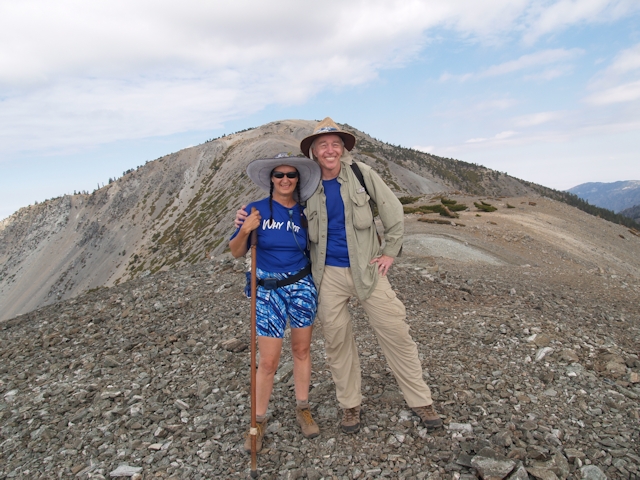
TR: Mount Baldy via the Ski Hut Trail
Vicki and I spent two nights and three days in the Mount Baldy Area in late July 2013. Our goal was to become acclimated to high elevation preparatory to our trip (two days later) to northern Yosemite. Climbing a ten thousand foot mountain and enjoying the beauty of the Angeles National Forest were added perks.
However, let me admit right now that climbing Mount Baldy was NOT our first choice. Our original plan was to spend two nights at ten thousand feet in the San Jacinto Wilderness, but the Mountain Fire was burning full blast in that area and the park rangers had called to let us know that the park was closed and our permit was cancelled. Bummer! Some quick thinking led us to consider the Mount Baldy area: First, we’d never climbed Baldy before, which was a serious omission as it was one of the major peaks in Southern California. And second, we’d be able to get at least partially acclimated by camping above eight thousand feet. It wasn’t as good as sleeping at 10k, but it would have to do.
Yes, it’s true: We were Baldy Virgins. And, like many happily de-flowered virgins, the only thing we can say (afterward) is “Why did we wait so long? It was great!”
Click on the photo to read the complete Trip Report
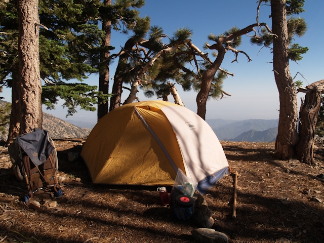
Continuing this year’s PCT hiking theme, Vicki and I decided to hike another section, but a section far removed from the others. This one was up north of Los Angeles, in the Angeles National Forest and Sheep Mountain Wilderness.
Water, particularly in this extra-dry year of 2013, was one of the main factors in determining where to hike. And the Little Jimmy Campground, with the always-flowing Little Jimmy Spring, fit the bill perfectly. It was a short, easy hike into camp from Angeles Crest Highway (Hwy 2), a mere two miles and 700 feet of climbing, and was positioned right on the PCT.
Click on the photo to read the complete Trip Report
Three cold nights at Kelly Camp, Memorial Day Weekend 2012
Good thing we just bought that new +15 degree F goose down sleeping bag! We would have been frozen solid without it. Brrr!
Now, the entire week prior to this trip, the second of our planned hikes this summer season, I had been checking the weather forecasts. I’m a weather geek; it’s what I do. Ten days earlier, the long range models showed something odd happening, but I ignored these premonitions of doom since ten days was at the limit of their range. But as time passed, it became more and more obvious that an anomalous closed low, a late-season cold-cored closed low, was going to form way up north in icy Canada and drop down into southern California. How cold, how far, and how fast it would drop was relatively unknown; closed lows aren’t handled very well by the weather models, as they are no longer attached to the main flow of the jet stream. Just the same, a week later, on Wednesday, the weather service was predicting a half inch of SNOW on Friday night! Snow! True, I thought that snow might be kind of fun, in a photographically lovely sparkly icey sort of way, since we wouldn’t be hiking until Saturday morning. Not that I was particularly thrilled at the idea of snow on Memorial Day Weekend, the traditional start of summer. At any rate, the forecast said that it would continue to be cold on Saturday, when a second trough riding on the back of the closed low would spin through the area, but afterward we would see gradual warming through Monday, while Tuesday would be back to more normal temperatures.
And if I didn’t like the thought of camping in cold weather, my only other option was to give up and stay home. Not much of an option. Especially with our new sleeping bag! But did I pack lots of extra-warm clothing? Of course I didn’t! I packed an extra (very thin) shirt and an additional (very thin) wool cap, so as not to substantially increase the weight of my backpack. My reasoning was that I’d simply hide inside my beautiful new sleeping bag if I got cold. In other words, I was a complete idiot. How long can you hide in a sleeping bag before it drives you insane?
Click on the photo to read the complete Trip Report
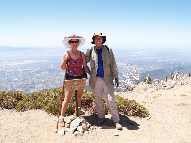
Last year (June 2010) Vicki and I backpacked up the Icehouse Canyon trail to Kelly Camp for two nights, and devoted the middle day to day-hiking Ontario and Cucamonga Peaks. We had a lot of fun, but, not surprisingly for a Saturday arrival, Icehouse Canyon was insanely crowded. This year we decided to head back to Kelly Camp once more, but via the eastern route, up the Middle Fork of Lytle Creek. The trail starts lower, at about 4000 feet elevation, so we decided to hike it over two days, staying Saturday night at Commanche Camp, elevation 6100 feet, followed by a two-night stay in Kelly Camp, elevation 7800 feet. And, as predicted, it wasn’t crowded at all. Just the way we like it.
Click on the photo to read the complete Trip Report
We woke up Saturday at 3am and finally got out the door at 4:30 for the two and a half hour drive from San Diego to Icehouse Canyon. We’d never been there before, so as we stopped along Mt Baldy Road to take the obligatory pictures, car after car went past us, heading up-canyon. By the time we got to the trailhead, just after 7am, the parking lot was already full.
Click on the photo to read the complete Trip Report
