Three cold nights at Kelly Camp, Memorial Day Weekend 2012
Good thing we just bought that new +15 degree F goose down sleeping bag! We would have been frozen solid without it. Brrr!
Now, the entire week prior to this trip, the second of our planned hikes this summer season, I had been checking the weather forecasts. I’m a weather geek; it’s what I do. Ten days earlier, the long range models showed something odd happening, but I ignored these premonitions of doom since ten days was at the limit of their range. But as time passed, it became more and more obvious that an anomalous closed low, a late-season cold-cored closed low, was going to form way up north in icy Canada and drop down into southern California. How cold, how far, and how fast it would drop was relatively unknown; closed lows aren’t handled very well by the weather models, as they are no longer attached to the main flow of the jet stream. Just the same, a week later, on Wednesday, the weather service was predicting a half inch of SNOW on Friday night! Snow! True, I thought that snow might be kind of fun, in a photographically lovely sparkly icey sort of way, since we wouldn’t be hiking until Saturday morning. Not that I was particularly thrilled at the idea of snow on Memorial Day Weekend, the traditional start of summer. At any rate, the forecast said that it would continue to be cold on Saturday, when a second trough riding on the back of the closed low would spin through the area, but afterward we would see gradual warming through Monday, while Tuesday would be back to more normal temperatures.
And if I didn’t like the thought of camping in cold weather, my only other option was to give up and stay home. Not much of an option. Especially with our new sleeping bag! But did I pack lots of extra-warm clothing? Of course I didn’t! I packed an extra (very thin) shirt and an additional (very thin) wool cap, so as not to substantially increase the weight of my backpack. My reasoning was that I’d simply hide inside my beautiful new sleeping bag if I got cold. In other words, I was a complete idiot. How long can you hide in a sleeping bag before it drives you insane?
Anyway, the trip began Saturday morning when we hiked up the Icehouse Canyon Trail, and it was cold and clear initially. Not many cars in the parking lot at dawn that day. The hike in the lower canyon was beautiful, as usual, and we saw rime ice high on the trees to the north, on Telegraph Peak. Very Pretty.


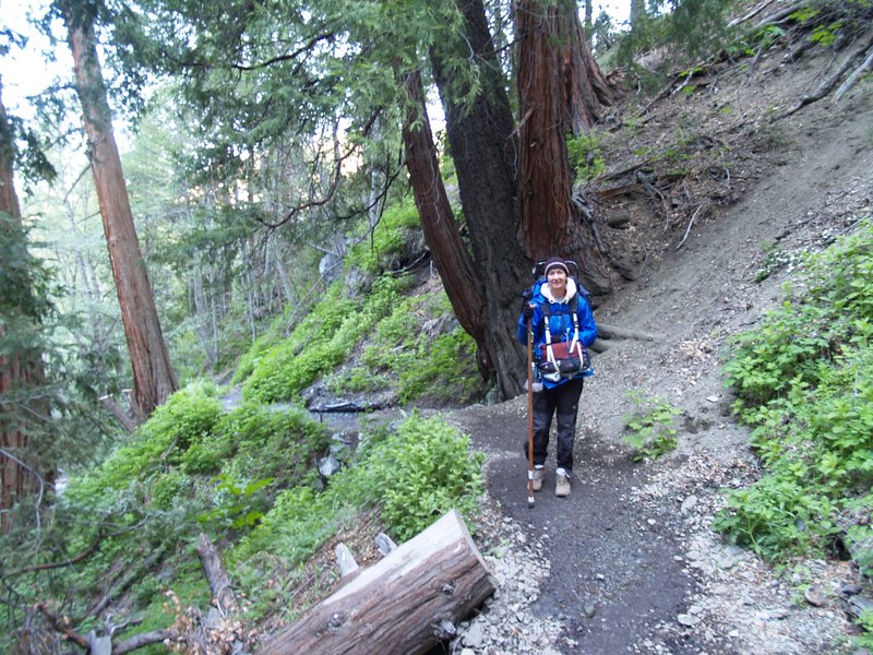

As the hike progressed, so did the cloud cover. It began in the west, and we could see it filling the canyon down near Mt Baldy Village. Soon it began pouring in from the north, over the top of the ridge below Telegraph Peak, clouds and fog blowing by, obscuring the sun. And the air was COLD when the clouds rolled past. But we were OK. We had thermals and fleece and gloves and wool hats on, as well as our goretex rain gear over all. We felt the cold, but were fine as long as we kept moving. There were day-hikers passing us wearing only shorts, but you can’t fix stupid, so we shook our heads and trudged on. By the time we got to Icehouse Saddle we were in the clouds continuously, wisps blowing past. The day-hikers immediately turned around and practically ran back down the trail, trying to keep from freezing. Generally speaking, it was much more fun to see this misty flow happening than to feel it.
Video of clouds blowing up Icehouse Canyon
Video of driving clouds and fog on the Ontario Peak Trail
We got to Kelly Camp, set up the tent, and got inside. I blew up the pads and deployed the new sleeping bag. Then we changed out of our sweaty clothes and got inside. Vicki was asleep instantly. I read my kindle for a while, then fell asleep. Time for a nap! We’d woken up at one AM and left San Diego at 2:30, so we deserved it.

Video of Kelly Camp Spring (May 2012 – in drought years and during autumn it is reported to go dry)

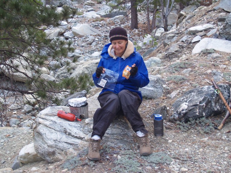
A couple of hours later we woke up and decided that we shouldn’t really spend the next sixteen hours in bed, so we got up and took a hike up to the ridge above camp, between Bighorn and Ontario Peaks. Lots more clouds were blowing by. Some of the trees on the ridge had ice on them, but it was melting and falling off in small pieces. Every so often the clouds would clear and we’d be in the warm sun, or we’d see Baldy for a moment, but then the clouds would close back in. Pretty cool weather. But we didn’t stay out for long. We got back, cooked dinner, had some hot chocolate that didn’t stay hot anywhere near long enough, then snuck back to the sleeping bag. Like the groundhog, we poked our heads out another time just before sunset, and the weather had cleared up completely. Nice and clear and sunny. But cold. And the night was destined to be colder still.


Vicki and I put on almost every piece of clothing we brought and snuggled tight inside that fluffy down bag, and we survived OK. I admit that we were a bit chilly in spots, but we slept fine. We flipped over in synchrony repeatedly during the night, spooning to keep our heat contained. If it had been much colder we would have been in trouble. We must be what they call “cold” sleepers, meaning that the ratings on the sleeping bags don’t work for us. That they lie, in other words. I’m not sure if they have a rating for the “cuddle” factor, either.
We stayed inside the tent Sunday morning much longer than usual. It was cold! I refused to get up until I saw the sun actually shining on the wall of the tent. And even then it was cold out. Vicki was hungry, so she’d already made food, and when I crawled out I had nothing but cold chocolate. I deserved it, I suppose.
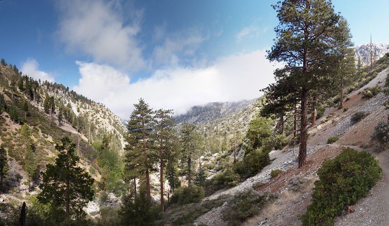
We decided to hike at least two of the three “T’s” that day. And we did. The sky was clear and the sun began warming the air pretty well, although it never got much above the fifties that day. It was weather similar to the High Sierras in summer, where it’s hot in the sun but you freeze in the shade. Good hiking weather, in other words.


Video of the most useless sign in the wilderness, on the saddle between Timber and Telegraph.


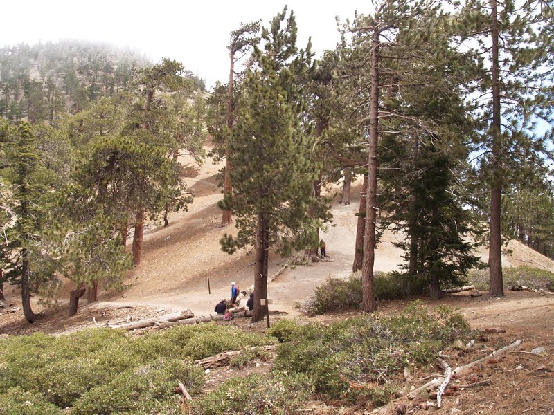
We climbed over the shoulder of Timber and reached the summit of Telegraph Peak by noon. We had lunch there, and met a couple of parties of hikers, including several Boy Scouts who were also camping at Kelly Camp. There was little wind on the summit and we relaxed there for a while.

Telegraph Peak Panorama Video

The scouts continued on to summit the final “T”, Thunder Mountain, but Vicki and I didn’t feel like it. Telegraph Peak is truly great; the other would only be an anti-climax. Still, that didn’t stop us from climbing to the summit of Timber Mountain on the way back. I signed the summit register and we continued on back to camp. The scouts arrived just after the sun had set. They didn’t make much noise after that – they were exhausted.


Monday morning dawned much warmer still. I had taken Tuesday off from work making this a four-day trip, so that day, when everyone else was packing to go home, we went off on another day-hike. This time we hiked up to the ridge above camp, then headed left to bag Bighorn Peak. On the way up we noticed VERY fresh tracks of what we hoped were bighorn sheep. Some fresh scat on the trail confirmed it, since the scat differed from that of deer. We climbed up as silently as possible, but the breeze didn’t help us. We were heading downwind, and I knew that the sheep would sense us. And we found nothing but the same old plastic register on the summit. I signed the register, and we headed on over the top.


We decided to take a shortcut, by hiking cross-country down the ridge to the saddle between Bighorn and Cucamonga Peaks. It was steep in places, but there was an obvious use trail, complete with mini-switchbacks.


Then we began the real set of switchbacks on the main Cucamonga Peak Trail. On the way up I noticed that there was still a tiny patch of snow in the couloir, so I headed off across the scree and grabbed some snow for Vicki. She likes to put it in her hat to keep her head cool.


There were several groups up on the peak enjoying the view. There’s a new summit sign on top, but I didn’t find the register. The old one must have been taken away by some unpleasant person who revels in spoiling the fun of others. So we didn’t get to sign in on the peak. Bummer. Vicki took yet another nap and I read my kindle high above the world. It was a nice day to be on top of a mountain.


We descended the switchbacks to the saddle, then decided to take the main trail back to Icehouse Saddle; we’d hike all the way around Bighorn Peak without the additional energy output of going directly over the top. Sometimes longer is better. And it was a good thing we did, because we finally found those elusive Bighorn Sheep grazing just above the trail on the way back! There were four of them, but I only got pictures of three. They stood their ground, I took a bunch of rapid photos, and we hiked on, leaving them alone to be wild.


We were excited. Seeing Bighorns is a rare thing at any time. And seeing them on a mountain named Bighorn Peak seemed even better! The entire way back to camp Vicki kept hiking along while looking uphill to the left. She kept hoping to find more (or the same) sheep on that mountain. She’s lucky she didn’t trip on a loose rock. But there were no more sheep to see.

That last night, Monday night, we had Kelly camp all to ourselves. At dusk, we saw a doe come down and drink some water in a pool below the spring. The normal wildlife was out now that the mad influx of humanity was over. And the temperature was much nicer; we barely needed any clothes at all in that fluffy warm sleeping bag. But any additional details will not be divulged; this is a family trip report!
The next morning we woke up at the crack of dawn and proceeded to pack up everything. We headed out of camp before seven. We had a plan. On the way down we decided to take the longer Chapman Trail back to the car, a trail we’d never taken before.


The Chapman Trail stays high up along the north slope of Icehouse Canyon, giving fine views all along the way. But if you are scared of heights, or hate walking on trails cut from the side of a steep scree slope, then this trail might not be for you. Just the same, it sure was pretty.


Along the way we passed through the Cedar Glen Campsite, and found the stream just below it to be small, but running steadily. It looked like a nice enough camp, but I wasn’t sure if we’d ever stay there. It’s hard to compete with Kelly Camp for pure excellence.

Video of the stream flowing below Cedar Glen Campground

Eventually, all hikes and camping trips must come to an end, and the final hike through lower Icehouse Canyon was a nice way to end it, with pretty cabins and a briskly flowing stream. We got to the parking lot in the early afternoon, and it was finally hot out. We’d been sweating the last few hours. Summer had finally arrived.


And our new sleeping bag worked great!
Even more pictures and videos on my Flickr Page, if you could possibly look at any more…
For full-size, readable topo map click here, or else you might also view the interactive topographic map on my CalTopo Page
