We backpacked the Pacific Crest Trail from Interstate 15 to Vincent Gap, near Wrightwood, over the Memorial Day weekend. Being section hikers, we had our choice of direction, so we decided to hike this thirty two mile stretch of trail downhill. Both ways!
On past trips, we’ve rented cars, had our kids drop us off, and even hitchhiked in order to start hiking at the beginning and meet up with our car at the end. But this time we changed the plan by buying a second car! No more bumming rides. And we could sleep comfortably in the new car if we wanted to, which would be a definite plus at lonely trailheads, or during bad weather. So this time we dropped off the Corolla at the Interstate 15 trailhead and drove the new Rav4 up into the San Gabriel Mountains near the ski town of Wrightwood.
Day 1:
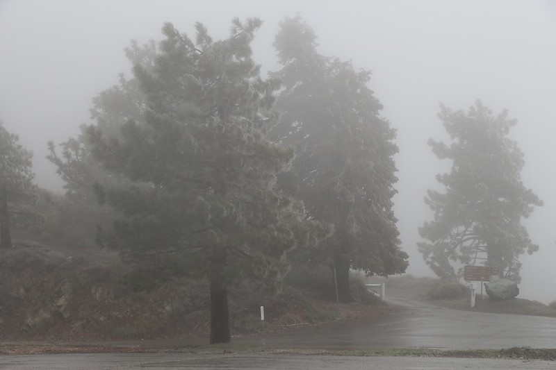
We arrived at the Inspiration Point Trailhead parking lot at 7am and finished getting our backpacks together. It was in the upper thirties and there was a bit of a breeze. Brrr! We were hoping it would warm up a lot but the forecast wasn’t promising, even though it was sunny at the moment. But it didn’t matter, as we were prepared for it. And that makes all the difference.
Unfortunately, the gate to Blue Ridge Road was still locked for the Winter season, and so part of our plan didn’t work out. We wanted to drive up the road and park at the highest location on the ridge, so that the entire hike would be downhill from there. But it wasn’t meant to be. Instead, we had about a thousand feet to climb. But that wasn’t much, hike-wise, just a good workout, and we rationalized it further by thinking of how warm we would get climbing uphill in this chilly weather. And that’s exactly what we did.

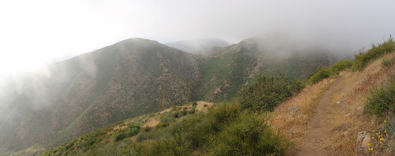
The Blue Ridge runs mainly east-west in this mountain range, and lies directly next to the San Andreas Fault. The uplift that formed the ridge is what gave it so many great views, both north and south. And the PCT runs right along the top. We got to check out all of the dominant local peaks from up there. Most of which still had snow on top.
We also got treated to some residual snow from a recent storm. There were already plenty of footprints from yesterday, so it wasn’t slippery and we weren’t sad that we’d left the heavy pairs of microspikes in the car.


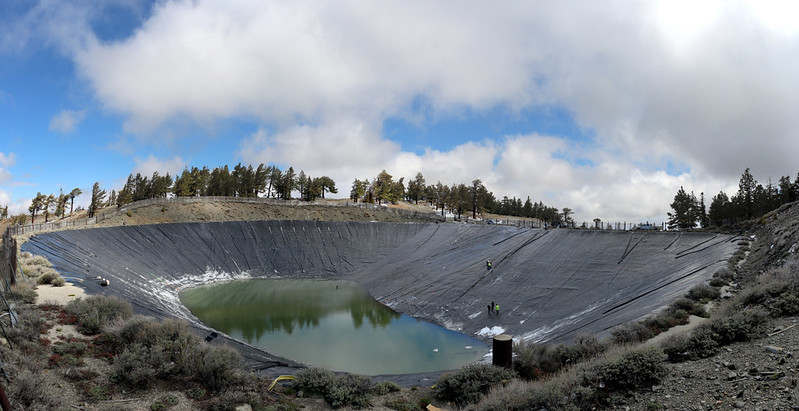
The trail parallels the road and passes by the top of several ski lifts from the Mountain High Resort, originating down below in Wrightwood. Here in Southern California, we don’t get as much snow as we’d like during the Winter, so the resort had created a couple of huge, artificial, rubber-lined, water reservoirs up on top of the ridge. These were used when making artificial snow for the skiers. At the time we passed by, one was full to the brim, and the other was partially drained so that they could do some maintenance. It should be noted that these ponds also serve the firefighters when needed.
As the sun got higher, so did the temperature, and soon all of the ice-coated trees began melting. Chunks of rime ice began falling all around us, and it made hiking under the trees a bit more adventurous than we’d expected. We hadn’t brought mountaineering helmets, either!

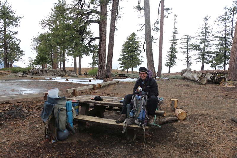
After five miles and six hours of hiking, we were getting a bit tired. A lot of cumulus clouds had begun to form, and they blocked the sun too well. The temperature stayed low, so we kept our layers on, including gloves. We decided that Guffy Camp would be our lunchtime destination, because we’d heard good things about it from other PCT hikers we’d passed that morning. There were picnic tables, a pit toilet, and fire rings, almost like actual civilization. And the views were excellent in every direction. If it weren’t for the fact that our water stash was further ahead, we might have camped right there. Let’s face it: Getting warm inside a cozy tent sounded like a great idea to us, after waking up that morning at 2am. Instead, Vicki decided to compromise, by getting out the stove and cooking up some delicious hot ramen noodle soup. Which she ate almost entirely by herself. I got to eat a cold sandwich. But that’s OK. It was tasty enough. I’ve found over the years that it’s best not to get in between Vicki and her ramen.


We put on our packs and got hiking again, before we got too cold. We had another mile or so to go in order to collect our two gallons of bottled water, which my son and I had carried up the Acorn Trail the previous weekend. We hid them behind a big dead log not far from the PCT. The Acorn Trail was a fun hike, but it was steep. If the gate to Blue Ridge Road had been open we would have driven as far as possible toward Guffy Camp, and left the water at the campground. If we had, Vicki and I might have camped back there. Instead, we put in an extra mile on today’s hike. We grabbed the water and figured out a way to stuff the bottles into our backpacks, then headed onward.
We were lazy and didn’t hike much further. We found a really nice spot just off the trail a quarter mile or so later, and decided that enough was enough. We needed some sleep in the worst way. So we set up camp, cooked dinner, and conked out before the sun went down.
Day 2:
It turned out that our campsite was perfectly situated to get struck by sunshine at the crack of dawn. That doesn’t mean we got up immediately, but we were perfectly happy to let it warm up the inside of the tent for a little while. Soon enough, however, we sat up and did our usual jobs of packing gear and making breakfast. Then we ate it with the sun shining on our black outer layers. And it felt good.

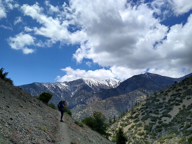
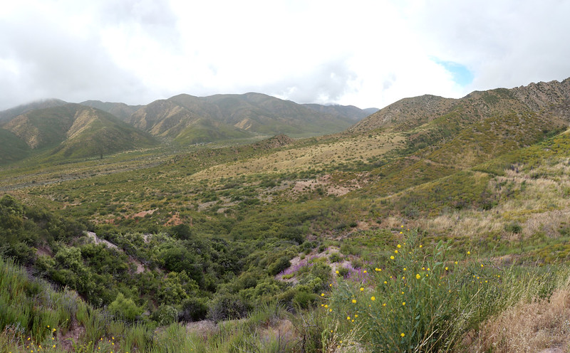
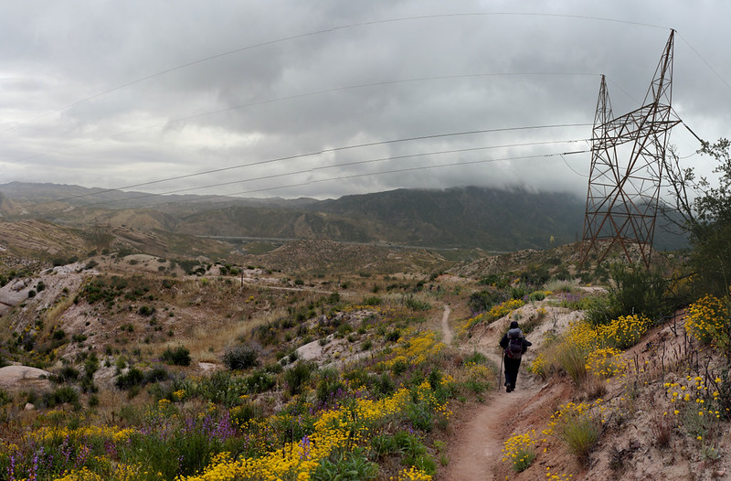
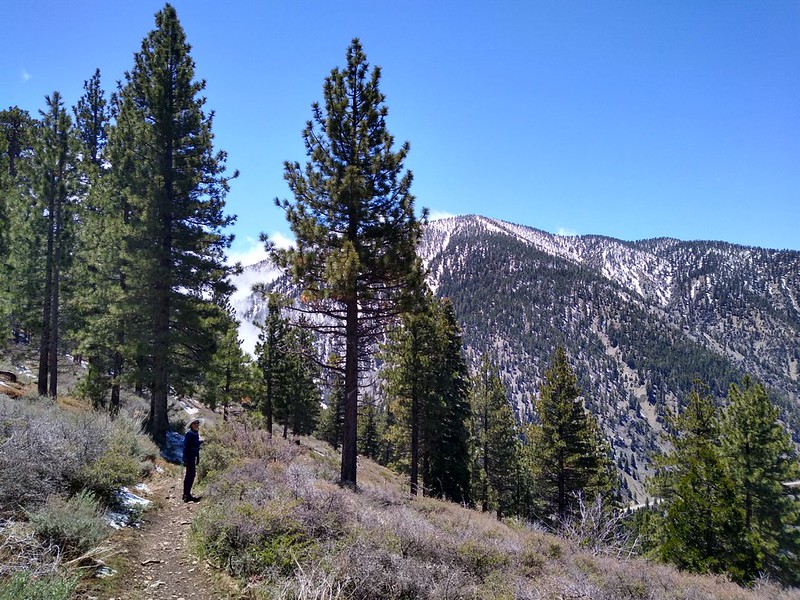
The next few miles were quite enjoyable. The trail traversed horizontally around Wright Mountain, then began the twenty mile long, five thousand foot descent to Interstate 15 along the bumpy ridge. At first it continued to be called “Blue Ridge” on the map, but it soon changed its name to “Upper Lytle Creek Ridge.” It also started with plenty of tall pine trees, but as we descended the pines gradually petered out and the vegetation turned into scrubby chaparral. The wildflowers began to show themselves here and there, and the views were excellent. The sun was out and the temperature was perfect for hiking.


Panorama video from the south side of Upper Lytle Creek Ridge

As the afternoon wore on, and the long descent continued, puffy cumulus clouds began forming over the higher peaks, like nearby Mount San Antonio. Those same clouds had kept us cold the day before, but now we were lower, and further from the thermals that created them, so we continued to hike in the sunshine.
We hiked down through areas that had been ravaged by wildfire several years ago. Namely: The Blue Cut Fire of August 2016. Now, three years later, the chaparral was beginning to grow back, and the oaks were re-sprouting around the bases of their trunks, but their stark skeletons still stood as a grim reminder of the past.


As the afternoon wore on, we began to see some light at the end of the tunnel. The dirt road that my son and I had driven up last weekend wasn’t much further, and I told Vicki that our water cache was just a little bit further. This helped keep her motivated, as she was getting quite tired by this time. We’d been hiking all day, with very few rests. Just knowing the end was near was a great morale booster.

Just before the road, we saw a couple of small spots that looked well-used by PCT hikers, and we decided to camp there. I went forward and collected our two gallons of water, then carried them back to camp. We knew that we were well-supplied for another day, and that was a good feeling.
We solidly staked down the tent as it was getting quite breezy up there. We knew that the weather forecast predicted that a windy storm was coming through tomorrow. We ate a quick dinner and decided to head to bed early. We set our alarm for o’dark-thirty, as we wanted to get moving in the morning before the tent got totally soaked with rain.

All told, we descended 3200 feet that day, and hiked over 12 miles! That’s a really big day for us, even if it was mostly downhill. But at least the weather was sunny, and the temperature was mild, so all in all it was a win. For everything but our sore feet.
Day 3:
We made the right decision by waking up in the pre-dawn darkness. The winds were quite gusty outside the tent, but we didn’t really care. Our plan was to eat a cold breakfast and not bother with the stove, to help us get packed faster. In fact, we ate, got dressed and packed up almost everything while sitting inside the cozy tent! Very convenient. Then we tossed the gear outside, took down the tent, and finished packing our packs. We got hiking before the sunrise.

Video of windy swirling clouds at dawn


We had about 2300 feet to descend that day, and about ten miles to hike. Most of the downhill section was in the beginning, as the trail gradually left the ridgetop and headed down into a valley. It wasn’t steep at all, and made far too many long switchbacks for no great gains. But that’s how the PCT often is. Complaining about it doesn’t help.
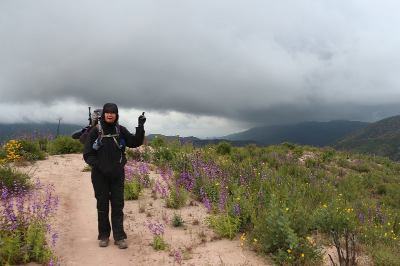
It was also quite cold, and the winds soon began gusting seriously. The weather forecast predicted gusts up to forty miles per hour, and Vicki and I didn’t have much trouble believing them! We kept our hoods, hats, and gloves on. And just kept on hiking.

Video of strong gusts of wind as we descend into Lone Pine Canyon

Eventually, we made it down to the bottom of Lone Pine Canyon, where we signed a trail register, crossed a dirt road (Swarthout Canyon Road) and met a bunch of northbound PCT hikers at the big water cache. Most of those crazy hikers were wearing shorts! They had to be nuts, we decided. And they were all intending to hike uphill into what promised to be a couple inches of snow by the end of the day! Well, we warned them, and gave them advice on what to expect in the next few miles, and wished them well. It’s all part of the adventure, I suppose. One group decided to stay in their tents, and hunker down for the storm, but it was so windy down there on the exposed valley floor that I wasn’t sure if it was worth it. Maybe it would be better to keep on hiking, even wearing shorts.


Video of storm clouds blowing in Lone Pine Canyon as we hiked the PCT near Ralston Peak

The trail continued east, traversing along the side of Ralston Peak, eventually leading to a ridge which separated Lone Pine Canyon from Cajon Canyon. Then the trail proceeded to stay directly on top of this ridge for a long time. And the winds were howling.
Now I have to admit, that when planning this trip, the section of trail across Cajon Canyon was on my list as strictly optional. One of my plans was to leave the car back at the dirt road by the PCT water cache. Surely, crossing a bunch of railroad tracks and a busy freeway didn’t exactly sound like wilderness hiking. So why bother? In the end, Vicki decided to give it a try, and both of us were glad we did. This may have been the prettiest section we’d hiked that weekend!
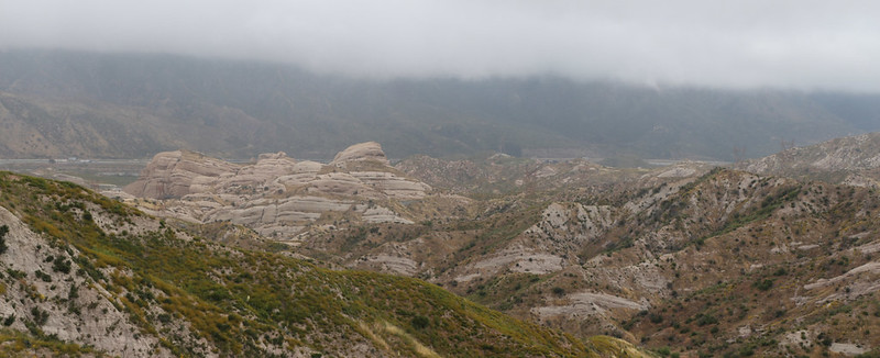
Video from the ridgeline between Lone Pine Canyon and Cajon Canyon with plenty of gusty winds

The Mormon Rocks (of which this area was a subset) are made of sandstone and provide striking colors as they jut out from below. Supposedly, they are yet another result of the San Andreas Fault, which lies just below. And they sure are pretty. Meanwhile, the Winter of 2018-2019 was a very wet one, and as we descended into the canyon, the wildflowers were super-blooming all around us. It was truly beautiful, and a lot of fun to hike. Even with all the wind.


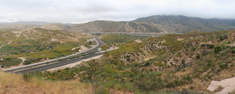
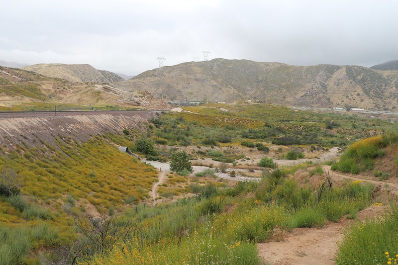
The trail meandered along the eroded sandstone ridgetops and gradually headed downhill toward the first set of railroad tracks. According to the map, there were three entirely different sets of tracks running up the canyon right here, which speaks volumes about the importance of this route. The freeway, the powerlines, and the trains all run through here on their way to Cajon Pass.
The trail crossed directly over the westernmost track, which was a bit of a surprise, but there were no issues for us. In fact, there hadn’t been any trains in a while, which seemed unusual, since we had heard the horns from the trains all night long from our campsite. Then we realized that it was noon, and that the train crews were all having lunch. We continued hiking and went under the second set of tracks through a large, round, steel culvert. There was a protected spot with little wind, so we also stopped and ate lunch. It was a Union Break, of sorts.

We began hiking after a short rest, and then the trains started up again. We got some fine views, photos, and videos of the BNSF trains heading both up and down the canyon on the two tracks. I love trains, so this was quite a treat for me.
After that, we continued across the valley and discovered the third set of tracks, which paralleled the Interstate. There was a cement trestle that we had to walk under, so there were no more track-crossing issues.

Video of two freight trains heading in opposite directions
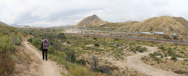
At that point, the day’s hike was almost over. We walked underneath the busy freeway through a huge, curving cement tunnel (which actually served as a drainage culvert for Crowder Canyon) and came out at the PCT trailhead near the famous McDonalds at Cajon Junction, where Highway 138 intersects I-15. This McDonalds has made countless PCT hikers happy over the years, and the trail sign at the trailhead even gives an official distance to reach it. Our car was parked just up the hill beyond it, but we didn’t stop to eat. We had other plans.

We needed to head back up into the mountains, to join with our other car. And, as long as we were heading that way, we decided to eat our dinner in Wrightwood, at the Grizzly Cafe. I’d never been there, but I liked the name. And it was tasty. Vicki had the daily special, crab salad, and I ate the signature Grizzly Burger. It really hit the spot.

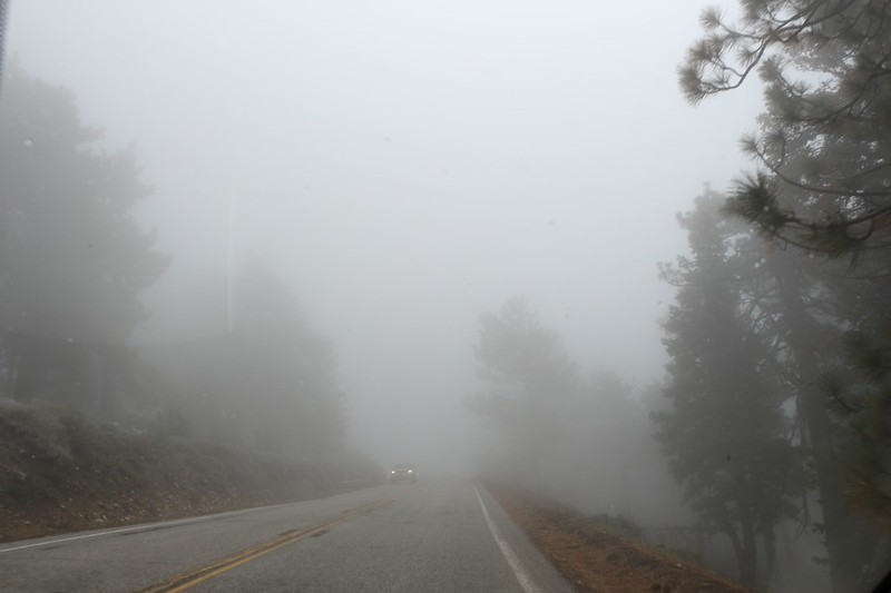
It was sunny in Wrightwood, but it was still quite windy and cold. We were hoping that the worst of the storm was over. But our hopes were dashed as we continued higher into the mountains on Highway 2. Soon we were driving inside blowing clouds, with the windshield wipers on. But “you can’t change the weather,” as my mom always said, so we dealt with it. If anything, we were happy that it was only 3pm, so that the roads were merely wet and not icy.

We made it up to Inspiration Point but there were no inspirational views to be found. It was all blowing clouds and mist. We parked the Corolla next to the Rav4, and then sat in the car with the engine running and the heater blowing, while we tried to decide what to do. A check of the weather showed that the storm was nowhere near finished, and that it might be midnight before the clouds blew away, the winds died down, and the temperature began to plummet. It was supposed to get down to 30 degrees in Wrightwood, which meant that it might be about 20 up at this altitude. We looked out the car windows and were getting worried for the other PCT Hikers we’d met on the trail. This was unusually cold and severe weather for the end of May in Southern California. Hopefully they were fully prepared, or were headed down into Wrightwood for the night.
But what was our plan? We noticed that the gate to Blue Ridge Road had been opened for the holiday weekend, and our original plan had been to stay inside the Rav4 up at the campground. But did we really want to drive up there right now? Or should we leave? We still had another four miles of trail to hike tomorrow (starting from where we were parked right now), headed west to Vincent Gap, so we didn’t really want to tuck our tails between our legs and head back home. We knew that we had plenty of Winter clothing and gear, and that surviving the night inside a nice solid car (rather than a wildly flapping tent) wouldn’t be all that bad, in truth. Therefore, we resolved to spend the night right there in the parking lot. It would be a bit of an adventure.
Video of rain, sleet, and snow at Inspiration Point from the door on the leeward side of the car

And it was! Vicki stayed in the warm car while I jumped out and climbed into the icy Rav. I started it up and turned on the heat, and while I was waiting, I folded down the seats and got the new air mattresses inflated. I was in and out of both vehicles until I had everything set up comfortably in the back, and had the important gear/food within reach in the Rav’s front seats. Then I turned off the car and went back to get Vicki. The two of us climbed in the back and got ourselves ready for the night, with our legs under the fluffy down sleeping bag. We read our books and took life easy, while the storm blew like crazy outside. It was a safe and cozy feeling.
According to the car, it was 33 degrees outside, which accounted for the wet, sleety, wintry mix that was coating the windows of the car. We could barely see what was happening outside, and kept opening the leeward door to see what was going on, to prevent the sleet from coming inside. The parking lot was about a half inch deep in slush.
It was getting dark, about a half hour before sunset, when I heard some voices outside the car. I sat up and saw two shadowy forms go past the rear window. Were those PCT hikers? If so, they were probably in big trouble. Vicki pounded on the window to get their attention and I had no choice but to open the windward door to see them. It was a young couple, and they were wearing backpacks and raingear, but were absolutely soaked and miserable. Probably had a bit of hypothermia, or else they’d have it soon without immediate shelter. I asked them if they needed a ride down to Wrightwood. They were quite startled to see us, but more than happy to accept a ride. The only other real choice they had at that time was to take shelter within the nearby concrete pit toilet! I’m sure a few people have stayed overnight inside there, but getting a ride was what turned their waning luck toward the positive.
Vicki put on some extra clothes and shoes, then rushed outside to help them load their gear into the Corolla. We thought about using the Rav with its four wheel drive, but it would take too long to put everything away, and these kids needed some warmth right away. Foolishly, I ended up staying in the Rav while Vicki drove into town. And she was gone for what seemed an interminable time. It began getting dark, and the weather was now more snow than rain, and my worry-factor began rising. I realized that Vicki and I were buddies, and buddies shouldn’t split up, ever. What if she got stuck? Or lost? I was the one who drove here, after all. What if they locked the gate down in Big Pine? A half hour had already gone by. Where was she? Being all alone and worrying is a miserable job.

You have no idea how relieved I was when I saw those familiar headlights pulling into the parking lot! She made it! She parked the car and came back into the Rav. She took off her outer layers and told me that the last hundred yards coming up the hill were the absolute worst, as the car’s traction-control system began beeping and complaining while the front wheels spun on the ice. But she kept it rolling and made it to the top.
She told me that the couple were safe in Wrightwood, and that they were definitely hypothermic, as one of them had accidentally left a zipper on his pack open, so that his wallet and some other gear got lost in the snow up on Blue Ridge. This is a classic hypothermia move, like inexplicably leaving your gloves by the trail when you’re shivering with cold, because your brain is no longer working properly. Anyway, they were safe for now, and the wallet would have to be dealt with tomorrow, when it was sunny and the snow began melting.
We took a long time to get to sleep after all that excitement, let me tell you. But it was all good, because we were together, and we were safe and sound. And warm.
Day 4:
The storm blew out about midnight, and the winds grew calm. Vicki had to go outside, to visit the pit toilet (which thankfully had no frozen people inside) a couple of times that night, and she said that the stars were beautiful. And the air smelled like snow. And that it was freezing cold! But I was happy to stay inside the sleeping bag. Sometimes it’s good to go to bed slightly dehydrated.

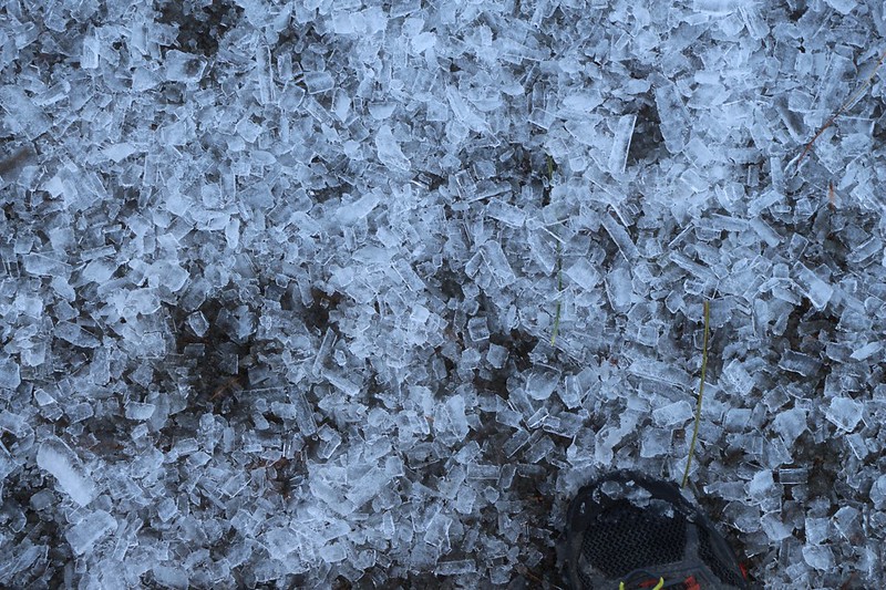
When dawn came, and she had to go out again, she nearly slipped and fell as soon as she stepped outside. It was a glaze of black ice just outside the door! She was about to keep on walking when I stopped her, and reminded her that we still had those microspikes in the car (that we didn’t carry on our hike). It didn’t take long before she had plenty of traction. She felt a lot more confident. Then it was my turn to get ready. I put on a bunch of layers and went outside. It was 20 degrees out there, and the air was crisp in my lungs. I could feel it on my nose and ears. You don’t get to feel this very often when you live near the coast in San Diego. But the microspikes worked great. I grabbed my camera and wandered around the parking lot taking pictures of the icy wonderland. Then Vicki and I took a walk around the area. One thing was certain: We weren’t driving anywhere until the sun rose high enough to melt the roads. Which meant that we had plenty of time to enjoy ourselves.


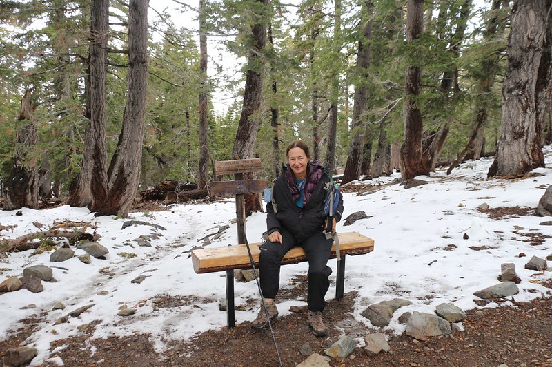
All of the nearby trees were absolutely coated with sparkling rime ice. It was truly beautiful, and I took way too many photos, as usual. We decided to hike up the PCT a bit, mostly to test out the microspikes, but also to check out the views and get enough cell phone signal to send out our selfie picture to friends and family. This is an important part of the wilderness experience.


We got back to the car and began getting ready for our day. Vicki got out the stove and cooked some breakfast and hot coffee while I got the day-pack together. Then we sat at the picnic table and enjoyed our meal in the sun. It was getting warmer already, and it was looking to be a beautiful day. Our plan was to leave the heavy packs in the cars while hiking an easy five miles (downhill, of course) with me carrying a day-pack full of water, snacks, and lunch.

After dropping off the car near the trail to Mount Baden-Powell (which we’d hiked many times in the past), we drove back to the Inspiration Point parking lot and started hiking again, northbound on the PCT this time.
The trail climbed a bit initially, but then stayed fairly level up on top of Blue Ridge. Along the way we saw lots of trees coated in rime ice, and by that time the ice was melting fast. Chunks were falling all over the place, like random acts of destruction, and every tree was dripping. It was really pretty, and lots of fun. We even reconnected with some of the PCT Hikers we’d met over the past couple of days, most of whom had wisely spent a “zero day” (zero miles hiked) in Wrightwood during yesterday’s storm. Even if it meant staying two days. This was a wise move. I told them all that the weather forecast showed no rain for at least the next ten days, and confidently announced that Summer was here to stay. They all cheered and hiked on, ready to have the time of their lives. I admit that I was jealous of them. And I yearned to join them as soon as I could figure out a way to retire and pay off my mortgage. I still have hope.


Video of melting Rime Ice as it drips from above in the pine trees
The ice and snow continued to melt as we hiked, and the views to either side of the ridge remained excellent. The Mojave Desert extended out endlessly to the north, and the high peaks of the San Gabriel Mountains were off to the south. As the morning went on, more and more steamy clouds began forming along the flanks of the nearby mountains. It looked cold and dank inside those clouds. We were happy that the Blue Ridge remained warm and sunny, with plenty of easy hiking.


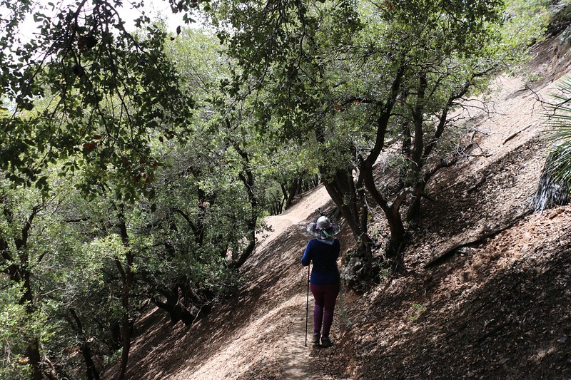
As we neared Vincent Gap, the trail swung south off the top of the ridge and began heading downhill steeply, a 900 feet elevation loss within a mile’s distance, to arrive at Vincent Gap, where we’d parked the car. As it descended, the pine trees gave way to an oak forest, and it was enjoyable to hike under the shady tunnel that the oaks provided. It was a pleasant way to end a long hiking weekend.
We drove back to the other car, then split up some of our gear. From this point on we’d each be driving alone. We decided to travel together to Wrightwood, where we would grab a sandwich at the grocery store’s deli counter, and fill both cars with gas. We had a great weekend, and it only seemed fitting to spend some of our money in the local town rather than along the busy, impersonal freeway.
We sat in the parking lot and ate our sandwiches. We talked about the trip, and what an amazing time we had. This was some crazy cold weather for the end of May, we thought, but remembered another year when it had been equally cold up here. And then again, there were still other years when we’d roasted in 90 degree heat. It wasn’t very predictable, but it was always beautiful. And then it was time to join the Memorial Day traffic, as we made our way back home.
The rest of the trip’s photos and videos can be found on my Flickr Page.
For an interactive topographic map of our hike, including GPS Tracks, please see my CalTopo Page.
