On the second day of my trek I backpacked from Flower Lake to Charlotte Lake via Kearsarge Pass, and managed to spend some quality time trout fishing in the Kearsarge Lakes and Bullfrog Lake along the way.
Of course, that wasn’t my plan when I woke up at 3am. Or maybe it was. It wasn’t when I went to bed. By the time I woke up, however, I realized that I really didn’t feel like hiking that extra-long southern loop that I’d planned. I would have been slaving away, hiking fifteen-mile days, which wasn’t a lot of fun. More like a sufferfest than a vacation. Thus, when I woke up that morning, I already knew that I just wanted to have a bit of fun exploring a new region of the High Sierra, and if I could get in a bit of fishing along the way, well, good for me! The shorter, northern loop would still be a challenge, I was sure. I would visit Gardiner Basin and Sixty Lakes Basin this week, and there were plenty of trout-filled lakes on this route. I got out my InReach, turned it on, and sent Vicki a text via satellite letting her know of the change. Informing family of ones itinerary is a cardinal rule of backpacking in the wilderness, after all. Especially when solo hiking.

I boiled some water and made a cup of hot oatmeal, then sat in the dark looking at the map on my phone while I ate. Charlotte Lake wasn’t all that far away, but it was the perfect spot to camp before taking on the challenge of the unmaintained and mostly-vanished Gardiner Basin Trail. If I stopped at a few lakes along the way, I could add some extra miles to today’s hike. It was a plan.
After that, I packed up everything and got on the trail while it was still dark. Kearsarge Pass was 1300 feet up and two miles away, and hiking it in the cool of the morning was wonderful. I started out using my headlamp, but soon enough the light grew in the east, and the valley was bathed in the soft light of alpenglow.


The sun didn’t rise until after I finished climbing the headwall above Heart Lake. The long switchbacks to Kearsarge Pass remained in shade as I continued west. This was part of my plan, as this stretch of trail was brutally hot and exposed to the sun during the day. Sadly, in my haste to get to the pass, I forgot all about fishing in both Heart and Big Pothole Lakes! These two lakes lie far below the trail, so they’re hard to reach, but I knew that they had fish, as I could see them rising and jumping, creating circles of waves on the surface. I decided that I would have to come back to Onion Valley another time to fish those lakes. What a shame that I forgot!


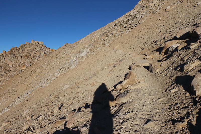
I made it to Kearsarge Pass, at 11,760 feet elevation, and my lungs (and brain) felt fine. Spending the night at 10,500 really helped. I stopped at the top to take some obligatory photos, although the Kearsarge Basin, below me to the west, was still largely in deep shadow. It didn’t make for great photography, but my eyes had no trouble seeing the beauty. Down below were the Kearsarge Lakes, reflecting the deep blue sky, and I could see countless wave circles spreading slowly on the surface. I wondered which of those trout were going to be hooked on my line in an hour or so. I put my pack back on and hustled down the trail.


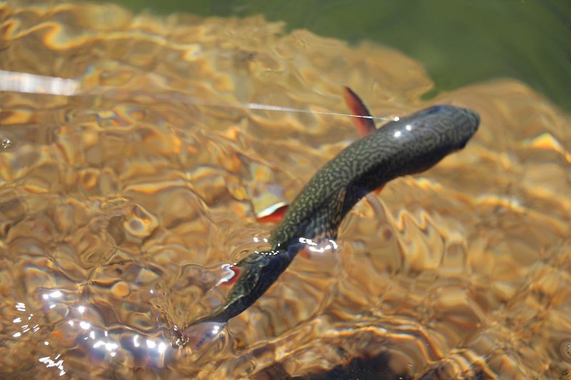
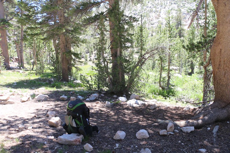
I arrived at one of the upper Kearsarge Lakes and set down my pack. I got out my ultralight, carbon-fiber, Tenkara Fly Rod and attached a line (with fly). Now, Tenkara is basically just a long pole and a line, without a reel, so you can only cast it so far. Not very far at all, in truth. But I didn’t need to cast far up in the High Sierra, where you can see the trout swimming by near shore. It didn’t take long before I’d caught (and released) several feisty little Brook Trout. In the past, I always wondered about those people who wanted to fish when they weren’t even eating them, and now I know why. It’s a fantastic feeling when that trout hits the fly and runs with it, and you see its bright scales flashing and shining in the sunlight, and feel the tug as they dart this way and that. It’s amazing how strong such small fish can be, and I usually let them run with it a bit, just to tire them out. Sometimes they spit out the hook and that’s OK. And it’s much easier on both you and the fish to remove the tiny barbless hook from a fish that isn’t wriggling like mad to escape.

Video of a small (8 inch) Brook Trout fighting and flashing in the morning sun at the Kearsarge Lakes

After fishing in three of the Kearsarge Lakes, it was time to move on. Next stop: Bullfrog Lake, which was less than two miles away, mostly downhill. When I got there it was a bit too breezy to fish (the wind was blowing directly at me, off the water) and the waves were big enough that they obscured my view of the trout. I followed the trail to the west, then backtracked cross-country, up and over a low ridge, to a small cove where there wasn’t much wind. I ate some lunch in the shade and did a bit of fishing, catching a couple more Brookies.


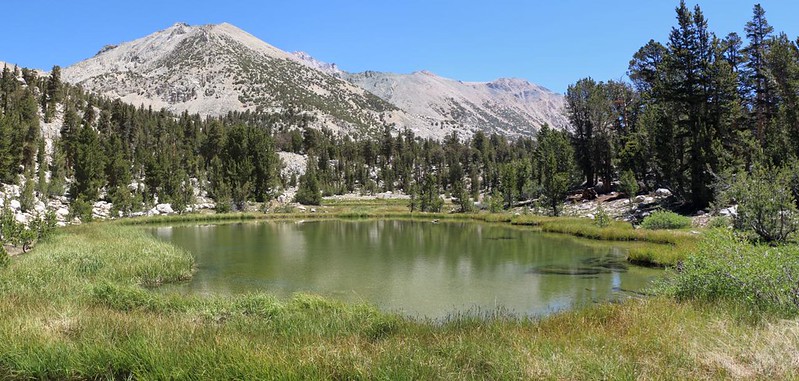
After that, I continued west along the Kearsarge Basin Trail, heading for its intersection with the Pacific Crest Trail / John Muir Trail. Along the way, I passed by two shallow ponds. I looked for trout, but they didn’t seem to have any. I speculated that their minimal depth might allow them to freeze solid in the long Winter months, killing any trout that may have been seeded there in past years. Regardless, they were lovely ponds, and I took photos of them. Of course.
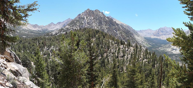
My journey on the PCT was a short one, about half a mile, after which I headed west, down the hill to Charlotte Lake. I was finally breaking new ground! I had never been this way before, and it felt good. Going downhill felt even better, although I knew I’d have to pay the price eventually. But that was later, and this was now, so I practically skipped my way down to the lake. And it was a very long lake! It was nestled into the narrow valley below Mount Bago. Above it, to the north, the PCT continued upward toward Glen Pass. I had been to the pass thrice before, twice in 2019 with Vicki and again in 2020 with my son. I had taken many photos of Charlotte Lake from above, but none of them were up close and personal like the ones I took today.


My plan was to camp by the lake, as far west as possible, to make tomorrow’s more challenging hike a bit easier. Luckily, the ranger station and campsites were all down at the far end. I decided to get some extra solitude by taking the furthest spot, even though it was nearer to the outlet stream (Charlotte Creek) than the lake itself.
It was early enough in the day so that I still had an hour or so of free time that could be spent fishing. Sure enough, there were trout in the lake, and this time they were Rainbows! Nice. This may have been the first rainbow trout I’d ever caught, and I was pleased.

While fishing, some of my neighbors came out to the lakeshore to play, and a few were daring enough to go swimming. Wow! Some people are a lot tougher than I am, to swim in a High Sierra lake in early July. My map said that Charlotte Lake was at 10384 feet elevation. In fact, it probably finished thawing out about a month before! Nuts. But it takes all kinds to make a world, as they say. And the trout didn’t seem to care.

I filtered some drinking water for dinner and tomorrow’s hike, and then boiled up some ramen noodles. Not much of a dinner, but it was salty and warm, so I was happy. Today had been a truly good day. I crawled into my sleeping bag a bit before sundown and got out my map. My plan was to follow the old Gardiner Basin Trail. It didn’t look too bad, although on my phone the “trail” was designated by little dots rather than dependable solid dashes. I had a feeling that it would be more of a route than a trail, and would be moderately challenging. Maybe with a bit of luck, and a lot of perseverance, I would be camping at the Gardiner Lakes tomorrow night. All I could say right then was that I’d try my best.
For a topographic map of the hike see my CalTopo Page
For LOTS more photos of the trek see my Flickr Page
 << Back to Day 1 Onward to Day 3 >>

