On my third day I backpacked from Charlotte Lake to Charlotte Dome, headed uphill to Gardiner Pass on the unmaintained Gardiner Basin Trail, and eventually camped at beautiful Lake 9534, just above Gardiner Creek.
My original plan was otherwise. I never did make it to the high lakes in Gardiner Basin in one shot. It took me yet another day to do it! The trail’s GPS track (which I pre-downloaded at home) showed it to be a ten mile hike with about 4000 feet of elevation gain. This sounded like a tough but doable day to me. Little did I know! The reality was far more grim. I learned to my dismay that the Gardiner Basin Trail was all but gone, erased by the ravages of time. It was also closer to 15 miles, not ten. And the going was slow, since it involved a lot of route-finding.
But I didn’t know any of this when I woke up that morning. I even slept in a bit, and didn’t get hiking until 7am! Since this was new territory for me, I wanted to be sure that there was plenty of light for photos.

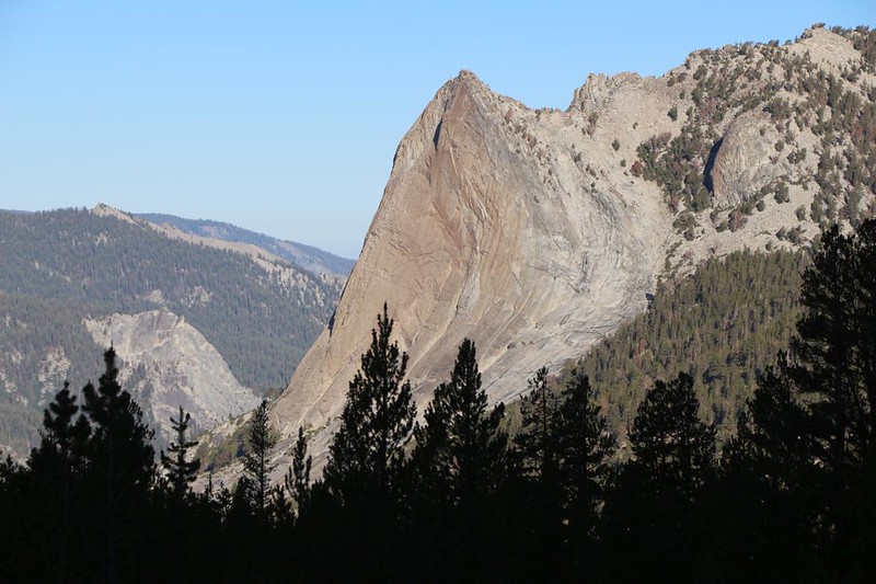
The first two miles of the trail were easy to follow and were in good shape. This was mainly due to the rock climbers heading for Charlotte Dome. One of the climbing routes on the dome was featured in the book “50 Classic Climbs of North America” by Steve Roper and Allen Steck, so it was climbed more often than other routes deep in the backcountry. The trail still had a few blowdowns to deal with (Kings Canyon NP was no longer maintaining the trail) but at least it was fast and easy to hike. I saw a few campsites near the dome itself, but after that the trail essentially disappeared. There obviously weren’t enough crazy people like me out there!


Heading north from the dome, uphill toward Gardiner Pass, I saw a few cairns to mark what might have been a trail, but soon I either lost the path entirely, or they gave up making cairns. It didn’t really matter at that point. I stopped every five or ten minutes to check my location on my phone, and tried to roughly follow the dotted line denoting the old trail. Generally speaking, I was following the “Rule of Up” and I only had to worry about foot placement. And stopping to catch my breath. This slope was steep! And the going was slow. But I trudged onward anyway. I kept thinking that a proper trail with switchbacks would have been a nice thing to find. But no.


It was almost noon by the time I made it to the top of Gardiner Pass. It felt great to get there, and I took a bunch of photos and videos. I was pleased to see a number of lakes in the basin to the north, where I would be hiking next. Far below that was the deep trench where Gardiner Creek was flowing. I decided that this spot was worthy of a good long break.

GoPro panorama video from Gardiner Pass – this is a rarely visited spot, indeed

I got out my lunch and also my map. My GPS said that I had already hiked about 4.7 miles, and it took me about 4.5 hours. Not bad for semi-bushwhacking, but I wasn’t making any speed records either. As I looked at the map, I also came to realize a simple fact: If I kept up this pace I wouldn’t get to the upper basin until well after dark! I’d only climbed 1500 feet so far, and I still had to drop 2300 feet to the creek and climb another 2500 afterward. There was only one conclusion to be reached: I would have no choice but to do this section in two days. So much for a “tough, but doable” day.
This threw a monkey wrench into my planned itinerary. An extra day here meant one less day elsewhere, because I only had so much food. Luckily, I had a bit of extra snack, and I could probably get by on that, in a pinch. I decided not to worry about it right then. What really mattered was choosing a place to stay tonight. The map suggested Lake 9434, the big lake at the far end of the basin below me. There were no guarantees of finding a good “Leave No Trace” camping spot near the lake, in a basin as infrequently visited as this one, but I decided that it was worth a try. The silver lining to today’s dilemma was that I might be able to do a bit of trout fishing at some of those smaller lakes along the way! This sounded like a plan to me.
I used my InReach to text Vicki about my change of plans, so she wouldn’t worry. Then I packed up everything and headed over to the east end of the pass, where the trail supposedly went. I peeked over the edge of the cliff on the north side, and off to the right I saw a very steep “trail” making short zig-zags down a chute. Yep, that must be it, I thought. But at least it looked like a trail! I found a stone cairn nearby, on top of the pass, and paused once I looked down. It was truly steep! And loose! I put down my pack and got out my hiking stick. A little extra balance (and stopping power) seemed like a great idea. And then I headed down the slope, slowly and carefully. Getting hurt while out solo in the middle of nowhere is an outcome to be avoided.

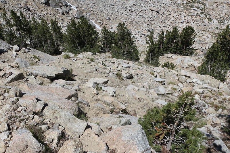
I thought about taking a GoPro video on the way down, but I was too busy keeping myself upright. I took more photos once I reached the bottom of the first, steep section. There was plenty more downhill left to go, but it was obvious that the worst of it was over. Woo hoo! I realized that I was committed to this route by this point, as I had no intention of climbing those loose switchbacks. But that was OK. I also noticed that the “trail” had disappeared once again. As I continued downhill, I saw occasional cairns for a while, but they weren’t very helpful. I had to pick and choose my path constantly. My general plan was to head to the nearest lake, then roughly follow the watercourse as it made its way down the valley, one lake at a time.


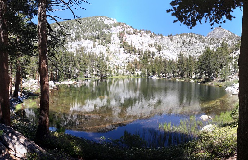
When I reached the first small lake, I saw a few tiny trout in the water. I stopped and got out my fly rod, attached the line and fly, and gave it a shot. Well, I tried, but they just didn’t seem interested. As the old saying goes, it’s called Fishing, not Catching, and I didn’t fish all that long. There were plenty more lakes ahead of me! As it turned out, some of them had fish which wouldn’t bite, others had too many reeds or trees along the shore, and still others were more like swamps with open water far beyond the length of my line. Lots of lakes, but no hooked fish. Just the same, a lack of fish didn’t take away their beauty, and I was enjoying myself, taking photos like mad.


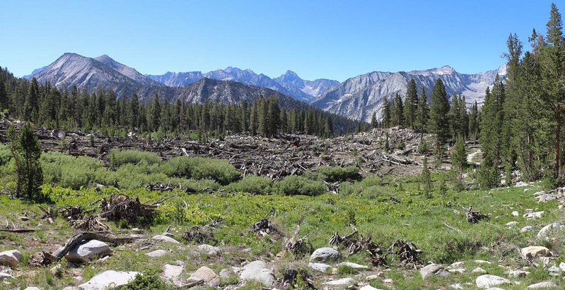
I really had to admit it: This basin was fun to hike. Sure, I had to choose my route carefully, but for the most part it was easy hiking, over slabs of glaciated granite, or under pine trees with little to no undergrowth. The many lakes and ponds simply added to the beauty. Every once in a while I came across signs of the old trail, which I dutifully followed, and just as quickly lost the track. I would get out my phone, check the CalTopo app to make sure that I was heading the right way, and hike on. All in all, I was a happy hiker.
Eventually, after several miles and as many hours, the so-called trail came near my day’s destination: Lake 9434. I veered off to the left of the track (per my app) and walked along the shore, which was difficult to approach due to marshy areas swarming with mosquitos. My map showed a peninsula sticking out into the lake, and I headed for that. As I approached, I could see the bare granite slabs. They looked flat enough to me! I could easily set up my tent on top of raw granite. I found a path between the bogs and discovered that there was a great view of the lake. As a bonus, there was a nice breeze which kept away the bugs. It was perfect.


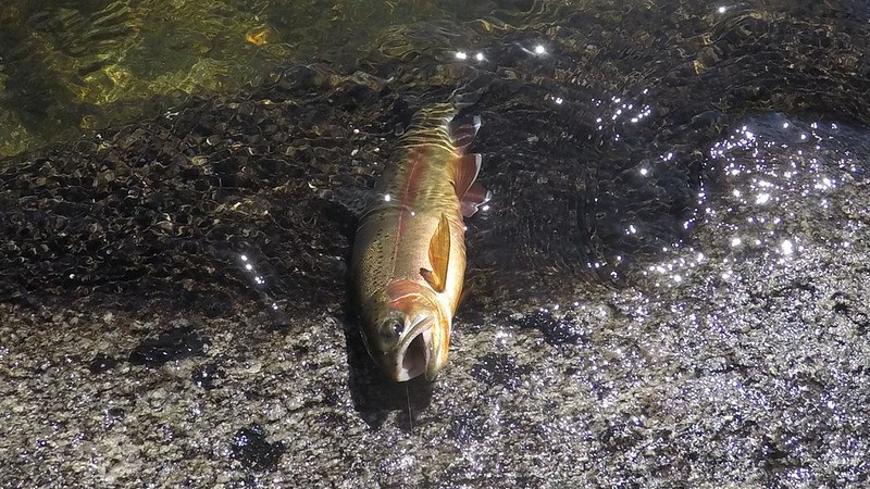
I set up my tent and got some water from the lake. It was still early enough that I had plenty of time to do a bit of fishing. I got out my rod and walked along the shore, trying different spots. Eventually, I found a good location and caught a couple of twelve inch Rainbow Trout! They were big enough that they put up a decent fight. And then I let them go. Catch and Release. And I was willing to bet that I was the first person to fish the lake this year. Possibly in several years. I was truly in the backcountry now.
After that, I cooked up a cupful of ramen noodles for dinner, and ate some salty chips. I drank a bunch of water to rehydrate, and ate some peanut butter cups for dessert.

When the sun went down it got cooler and the bugs came out in force. It was definitely July in the High Sierra, the season of maximum mosquitos. That was when I crawled into the tent and read my book in peace. It was pleasant to do nothing after such a long day of hiking. Yes, Life was good on Lake 9534.
For a topographic map of the hike see my CalTopo Page
For LOTS more photos of the trek see my Flickr Page
 << Back to Day 2 Onward to Day 4 >>

