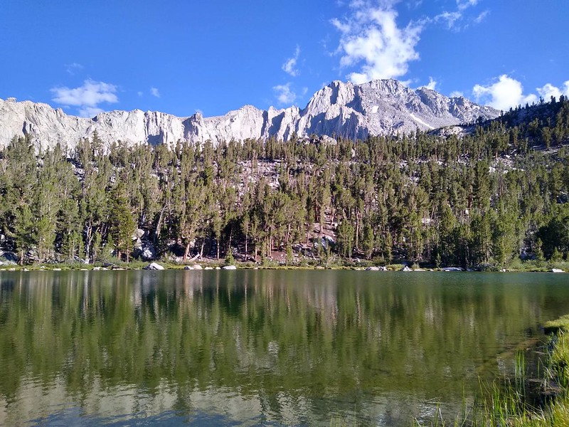
I spent the first night of my seven-day Sierra Trek at Flower Lake, getting acclimated to elevation at an altitude of 10,500 feet, after a pleasantly strenuous 2.5 mile hike out of Onion Valley on the Kearsarge Pass Trail.
This was a solo hike, but it wasn’t planned to be that way. Six months earlier, in the dead of Winter, I got a wilderness permit for five hikers. I was supposed to hike to Mount Whitney with my son and three of his friends. As the months went by, all my plans were rendered useless as first one, and then another, and then all of them discovered reasons to back out. They had perfectly good reasons, and it wasn’t particularly surprising, considering that they were all in their early thirties, a time when jobs and wives and small children exert their claims on a man’s limited freedom. I’m retired, so I don’t have those problems. My remaining difficulty was in figuring out a new plan for the week.
Where would I hike? I already had the permit, so the date and trailhead were set in stone. What I needed was a destination. I’d already done the Whitney hike, solo, back in 2018, when the same exact thing happened. This was the third Whitney hike (with my son) to fail! I resigned myself to hiking alone, as my wife and I had just spent a week fishing around the Onion Valley area, and she was busy this time. I stared at maps, trying to come up with loop hikes in the 50-70 mile range, intending to spend a week visiting someplace new. I didn’t mind climbing over Kearsarge Pass yet again, as it was always beautiful. As it turned out, there were only a few options. One, the Rae Lakes Loop, was far too crowded, and it dropped down into the hot elevations. No, thanks! The other two required significant off-trail, cross-country hiking. These were more my style. I saved the tracks and imported them into my GPS and phone app, so I would be prepared.
The day before my official start date, I left San Diego for Onion Valley (in the early morning, to avoid L.A. traffic) and arrived there about noon. My plan was to sleep in my car that night at the trailhead. It was up at 9300 feet, perfect for acclimating to elevation. Plus, I could get an early start the next morning.
Once I was parked in the sunny, shadeless lot I realized that I still had eight hours to wait before sunset. Boring! And hot. I looked around. There were no official Inyo National Forest vehicles in sight. I realized that if I started hiking right then, a day too early (according to my permit) I could make it up to Flower Lake in a couple of hours. It was a mere two miles away (uphill of course), but I knew that there were shady trees all around it, a perfect place to spend the night. Wouldn’t it be better to acclimate up at 10,500 feet elevation rather than 9300? I asked myself. Of course it would, I replied. And no real harm would be done to the wilderness, as I really did have a permit. As long as I managed to avoid detection today, all would be well. My decision made, I finished packing and locked up the car. It was time to hike!


I was carrying a week’s worth of food, so my backpack was relatively heavy, which slowed me down a bit on the climb. Day-hikers were passing me by, but I didn’t care. I was still much faster than I would have been with Vicki, who was notoriously slow on uphills. Also, I was carrying my solo backpack, which was about half the weight of my monster pack, so it wasn’t too bad.
Soon, I was high above Onion Valley. The final headwall of the day appeared when I reached Lower Pothole Lake. This lake had two waterfalls pouring into it. One was from Gilbert Lake and the other from Matlock Lake. University Peak (13985 feet elevation) began to show above the headwall, and a few cumulus clouds made their appearance. Very pretty.
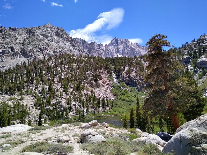

When I made it to the top of the headwall, the trail entered the talus section. This was the last opportunity for cell phone signal. I called home to say hi, and also to let Vicki know that I was on the trail a day early. I already had my Garmin InReach set on tracking mode, so if she wanted, she could view my progress on the internet. When you’re hiking solo, it’s a good idea to do this. Interestingly, it also made me feel less alone, which was nice.
The first major lake on the Kearsarge Pass Trail was Gilbert Lake. I hadn’t tried fishing this lake last time, during our fishing hike, and I planned to make up for it today. This was part of the reason for sneaking up here a day early. But first I needed to hike a bit further, and set up my tent at Flower Lake. Onward!
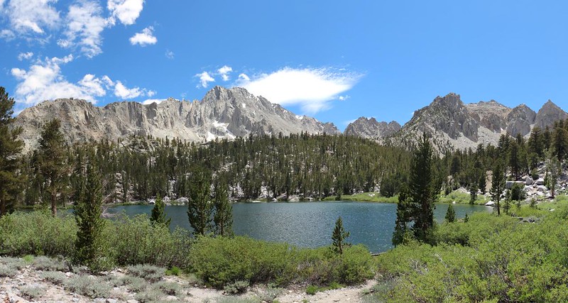
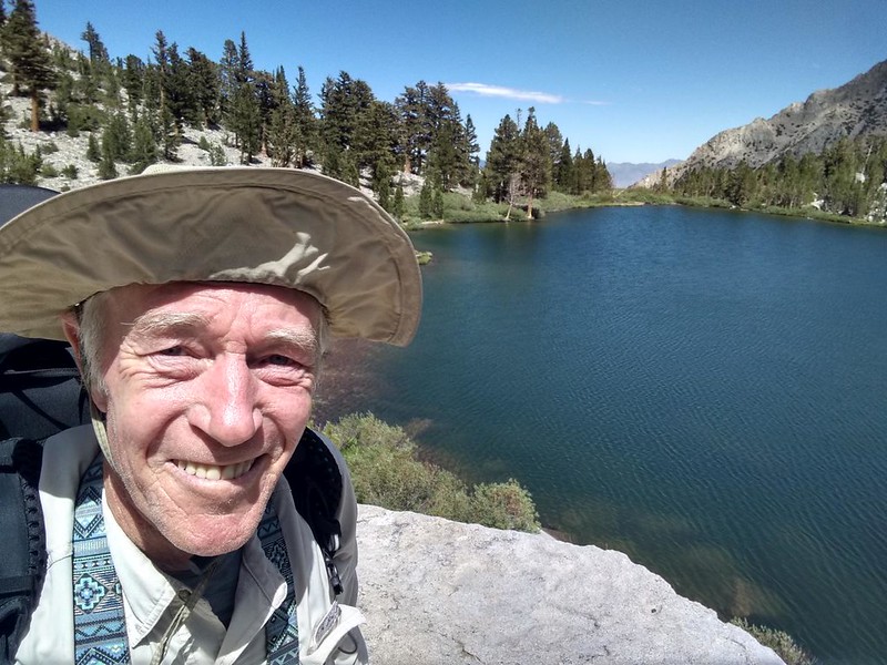
It was only a short hike and a 100 foot climb to Flower Lake. I went around to the south side of the lake using the Matlock Lake Trail. I found a good spot and set up my tent. It was a lovely day. I unloaded almost everything from my backpack and put it inside the tent. All except my fishing gear.


I walked back to Gilbert Lake and took out the rod and line. I walked along the southwestern shore and tried fishing from a few large boulders that conveniently stuck out into the lake. I tried to avoid pine trees, willows, and reeds, as they are excellent spots to lose a fly. My Tenkara fly rod was really good for fishing these High Sierra lakes, where I could see the trout swimming right up to the fly. Since Vicki wasn’t here to eat them, the flies I was using had barbless hooks, so they were easy to remove (and easier for the trout to spit out!) and didn’t cause any lasting damage to the fish. I caught and released several Brook Trout in a short period of time.

I discovered that I wasn’t acclimated yet when I climbed the measly 100 feet back uphill to Flower Lake. I was pausing for breath in a major way! I think that I may have tricked my body on the way up by hiking so fast, because I sure didn’t notice it earlier, when I had a full load. Oh well. This made me even gladder that I had left a day early.
I put down the fishing gear in camp, and grabbed my water jug. I decided to collect my water from the lake’s inlet stream rather than the easier-to-access outlet. I got the water, and continued on around the lake, circumnavigating it. There were some nice meadow areas on the northern shore. But I still liked my southern campsite best, as it was further from the busy Kearsarge Pass Trail.
After that, I got out my stove and cooked up some ramen noodles for dinner. I sat on a nice boulder by the lake and watched the trout swim past. Soon enough, the sun went down behind the high ridge to the northwest, and it began to get cold. I retreated to my tent and got out my maps. What was I going to do tomorrow? The big loop to the south or the shorter one to the north? Or both? I decided to decide after a good night’s rest. And then I fell asleep.
For a topographic map of the hike see my CalTopo Page
For LOTS more photos of the trek see my Flickr Page
Onward to Day 2 >> 

