On the sixth day of my week-long Sierra Trek, I hiked out from Rae Lakes toward the Kearsarge Lakes, via Glen Pass on the John Muir Trail, on my way back to Onion Valley. I had thought about getting there the difficult way, via Dragon Pass, but my recent experience hiking cross-country into Gardiner Basin had used up my reservoir of adventurishness. I just wasn’t feeling the need to prove myself, ala Man versus Nature, after having proven myself the victor so thoroughly two days ago. Or so I told myself, as I took the easy way out. Not that climbing over Glen Pass was easy. At almost 12,000 feet elevation, it was still one of the major passes on the PCT, with a climb of 1400 feet from the lakes.
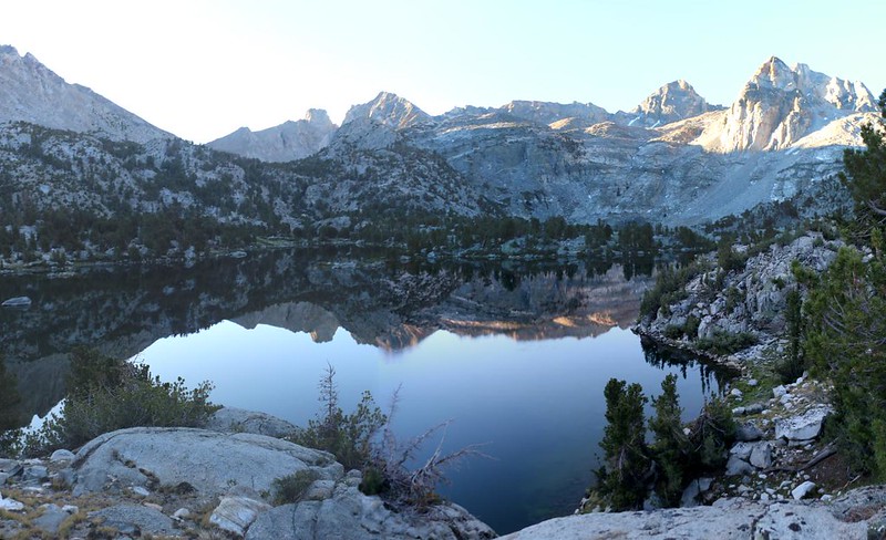
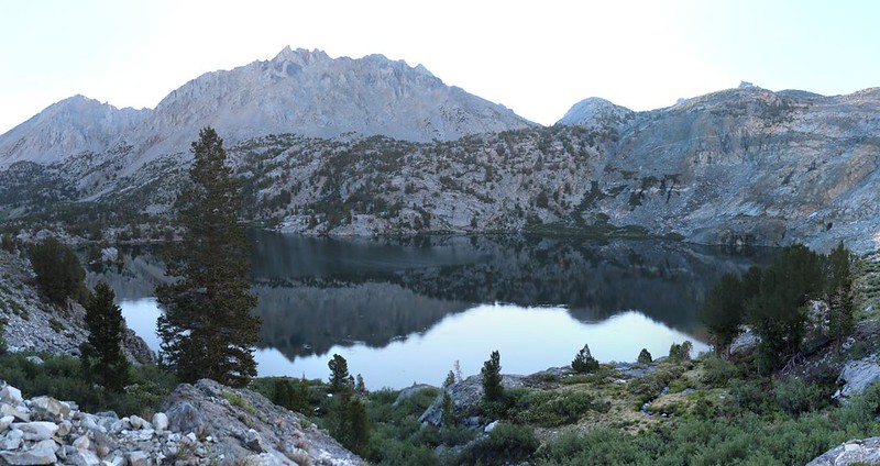
I woke up that morning at first light, ate some hot oatmeal, and packed up camp. I was getting good at this solo backpacking now, and breaking camp had become a routine. I took some photos of reflections on the lake, then hiked along the shore to the Sixty Lakes Basin Trail. It was only a short distance to its junction with the JMT, and then I headed south, uphill toward the pass. This was a beautiful section of trail, with running water and lovely views down into the Rae Lakes Basin.


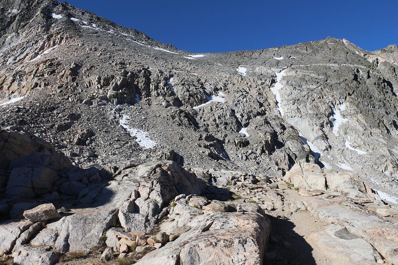
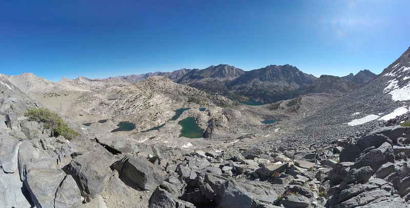
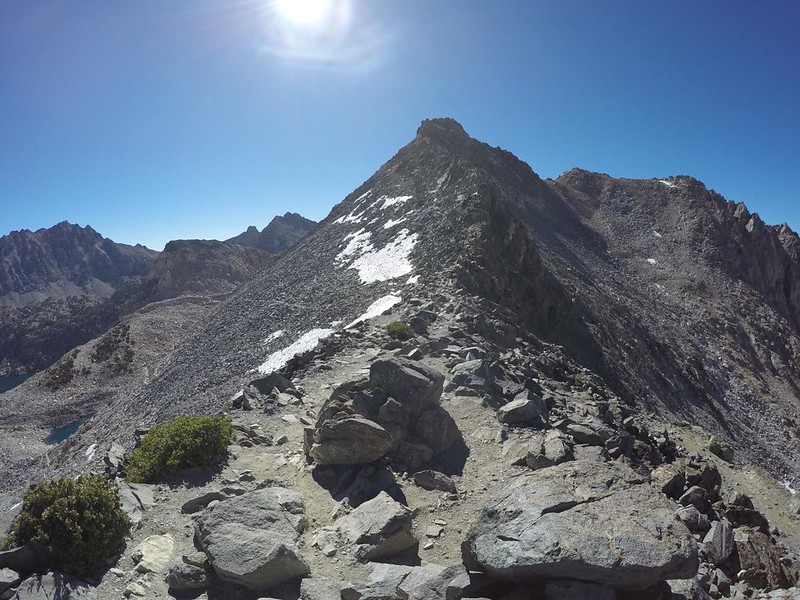
It didn’t take long before the trail ascended beyond the treeline. The raw Sierra granite dominated the view in all directions. After the final stunted pines were left behind, all that was left were high lakes nestled in shallow stone basins, fed by melting snow, connected by cascading rivulets of icy water. The trail wove its way through knuckles of smoothed, glaciated rock, and then began a long series of switchbacks as it made it way up to the top of the pass.

I began to slow as I neared the pass. Several younger hikers passed me as I paused for breath. I typically take photos when halted, and, believe me, I took a lot of them that morning! But I didn’t really care. I knew that I could hike harder if I wanted to. It was only twelve miles to the car, and I could easily hike it in one day if need be. My plan was to take two days, in order to enjoy the mountains longer, and get in a bit of extra fishing and relaxation along the way. This is what being retired is all about! No deadlines and an open schedule.
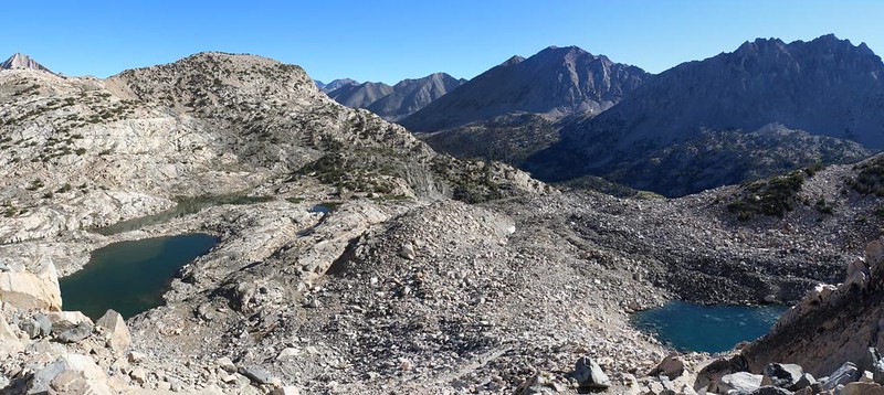
The views got better as I climbed. Soon, I was able to see over the top of a ridge into upper Sixty Lakes Basin, where I had been yesterday. The Rae Lakes were far below, in shadow. I’d been on this pass before, and it was satisfying to be certain that I was hiking on the final, long switchback.


People often take extended breaks on high passes, so hikers tend to accumulate on these spectacular spots. It was rare to get a JMT pass all to oneself. I met up with several groups, and most were heading south toward Mount Whitney, the terminus of the John Muir Trail. We looked at the views, took each other’s photos, and talked about hiking, the weather, and what to expect next. I even brought out my Tenkara fishing rod and showed it off. It was fun.

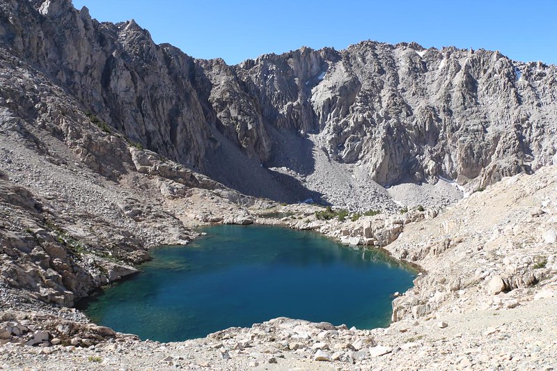
It was also cold and breezy up there, and soon enough I decided to hike on. There was a beautiful high lake just south of the pass, and as I looked down, I noticed the circular ripples that could only mean one thing: Trout rising. Going down those switchbacks was quite a joy. When Vicki and I passed this way back in mid-August 2019 (a very wet year) there was still plenty of snow and ice along the trail. But 2022 was a dry year, and in early July it was almost all melted out. Since I had plenty of time, I took yet another long break at the lake. I got out my fishing gear and hoped the fish were hungry. And they were! I caught several within five minute’s time. The water was so clear that I could see four or five small Brook Trout chasing after the same fly, like kittens chasing a string. It got so easy to catch them that I started teasing them, pulling the fly away before they could catch it. Good times!

After that, I continued hiking downhill. The trail stayed high above Charlotte Lake, and the views were excellent. Charlotte Dome, where I had been three days ago, stood proudly in the sunshine, further down the valley. I was getting close to closing the loop on this week-long hike. And I was glad that I hadn’t opted for climbing over Dragon Pass. Maybe I’d climb it some other time; it was still on my list of Things To Do, after all.


Before I knew it, I was at the trail junction with the Kearsarge Pass Trail, the high trail that heads directly to the pass. On the way in, I had taken the lower trail. So the loop hadn’t closed yet! This time, I got to view Bullfrog Lake from above. The Kearsarge Pinnacles, East Vidette, and Mount Bago formed a gorgeous surround to the centerpiece that was Bullfrog Lake. I found a perfect spot with this view and took a nice long lunch break. I had all the time in the world, and this was a world-class view.


I continued on the high trail, east toward Kearsarge Pass. Eventually, it made more sense to leave the trail and angle my way downhill to the Kearsarge Lakes, rather than take the longer path on the main trail. It was easy route-finding, as I had no choice but to hit a trail eventually. With the aid of my GPS I hit the Kearsarge Lakes Trail perfectly. And at that moment, the “Gardiner Basin to Sixty Lakes Basin Loop” was closed.


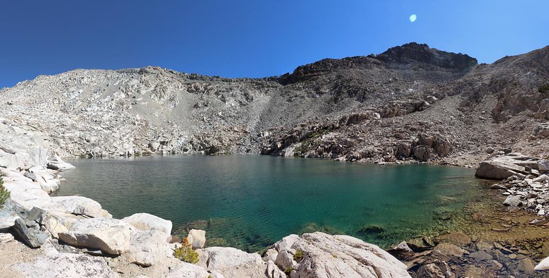
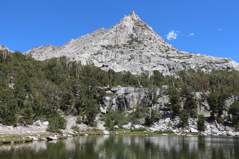
It was only midafternoon when I arrived at the upper lake, and I wandered around a bit, looking for a shady spot for my tent. I found a good spot, then set up the tent and tossed my heavier gear inside. I would deal with that stuff later. I put on my backpack (with fishing and water collection gear) and headed down to the lakes. I found some fresh water near a small inlet stream rather than drinking directly from the lake. An awful lot of people camp there, and I felt better about the water from across the way, where no people go. Even though I filtered it. But that’s just me. I also headed down to the largest lake, and did a bit of fishing. The fish in these lakes were all Brook Trout, from what I could see, and there sure were a lot of them!


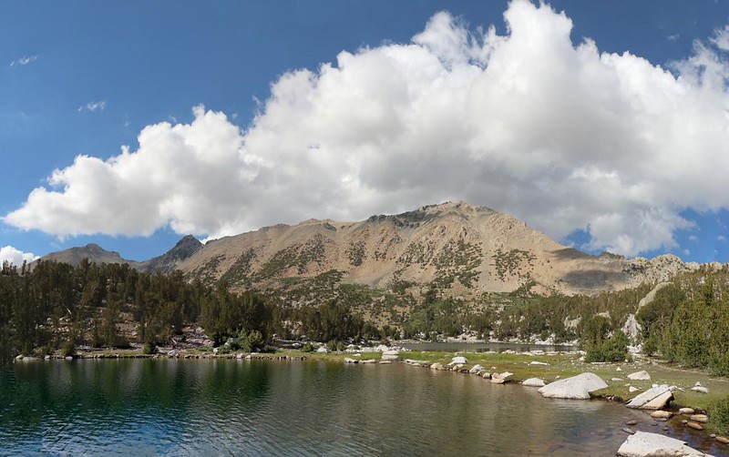
After that, I went back to camp and hung out in the tent, just reading. I watched big cumulus clouds forming over the Sierra Crest, just like yesterday. But none of them grew large enough to threaten rain or lightning. Good! Nobody wanted lightning, not on a dry year like this one! Rain might have been nice, though.
I texted Vicki via the Garmin InReach, and let her know that I would certainly make it home by tomorrow evening. After a week in the backcountry, it always feels good to be heading home. Paradoxically, once I get home I wish I was back in the Sierra again! Crazy but true. At least it keeps me planning new hiking trips!
For a topographic map of the hike see my CalTopo Page
For LOTS more photos of the trek see my Flickr Page
 << Back to Day 5 Onward to Day 7 >>