Day 6: Glen Pass to Kearsarge Lakes
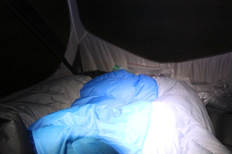
The alarm went off at 3am. It was pitch black in the tent. Well, almost. The screen of my phone was asking me if I wanted to hit the snooze feature. I was tempted, believe me, but I knew we had to get up and get packed. We had a long hike planned, and we had no intention of going over Glen Pass during the heat of the day. Our goal was to leave before dawn and have a cool and enjoyable climb, with good solid snow, using the Microspikes that I’d been carrying all these miles.
It was seriously cold that morning, below freezing, way up there at 11,300 feet elevation. We got dressed in stages, diving back into the sleeping bag as we donned each new item of icy clothing, to help warm it up a bit. We giggled to ourselves as we dressed, because staying in the sleeping bag wasn’t really all that necessary, but it was fun. Then we packed up as much of our gear as possible while staying inside the semi-warm tent. I stuffed the sleeping bag and deflated the pads. Then we bit the bullet and tossed all our gear out the doors. We took down the tent in the light of our headlamps, although there was already a faint glow on the eastern horizon. We could see Glen Pass looming high above us, even though there were still some stars in the sky. It was a peaceful and beautiful sight.


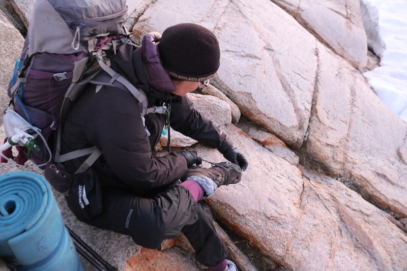
We put on our packs and carried our Microspikes across the granite ridge to the snow-covered trail, then stopped and put them on over our boots. We tested the snow with our hiking poles, and it was frozen solid, with a smooth glaze of surface ice left over from the day before. This snow had been melting for months, and it was very firm and consolidated. I tried stepping on it without the spikes, and knew right away that I would slip and fall without them. The spikes made everything great. Those things really work! We had plenty of traction and felt quite confident about climbing the rest of the way to the pass.


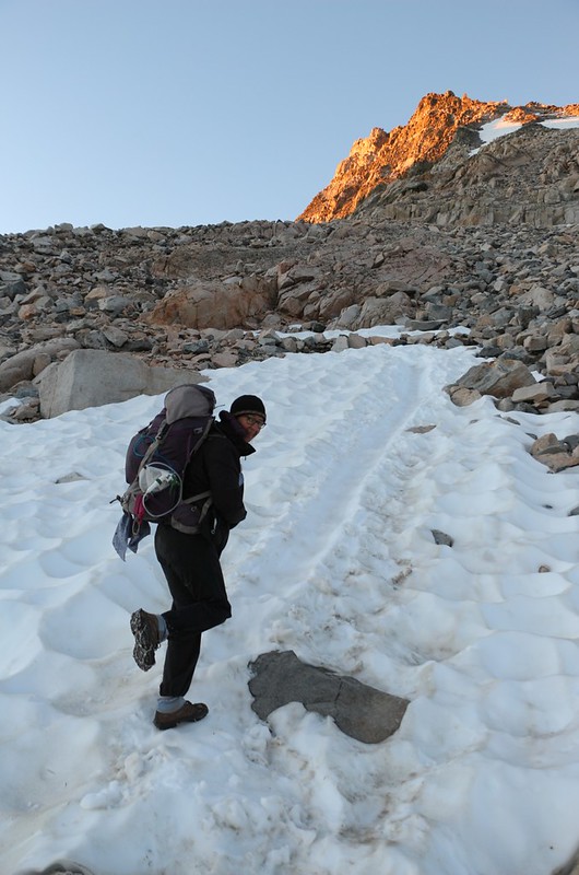
We only had about 700 feet to climb, and we took our time. We rested and took photos when we felt like it. The cool temperature helped us out, and we only removed a layer or two along the way, to avoid sweating. The views got better and better. The sun rose over the peaks to the east and warmed us a bit. It felt good on my black outer layer. But the air was still cold and the snow stayed icy and hard. By mid-morning it would be slushy again, but not now. This was working out exactly the way we’d planned.


Panorama video as the sun rose higher


We thought for certain that we’d be the first to summit the pass that morning, but just as we made it to the final snow traverse, we saw a silhouette of a lone hiker up on the top! It was a bit annoying, I admit, but no big deal, really. We decided to embrace him as a fellow Early Bird as we passed each other on the snow. It was a beautiful day, and we were the only ones up here to enjoy it.


We took our packs off at the pass, and took a bit of a break. It was breezy up there, and the air was still cool, so we didn’t rest too long. Mostly we took photos and videos, and took one final look back down into the Rae Lakes Basin. Good-bye Rae Lakes! You were beautiful! And then we set our sights on the trail to the south.

GoPro panorama video from Glen Pass

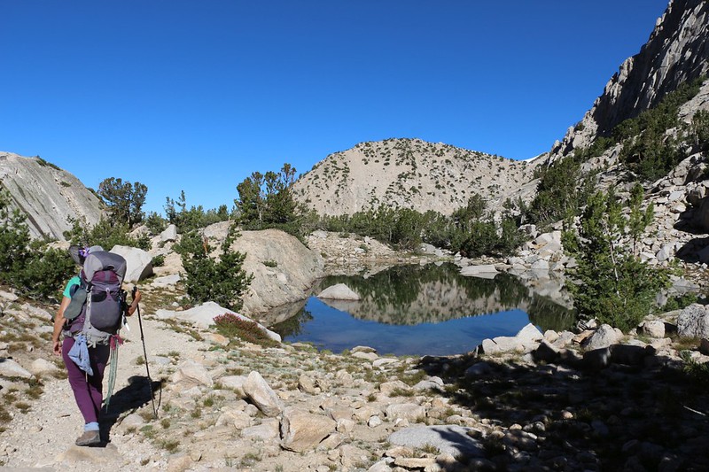
The valley to the south of the pass was deep in shadow, which made us happy, because we knew that the snow patches would still be icy, and that we could use our Microspikes again. So we hiked on down the steep switchbacks, and put on the spikes when we needed them, and soon enough we were back down near the small pond where we’d camped four nights ago. We said good-bye to Glen Pass, and continued on down the valley.


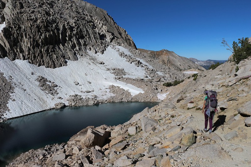
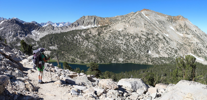
It was great hiking down the gentle slope. Soon we were walking high up above the Charlotte Creek Valley, with Charlotte Lake a deep blue below us, and Charlotte Dome looking like the glaciated granite monolith that it is. We’d been awake for about six hours by this time, 9am, and Vicki decided that it was a perfect time for a snack and a nap. So I got out the foam pads and she got some sleep on top of a boulder in the sun. I took photos and read my book, as usual.


After resting, we passed by the junction with the Kearsarge Pass Trail (that we hiked on the way in) and continued on the PCT into new territory. Our plan was to stay down in the bottom of the Kearsarge Basin this time, and camp at the Kearsarge Lakes. So we descended on the trail past the Charlotte Lake Trail to the Bullfrog Lake Trail. Then we left the PCT just as it was about to descend 900 feet to Bubbs Creek. We had no interest in going down there!


So we turned left and headed east, toward Bullfrog Lake. There was a small pond below the lake that was quite pretty, so we stopped and took some photos, and took another short break.


After that, we hiked uphill a short way and came upon Bullfrog Lake. It was big and blue and beautiful. Many years ago, they use to allow camping along the shore, but not any longer. It had been getting over-camped. But now the scars had healed, and the lake was pristine again, a true jewel in the wilderness.


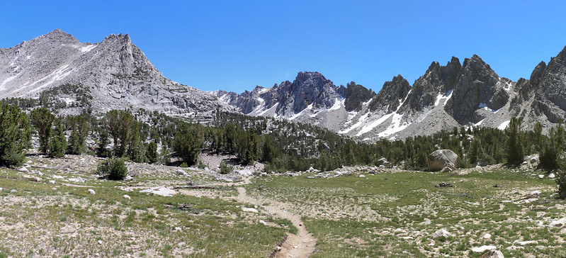
The next stage of the hike entailed climbing uphill through the basin toward the Kearsarge Lakes. It was hot and dry in this section, and Vicki was getting a bit tired and overheated. We stopped in the shade of some pines so that she could take yet another nap, and I read my book in peace. It was a mellow day, and only one small group of people happened by. I held my finger to my lips and they complied by remaining as silent as possible so that Vicki would get some rest. Everyone is very polite in the backcountry. But they certainly were puzzled to see a napping person next to the trail. Let’s face it: Vicki is unusual. But in a good way.

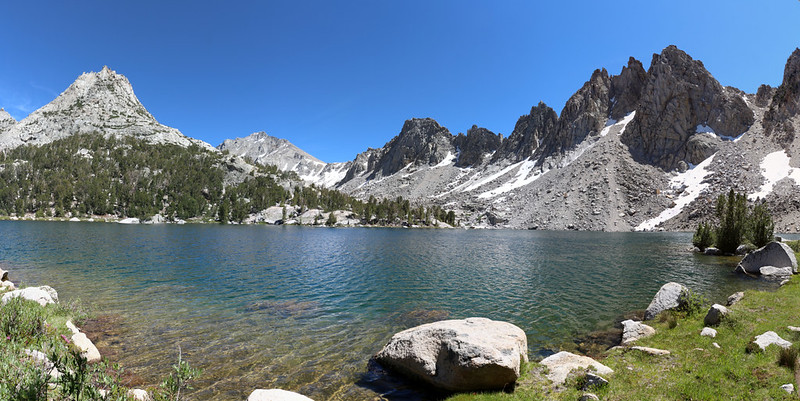
We hiked on for a bit longer, and soon enough we arrived at the Kearsarge Lakes. Vicki was tired of carrying so much weight all day long, so we found a camping spot just uphill from the first lake and put down our packs. It was mid-afternoon and the sun was beating down, so we only set up the tent. We left the rest of our stuff in the packs and decided to explore the area, as we had never been here before.

We headed south along the lakes toward the Kearsarge Pinnacles, which defined this side of the basin. There were fishermen fly-casting for trout along the way, and they seemed like the happiest campers we’d seen all week. Hikers like us work hard and do a lot of sweating, but fishermen seem to have the knack of relaxation. If they’re lucky, they get fresh fish for dinner, and if they’re not, then they still had a fun time fishing.
We hiked for a lot longer than we originally intended (we brought no water with us) and managed to get all the way around to the outflow from the biggest lake. We found a bunch of fun campsites along the shoreline, and discovered a few folks taking naps in hammocks. Everyone was having a great day in a gorgeous location.


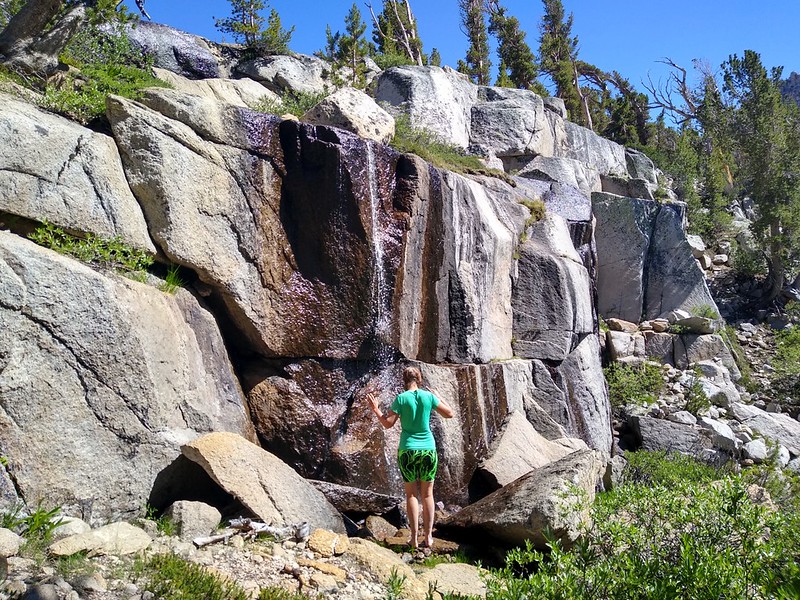
As we headed back toward camp, we spied a waterfall just across the way to the east. The air was still warm, and Vicki decided that she wanted to take a shower under it. So we made our way across the creek between the two upper lakes and climbed up to the granite face that was stained brown from years of water flowing over it. Vicki took off her shoes and made her way to the base of the falls, taking care on the slippery rocks. She almost got close enough to stick her head under the main flow, but not close enough. That water was cold! She couldn’t get herself to come any closer to the actual falls, as the spray and splatter were enough to chill her completely. So we laughed and headed back to camp.
Video of Vicki almost taking a shower under an icy waterfall

We arrived in camp, and drank a bunch of water, then grabbed the filter and headed down to the lake. We purified two gallons and carried them up the hill. Vicki got some dinner going while I inflated the sleeping pads and spread out the sleeping bag. By that time the tent was in the shade and the air was cooling. We got into our warm night clothes and hung out, eating dinner down by the lake. We watched the trout as they jumped out of the water, trying to catch their own dinner. We felt the breeze die down and watched the lake’s surface became placid and smooth. Very peaceful.
It had been a really long day, and even though Vicki took plenty of naps, getting up at 3am takes its toll. We crawled into the tent and fell asleep before sunset, dreaming of lakes and snow, of High Sierra passes, and of the endless trail stretching out before us.
For a topographic map of the hike see my CalTopo Page
For LOTS more photos of the trek see my Flickr Page
 << Back to Day 5 Onward to Day 7 >>