I spent a full day exploring the Sixty Lakes Basin from the top to the bottom, entering via Sixty Lakes Col from Gardiner Basin, hiking far down the valley to the largest lake in the lower basin (catching several Golden Trout), and exiting over the pass in the east to the Rae Lakes.

After yesterday’s terrible bushwhack along lower Gardiner Creek, I had a feeling that today’s hike was going to be memorable in an entirely different way. Shoving my way through willows and thick brush was a thing of the past, I told myself. All I had to deal with today was good old glaciated granite. Avoiding falling off cliffs was my biggest concern. Meanwhile, Sixty Lakes Basin was known for being one of the gems of the High Sierra. Vicki and I had reached an overlook above the basin back in 2019, but she didn’t want to hike all the way down into there. This time, I would make up for that hesitancy.
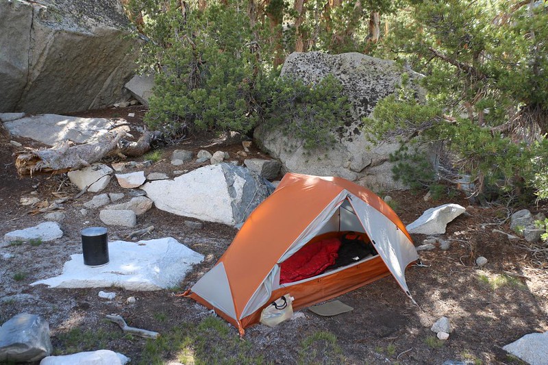
It was cold up at 11,400 feet that morning, so I stayed in my tent longer than usual. I even cooked breakfast with my legs inside my sleeping bag! But I got ready eventually. When I turned on my Garmin InReach there was a message from Vicki. She had answered my request for info (from the internet) on how to climb over Sixty Lakes Col. She said that “there are no shortcuts” and that I had to climb it the old fashioned way: By finding a route on my own. Well. that was a relief, in a way, because it sounded like it wasn’t impossible. I thanked her, letting her know my plan for the day, and put on my backpack.
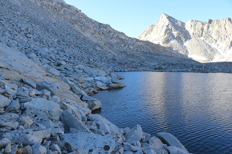
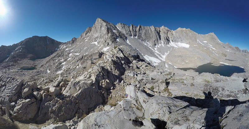
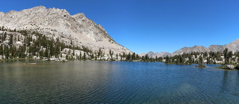
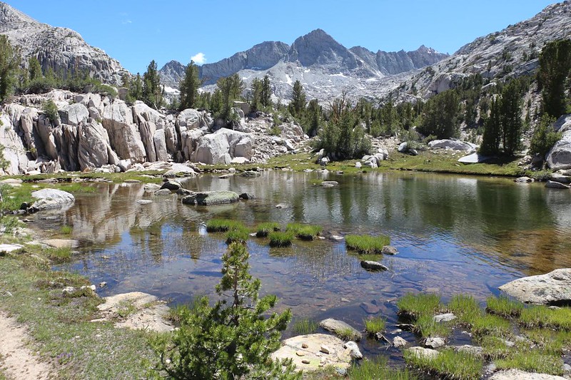
The sun was already shining on Mount Gardiner on the west side of the lake by the time I started hiking. I wasn’t worried, as I would be in the shadow of Mount Cotter all the way to Sixty Lakes Col. I had to choose my route with care. It looked like there would be large blocks of talus most of the way along the edge of Lake 11407, except for the first part, which had smooth granite cliffs plunging into the water. I had to climb inland, up and over a big granite outcropping, then descend to the shore. Once there, I discovered an actual path through the talus! Someone had built this trail long ago, and I thanked them now. The old Gardiner Basin Trail may be unmaintained, but way up here it couldn’t get overgrown because there were no plants! Only rockfall could cause problems, and there hadn’t been much of that. Hooray! I made great time around the lake. It was fun, hopping on the big talus.
From camp, I had seen a possible path up to the top of the col, but it was on the far end. As I hiked along, I noticed several stone cairns on the closer side, leading uphill at an angle. I decided to follow them. And it worked out quite well. This section was more like granite ledges than loose talus, and I made my way up, one ledge at a time. Yes, I admit that there were a couple of tricky spots with Class 3 scrambling, and maybe one Class 4 spot where I could have fallen to my death, but all in all, it worked out quite well. And it was fun! I had made it to the top, and it was time to take a break in the sun. And look for a safe path down the other side.


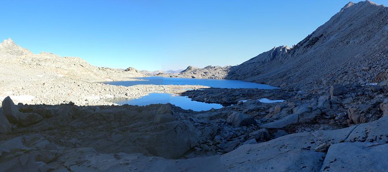
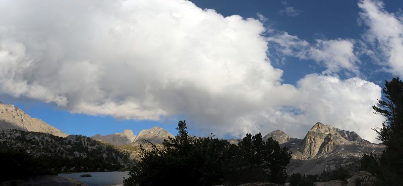
The view from Sixty Lakes Col, at 11,700 feet elevation, was truly excellent. I hung out there for quite a while. Now, this was the High Sierra! Nothing but gray granite, blue lakes, and a deep blue sky. All it needed now were a few puffy cumulus clouds to offset the granite, and it would be a photographer’s dream. Maybe the clouds would appear later on today, but I would be long gone from here by then.
The other thing this spot had was mosquitos! I didn’t think that they would even exist at this elevation, so far from a lake, but I was wrong. In fact, they were so bad that I had to apply DEET a second time within two hours! Oh well. It must’ve been due to the snow that was still melting nearby. Meltwater and mosquitos go hand in hand.


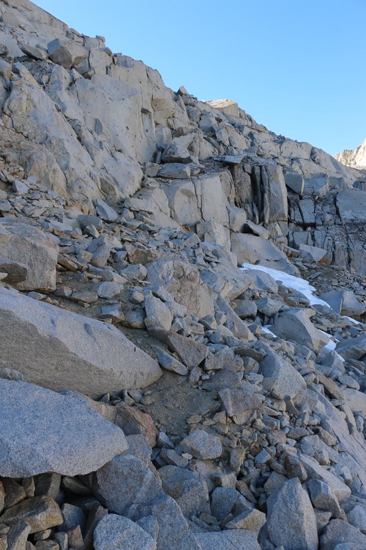
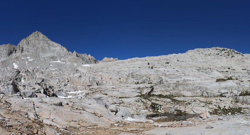
I pulled out my hiking stick for the descent, and put on my backpack. Time to go! And then I took it slow, one granite ledge at a time. It was easy to walk along a ledge, but that wouldn’t let you head downhill. I had to find safe paths. Some were over snow, which was melting and slushy in the sun. Other paths consisted of jumbled talus. And there were plenty of smooth granite slabs. Now that it was sunny, I was very glad to be heading downhill.
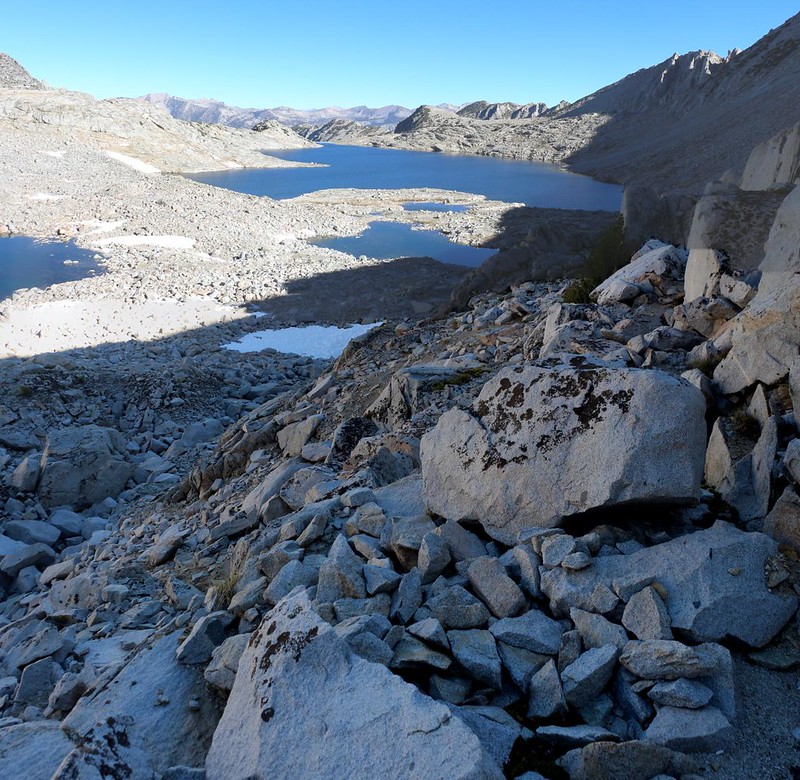
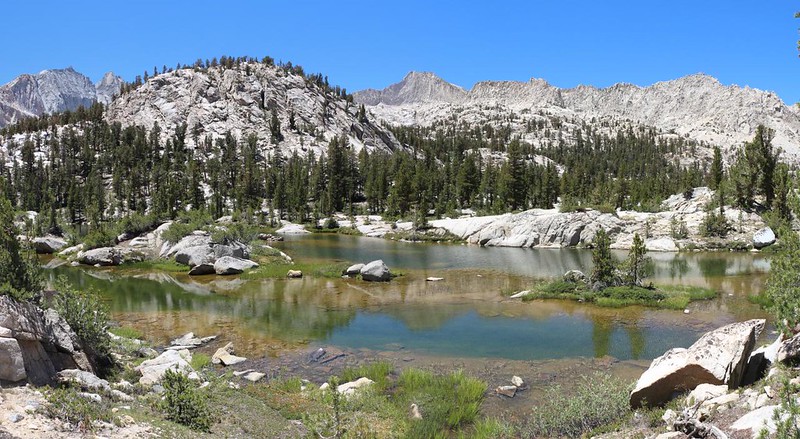
Part of my plan was to follow the creek at the bottom of the valley. It was hard to get lost that way. It was only annoying when it plunged over a cliff, because I had to find a safe way down. But then I also got to see a waterfall, which made up for it. Before too long, Sixty Lakes Col was behind me, and I was hiking in Upper Sixty Lakes Basin proper.


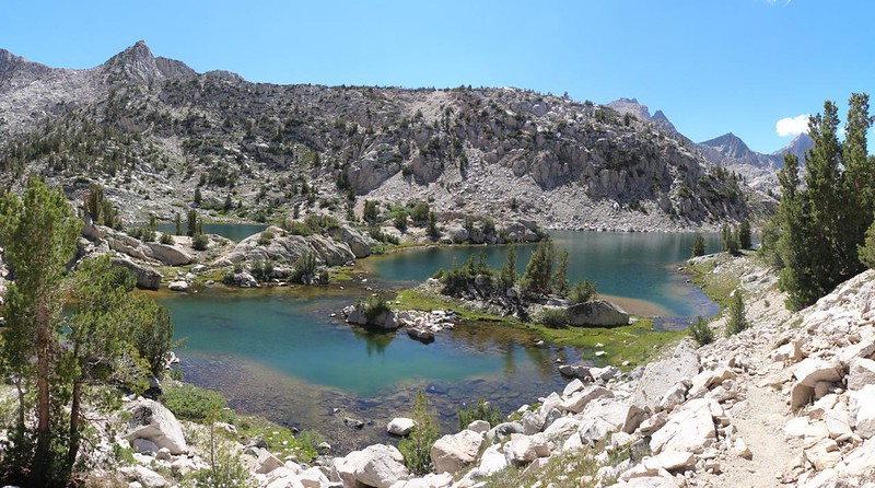
Following the creek, I soon came upon Lake 10840, which filled the entire basin in this narrow region. Unfortunately, I soon discovered a granite cliff in front of me, which plunged into the lake. I checked the map. Getting to the other side of the lake would require a lot of backtracking, uphill of course, and when I looked across the lake, there were cliffs on the other side, too! I sighed, deeply. Did I have to climb all the way up, above and around this cliff? I continued forward, hoping to see a safe path. And then, up above me on the cliffside, I spotted a tiny stone cairn on top of a big boulder. A cairn? Up there? Well, those rocks didn’t stack themselves, I said to myself. I looked around, and there actually was a crazy, sketchy route leading up to there. I steeled myself, and tightened the belt on my backpack. And then I performed some Class 4 backpacking, once again, and scaled the cliff successfully.


After that, the way was clear and easy. The cliff had been the crux of my hiking day. I hoped. I paused to take some photos of the lake, then headed down an easy slope to the northern shore. I took a few more photos and thought about taking a good long break. My eye caught some movement on the hillside above me and I discovered two bears! To make it worse, it was a mama bear and her little cub. Rather than run away, like a wimp, I whipped up my camera and zoomed-in, snapping shots like crazy. They were up on one of those granite ledges, moving parallel to me (and in the same direction), and didn’t seem to notice me at all. My favorite kind of bear. After they disappeared into some low pines, I decided to scrap the “break” idea. I checked out my GPS and headed off downstream, moving faster than the slowly ambling bears. Much faster.


When I came to the next small lake, I noticed that it had a pair of foam floats, anchored to the bottom, like smaller versions of crab pots that you see in the ocean. The previous lake also had them. Looking closer, I noticed the monofilament line suspended by tiny floats, strung between them. Hmmm, I thought. I’ll bet those are gill nets. No wonder I didn’t see any trout in the last two lakes! I’d read that the park service had been killing all the trout in certain high lakes in order to reintroduce the endangered Sierra Yellow-Legged Frog. And then I realized why the mosquitos were so bad up here: There were no fish to eat the larvae! And no frogs either! Oh well. I might not like it (killing the fish), but it isn’t my decision to make. All I can say is that trout sure taste a whole lot better than frogs! And they’re way more fun to catch. Darn! There went my dreams of fly fishing the Sixty Lakes Basin! Phooey.

I hiked across the creek and checked my GPS. I knew the the official Sixty Lakes Basin Trail, the one that started in Rae Lakes Basin, was somewhere nearby. I walked along briskly until I found it. A trail! A trail! It was a heartwarming sight after two lonely, challenging days spent stumbling cross-country through a trackless wilderness. Or so I felt upon seeing this glorious testament to human civilization. You have no idea what a relief it was, even though I knew full well that there had been no real reason for worry.

The trail was very faint, compared to superhighways like the PCT/JMT, but that was to be expected, as very few hikers are willing to travel into what looks like a dead-end basin on the map. In fact, I hadn’t seen a human in three days, and I wasn’t feeling too sad about it, either. Maybe that’s why I was talking to myself!
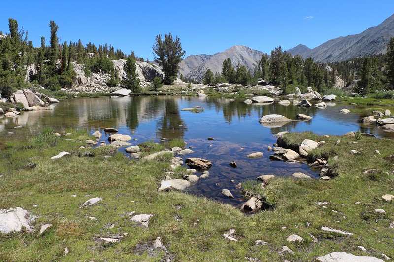
I decided to continue down the basin on the trail. It was super-easy hiking as this section was quite flat. There were more fishless lakes, all connected by creeks. Finally, the trail began dropping in elevation, and the creek went over a small waterfall. I noticed movement in the water: There were trout swimming below the waterfall! It wasn’t much of a drop, but it must have been enough to stop the trout from migrating upstream into the fishless zone. And now I was happy again. Maybe I could do a bit of fishing today, after all.


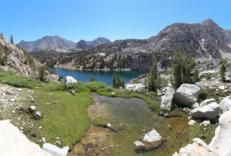
I headed downstream (downbasin?) until I reached the largest lake in the lower basin. This is also where the official trail ends, according to the map. It was lunchtime, and also fishingtime, so I found a good spot with a nice big rock along the shore. Perfect for casting my fly hook. I got out the rod, and the lunch, and proceeded to relax. I deserved it, after all. And the trout were hungry! I caught several in no time at all. They were small, like Goldens tend to be, and I let them all go, hopefully a bit wiser about nibbling on fly hooks.

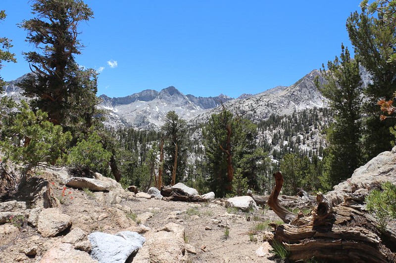
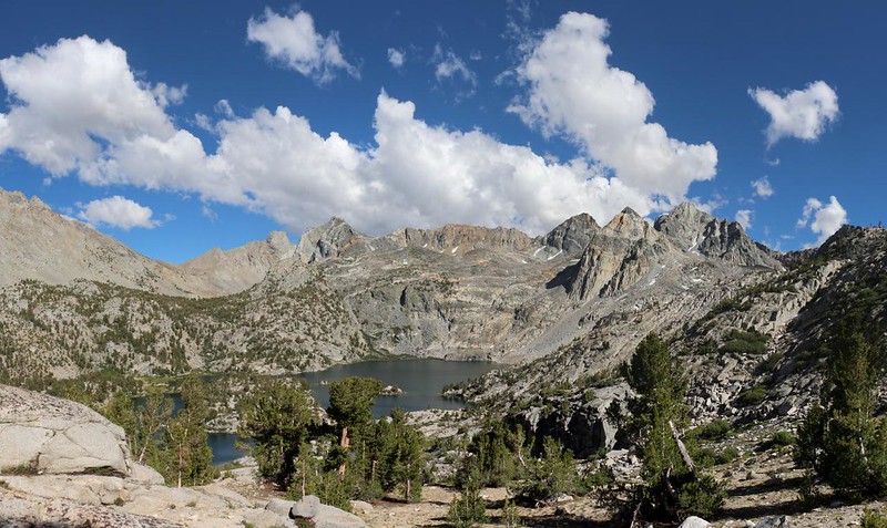
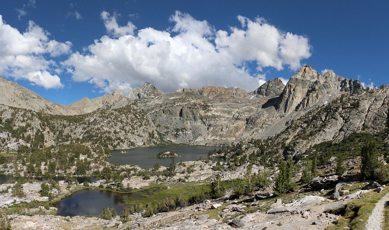
It was just past noon when I packed up my fly rod. One of my earlier plans was to camp near here, but it was too early in the day for that. And the mosquitos would probably be deadly that evening, down here near so much water. One of my earlier options for this loop hike was to head cross-country over Basin Notch in the east, eventually arriving at Arrowhead Lake on the PCT. I checked out the map, and it looked like it might work for me, that I had enough time to get there before dark. So I headed off toward Basin Notch, choosing a path near several other unnamed lakes in the basin. Beautiful. It seemed like every view with a lake was postcard-perfect.


I climbed up to the notch and checked it out. I discovered an extremely steep, 500-foot descent in front of me. Down near the bottom was an obvious clump of willow bushes. Did I really want to do this? Once I went down I wasn’t going to climb back up, and how thick were those willows? I looked at the map on my phone. I had no idea what was around the corner to the right, except that I’d have to cross Woods Creek to get to the PCT. That could easily mean even more willows and brush. It was looking like an epic adventure in the making. Did I really want to subject myself to yet another episode of brutal bushwhacking? I was conflicted, because I like a good challenge, but my enthusiasm was tempered by yesterday’s ordeal down in Gardiner Creek.
In the end, my cautious side won, and I turned back to rejoin the Sixty Lakes Basin Trail. I like trails. Trails are good. They’re easy to hike, and, as a solo hiker, if something bad happened to me, then I would be found and/or helped much sooner on a real trail. I still had another plan up my sleeve to do some off-trail hiking tomorrow, by climbing up and over Dragon Pass. So I retraced my steps to the big lake, then turned south on the trail.

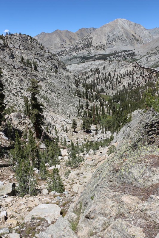
I arrived at the spot near the gill nets where I joined the trail that morning. I also met some actual, live humans, two young ladies just setting up their tents. “Humans!” I called out. “I haven’t seen another human in three days!” They were intrigued. The fact that they’d hiked into this secluded basin proved that they wanted a bit of solitude, so I told them where I’d been. One of them had a fly rod, so we talked about trout. She was sad that the lakes had gillnets in them, but I made her happy when I told her that there were plenty of Goldens down below, less than a ten minute walk away. She was carrying both a conventional fly rod and a Tenkara rod, so this news really made her day. And then I hiked on, eastward and upward, toward the pass that separated the Sixty Lakes and Rae Lakes basins. Not surprisingly, there were plenty of additional lakes to see along the way.


After 700 feet of climbing in the hot sun, I finally reached the pass. Once again, there was another awesome lake on the other side. This spot was the furthest point that Vicki and I reached the last time, when we hiked up from our camp next to lower Rae Lake. I was back in familiar territory, and it felt good. I only had a mile or so left to hike before I made camp, and all of it was downhill.


Along the way, I was able to scope out Dragon Pass, part of my potential route for tomorrow. I had heard on the internet that it was one of the toughest passes in the High Sierra, and I began to get an inkling as to why they said it. Vicki and I had seen it from the other side earlier this year, and it looked tough enough from there. Now that I could see it from this side as well, my desire to climb it took a severe downturn. That thing was steep! On both sides. Finding a safe route looked extremely difficult. I’d read that there were bus-sized talus blocks up there, and if you fell between them your chances of rescue were slim. My InReach wouldn’t work if it couldn’t see the sky, or if I couldn’t push the SOS button. I continued down the trail, and put off the this decision until later. Maybe I’d feel more excited in the morning, when I was fresh.

When I neared lower Rae Lake, I left the trail and headed north along the western shore. Back in 2019, Vicki and I found a nice campsite on a peninsula that was rarely visited. I set up the tent in the same exact spot, then filtered some water from the lake. I decided to eat dinner right away, as the cumulus clouds were building ominously over the Sierra Crest, and the wind was whipping like it might rain. It never did bring any rain, but it certainly blew all the mosquitos away!

I did a bit of fly fishing after dinner, and watched the PCT hikers in the campground across the lake going skinny dipping. That water was cold! And every single one of them whooped in shock after they dove under. Good times. As for me, I caught a couple of Brook Trout, even though I wanted to catch a rainbow. These are big lakes and might have bigger fish. But I was happy to catch anything, so it’s all good.
I checked out the map after I settled into my sleeping bag in the tent. I had two 2-day route possibilities for getting back to Onion Valley. One was up to Dragon Lake and Dragon Pass, then down via the Golden Trout Lake Trail, and the other was the conventional route on the PCT via Glen Pass and Kearsarge Pass. I decided not to decide, for now. Then I read my book until I was tired.
All in all, today had been a really fun day.
For a topographic map of the hike see my CalTopo Page
For LOTS more photos of the trek see my Flickr Page
 << Back to Day 4 Onward to Day 6 >>

