Day 7: Kearsarge Pass to Onion Valley

On the final day of my solo Sierra Trek I hiked back to my car in Onion Valley from Kearsarge Lakes, crossing Kearsarge Pass.  I also visited the Matlock Lake Basin, in order to get snow for keeping fresh several trout that I caught in Flower and Gilbert Lakes, which I brought home to my wife.

I woke up early and left camp before dawn, heading east toward Kearsarge Pass - I wanted to climb while it was cool
I woke up early and left camp before dawn, heading east toward Kearsarge Pass

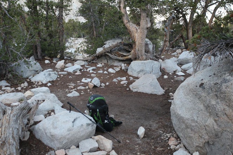
I was so excited to enact my trout-catching plan that I woke up super-early, at 4am, and packed up everything in the dark.  I also wanted to climb up to the pass while it was still cool and shady, of course.  And that’s exactly what I did.  It was only 800 feet of climbing in a bit over a mile, so it didn’t take me very long.

View of Bullfrog Lake and Mount Bago just after dawn, from the Kearsarge Pass Trail
View of Bullfrog Lake and Mount Bago just after dawn, as I climbed the Kearsarge Pass Trail
Dawn reflections on the Kearsarge Lakes - I could see the trout rising, but I was climbing toward Kearsarge Pass
Dawn reflections on the Kearsarge Lakes – I could see the trout rising, but I was climbing toward Kearsarge Pass
One of the last switchbacks on the way to Kearsarge Pass - I made it there early, in the shade all the way
One of the last switchbacks on the way to the pass – I made it there early, in the shade all the way

I arrived on top along with one other early-bird hiker, and we talked for a while.  We also took photos for each other.  It’s not easy getting shots of yourself while solo hiking.  Sadly, the light was too bright on the pass and too dark down below in the basin, so I’m not showing the result here.  These things happen.  But the views from Kearsarge Pass are excellent, so we hung out for a short while.

View of the John Muir Wilderness sign at Kearsarge Pass, with University Peak up above
One last view (and shadow-selfie) of Bullfrog Lake and the Kearsarge Basin to the west, from Kearsarge Pass
One last view (and shadow-selfie) of Bullfrog Lake and Kearsarge Basin to the west
Panorama view east from Kearsarge Pass, with Big Pothole Lake down below me and the Kearsarge Pass Trail on the left
Panorama view east, with Big Pothole Lake down below me and the Kearsarge Pass Trail on the left

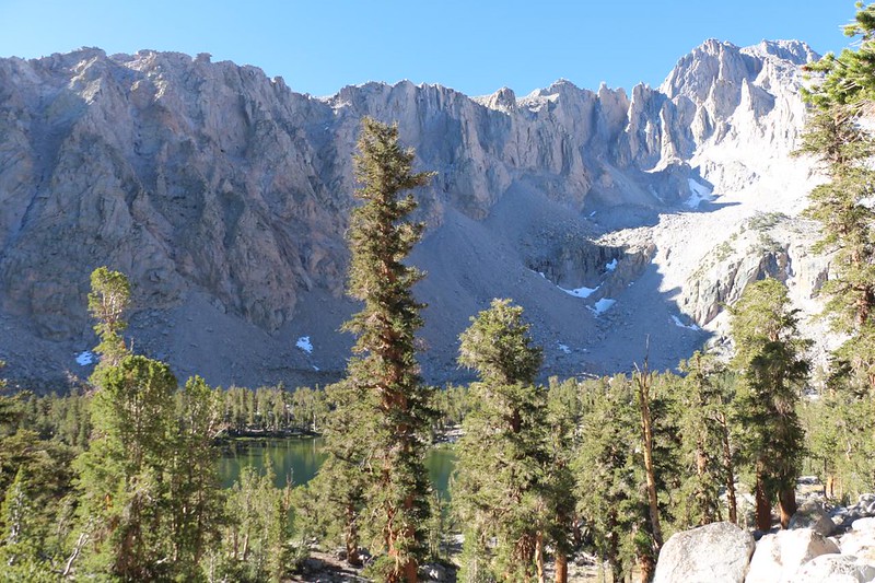
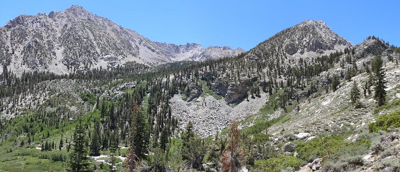
Once again, I saw trout rising in Big Pothole Lake, and, once again, I passed right on by without fishing.  I had other fish to fry, so to speak.  My primary goal on the way down from the pass was to find some residual snow, and it wasn’t looking good.  The winter of 2022 had been very dry, and although it was still early July, essentially everything was melted and gone.  Especially on this trail, which was located on a south-facing slope.  But I still kept my eyes peeled as I blasted downhill in the cool of the morning.  The only accessible snow that I could see was far across the valley, on the north face of University Peak.  There was still plenty way up high, of course, but getting to it would be problematic, and might easily take all day.

Heart Lake in the morning light, from the Kearsarge Pass Trail
Heart Lake in the morning light
I saw snow patches on the northern face of University Peak, with Flower Lake below, from the Kearsarge Pass Trail
I saw snow patches on the northern face of University Peak, with Flower Lake below – I wanted to get some snow!

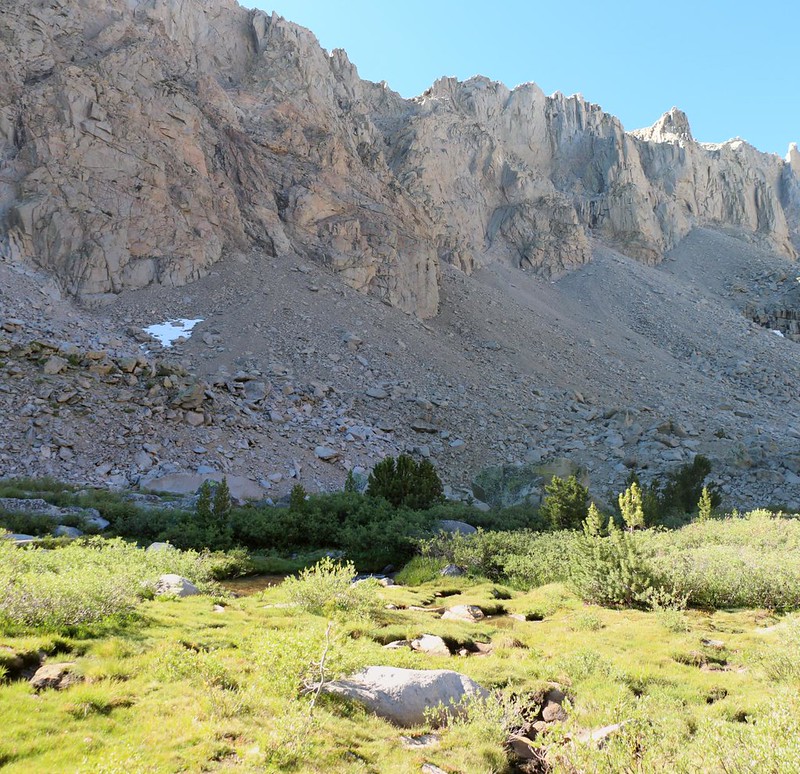
My only hope turned out to be some low-lying snow in the Matlock Lakes Basin.  I could see it, way over there in the shade, tantalizing in its stubborn iciness.  When I reached Flower Lake, I took the side trail to Matlock Lake, then headed cross-country through willows and a swampy creek, directly toward a convenient patch of snow.  It was still frozen solid, like ice more than snow, but that was OK with me.  I got out my one gallon water bladder and opened up the top.  I used my small metal shovel to chunk out pieces of icy snow, and filled it completely.  I hiked fast after that, for I knew that it would start melting rapidly in the bright sunshine, as I returned to Flower Lake.

I took the Matlock Lake Trail south in order to collect some late season snow, with Matlock Lake down below
There were several low snow patches on the shady north side of University Peak just south of Matlock Lake
The snow was still hard and icy that early in the morning, so I chopped it up and filled my gallon water bag
Yet another pretty lake in the Matlock Lake Basin, but there were no fish in these lakes, only frogs

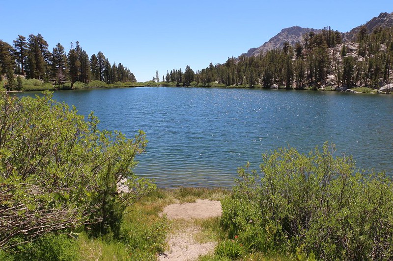
I hiked over to the big boulder on the southern shore of Flower Lake where I had done plenty of fishing the month before with Vicki.  I hung the snow in the shade on a dead branch, then got out my Tenkara rod and attached the line and fly.  There would be no more catch-and-release this time!  I was fishing for keeps.  Vicki loves eating trout, and this entire plan was my idea of giving her a present, since she didn’t get to come on the trek with me.

I got out my tenkara fly rod at Flower Lake, hoping to catch some trout to bring home to Vicki - hence the ice!
I got out my Tenkara fly rod at Flower Lake, hoping to catch some trout to bring home to Vicki – hence the ice!
Panorama view over Flower Lake, with Mount Gould, center, as I hiked east to Gilbert Lake to try more fishing
Panorama view over Flower Lake, which had plenty of trout
I caught one Brook Trout in Flower Lake, but the rest were ignoring me, so I headed for Gilbert Lake to try again

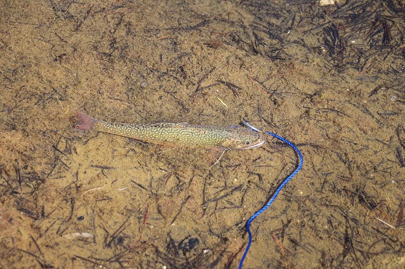
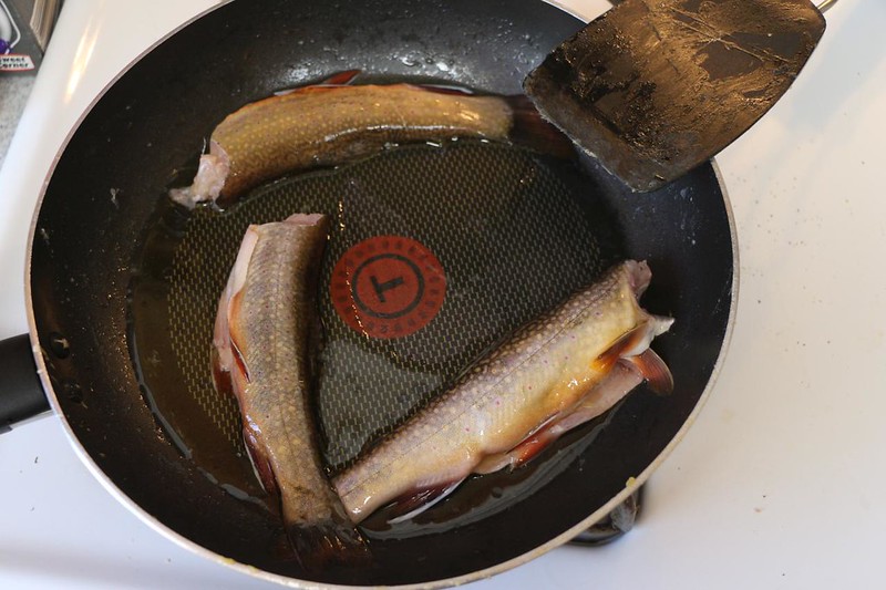
In Gilbert Lake I caught two more Brookies, bringing my total to three trout.  They were small, so I needed several in order to make a decent meal.  I put them in a sealable bag and laid them on top of the snow, which was already starting to melt.  It was hot out there in the sun!

My fishing spot on Gilbert Lake - I put the three trout in a baggie and laid them on the icy snow in my water bag
My fishing spot on Gilbert Lake – I caught two more trout here
It didn't take long before I had three Brook Trout on my stringer - that was enough for me - now to get them home!
It didn’t take long before I had three Brook Trout on my stringer – that was enough for me – now to get them home!
I carried my trout in a baggie resting on icy snow to keep them fresh - it was hot and the snow was melting fast!
I carried my trout in a baggie resting on icy snow to keep them fresh

I put away the rod and started hiking fast.  I kept switching hands when carrying the fish, depending on the switchbacks of the trail, in order to keep the snow in the shade of my body as much as possible.  I had a bit over two miles to hike to reach the trailhead parking lot, and I really made some time as it was all downhill.  Easy hiking.

The Kearsarge Pass Trail passed through a talus trench just east of Gilbert Lake
I was hiking fast on the Kearsarge Pass Trail, and soon my car down in the Onion Valley parking lot was visible
Panorama view from the Kearsarge Pass Trail as I headed down to my car in Onion Valley
Panorama view back up the trail as I headed down the final switchbacks

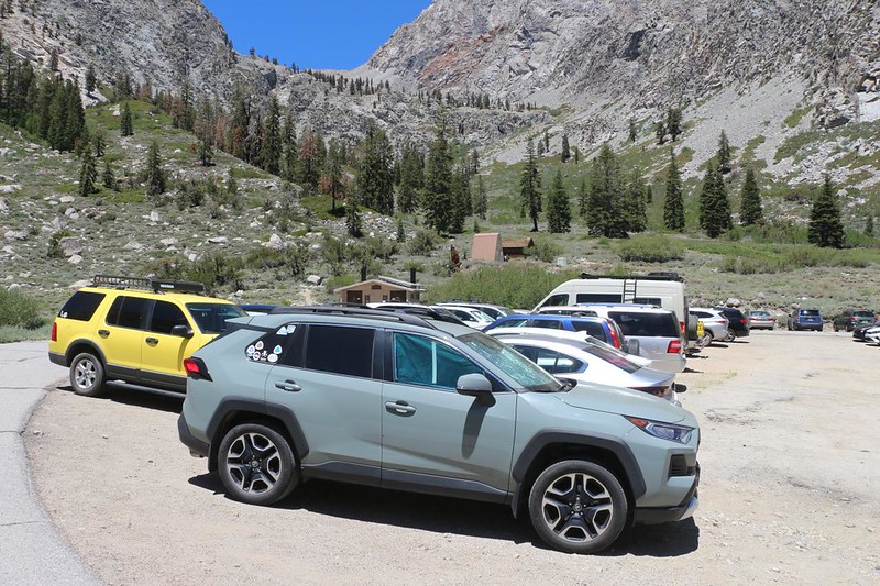
I made it to the car and opened up all the doors.  It was hot in there!  But I’d had the foresight to hide some cans of soda under quite a bit of insulation, so they were still nice and cold.  I popped one open and sucked it down.  Ahhh!  That really hit the spot.  Then I got some snacks ready-to-hand for the long drive home, and headed down Onion Valley Road to the town of Independence.

My car at the Kearsarge Pass Trail trailhead in Onion Valley - my week-long backpacking trek was over!
My car at the Kearsarge Pass Trail trailhead in Onion Valley – my week-long backpacking trek was over!

I went directly to the nearest gas station and bought a bag of ice.  It was far more than I needed, but that was OK.  I poured out the melted water from the bladder, and was pleased to see that there was still a significant chunk of snow left inside.  The trout were staying cold.  I added more ice on top of them and set them on a foam pad on the floor, then covered them with my jacket.  I decided not to keep the rest of the ice and dumped it.  If I needed more along the way I would buy it.

My gallon of icy snow barely made the journey down into town, but the trout were still cold, so I added more ice
I bought a bag of ice for my trout down below in the town of Independence - it was 100 degrees!
I bought a bag of ice for my trout down below in the town of Independence – it was 100 degrees!

I filled the gas tank and started driving.  It was a five hour drive to get to San Diego, so I needed to get moving.  By leaving in midafternoon, I was able to arrive in Los Angeles right at the end of rush hour, and had a fast run south from there.  I made it home just at sunset.  Perfect timing!  And Vicki was thrilled to get the trout!

After a five hour drive I arrived back in beautiful San Diego, and the three Brook Trout were still icy cold
Vicki cooked up the trout the next morning for breakfast - she was glad to see me but gladder to see the trout!
Vicki cooked up the trout the next morning for breakfast – she was glad to see me but gladder to see the trout!

All in all, the trip had been a lot of fun.  Some parts had been quite challenging, but almost all of it was beautiful.  I think that if I ever go to Gardiner Basin again, I would avoid going the way that I did, over Gardiner Pass and through the miserable brush down in Gardiner Creek.  Instead, I would go in via Sixty Lakes Col.  That way I’d get to visit Sixty Lakes Basin twice!  Truly, this was one of the loveliest and most remote spots in the Sierra Nevada.


For a topographic map of the hike see my CalTopo Page

For LOTS more photos of the trek see my Flickr Page


  << Back to Day 6


Up to “Sierra Nevada”