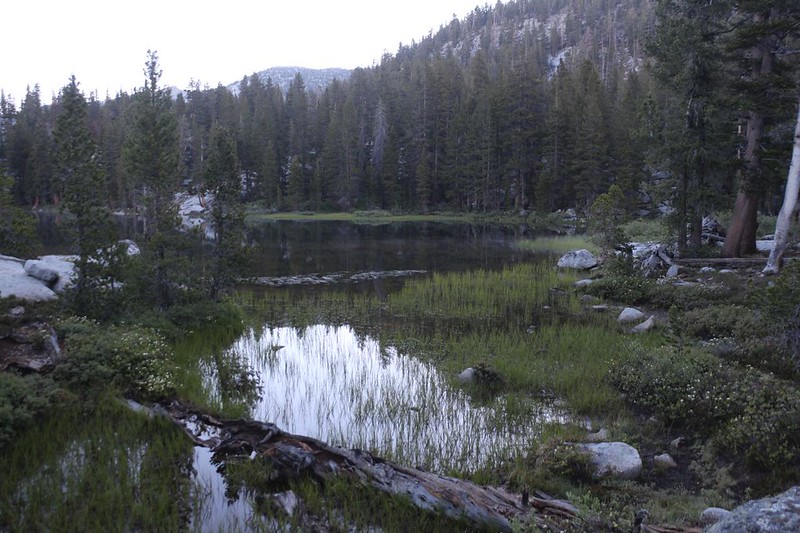
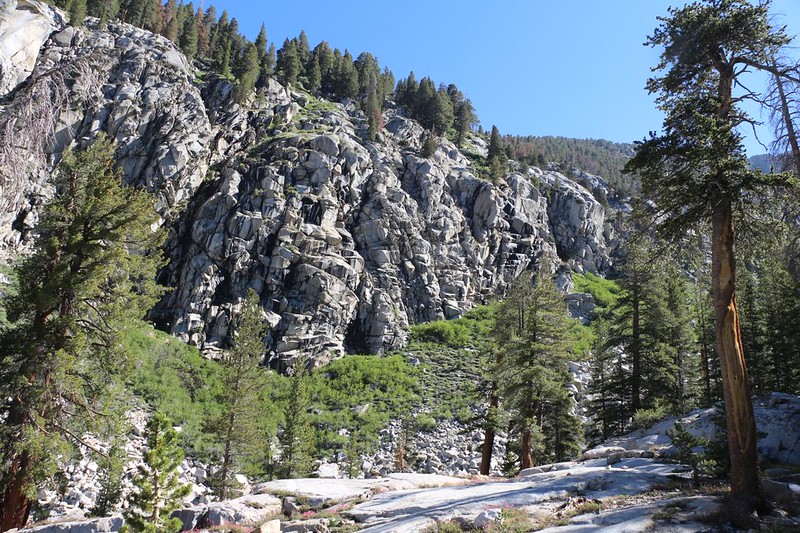
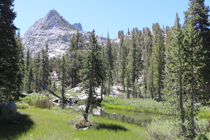
On the fourth day of my solo trek I continued backpacking on the old, unmaintained Gardiner Basin Trail, initially descending and bushwhacking across Gardiner Creek at 9000 feet elevation, then steadily climbing another 2500 feet to arrive at the Gardiner Lakes in upper Gardiner Basin. Along the way, I crashed through thick brush, was swarmed by voracious mosquitos, sweated up steep slopes, and eventually emerged into a glorious region of granite slabs, pristine lakes, and expansive views.

I woke up at first light and started getting ready. I cooked some oatmeal for breakfast and read my book while eating it. I wasn’t in a huge rush, but I also knew that I had a big day today, hiking cross-country in a rarely-visited part of the High Sierra. If yesterday was my yardstick, then today would be at least as difficult, and probably more so. But I vowed to go on, as I had zero desire to go back over Gardiner Pass from this side! I finished packing up my gear and double-checked the area before heading out. I was not coming back here again, if I could help it. Don’t get me wrong: The camping spot was beautiful; it was getting here in the first place that was problematic.
I headed north along the marshy edge of the lake, checking my GPS to get somewhere near the nearly-vanished Gardiner Basin Trail. I didn’t see much, trail-wise, until I approached the edge of the drop-off, where it plunged down into the Gardiner Creek Valley. That’s when I saw a small stone cairn. I also saw what was unmistakably a recent human footstep! It had been made after the last rain, at any rate. This gave me new confidence. I saw no dead bodies, so I concluded that this route might lead to success. I also saw a faint Use Trail angling down the extremely steep hillside. I stopped and got out my hiking stick, for balance, as there were plenty of loose leaves on the path. Then I began the descent. I took my time, and in a short while arrived safely at the bottom of the slope.

I looked at my GPS app. The “true” creek crossing (of the dotted line that represented the trail) was much further downstream. My path down the slope had diverged significantly. Meanwhile, there were ducks marking a route right here, headed directly for the creek! Foolishly or not, that was where I headed. I no longer trusted the line on the map. I decided that it had been written long ago by people who were only guessing at the true location.
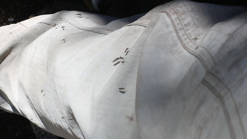
My choice seemed good at first, but I soon began bushwhacking in earnest, and all signs of the path vanished. Plants thrive in the wet environs of a creek. They got thicker and thicker as I pushed on through, shoving branches aside and stomping on anything else below my knees. It took determination to keep on moving forward, but going backward seemed just as bad. Sadly, mosquitos also thrive in this moist environment! I paused to apply DEET early on. This stopped them from landing on my exposed skin, but did nothing to prevent them from being everywhere else. Every other photo had a flying bug in it!
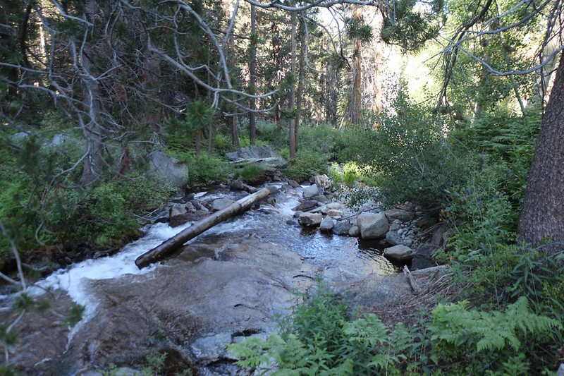
I reached the creek, and discovered that it was flowing stronger than I’d expected. There was no place to cross! I looked upstream and down. Not far away was a downed tree. Maybe it would help me. I powered over to it and made yet another decision to cross. Success! My feet were still dry. But then I realized that I had to climb out of the creekbed; it was very steep and the brush was dense. I grabbed some bushes and used them like jungle vines, pulling myself uphill. Sometimes you just have to go for it!


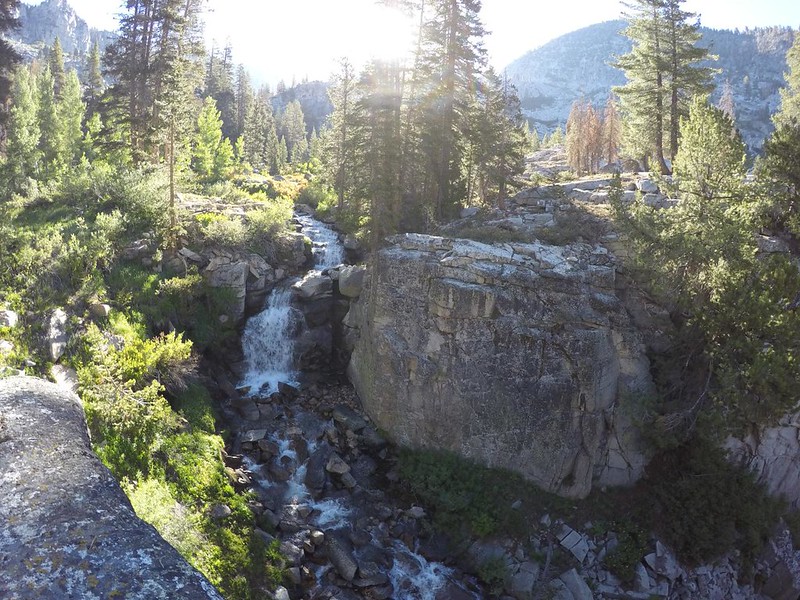
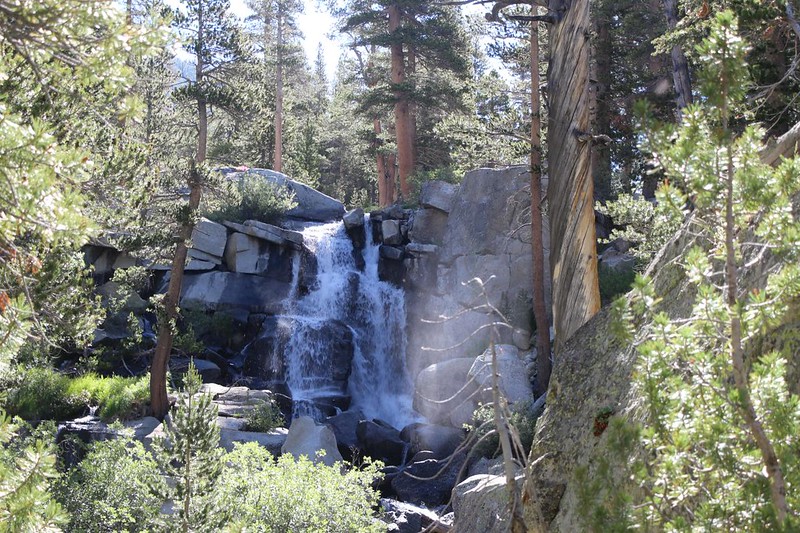
After continuing uphill, hoping to rejoin the dotted line on the GPS, I came across a deep granite gorge. Gardiner Creek poured into it via a stunning waterfall. I decided that this was a good time for a break. I was finished with the creek crossing, and up above me was the likelihood of yet more brutal bushwhacking. But here on the rim of the gorge, it was beautiful. I’ll take my beauty whenever I can get it.

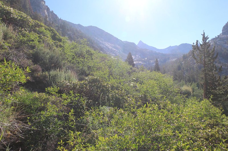
The map said that the trail was up above me, paralleling the creek, so I headed that way. It was a south-facing slope, and the vegetation matched it: Hot and Dry. It was typical chaparral, primarily sage and manzanita and mountain mahogany, and it was tough to find a non-scratchy path between the clumps of bushes. Once again, willpower and determination came into play. The heat and the mosquitos just made it more challenging!


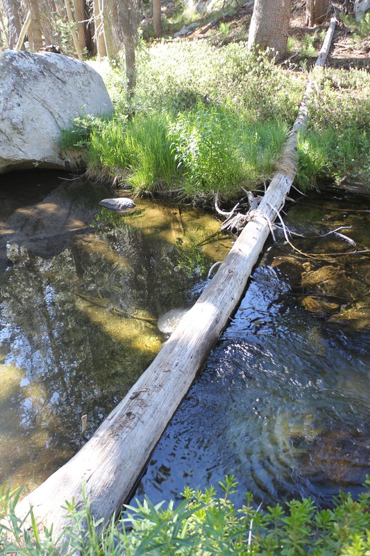
Naturally, after a difficult creek crossing and a more difficult bushwhack, the “trail” crossed the creek again! I was not amused. But at least I found a decent path through a dried-up meadow which was easy to hike. And then I found a perfect log that crossed the creek, which was deep and slow in this flat meadow region. Once again, I got out my hiking stick to help me balance along the log. I also put my big camera in a dry bag, just in case I fell. But I made it across just fine. Not surprisingly, the mosquitos were also happy to see me! They loved the creek. They swarmed me by the hundred-load as I stopped to put away my stick and dry bag. If it weren’t for DEET I’m not sure that I would have survived. It helped that my nylon pants and shirt had a tight weave that was impregnable to bugs.
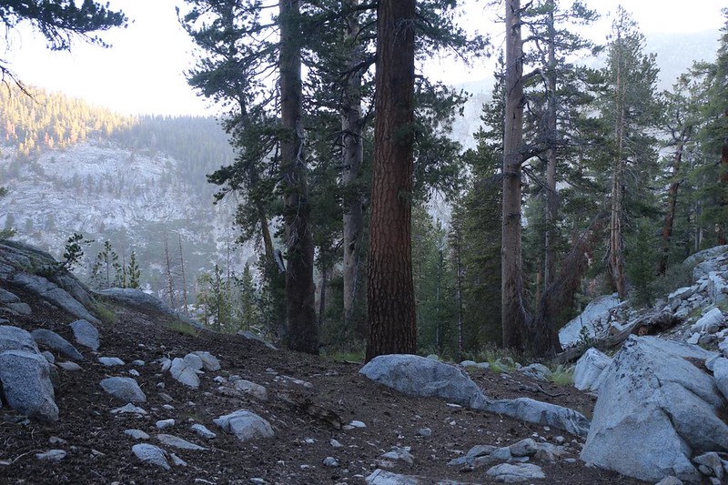
I didn’t realize it at the time, but the worst part of the day’s hike was behind me. I began climbing steadily, in a pleasant forest with no chaparral bushes and fewer mosquitos, but plenty of granite slabs. There was also a lot of route-finding, as the trail was no longer evident. But I didn’t really need it anymore. My GPS gave me a rough idea of where it ought to be, but the real truth was that I had to keep following the stream using the time-tested “Rule of Up.”
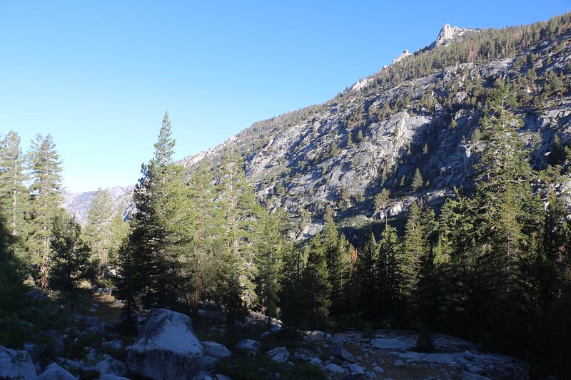
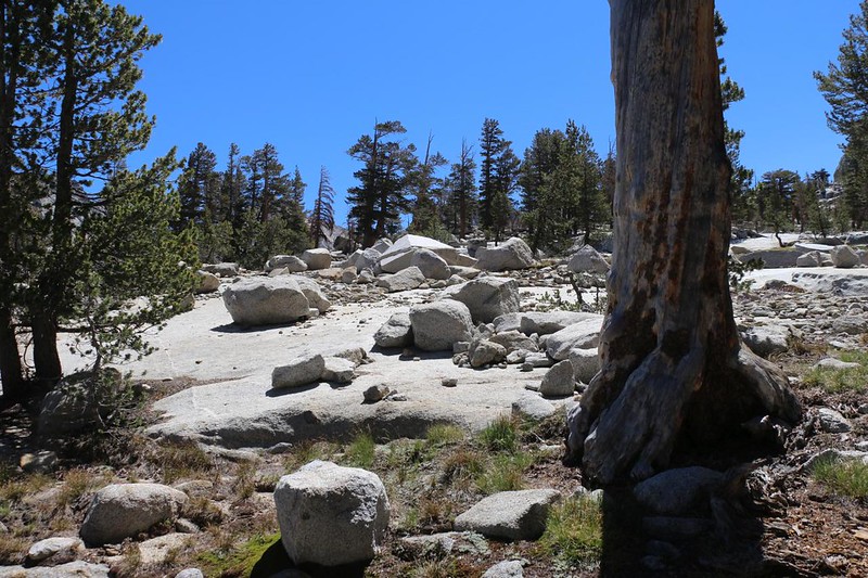
The hiking got mellower once I made it up to the 10,000 foot mark. Glacial slabs of granite abounded, and the trees weren’t crowded. There were just enough shady spots to provide excuses to pause, cool off, and breathe. This was true High Sierra hiking! You don’t really need a trail up there, but it helps to keep your wits about you.
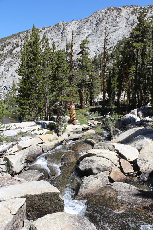
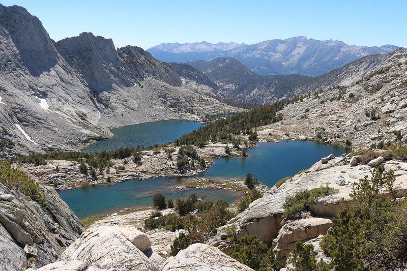
Once I reached lower Gardiner Basin, the hiking became even easier. It was still uphill, as I was roughly following the creek and valley, but the slope was a lot less. This was a region with plenty of high, alpine lakes, and mellow creeks. I saw schools of small Golden Trout in the creek, but I didn’t really feel like fishing for them. Creeks can be difficult, because your hook can get snagged (and lost) much more easily. Plus, these fish were less than six inches long. My size 12 fly hooks were probably too big for their mouths.


I crossed the creek yet again, and now the trail began climbing to the north of the creek. By the time I stopped and looked around, I discovered that I’d completely missed visiting a decent-sized lake. It might have been good for fishing!

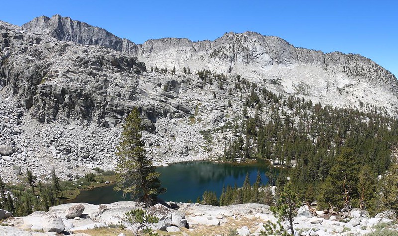
Based on my recent progress, I realized that I had some extra time today, and I was sorry that I’d skipped that first lake. I’d lost my only chance. But the next two lakes weren’t much further below me, so I headed directly south to check them out. It really wasn’t all that far. I stopped along the shore and put down my pack. I got out my Tenkara fly rod and set it up. Wham! I hooked a trout almost immediately. Nice! These fish were hungry, and they had no idea that hooks and monofilament even existed. They were all Golden Trout. I ended up fishing in both lakes, and simply carried my fully-deployed rod between them. Easy hiking and easy fishing. Good times.


I felt a lot better after taking a fishing break. Since I don’t eat the trout, it was much less time consuming to simply catch them with a barbless hook and then release them back into the wild.
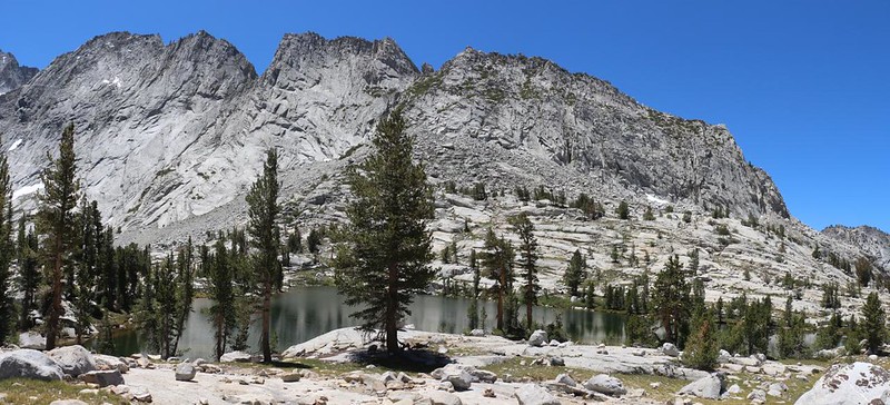
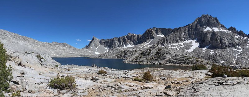
I saw the big headwall ahead of me, and I knew that this was the final obstacle of the day. Consulting the map, it looked like there were several other lakes on the way up, lying between the lower and upper basins. The official trail didn’t go directly up the headwall; it angled upward to the north. This sounded fine to me. Now that I was at 10500 feet elevation, there was very little vegetation. There were a few stunted pines hanging on for dear life, and the rest was bare rock and low, hardy, tundra-style plants. It was freezing cold up here for most of the year.


About halfway up, I made it to the middle lake. I stood along the shore, searching the ultra-clear water for trout. There was nothing! It was a fishless lake. This made me even happier that I’d gotten out the fly rod earlier. Oh well. Before people stocked all these lakes many, many years ago, almost all of the High Sierra lakes were fishless. Some, like this one, were also frogless. The only things living in the water were a few bugs, and there weren’t many of them, either. So I continued onward. But now I had less hope for fishing in the highest lake.


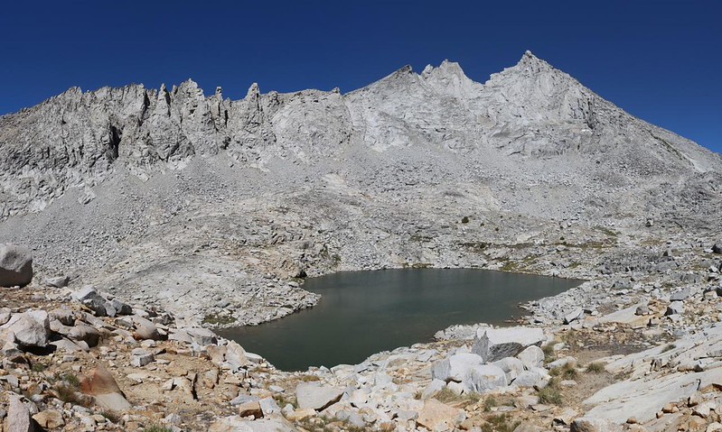
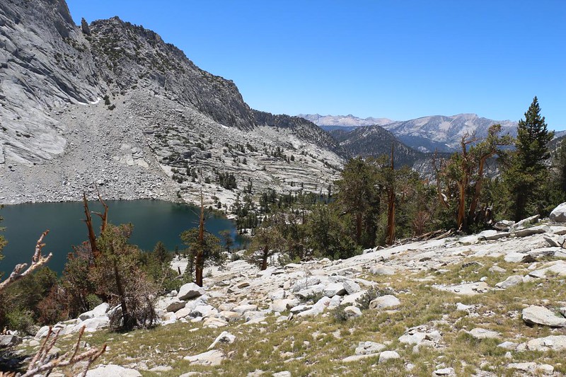
Eventually, of course, I made it to the top of the headwall at 11,500 feet. I stopped to check out the views. The lovely lakes of Lower Gardiner Basin were spread out below me, and I marveled that I had climbed all that way today. The evil bugs and bushwhacking of the morning had been left far behind. The air up here was pure and crisp, and the sky was a deep, dark blue, a color never seen at lesser elevations. I knew that I was almost at the main upper lake (where I intended to set up camp), but I didn’t care. Why rush? I stopped and sat down for a while, and simply took in the scenery. I’d worked hard for this, and I was going to enjoy it!
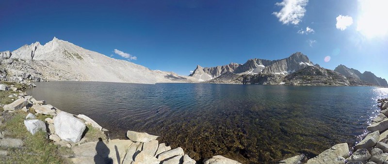
I began to get cool, sitting in the breeze at 11.5k feet, so I put my shoes back on and picked up my backpack. All I had left to do was set up camp and check out Lake 11407, which was down below me in Upper Gardiner Basin. The map showed additional lakes beyond this one large lake, but I couldn’t see them from here. Finding a campsite proved to be interesting. There was plenty of rock, and almost no bushes, but there were only a couple of sandy spots suitable for setting up a tent. I chose one around the corner of a ridge, which was sheltered from the westerly breeze. And it had an awesome view!


After setting up camp, I went down to the lake and collected some drinking water. There appeared to be no fish in this lake. The water was so clear and clean that I didn’t even bother filtering it. If I couldn’t drink out of a pristine lake like this, then what was the world coming to? And nothing bad happened later on, as I expected.

I went back to the tent and cooked up some dinner, then sat around simply staring over the lake, with a particular eye toward the low spot in the east, Sixty Lakes Col. It didn’t look like a tough climb from here. Did it have cliffs? Was it worse on the other side? I realized that I hadn’t done my homework in regard to Sixty Lakes Col. I had no idea what to expect. I decided to put my Garmin InReach to good use. I texted Vicki via satellite, asking for some info. I figured she’d get back to me by tomorrow morning. And if she didn’t, well, I’d be climbing it anyway. Because there was no way on earth I was going to head back down Gardiner Creek! No way, no how.
And then I went to bed, all alone in the Wilds of Gardiner Basin.
For a topographic map of the hike see my CalTopo Page
For LOTS more photos of the trek see my Flickr Page
 << Back to Day 3 Onward to Day 5 >>

