Day 1: Backpacked from the Onion Valley Trailhead to Kearsarge Pass and beyond to Bullfrog Lake
The plan for this backpacking trek in the High Sierra changed so many times that I’ve almost lost count. It changed its Start Date. It changed its End Date. It changed its Destination. It changed its Participants. The only thing it didn’t change was its Starting Trailhead: Onion Valley. And that was fine by me. I’d been there twice before: Once as a day-hike in 2011 and once as a backpacking trip in 2016. It was a beautiful place to begin a trek in the High Sierra.
It’s a very popular trailhead, and there is a daily quota for permits, so I initially made a reservation back in January (six months early) for the fifteenth of July, but it turned out that this date conflicted with my wife’s Summer teaching schedule. So I waited a week or so and made a new reservation for July 28th (and changed the Start Date). Our plan was to spend a week hiking over Kearsarge Pass, then north on the JMT/PCT to the Rae Lakes area, which was supposed to be exceptionally lovely. I had it all planned out: campsites, timing, everything. And then Vicki hurt her foot in early July. As the date of the trek approached we realized that she wasn’t going to be able to make it. So I asked my son if he wanted to join me, which changed the Participants. Luckily, I already had a hike to Mount Whitney from Onion Valley completely planned out (to be hiked some other year), and decided to save Rae Lakes for next Summer. This revised hike would end at Horseshoe Meadows. Thus, I changed its Destination. Then at the last minute my son backed out due to work pressures, and I was left hiking by myself, which changed the Participants again. And I promised Vicki that I wouldn’t hitchhike alone from Horseshoe Meadows, so I changed the Destination yet another time by making it a solo there-and-back hike to Mount Whitney. It would still take a week, and that meant that the End Date was still unchanged. But, as you’ll see, that part changed as well.
The best thing about this trip wasn’t the fact that I would be climbing Whitney. I’d read enough about it to realize that it was a bit too crowded and overrated. Just the same, it was one of those peaks that a true Sierra backpacker should certainly summit, at least once. So that’s why I decided to climb it from the west, via the John Muir Trail. It would be a bigger accomplishment if I spent a week doing it. In other words, the best thing would be the scenery along the way.
Meanwhile, I’d also get the chance to see if I could truly enjoy a full seven days all alone in the wilderness. I’d done a couple of solo overnighters before, and I didn’t succumb to loneliness, so I figured I’d give this a shot. I also had a new tool, a Garmin InReach Explorer, which would allow me to text people from the backcountry via satellite, and would also provide location pings on a map that Vicki could see back home. This technology takes most of the worry out of solo hiking. All I really had to contend with was being alone. I was hoping that the grandeur of the Sierra, the long days of hiking, and the busywork of setting up camp would be enough to keep my mind occupied.

As usual, I woke up early Saturday morning and left San Diego at 3:30am. I arrived at the Lone Pine Ranger Station just before they opened at 8am and got my usual bad luck on the lottery drawing. I was number 36 out of 34 people in line! Don’t ask how this is possible, but it is. From past experience I knew that there would be a wait of at least an hour and a half! Oh well, I sighed. It meant that I might not make the full ten miles I’d planned for the day’s hike, which was aggravating. So I recalled my old faithful mantra and said to myself “It’s OK because I’m on vacation.” This really works! I calmed down immediately. I decided to make the best use of the downtime by heading into town and buying some breakfast. I drove back to the ranger station and ate it in the parking lot, then checked how the line was moving. Pretty slow. So I got dressed in my hiking clothes and finished the last minute additions to my backpack. I would have had to do these things at the trailhead so it wasn’t a total waste of time.
After getting my permit I drove north to the town of Independence and turned west toward Onion Valley. The parking situation up there was the most crowded I’ve ever seen it. Lots of day-hikers everywhere. I found a spot, put my excess food in a bear locker, and shouldered my pack. It weighed just shy of forty pounds, which wasn’t too heavy, considering I had a week’s worth of food in a bear can. Its base weight was about twenty pounds, which isn’t bad.
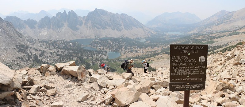
It was 10:30am when I finally began the 2600 foot ascent to Kearsarge Pass. So much for an early start!

Luckily, I was on vacation, I was backpacking in the wilderness, and life was good again.
The only real downside was the weather. There was a big fire just west of Yosemite, the Ferguson Fire, and a smokey haze was in the air. I was able to smell it the moment I got out of the car, and even nearby peaks were getting obscured by it. I was hoping that the weather would shift it elsewhere over the next week, and also hoped that it would be better once I climbed high enough. Both of these wishes came true, thank goodness.
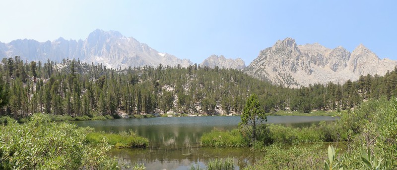
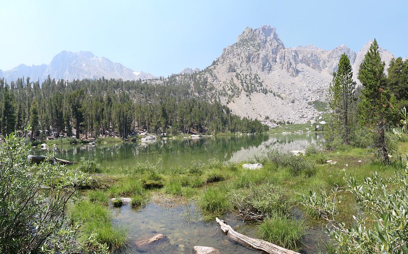
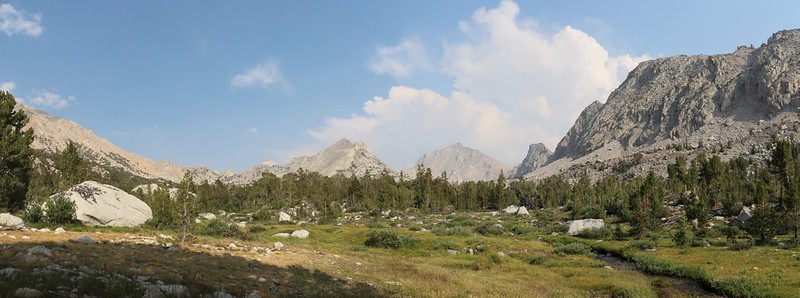
If it weren’t for the smoke, the first section of the trail would have been marked by distant views to the east over the Owens Valley to the Inyo Mountains. But not today. Soon enough, I came upon Gilbert Lake and Flower Lake, true gems that make the Onion Valley climb worthwhile. I also got the first real views of the Sierra Crest and Kearsarge Pass in the distance. University Peak, at 13589 feet of elevation, was the dominant peak in this valley.
I was so concerned about the time I lost due to my bad luck at the lottery that I didn’t even stop for lunch along the way. In retrospect, this was probably a bad decision on my part, but at the time it made sense: If I was going to hike ten miles today then I’d better get a move on. So move on I did, though the grade made it slower than I liked.
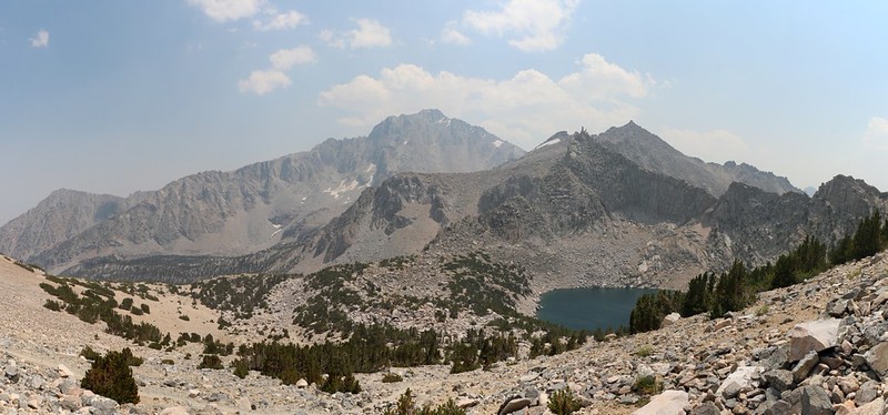
I climbed the switchbacks until the trail looked down upon Heart Lake, then took a breather and ate some snack. I aired out my feet for a few minutes in the shade. I reminisced about the time in 2011 when we ran low on water and I descended the crazy-steep slope to Heart Lake and filtered some while Vicki took a nap up above. It was a tough climb, and I remember thinking that not many people could say that they had drunk water directly from the “Heart” of the Sierra. Vicki even called me her “hero” for doing it.
But those thoughts were bringing on a bout of loneliness, so I resolutely shouldered my pack and continued on.
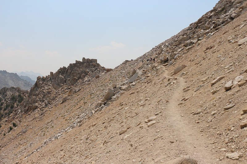
The next stretch of trail stayed high above the tree line, and climbed relentlessly in the sun. I could see other backpackers struggling upward much like myself, and all of us were pausing often to breathe, while cooling off in the gentle breeze.

GoPro panorama video of Heart Lake
It took almost four hours to climb the five miles of trail to Kearsarge Pass, which wasn’t all that bad. It was the crowd of people at the top that was surprising. I hadn’t been seeing all that many hikers on the way up, but when I got to the top it seemed like everybody and their brother was up there! I wanted to take some good photos of the amazing views from the pass, but it was impossible to do so without getting people in the frame. There was also a whole lot of yakking going on.

GoPro panorama video from Kearsarge Pass
I would’ve loved to take an extra long break and have some lunch with a breathtaking view, but it wasn’t going to happen. So I took a few photos and videos, then started descending the trail into the west. This was the second time I’d opted not to eat my lunch, and it didn’t make things any better for me. But the next five miles were all downhill, so how bad could it be? Easy hiking, I said to myself, and headed on down the trail. So what if I was suffering from a bit of altitude sickness. I had a headache and my belly wasn’t feeling so great, which was perfectly normal for anyone up at 11000 feet after starting the day at sea level, and heading downhill was the best thing that I could do.
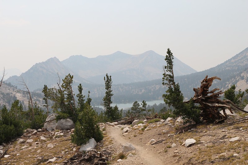
After two miles of hiking I came to the conclusion that I had been pushing myself too hard. I was starting to “bonk” (as the trail runners say) and my energy level was dropping rapidly. I felt tired and totally exhausted. The headache and stomachache merely added to the feeling of general malaise. I headed off to the side of the trail and found a relatively flat spot in the shade. I finally had no choice but to do something.
So I set down my pack and got out my bear can. Time to eat! But my tummy didn’t want much of anything. I told it “too bad” and started eating some salty carbs. I thought that I was probably dehydrated so I drank a bunch of water. I also took an aspirin for my head. Then I got out my book and began reading while trying to stuff more food down my gullet. It wasn’t easy. And, probably because I waited too long to begin with, the food and water didn’t seem to have much of an effect. I still felt like crap. I decided to take a nap and see if that would help. Naps worked wonders for Vicki; maybe a good solid rest was what I really needed. And I tried; I really did. But the best I could manage was a light doze, which was broken whenever a group of noisy hikers went by.
I sat back up and pulled out my map and GPS. The GPS told me that I’d only hiked 6.5 miles out of the ten miles I’d hoped for. And it was already 4pm. I laughed at one of my earlier plans where I had imagined that I could hike fifteen miles per day for two days, rather than three ten mile days. But it wasn’t only a matter of distance hiked. The positioning of the two high passes and the proximity to water when camped played a key role in a plan’s viability. Meanwhile, what my body wanted to do more than anything was to go to bed. In a tent. For the night. So I stared at the map and decided to combine the plans. If I slept here tonight, I would have to get up early tomorrow morning and hike almost fifteen miles. At that point I’d be back on track. I knew that if I was feeling better this would be no problem at all, so I decided to find a camping spot right near here. If I still felt bad in the morning I’d abort the trip and head back to the car. I didn’t come to the High Sierra to suffer, after all.
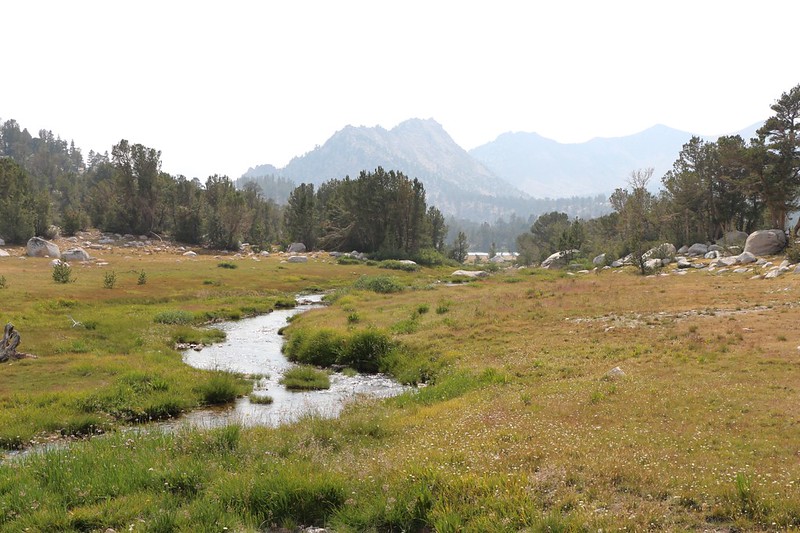
I put on my pack and headed directly downhill toward the stream that ran through the valley. It was pure luck that I had stopped for that big rest about a quarter mile from Bullfrog Lake, as I knew from the park’s website that there was no camping allowed within a quarter mile of the lake. It was still sunny out and I was looking for a flat spot with some shade where I could pitch my tent. I’d roast in there if I tried to sleep inside it under full sun.
There was a bit of a meadow near the stream, and I found a marginal spot that wasn’t too bad next to a sheltering pine tree. I had to move a few rocks but I eventually made a flat place that was just big enough for one person to sleep on. I set up the tent and got my gear inside. I blew up the air mattress and spread out the sleeping bag. Then, even though I didn’t want to do it, I went down to the stream and filtered enough water for the night and also for tomorrow’s hike, so I could get started early.
I got in the tent and checked my watch. It was only 6pm! I was pathetic. There were hours of daylight left! I really should be hiking right now, I told myself. But it didn’t matter any more. I got dressed for the night, then ate and drank as much as I could while reading my book. If I was going to hike fifteen miles tomorrow I’d better store up some energy right now. And then I texted Vicki through the satellite link that I wasn’t feeling so hot and was camping early. She’s been in this position before, and she would understand. For after all, in the end, the best thing you can do is take care of yourself.
For a topographic map of the hike see my CalTopo Page
For LOTS more photos of the trek see my Flickr Page
Onward to Day 2 >> 
