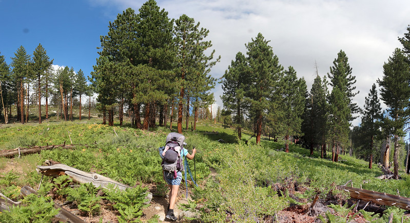
On this day we climbed out of Kern Canyon on the High Sierra Trail, hiking from Funston Meadow to Moraine Lake, for a net climb of almost 2700 feet and six long miles. We woke up at 3am and began hiking before dawn, to get uphill as far as we could before the sun came out and roasted us. Vicki had been dreading this day, and it had finally arrived.
The alarm went off in the dark of night. I gave it a ten minute snooze, just in case, but we didn’t really go back to sleep. We knew what had to be done. We started by getting dressed in our day clothes, and proceeded to pack up as much of our gear as was possible while staying inside the tent. Why? It was cold out there! There was a cold breeze heading down the canyon, as there often is before dawn. Once we put on our windproof gore-tex layers we were ready. I made it a point to take everything I could from Vicki’s pack: Both bear cannisters, all of the food, and even some extra water. My backpack was in full Beast Mode, close to sixty pounds, but I wasn’t worried about me. Vicki was the weak link in the Canyon Climbing Chain, and we both knew it. So we worked together to make it happen. And it did! This was a vacation, after all, not a suffer-fest.

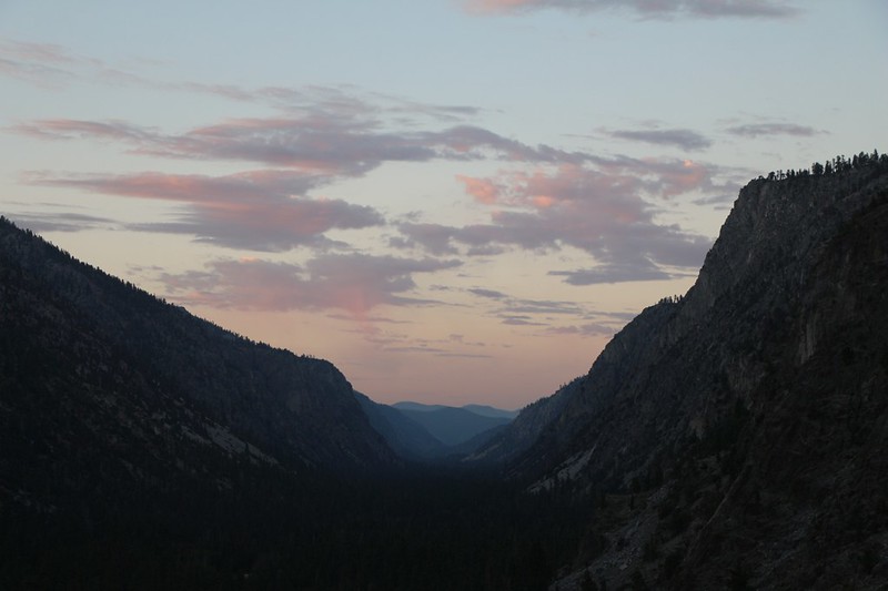
It was cool and dark and peaceful as we hiked out of camp under the light from our headlamps. The moon was still a waning crescent and hadn’t yet risen over the canyon wall. We hiked to the stock gate at the head of the meadow and continued on to the trail junction. We made a sharp left and began climbing up the switchbacked trail that runs parallel to Funston Creek. It was pitch dark at first, but the light gradually grew in the east, and soon we were treated to a lovely sunrise of clouds down-canyon to the south. “Red Sky In Morning, Sailor Take Warning” we said to ourselves, and wondered if we were in for yet more thunderstorms that day. I thought it was likely. All the more reason to get up the trail and into camp before the rain started! But there was no hurrying Vicki. She was doing the best that she could. By dawn, we were already high above the floor of the canyon. Our plan was working!


The windbreaker jackets were long gone by the time the sun was high enough to strike us. We were already more than halfway up the slope, and the air was still blessedly cool. After three hours of hiking, we decided that we’d gotten the jump on the heat, and decided to take a decent break. We took off our shoes and aired out our sweaty feet, and Vicki took a short nap. We ate a bit of snack to recharge our batteries, then put our packs back on. “We must go!”


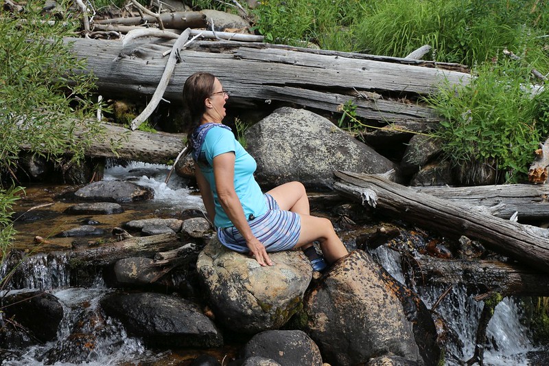
Soon the views into Kern Canyon were left behind, and we continued up the side-canyon that contained Funston Creek. And it, too, vanished, heading off to the left, directly toward our destination at Moraine Lake. We had to continue up a mostly-dry canyon which, after a long hot mile, led us to Chagoopa Creek. This was the halfway point of the day’s hike, at the three mile mark, and we took another needed break. It was getting hot, and taking off our boots and sticking our feet in the icy creek was a welcome relief. We thought about the water going by, and looked east, where we knew that it plunged off the walls of Kern Canyon as a stunning waterfall. We thought about day-hiking down there to investigate, but remembered from experience that waterfalls only look good from below. The view from the top is just a view, but it isn’t a view of the waterfall.
Unfortunately, we still had quite a bit more climbing to do, about 700 feet in three miles (we had already climbed 2000 feet in three miles) but at least it wasn’t quite as steep. And once we arrived on top of the Chagoopa Plateau, the trail would be mostly flat for the last two miles. This was our next goal, to gain the plateau. And as we climbed, we were finally treated to views back east, out beyond the Kern Canyon entirely. We had escaped the canyon! Vicki was tired but happy when I announced this conclusion. She smiled weakly and plodded onward, uphill in the sun, pausing in every drop of shade that presented itself.


By 11am we had been hiking for six hours, and it was time for a major break. We had arrived on the plateau, and all we had to do was cover some distance. But lunch was required. And so was a nap. A long one. We found a nice spot with a breeze and relaxed for a while. I read my book while Vicki slept.

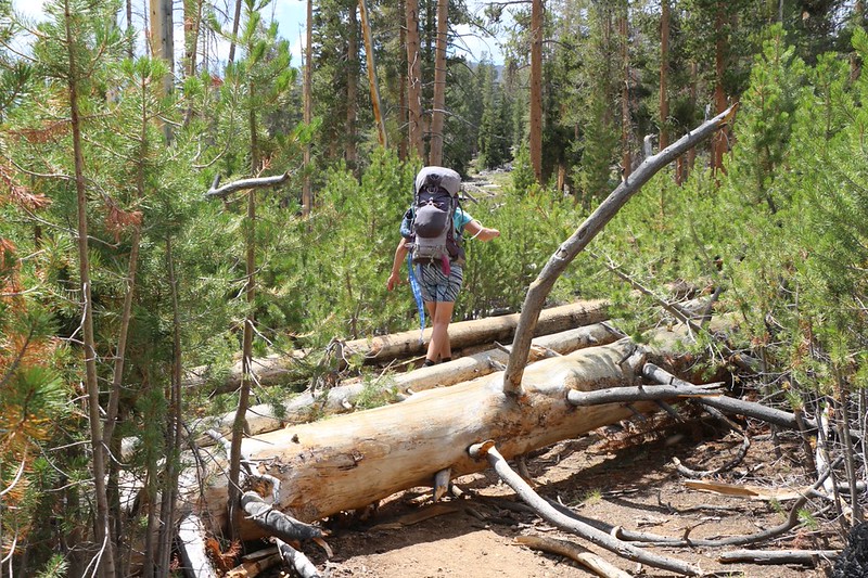
We continued onward through a section of forest which had burned many years ago. Lots of happy new pines, many of them ten feet tall, were everywhere, while other areas had barely been touched by the flames. A windstorm must have come by within the past Winter and knocked down a bunch of the older dead trees, as they were strewn across the path, and were extremely tough to cross without lots of awkward climbing. It didn’t help that in the year 2020 there was no trail maintenance being done, and no horses to bring in the trail crews. So climbing the trunks was the only solution. Maybe next year they’d fix the trail.

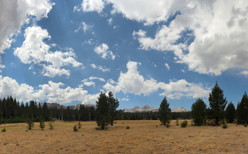
We arrived at the High Sierra Bypass Trail that led to Moraine Lake, and left the HST. Less than a mile and a half to go! And most of it was flat. So we hiked happily onward, and were soon treated to the vastness of Sky Parlor Meadow. It was aptly named, as we discovered when we took yet another break and watched the cumulus clouds drifting northward across the sky toward Mount Kaweah. Beautiful!
Panorama video of Sky Parlor Meadow

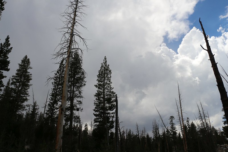
After a short nap, Vicki felt ready to tackle the final hike to Moraine Lake, where we intended to set up camp. We walked through still more burnt pines and watched the clouds building into cumulonimbus clouds, with dark, angry bottoms and bright puffy tops high in the sky. We both knew that it was going to rain again today. We could feel it by this time. In fact, there had been a light sprinkle back at the meadow, but that hadn’t amounted to anything. These new clouds looked like they meant business! Hmmm… Maybe we shouldn’t have taken that nap!

By the time we arrived at the lake, it was already raining. Not hard or anything, but we were thankful for the pine trees. Now to find a place to set up the tent! We could hear thunder in the distance to the southwest, and we knew that it was only a matter of time before we got drenched. We had no idea where to go, so I headed for the lake. I figured that at least I’d get a few good photos in before the deluge. Vicki was not amused as I paused to take those precious pictures, but I did it anyway.

Panorama video of Moraine Lake with clouds and rain and hail forecast to arrive soon

It all worked out for the best. We saw a potential campsite not too far from the shore and put down our packs under sheltering pines. Thankfully, the rain let up temporarily and we set up the tent in record time. There had been a perfect spot for the tent, a flat shelf on the long slope to the lake, and we almost put the tent directly on it. We looked at each other, and looked at the rain clouds. We had learned over the years to never trust these perfect flat spots. They often became deep puddles during the torrential downpours in thunderstorms. Unless they had good drainage, that is, and this one didn’t. So we decided to suffer a bit by sleeping on a slope as insurance against flooding. And it’s a good thing we did!


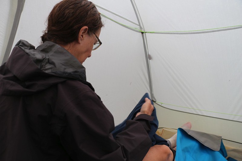
We put our gear into the tent as soon as we could, and placed our backpacks within the vestibules, so that all was sheltered. But the rain held off. We went down to the lake and filtered two gallons of water, but that was all the time we were given. The rain started back up and we dove inside the tent. The air got cold and we spent some time getting into our warm, nighttime clothes. The sky grew dark and it got even colder. The spattering raindrops got larger and louder, and then they changed into hail. Soon we were subjected to a staccato pounding on the tent, like a drummer on a snare drum, and we watched as quarter-inch hailstones began piling up just outside the vestibules of the tent. The hail eventually passed us by, and the large raindrops continued to fall. We checked for leaks all around the perimeter of the inside of the tent and thankfully didn’t find any. Yay, tent! A few minutes later the rain stopped, and we dared to look outside through the doors. There was a significant pile of hail next to the tent, and plenty more dusting the campsite with white. As predicted, the “perfect flat spot” just downhill from the tent was a giant puddle about two inches deep. Yay, us!
GoPro video of a hailstorm from within our tent while we hunkered down


We didn’t know it, but this series of thunderstorms were not localized to this area. They were affecting almost all of California, due to a huge plume of moisture welling up from the Pacific Ocean in the south, the remnants of Tropical Storm Fausto. These storms spawned almost 11,000 lightning strikes (mostly dry lightning) and started 367 fires in Northern California on August 16 and 17, 2020. Many of those fires became huge, and much of the state was swathed in smoke for months. But we knew nothing of this at the time, being out in the middle of nowhere, warm and dry and blissfully ignorant.
In fact, the only thing we were interested in was checking out the lake and eating dinner. It didn’t take long before most of the clouds began breaking up, although we still saw (and heard) continued thunderstorms to the west of us over the Great Western Divide. We cooked up some dinner and took it down to the lake shore, in order to dine with a view.


Afterward, we took an after-dinner constitutional along the lake shore. The lake was steaming and there were some ducks in the reeds. The lake seemed shallow, and probably warm, but we didn’t try to take a swim after all that ice just got dumped into it. We met a few fellow campers and talked about the trail, and what a weird year it was in the backcountry, thanks to Covid-19.


We retired to the tent and got out the map. Tomorrow we would be hiking about seven miles to the Big Arroyo Camp, which was about the same altitude as we were (9300 feet) but the trail climbed up to 10,600 along the way before heading back down to 9500. At this point, we considered that to be merely a moderate day of hiking, but we still wanted to leave early to attack the uphill part while it was cool. So we set the alarm for O’Dark-Thirty and went to sleep. We had survived the toughest day of the trek, and if anyone deserved a rest it was us!
For a topographic map of the hike see my CalTopo Page
For LOTS more photos of the trek see my Flickr Page
 << Back to Day 6 Onward to Day 8 >>
Up to the main page: “High Sierra Trail 2020”

