We hiked north on the Pacific Crest Trail to Thousand Island Lake, then turned south on the John Muir Trail and visited Emerald Lake, Ruby Lake, and Garnet Lake, after which we continued on the JMT to camp near Shadow Creek. All in all, it was a beautiful day spent backpacking in the High Sierra.

When your alarm goes off in the darkness, you always spend a moment or two wondering why you set it. Not necessarily because you’re confused about where you are or what you have planned, but why on earth you chose to set it at this ungodly hour of the night? After all, it’s quite cold in the morning at 9500 feet elevation, even in the middle of Summer. Why not just stay in your sleeping bag a little while longer, until the sun comes up and warms the air? Those are the important questions that plague the wannabe early riser.
This was one of those days when I asked those same questions of myself, and hit the snooze button on my phone. I snuggled a bit deeper next to Vicki. She wordlessly agreed with my decision. But it was too late for us. We were already wide awake. These things happen. It didn’t stop us from waiting the ten minutes of snooze-time, but we got up on the next round. We knew that there was uphill hiking to be done, and getting it over with in the shade is what makes Vicki happiest in the long run.
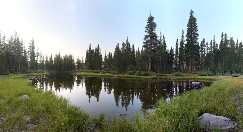
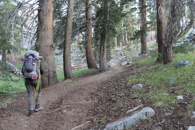
We got dressed, ate breakfast, packed our gear, put on our backpacks, and said goodbye to the Badger Lakes. It was time to get hiking!
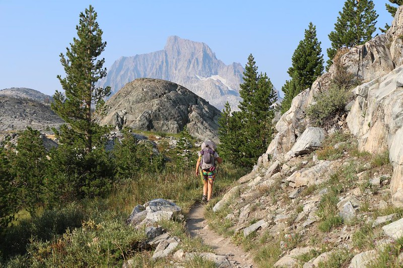
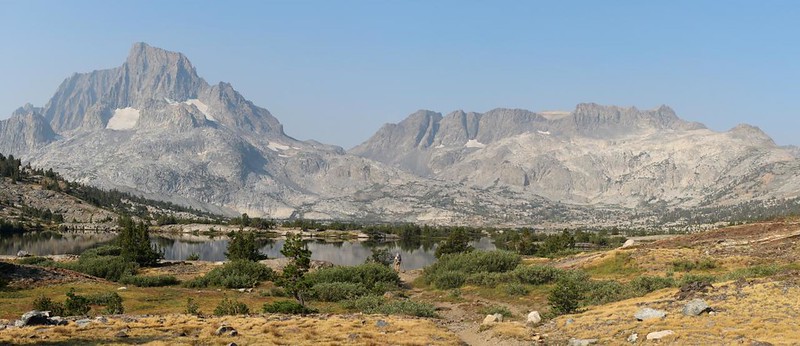
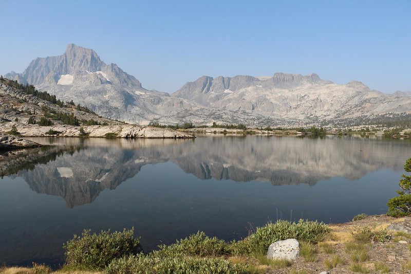
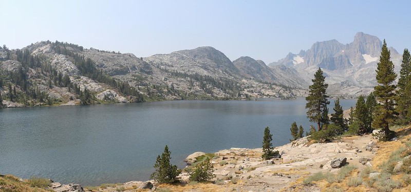
The PCT headed west toward Thousand Island Lake, uphill, generally following the Middle Fork San Joaquin River valley. The river had its source in the Thousand Island Lake Basin. Now, 2021 was a very dry year in the Sierra, but there must have been some snow still melting somewhere up there in the high peaks, because the river was flowing just fine. And Vicki was enjoying the views immensely, especially when Mount Ritter and Banner Peak appeared. They were mighty peaks, and quite distinctive. We’d seen them years before, when we did a loop out of Tuolumne Meadows in Yosemite. On that trip, we headed southbound on the PCT/JMT and turned around at the lake. This trip would (finally) link up our trail sections! I was excited, to say the least.


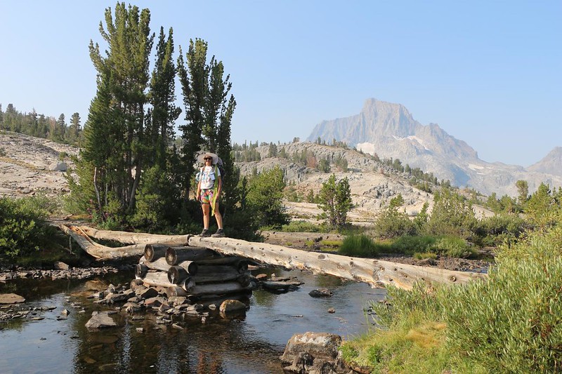
We met a group of backpackers heading south, and we took each other’s pictures. The view really couldn’t be beat. Vicki and I try to get a decent shot of the two of us on each major hiking trip, and this spot really ticked off the checklist. What a view!

We continued down to the lake and found the trail sign where the northbound PCT joined the JMT, The linked trail continued north to Yosemite, on the route we’d already hiked. Our plan for this trek was to hike both of the “separated” sections of trails. One end was here, and the other was down at Devils Postpile National Monument. We would take two days to get there (mostly because we’re wimpy hikers – many people do it in one day). Therefore, after taking a short break for photos, we turned around and headed south on the John Muir Trail.


After an easy climb out of the basin, maybe 100 feet or so, we came upon the second lake of the day: Emerald Lake. The trail didn’t get very close to the shore, so we simply enjoyed the view from above. Very pretty.


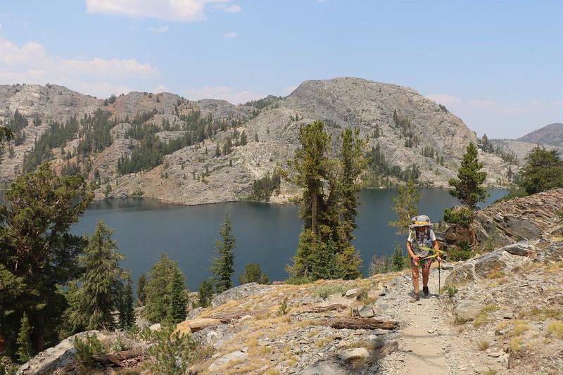
We hiked a ways further and came upon Ruby Lake, which seemed much deeper than Emerald Lake. I checked on the map, and there was a regular gemstone theme going on in this part of the Sierra! Vicki and I liked it better than spots with unimaginative names like “Lake Number One.” In this lake’s case, at least there was some reddish rock to help give the blue water some reflected color. We met another group of hikers while climbing up from the shore, and I offered one of them a hundred dollar bill if he would jump off the high cliff across the way into the obviously deep water below. We all laughed, but no one took me up on it.


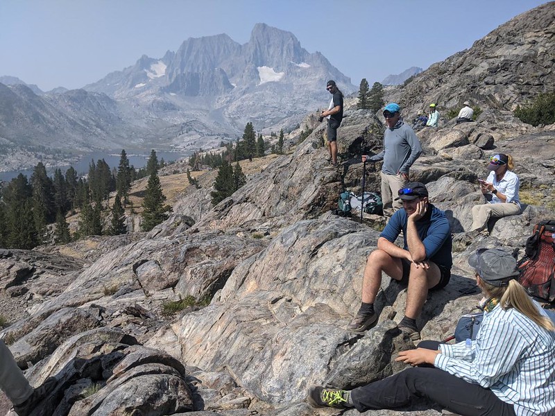
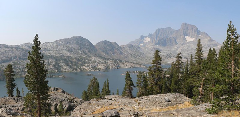
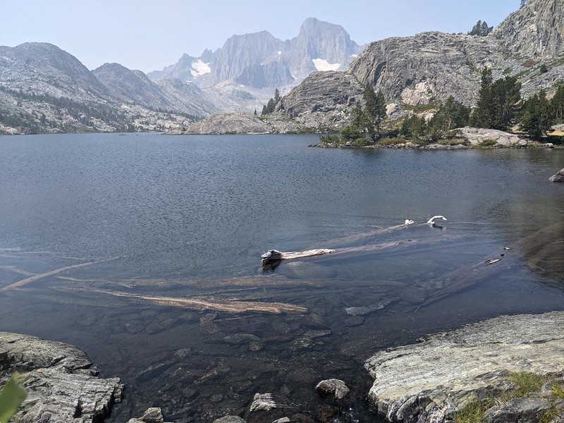
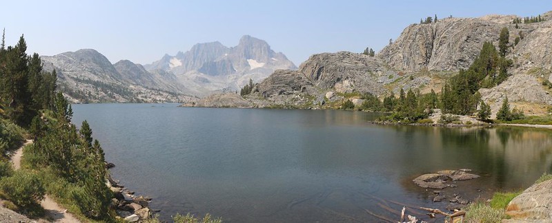
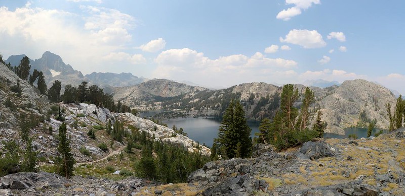
After climbing up some switchbacks we arrived on an unnamed pass. There was a great rest spot made of rounded granite slabs, which had an incredible view over Garnet Lake, looking west toward Banner and Ritter. There were several people up on top, taking a break, and we decided to take one, as well. More hikers arrived and joined us afterward. I took a ton of photos and videos, as usual. These folks were mostly JMT hikers this time of year (both north and south bound), as the PCT crowd was long gone by mid-August, headed into Oregon and beyond. (It turns out that plenty of PCT hikers take the JMT side of the valley, because of the pretty lakes, even though they technically aren’t allowed to be here, and would get in trouble if a ranger caught them.)

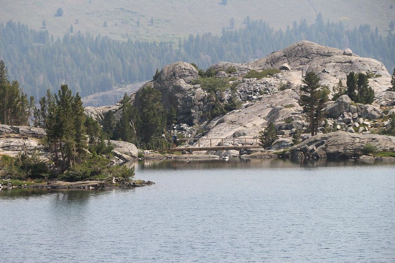
We headed down the long trail to Garnet Lake (it seemed long because I kept stopping to take photos) and eventually made it to the wooden bridge that crosses the lake’s outflow creek. We met a bunch of people hanging out there, as well. And why not? The view across the lake was surely one of the best in the Sierra. We got out our lunch and took a very long break. Vicki even took a lengthy nap in the shade. Meanwhile, I read my book, looking up often to gaze at the view. I could’ve stayed there all day.


A Rested Vicki is a Happy Vicki, and soon enough we were hiking south once more. We had about 400 feet of climbing in a mile of hiking to get up and out of the Garnet Lake basin, and it was hot in the sun. Just before the trail left the shore of the lake, Vicki went down and doused her shirt and head in clear, cold lake water. She whooped from the chill when she put the soggy shirt back on! (Sorry, no videos!) And then we started climbing. Goodbye Garnet Lake! If I had known beforehand, I would have figured out a way to camp there. It was that pretty.


We ground up the switchbacks and eventually arrived at the pass. Yet another unnamed pass. If you ask me, one of them ought to be called “Garnet Pass.” The northern side had the best view, so that’s the one I’d vote for, except for the fact that Garnet Peak was on the south side. Hmmm. No matter its name, Vicki was happy when the climb was over.

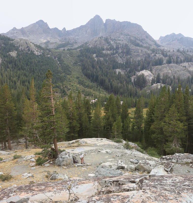
I checked my map, and it looked like we only had two miles left to hike, downhill for about a thousand feet, deep into the Shadow Creek Valley. This was the sort of news that an overheated Vicki loves to hear. After a short break to cool off, we cranked out the miles in what seemed like no time at all. Along the way we got interesting views of the Minarets off to the west. They were steep and formidable looking peaks.
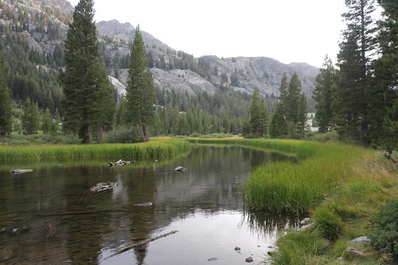
Once at the bottom, near the creek itself, we learned from an official sign that we weren’t allowed to camp too close to the water. It had been seriously overused in the past, and was now recovering. So we put down our packs just off the trail, and I went in search of a proper spot. Vicki took a well-deserved break. I could tell that she was done for the day.


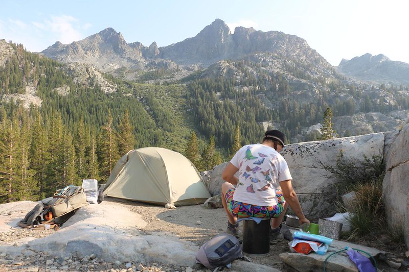
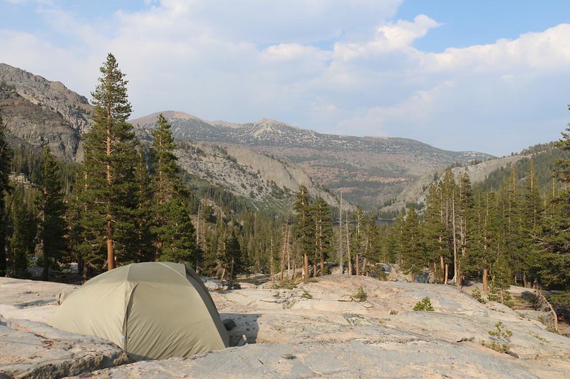
I found a spot with great views, up on top of a glaciated granite ridge just north of the creek. We set up the tent and put our gear inside. Then I went down to the creek to get some water. It was very peaceful down there, with lots of great places to camp. All forbidden now. No wonder it got overused!

Pretty soon Vicki had dinner cooking, and the two of us ate it with great vistas all around us. The Minarets were in the west, and Shadow Lake was down below us to the east. Far across the valley was the trailhead where we started our hike yesterday morning. In two more days we’d be back there once again.
I brought out the map and showed Vicki tomorrow’s plan. We would hike down the valley to Shadow Lake, then climb up 700 feet to the south. Vicki groaned about that. We concluded that we should get up extra-early once again, so that she could make the climb in the cool of the morning. And that decision pretty much ended our day. We headed for the tent as the sun went behind the Minarets. The air cooled and flowed down the valley, as the shadows fell upon Shadow Creek.
For a topographic map of the hike see my CalTopo Page
For LOTS more photos of the trek see my Flickr Page
 << Back to Day 1 Onward to Day 3 >>

