On the third day of our trek we continued south on the John Muir Trail, hiking from Shadow Creek to Minaret Creek, while visiting numerous lakes such as Shadow Lake, Rosalie Lake, Gladys Lake, the Trinity Lakes, and Johnston Lake. It was truly a stunning Summer day in the High Sierra.
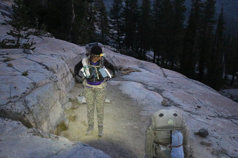
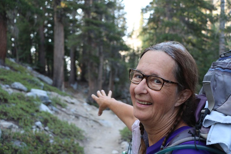
Vicki wanted to make the 700 foot climb south from Shadow Lake in the cool of the morning, so we packed up everything by first light. We tiptoed out of camp to avoid waking the neighbors, and soon were heading downhill along Shadow Creek.

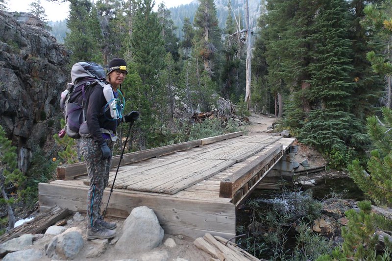
GoPro video while crossing the footbridge over Shadow Creek on the John Muir Trail
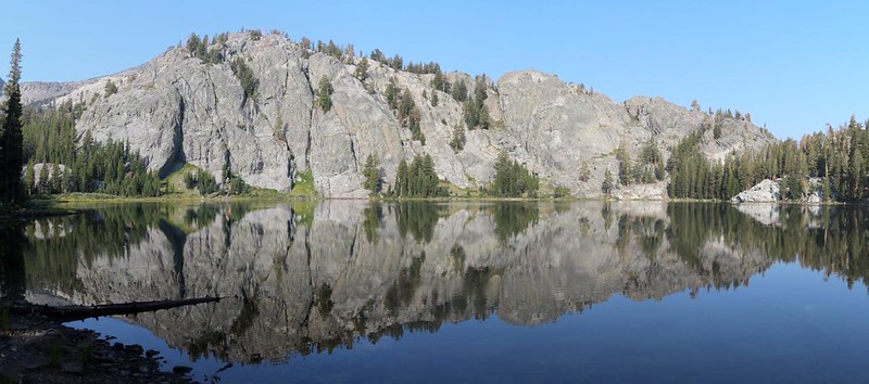
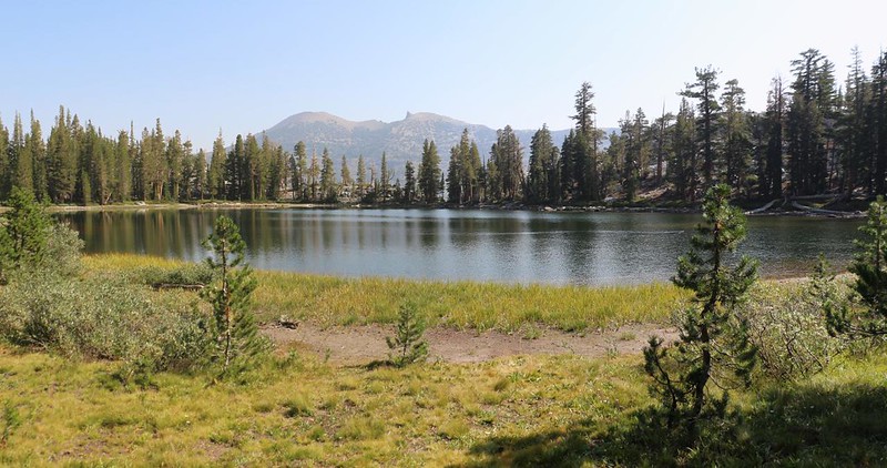
We arrived at Shadow Lake at dawn, just like we’d planned. We took a short break to take in the sights. There were many ducks swimming on the still surface of the lake. The air was dead calm, so the reflections of nearby mountains in the morning light were lovely. I took too many photos, as always.

Video of ducks swimming across the still waters of Shadow Lake before dawn


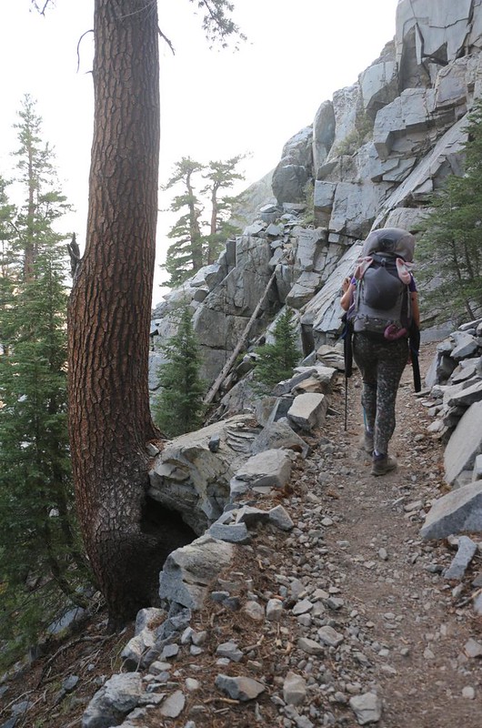
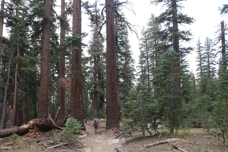
We spent the next hour climbing a crazy-steep slope, and we were thankful for the switchbacks. It was a 15% grade even with the zig-zags, and whole lot steeper if you tried to climb straight up. No, thanks! We took at least one good break on the way up, and were grateful for the shade and cool temperatures. Getting up early paid off. Vicki was actually happy and still had energy when we reached the top! Amazing but true.
Rosalie Lake was really pretty. We walked along the shore and took lots of photos. Down at the far end, near the outlet, there were a group of people camping. They were just waking up and eating their breakfast. We recognized each other. These were the same folks we’d hung out with yesterday, up on Garnet Pass. They were a fun crowd. It was like Old Home Week on the trail. Vicki and I kind of wished that we had hiked a bit further yesterday, so that we could have joined the party. But there was no way Vicki would have made it up that hill in the heat of the afternoon. No, it was probably better this way. We continued onward, and said “See you soon!” because we knew that they were heading all the way to Reds Meadow, and would surely pass us by in the near future. We’re not exactly speedy hikers. We just get up earlier.


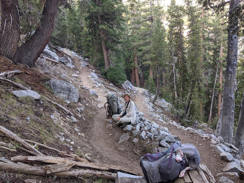
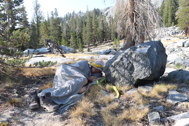
Speaking of slow and early, we had 300 more feet of climbing to do in order to reach the next lake, and Vicki wanted to get it over with before it got too hot. So we continued on, and soon enough we were on top of a broad saddle. We were directly in between Rosalie and Gladys Lakes. Unfortunately, this climb was the final straw for Vicki and her energy level. She made it to the pass, but ran out of gas. I looked around and found a nice spot for her to take a nap, which she promptly did. I got out my book and began reading for a while. It was a mellow spot. We moved on after Vicki woke up and ate a bit of snack. Her energy had been restored. A nap is much more healing than most people realize.
Gladys Lake turned out to be much smaller and shallower than Rosalie Lake. It was up high, so there were decent views of surrounding peaks. We could see that its water level changed significantly during the dry season, as it wasn’t fed by north-facing slopes with long-lasting snow. But let’s be honest: It’s hard to complain about any lake up here in the High Sierra! They are all unique in their aspect and beauty.

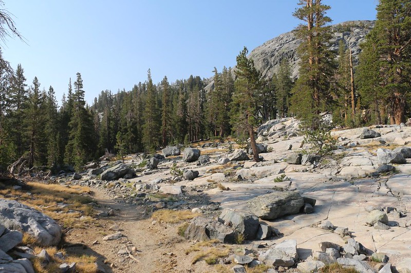
There was only about a hundred feet of climbing left, in order to get out of the Gladys Lake basin. Once we made it up there, we were home free. The rest of the day’s hike was going to be downhill! Vicki was happy, and that’s an understatement. We had four and a half miles to go, with a 1600 foot descent. That’s a nice, mellow slope. Easy hiking.

The Trinity Lakes were next on our day’s agenda. There were several of them, but only two were situated next to the trail. We stopped in the shade along the shore of the first one and ate an early lunch (since we woke up so early). Our friends from Rosalie Lake passed us by as we ate, and we wished them a successful climb of Mount Whitney (the southern terminus of the John Muir Trail). A few months later on, one of them sent me photos of us that he had taken, and he informed me they all managed to summit together. Yay!


The trail continued descending for a few more miles. The trees got larger, and the clouds in the sky got bigger. We welcomed the shade when a cloud drifted by overhead, but hoped that there wouldn’t be any thunderstorms later on that afternoon. But if they did, we were prepared. Also, we were making good time, and would probably have our tent set up by then anyway.
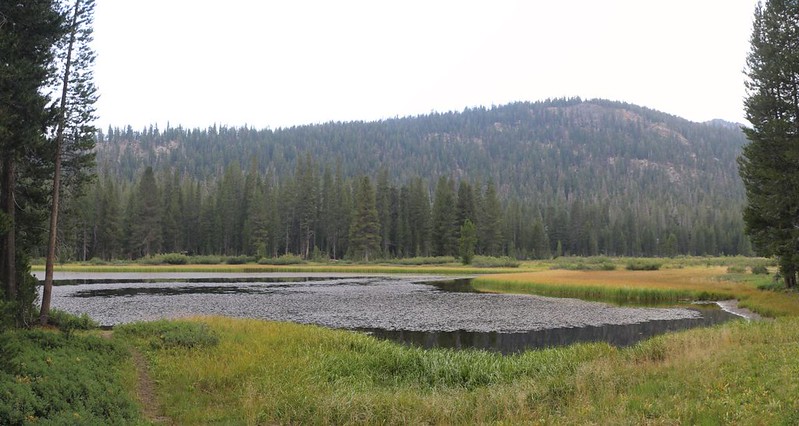
After hours of easy hiking, we made it to the bottom of the Minaret Creek valley. Johnston Lake was there, surrounded by reeds and swampy land. The valley was very wide in this section. It narrowed as we continued south, and soon the creek was flowing next to the trail. It was running quite low and slow. It must rage in the Spring, judging by the long log bridges that crossed it. They hardly seemed necessary right now.
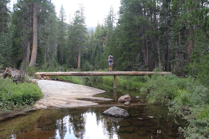
GoPro video as I crossed over Minaret Creek on a long and narrow log bridge
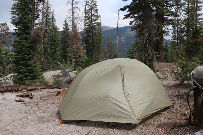
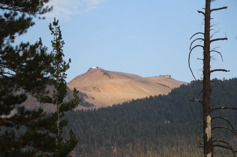
We found a decent spot to camp, just above Minaret Falls. I chose this spot because I wanted to be near water, and also because I knew that we weren’t allowed to camp within the Devils Postpile National Monument, which was less than a mile down the hill. There were a number of campsites all along the trail in this area. Other hikers must have had the same idea. The bad part about the spot was that we didn’t have a lot of shade, and it was really hot down there at 8000 feet elevation. The good part was that we could see Mammoth Mountain, and there were cell phone towers on top of it. Signal! I sent some pictures to friends and family to make them jealous of our vacation. That’s what cell phones are for!

We took life easy for the rest of the day. We hung out in the shade of a nearby pine and read our books, while listening to the sound of Minaret Creek down below us. A number of hikers went by, but most of them wanted to get a hamburger at Reds Meadow Resort. That’s a mighty strong aroma, to have made it all the way over here from several miles away! We laughed, but we couldn’t help them with directions, as we’d never been there ourselves. Tomorrow, however, was another story. We’d be finishing up the loop hike, and burgers were on the menu!
After dinner, I got out the map and we looked at the plan. We’d be heading down to the junction where the Pacific Crest Trail diverges from the John Muir Trail. We would hike the PCT north for six more miles and 700 feet of climbing. For much of the way, it followed the Middle Fork San Joaquin River, with an easy grade, but then at the end it climbed up the canyonside to Agnew Meadows, where we left our car three days ago. It sounded like a plan. And then we headed into the tent and hit the sack. It had been a very long day.
For a topographic map of the hike see my CalTopo Page
For LOTS more photos of the trek see my Flickr Page
 << Back to Day 2 Onward to Day 4 >>

