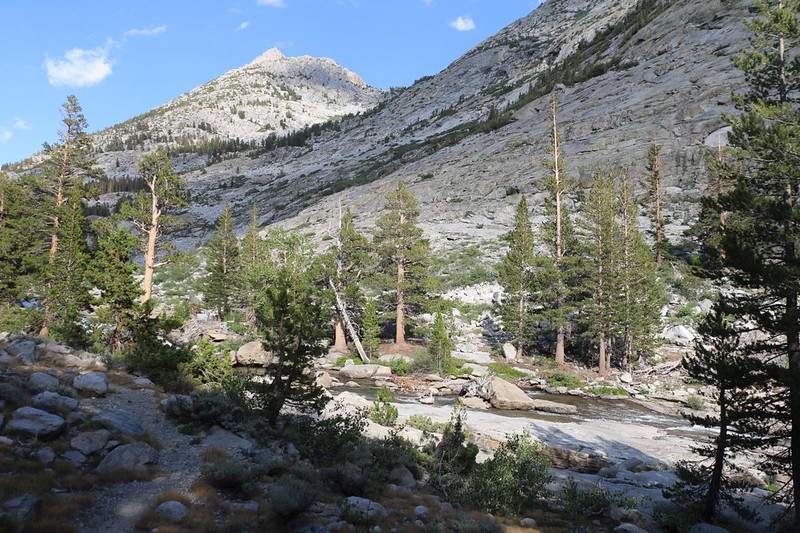
On the fourth day of my trek, I backpacked north from Evolution Lake, down into the Evolution Valley with its lush meadows and waterfalls, then down even further to the South Fork San Joaquin River, which I followed downstream yet more, until I left the JMT/PCT for the Piute Pass Trail, climbing this time, and eventually camped along Piute Creek. It was a very long day.
I woke up before dawn, as usual. That’s what happens when you go to sleep at sunset! I ate my usual cup of hot oatmeal and packed up my gear. By the time I was ready to hike I looked down at the tents below me on the shore of the lake and only one person had crawled out of their tent. The rest were lazy snoozers. But that suited me fine. I’d have the trail to myself for a while.

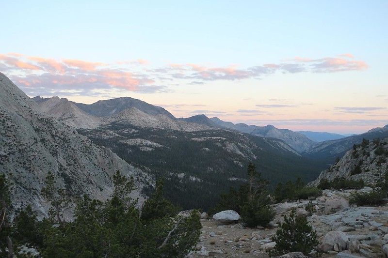
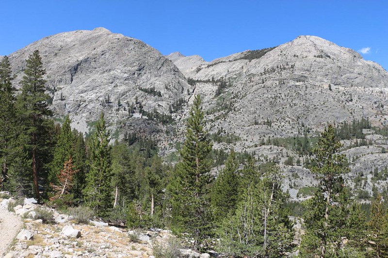
I climbed down off my hilltop aerie and walked along the southern shore of Evolution Lake. I didn’t see anyone moving this time. Then I continued north. The trail descended steeply into the forest as it left Evolution Basin. No more High Sierra tundra for me today! Meadows and trees and waterfalls were on my menu. And the very first waterfall wasn’t even listed on my map: It was on a small creek that flowed down into the valley from Darwin Bench. I heard it thundering off to the side of the trail and went over to check it out, and I’m glad I did. Excellent!


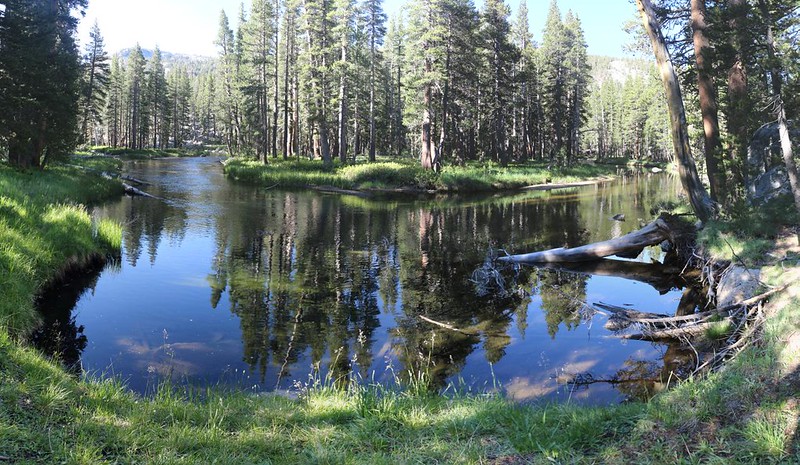
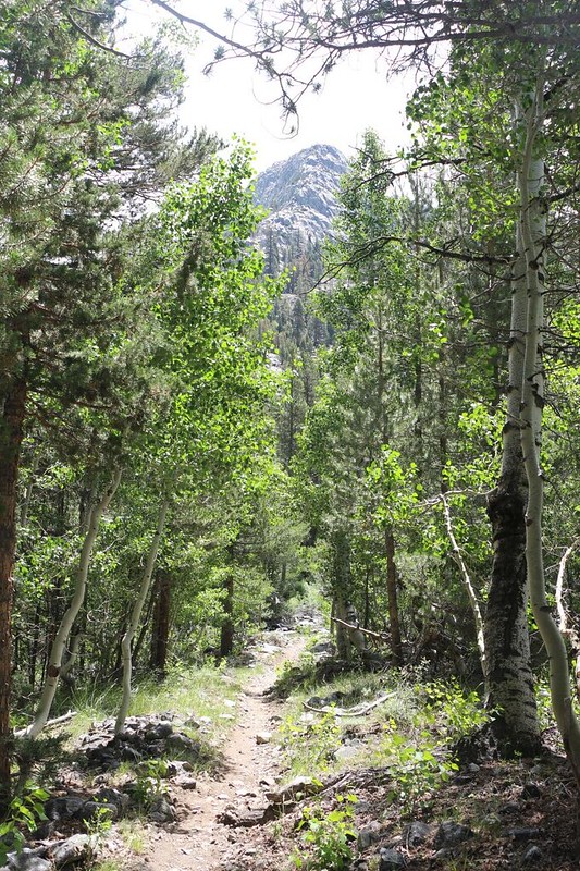
After that, I was down on the floor of Evolution Valley. The trail wandered along through the forest, not far from Evolution Creek, which was flowing peacefully and slow. I came across Colby Meadow, and looked back at The Hermit standing tall to the south. Next came McClure Meadow and the Ranger Station. Thanks to Covid regulations, the signs posted trailside asked people not to visit unless it was an emergency, One of the signs mentioned a “Bold, Aggressive, Large Bear” that had been raiding food at the Piute Creek area – exactly where I planned to stay that night! Oh boy. Just what I didn’t need. I took a break on the edge of the meadow and got out my map. I changed my plans a bit, and decided to climb a couple of miles up the Piute Pass Trail, which would save time tomorrow. Truthfully, I wasn’t all that worried about a bear. I had my food in a bear cannister, But getting partway up toward the pass seemed like a fine idea. I’d see how I felt when I got to the trail junction.


Evolution Valley was about four miles long, and descended from 10,000 to 9,000 feet elevation, which was quite a mellow grade, and definitely below the treeline. Even in this dry year of 2021, there seemed to be a decent amount of water in the creek. As I hiked along, I met several PCT Through-Hikers heading north. They were running a bit late to make it to Canada before the Autumn snows, and they knew it. They were hustling right along. I told them to skip Oregon, because it sounded mostly like boring forest with no views, and a hiker named Strawberry told me that there was a thing called “Oregon in Two Weeks” which skips the lame parts. She was seriously considering it. I wished her well.
Soon the trail crossed Evolution Creek, which was quite large at this point. More like a river. There was no bridge. There was a traditional wide and shallow ford. I finally had a chance to use the water shoes I’d been carrying! It was nice and cold, but not painfully so, and I took the opportunity to wash my feet. There were hikers with quick-drying shoes that just walked right in, but most of us had a chance to talk as we dried our feet. Backpackers are really friendly and fun, so it was a good time.
GoPro video as I forded Evolution Creek, just north of Evolution Meadow
I continued down through the forest, not far from the creek, until I neared the northern end of Evolution Valley. It ended the same way that it started: With Waterfalls! Very exciting. I left the trail to follow right along the creek, and took way too many photos and videos. The water was seriously cascading as it made its way over the steep edge of the valley, flowing downward into the South Fork San Joaquin River Valley, which I could see off the edge of space to the north.


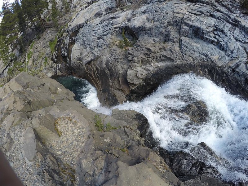
I didn’t realize it, but that was the last I’d be seeing of Evolution Creek. The JMT headed off to the west before switchbacking its way down to the valley floor (700 feet of descent) while the creek simply dropped straight down over the side of the canyon. There must have been many more waterfalls on the way down, but, sadly, that wasn’t part of my plan for the day. The map showed that it eventually merged into the South Fork San Joaquin River somewhere out of sight of the trail.

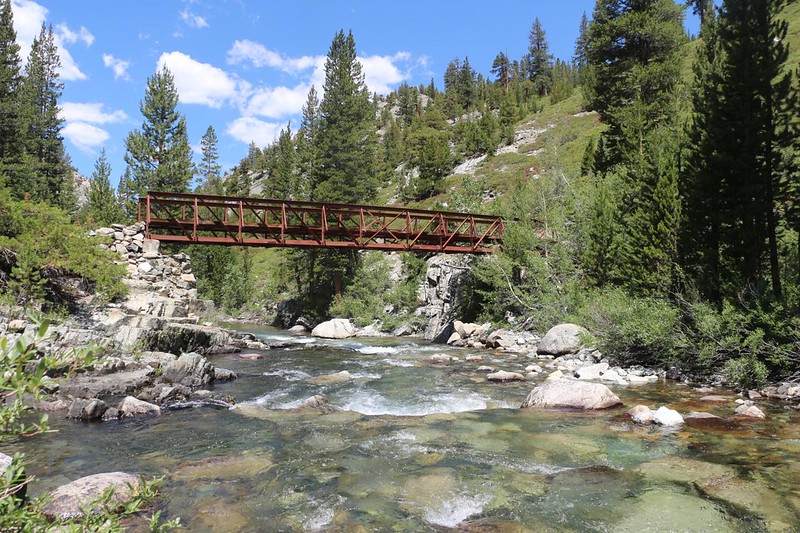
After descending into the valley, I noticed how hot it was. I was down at 8400 feet elevation, with little to no breeze, and it was roasting! Not only that, but the trail was going to head even lower as I followed the river downstream. Oh well. At least there might be shade along this section, I thought to myself. The first thing the trail did was cross the river on a wooden bridge, far upstream from its merging with Evolution Creek, so it was still relatively small. Then I hiked north, paralleling the water. It was high noon, I realized, and there wasn’t any shade at all on the trail with the sun beaming straight down between the trees. I wasn’t enjoying this as much as I would have liked.

GoPro video as I crossed the wooden bridge
I decided to stop for lunch a short ways ahead, and hung out in the shade next to the water with a couple of PCT hikers that I’d spoken to earlier. They finished up their meal and continued onward, while I read my book and watched the river go by. Evolution Creek had already joined forces and the river was much larger. There was a strong metal bridge just downstream, and it was fun to cross. I like bridges; what can I say? Building anything out here must be quite the challenge. After lunch was finished, I reluctantly put on my pack and continued hiking in the roasting sun. Maybe if I was lucky there would be a breeze.
Video of the river from my lunch spot

I hiked along this stretch of river for almost three miles, and sweated profusely the entire time. I drank a lot of water. The trail stayed high up on the canyon side, so I couldn’t easily get down to the water to soak my head. Oh well. I’d get my chance eventually. At first the canyon was narrow, and the river had created deep channels to flow through. It was quite dramatic. In the Spring of a snowy year it must be incredible.
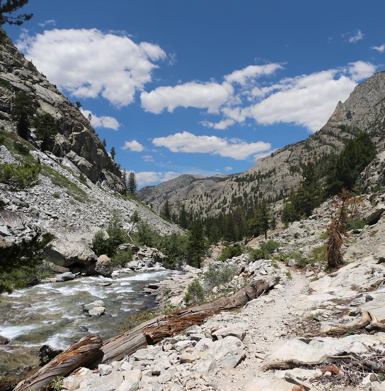

Along the way I came across the “Muir Rock” which I had seen on the topo map. It was a big boulder located down along the river bank, and had been engraved by the original builders of this section of trail back in 1917, over 100 years ago! This trail really had a lot of history behind it, and I wondered just how many horses and people had travelled through here in the past. Thousands upon thousands of happy people enjoying the wilderness.

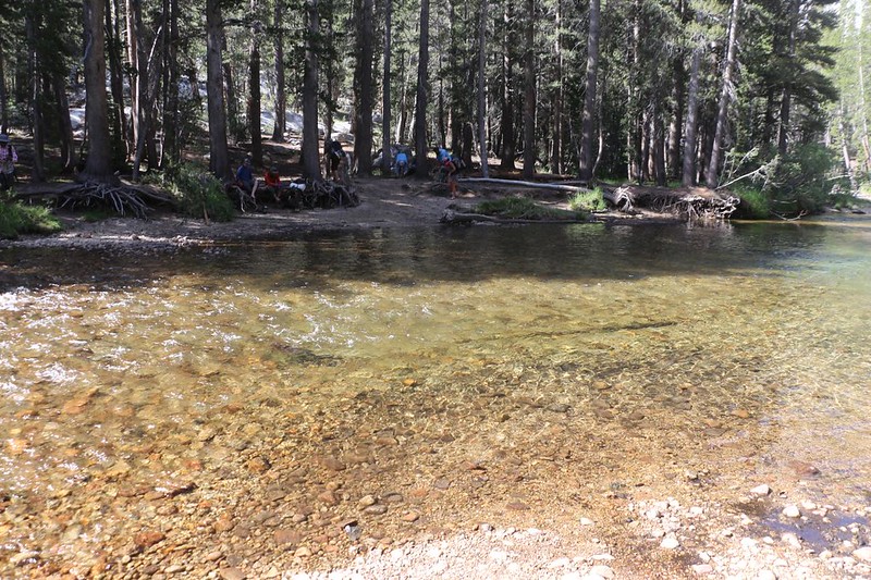
After the narrows, the valley widened and there were many hot and sunny meadows that I trudged through, at least according to the map. I didn’t pay a whole lot of attention, I’m sad to say, and even fewer photos. I was definitely overheating, and simply wanted to take a long rest. Which didn’t happen until I reached Piute Creek and the metal bridge that crossed it. I found a shady spot above the creek and took off my pack. I went down to the water and splashed some on my head. Aahhh! That felt great! I sat down on a boulder near my gear and got out some snack. I took off my shoes and let my damp feet dry out in the breeze. Oh, yes, this was heavenly!
It was only 1:30pm, and I had a decision to make: Was I going to camp near here (where the large, aggressive bear might be prowling) or was I going to continue hiking on the Piute Pass Trail, uphill for miles in this roasting heat? This wasn’t a trivial decision. I got out the map and came up with a plan, but it wasn’t perfect. The Guthook PCT app on my phone showed most of the camping spots along the main trail, but it didn’t show any of them on the trail I was about to take. Just as I was pondering what to do, a couple came down the trail! I jumped up and pumped them for information. Their answers were vague, as expected, but they did say that there was definitely a spot a decent ways up the trail, but they weren’t great judges of distance. I was OK with this, as it’s hard to tell distance when you’re hiking fast downhill, as it feels so much different heading the other way. But it helped me make up my mind. I would head up the trail. If I did this, then I might make it over Piute Pass the next day, and hike out early on the final day, which would allow me to drive home later on that afternoon. That was the new plan, I decided. Now that the best parts of the trek were over (quite possibly), I was beginning to yearn for home.
But it was still too hot for climbing, I told myself. Maybe if I waited a bit the sun would be at a lower angle as I headed north, so that the trees would have longer shadows for me to rest in. Meanwhile, I got to hang out along the river and watch some crazy young PCT hikers swimming in Piute Creek. They were having a seriously fun time on a hot Summer’s Day. My mood was improving by the minute!

Video of a PCT hiker butt-sliding under the bridge

I hung out by the creek for an hour and a half, until 3pm. The air seemed to be getting a bit cooler, so I packed up my stuff and headed out. It was uphill all the way, and there was occasional shade, as I had hoped, so I didn’t get heat stroke or anything. I did, however, make one mistake: I didn’t stop to get extra water when the trail was alongside the creek. The trail immediately climbed high above the creek, and stayed there, perched on the canyon wall. I only had about a liter left of the three I’d started with that morning. I wasn’t thrilled, but I figured that there would be a side creek somewhere along the way, as the map showed some possibilities. I hiked onward, rather than head back down.


I used my water like always. In other words, I was probably dehydrated. I kept hoping to find a side stream, but all of the obvious places were dry as a bone. The year 2021 was certainly one of the driest in a long time, as it was early July and the hills were bone dry. But the views from the trail made up for it. I could see both up and down the canyon, and there was no shortage of glaciated granite in evidence. The trees were also providing good shade, except for a couple of bare places where avalanches had swept the forest away, leaving only chest-high chaparral. Then it was hot, and I sweated out what little water I had.

I climbed upward for two miles without seeing a single decent campsite, either. I needed both water and a flat spot. I met with several hikers heading downhill and they gave me vague reassurances that there might be spots up ahead, but they hadn’t really been looking, as they planned to camp at the bottom. Finally, two ladies told me that there was a spot just ahead, right next to the creek! I was overjoyed, and felt a million times better. I sucked the last of my water from the hose and hiked on, filled with new energy. The trail even flattened out to make my way easier. Life was good again.
I found a spot right next to the creek in the shade of a small grove of trees. This site had been used for years, and there were several flat spots. I set up my tent and got my gear situated inside. Then I got some water and filtered it. Yay! It tasted cold and fresh. A couple of mosquitos came out in the cooler air as the shadow of the mountain came into camp. I put on my night clothing and used a bit of DEET on my face to repel them. I’ve seen worse, bug-wise. Then I ate some dinner and took photos and videos of the waterfall that was just downstream from my tent. Very scenic.

Video of a waterfall on Piute Creek near my campsite in lower Piute Canyon

There wasn’t going to be much of a sunset from down in the canyon, so I went to bed early. I also set an early alarm. I had 2500 feet of climbing to do tomorrow, and I wanted to get as much of it done as possible while it was still cool. I checked my GPS and discovered that I had hiked almost 15 miles today! And it felt like it. I had descended 2500 feet and climbed another 1000 feet to get up here. It had taken me almost twelve hours, although I have to admit that I took several very long breaks. It all worked out in the end, however. I had a really good time and met several really nice people. The forest and meadows of Evolution Valley had been very beautiful, as had the waterfalls along the way. All in all, it had been another great day in the High Sierra.
For a topographic map of the hike see my CalTopo Page
For LOTS more photos of the trek see my Flickr Page
 << Back to Day 3 Onward to Day 5 >>

