After visiting the Muir Hut, I hiked onward from Muir Pass, down into the starkly beautiful Evolution Basin, as the John Muir Trail followed Evolution Creek past Wanda Lake, Sapphire Lake, and, finally, Evolution Lake, where I spent the night. It was one of the most scenic hikes I’ve done in the High Sierra, and that’s really saying something!
After taking a long break and exploring the Muir Hut, it was time for me to continue on. I’d been there alone for more than a half hour, which was pretty amazing as it is typically quite a busy place during the day. Maybe it was because it was still early morning. Pretty much everybody on the Pacific Crest Trail / John Muir Trail stops here for a long, well-deserved rest. So I put on my backpack and started downhill, heading north. I had about five miles to hike, descending 1100 feet. I was feeling good, and had a big smile on my face. This was the life for me!


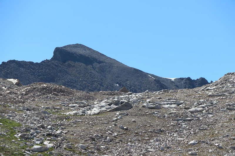
First Stop: Lake McDermand. This lake seemed relatively shallow, at least from the trailside perspective. It was as if the ice field/glacier that filled this basin 20,000 years ago simply scraped flat everything and anything in its path. This lake was one of the slight depressions that it left behind in the solid granite bedrock. I wondered if there were fish in it, but I didn’t stop to check. I met a few JMT hikers heading southbound toward the hut, which I pointed out to them in the distance. I also learned from one couple about a great spot to camp at Evolution Lake, which they showed me on my GPS map. Nice. I hate setting up my tent only to find a “perfect” spot afterward, when it was too late.

In this extra-dry year of 2021, I had no trouble at all crossing Evolution Creek as it flowed down into Wanda Lake. The trail was also very easy to hike. There were mountains all around me, ringing the upper basin. I got out my phone app (PeakFinder Earth) and used it to put names to many of them. It’s as good an excuse to stop for a break as any other!
Panorama video with Lake McDermand and Wanda Lake
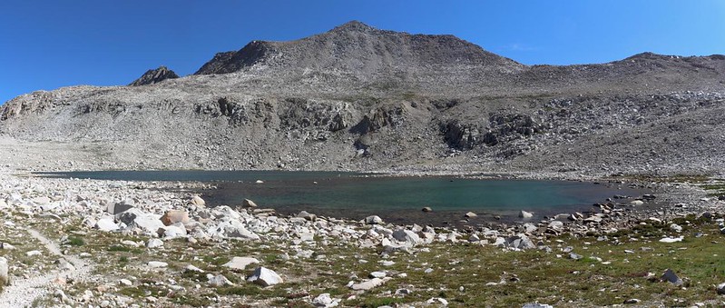
Wanda Lake seemed darker-colored and deeper than McDermand. The trail followed directly along the shore. And that was when I experienced one of the wildest things on this entire trek: The mosquitos on the edge of the lake were swarming like I’d never seen before. Thick clouds of wildly swirling bugs were all around me! The whine of their wings was incredibly loud. It was insane. They smacked into my face and I even breathed one in! I tried to wave them away but it was impossible as there were simply too many. The only thing I could do was run! I walked/jogged as best I could, but still stopped to try to get them on my camera, on video. Sadly, they were so small and fast (and unfocused) that I didn’t know if it was possible. After a quarter mile of this madness the trail finally drew away from the water, and the bugs ceased just like that. Amazingly, none of them had bitten me. I wonder why not. Maybe they weren’t mosquitos at all? But I didn’t go back to test it, either.
Video of a crazy Mosquito Swarm at Wanda Lake – Look closely and you can see them swirling

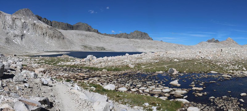
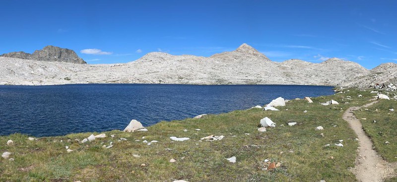
After that experience, I took a short break to recover my wind. Then the trail swung north and dropped down into (middle?) Evolution Basin., where there was yet another beautiful lake. This one had no proper name; like so many lakes up here. It was designated on the NFS topo map by its elevation: Lake 11293. It probably should have been named after a biologist or philosopher, like the rest of the “Evolution Theme” that took place all around here. Mounts Darwin and Mendel being representative of the idea.


The trail continued steadily downward until it went beyond a lip and dropped precipitously into lower Evolution Basin. Sapphire Lake came into view. And, yes, it was very blue, although I’m not sure it truly qualified as sapphire. Still, it was quite lovely. The surrounding mountains made for a stunning backdrop, and I was happy to see some cumulus clouds beginning to form. As always, I took far too many pictures. I can’t seem to help myself.
GoPro panorama video of Sapphire Lake

I left the trail and headed down to a flat granite slab near the lake. I took off my backpack and got out some lunch. Vicki had made me several quesadillas to carry with me, because the melted cheese and flour tortillas stayed fresh almost indefinitely. They were a great trail food. I got out my book and simply relaxed. Life was good, and this was a perfect spot for enjoying it. A few people hiked by on the trail and we waved to each other, but I was otherwise left undisturbed. Very mellow. It was noon and I only had two more miles to hike, so why rush things?
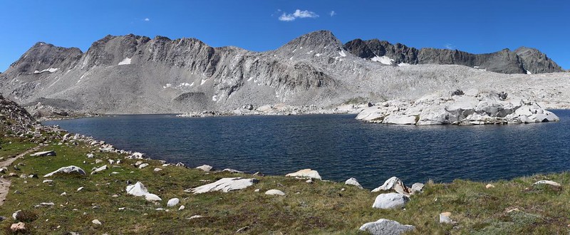
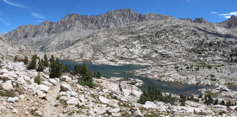
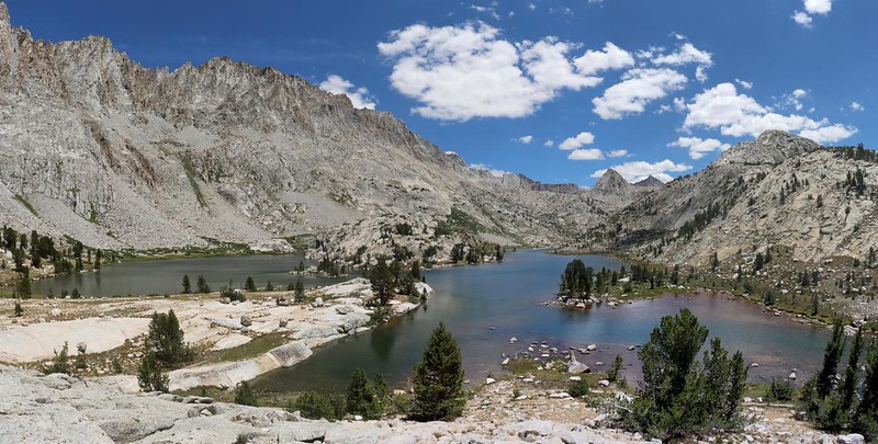
Eventually, of course, I packed up everything and continued onward. Maybe I was feeling the need to snag that really great camping spot that I was told about. Regardless, I started hiking. In a half mile, Evolution Lake came into view, and so did the wide ford that crossed Evolution Creek just above the lake. Large boulders had been placed to help hikers cross it with dry shoes, which I appreciated. The stones were large and solid, and it was fun hopping across them while keeping my balance.


The final piece of trail alongside Evolution Lake was almost two miles long. That’s a big lake! It stayed high up above the meadow-like region next to the lake, which I think may be a new trail location to keep the damage to the area to a minimum. I could see an old path down below near the shore, and it looked quite tantalizing as I climbed upward over a ridge in the hot sun. But it was all for the best, I suppose. An awful lot of hikers travel this trail every Summer. On the plus side, the views of the lake were better from up there. And I really don’t mind working extra to gain great views.

Panorama video of Evolution Lake (10852 feet elevation)
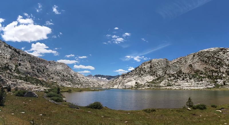


I made it to the north end of the lake where most of the campsites were located. It was only 2pm, but there were already several tents set up on the isthmus that aimed southward. That was one of the prime spots I’d heard about. The other was up on a rounded granite hill to the north. It looked pretty steep to me, so I wandered down the trail and eventually discovered an easy way up, then headed back toward the lake. There were several spots up there, and the view was everything I was told it would be: Glorious. There was also a bit of a breeze, and the sun was quite intense, so I picked a spot in the lee of some stunted pines. It would be shady eventually, in the late afternoon.
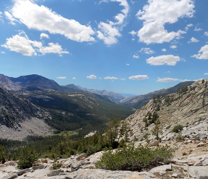
After setting up camp, I wandered around on top of my glaciated granite knob. I took pictures and videos in every direction. To the south was Evolution Basin, and to the north was Evolution Valley, where I would be hiking tomorrow. There were meadows and trees down there, unlike the stark basin. It looked lush, and interesting. That guy I spoke to had been right: This was a great campsite!
GoPro video from my campsite

Panorama video looking down into Evolution Valley
Eventually, of course, I had to find a path down to the creek to get water, and I found an easier route than the way I came up. I schlepped the filtered gallon back up the steep-sided hill and set about making some more noodles for dinner. They weren’t much, but they were OK once I added extra salt. I also ate a bunch of Cheeze-Its, which really hit the spot.

I read my book and looked down on the lake. Some of the folks on the isthmus were swimming in the icy water. No thanks, I said to myself, even though it had been a hot afternoon. Maybe some other time. As the shade from the pines covered my tent, I retreated inside and took a short nap, then read my book some more. This really was the life. I could do this all the time!
For a topographic map of the hike see my CalTopo Page
For LOTS more photos of the trek see my Flickr Page
 << Back to Day 3a Onward to Day 4 >>

