I spent the second day of my trek hiking from upper Dusy Basin on the Bishop Pass Trail, all the way down into Le Conte Canyon, at which point I headed northbound on the John Muir Trail, and stopped for the night alongside the Middle Fork Kings River, a few miles shy of Muir Pass.
I woke up that morning at first light, 5am, and poked my head (and camera) out the tent door. To the east was the waning crescent moon, just above the Sierra Crest, along with a few of the brighter stars. It was cold and clear, and I didn’t really want to go outside right then, So, once again, I violated the rule against cooking inside your tent, and boiled some water for a hot oatmeal breakfast. Technically, it was under the vestibule of the tent, not inside the tent itself, so it was OK. I guess. But my legs stayed warm, and it sure tasted good!


Then I started packing up my gear, in my usual methodical way. No matter how fast I go, it always seems to take me about two hours to get ready (an hour and a half without breakfast). So I left camp at 7am, as the sun rose above the Sierra Crest, at precisely the moment when I no longer needed it for warmth. Typical.
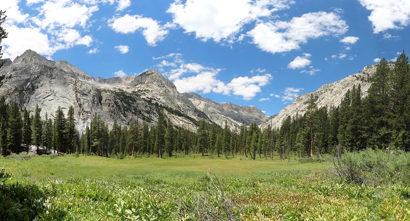
I had about 2500 feet of descent ahead of me, in four and a half miles, which is steep but not excessively so, and I fairly flew down the trail. Before I knew it the Sierra Crest was gone from view, and I was hiking through lower Dusy Basin. This is a very pretty area, with lots of water. Mosquitos, too!

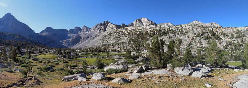

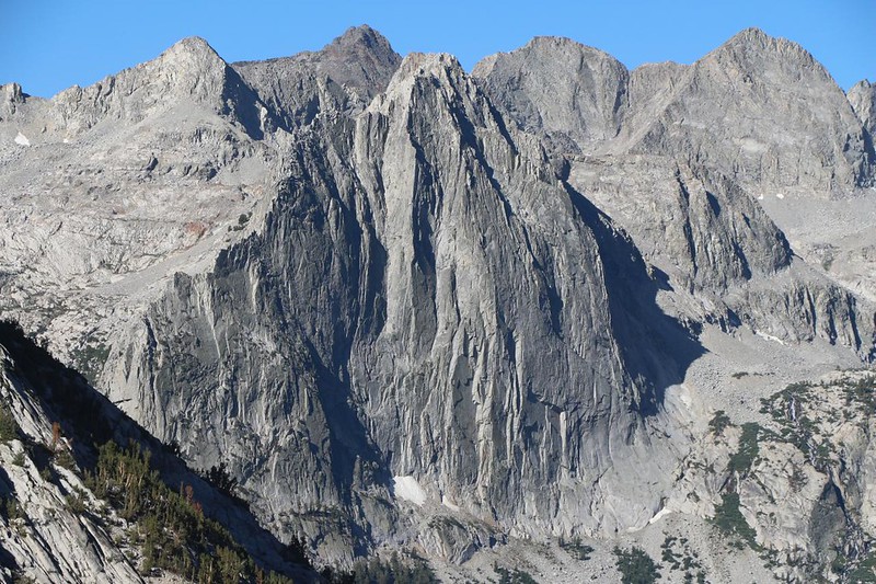
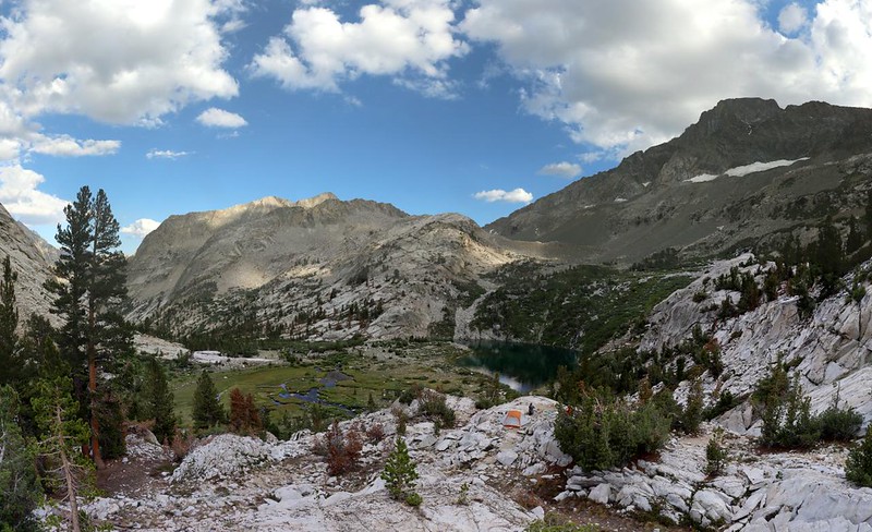
Soon enough, the trail popped out above the headwall, looking down into Le Conte Canyon. The Citadel and Langille Peak were the two dominant mountains across the way. Two thousand feet below me flowed the Middle Fork Kings River. I remembered climbing it the previous year with my son, and it made for one heck of a day. That climb was the main reason why I was descending it this year! No lie. Most people hike this loop counterclockwise, but I knew better. At least I hope I did. I’d find out for sure in four more days, when I climbed up the long trail to Piute Pass.


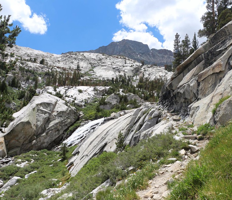
The creek that flows out of Dusy Basin is called the Dusy Branch. “Branch” is an odd descriptor for a creek, but that’s what is written on the topo map. And it wasn’t the first Branch I’d seen in the Sierra. But its name certainly didn’t detract from the way it cascaded down out of the basin. It was beautiful. Waterfalls are always worthwhile.

Video of the waterfall and bridge on the Dusy Branch

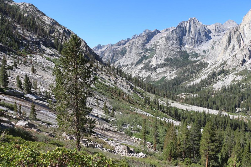
Anyway, I can now say with certainty that going down into the canyon was far easier than climbing out of it. I took a short break at the junction with the Pacific Crest Trail / John Muir Trail and had a bite to eat. The weather was much warmer down there at 8700 feet elevation, and it was sunny. I knew that I had to head up-canyon the rest of the day, and I was about to do some serious sweating. It wasn’t the lowest point on this trek, but it was low enough for me.
I packed up my gear and put on my pack. Time to get hiking! I’d gotten myself down into this deep canyon, and now I had to get myself back out of it. One foot after the other. And it wasn’t so bad, really. The views down here were seriously nice, and the sound of running water was never far away. Next stop: Little Pete Meadow and Big Pete Meadow. And now I’m wondering who “Pete” was. But I can’t seem to find anything on the internet.


It was a steady climb through the meadows, and it had been just as hot as I’d expected. I had to pause in the shade of trees every so often to cool down, as there wasn’t much breeze that day. When the trail neared the river, I took off my pack and soaked my head in the icy water. Now that was the way to get cool!
As the afternoon wore on, the valley narrowed and steepened. The river started to get seriously loud. There were many small waterfalls along the trail, and they all gave me good excuses to cool off while stopping to take photos and videos of them. It was a Win-Win situation.

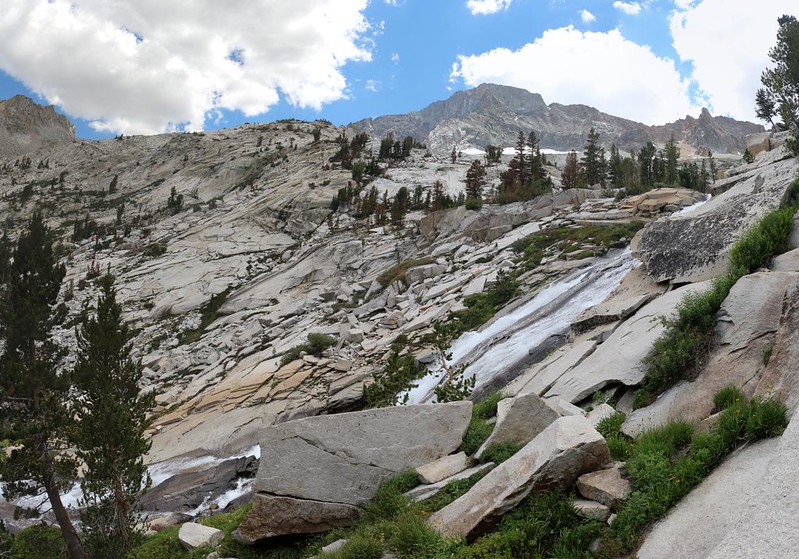

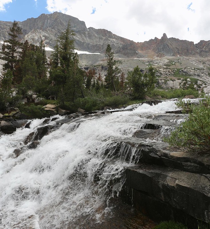
Whenever there is fast water, you know that the trail will be climbing steeply. The two go hand in hand. But the waterfalls ended eventually, of course, and the river passed through a soggy meadow. It was pleasant to hike on a flat trail, even if it didn’t last very long. I consulted the maps on my phone. I had hoped to camp somewhere along this stretch, but where was a good spot? I didn’t want the bugs that live near a meadow, but the steep areas rarely had campsites. The Guthook app showed that there were several just up ahead, and that became my next goal.

I arrived at the campsite and was the only one there, so I had first choice of spots. The crowdsourced comments in the app mentioned a hidden spot up above the trail, and that was the one I picked. By the time I had my tent set up and air mattress inflated, the lower campsites had been filled with other campers! I discovered this as I headed to the river for water. We exchanged the news of the trail, as always. I heard about a possible rogue bear up near where I planned to camp in two days, so that was interesting. Maybe I would change those plans.

Then I headed back to camp and settled down to a tasty dinner of ramen noodles. I sat and ate it, while perched on the rocks overlooking Le Conte Canyon and a nearby pond. Very pretty. I got out the map and checked my position. I had hiked a bit over nine miles, and climbed more than halfway to Muir Pass, which would make tomorrow morning’s hike much easier. And after today’s heat, I decided to wake up extra early, so that I could climb while the air was still cool. I set my alarm and went to sleep, wonderfully tired after a solid day of hiking. I was really looking forward to tomorrow’s hike, which promised to be the most beautiful section of the entire trek.
For a topographic map of the hike see my CalTopo Page
For LOTS more photos of the trek see my Flickr Page
 << Back to Day 1 Onward to Day 3 >>

