Day 3: Glen Pass to Rae Lakes
This was scheduled to be the easiest hiking day on our entire week-long trek. All we had to do was climb up and over Glen Pass (we were camped just below it) and descend a mile or three to the Rae Lakes Basin. 800 feet up and 1500 feet down. So it was no surprise that we took our time waking up that morning.


We packed up everything and began hiking uphill in the sun.
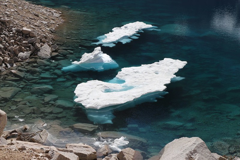
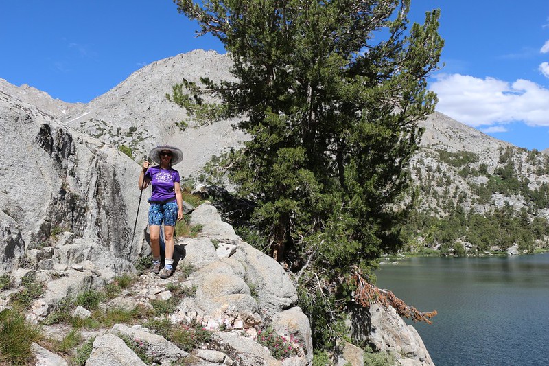
We passed the lower of the two big ponds and checked out the small icebergs that were still melting out from last Winter’s snow. The Sierra had received double the normal snowfall, and the highest elevations were barely done melting out even now, in late July. No wonder there were so few plants up here above the treeline: Their growing season was incredibly short, being frozen for a solid nine months of the year. To some, the High Sierra may seem barren, but to us the towering rock made for its own kind of austere beauty. And the plants that lived here were a triumph of biological survival.


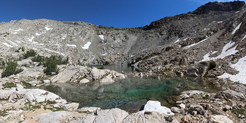
We arrived at the upper pond and took a short break. It was getting warm in the sun. From there, we could see the south-facing headwall of the canyon, and Glen Pass on top of the ridge. We spied a number of hikers, some climbing and others descending the switchbacks on the trail. We also noticed that the trail traversed large patches of snow. We asked one group about the snow, and they said that it was easy, that it was already slushy, so we wouldn’t need Microspikes. And the snow on the north side of the pass was no longer as dangerous as it had been earlier in the season. This was quite a relief to hear, so we put on our packs, got out our hiking poles (for balance on the snow), and began the final climb to the summit of the pass.
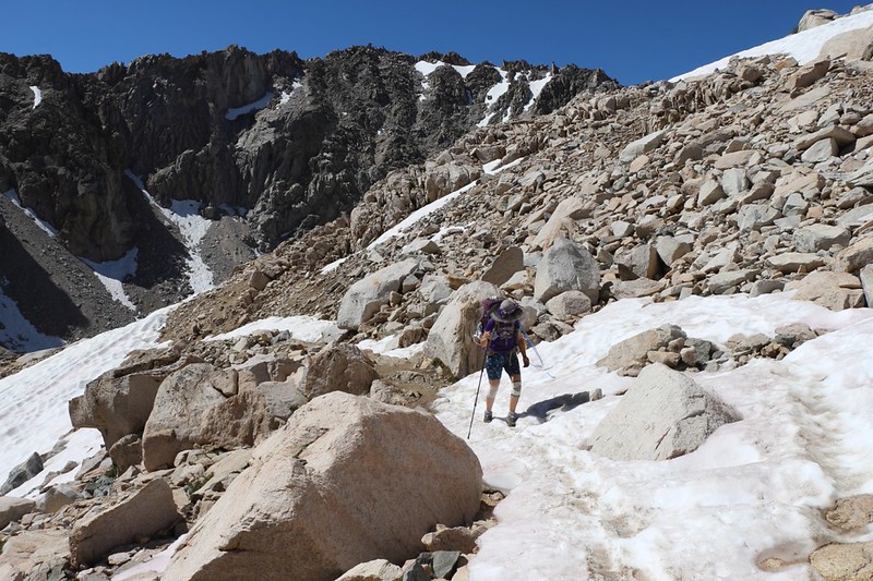


Sometimes the obvious trail went directly over a snow drift, and in other spots the slope was too steep to attempt it, so we climbed up the extra-steep “use” paths that stayed on the loose rocks and talus rather than the snow. You can trust a rock (most of the time), but snow and ice are always a bit dicey. It’s better to err on the side of caution than take an injury out in the middle of the wilderness.

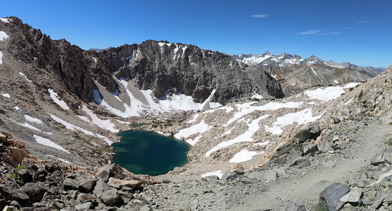

It took us about two hours to climb one mile on the steep trail to the pass, but we didn’t care about that. Especially once we got there. Because the views were truly magnificent. We posed for some photos with the Rae Lakes down below us, and then took off our packs for a short break.


I took a bunch of photos and videos because that’s what I always do when there’s a view this fine, but I won’t show them all here. We also spent some time talking to other hikers, and helped them take their own group photos. It was a bit of a party going on up there. As a general rule, backpackers are great people, very friendly, and willing to lend a hand. And this was no exception. For the most part, we met up with northbound PCT hikers and southbound JMT hikers. There were only a few like us, who were heading to the Rae Lakes on a there-and-back trek. So we got to hear some entertaining stories of the trail when we wanted to, and had plenty of solitude in the wilderness when we didn’t. It’s all good, especially on a beautiful Summer day.

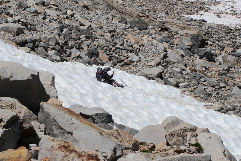
Once we stopped climbing for a while, we noticed that the pass was also a bit breezy and cool. So we put away our snacks and donned our packs. It was time to make the big snow traverse, the one that causes so many problems each Spring. Not only was the snow quite steep, it was also on the north side of the pass, so it didn’t melt rapidly, even on a normal snow year. We could see that there were several versions of paths that hikers had made over the last few months. Back in June, they never even bothered hiking where we were now, but instead stayed high on the main ridge to the west, then angled downward as best they could where there wasn’t a dangerous cornice. In July, they crossed along the top of the pass, but the cornice was still present, so they didn’t do the traverse until they found a safer spot. Now, in August, we were hiking much closer to the location of the actual trail.
It turned out just the way the other southbound hikers had reported: It was now a deep trench of melting slushy snow (with hard snow underneath the slushy layer) and it didn’t feel dangerous at all, considering. We still took it slow and used our hiking poles just in case, but we never really felt like we were at risk of sliding down to our doom on the rocks below.


GoPro video of hiking across the snow traverse
After that, we simply headed down the many steep switchbacks. There were still a few spots with snow where we had to scramble on rocks (just like on the south side) but with a bit of care we made it all the way to the basin full of unnamed lakes.


Earlier that morning, while lazying around in camp, Vicki and I had taken out the map and tentatively planned out the next few days. We decided to make a few revisions to my original plan, which may have been overly ambitious. I tend to do that sort of thing. One of the items concerned the hike back out. Yesterday’s plan of camping just below Glen Pass was hailed as a great idea, since it made today so much easier. So Vicki wanted to do the same thing on the way back. This area we were in now, the basin of unnamed lakes, was the perfect spot to camp on the way out of the Rae Lakes environs. So, while we were here taking a break, we looked around for likely spots to pitch a tent. And we found a few. So we memorized what it looked like when facing the other way, and then continued down the trail. We were anxious to find a good spot for our “Base Camp” at lower Rae Lake, as we would be spending two nights there.
But first we had to hike on down the trail.

Video of the snowmelt creek from Glen Pass as it headed down into the Rae Lakes Basin
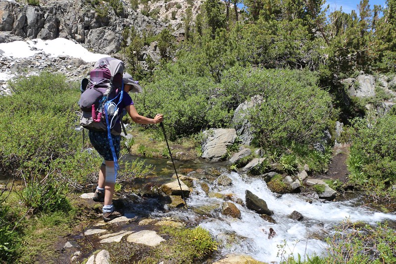
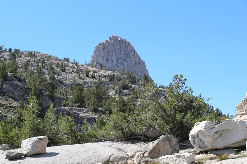
We continued down along a noisy cascading creek and eventually turned a corner and the upper lake came into view. Painted Lady was the peak to the south, with veins of reddish rock, and I told Vicki how it tended to dominate the view from the lakes. Thousands of pictures of Painted Lady had been posted online. And I’m adding to them even now.


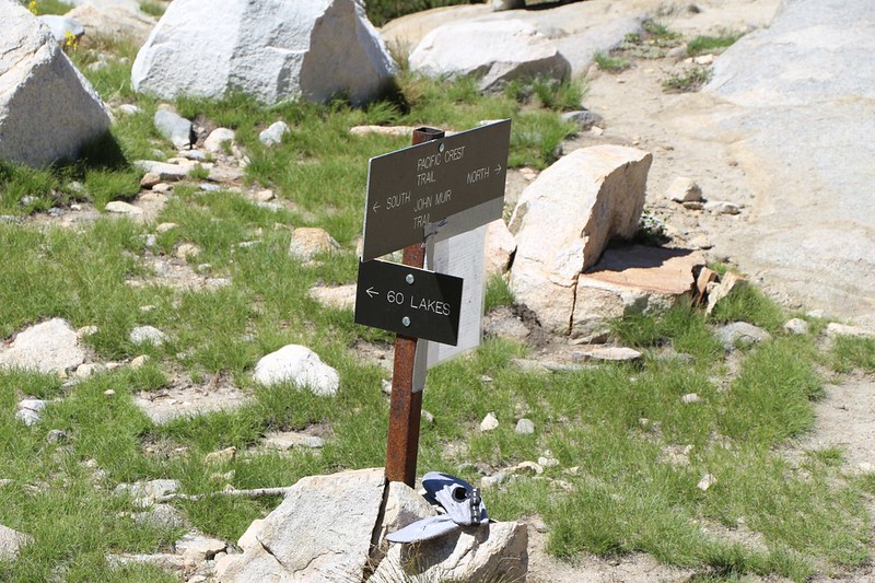
Near the division between the upper and lower lake was the junction between the PCT/JMT and the Sixty Lakes Trail. My plan was to take the Sixty Lakes Trail part of the way around the west side of Lower Rae Lake, then leave the trail and strike out cross-country along the western shore. Almost all of the through-hikers would be camping on the eastern side of the lake, or somewhere near the trail. I figured that we’d have plenty of great views without any of the annoyances of crowded camping spots. Peace and Solitude is part of the Wilderness Experience, at least for us. And we weren’t afraid to do a little extra work to get it.


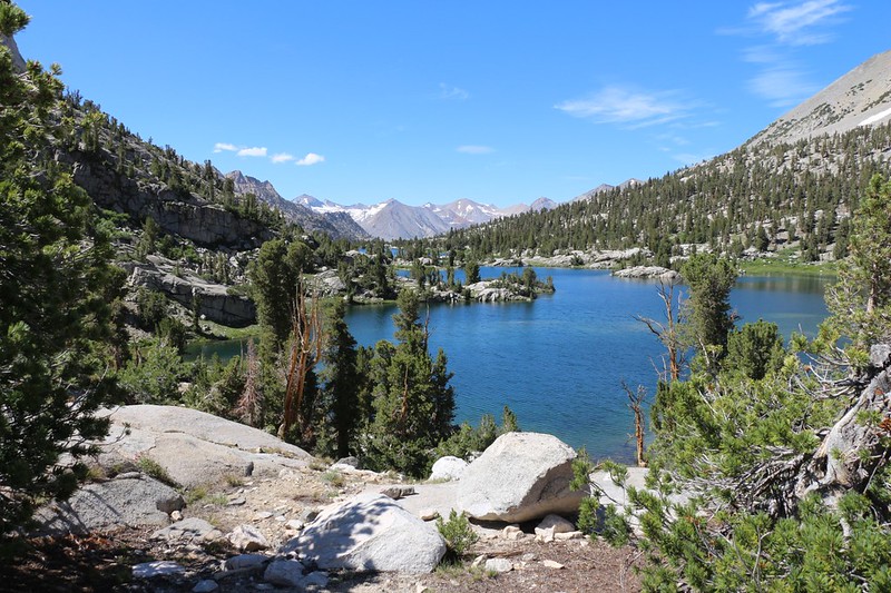
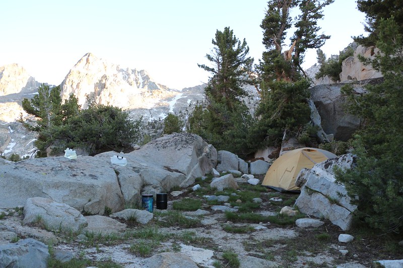
Once the 60 Lakes Trail began climbing, it was time to leave it and follow the shore. I kept checking my GPS, to make sure we were nearing the spot I’d picked back at home, using satellite imagery and the topo maps. Soon we came to the peninsula that stuck out into the middle of Lower Rae Lake. This was the spot! Or so I hoped. Last night’s spot had been covered in snow, so we had to improvise, and today’s might not be any better. We set down our packs near a potential spot, then walked around looking for a better one. And we found it, but we had to climb up and over a granite outcropping to get there. And it turned out to be directly on the peninsula, so I was happy.

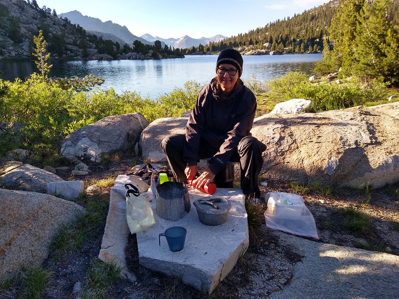
So we went back and grabbed the big packs, then carried them down into our new home. We set up camp right away. It was still early in the afternoon, so Vicki declared that it was time to get some laundry done. We did it together, soaping and rinsing and wringing out the clothes just like it was done in the bad old days. It was hard work! Then we hung them in the sun on a piece of light rope and let the breeze do its job.
I took some photos, and Vicki took another nap. I joined her in the tent and read my book for awhile, until I, too, fell asleep. It was a very mellow afternoon.

The sun hid behind the mountains quite early on this side of the lake, and we put on some extra layers. We thought about swimming in the lake, and it would sure feel great to have cleaner bodies, but we knew that it wasn’t going to happen. Clean clothing would have to do.
We took some short walks around the peninsula after dinner, and I took a few sunset photos. We sat and gazed across the lake, both north and south, and marveled at its beauty. We were truly visiting one of the gems of the High Sierra.
For a topographic map of the hike see my CalTopo Page
For LOTS more photos of the trek see my Flickr Page
 << Back to Day 2 Onward to Day 4 >>
