Three of us hiked to Mount Whitney’s summit (and back) in a single day, starting on the east side of the Sierra at Whitney Portal, for a 6100 foot elevation gain/loss over a 21 mile round trip distance, and it took us 19 hours to complete. We started in the dark and ended in the dark. It was totally worth it, as we had an excellent time.

When you live at sea level, climbing the tallest peak in the continental US can be quite a challenge. The mileage and elevation gain alone are strenuous obstacles, but the air is also very thin up at 14,508 feet. Only very fit hikers should attempt this trail, but it turns out that fitness isn’t everything. Spending extra time getting your body acclimated to high altitude is the key to having a fun hike, as many people who succumbed to (or suffered with) altitude sickness will testify. Of course, nearly everyone knows this about Whitney by now.
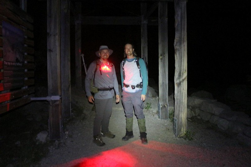
And that’s why we (my son, my nephew, and myself) started from San Diego two days earlier. We left on a Wednesday evening and arrived up in Horseshoe Meadows (at 10,000 feet) after midnight. We spent the rest of that night sleeping at elevation. The next day, we decided to camp even higher, so we drove north up the Owens Valley and checked out the Ancient Bristlecone Pines, and then spent the night up at 11,500 feet. On Friday, we drove south to Whitney Portal, at 9300 feet. Once there, we spent a mellow day hiking around the area, boulder-hopping on Lone Pine Creek, and eating burgers and fries at the Whitney Portal Store grill. We checked out the trailhead structure and grabbed wag bags for ourselves, as we knew that it would be dark when we passed by later on that night. We set up camp in the Walk-In Campground, and tried to get to sleep early, so we could get as much rest as possible before the big hike the next day. This was about as acclimated as we were going to get, and we hoped that it would be enough. I had a feeling that it was more than most people got.


We headed to bed before dark, and the plan was to wake up at midnight. Midnight came, my alarm sounded, and nobody moved a muscle. I reset the alarm to 1am and went back to sleep. When that one went off, I started moving anyway. The cousins had no choice but to get going, as I wasn’t making sleep very easy for them. We packed up the tent (because there were rogue bears at the portal) and put on our already-prepared daypacks. We stopped to drop the tent/sleeping bags at the car, and moved the extra food to a nearby bear box. Then we headed for the trailhead. We got there and weighed our packs. We knew that it was going to be cold and windy up high, so the packs were much heavier than we liked. I also had too much water, so mine was the heaviest. Oh well. I could always pour out the water, I told myself.


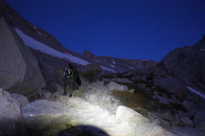
We hiked the first few miles in complete darkness, with the exception of our headlamps. We met other hikers who had also left early. Leaving at this hour was Standard Operating Procedure for Whitney. The first part of the trail consisted of smooth and steady climbing, which we liked. We stepped lively, but not too lively, as we needed to conserve our energy for the long haul.
We crossed the log bridges over Lone Pine Creek with our headlamps turned high in brightness, and then discovered that it was suddenly getting windy and colder. The wind was blowing out of the west, directly in our faces. We stopped to put on a second layer of light jackets in the lee of a big boulder, and then headed into the Whitney Zone. We’d hiked four miles when we made it to outpost camp, crossing the creek yet again, and it was still too dark to see the waterfall. We continued up some more switchbacks, and passed by Mirror Lake in the dark. I only knew about it because I stopped to check the GPS app on my phone.


After three hours of climbing in the dark, the dawn sky began brightening. We still needed headlamps to step safely on the trail, but at least we could see vague shadows of the canyon walls around us. There were pretty clouds over Owens Valley, behind us, and we hoped for a good sunrise, which eventually materialized. The air continued to grow colder, and the wind stronger. Soon we were wearing gloves and hats and hoods. It was COLD, and colder with the windchill. When we took a break we hid behind a wall of stone to block the breeze.

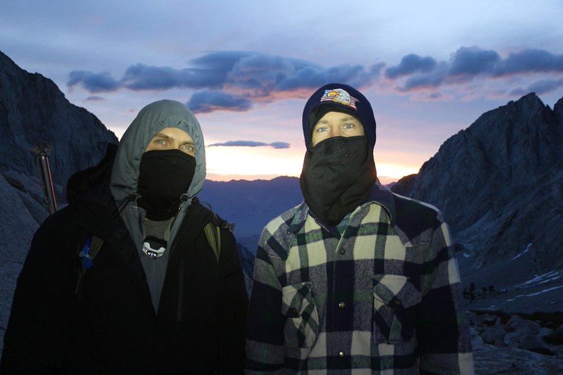

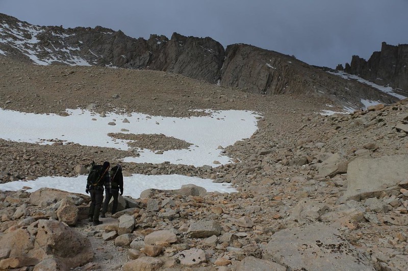
We no longer needed our headlamps by the time we reached Trailside Meadow. The dawn alpenglow was lighting up the granite with a lovely pinkish-orange color. This soon turned to solid orange as the sun rose up above the Inyo Mountains to the east. It was turning out to be a beautiful morning, albeit a freezing cold one. We climbed up out of the deep canyon, and Consultation Lake, its surface still frozen, came into view. We decided not to consult with it right then, as it looked a bit stubborn and recalcitrant. The Sierra Crest also came into view in the west, and we gladly headed toward it. We were making significant progress!


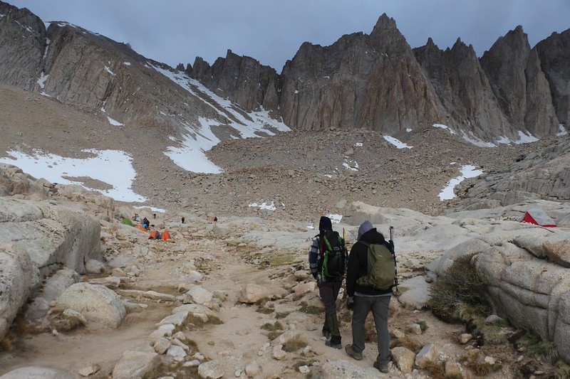
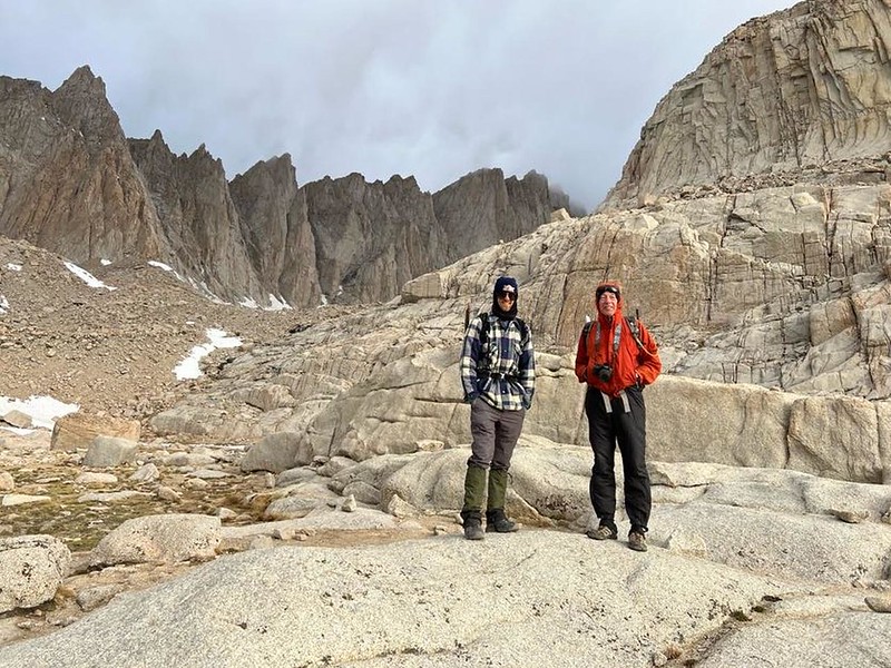
After hiking across a snowbank (in a well-packed trench), we arrived in Trail Camp. We had hiked six miles in five hours, and climbed almost 3000 feet. This wasn’t bad, but it wasn’t fast either. I had a bad feeling that I was the one slowing the group down. Maybe my age was catching up to me, I thought. As we walked through Trail Camp, I felt like I was the oldest person present. This was rare for me, feeling that way, but there it was. Other hikers had been passing us all morning. And now that we were in Trail Camp, all the backpackers were finishing breakfast and getting ready to climb to the summit. They were fresh as daisies, too. We paused for a photo-op, and suddenly they were storming past us, heading for the summit. Maybe that’s what did it to me. Comparing myself to them was like apples and oranges. Not a fair comparison at all. Yes, I was a bit on the slow side, but I was conserving my energy for the Long Haul. That’s all it was, I told myself. And, just maybe, I was carrying too much water.

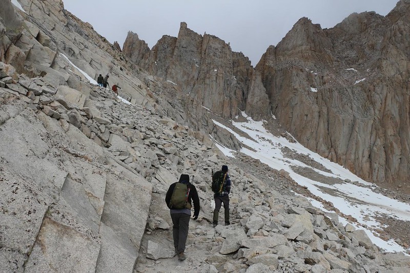
The wind was still blowing cold and strong out of the west as we left Trail Camp. The next stage of the hike was known as the “97 Switchbacks” in Whitney-Speak. Some folks call them the 99 switchbacks, but that’s not true. There are 97 and they have been counted officially. Let us have no more nonsense on this matter.
Once we realized what we were about to do, we took a short break. I got out my tiny thermometer and it read 24 degrees! That was a lot colder than I liked. The summit, 2500 feet above us, was probably in the low teens. We could see it to the north over the basin and it was almost continuously shrouded in blowing, scudding clouds. It looked like absolutely miserable conditions up there. I’ve been in those cold clouds in the mountains, and they are not pleasant at all. Dank, wet, and cold, they could chill a person to the bone in no time at all, especially with this much wind. I felt sorry for the faster hikers that were already up there. I wondered out loud whether we should just quit and turn around, but my two partners were not about to give up so soon. It was still fine down here, so why not keep going? And that’s when it started to SNOW! One particular cloud must have come flying over the crest, absolutely laden with moisture, which precipitated in those high elevation conditions, causing a fine haze of snow and ice particles to fill the air around us. We all started laughing. This was nuts! And then it was gone, with no harm done. We put on our packs and I said “We must go!” All three of us pointed up the switchbacks toward Trail Crest and said it again, in unison. “We must go!” Our goal was up there, and we weren’t going to quit over a few flakes of snow.


And the long climb went on. Down in the lower part of the 97 there was a seasonal spring, and it had iced up the trail in a major way. Some parts looked more like icy waterfalls. Other parts showed icicles that were still dripping, or sheets of ice with flowing spring water underneath them. It was a bit scary to walk on, but also very beautiful to see. We stopped for breaks every so often, but mostly to take pictures and to gaze out over Trail Camp in the east, and Whitney with its blowing clouds in the north.

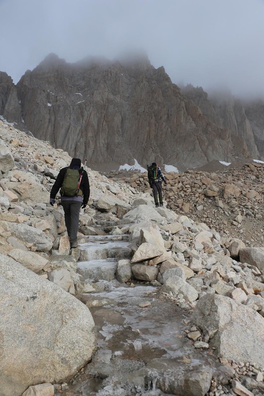


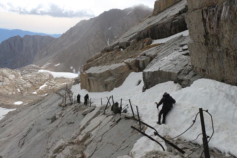
About halfway up the switchbacks, we came upon the notorious “Cables Section” in which the granite slabs were so steep and treacherous (when icy in the Spring, like now) that they installed posts and steel cables for safety. In fact, we had heard that someone slid to their death on the Cables Section two weeks previous to our visit! This is why we each carried ice axes and MicroSpikes in our backpacks. It turned out that the snow had melted significantly in the two intervening weeks, so we only used our ice axes. And I have to admit that I felt safer with the pick embedded in the consolidated snow, although I liked holding on to the cables even more.


Luckily, some of the remaining 50-plus switchbacks were very short, so they happened quickly. Others had icy snow, and we found steep shortcuts to avoid it. But it still took a long time to climb. We tried singing the “99 bottles of beer” song (with switchbacks replacing the word beer) but we found ourselves taking a lot of deep breaths, instead. The air was getting thinner. We climbed on. Other hikers nearby were checking out their GPS apps, telling us how many switchbacks we had left. But the words didn’t mean much to us any longer. We just wanted to get to Trail Crest. Meanwhile, scudding clouds were blowing by overhead, and they were getting closer and closer.


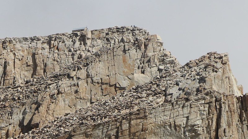
The final ten switchbacks were much longer, and the last one was the longest of all. We were cold on the outside but warm within, thanks to the energy we expended while climbing. We noticed that the clouds had begun breaking up a bit more, and that patches of blue sky were starting to show, up above the crest. During one clear, cloud-free interval, we were able to make out the summit hut on top of Whitney, which was still two miles away to the north. This put energy into our steps.


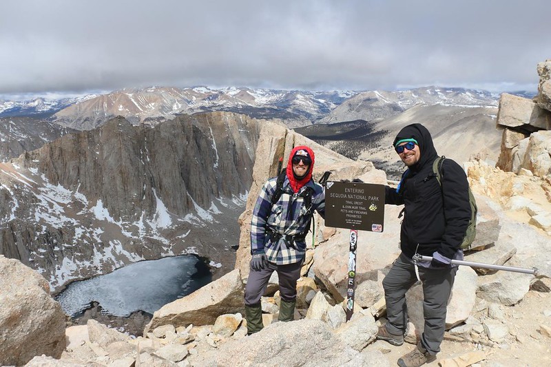
We took one final break just before Trail Crest, while we were still on the east side, in the lee of the wind. It hadn’t gotten much warmer, and we knew that it would be extremely windy just beyond the crest, so we stopped to add more layers. I had to strip off my shoes and pants in order to don a pair of long johns, but I sure felt better afterward. I also put on my ultralight down jacket. My son added an extra jacket, as well. I’m pretty sure my nephew was already wearing all the clothing he had, but at any rate he was fine. And then we put on our packs and hiked the final few feet to the official Trail Crest sign. We had made it to 13,600 feet elevation! Less than a thousand feet left to climb to the summit! Whoo hoo! We were seriously stoked, and we knew that nothing was going to stop us now.
The wind was blowing strong at the crest, but we didn’t care. The views to the west were fantastic. There was a cloud layer blowing toward us, and it felt as if our heads were almost touching the bottoms of the clouds. But at the moment they were above us, and there were clear views in all directions. We took a ton of photos and videos, and then we continued onward. “We must go!” we shouted into the wind, laughing. This was now our rallying cry.
For a topographic map of the hike see my CalTopo Page
For LOTS more photos of the trek see my Flickr Page
Onward to Part 2 >>