After pausing at Trail Crest on the Mount Whitney Trail in order to take the obligatory photos, it was time to continue onward to the summit, with a mere two miles left to hike. We knew that we could do this. I was excited for my partners, as I had been here before: I knew that the next two miles were the best two miles of the entire hike.
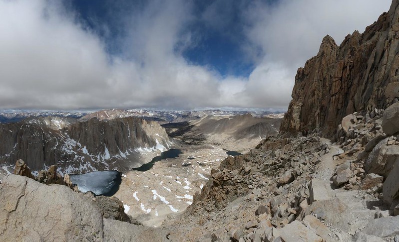
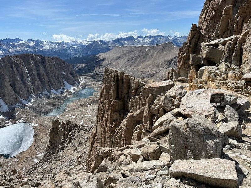
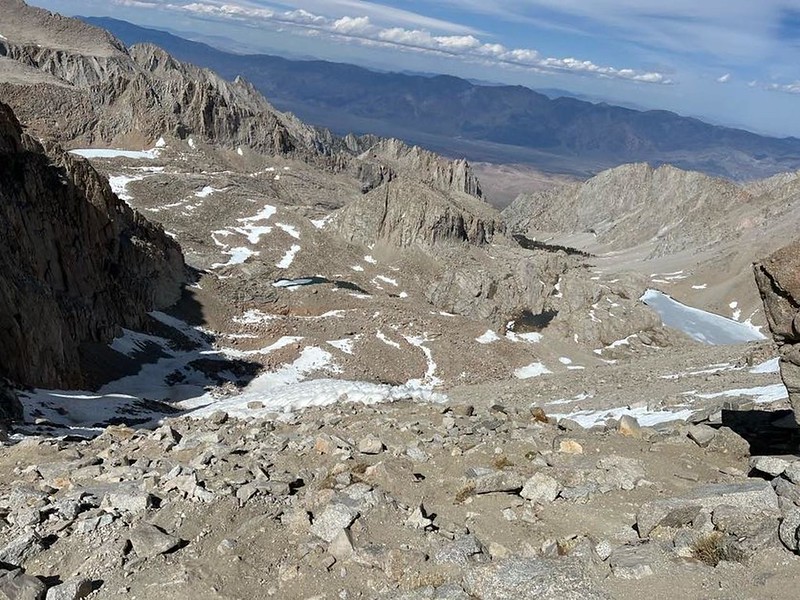
We never looked back to the east, because we were done with that now. The views that mattered were to the west, out over the vastness of Sequoia National Park. And also down below us, where the Hitchcock Lakes lay like gems in the upper Whitney Creek Basin. One of them was still mostly frozen, but the lower lake, and Guitar Lake as well, were already thawed for Summer, even though it was only the end of May.
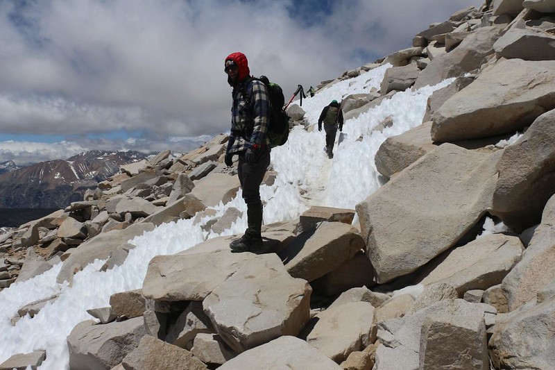
After the morning’s long climb, we were saddened when the trail descended steeply for two hundred feet over the next quarter mile. No one likes to see their hard work destroyed. We’d have to re-climb that loss on the way to the summit, and then again later on when we came back to Trail Crest. It would be convenient to curse the trail builders for such an oversight, but up here that wasn’t possible. Simply making this trail, on this terrain, was more than enough. The cliffs in this region didn’t leave them a whole lot of choices!

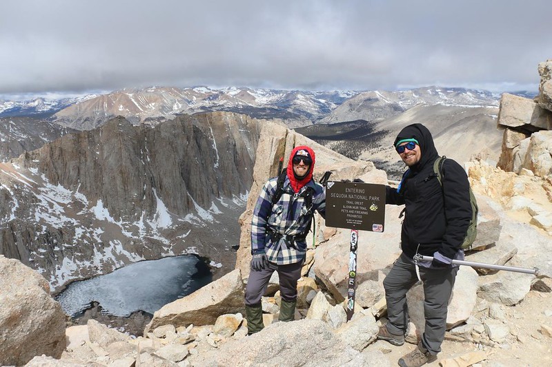
Soon we arrived at the “other” Trail Crest, where the Mount Whitney Trail from the east met up with the John Muir Trail from the west. The Whitney Trail lost out in the naming department, and now we were hiking on the final two miles of the JMT. Interestingly, the mountain (or pinnacle, or needle) on our immediate right was named Mount Muir. Many of the regular Whitney hikers like to climb these needles just to keep things spicy. We had no time for that. As it was, it had taken us nine hours to hike the first eight miles, which wasn’t all that great, pace-wise. And I had to admit that it was me who was slowing things down. Right along here was when I let the cousins carry my two extra liters of water for me. I noticed the weight change immediately, and hiked faster. For a while.

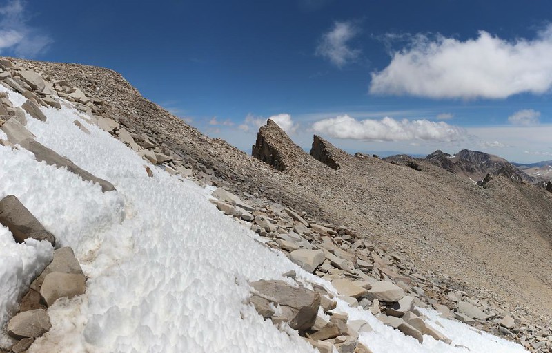
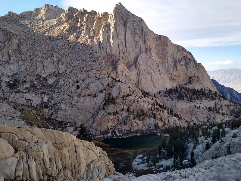
This stretch of trail along Mount Muir was one of the most incredible parts, in my opinion. Towering granite spikes were thrusting up everywhere, with cliffs and vertical cracks abounding throughout. It was all the product of ancient glaciers from the last ice age. The freeze-thaw cycles cracked the rocks, then the glacier froze onto the rocks and slowly flowed away, gradually pulling and stripping the rocks, one by one, away from the main mountain block.
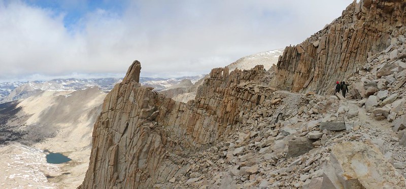


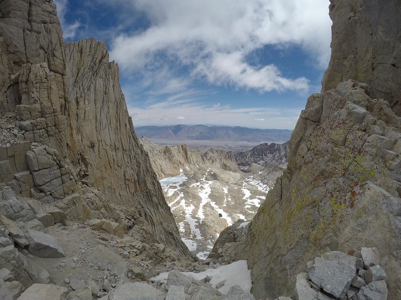
The iconic cliff-like pillars that you see from the east side look completely different on the west. Over here, the mountaintop slopes downward more smoothly. That’s why the trail was over here. The trail also tended to travel just below the drop-offs between the pillars and needles, which allowed us to check out the view down into the east, every so often as we hiked along. Some of those chutes were incredibly steep, and most of them still had snow and ice within them.


As we continued past the needles, I noticed that I was feeling some major fatigue. I was just plain tired. I had tried to keep on eating snacks since we left at 2am, but I think that I finally began to “bonk” as the trail runners say. I had run out of “easy” glucose from my liver and was now metabolizing fats to supply more glucose to my blood and muscles, which is a much slower process. Either that or I was being powered primarily by Skittles candies dissolving into my blood, and I wasn’t snacking enough. I kept pausing and sitting down, and when I did, I tried my best to take deep breaths, just in case it was oxygen I needed. Meanwhile, my willpower wouldn’t let me quit, so I’d stand back up and keep going for a while, until another perfect seat-like rock would appear along the path. This went on for quite a while, and I made progress. Meanwhile, I took photos of everything I could, and my camera has always been a good excuse to pause for a moment of artistic contemplation.


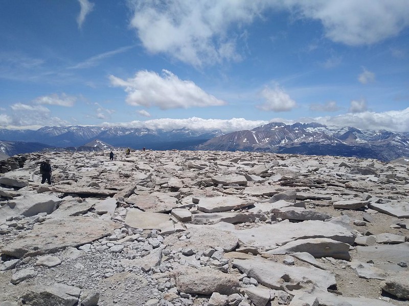
Eventually, the needles were left behind, and we were hiking on the broad Whitney Massif. This was the final huzzah, and we knew it. A patch of snow was on the trail, and that gave me something to think about, and we had fun crossing it. Then we continued onward, one foot in front of the other, until we neared the summit itself. That was when my DSLR camera’s battery died. No problem, I thought, and took off my pack. But it was a problem, as I had forgotten to pack a spare battery! Aarghhh! This hasn’t happened to me in years and years. But it was true enough. Therefore, all the photos from this point on are either from my GoPro or a cell phone. It worked out OK, but I would have taken a lot more photos with my big camera if it had been working. Oh well. You can’t get electricity from a dead battery.

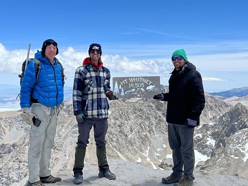
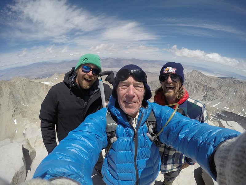
We made it to the summit just after 1pm, which worked out to around one mile per hour. Pretty sad, but that’s life. What wasn’t sad was the three of us. We were stoked! We made it to the summit of Mount Whitney, at 14,508 feet elevation. We gave each other some high-fives and moved on up to the top of the mountain, near the cliff on the east side. This is where the official “Whitney” signs are. We held them up and got some other hikers to take our photos. This was our big moment. I turned on my phone and got a tiny bit of signal, so I sent a text to my wife to say we made it. I learned my lesson the last time I was here, and didn’t try to send a photo. Too much data from too far away. But a text worked fine.
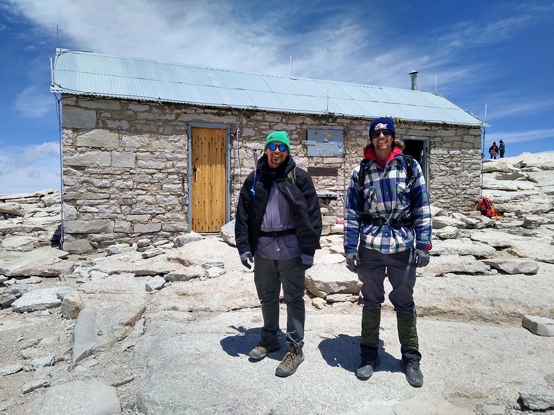


Amazingly enough, the howling winds of this morning were largely absent up there. Sure, there was a breeze, but it was nothing like the gusts we’d seen in Trail Camp. In fact, it was quite nice to hang out in the sun on the summit. We stopped for a break in the lee of the stone hut and hung out with some of the other hikers. Several were PCT Thru-hikers, and we chatted a bit about the trail. All I was willing to tell them was that it only got better the further north you went from here, at least until the northern end of Yosemite, which was considered to be the end of the High Sierra. They were feeling quite stoked about it, as you might well imagine.
After that, it was almost 2pm and we knew that we needed to head back down. If we were fast, we might make it down before dark. But I had my doubts, as the trail was mostly stone steps, and knees can only take so much abuse. My main hope was that we’d get past the snow at the cables section while it was still melted and soft, before it froze again for the night. So we put on our packs and started hiking, but not before my son graciously stored my heavy camera safely within his backpack. It was nice to lose a few more pounds.
And then we all said, yet again, pointing down the trail: “We must go!” And we went.

On the way downhill, I was feeling better, and no longer needed to stop for breaks. But the trail itself didn’t make for fast hiking. One false step and you’d be in big trouble, and the stone steps were tough on the knees. I got out my hiking stick and used it to ease myself down the bigger steps. My knees thanked me, but it sure didn’t improve my hiking speed! Meanwhile, there were plenty of great views to the west. I stopped every once in a while to take a photo, but mostly I just concentrated on walking.


It took almost two hours to hike the two miles to Trail Crest. This was not a great pace, but that was life. We climbed that extra 200 feet that we’d lost earlier, and then I realized that I still had a trace of that nasty fatigue left within me. Whew! That was tough. And slow. But I made it just fine. I took one last photo out to the west and said goodbye to Sequoia National Park. For now.
It was time to descend the infamous 97 Switchbacks! We could see Trail Camp out there in the basin, a mere 1700 feet below, with two more miles of hiking to be done. So we got down to it. And this time it only took us an hour and a half. Major improvement. There’s nothing like a gravity assist to keep you moving. And I was glad to discover that the snow at the cables was still in sunshine, which made it easy and safe. No injuries allowed!


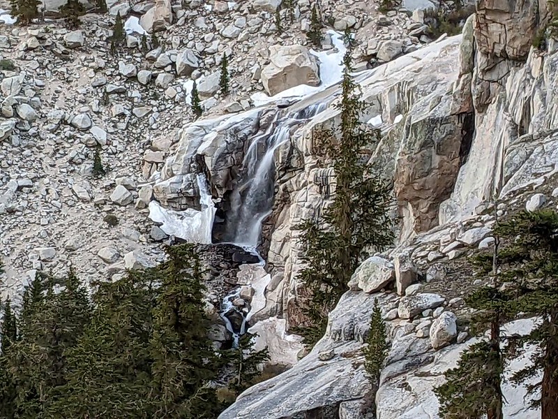
By this time we were all feeling tired, and conversation flagged after we left Trail Camp. We were more like downhill hiking automatons than anything else. Even saying “We must go!” didn’t help very much. We had no choice but to go. We passed Trailside Meadow, which was now in shadow, and soon afterward we got to see Mirror Lake, which had been hidden in darkness earlier that morning. We also got to see the waterfall at Outpost Camp. I decided that I liked that campground much better than Trail Camp. There were trees and waterfalls there, although the view of Whitney isn’t bad from Trail Camp. To each his own.

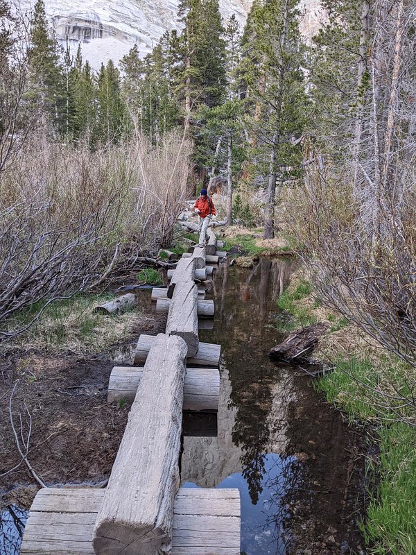
We continued hiking down stony steps and switchbacks. The pace was better than uphill, but that wasn’t saying much. As the sun was setting, we arrived at Lone Pine Lake, but we didn’t stop to check it out. At this point we only wanted to get back to the car. We crossed the log bridge over Lone Pine Creek, and after that we got a view of Whitney portal down below. Only three more miles to go!

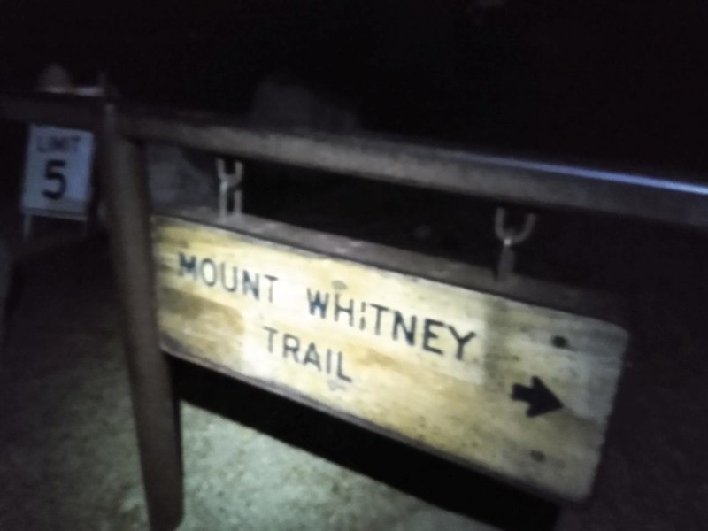
Luckily, the trail smoothed out and it became easy hiking. We stretched out our legs and let the switchbacks fly by. Soon enough, it got completely dark, and we were hiking using our headlamps, exactly the way we started this hike. And we arrived at the trailhead around 9pm. It had been nineteen hours since we started! That was some pretty sad time, and I had to admit that it was mostly due to me. If I did this again I’d need to do a lot more training. It wasn’t just my age. I was out of shape. In other words, I just needed to get out hiking more often! That’s the kind of cure I really needed.
We opened the car and got out the tent and sleeping gear. Then we walked down the hill to the Walk-In camp, and found a vacant spot. We set up the tent in record time, and crawled inside to crash. After first taking an ibuprofen for the swelling and pain. We were more than whupped, and had no problems getting to sleep.

We woke up a bit late, just because we didn’t care. Or, to be more accurate, I woke up at a normal time, and my son and nephew slept on. And on. I went back to the car and read my book in peace, while eating some snacks from the food bag I got out of the bear box. It was a mellow morning, and I felt that sense of accomplishment that comes from completing a difficult task. The best part of the whole thing was that I didn’t appear to have a single blister on my feet. That was what I expected, and I think that the cold temperatures, plus the use of my hiking stick going downhill, was what saved my feet from destruction. I’d call that a win.
An hour or so later, we packed up camp and it was time to head back home. “We must go!” but for real this time. I asked if they wanted to check out anything else, or take another hike, as long as we were in the High Sierra, but it seemed that the Whitney trail had totally satisfied their thirst for adventure. And anything else would surely be an anticlimax. We said goodbye to Whitney as we drove away, and wondered how many more people were climbing up there at that very moment. We wished them well, and headed home happy.
For a topographic map of the hike see my CalTopo Page
For LOTS more photos of the trek see my Flickr Page
 << Back to Part 1

