I went on a hiking trip with my son and nephew in the White Mountain Wilderness and visited the Methuselah Grove in the Ancient Bristlecone Pine Forest. We also drove further up White Mountain Road, and discovered that access to the Patriarch Grove was denied us due to a large snowdrift on the road. After that, we continued driving toward the Barcroft Gate, and discovered that it, too, was blocked by snow. We ended up spending the night on a small side road up at 11,500 feet elevation.
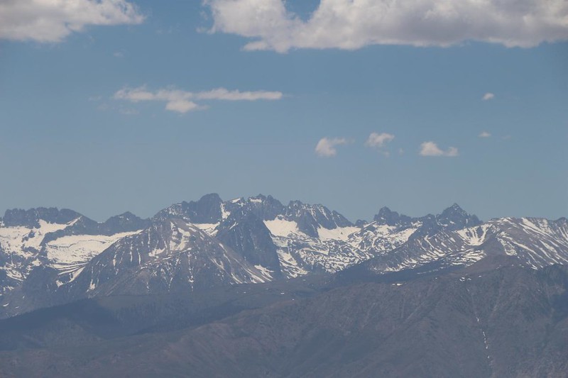
We drove up Highway 168, east of the town of Big Pine, then turned left on White Mountain Road. This was the main entrance to the Ancient Bristlecone Pine Forest area. The entry booth was unmanned, but I wasn’t worried as I have a Lifetime Senior Pass and get to enter for free anyway. The road climbs quite a bit, as the bristlecone pines typically grow up at 10,000 feet elevation. Soon, our ears were popping and the temperature was dropping. We made our first stop at the Sierra View Overlook, and stopped to stretch our legs. It was a beautiful day, and the view was fantastic. We could see most of the Eastern Sierra Nevada from up there! I pointed out a few landmarks, and took a bunch of photos and videos. Great spot.
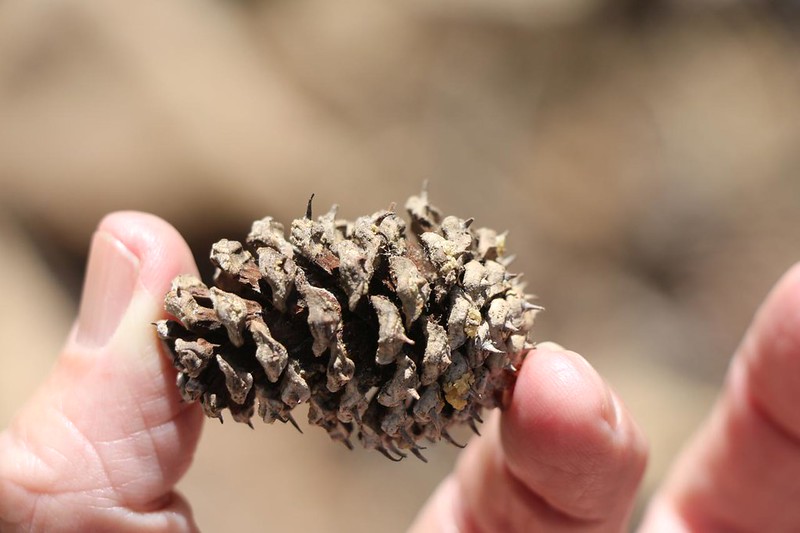
After that, we drove to the Schulman Visitor Center. It was a nice new building, and the displays inside were quite informative, detailing the methods involved in dating these fantastically old trees. On the oldest trees, the rings were so finely-spaced that you needed a microscope to make them out clearly! Extraordinary. Even though I had a Senior Pass, I still donated some cash. Those fancy color brochures cost about two bucks each! It adds up after a while, and National Forest budgets are always too small.

The Methuselah Trail begins at the visitor center. I had been here before, back in 2016, so I knew the way. The three of us hiked the trail backwards, to get to the ancient trees via the fastest possible way. We had one of the fancy brochures, and the trail had numbered areas, so I read the appropriate sections as we hiked. I would make them learn something whether they wanted to or not!
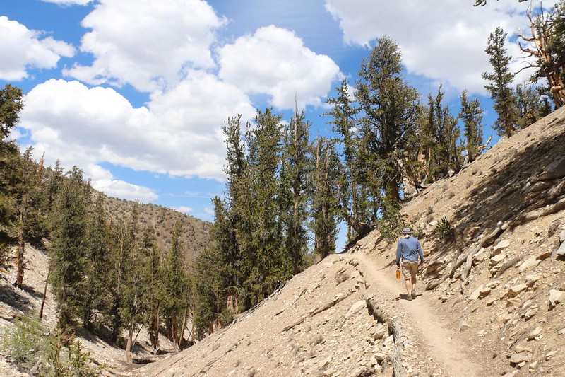
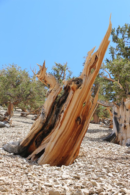
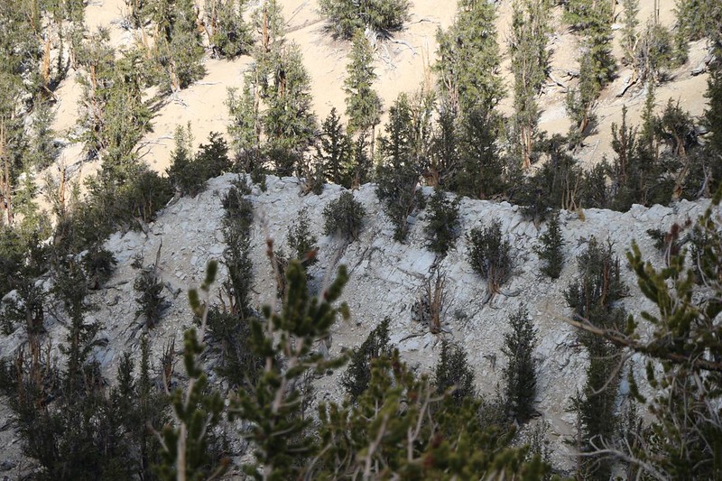
The trail descended into a valley, so it was fast and easy hiking. Soon, we came into sight of the small limestone ridge that stuck out from the main ridge up above. I pointed it out, and had them pose with it behind them. Now they were hanging out with the oldest tree on earth! The trees along most of the trail were only normally old, as their soil was much richer in nutrients and water. To become truly ancient, the trees had to suffer deprivation, and that limestone ridge had it all, suffer-fest-wise. Hardly anything could grow on it, and that’s why the bristlecones were able to survive and not be out-competed. “Grow Slow, Grow Old” is what they say of those ancient trees.


After that, I asked them what they wanted to do: Continue around the trail (backwards the way we started) or turn around? The best part was over now. They opted to continue. We needed the exercise anyway, as we would be heading for Mount Whitney tomorrow night. So, on we hiked. The trail began climbing. Along the way, we passed by some of the most photogenic bristlecone trees (and old dead trunks of trees) on the entire trail. Photographers will hang around this area in the morning and evening, hoping for the perfect lighting conditions. Sorry, readers: I like to take photos, but I’m not really an artist about it. My pictures are taken in order to tell a story. If I frame one well, then good for me, but I give nature full credit for the beauty. I don’t even have the urge to post-process them; the most I’ll do is crop one down or stich several together into a panorama. Yes, you’re getting pictures worth a thousand words, not a thousand dollars!


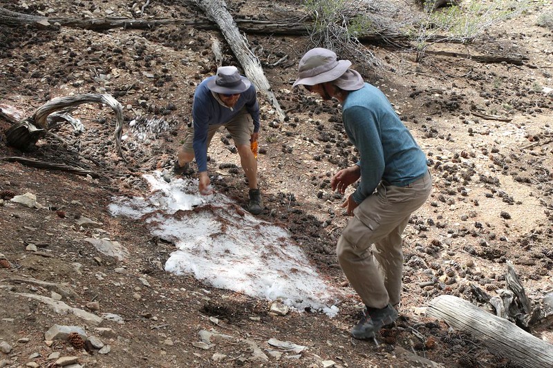
The rest of the hike went by quickly. Those guys really like to blaze right along, and I had my work cut out for me just to keep up. As we hiked along the upper region, we were able to look down into the valley, where we could see the limestone ridge and the Methuselah Tree. It was already in shadow, as the afternoon was getting on. We also found a tiny patch of last Winter’s snow, and those two immediately descended upon it and started throwing snow at each other. Even I, an innocent bystander, was hit in the barrage, and ended up with a chunk of icy snow landing in my pocket. That really made me jump!
We made it back to the visitor center. I went inside and gave the rangers back my nearly-pristine brochure, to be used again. I knew that I still had one at home collecting dust, and it wasn’t really something I needed to keep anyway.
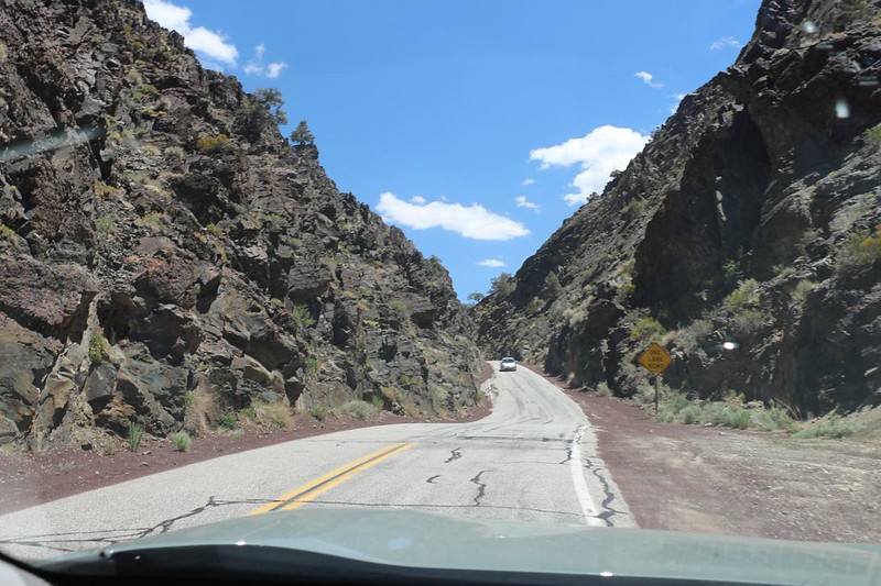
After that, it was time to drive onward. White Mountain Road was unpaved beyond the visitor center, but it was well-plowed, and the car had no trouble. I simply slowed down a bit, to keep the dust down and to give me time to avoid any tire-puncturing rocks. This road has been called the “Flat Tire Highway” and I wasn’t taking any chances.


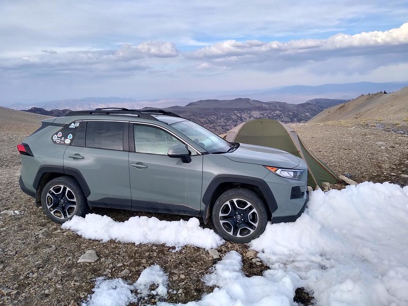
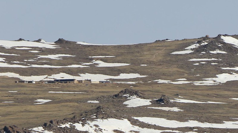
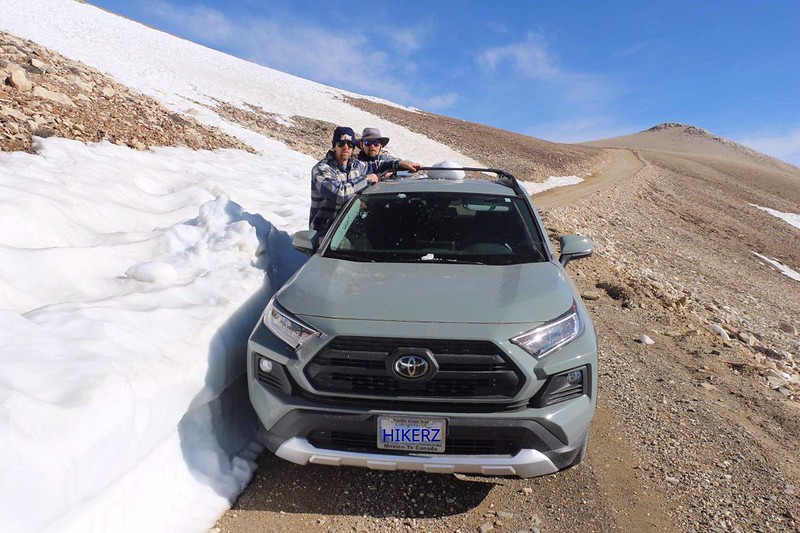
We decided to check out the Patriarch Grove of bristlecones, but were thwarted by a snowdrift on the road. My car is 4WD, and has a “Snow” button to activate a fancy traction mode, but I still didn’t want to chance it. So we turned around and continued higher. There were drifts here and there, but I really thought we might reach the gate, which was at about 12,000 feet elevation.


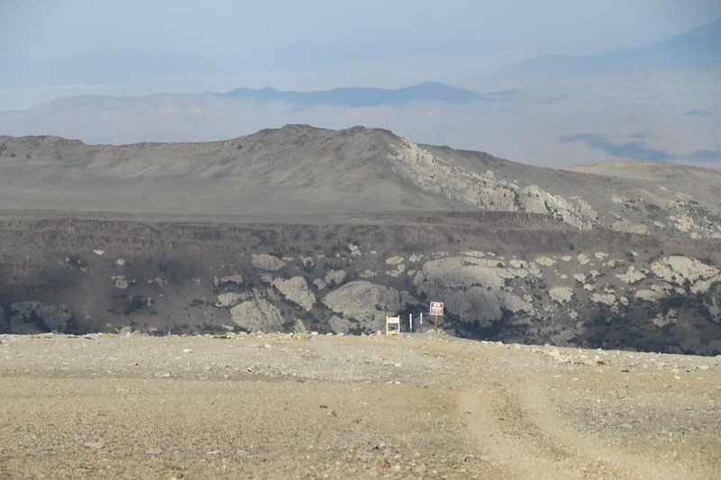
About a half mile from the locked gate, we encountered one last drift across the road. There was no safe way around it, so we backed up until we could turn around. My nephew remembered that there had been a faint, rarely-used side road a short ways back. Maybe we could camp along that road somewhere. We decided that it was worth a try. The side road was a whole lot rougher than the plowed road, but it wasn’t all that bad. We took it very slow. Eventually, it went up and over a rise, and then we could see that it disappeared into a deep canyon. There were signs posted at the edge. When we got close enough, we saw that it was a Double-Diamond-Difficult 4WD Road beyond that point. “No thanks!” I said, and stopped the car. The guys wanted to try it, anyway. I laughed at them. Luckily, it was my car, so we didn’t bother attempting to destroy it.


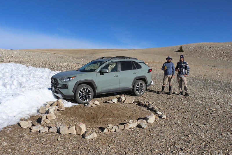
Instead, we looked around us for a spot to camp, just above the drop-off. I was planning to sleep in the car, so all we needed was a flat spot for me and a smooth spot for the tent. It was a bit rocky up here, but with some work a flat-enough area was created. The wind was also blowing strong out of the west, so we decided to use my car as a partial wind-screen. It was a decent plan, and it worked fairly well. They even piled rocks around the tent, and made a wall out of snow, both in front of and next to my car. The tent still shook a bit in the gusts, but it was much better. They would survive the night.


It was cold and windy, so we went to bed early. By the next morning, the breeze had mellowed, and we packed up everything. We were hoping that a night spent at this high altitude would get us acclimated, thereby helping us the following morning when we planned to climb to the summit of Mount Whitney at 14,500 feet. It was worth a try, and this was the highest spot that I could drive my car. And I was still cursing that pesky snowdrift from yesterday. It cost us an additional 500 feet! Oh well. It is what it is.

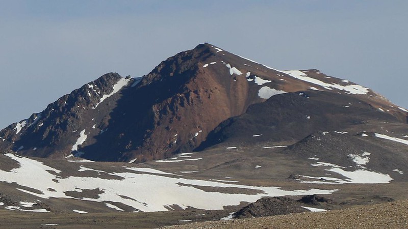
After that, we headed out. We still had to drive all the way back down White Mountain Road, and that was going to take a while. We decided to stop and see the sights along the way, as we were in no rush. We paused to view White Mountain Peak itself. It was also a fourteener like Whitney, topping out at 14,252 feet elevation, and was the third highest mountain in California. (Vicki and I had climbed it back in 2011, and the views from up there were truly spectacular.) We also stopped the car alongside a snow drift, and they grabbed a chunk of icy snow to bring down with us. They left it sliding around on the roof between the roof rack bars. We laughed every time I went around a corner, making noise as it skidded from one side of the car to the other.
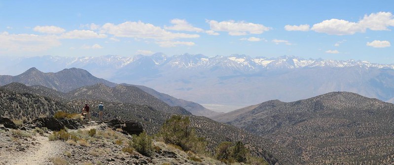
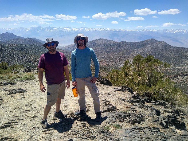
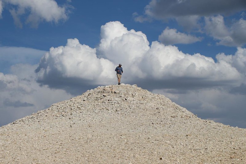
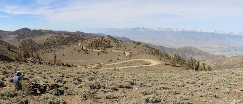
Along the way, we decided to take one final hike, just because we were there. We chose a small peak to climb that wasn’t far from the road. There wasn’t any parking area dedicated to it, but there wasn’t any traffic either (we hadn’t seen a car since yesterday) and so I parked directly on the right side of the road. We got out and made our way to the top, then posed for the usual photos and videos. Later on, when I got home, I discovered from a GPS track that this peak is named White Mountains Peak. “Seriously?” I said to myself. White Mountain Peak is the mighty fourteener, and this little roadside attraction has almost the same exact name? Yes, folks, it does. At least on my map. Strange but true. It’s also called Peak 10920, which is probably a better name, and less confusing. Regardless of its name, we got some great views from up there.

Video of us making cool clinking noises walking on the fractured rocks
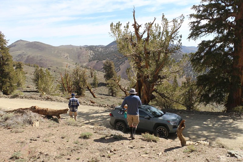
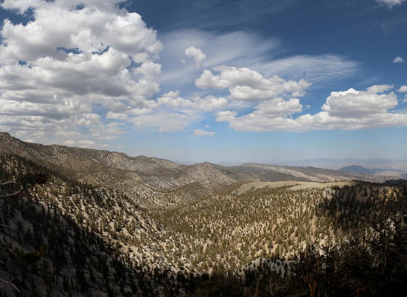
After that, it was time to leave the Bristlecone Pine Forest. We were a bit sad to see it go, as it was quite interesting. And we were glad to have seen the world’s oldest tree. We also had a lot of fun driving up in the high country. It looks like a desert up there, but really it’s more like alpine tundra, far above the treeline. It sure makes for great views, and gives the bristlecones an environmental niche that few other trees can compete for. A starkly beautiful place, and I’d love to head back there in the future.
For a topographic map of the hike see my CalTopo Page
For LOTS more photos of the trek see my Flickr Page

