I woke up early at Soldier Lake and hiked cross-country into Miter Basin, where I enjoyed the majestic beauty of Sky Blue Lake and the sharp, forbidding granite of the Sierra Crest, then continued onward to summit the rarely visited Crabtree Pass. Everything was beautiful, and it was surely a day to remember!
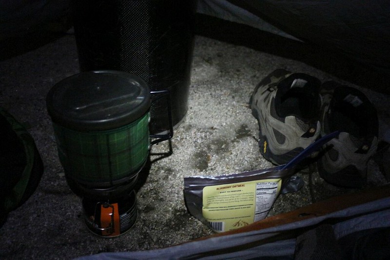
I had my alarm set for 3am, but my nearest neighbor was a restless sleeper; he had the most annoyingly noisy air mattress, so I woke up a bit early. But I felt rested, and that’s what mattered. It was going to be a long day of hiking. I cooked up some oatmeal in the dark and ate it with my legs inside my warm sleeping bag. It was cold out there! But I eventually changed clothes and started packing in earnest.
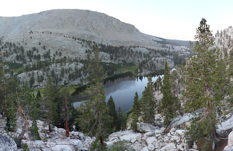
It was still dark when I started hiking, with only the tiniest bit of light in the eastern sky. I left camp quietly, and headed to the south side of the lake. I circled around and took the fisherman’s path along the western shore. The lake was perfectly still at that hour, and the reflections were superb. So of course I took far too many photos. But I wasn’t worried. I had a feeling that I would be taking a record number of pictures that day! Photo-wise, I was happy that there were already puffy cumulus clouds in the sky, but it also worried me a bit, as I’ve learned that clouds in the morning mean thunderstorms in the afternoon, at least in the High Sierra. This only made me hike faster.
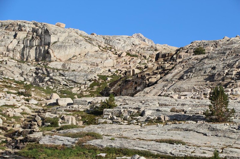
I followed the path until I found a relatively easy spot to climb, taking me up and out of the Soldier Lake basin. I could see the faint remnants of a use path, or animal trail, that zig-zagged up the slope. It didn’t matter where I went up, only that I made it up there safely. There would be plenty more route-finding choices ahead of me that day.


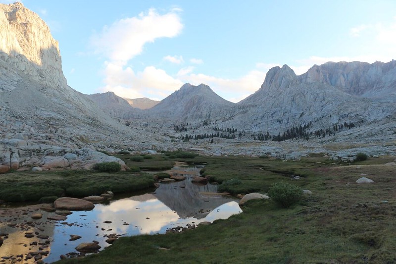
After the climb, I continued north along the ridge, crossing over to get within sight of Miter Basin, so that I could better plan my route, from up above, using the Mark 1 Eyeball. After I paused to gaze in awe at the view, of course! The valley was still in shadow, with the clouds lit up, high above it. The water-filled pools of Rock Creek were down below, reflecting the bright blue sky. I took too many photos.
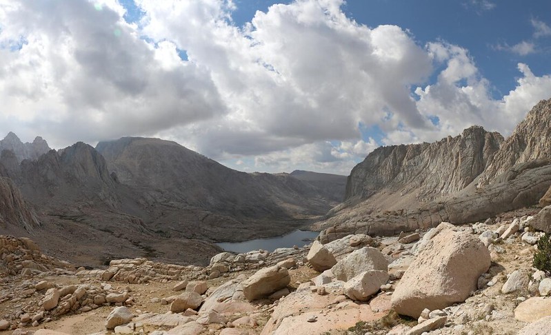
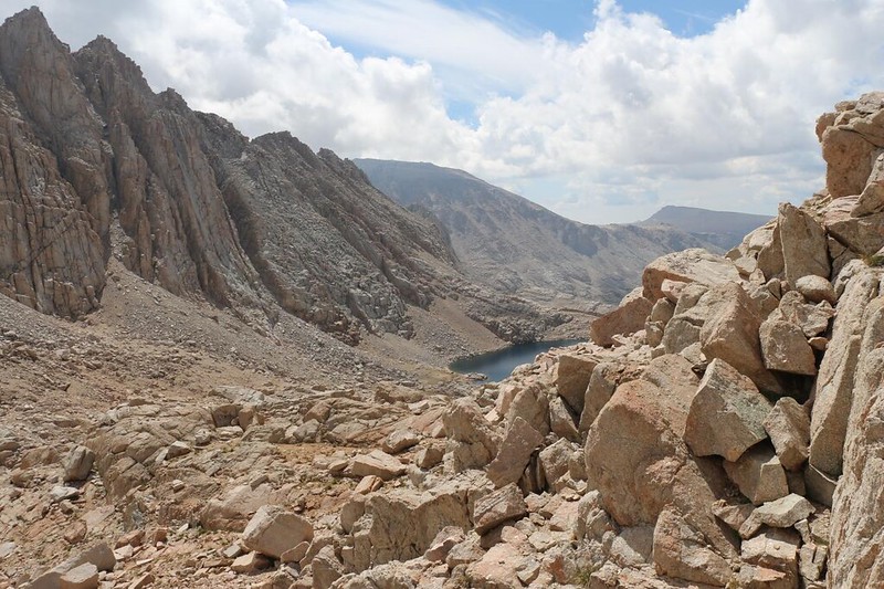
Then I came to my senses and got out my phone to consult the GPS. I decided that dropping directly down to the creek made no sense, as I would have to climb up the valley anyway. There were no more trees along this side, so I merely maintained elevation, side-hilling on slabby granite, and waited for the valley floor to come up and meet me. My map showed an old trail down there, the Rock Creek Trail, and it eventually led to Sky Blue Lake. After that, I would be on my own as I headed cross-country to Crabtree Pass at the top of the Miter Basin. I saw the trail below me, and eventually hiked on it, too, but it really only existed within the grassy meadow sections, and vanished utterly when the valley floor turned to stone. Just the same, it was easy hiking, and everything was beautiful.


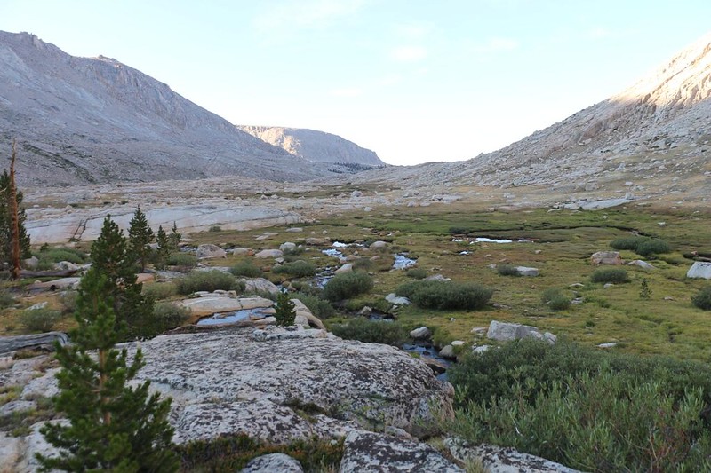
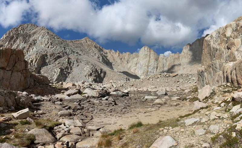
Lower Miter Basin was broad, and slightly swampy in the spots where Rock Creek spread out wide. Eventually, there was a bit of a headwall to the lower basin, and I could see and hear the creek tumbling down in cascading waterfalls. There wasn’t much water flowing this year, but I could see the staining on the rocks from prior years. This place must be roaring during the Spring melt! I had to consult my GPS yet again to find the proper path up the headwall. I scrambled up the granite, following a few piles of strategically stacked rocks (or cairns, or ducks).
Video of Rock Creek cascading down into lower Miter Basin, from just below Sky Blue Lake
I knew that Sky Blue Lake was just above the headwall, and I hurried to see it. With a name like that, who wouldn’t? And it turned out to be everything I had hoped to see in a High Sierra lake. At 11545 feet elevation, this lake stayed frozen for much of the year, and I had no intention of swimming in its icy waters. But I could look, and take photos, and sit along its shore and dream.
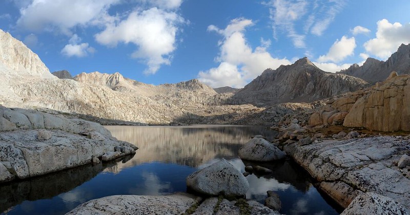

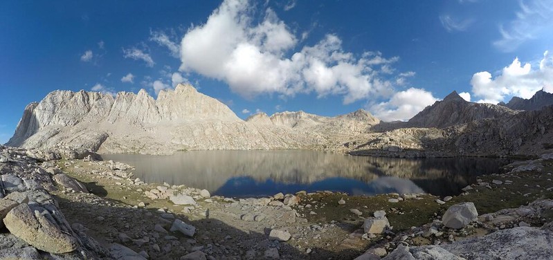


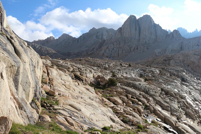
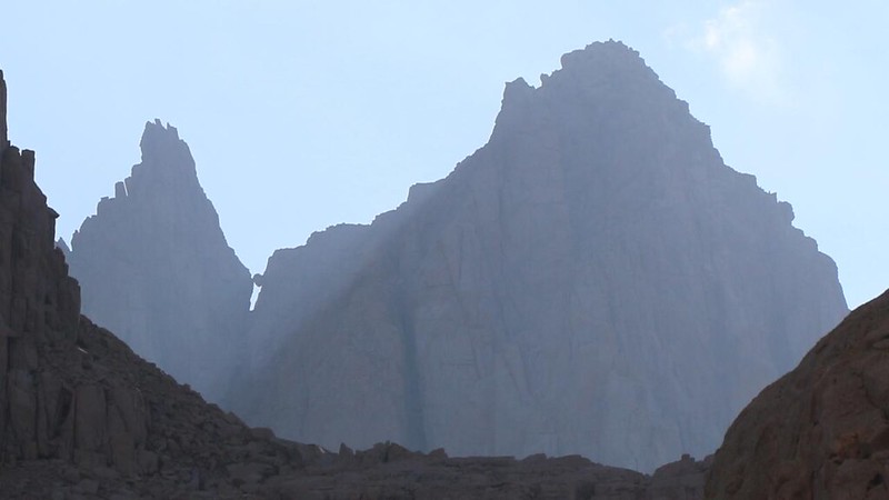
I hiked all around the east side of Sky Blue Lake, and the perspective changed constantly. I took tons of photos and videos. I even stopped for a snack break up on a rocky promontory. Off to the west side, near the outlet, was a tent, with one person standing nearby holding a cup of coffee. Nice spot! I decided that I would love to camp up here some day. But not right now – I had a limited food supply, and miles more to hike. So I continued trudging, onward and upward. But I turned around quite often to gaze back down at the lake, and to take in the ring of extraordinary mountains that lined the basin. Especially the sharp granite edges along the Sierra Crest.


There was yet another steep headwall above Sky Blue Lake, and the route I had pre-downloaded onto my GPS showed a pronounced loop to the west to avoid it. Since I was all alone, and this was the route I’d left with my family, I decided to stick with it, and not risk any direct attacks on the headwall. This section was composed of a lot of tumbled talus, dried-up tarns, and raw granite, with limited visibility. Which led to a few route-finding issues, and I got a bit off-track, but my GPS brought me back. I even lucked out by meeting a fellow climber, who was returning from bagging Mount McAdie. He gave me a bit of advice in regard to summiting Crabtree Pass. And then he continued downhill. He was partnered with the guy I saw drinking coffee. They had been up here in the basin for days, bagging every peak they could see. I wished him well and continued on, climbing upward and scanning for more cairns to help me on my way. They were the most reliable means of finding the route up here.

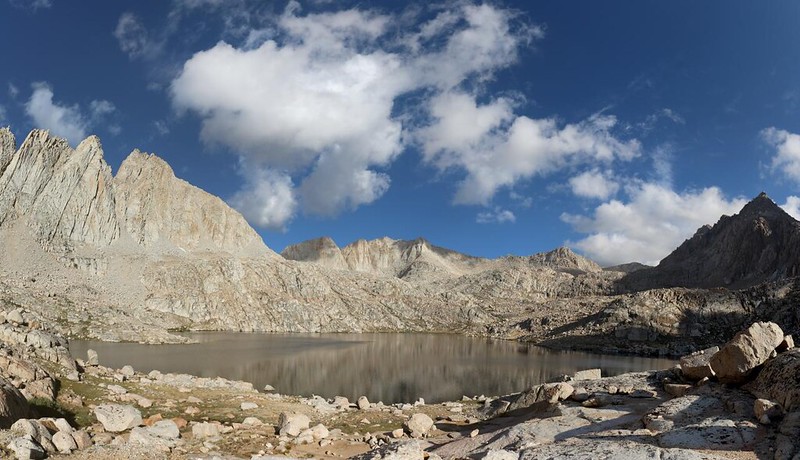
Next stop: Lake 12129. Crabtree Pass was visible from here. In fact, it looked to be only a short distance away. But looks can be (and were) deceiving. It was still morning, but I couldn’t help notice that the clouds had been steadily increasing, and I wasn’t even up at the pass yet. I was sure glad I’d woken up so early. Meanwhile, the air was getting thinner, and I was slowing down with all the rock scrambling. I powered down some extra snack to try to get my blood glucose higher, and vowed to eat lunch on top of the pass. Gotta stay fueled and hydrated. I decided not to let the clouds worry me, and I took plenty of photos and videos along the way. This place was truly awesome, so why rush it?

GoPro panorama video from upper Miter Basin near Lake 12129


When viewed on a topographic map, the GPS track I recorded looks fairly direct, way up there in the upper basin, but it is a lie. Every tiny turn you see was yet another decision, another pause to find the next cairn, another upclimb or downclimb across steep chunks and blocks of granite. I was breathing pretty hard, and every time I looked, the pass hadn’t gotten much closer. Oh, I knew it was closer. It had to be. But there it was, off ahead and above me, every single time.


But I didn’t give up. I recalled what the peakbagger had told me, and stayed off to the left side of the pass, rather than downclimbing a hundred feet to a smaller tarn, like the route on my GPS told me to do. I didn’t discover until it was too late, when I was up on the highest and steepest section of the pass, that this was a big mistake. Meanwhile, I still had rock cairns to follow! So surely this route was OK, as well. Another lie. The ducks led me upward, and I followed them, with the steepest scree field of all right at the very summit of the pass.


That last scree climb nearly did me in! But I made it, and that was what really mattered. All I really wanted to do at that point was take off my pack, eat some lunch, and find out what was on the other side.
For a topographic map of the hike see my CalTopo Page
For LOTS more photos of the trek see my Flickr Page
 << Back to Day 1 More Day 2 >>

