I hiked from the Cottonwood Lakes Trailhead in Horseshoe Meadows, enjoyed the beauty of the Cottonwood Lakes Basin, climbed up and over the Sierra Crest at Old Army Pass, then continued downhill to set up camp at Soldier Lake.
This was the first day of a four day solo backpacking trek, with the main goal being the exploration of Miter Basin (which would happen on the second day). Originally, this trip was planned to be a week-long adventure with my son and his friend (summiting Whitney along the way) but a sudden illness hit, and our big trip got cancelled. For the second year in a row! I vowed that we would succeed next year, in 2022, but meanwhile, there I was with a hiking permit and nothing else to do. I did some quick scrambling, and came up with a plan to visit the Miter Basin, which had long been on my short list of out-of-the-way Sierra locations to visit.
I drove north from San Diego, got my permit in Lone Pine, and took a side trip to Whitney Portal for lunch. This was about as close as I was going to get to Whitney this year, I said to myself, as I drowned my sorrows with a tasty Portal Burger and beer. There were certainly worse places to be! Then I headed to Horseshoe Meadows and spent the night acclimating to elevation in the back of the car. I woke up early the next morning, well rested and ready to hike.

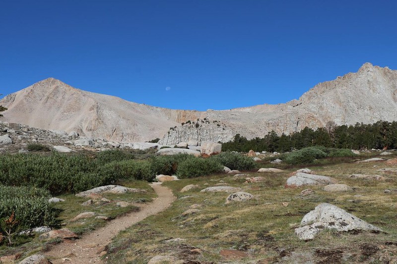
I have hiked this trail before, several times, and there were no new surprises. Just the same, the frosty meadow was quite beautiful in the early morning sunshine, as the light sparkled off the frozen dew drops clinging to the heavy, bowed-over grass stems. The air was crisp and felt good as I breathed it in deeply, hiking fast and hard, uphill along Cottonwood Creek. There wasn’t much water in the creek, not in this extra-dry year of 2021, but there was enough to keep the wildlife happy.


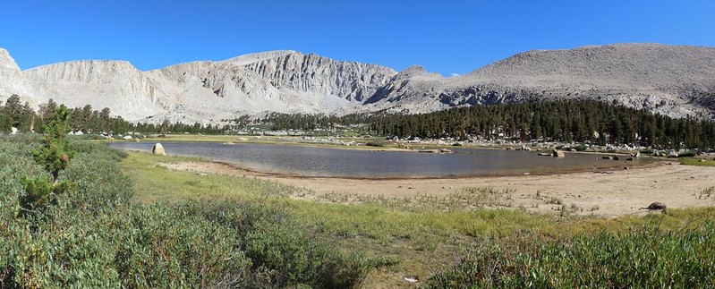
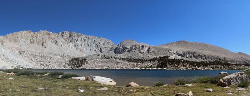
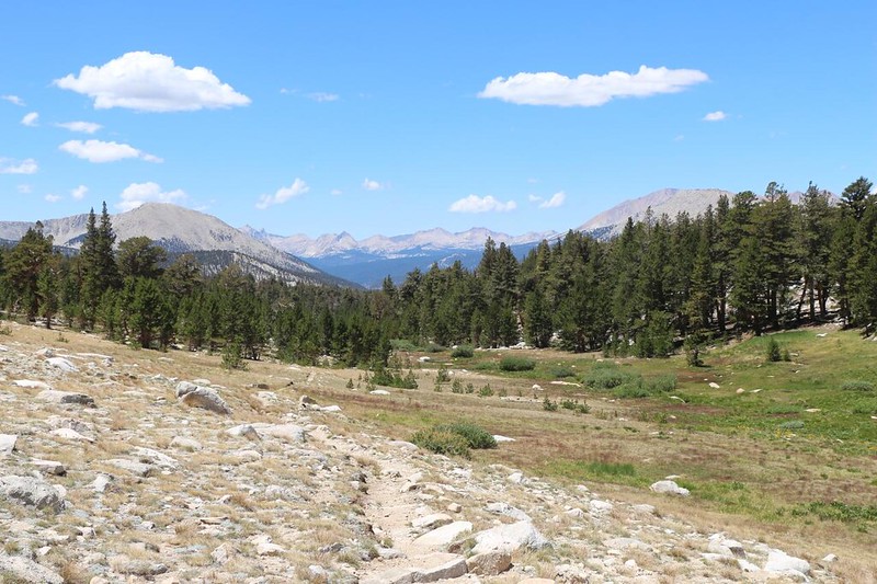
After about five miles of hiking, and a climb of a thousand feet, I arrived at the level of the Cottonwood Lakes Basin. I was able to really stretch out my legs for the next two miles as the basin is relatively flat. It is also exceptionally beautiful. The nearly full gibbous moon was setting in the west, beyond the Sierra Crest, and the basin was ringed by granite peaks. Mount Langley, California’s southernmost fourteener, looked down on the basin from the north.
As I hiked, I discovered that one of the shallow lakes was looking quite dry; it didn’t have any input sources with snowmelt. But the main set of lakes were still relatively full, and there was water flowing in the interconnecting creeks. The Winter season had been very dry, but a few weeks before, in early July, there had been quite a bit of monsoonal rain delivered to the southern Sierra. I know, because I was present for some of it! The big wildfires of 2021 were all up in NorCal, not down here.

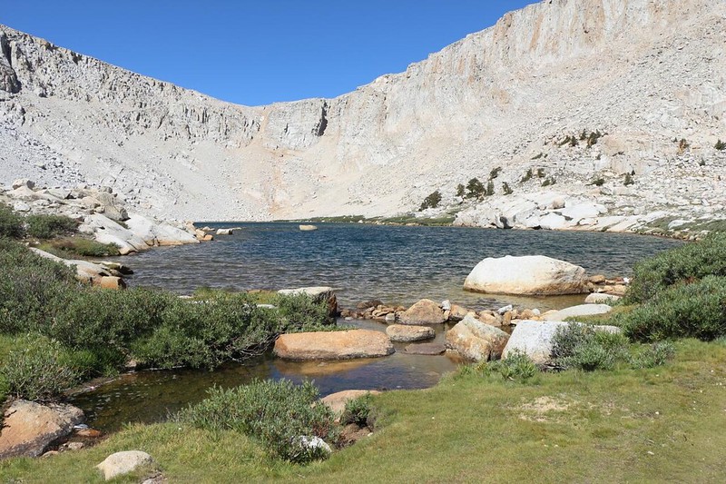
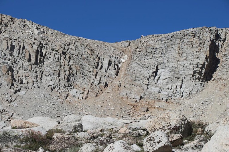
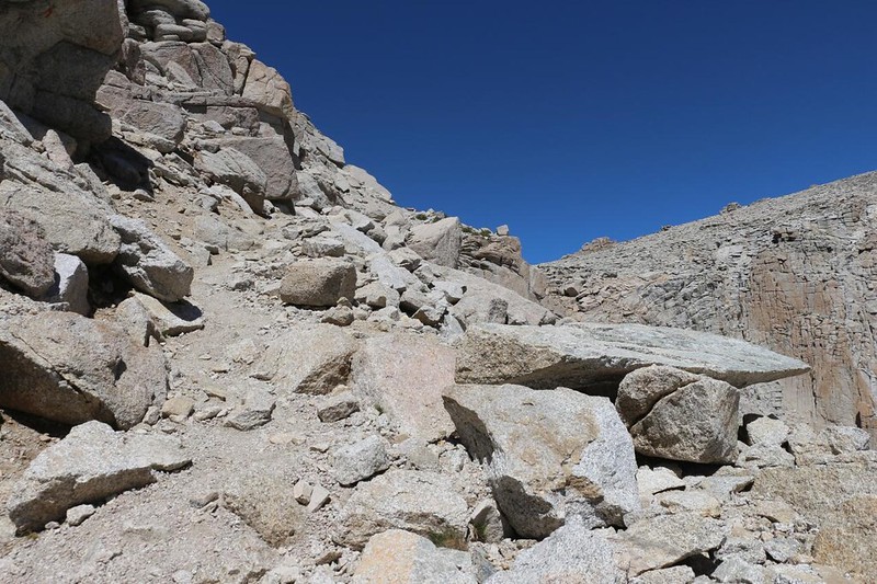
I hiked up to Cottonwood Lake Number Four, and Old Army Pass came into view. It was at an elevation just below 12,000 feet, so I still had another 800 feet to climb. I took a short break and ate a bit of lunch, enjoying the view before the final ascent. I had heard three weeks ago that the snow was almost completely melted, and those reports were correct. There was only one tiny patch remaining in a cleft below the pass. On a big snow year, this pass can stay icy and dangerous all Summer long, so that safety-minded hikers have to climb an extra 400 feet over New Army Pass. No thanks! Plus, the views of the lakes were much better from here.
The trail over Old Army Pass (originally just called Army Pass) has been removed from the USGS Topographic Maps. The authorities created New Army Pass (and now want to call it Army Pass) to ameliorate the danger of the icy, north-facing slopes of Old Army Pass. But the trail is still there. It is no longer maintained by the National Forest Service, so now it also suffers from a few areas of excessive erosion and some fairly major rockfall up near the top. But it was still a great trail, and much shorter and easier than the new one (provided that the snow was all melted). Naturally, being me, I preferred to show my rebellious nature and take the Forbidden Path. And I enjoyed it!
GoPro panorama video from the Old Army Pass Trail as I climbed closer to the pass

It was a steady climb in the hot sun, but I made it up to the top, where there was a solid breeze blowing in from the west. This was the Sierra Crest itself, and the point where I crossed into Sequoia National Park. I took some more photos and videos, and headed down the trail a bit, then took a break out of the wind in the shelter of a tall boulder. I sat and ate my snack, then read my book for a while. The rest of my hike was downhill, and only a few more miles. I had plenty of time to relax and enjoy the views. Being up at 12,000 feet is almost always worth while, view-wise.


After that, it was time to head west, down the New Army Pass Trail toward Rock Creek and the Soldier Lakes. There was a bit of a militaristic naming theme going on in this region of the Sierra. Army Pass, Soldier Lake, and The Major General (a prominence on the southwest ridge of Mount Langley). Meanwhile, the views into Sequoia Park were crisp and clear. I knew many of the peaks without even consulting my phone app, thanks to our trek last year on the High Sierra Trail.

I left the trail when it arrived at Soldier Lake. It was still early afternoon, so I headed further north this time, around an outcropping, and camped right next to the lake on a protruding granite peninsula. Perfection! I was the first one there, so I got the best spot. I hoped that no one else would hike that extra distance, but of course it didn’t happen. Soon enough, there were a dozen or more people setting up their tents nearby. Oh well. It was all good. And as a solo hiker, it was actually nice to meet some new people and be sociable for a while.


I filtered water from the lake, then cooked and ate my dinner of ramen noodles. Very simple, but nice and salty. I got out my map and studied my plan for tomorrow. I had a lot of miles to cover, and many of them would be on a “Route” and not a trail. This meant that I would be spending much more time deciding precisely where to walk, and possibly taking even more time backtracking when I chose poorly. I was a bit nervous, as this would be my first cross-country solo hike into the backcountry, with no “Buddy” to help me out if I got in trouble. My InReach satellite transponder would have to do. Plus a healthy dose of caution. I also knew it was going to be a very long day, so I headed to bed before sunset, and set my alarm for 3am. I planned to already be hiking at first light.
For a topographic map of the hike see my CalTopo Page
For LOTS more photos of the trek see my Flickr Page
Onward to Day 2 >> 

