After hiking all morning through Miter Basin to summit the rarely visited Crabtree Pass, I descended an insanely steep slope of scree to reach the starkly beautiful Crabtree Lakes, then followed Crabtree Creek to Crabtree Meadow, eventually arriving at Whitney Creek and the PCT, where I successfully set up camp, minutes before being inundated by thunder, lightning, hail, and torrential rains for hours into the evening. It had been a truly exciting day!
By the time I reached Crabtree Pass, I was more than ready for a break. After hiking six hours, covering six miles of an off-trail route, and climbing over 1800 feet, I was well and truly whupped. I took off my pack and got out some food. I sat down in a great spot with fine views in all directions. I took off my shoes to dry my sweaty socks, and ate my lunch in silence. There was a mellow breeze blowing to the east. Up there at 12,600 feet it wasn’t exactly warm, but it was the perfect temperature to sit in the sun. This was one of those “Bucket List” moments, the ones where you wish they could last forever. They never do, of course, but I wasn’t going to rush onward quite yet.

GoPro panorama video from the top of Crabtree Pass, looking into both the Miter and Crabtree Basins

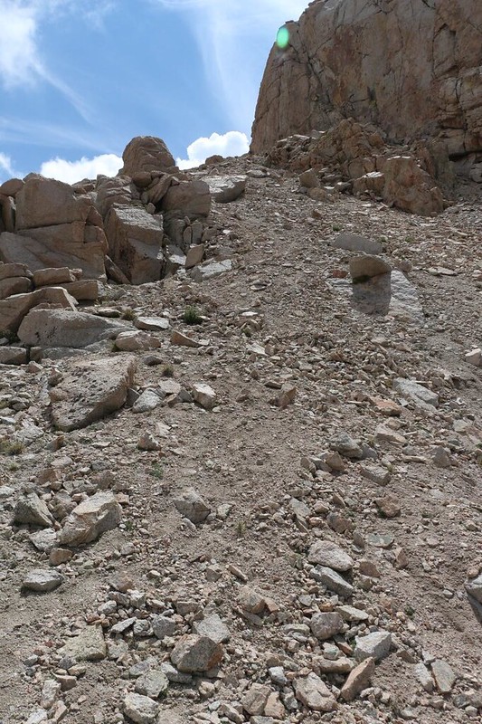
Eventually, of course, I had to go. I took a few more photos, and then checked out the “trail” heading north toward the Crabtree Lakes. There was a 500 foot drop on that side of the pass, and it was incredibly steep. Scary-steep, in fact. I could see where other fools (like myself) had arrived at this location and headed down. Or maybe even up! I began to doubt the wisdom of the advice I had been given earlier that morning, to come to this end of the pass, rather than the lower, eastern side. But there was no changing that now. The path to the east looked scary, too!
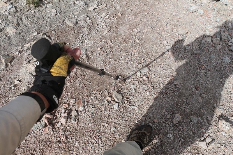
So I packed up my gear and got out my hiking stick. Normally, I only use that stick when crossing streams, to keep my balance on slippery rocks and logs. But this slope looked awfully serious. The last thing I wanted was to slip and lose my footing, as I might keep rolling and/or bouncing, or sliding and scraping, for far too long a distance. No thanks. As a solo hiker, it was my duty to take fewer risks, when possible. The hiking stick would have to do, since the slope wasn’t about to change.
Camera in one hand and hiking stick in the other, down the scree I went. I tried to slow myself down, but it wasn’t always possible, with slippery scree sliding out from under my feet. Sometimes it seemed safer to do a bit of shoe-skiing, provided that I could see a bigger boulder up ahead, positioned for use as a solid stopping point. Being able to pause made all the difference, like a landing on a stairway. I stopped for photos part way down, but eventually I gave that up and simply concentrated on getting this madness over with.
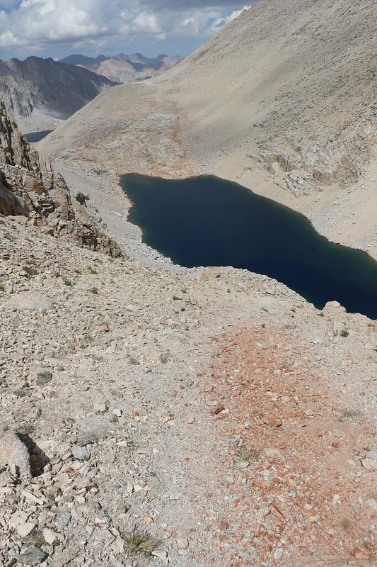
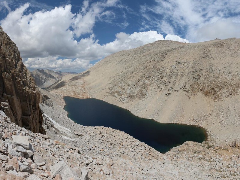
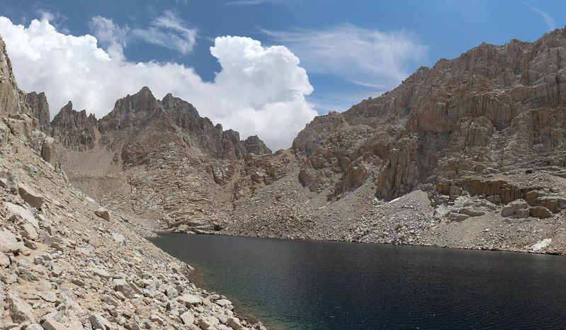
As I neared the bottom, the slope got less steep, and soon I was picking my way over granite boulders and outcroppings. I arrived at the lake’s shore in record time, if you compared it to how long it took me to climb 500 feet that morning! Wow!


This lake, the highest of the Crabtree Lakes, is at about 12,100 feet in elevation, and stays frozen for much of the year. You could tell by looking through its crystal clear water at the turquoise color of the glacial sediment at the bottom. This was some of the purest water in the Sierra Nevada, fed almost entirely by snowmelt. The route on my GPS sent me hiking along the northern shore, and there was a decent “use path” there from previous hikers, or maybe from fishermen. I didn’t see any fish, but I wasn’t looking, either.
I just hiked along, taking photos and videos. I also hiked fast, because the cumulus clouds (which look so pretty in pictures) were beginning to get taller, and their bases were getting wider. I still had about 6 more miles to go to reach camp, and I didn’t want to get caught in what Vicki and I call the “Daily Afternoon Thundershowers.”


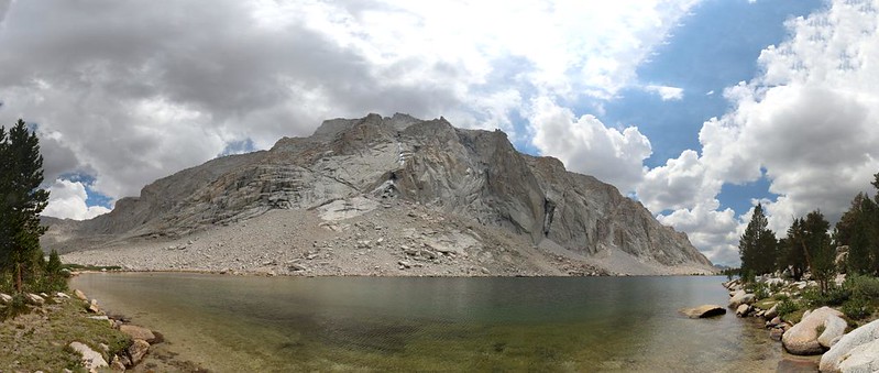
I noticed that there were several tent-sized camping spots near the lower end of the lake. I thought that I might put this knowledge to use next year, if my son and I passed this way after bagging Whitney. I also knew that I was very close to Mount Whitney at that very moment. As the crow flies, that is. Just to the north of the lake was what is known as the “Giant Sandhill,” a mound of granite scree and sand roughly 2000 feet high, that led up toward the Discovery Pinnacle and Trail Crest on the Mount Whitney Trail. It would be a terrible slog to climb from here, but it might be fun to come down! People had done it both ways and survived.
The next phase of the hike was continuing down Crabtree Creek to the next lake, known as Upper Crabtree Lake (Lake 11339 on the USFS Topo Map). This stretch entailed about a mile of boulder-strewn valley floor, a floor made of delightfully slabby glaciated granite. When I could find the slabs, that is. There was no obvious trail in this rocky zone, and some of my route choices proved faster and easier than others. Just the same, I made pretty good time.


Soon enough, I came upon Upper Crabtree Lake. There was something vaguely resembling a trail along the northern shore. It was faint, but I’ve been honing my woodsman’s skills for a long time, and I was able to follow it, keeping to the faster track, the path made by others in the past. The lake stayed down below as the trail cut the corner when the valley curved to the north.


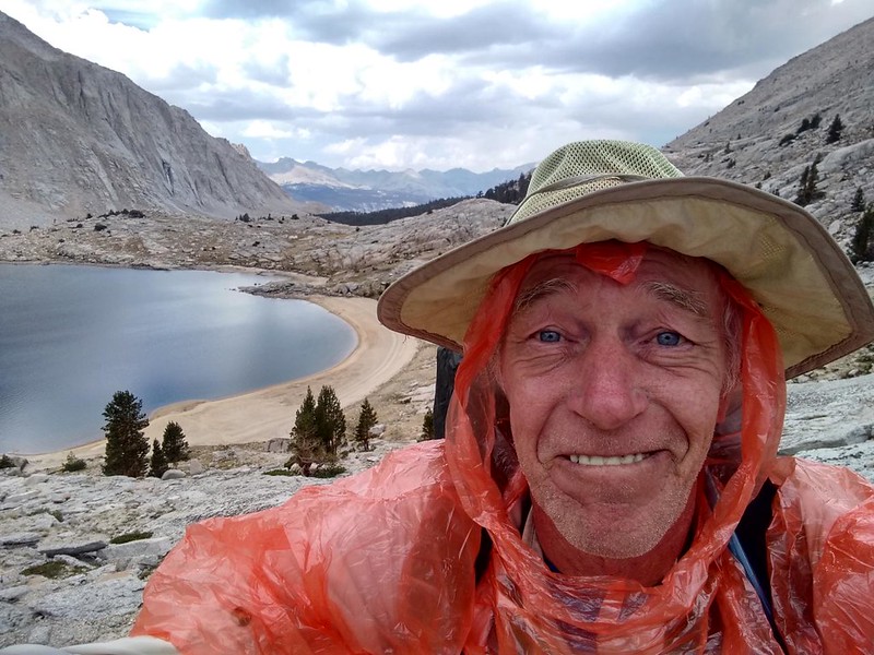
As I climbed up and over a broad granite ridge, a particularly dark cloud drifted in from the southwest. There was still some blue sky all around me, but not overhead. I began to hear the tiny pops as droplets hit my hat brim, and I could smell the petrichor smell of a Summer rainstorm as the ground began to dampen. I stopped for a moment and took off my backpack. This didn’t look like a major soaker, so I only got out my wimpy four-dollar poncho and put it over my head. I also put the waterproof cover over my backpack, even though everything inside was already inside plastic bags. I was carrying it anyway, so why not?
After that, the path led down to the lakeshore, where there was a delightful sandy beach. I discovered a few fresh footprints, and wondered if anyone was still here. If they were, they were probably taking shelter. I stopped and enjoyed watching the tiny raindrops making circles on the surface of the lake. Very pretty.


Fishermen liked to come to this lake, so I figured that they were the ones who left the footprints, which may have been a day or two old. Maybe they had camped down below, at Lower Crabtree Lake, or even further down, at Crabtree Meadow. I’d probably never find out, but it was fun to speculate.
After this lake, the trail was a true trail. It even had a name, the “Crabtree Lakes Trail.” and its character changed on my topographic map, from a little dotted line in the upper basin, to a firmly dashed line from this point downstream. I began to make seriously good time, and I really wanted to. I took off my poncho after the rain stopped, but the clouds were still getting more threatening. I stretched my legs and blasted down the trail. It was time to crush those miles. I wanted to set up camp before the deluge!
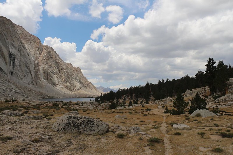

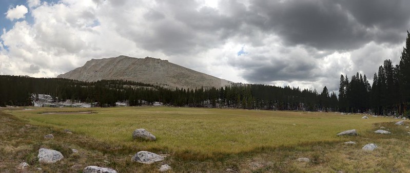
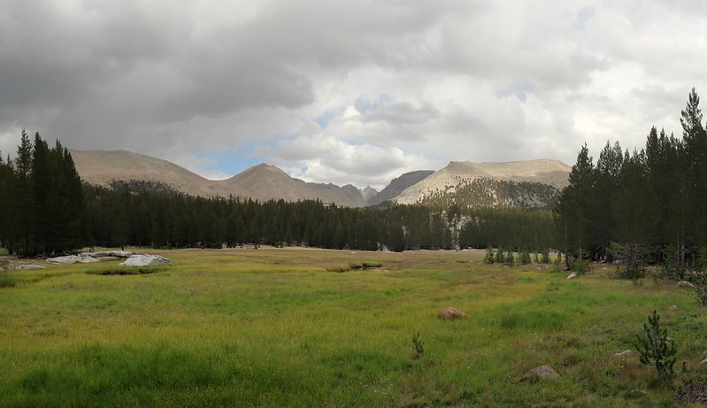
After that, the trail entered some forest. It appeared that I was truly below the Tree Line now. I got occasional views to the west into Sequoia Park, and the trail eventually led toward some very large meadows. This was Crabtree Meadow, in fact, which has both an Upper and a Lower, just like the lakes.
I had about two and a half miles to go, and the clouds had almost entirely covered the sky, at least off to the west. The Sierra Crest in the east still showed patches of blue sky, which was quite unusual. Ordinarily, the crest is what creates the huge updrafts that lead to thunderhead formation. I began to wonder if it was really going to thunder after all. But I still kept hiking fast, just in case.


Once I reached Lower Crabtree Meadow, I began feeling less pressure, but I still kept hiking fast. I saw Mount Whitney to the east, standing proudly in the sunshine. Normally Mount Whitney makes its own weather! This was odd, but I wasn’t going to complain. I met several groups of hikers heading that way, some of whom looked like noobs. I warned the noobs to place their tents in well-draining, slightly sloping areas, even if it meant you had to sleep with your head uphill rather than being perfectly flat. Flat meant puddles in a rainstorm. They nodded, thanked me, and hurried on. Getting soaked and frozen can turn an otherwise fun rainstorm into a nightmare.
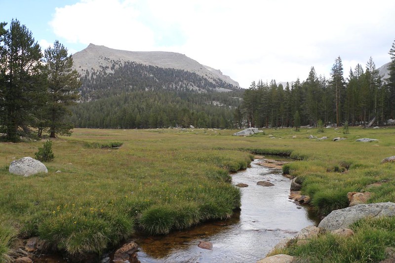

I heard the first roll of thunder as I crossed Whitney Creek on the PCT. It seemed odd, as the thunder sounded like it was off to the southwest, not toward the crest. Maybe if I was lucky the storm would drift off in a different direction, and leave me alone. Yes, I know; it was wishful thinking. I saw the campsite I wanted just ahead, the same one that Vicki and I had stayed at last year, and it was empty. Hooray! I took one last photo of Crabtree Meadow so that I could show it to Vicki when I got back home. Then I arrived at the campsite, which was just off the trail, set back from the meadow.

I set down my pack and got out the tent. I put it up in record time. I watched as a few tiny drops landed on the top of the tent. Thunderstorms don’t give you much time between the baby drop stage and the full downpour stage, so I knew I had to hurry. I didn’t bother putting anything in the tent, but instead grabbed my big gallon water bag and jogged back to the creek. I filled it up with two rounds from my collection bag. No time for filtering today! I would purify it with chlorine back in camp.
Thunder boomed again. It seemed a bit closer this time. The rain began sprinkling in a more serious way as I ran back to camp. The drops were still small, but there were a lot more of them. My pack was still outside, with my expensive camera sitting right next to it, getting wet! I realized that there was no time to do my usual tent-preparation routine, where I organize everything in an orderly fashion. No, not at all! Everything needed to get inside the tent, right now. Including me. I grabbed my camera and backpack and stuffed them under the vestibule tarp, then grabbed the bear can and ducked inside. I sat my butt down on the tent floor and zipped up the tarp. I was inside! And mostly dry.
I even had water! Thank goodness I hadn’t put that chore off until after my gear was arranged. I was quite dehydrated and my water bladder was almost empty after such a long hiking day. All told, I had hiked 12 miles (much of it cross-country) in 14 hours, starting before dawn and ending just before sunset. My legs and feet were feeling it. But now I was safe in camp, and could finally think about resting.
I sat there and listened to the occasional thunder, while the rain sprinkled lightly. Then the rain started getting harder. It seemed that I wasn’t going to avoid the thunderhead after all. “You can’t change the weather,” as my mother used to say, so I figured that I might as well enjoy it. Why not? I took some videos, too. I figured that this storm would be over in a few minutes, like most Sierra thunderstorms.
But this wasn’t the average storm.
GoPro video as the rain started sprinkling, from inside my tent
GoPro video of thunder booming!

The sky grew dark and the thunder was louder and stronger. Flashes from lightning lit the tent, and the thunder rolled out along the valley, echoing and booming from the granite walls. The rain began pounding down, and soon enough there was a bit of hail. I was directly under the storm at that point. The air grew cold in the hail-laden downdraft. I got out my goose down jacket and pants, and even used my absurd goose down hat for the first time ever. I sat and waited, toasty warm, but the rain didn’t seem to be stopping. In fact, puddles were forming outside, below the dripping tent corners, and then I discovered a tiny streamlet running directly underneath the tent! This was a call for action.
It was time to set up the inside of the tent. There was no longer any point in waiting for the rain to stop. If anything, it was getting even darker as sunset approached. But how? I had the interesting problem of, essentially, making my bed while sitting on top of it. First I got out my plastic “bathtub” sheet (a cheap vinyl tablecloth) and spread it out. This would stop any leak-through from the outside, in case the supposedly waterproof nylon floor was no longer impervious. Next was my thin foam insulating pad. Then came the trickiest part: Inflating my air mattress without sitting on it. I stood it on its side along the back wall of the tent as I blew it up, my face pressed against the head-end of the tent. It was contorted, but it worked. Spreading the sleeping bag was easy after that.
I stuck my legs into the sleeping bag and opened up the bear cannister. I decided not to bother cooking anything that night. I had enough extra snacks to make do. Then I purified my gallon of water, and all was well. I sat and munched on snacks while reading my kindle by the light of my headlamp. Very cozy and warm. The thunder kept on booming, and slowly grew further away. Every so often, I peered around at the corners of the tent, to make certain that it wasn’t leaking. All was well.
Eventually, I lay down and read some more, and the rain kept on coming down. Sometimes soft and sometimes hard, the rain just never let up, even after the thunder had long since petered out. I fell asleep to the sound of rain. I woke up later on that night and realized that the tent was no longer getting sprinkled. The drips were all nearby, the sound of large drops falling from trees. I checked my watch. It had rained for almost six hours! And here I was, snug and warm and dry in my tent. What an incredibly excellent day it had been.
For a topographic map of the hike see my CalTopo Page
For LOTS more photos of the trek see my Flickr Page
 << Earlier Day 2 Onward to Day 3 >>

