On the final day of my trek I hiked north on the Pacific Crest Trail from a campsite below Duck Lake, all the way to the Reds Meadow Resort near the Devils Postpile National Monument, passing Deer Creek, Crater Meadow, and the Red Cones along the way, and then I used the Mammoth Lakes shuttle bus system to get back to my car at the Duck Lake Pass trailhead.
I got up plenty early that morning, and it was very dark. But I was used to this, and getting my gear ready followed the usual steady progression. If I cook breakfast, it takes about two hours, and if I eat a cold breakfast on the trail then its closer to an hour and a half. Today I had a couple pop-tarts ready for just this eventuality, so I slipped them into my pocket and finished packing. I put on my pack and started hiking just after 5am.

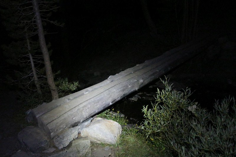
At that hour there was barely any light in the sky at all. I hiked using my headlamp, and walked softly and quietly along the trail, amongst the many tents and sleeping hikers. Only one tent had another early bird inside, the nylon glowing faintly from their own headlamp. I whispered “Good Morning” just loud enough for them to hear me as my boots softly crunched on the sandy trail. And then I was gone, a shadow in the night.

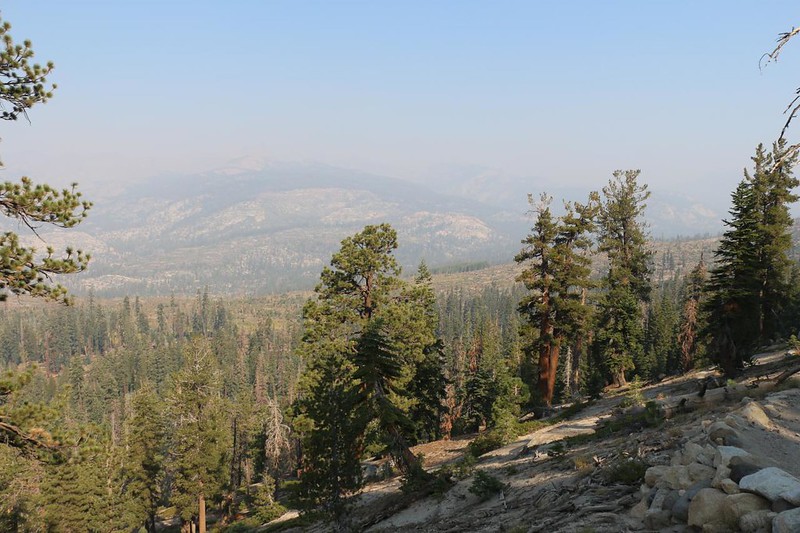
The PCT stayed high above Cascade Valley, and as dawn approached, the opposite side of the valley came into view. Sadly, it looked to be another smoky day. Not much opportunity for dramatic photos, I decided, and was even more glad that I’d left camp early. I don’t want to hike in the dark if it means I’m going to miss something!

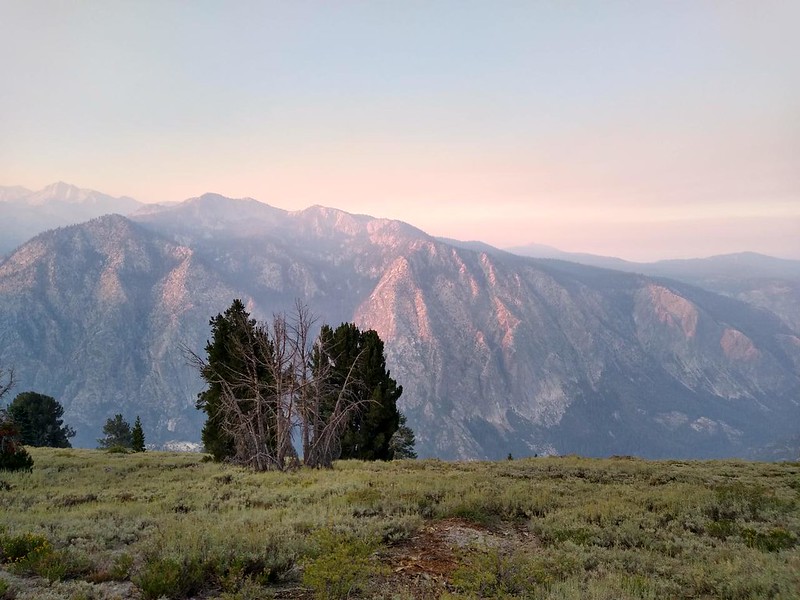
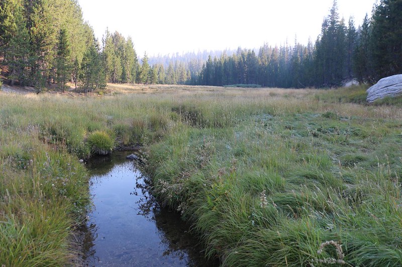
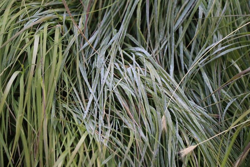
The sun rose as the miles ticked by underfoot. The granite to the west took on a distinctly reddish cast as it climbed through the smoky layers. Eventually, the trail headed into the forest, and travelled along Deer Creek, and its lush meadow. The still air had left a lot of frosty grass in the meadow, and it sparkled in the light as I walked past. The temperature was cold but I was warm from hiking, so it all worked out perfectly. I’d already hiked five miles out of twelve, and it was still early morning. I was making excellent time!
A few miles later and I came upon one of the highlights of the trek: The Red Cones at Glacier Meadow. I had seen them on the topo map when I was planning the trip, and I was able to learn about them, too. They looked like twin volcanos from the satellite view, and were composed of a rich red rock. But they weren’t exactly volcanos, at all. They were volcanic vents. Which meant that they were formed by hot gases blasting out of the ground for what must have been a very long time. And those gases must have been moving fast! They carried along all sorts of pumice and other volcanic cinders and ash and shot them into the air. The loose pieces eventually formed two large cones around the vents. Imagining the sight of it happening is one thing, but imagining the smell of all that stinky sulfur is another! Phew! I’m glad I wasn’t there, regardless of how amazing it must have looked.


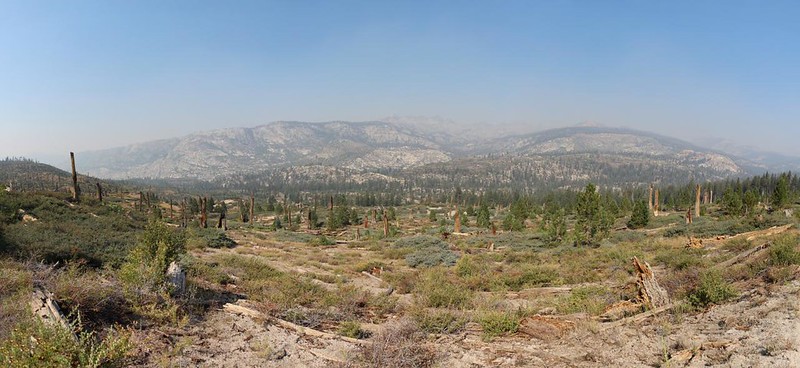
After the cones, the PCT emerged once again above a huge valley. I checked the map on my phone and discovered that the Devils Postpile was somewhere to the north within that valley, and that the Middle Fork San Joaquin River was down at the bottom of it. Too bad the smoke made the view so hazy. But I realized that this also meant that I was nearing my destination. Another hour or so of hiking and I would be finished. But first I had to head downhill through a pine forest. I could handle that. It was starting to get warm in the sun.
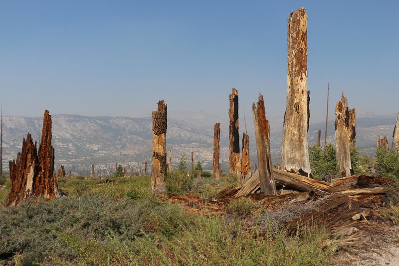
The trail was smooth and had a steady grade. Easy hiking, and my feet were happy. Soon the forest ended and I arrived at a huge, desolate area. There were thousands of thick dead stumps, of varying heights, standing all around. Plenty of young pines were growing in between them. This was obviously from a very old burn (1999, I believe) and the forest was taking its own sweet time renewing itself. This is the natural way, of course, but to short-lived humans such as ourselves, it sure seems to take forever. The fires up north that were making all this smoke were destroying forests that I’d never seen, and now would never see. I was too old already. Sad but true.

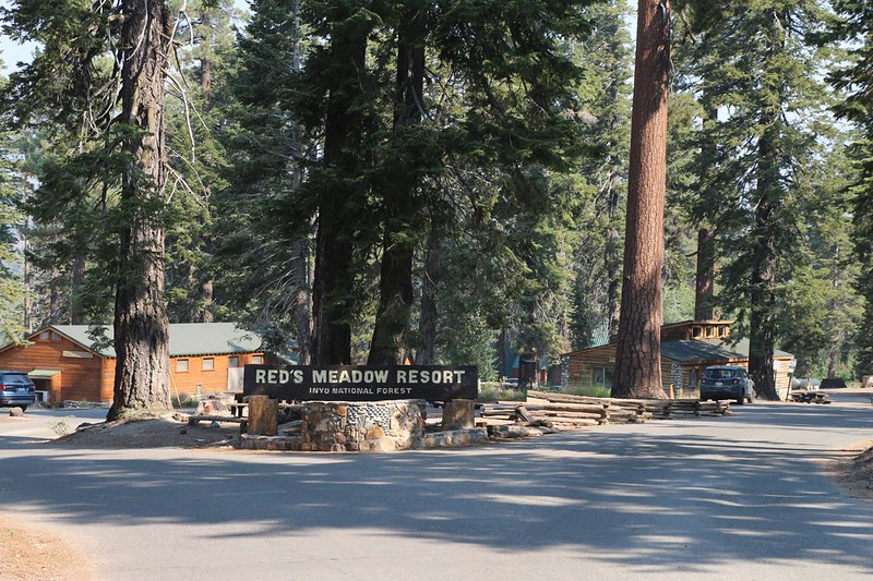
It was hot on the sun-exposed trail, but at least it was downhill. Eventually, I made it to the PCT’s intersection with the Rainbow Falls – Reds Meadow Resort Trail. This was where I started hiking north a few weeks earlier. At that point, my PCT section hike was officially finished. All that remained now was getting back to my car. In order to do that, I had to hike on up to Reds Meadow Resort with the rest of the Devils Postpile tourists.


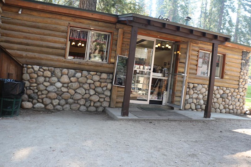
But I wasn’t in such a rush to get to my car that I didn’t want to take a long break outside the resort. It was still morning, so I bought a huge breakfast burrito at the cafe. I hung around at one of the picnic tables and ate it, while talking to other JMT hikers. Getting real food from this place was one of the highlights of the JMT, after all. And I enjoyed every bite.
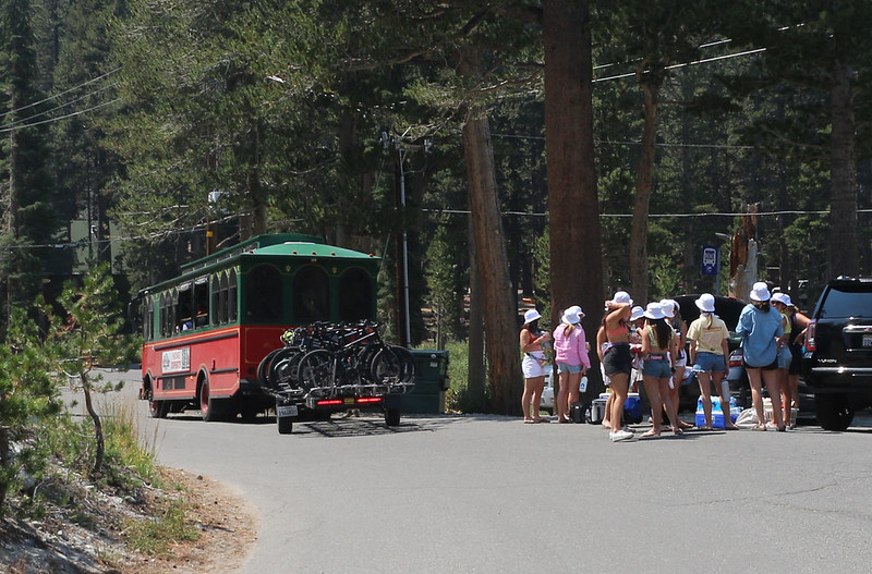
After that, it was time to board a succession of buses and shuttles. The first one cost me $15, and it dropped me off down at the Mountain Center, where the skiers and bike riders (in Summer) take lifts up to the top of Mammoth Mountain. That sure sounded like a lot of fun. People kept getting in line to do it over and over. Downhill cycling, all day long! What a ride.
The first bus driver told me how to get where I wanted to go, and the next two shuttles were free of charge. The city of Mammoth Lakes wants tourists to have a good time, and it shows. Great idea. I got on the the second bus a few feet from where the first one dropped me off, and it took me downtown. Then all I had to do was cross the street and I was on the third bus to Lake Mary. And everything worked like clockwork, with barely any downtime. Nice!


Unfortunately, Lake Mary was about a mile down the hill from the trailhead, which was at the far end of a very large campground. I put on my pack and hiked along, heading uphill once again. But it was an easy mile, and soon enough I was at my car. Excellent! I put my pack in the back and opened the windows, then got myself ready for a six hour drive home. I changed my shoes and socks, and felt better immediately. And the best part was that I still had half a breakfast burrito in my backpack to eat on the drive to San Diego.

On my way home I was already thinking about next year, in 2022. I had already been mapping out a “loop” hike that would complete the last section of the JMT that I had yet to do. (This was also the final piece of PCT California Section H.) Vicki said she wanted to do it with me, and that made me happy, even though we’d have to take more days to complete it. This solo hiking certainly got the miles done quickly, because I’m a strong hiker, but I could see that being all alone, day after day, would eventually start to bother me. I can do it, but the experience loses some of the fun when there’s no one nearby to share the everyday joys and beauties of the trail with. Oh well. I blame the wildfire smoke for this trip, or else Vicki and her sensitive lungs would have been there with me. Let’s hope that 2022 will prove to be a less fiery year in California!
For a topographic map of the hike see my CalTopo Page
For LOTS more photos of the trek see my Flickr Page
 << Back to Day 3

