On the third day of my trek I hiked on the Pacific Crest Trail, from Silver Pass Creek up and over Silver Pass, down into the Cascade Valley, then uphill again following Fish Creek to Tully Hole and Lake Virginia, took a break at Purple Lake, and hiked a few miles further north to wind up just below Duck Lake.
As always, I woke up in the early morning darkness. But not too early this time. There was a faint smell of smoke in the air. I had a feeling that the weather pattern had shifted and dragged some smoke down from the large wildfires that were burning up in far northern California and Oregon. I sat in my sleeping bag and cooked up some oatmeal, and ate it by the light of my headlamp. By the time I finished packing all my gear, there was plenty of pre-dawn light for hiking. My plan was to make it up to the top of Silver Pass before the sun had a chance to utterly roast me. I knew that it would have plenty of chances later on, but first things first.

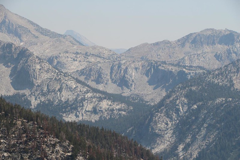
Everything was hazy that morning, even the nearby valley walls. Distant mountains were essentially gone from view. But I didn’t despair. There was still beauty in the world, and I intended to find it. I wasn’t carrying a heavy DSLR camera around all day for nothing!
The climb to the pass went fairly swiftly. I was feeling strong and the trail wasn’t very steep. I checked out Silver Pass Lake, and saw a couple of campers on the northern shore. They were barely up yet, standing outside their tents drinking coffee and eating breakfast. I waved and hiked on

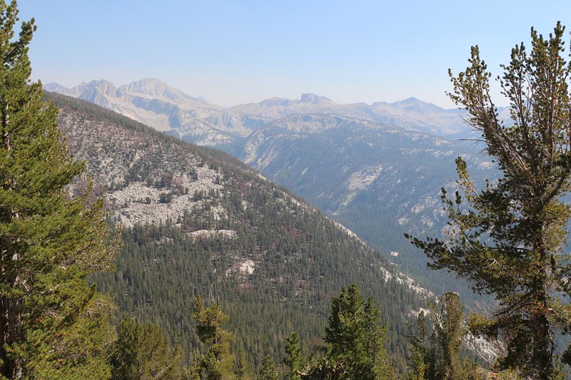
Thanks to the high walls of the valley on the eastern side, only the final 100 feet of trail leading to Silver Pass was in the sunshine. Perfect! I took off my backpack and sat down for a break. I remembered yesterday’s extraordinarily clear view to the north, and today’s was sadly lessened by the smoke. I could barely make out Banner and Ritter. All of California was beset by foul wildfire fumes, it seemed. While I waited, a solo hiker arrived from the north. Another early riser! We congratulated each other for our early morning awesomeness. And then we took summit photos of each other, as well. Nice! It’s hard to get a decent photo of yourself when solo hiking, as “selfies” don’t get all of you and setting up a timer shot is fraught with difficulty.

I headed downhill on the PCT, striding long and strong. It felt good to be heading back north. Even though this part of the trek was a “There and Back” hike, the world still looked different when facing the other way. I knew that I only had about twenty two miles to go until Reds Meadow and the Devils Postpile, which would complete this section of the Pacific Crest Trail. That was the official “purpose” of this trek. Enjoying the High Sierra along the way was merely a byproduct! The current plan had me camping at Purple Lake tonight, then Reds Meadow tomorrow, followed by hiking up and over Mammoth Pass to the car the next day. Maybe by then the smoke would have drifted away. One could only hope.


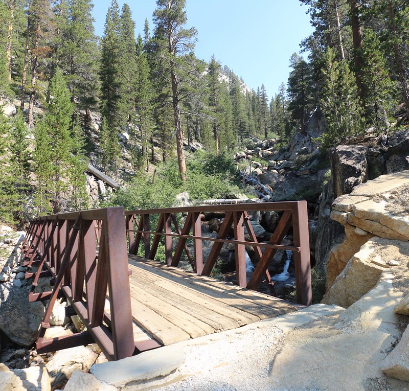
Down at the bottom, in the Cascade Valley, I came across the sturdy metal bridge over Fish Creek. It had been too dark yesterday morning to enjoy it. I stopped for a break and cooled off my feet for a while. Unlike yesterday, I met several more hikers down there, all heading south. We exchanged information about the trail, and all of us lamented the smokiness. My break over, I put on my shoes and headed upstream. It was quite pretty.

When I neared my old campsite south of Tully Hole, I came upon a young bear! It saw me as I rounded a turn and darted up into a boulder field. It was just as shocked as I was. I stopped to take too many photos, like an idiot. Once my brain began working again, I realized that there might be a momma bear nearby. Then I really started hiking fast! But all was well in the end.

It was 11am when I arrived at the meadow in Tully Hole. It was hot by then. I remembered the hikers I met on this next steep climb, and how they suffered in the sun, sweating profusely on each and every exposed switchback. That was going to be me this time. I took off my pack and walked over to the creek, and splashed a bunch of cold water on my head. Aaahh! I plopped my hat on top, and spent a few final moments in the cool shade of a tree. Then it was time to start climbing. It was up to me to get this done.
Halfway up, I found a lone tree and a shady spot beneath it. I took off my hot shoes, and also removed the lower section from my cargo pants. I was in Full Shorts Mode now. This rarely happens to me, so you know that it was hot! Then I continued onward, one hot step at a time.


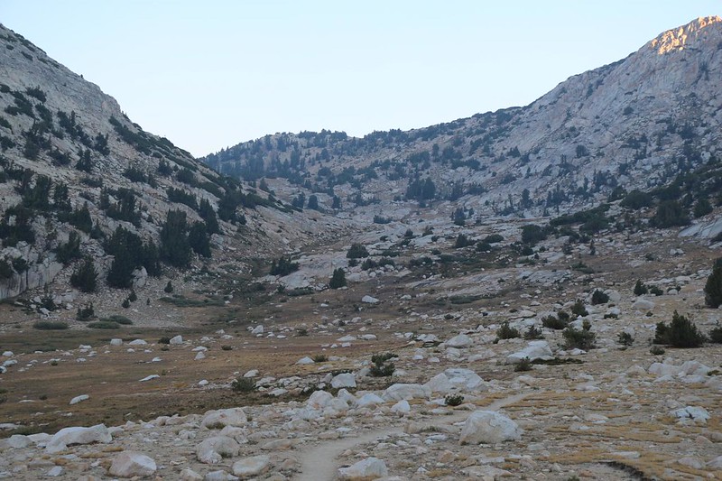
It was noon by the time I got to the saddle at the top, just south of Virginia Lake. I decided to take another break, this time for lunch. I checked the Guthook PCT app on my phone. It was only 2.5 more miles to Purple Lake from here, which meant that I would arrive in the early afternoon. From info I had obtained earlier from hikers at the Fish Creek bridge, the large group of loudly yakking horse-packer people were still present at Purple Lake, and they would be staying there again tonight. My fellow hikers had suffered from lack of sleep last night, and were not amused. Plus, they’d hogged up all the best camping spots! This was intolerable. I realized that I needed to change my plans. The smoke was bad enough, but those loudmouths were far worse. The map suggested that I could hike an additional 2.5 miles and make it to a large camping area near Duck Lake, and I knew that there was water in the creek there. And that became my new plan.
So I put my shoes back on, and headed north to Virginia Lake. I also thought about camping here, since it was so pretty, but no. Too soon. I’d be bored to tears all afternoon.


So I continued up and over the saddle, then down into the valley. Purple Lake was perfectly nestled in a bowl. Very pretty. I stopped to take another break, because I still had plenty of time. Plus, there was yet another sun-roasted uphill climb to do. I spoke with several hikers, two of which I had met earlier this Summer near Muir Pass. It’s a small world, it seems. And I did NOT head over to visit the main “Yakker Camp” although I most certainly heard them loud and clear. Some people have no idea how far their own voices carry. Or simply don’t care.


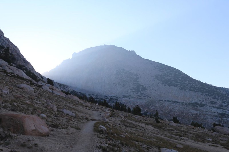
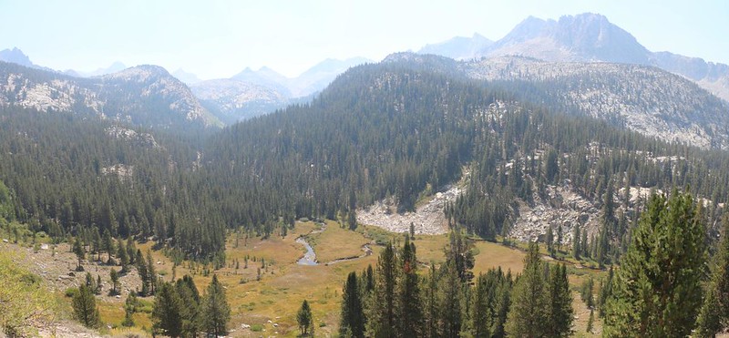
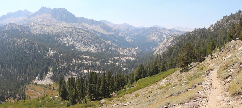
The uphill climb was everything I expected it to be: Hot and sweaty. But there were occasional patches of shade, and the afternoon breeze was blowing, so it ended up being enjoyable after all. The views over Cascade Valley were spectacular. It seemed that some of the morning’s smoke had blown away to the east, although some haze remained.

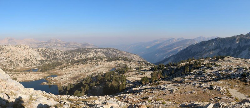
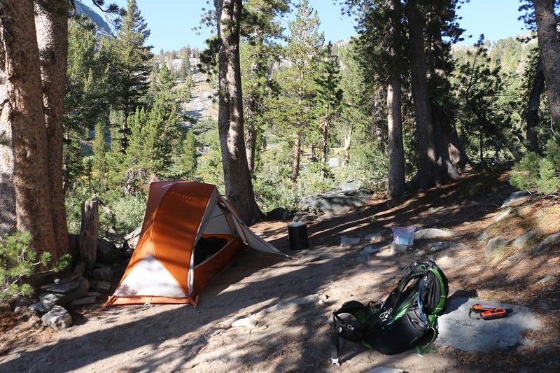
Eventually, the trail curved around and descended into the valley below Duck Lake. The Duck Lake Pass trail headed off to the right. That was the way I entered the wilderness, and my car was up there somewhere. But now I was on virgin territory (to me) and the next ten miles of PCT would be tomorrow’s problem. Just the same, today’s campsite was less than a quarter mile away. I headed down into the valley. According to the Guthook app, there were many places to camp around here. And I saw quite a few backpackers setting up their tents across the way, and getting water from the creek. It looked crowded on the north side of the valley, so I wandered around on the south side until I found a really nice, isolated spot with some shade and a bit of a view. Perfect!


I set down my pack to claim the spot, and decided to get my water first. Maybe I’d find a better spot along the way. But it didn’t happen. Just the same, I found a side-creek with extra-clean water bursting out of the hillside above the main creek, which was flowing slowly and contained semi-stagnant water out of Duck Lake. I liked the spring-like water better, so I collected my usual gallon. Then I went back to camp and set up the tent. Soon enough, everything was in perfect order, and I made myself some ramen noodles for dinner. Then I sat and relaxed in the late afternoon sunshine. Very peaceful.
After dinner, I sat in the tent and reviewed tomorrow’s trail. Hiking that extra 2.5 miles today might require yet another revision in the plan. I started reading the crowd-sourced comments in the Guthook app, and several of them mentioned the shuttle buses in the town of Mammoth Lakes. I also remembered all the tourists lining up for the bus at Reds Meadow Resort, as that was the standard method for exploring Devils Postpile National Monument. It costs $15 for a ride down the hill, then after that there were several free shuttle buses that took people all over the town. Mammoth Lakes was extremely friendly when it came to tourism! Although my original plan had been to camp at Reds Meadow, then take an additional day to hike back to the car, I realized that the goal of this hike was to “bag” a section of the PCT. This extra day wasn’t really needed for that. If I headed out really early the next morning, I only had an eleven mile hike, most of which was downhill, and then I could take a bus to the car! I could be back in San Diego tomorrow night, sleeping in my own bed. This became my new, finalized plan. I set my alarm for 3am and headed to sleep early. I could hardly wait to get back on the trail.
For a topographic map of the hike see my CalTopo Page
For LOTS more photos of the trek see my Flickr Page
 << Back to Day 2 Onward to Day 4 >>

