On the second day of my trek I hiked on the John Muir Trail down into the Cascade Valley from Tully Hole, climbed up and over Silver Pass, found a campsite along Silver Creek, then day-hiked south, down to the junction with the Mono Pass Trail, and headed back up the hill to camp. This seeming silliness was part of my carefully calculated plan to complete yet another section of the Pacific Crest Trail.
As a morning person, I tend to get up early. But hiking in the Sierra also tires me out, which causes me to go to sleep before sunset. This makes me wake up even earlier, thus reinforcing the cycle. Often, this works out well for me, such as when there are late afternoon thundershowers and I am already safe and dry inside my tent in camp. But there were no thundershowers predicted today. And yet, there I was, packing up my gear at O-Dark-Thirty.


I wasn’t too worried about it. I had a long climb ahead of me, up and over Silver Pass, and getting it done in the shade, during the cool of the morning, sounded like a great idea. It was about a mile downhill before the trail crossed Fish Creek, and I hiked it by headlamp. It was very dark under the trees! The sky didn’t get light enough to be useful until I was already hiking up and out of the Cascade Valley. On yesterday’s hike I had been worried that the JMT would go down to the bottom of this valley, and my fears proved to be true. The only good thing about it was that it waited until the valley wasn’t as deep. Just the same, I had a 1700 foot climb ahead of me. So up the trail I went.


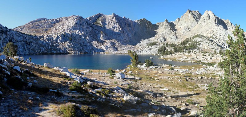
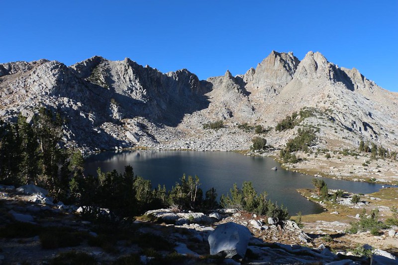
About halfway up to the pass, the trail wandered among what could be called the “Native American”-themed lakes. There is a Warrior Lake, a Chief Lake, a Papoose Lake, and a Lake of the Lone Indian. There was also a Squaw Lake, but this name only shows up on the older topographic maps. I never thought of “squaw” as a demeaning term, but apparently its use is no longer Politically Correct, and it is gradually being redacted from lists of official names all over the country. Weird but true. Maybe they can find a better word for a native female, and rename this lake? Right now it is nameless and forlorn. But the lake itself is quite lovely.


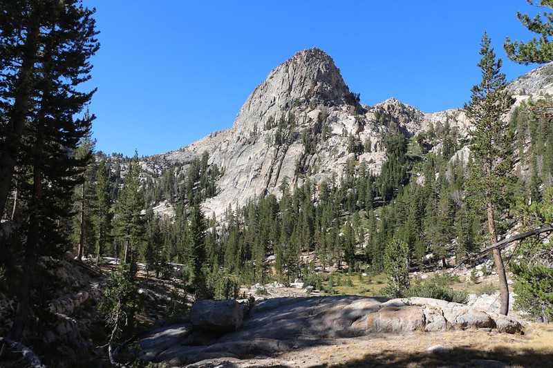
Chief Lake was also beautiful. I took a lot of photos of this lake. It is situated just below Silver Pass at roughly 10,500 feet elevation, and is surrounded by the granite peaks of the Silver Divide. It was a clear day, and the views north were spectacular.
Soon enough, I was taking a break on top of Silver Pass, at 10,745 feet elevation. This wasn’t one of the highest passes on the JMT, but it was considered to be one of the major ones. And if the long climb wasn’t enough to convince you of its importance, the stunning views made it obvious. I hung out up there and took a bunch of photos. I was also the only person around, thanks to waking up so early. Yet another reward for early risers. Early Birds don’t only get worms – they also get solitude and the stunning scenery that happens before the afternoon haze can develop.
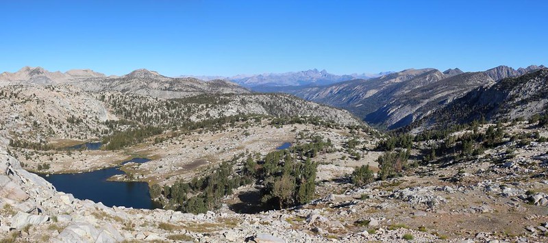

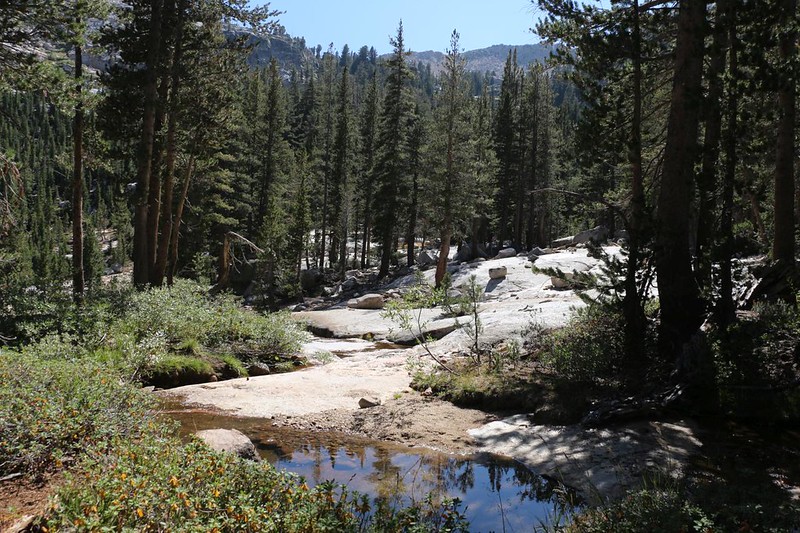
I made it to the pass by 9am, and the weather was starting to heat up. I took a break to cool off my feet, but decided that I wouldn’t stay there too long, as I had quite a bit more hiking to do. I put my backpack on and continued south, heading downhill next to Silver Pass Lake. It was nestled within a typical High Sierra basin, mostly grassy and rocky, with tough low pines and a swampy, tundra-like feel. Good views and easy hiking.
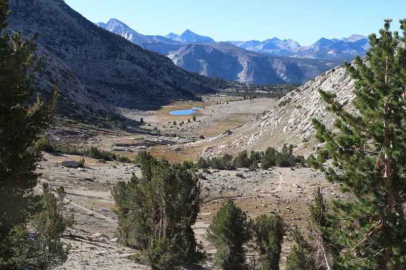

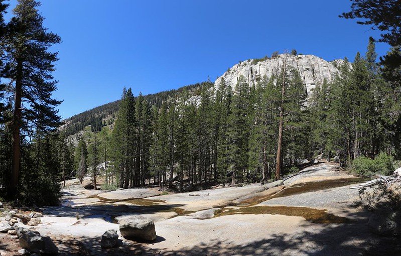
Beyond the high basin, the JMT dropped into a light forest. Silver Pass Creek was flowing sluggishly down below in the valley bottom. This late in the season during a dry year (August 2021), there wasn’t a lot of water in this tiny creek. But I wasn’t too worried, as there had been plenty in the lake, and my Guthook PCT App made it clear that there was good water down below in Mono Creek.
According to my GPS and the original plan I had made, I needed to find a camping spot somewhere along here. Preferably near water. My plan was to hike about seven miles with my backpack, set up camp, then dayhike another five-miles on a round trip visit to the junction with the Mono Pass Trail. Next year, in 2022, I planned to do a loop hike over Mono Pass, meeting up with the JMT in that same spot, then heading further south to the Piute Pass Trail, which I had hiked last month on my South Lake to North Lake Loop trek. That intervening piece of trail would be the final section that I had yet to hike on the JMT, as well as the final part of PCT Section H. We section hikers have odd goals, but completing a longer hike in smaller pieces is the general idea.

So I found a spot across the creek where my topo map showed an older version of the trail. I set up my tent under some tall pines, and hoped that there would be enough shade later on, when I returned. I collected a gallon of water from the creek, so I was set, water-wise. I emptied out most of the gear in my pack and stashed it inside the tent As long as I was going to do a day-hike it was going to be as light as possible.
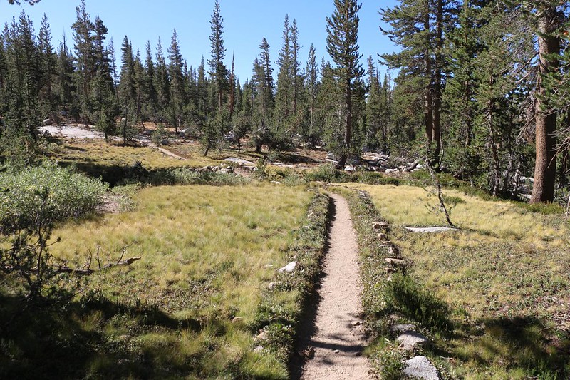
So off I hiked. The first part was easy hiking, with a mellow descent along some pleasant meadows. After that, I came to the edge of a deep canyon. The North Fork Mono Creek was down in the bottom of it. And there were a whole bunch of switchbacks on the way down.


After that, the trail headed down the valley, mostly in the sun, but sometimes in the forest. It was a nice valley, and I saw several camping spots along the way. Too late for that! In less than an hour I made it to the intersection with the Mono Pass Trail. After this, I would be heading north, and I would be calling it the Pacific Crest Trail, per my personal naming convention. But first I needed to take a good long break. It was lunchtime. I got out my book, some water, and my lunch (a cheese quesadilla) and relaxed on a big boulder in the shade, with the sound of Mono Creek not far away. Very peaceful. That was when I realized that I hadn’t seen a single hiker all day long! This was most unusual on a trail like the JMT-PCT. But I wasn’t complaining. Much. It can get lonely on a solo trek, you know.


Then it was time for the 1400 foot climb back to my tent. This would bring my grand total to 3200 feet of elevation gain. That’s a solid day of hiking. But first I had to get there. I headed back up the creek in the afternoon sun, and it was hot. I rested in the shade when I could get it, and was thankful that my pack was so light. Then I slowly plodded my way up the steep switchbacks. I took one last view down into the North Fork Mono Creek valley, and continued on. I finally met another hiker, headed south, and he was similarly amazed at how empty the trail was that day. I gave him some info on the water situation down in the valley and told him about the fine camping spots under the tall pines. That made him happy, and after that we parted ways.


When I got to the marker stones I’d left on the trail, I headed across Silver Pass Creek to my camping spot. The tent was, unfortunately, sitting directly in the sun. It was probably about a million degrees inside. Taking a nap was not much of an option. So I got out my book and took a long break on a shady boulder. Ah, yes. This was the proper High Sierra Lifestyle. I could do this sort of thing anytime.

I’ve discovered that the main problem with waking up early when solo backpacking is that I often get done with my day’s hike far too soon. I’m faster than I think I am, and I also get bored in camp. When it’s early and I’m by myself, I find it hard to just sit around doing nothing. When Vicki and I hike together, we both take a nap or a short walk, or read our books together. But not solo. I’m not sure why this happens, but it does. So, once again, I hung around in camp and did my best not to start packing my gear and continuing north, to get a jump on tomorrow’s hike. I cultivated my boredom as best I could. But it only worked so well. I still ended up eating dinner and heading into the tent for the night long before sunset. Oh well. It looked like it was going to be another early day tomorrow!
For a topographic map of the hike see my CalTopo Page
For LOTS more photos of the trek see my Flickr Page
 << Back to Day 1 Onward to Day 3 >>

