This was the first day of a four day solo backpacking trek, where I started on the Duck Lake Pass Trail (in Mammoth Lakes) and climbed up and over the pass to Duck Lake, then continued south on the Pacific Crest Trail, past Purple Lake and Virginia Lake, eventually arriving at the meadow known as Tully Hole, and camped for the night.
Now, originally, Vicki and I were going to do this hike immediately after our previous hike in the Devil’s Postpile area, but then a bunch of wildfire smoke drifted in from NorCal and Vicki’s lungs decided against it. So we drove back home to San Diego. But it still didn’t set well with me. I really wanted to “bag” this section of the Pacific Crest Trail. And when I saw the smoke drift away again on the weather satellites, I decided to come up here by myself and do it anyway. Vicki didn’t particularly care about hiking it, so away I went. I reserved a permit for the Duck Lake Pass Trail online, and picked it up in Lone Pine at the Ranger Station on my way north. I was good to go! I bought some fast food in Mammoth Lakes, and drove up to the trailhead parking lot near Mary Lakes. I did a bit of day-hiking in the immediate area, then crawled into the back of the Rav before sunset and crashed for the night.

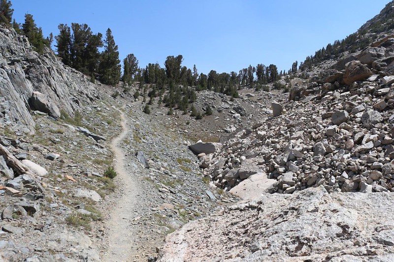
I woke up around dawn and got my gear together. I stashed the car-gear under the back cover, out of sight, and called it good. This seemed like a safe enough place to leave your car for a week. Then I headed for the trail, and began the long climb up to Duck Lake Pass. And it turned out to be a very pretty hike. There were several lakes along the way, each one lovelier than the last.
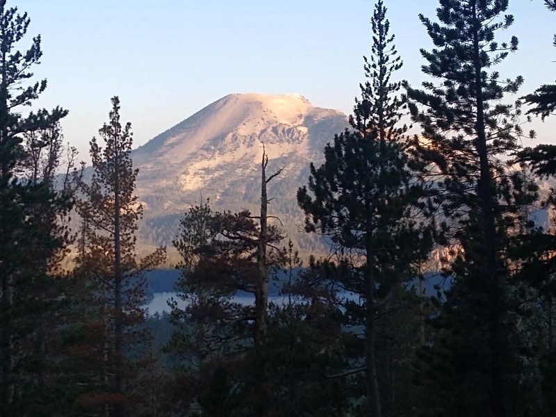


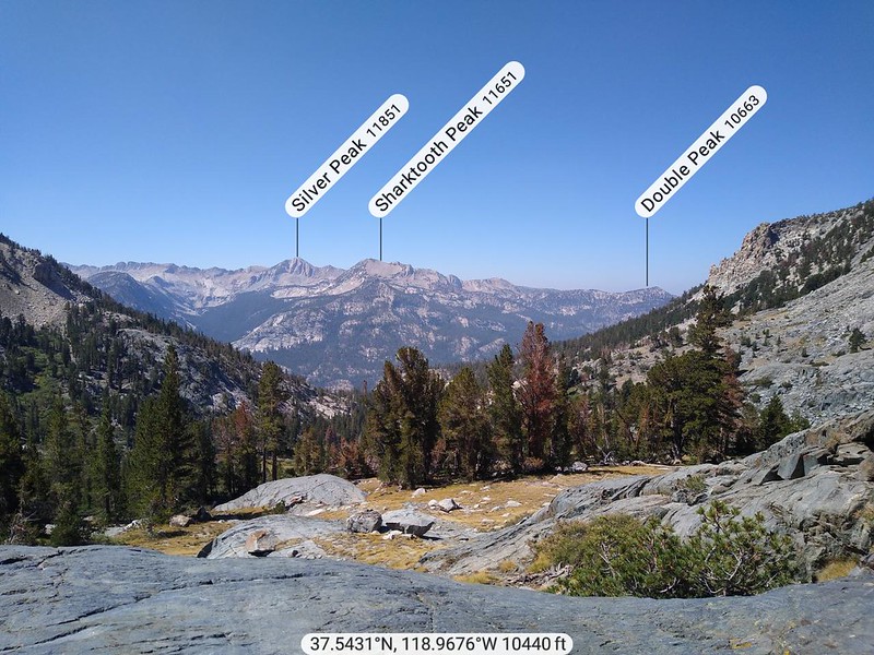
The trail climbed 1700 feet in four miles, so it wasn’t overly steep. Except maybe near the pass, when it started switchbacking in earnest in order to surmount the valley’s headwall. The views north got better and better the higher I climbed. Plus, Mammoth Mountain was in view, and it had cell towers on top. I was able to send photos back home to friends and family, and make them totally jealous. Isn’t that the point of Modern Communications?
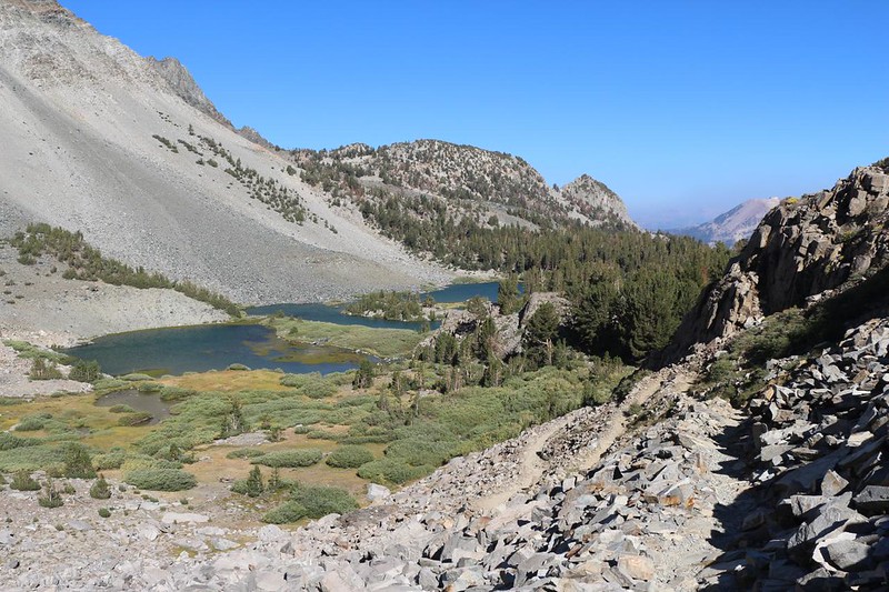

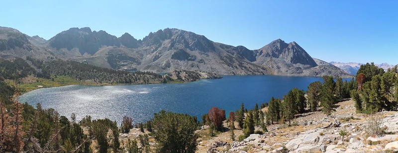
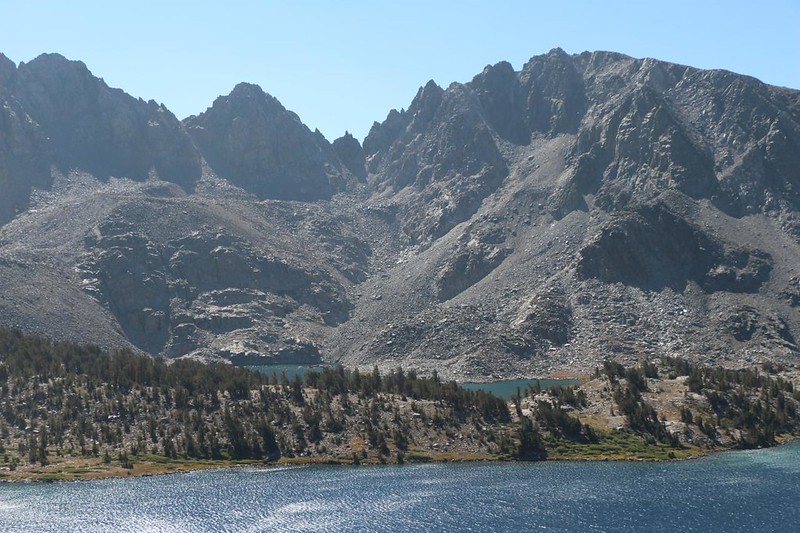
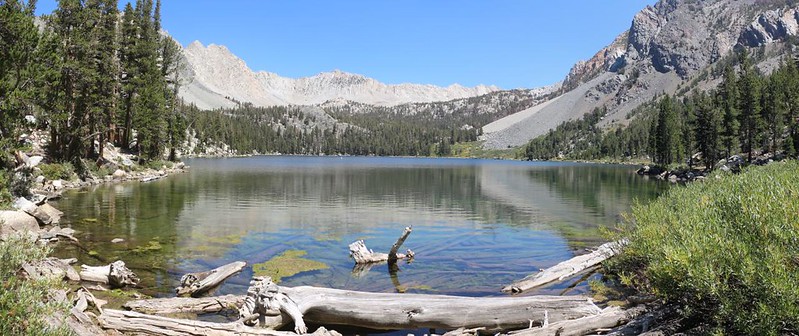
After enjoying the view from up on the pass, I decided to take a quick break. I took off my boots and cooled off my feet. Then I simply gazed out at the beauty before me. Duck Lake was huge! Much larger than I had expected. I got out my map and discovered that Pika Lake was across the way, a bit higher than Duck Lake. It looked like a nice spot to camp, and I wondered if there were any Pikas living up there. Those little “Rock Rabbits” are seriously cute. And then it was time to get hiking. I had a lot of miles to cover. The trail stayed high above the lake until dropping down near the outflow creek, which it crossed.
The trail continued downhill along the creek until it joined with the John Muir Trail / Pacific Crest Trail. Since I was planning to head south on the trail initially, then turn around and come back in two days, I developed my own naming convention. I decided to call the southbound trail the John Muir Trail (since it is classically hiked from Yosemite south to Mount Whitney) and I would call it the Pacific Crest Trail when heading northbound, since most thru-hikers travelled that way. But this is strictly my own idea, and only for use within this particular Trip Report. Both names are equally valid in reality, as is hiking the trails either NOBO or SOBO.

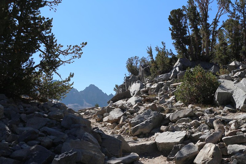
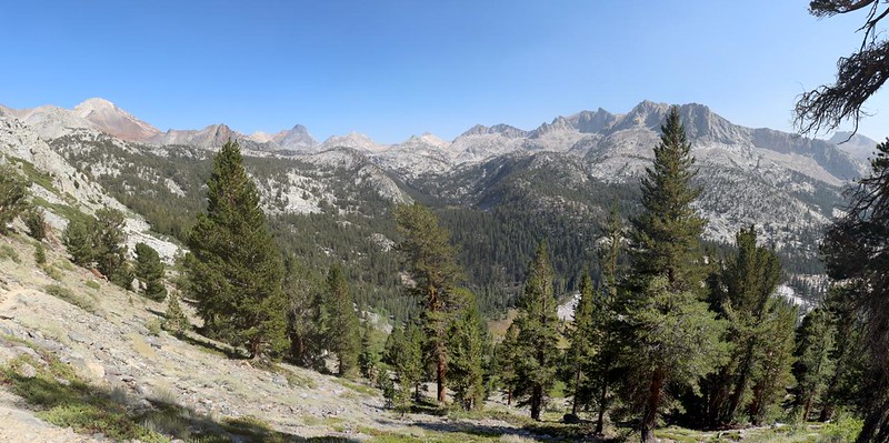
Therefore, I began hiking south on the JMT. It climbed upward initially as it made a long traverse around Peak 11365 (called Peak 3463 in meters on the USFS topo map). Down below me was the deep Cascade Valley, and I desperately hoped that the trail didn’t head all the way down into it before going up again. It was deep! Instead, it continued heading around the mountain, gently descending toward Purple Lake.

At Purple Lake I happily bid adieu to a large party of loudly-yakking hikers. They had been leap-frogging me since before Duck Lake Pass, and I was heartily sick of listening to their loud, obnoxious voices. Apparently, they were getting their supplies and gear delivered via mules and horses, by one of the local packing outfits. They were only carrying daypacks, which was why they were able to keep pace with me and my big backpack. Let’s face it: They weren’t in the best of physical condition, but I still gave them credit for getting out here. I just wish that our mutual timing had been different. Needless to say, I didn’t hang around very long at Purple Lake.

After leaving the yakkers behind, I had another 600 feet to climb, to get over the unnamed pass to Virginia Lake. It didn’t take me very long, but it was getting warm, hiking uphill in the sun on a Summer midafternoon.

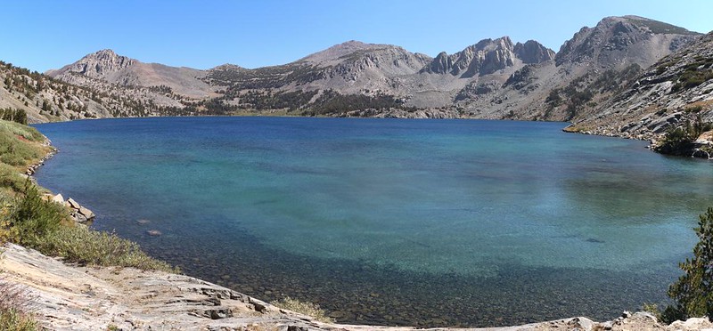
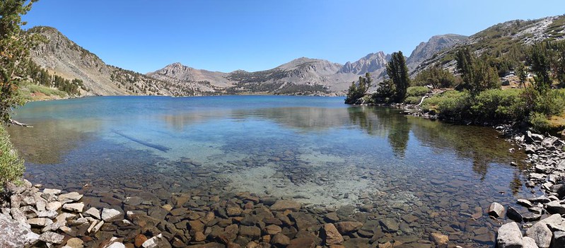
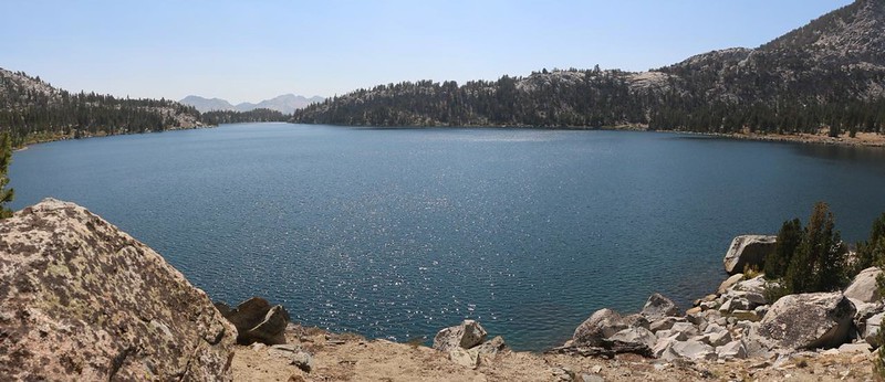
Lake Virginia was a large and shallow-looking lake. I met some people eating lunch in the shade of a pine tree, and realized that I hadn’t eaten my own meal yet. I hiked onward, and found a nice spot for a break on the northeastern shore. It felt good to simply relax and enjoy the view, as the breeze cooled me down. I was tempted to camp along this lake, but it didn’t fit in with my original plan, which was to hike a couple miles further. This would make tomorrow’s hike much easier. Besides, it was too early to set up camp. What would I do? Lie down inside a roasting hot tent in the sun? Boring! Unpleasant, too.

I hiked onward. The next pass was an easy climb, and then the final drop into Tully Hole came into view. This “hole” was actually a lush meadow hidden within a stony-walled canyon. Fish Creek flowed down through the meadow, and it was quite lovely. There were steep switchbacks leading downward into the hole, and this was fine by me. But it wasn’t fine for the PCT hikers I met climbing UP the hillside. The trail was in full sun, with limited tree cover, and they were roasting, huffing and puffing and sweating. I realized that I would be hiking back up this trail myself, two days from now, and I had a mild feeling of dread. It would probably be afternoon for me, as well. But some things in this world are unchangeable, and others get changed for you. I would worry about the climb when it happened.


Meanwhile, there I was at Tully Hole! It was time to find a camping spot. And the pickings were slim. The Guthook PCT App on my phone didn’t sound very promising. You can’t camp on a meadow, of course, and everywhere else was steep canyon walls. So I headed off downstream along Fish Creek, looking for a spot. And I found one! Thank goodness! Obviously, other folks in previous years had felt the same need.


I dropped my pack and got out my gear. The first thing was to set up the tent. Then filter some water. After that, it was time to make some dinner and begin the true relaxation that I so richly deserved. A shady campsite, a nearby stream, this place had it all. Except for a great view. But my feet really didn’t want to hike any further, so I called it good.

I finished eating dinner and set up the rest of my gear inside the tent. Then I got inside myself, and dressed for the night. The sun goes down early when you’re deep in a canyon, and the air gets cold. I got out my phone and sent a text back home via satellite on my InReach, letting them know that all was well. Then I checked the map on my GPS. All told, I had walked almost thirteen miles and climbed nearly three thousand feet. That’s a solid day’s hiking in my book. Plus, those lakes had been really nice. And tomorrow was more of the same. It had been another excellent day in the High Sierra.
For a topographic map of the hike see my CalTopo Page
For LOTS more photos of the trek see my Flickr Page
Onward to Day 2 >> 

