We hiked 7 miles from Upper Hamilton Lake to Nine Mile Creek on the High Sierra Trail, passing by Hamilton Falls, Bearpaw Meadow, and Buck Creek, all the while looking out over the glacier-carved granite in the valley of the Middle Fork Kaweah River.
After getting caught in the rain the previous day, Vicki and I decided to get up at first light. Not super-early, but not late either. We wanted to make it to camp before the rain and hail this time. We also ate a normal breakfast with coffee, and hung out along the lake shore and enjoyed the peace of the morning. Our neighbors were all still waking up when we were fully packed, but that was OK. They were all heading over the Kaweah Gap to the east, not hiking the HST backwards like us.

GoPro panorama video of calm-water reflections on Upper Hamilton Lake at dawn

I wanted to tell Vicki that the day was mostly downhill (because it was, technically) but I didn’t lie. There was no shortage of ups and downs on this section. The net downhill was from 8300 feet to 7500 feet, but afterward I discovered, based on my GPS track, that CalTopo calculated that we had climbed 2300 feet and descended 3000! So it wasn’t as easy as it looked. Vicki groaned about this, but what could we do? This was our tenth day of eleven, and there was only so much food left in our bear cannisters. We had to hike this far, if we ever wanted to see the car. So we donned our now-much-lighter backpacks and headed down the trail.
Next stop: Lower Hamilton Lake and Upper Hamilton Falls!


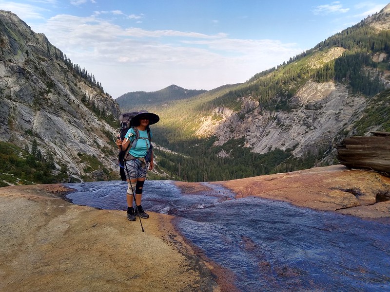
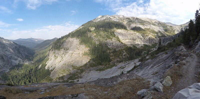
The trail stayed high above Lower Hamilton Lake, and offered great views of the cascading waterfalls leading into the lake. Needless to say, the views of Angel Wings and Cherubim Dome were also very impressive. We’d seen those mighty peaks of glaciated granite from above as we hiked down the trail yesterday, but from below they had gained a new mastery. We could understand why rock climbers hiked in for miles, with heavy ropes and gear, just for the opportunity to climb on them.
The trail continued downhill into the Middle Fork Kaweah River Valley, and there were yet more opportunities for excellent views all around us. The sky was blue, with plenty of clouds, and the photo-taking opportunities were too good to pass up. You don’t want to know how many pictures I took as we hiked along. Narrowing down the ones to show here wasn’t easy.


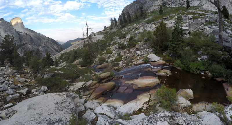
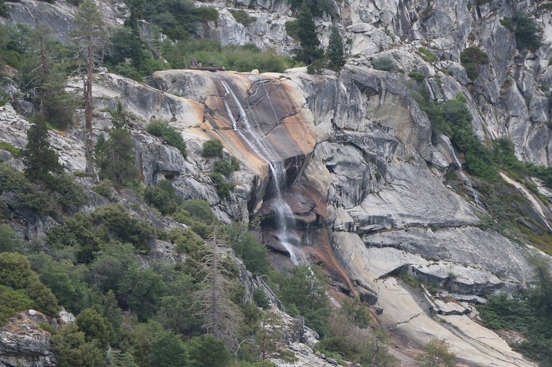
It turned out that the waterfalls above Lower Hamilton Lake were not the only ones on this creek. The trail even crossed the creek directly above a steep drop-off where we knew there was a waterfall, named Lower Hamilton Falls on our map. Waterfalls aren’t very exciting from above, but we would see this one later on. Meanwhile, the views were excellent.
GoPro video of a waterfall on Hamilton Lakes Creek
GoPro panorama video from the top of the waterfall on Hamilton Lakes Creek

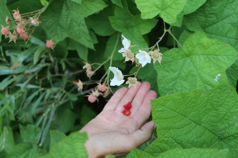
After crossing the river, Vicki found some late-season Thimbleberries, and the two of us munched on them for a while. There hadn’t been a lot of berries on this trip, in mid-August of a dry year, and these were quite welcome.
The trail on the north side of the valley took on a very distinct character. Namely: It was blasted directly into the steep granite walls of the canyon. We could see it stretching out ahead of us, maintaining altitude high above the floor of the valley. This trail truly was a prodigious feat of engineering. And dynamite! There were thick steel rods placed in drilled holes in the walls, and other hewn granite blocks were positioned on top of them, thus providing a level surface for hikers and stock animals.


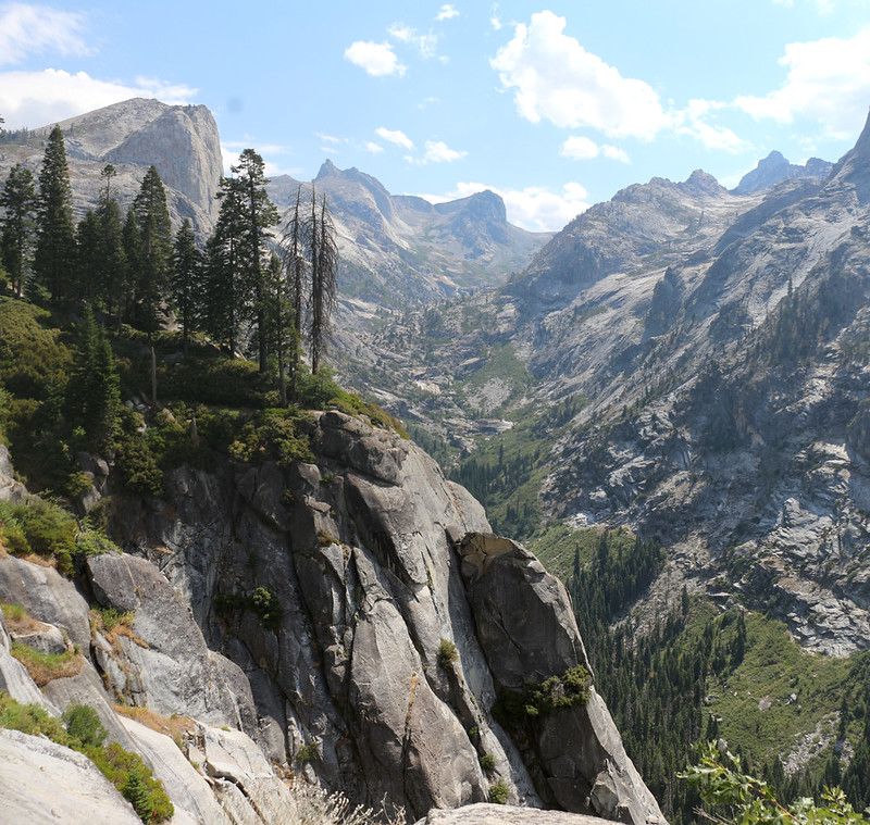
The views were continuous, and we were having a wonderful hike. Sometimes we remembered to look back up the valley, where we could still see Mount Stewart, which dominated the valley. On some parts of the trail we noticed that the outer row of rocks had been swept away by avalanches from above, and many of the inch-thick steel rods were bent over like grass in the wind.


Soon we came to the deep indentation where the creek and trail from Elizabeth Pass come down to meet the High Sierra Trail. We were able to see Elizabeth Pass in the distance, and I told Vicki about the time, back in 1997, when my son and I (and some older boys from his scout troop) came over that pass from Road’s End. Once we hiked down to that trail I would be revisiting this section of the HST. After a span of more than twenty years, I still remembered how beautiful this area was. I particularly remembered the granite domes across the way.

GoPro panorama video from trail with Elizabeth Pass and the Middle Fork Kaweah River Valley
The trail curved northward into the cleft and switchbacked down to the trail junction. Below, we could see where it crossed Lone Pine Meadow Creek on a steel bridge which spanned a deep granite cleft. When we arrived at the bridge, we decided that it was time for a good long rest. It wasn’t quite 9am, but the temperature was climbing and Vicki really needed a nap to recharge her batteries. But first we had to check out the footbridge. It was impressive, and when we looked over the rail, downstream, we saw the steel superstructure of an even older bridge wedged down in the gorge below us! The avalanche that took out the bridge must have been powerful! And then we remembered all of the bent steel rods on the switchbacks up above us. Yikes!


GoPro video of crossing the footbridge over the creek and chasm

After an extended break, we decided to keep on hiking. We still had miles to go, and it was already getting hot. Vicki soaked her hair with water, and got out the spray mister that keeps her from overheating. Naturally, the trail had to climb to get out of the side canyon, and we got even hotter. But we made it. And after that we were back to hiking on the dynamite-blasted trail that traversed along the granite walls of the valley. What a trail!

GoPro panorama video over the Middle Fork Kaweah River Valley

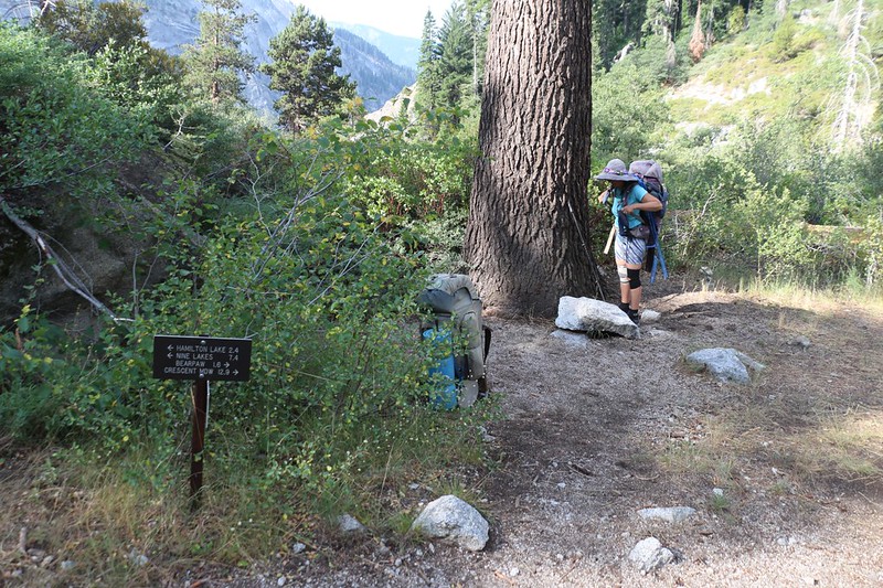
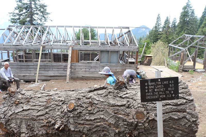
Next stop: Bearpaw Meadow. We had originally thought about camping here that night, but realized that it would make our final day even longer than ever. Also, it was only noon. There was still time to get further before the thunderstorms were likely to arrive. Just the same, we decided that the High Sierra Camp was the perfect spot for lunch. In this weird Covid-19 virus-year of 2020, the High Sierra Camps never opened at all. There was no way for them to do it safely with “Social Distancing” and so we regular hikers had the entire place to ourselves. No horses whatsoever. Even the local Park Ranger wasn’t in residence at his cabin. So we hung out and ate lunch. We checked out the buildings and amenities, and decided that when we got really old and could no longer hike that we might try this “horse” style glamping.

Thus far, we’d only hiked a bit over four miles, and our chosen campsite was about three miles further. That’s a lot of hiking in the hot sun. So I got out the map and Vicki and I checked it for options. If we really had to, we could stop early at Buck Creek, but that would make tomorrow’s hike a whopping eleven miles to get back to the car. Ugh. Vicki didn’t like it, but we really needed to make Nine Mile Creek today. So off we hiked, up and over a small ridge, then down the trail toward Buck Creek. One step at a time. And more squirts of water to keep Vicki cool.


We stopped at Buck Creek for another rest. We took off our packs and headed down to the water. The sun was roasting us, so we took shelter in the deep shade under the footbridge. We took off our shoes and cooled our hot feet, and both of us wet our heads with the cold, clear water. Ahhh!


We only had to climb a bit over 300 feet to get out of the Buck Creek valley, but to Vicki it was a miserable climb. She kept spraying her head and clothing, but there simply wasn’t enough shade along the trail at this hour of the day. The sun was hot. We kept hoping for shade, and then we finally got some: It was in the form of a dark, towering thunderhead! We looked at each other. Oh, no! Not this again! We hiked onward with renewed enthusiasm. There was still plenty of blue sky to the west, where we were heading, so the further and faster we hiked the better off we would be.

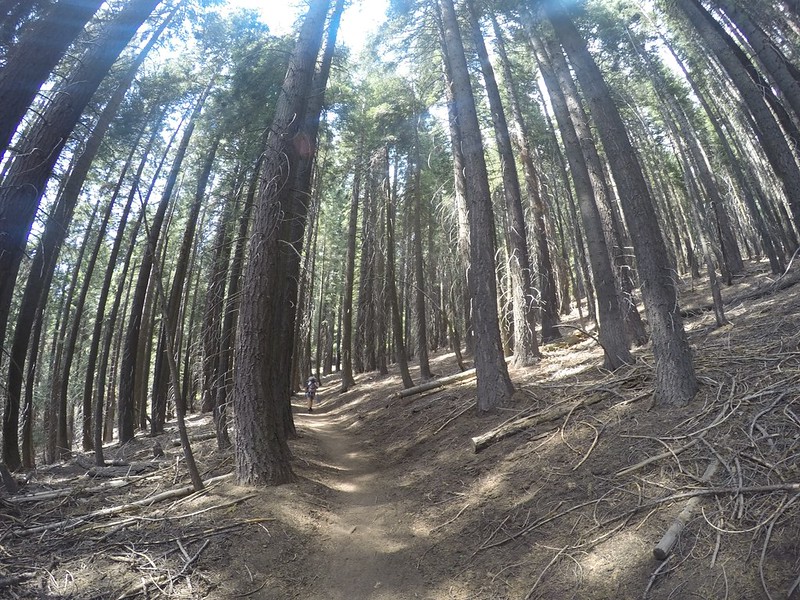
Luckily, the trail soon left the exposed wall of the big valley for a while, and entered into a region of forest. It was quite mellow in there, and we walked along in silence, respectful of the tall and stately trees. The views were fewer in this section, but we still liked it. Once in a while we would get a glimpse beyond the forest, and that was when we spotted Sugarbowl Dome, a glaciated granite dome on the end of the ridge that led back to Bearpaw Meadow.

Soon we came across another cool and inviting creek that crossed the trail. Vicki decided to stop and cool her feet, and I sat down with my pack off and read my book. It was pleasant there. After a few minutes we got up and put on our packs. It was time to head for the final stretch, to Nine Mile Creek! As we hiked out, I noticed a nice spot to camp not far from the creek, and Vicki spotted a bear box in the trees. Maybe we could camp right here, we thought. I got out the GPS to check our position. And then I started laughing. We were currently at Nine Mile Creek! This was where we wanted to go in the first place! Boy, did I feel like a fool. If we had hiked onward, we might not have found a spot to camp for another three miles. Vicki would have wanted to kill me by then! Thankfully, no harm was done. We put our packs back down, wandered around the area, and chose a campsite near the trail and bear box. We managed to make it to camp without getting rained on! Woo hoo!


We set up the tent and took a well-deserved nap in the shade. After that, we filtered some water, and hung out for awhile. At one point a few tiny rain drops made it down through the trees, but all of the thunder stayed far away to the east. We wondered how the folks we met yesterday were doing, and hoped they made it into camp on time, as well. A young couple came by and stopped for an early dinner. They were both into yoga and were very nice. We all got to see a doe with her two fawns come by for a visit. They were absolutely unafraid of us, and were undoubtedly hoping for a handout of food. But they got nothing and left soon enough. We said goodbye to the couple, who were camping at the next campground 3 miles away (where we almost ended up by accident). We told them that we’d see them tomorrow morning if they slept late.

After that, we ate our own dinner and went to bed early. After today’s heat, we knew that it was going to be even hotter tomorrow when we lost another 900 feet of elevation, and we weren’t looking forward to it. We also realized that this was our final night on the trail. Ten nights and eleven days was the longest trek we’d ever done. One more day of hiking and we’d be back in civilization. We started imagining what food we would eat, and how nice it would be to stay in a hotel room. With a shower! And that’s when we set the alarm for 3am! We decided that we were going to start out in the cool of the morning and get as many miles in as possible. And the sooner we took that shower the better!
For a topographic map of the hike see my CalTopo Page
For LOTS more photos of the trek see my Flickr Page
 << Back to Day 9 Onward to Day 11 >>
Up to the main page: “High Sierra Trail 2020”

