Day 8: Hiked the PCT south from Dicks Lake over Dicks Pass and camped at Susie Lake
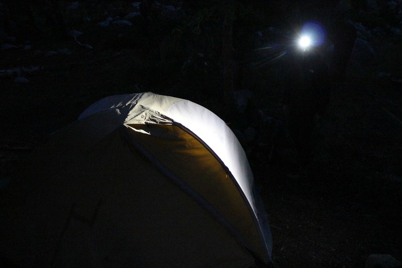
We woke up to the alarm in the dark at 5am and began getting ready using our headlamps. It was cold and breezy outside so we didn’t leave the tent right away. We got dressed and packed up as much as we could while keeping our legs inside the warm sleeping bag. It didn’t last, of course, because I had to pack that up, too, but we’d take the warmth we could get. Then I stuffed the bag and deflated the air mattresses. We tossed everything outside, then jumped out to greet the day. We had our gloves, hats, and hoods on. We finished packing the tent and stuffed everything into our big packs. Vicki handed me a cold fruit bar for breakfast, and we began hiking at 6am, just as dawn was breaking. Perfect timing.
Pre-dawn video panorama looking out over Dicks Lake from our camp on the northern shore
We headed off cross-country, directly uphill, to intercept the PCT at a better spot. It was the same shortcut we’d scouted out the day before. We’d like to believe that it saved us some time, unlike most so-called shortcuts.
After that, the PCT continued generally south, climbing higher and higher on its route to Dicks Pass. One thousand feet of ascent over two miles. There were numerous switchbacks along the way. It was strenuous, but we were glad that we’d left super-early. The trail was in the shade of the ridge the entire time, and the breeze kept us cool. We removed a few of our clothing layers as we climbed, but not all of them.

The climb began on bare granite but eventually entered a shady pine forest., This resulted in fewer views, but also cut down on the breeze. This seemed like a fine trade-off to us. We knew that the best views would happen once we reached the pass itself, so we were content to trudge along. Hiking in the forest is beautiful, too.

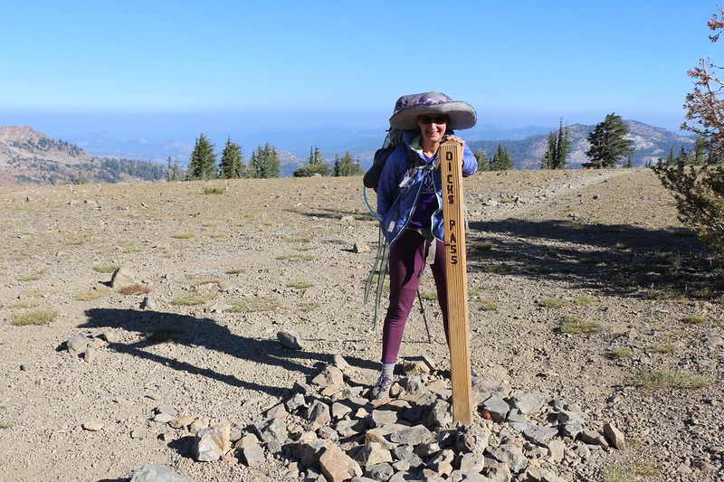
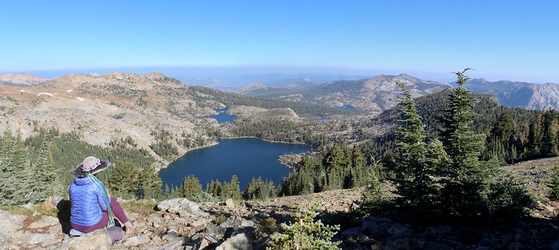
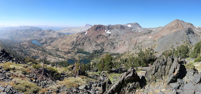
Eventually, of course, we arrived at Dicks Pass, elevation 9400 feet. This was the highest point of our ten-day trek. And we intended to enjoy this spot to its fullest. We had worked hard to get here, and the stunning views were our reward. It was still breezy and cool up here. We headed over to a protected spot in front of some low pines and sat down for a long break. There were excellent views north from there. Dicks Lake was directly below us, while off in the distance were other places we’d recently hiked: Fontanillis Lake, Middle Velma Lake, Phipps Peak, Phipps Pass, and Jakes Peak. Even part of Lake Tahoe was visible in the distance to the east.
Vicki took a short nap while I read my book in the sun. This was the life.
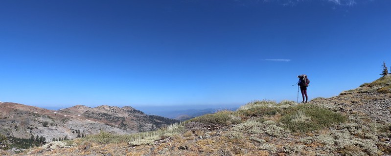
Then we put on our packs and headed further along on the trail. It was time to check out what was ahead of us, on the south side of the pass. New territory, with new sights and experiences.
Panorama video looking south from Dicks Pass
The odd thing about Dicks Pass was that the high point on the trail was not at the pass itself (normally the lowest spot on a ridge). We had to descend about 200 feet along the ridgeline to get there. Vicki was a bit annoyed, because she hates unnecessary climbing, but the views along the way more than made up for it. And it turned out that it wasn’t unnecessary after all: There were steep cliffs full of loose scree on the north side of the pass. The existing trail was definitely both easier and safer, and would melt out much sooner in the Spring.
Did we take another break at the pass itself? Of course we did. It was too good to “pass” up. (Groan.) While we were sitting there, a young woman arrived from the west, where there was only a faint, unmarked trail. We spoke to her for a while. She had already bagged Dicks Peak, elevation 9974 feet, and was heading back to her car at the Bayview Trailhead, just above Emerald Bay on Lake Tahoe. Needless to say, we were impressed. She was wearing shorts and had a very small pack. We couldn’t believe that she wasn’t frozen solid, since she had also started at dawn. But it was obvious that she was a trail runner, and was far more fit than we were. I guess all that climbing and running kept her warm. After she left, Vicki asked me if I wanted to bag the peak myself. She said that she’d wait. I looked at the map, and decided that climbing an additional 800 feet would take too long. Oh well. It would have been excellent, I’m sure.


GoPro 360 degree panorama video from Dicks Pass on the Pacific Crest Trail
We picked up our packs and continued on. Vicki was happy, as the trail was all downhill from here. 1700 feet of descent. And it wasn’t too steep, which was good for her sore foot and knees. Easy hiking. It was sunny, and there was a lot less wind on this side of the pass. Vicki soon lost her extra layers, and was hiking along in shorts and a T-shirt. Just another beautiful Summer Day in the Wilderness.
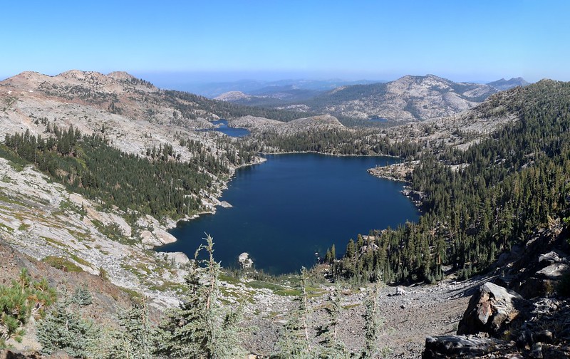
The trail headed southeast, descending below a ridge, and there was plenty to see to the west and south. Dicks Peak and Jacks Peak were across the valley, while Half Moon Lake was nestled down below. Susie Lake was off to the south, and far in the distance to the southwest we saw the blue waters of Lake Aloha below the Crystal Range, where we’d spent our first night. We planned to be back there tomorrow. We took a lunch break along the way, in the shade of a huge old juniper tree. After Vicki took a short nap, we got out the map, so that we could see exactly what we were in for. The map said it was only about 500 feet of climbing, which would make tomorrow an easy day.


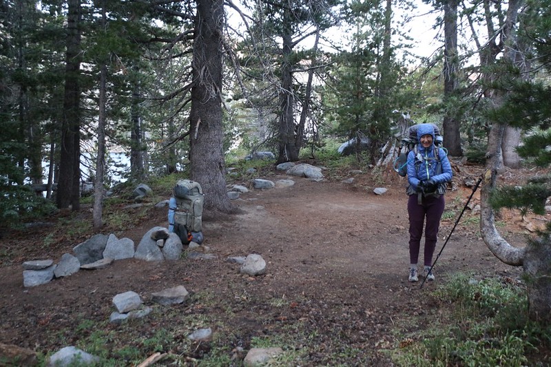
All told, it was about two and a half miles from the actual pass down to Gilmore Lake, our original intended camping spot. But part of our last change of plans was to hike further, to Susie Lake if possible. This was mostly thanks to the advice I received from a young couple on our first day at Lake Aloha, who couldn’t say enough good things about Susie Lake. Therefore, when we reached the side-trail to Gilmore Lake, we put our packs down near the intersection and simply took a short walk to check out the lake, to see if we wanted to camp there.
Now don’t get me wrong: Gilmore Lake was large and beautiful enough for anyone’s enjoyment, but it was also too close to civilization. It was only five miles from the Glen Alpine Trailhead at Fallen Leaf Lake, and there were a large number of groups already camped there.
So, after a short break spent looking at the waters of the lake, I asked Vicki how she felt about continuing onward to Susie Lake. It was only 2pm, the lake was about a mile and a half away, and it was mostly downhill to get there. Did she want to stick with the devil we knew, or head off into the unknown to find a better one? I was OK with it either way, although I admit that I wanted to head further. We got out the map and contemplated things for awhile. And, once again, our plans changed. We would camp at Susie Lake today, and tomorrow we would continue on beyond Lake Aloha, camping at either Lake Margery or Lake Lucille. That would put us closer to Echo Lake for our final day of the trek. It would make the total trek a day shorter than we’d planned, but Vicki’s sore foot necessitated it.
GoPro panorama video of Gilmore Lake

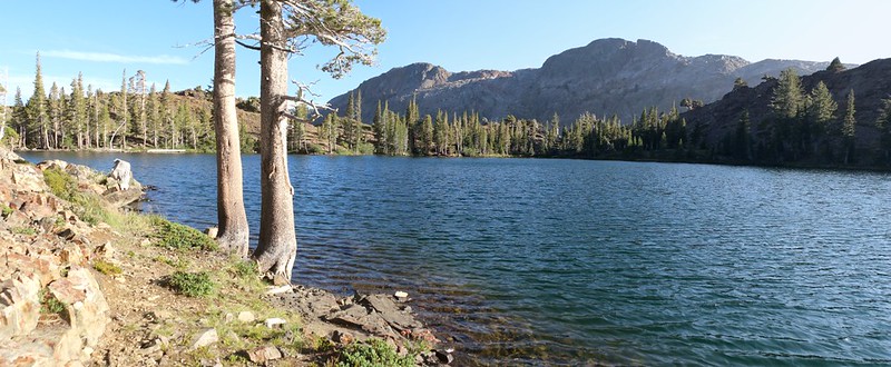
We walked back to our packs and continued on. The trail was easy, although there were a few rocky places that Vicki’s foot didn’t appreciate, mostly rocky, chunky scree that made secure footing difficult. But she soldiered on. We arrived at the eastern shore of Susie Lake at about 4pm, so there was plenty of daylight left. Vicki sat down in the shade and I ran off to find a good campsite. The rocky ground (this entire area was composed of sharp, red rocks, unlike the smooth grey granite we’d seen everywhere else so far) made finding a campsite more difficult. Smooth flat spots were in short supply, and the ones that we found were already taken. So I continued searching, and eventually found a decent enough spot near the shore of the lake. I put down my big pack to claim the spot, then went back to carry Vicki’s pack. She walked slowly, favoring her foot, but she made it to camp just fine.
Panorama video from the eastern shore of Susie Lake

We set up camp not far from the lake. Vicki and I vanished into the tent and took a pleasant afternoon nap. We do a lot of that, it seems. She was much happier afterward. I filtered two gallons of water from the lake while Vicki cooked up some dinner. We walked to the shore and sat in the sun on a small granite knoll with the sparkling waters before us. Peaceful and gorgeous. We both decided that the young couple was right: Susie Lake was a great place to camp!

When we came back to the tent, we discovered that our plastic trash bag had been damaged. A closer inspection revealed tiny tooth and tear marks. We hadn’t been gone for more than twenty minutes! We looked around, hoping to spy out the thief. And there it was: A sleek, fat chipmunk watching us from the top of a nearby boulder. I still swear that the creature was smirking at us, thinking that it was perfectly safe. It was so small and fast that a lumbering giant such as myself could never catch it in a million years. And it was right. But this only served to make me angry. I also didn’t want to put a leaky trash bag into the bear can with the rest of our good food, especially not a bag covered in vermin spit. I slowly reached down and picked up a loose rock, cocked my arm sideways, then fired it at the critter. Score! The small rock, imbued with the power of righteous indignation, sped straight and true. It bopped him directly in his smirking face, and he tumbled off the top of the boulder. “Ha!” I yelled. Take that!” I told Vicki about it, and she was also pleased, although, to tell the truth, I could hardly believe that it hit the poor little thing. I certainly hadn’t expected it. My main goal had been to scare it off. Sorry, Mr Chipmunk, but sometimes life hands you exactly what you deserve. I was a bit worried that I might have truly hurt it, but a short time later we saw it once again, perfectly healthy, and this time it was staying at a much safer distance from our camp.
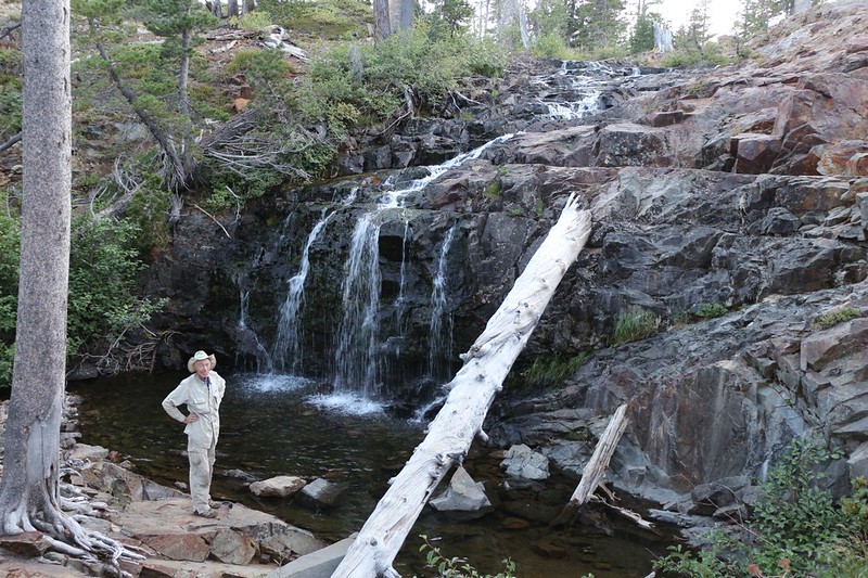
After dinner, we took our usual evening constitutional, this time with the goal of finding a waterfall somewhere below the lake, as the topographic map indicated. So we headed to the outflow stream, and spoke to some folks that were camping nearby. They pointed us to a small waterfall only a short distance away. It wasn’t the one marked on the map, but since the big one would have required a lot of laborious downclimbing, we decided that the small one would have to do. And it did. It was a waterfall in every sense of the word, with plenty of noise and rushing water, but its reduced flow made it obvious that the best time to see it would be in early Summer.

Noisy video of the waterfall
Then we headed back to camp as the evening arrived and the air cooled. The sun set over Jacks Peak and we were left in shadow fairly early. We checked the campsite to be sure that our friendly neighborhood chipmunk wouldn’t be able to damage any more of our gear, and then hit the sack before sunset. We talked about the day, and decided that climbing over Dicks Pass had been one of the major highlights of our entire trek. Totally worth it.
For a topographic map of the hike see my CalTopo Page
For LOTS more photos of the trek see my Flickr Page
 << Back to Day 7 Onward to Day 9 >>