We backpacked in from the Palm Springs Tram, spent two nights camping at Laws Camp, and day-hiked down to Caramba Camp in the San Jacinto Wilderness. This was the first year that this section of Tahquitz Valley was open to hiking since the Mountain Fire of 2013, and we wanted to see just how bad the forest suffered, and how much it had recovered.
The National Forest Service’s website had plenty of warnings about the trails in the area, because none of them had been worked on in at least five years. They were considered “unmaintained” at this point. But we weren’t worried, because we’d been there before, back in June 2012, and we were quite experienced at cross-country hiking. We had maps and a GPS, and we knew how to use them, so no worries on that score. What we were mostly worried about was how sad we might get at the fire’s devastation of what had once been a rare and beautiful area.
Day 1:
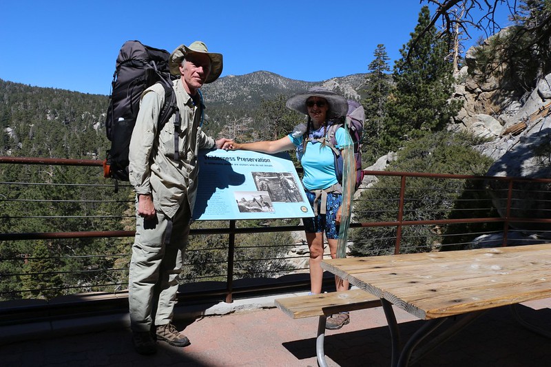
We arrived at the top of the Palm Springs Tramway about 10am, and got ready to hike. The air was cool compared to the desert heat down below, and the smell of pine trees was in the air. On our last hike to Laws Camp, we started down in Idyllwild, which required a grueling, two thousand foot climb, and we learned from that mistake. The Tram was the only way to go. All we had to do was climb about four hundred feet to Hidden Lake Divide, then descend thirteen hundred feet to our camping spot. This sounded like a much much better deal.
The Winter of 2018-2019 had been a very wet one, and we were happy to find water flowing all over the place. Long Valley Creek was flowing strong, and we even saw a small stream crossing the trail as we climbed.
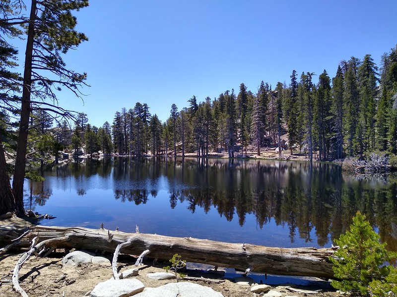
After about a mile and a half, we finished our easy day’s climbing, and we arrived at Hidden Lake Divide. We decided to eat lunch and check out Hidden Lake, which had been closed for a number of years. The last time we hiked this trail had been in September 2012, and access to the lake was forbidden. I had read online that a lot of work had been done on the area since then, and we wanted to check it out. And we were glad we did!
The lake was full, the sky was blue, and the setting was perfect. The trail had new railings to keep visitors away from the fragile plants along the shore, and had several informative signs, as well. We enjoyed the scenery, then continued walking on the trail beyond the lake, until it ended at Desert View. This spot provided a fine vista out to the east over the Coachella Valley. Or it would have been fine if it hadn’t been so hazy that day. But it was pretty good, just the same.


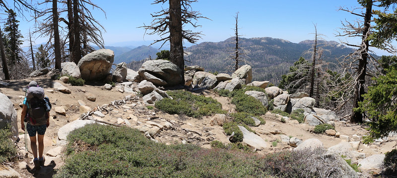
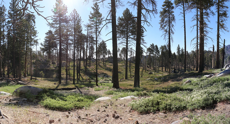
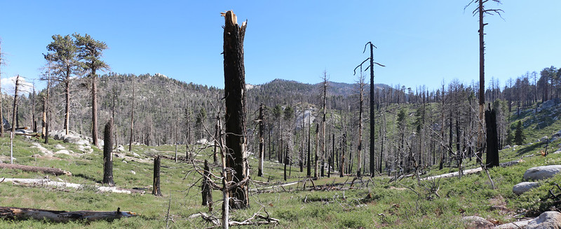
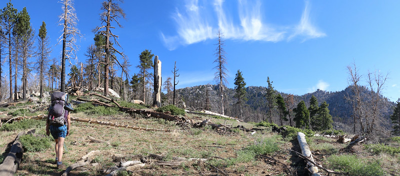
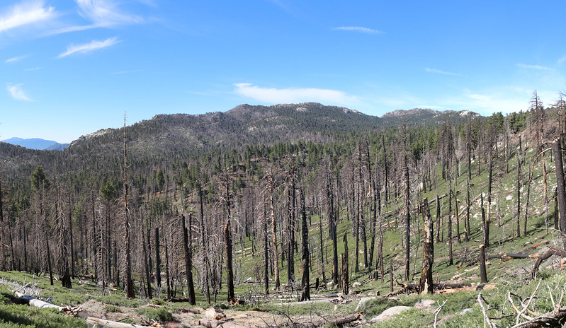
Our long break was over, so we walked back to the main trail and grabbed our big packs. It was time to head down into the Tahquitz Valley, to check out the devastation of the fire. We hiked uphill a bit further, and topped out at Hidden Lake Divide, where there was a great view out over the valley. We saw a lot of green pine trees out there, which was heartening, but we also saw a lot of areas with nothing but vertical sticks. It was probably about sixty percent burned, as a rough estimate, but it was patchy. In some areas, entire swaths of forest had been decimated, but in other sections it looked fine. From up there, at any rate. Many pine trees died when the fire burned their crowns (the fire fighters call it “crowning” when the fire exhibits that behavior) and in other areas the fire traveled low, staying down in the undergrowth, burning the pine needles and grasses.
As we hiked down the trail, we passed through both types of forest: Dead and Alive. Many of the trees that survived only showed living branches way up high, while their lower trunks were still blackened from the fire on the forest floor. And, after five years, it was good to see a few new pine trees sprouting here and there. It’s the Circle of Life, and we knew that it would eventually recover, so we took heart in that thought. But we also couldn’t help but realize that the two of us would never live long enough to experience that eventuality. Sad but true.


Along the way, we also noticed that very little work had been done on the trail. There were numerous downed trees blocking the path, and we had to either climb over them, or hike around them. There were many new paths that previous hikers had made in order to avoid the obstacles, so it wasn’t hard to figure out.

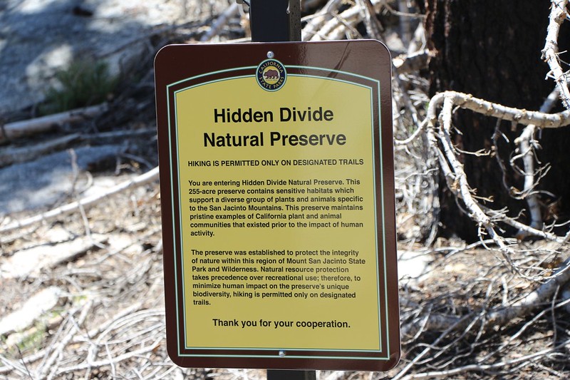
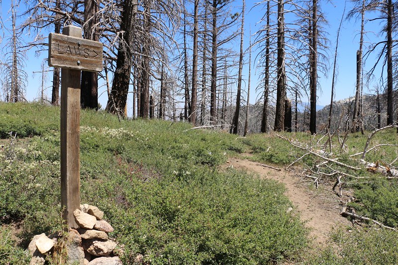
After a mile or so of hiking we came to the junction where the Laws Trail split off from the Willow Creek Trail. The Laws Trail had recently been reopened to access, when the five-year forest closure order expired and wasn’t renewed. For five years since the fire, the public hadn’t been allowed in that area, and no budget money had been spent on trail maintenance for the trails leading to Laws Camp and Caramba Camp. The USFS website made it quite clear that we were there at our own risk, and that the trail was unmaintained. But weren’t we always at our own risk in the Wilderness? Of course we were, and yet we’re still alive to write about it. I’ll worry later, when I have more time.
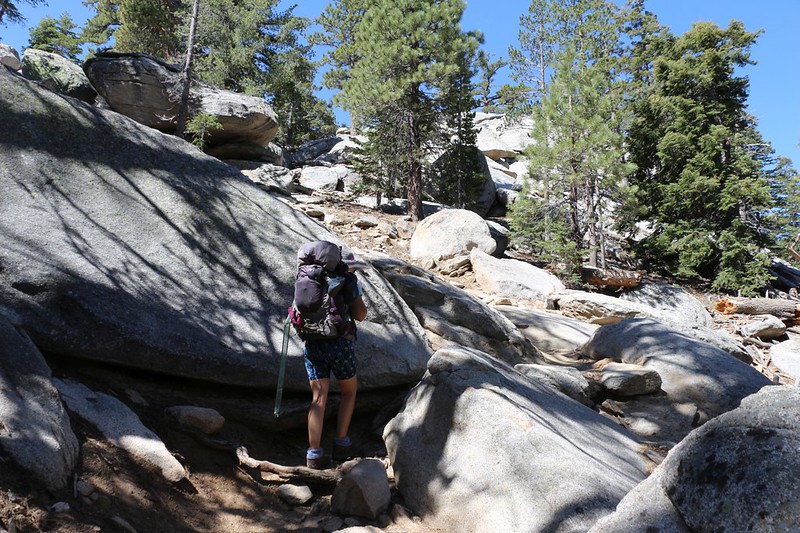
Exercising due caution, we got out the GPS and headed down the (extremely) faint trail. We could tell that a few hardy souls had already been this way, but the marks of their footsteps were faint, and our eyes had to keep scanning to find the original path.
I looked back at my 2012 photos, and it was amazing how different the trail looked. In 2012, there was abundant foliage on the pines, even down low near the ground, and the forest was quiet and dark, so that very few plants and shrubs were growing. But now, with the full sunlight passing through the dead tree trunks, the dreaded Buckthorn (also called whitethorn) plant had taken over this section of hillside completely. As the name implies, buckthorn has plenty of thorns, so it isn’t the most pleasant of plants to bushwhack through. And after five years, they were all about a foot or so tall. This made it relatively easy to simply stomp on them with our boots, but they were still quite good at obscuring signs of the original trail. And scratching Vicki’s bare legs.


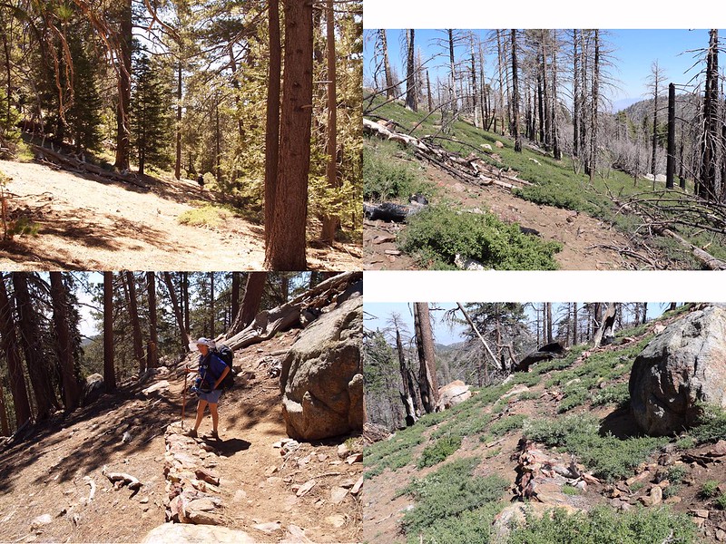
Well, we did our best to follow the old trail. I had my GPS in hand, and we wandered along, stomping buckthorn, casting about for the trail, which the map showed doing long switchbacks, back and forth down a ridge to Willow Creek and Laws Camp. It was generally difficult to find the old path, although in some spots you could tell that it was there. Eventually, however, we realized that this was a fool’s game. We could plainly see the flat ground and green plants in the creekbed down below us, so we gave up on that stupid trail. We simply picked a path between the fallen logs and nasty buckthorn, and hiked directly down the ridge to Laws Camp. Much easier!

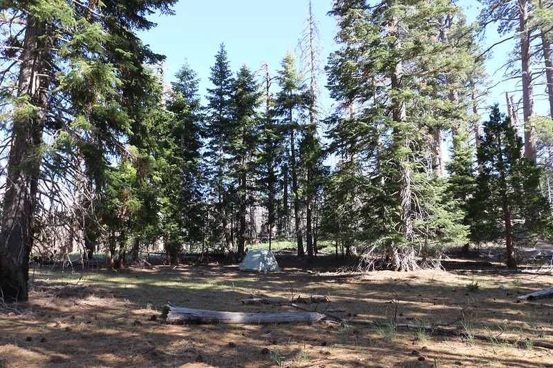
We ignored the creek and headed over to where we remembered the main camp was located. Back in 2012, there were people camped all over this area, but this time we were all alone. Which made us happy, because we don’t like noisy neighbors. And what made us happiest of all was that the central part of Laws Camp didn’t burn! There were big pines, and a soft forest floor covered in pine needles. It was like a slice of Heaven, a tangible dream of the past.
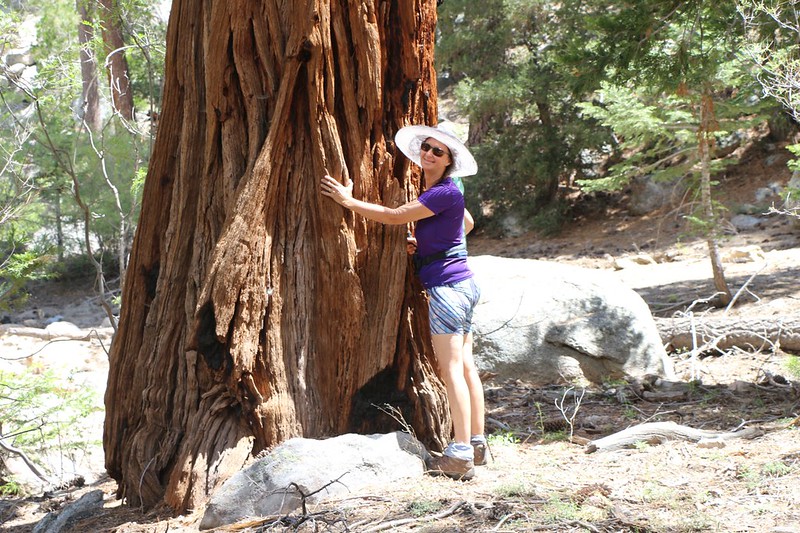
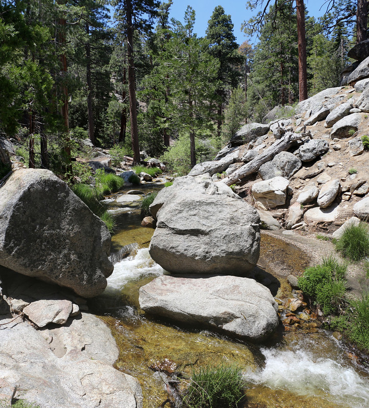
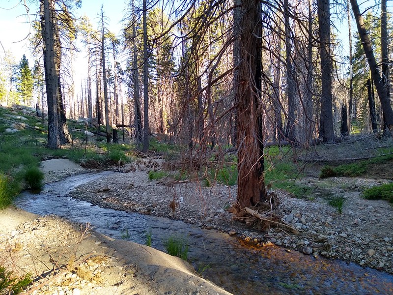
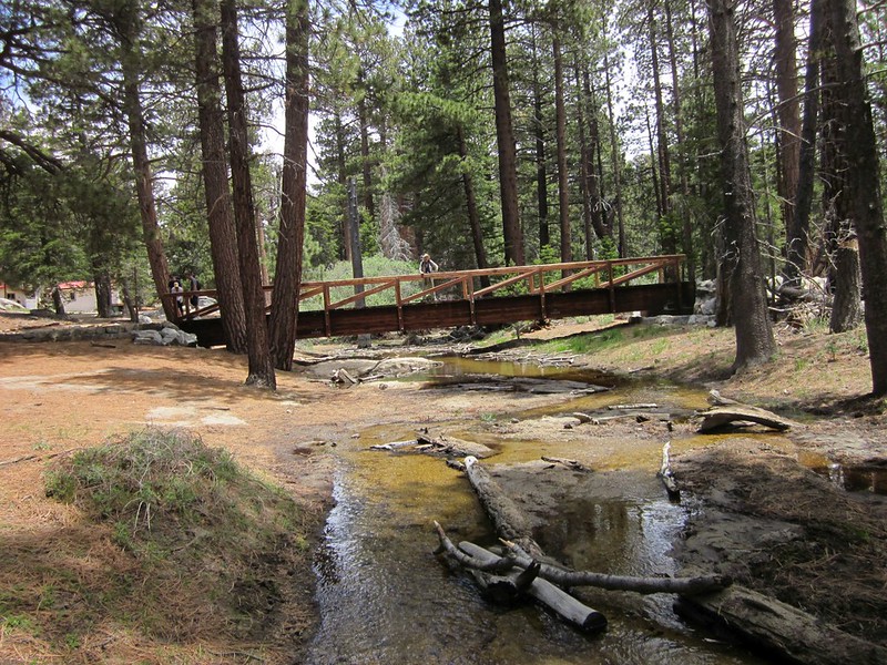
We found a shady spot next to some small cedar trees (because Vicki loves cedars) and set up the tent. I got the inside ready for habitation and Vicki found a good spot for her kitchen. Then she made some dinner using the water we already carried. We had our afternoon tea and ate dinner, sitting on a big old log in the quiet forest, reading our books in peace. After that, we headed over to Willow Creek and filtered two gallons of water, which would be enough for our hike tomorrow. There was plenty of water flowing in the creek, clear and strong.

Then we retired to our brand new tent. It weighed less than half as much as our old one, and was a bit smaller inside. It was also much more delicate, so we had to treat it gently. That’s one of the trade-offs you make when you lighten your load. Other than that, the tent seemed excellent in every way that mattered, and I was glad that we’d bought it. This was our test trip for the tent before our big trip to Vancouver in August, so we had to make sure that everything was working the way we wanted it. So far, so good.
Another item we were testing was a new double goose down sleeping bag, a Therm-a-Rest Vela HD Quilt. This bag was only rated down to about 40 degrees (unlike the heavy 15 degree bag we usually carry) but it was super light and compressed to a very small size, which is also important for our trip to Canada. We’d see if it kept us warm enough.
Why the new stuff? I didn’t want to take my old 1970-era full-frame backpack on an airplane, so we needed new gear to make this happen. This also included my brand new Osprey Volt 70 backpack to carry it all in. Oh, yes. Let’s face it: It’s a good year when you get to buy new gear! And my full kit weighed more than ten pounds less than the old. The “Big Three” of Tent, Backpack, and Sleeping Bag were all upgraded. This weekend would determine whether it was worth all that money.
Day 2:
We woke up when the sun hit the tent, and then we waited while it warmed the air. We weren’t in a big rush, since all we had scheduled was a day-hike down yet another unmaintained trail to Caramba Camp. The trail might be ugly or it might be easy, but there was only one way to find out. We planned to stay right here again that night, so it was nice not having to take down the tent.
Gear-wise, the new tent let in a bit more of the cold night breeze than our old, heavily-modified-by-Vicki tent, but the sleeping bag was plenty warm enough for these conditions. And since it was a quilt (like a blanket with no zippers on the sides) we actually had more room to move around during the night. With the old one we used to have to shift from one side to the other in unison, fitting like spoons, or else our knees ran into the zippered sides of the bag. As for the tent, we thought of a couple modifications that the tent could use, and I sent myself an email as a reminder.

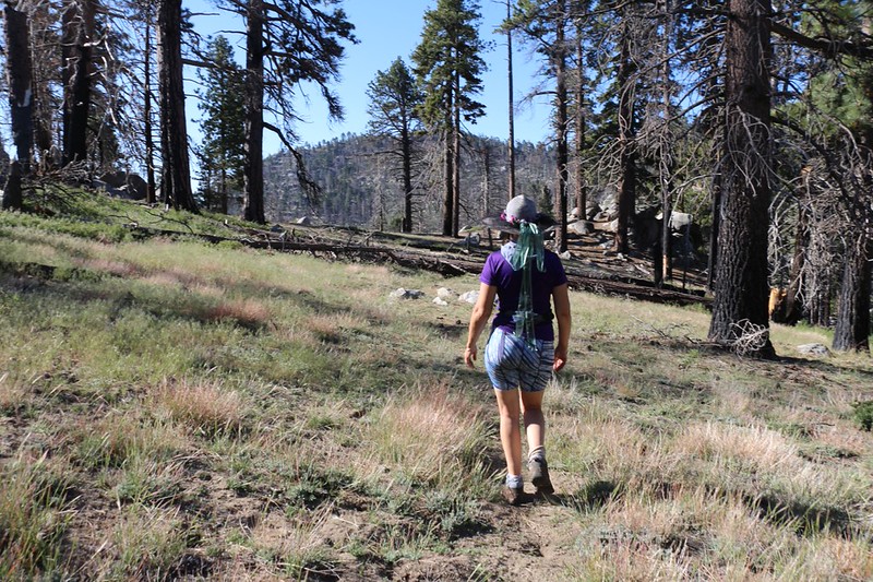
We ate breakfast and drank our coffee while sitting on a log with our backs to the sun. There was still a cool breeze running down the big Tahquitz Valley, but we knew it would be getting much warmer soon. Then we headed off to the tent to get dressed and geared-up for the day. It didn’t take us long, and we were hiking before 8am.
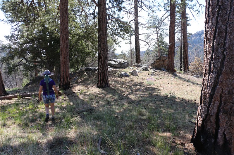
We found the Caramba Trail right away as it made its way through the campground. It was easy to see, as it was completely full of fallen pine cones! It was obviously the trail, and it was also obvious that very few people had been hiking on it recently. We felt a bit like pioneers.
For the most part, we were happy to discover that the trail was in much better shape than they’d led us to believe. It had been built well, after all, and those tell-tale signs were hard to miss. Also, this section of forest hadn’t burned as completely as the Laws Trail, because it wasn’t on a steep slope. Fires love to race up steep slopes. Also, this end of the Tahquitz Valley seemed to have missed the brunt of the destruction. Were there places where the trail was hard to find? Of course there were. But a quick check of the GPS or a simple glance around usually set us back on the still-obvious original trail. And the best part was that there was very little buckthorn!


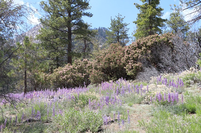
As we descended toward Caramba, we were thrilled to see the emergence of blooming lupine flowers. These were quite memorable from our last trip, and were a joy to see, and smell. When you get enough lupines together in one place, it smells like candy, a sweet smell reminiscent (to me) of Skittles, my favorite hiking snack. So I ate some more skittles and hiked on.


The trail headed east, staying high on the north side of the valley, until the very end, when it suddenly curved south and headed directly for Caramba Camp. We were happy to see that the fire didn’t destroy this beautiful area. There were occasional spots that took some damage, but they were fairly minimal.
The campground was empty of course, but it was ready for campers if they would only show up. Tahquitz Creek was flowing strong, and we headed down there immediately. The air was getting toasty in the sun, and our feet were in serious need of cooling. So we took off our shoes and dipped them into the chilly water. Whoo! It wasn’t exactly icy, but I wouldn’t want to take a bath in it either.
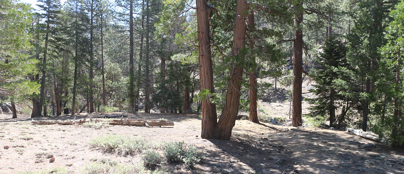

We headed back up to the camp and sat in the shade. We ate lunch and then Vicki took a long nap. It was a very mellow scene. She felt recharged after waking up, and we decided to head downstream to check out the small waterfall we remembered from last time. Along the way we saw huge cedars, which made Vicki happy.
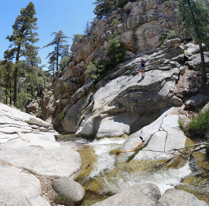
The creek tumbled between large boulders, and eventually narrowed and was funneled into a granite chute. We could see where the flow of water and sand had etched passages and bowls in the granite slabs over the millennia. The creek grew very noisy as we neared the small waterfall. We knew that there were several huge, impassable waterfalls further down this canyon, but we had no interest in heading down there. Mainly because we’d have to climb back up!
Video of Tahquitz Creek where it begins the first waterfall
GoPro underwater video of the swirling water with lots of bubble sounds

Our lunchtime visit to Caramba was pretty much finished by the time we got back to the camp, but Vicki wasn’t really ready to begin the long hike back uphill to our tent. It was hot outside, and she was worried about overheating. I decided to purify a couple of extra liters of water, just in case. Once again, I tested out some new gear: Aquamira Water Treatment Drops, which consisted of two one-ounce bottles that, when seven drops of each was mixed together, formed enough chlorinating agent to purify one liter of water. Or so the package claimed. I like filtration better, normally, but I still wanted to give this method a try. No point in buying new gear if you aren’t willing to use it.
Meanwhile, some puffy cumulus clouds had been forming over San Jacinto Peak, and they seemed to be consistently drifting our way, blocking out the sun roughly half the time. We decided that we should start hiking while we had the shade, so Vicki went down to the creek and dunked her shirt in the water. Then she put it back on. She made some funny squeals from the cold, let me tell you. But after that she was about as ready as she could be, and we started hiking uphill in earnest.


We made it a long way before the sun came out in earnest, and by then Vicki’s shirt was dry once more. I got out the squirt bottle and misted her head and arms and legs every so often. This helped enormously. She doesn’t sweat properly, so she’ll get heatstroke without it; that squirt bottle is truly a lifesaver.
Eventually, of course, it was time for yet another nap. We stopped at that same nice knoll where we’d taken a break on the way down, and I got a bunch of reading done while she slept.

After that, we continued onward, pausing in the shade when we found some. The trail went up and down, but mostly up. And we got to enjoy all the lupines once again. It was a good hike.
With all the rests and naps we took, plus the lounging by the creek, it took us a total of eight hours to hike five miles. Pretty pathetic, really, but we weren’t trying for any records. We arrived back at camp by about 4pm, and Vicki decided to have her afternoon tea right away. We sampled the purified water that we’d made and decided that it tasted just fine, with no residual chlorine odor, and so that was considered a win. We decided to be lazy and purify another gallon and a half from the creek the same way. It was much easier than using the filter. The true test would be whether we had digestive trouble a few days later. But we’d be home by then, so who cared? (And we never did have any trouble, by the way.)
After dinner, I insisted that we head over to the spot we’d camped at last time, where there was a stone-walled “structure” that I suspected may have been the location of the camp made by Mr. Laws way back when in the good old days. Of course, I have no proof of this whatsoever, nor am I certain that there was, in fact, a Mr. Laws, at all. But I like the theory anyway. So we headed over there (using the GPS) and it turned out that the area had burned completely. Sadly, it had been taken over entirely by buckthorn. There were also downed trees everywhere, and the hiking was very slow. What should have been a five minute jaunt turned into a half hour of pain. But we saw it, and I took my photos, and we headed back to camp.

After that, I returned to the creek and filled our two gallon jugs about three-fourths full, and headed back to camp. I mixed the drops of the two solutions according to the instructions (like a proper chemist) and dumped the resulting concoction into the jugs. By morning we would have plenty of clean water for the hike back to the tram.
It was supposed to be even hotter the next day, so we decided to bug out early and beat the heat. We went to bed before sunset and I set my alarm for 4:30am.
Day 3:
Naturally, we woke up early, at 4am, and realized that we weren’t going to get back to sleep. So we sat up and started our day. We had already planned to leave early, so our breakfast consisted of Pop Tarts (me) and wholesome Fruit Bars (Vicki) which needed no cooking. We got dressed in the dark by the light of our headlamps, then began the process of getting our gear together. It was quite cool outside, with that same constant breeze flowing down the valley, so we stayed inside as long as possible, but in the end we had to leave. We packed up the tent and got our packs ready, then headed over to the big log and sat in the first sunbeams to eat our cold breakfast.
Then it was time to go. We didn’t waste any energy trying to find the old trail and simply headed directly up the ridge, weaving around the buckthorn and dead trees. It was a lot steeper than the now-non-existent switchbacks, but it was a much better path. And Vicki’s legs weren’t getting all scratched by the thorns, a big plus.


By 9am we were back on the Willow Creek Trail, and began the second half of our day’s climb. The temperature was rising, and the sun was strong, but we were still glad that we’d started so early. Vicki soaked her hair and her clothing with the spray bottle, and she stayed cool enough. We took in the expansive views along the way, and this time we were better able to identify where we had hiked the day before, which was fun.

We reached the top of the climb, Hidden Lake Divide, by 11am, and took a long break. We ate lunch and congratulated ourselves for our efforts, as the rest of the hike would be downhill, all the way to the Tram. Vicki took a well-deserved nap and I read my book and enjoyed the view.

We’d only met a couple of people heading down the Willow Creek Trail that morning (and not a soul on the Laws or Caramba Trails), but we knew that this situation would change once we reached Hidden Lake. It was Sunday. and the Tram had been delivering hikers to the forest all morning. In fact, as soon as we came to the lake, a huge group of people, led by a Park Ranger, came out from the lake, yakking and laughing and being generally noisy. If only we’d been a minute sooner! So much for the Peace of the Wilderness. But it was all good, really. How could we be angry that so many people had experienced the lake when it was so full and beautiful? We’d done it, too, after all.
So we did what we always do when faced with excessive civilization: We hiked faster.
This didn’t work as well as one would hope, because the density of people on the trail increased exponentially as we descended into Long Valley, and it positively peaked once we reached the inside of the Tram Car. But that was to be expected. So we simply enjoyed the last part of the hike. Long Valley didn’t burn at all during the Mountain Fire, and it was wonderful to be back in the lush forest that we knew and loved.


All in all, it had been a good trip. We were saddened to see how much of Tahquitz Valley had been damaged by the fire, but we knew that it would all grow back, in time. The saddest part, perhaps, was the neglect of the trails, and it seemed a shame that the National Forest Service would allow such a thing to happen. I realize that their budgets have been cut horrendously in recent years, and that they have no resources to devote to the trails, but I also firmly believe that if they had had the courage back in 2013 not to close the forest to the public for five years in the first place, that the trails would have actually been used by hikers, such that all the buckthorn on the trail never would have had a chance to take root and thrive. Unfortunately, now it will take even more non-existent money to fix the problem that the closure order exacerbated. For after all, is the damage that a few hikers on a trail might cause to the “fragile recovering ecosystem” even remotely comparable to the unstoppable destructive havoc of an out-of-control wildfire? Of course not. Closing the area while the fire is actively burning? Sure. But to deny the public access to the public’s land for five long years? Really?
OK, enough of my ranting. It won’t do any good anyway, and I know it. But it sure made me feel better to write it.
On the way home in the car, Vicki and I talked about the trip. And mostly about how well our new gear worked. The tent, the down quilt, the new backpack, and the water treatment all passed the test with flying colors. We also decided that the burnt forest made us too sad, and we resolved not to head down that way ever again. We were getting older, after all, and there were plenty of areas that we had yet to explore, so we vowed to try our best to seek out new places, with more beauty, during our future backpacking trips.
An online topographic map and GPX file export can be found on my Caltopo Page
More photos and videos can be found on my Flickr Album Page
