After losing my job due to the Covid-19 pandemic, I had a whole lot of extra time on my hands, and, being an optimist, my reasoning went that I should spend as much of that new-found free time as possible backpacking in the wilderness. Now, earlier in the year, I had made a bunch of permit reservations in the Sierra Nevada, all of them pre-booked for this Summer, using every bit of vacation-time I had, but, suddenly, every day was a vacation day! So I made yet another reservation in the San Gorgonio Wilderness for the gap between two of the bigger trips. I chose San Bernardino Peak because it was a challenging trail, with a lot of elevation gain, and excellent views. Also, its forest hadn’t burned back in 2015, so I wouldn’t be subjected to the sight of blackened trees everywhere. I had been there before with Vicki, back in 2011, and she had zero interest in climbing 5000 feet in a single day. So I was on my own for this one.
So I packed my lightest gear in my lightest backpack, and decided not to even bother with a stove, water filter, or bear cannister. I decided to eat only no-cook food, use Aquamira purification drops on the water, and keep the food within my control at all times.

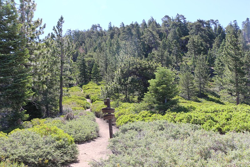
I left San Diego early Friday morning to avoid LA rush-hour traffic (which wasn’t bad thanks to all the Covid layoffs) and I got to the trailhead parking lot just after dawn. There were very few cars in the lot, as it was a weekday. Just the way I like it! I finalized my backpack preparations and started up the trail. I was sweating and breathing hard in no time. The trail had plenty of switchbacks as it crawled up the north slope of the mountain, far above the town of Angelus Oaks. After about one thousand feet of climbing, the trail crossed into the San Gorgonio Wilderness, but the switchbacks continued. Soon, there were much better views to the north, with Slide Peak being the most notable landmark.

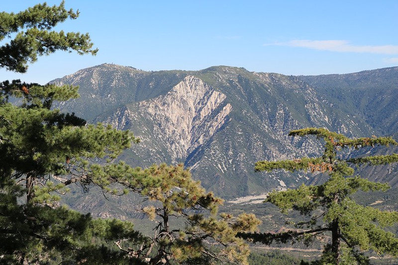
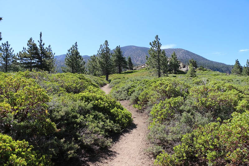
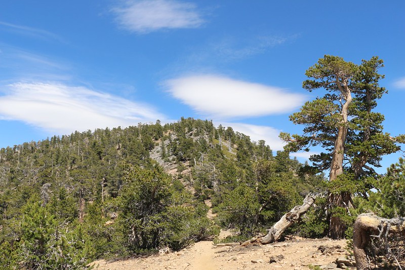
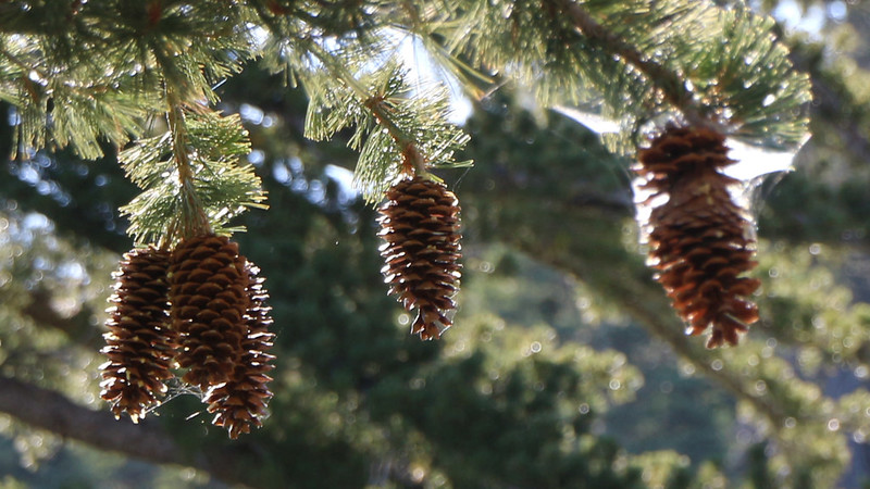
After 1500 feet of climbing, the trail headed due east, more or less directly toward San Bernardino Peak. Sometimes it headed through the cool shade of a tall pine forest, and other times it broke out into the sunshine of manzanita “meadows” which allow for better views all around.

The trail eventually flattened out significantly, for a mile or so, until it reached the John’s Meadow Trail. It was hot and sunny on this section, but at least it wasn’t steep, and I made good time. I paused for a short break near the trail intersection, then continued onward, up the steep, final switchback section that leads to Limber Pine Bench. I was hiking strong, and was really enjoying my extra-light backpack. This was so unlike my typical hikes with Vicki, where I tend to carry the lion’s share of gear.
Ever since the start of the hike, I kept leapfrogging another group of backpackers, which was composed of two adults and a bunch of kids. I saw them arrive in the parking lot as I began hiking, so they weren’t far behind, initially. They were strong hikers, and were training for a Sierra Trek in a month or so. First I would take a break and they would pass, then they would take a break and I would pass. Later on, as I was passing them yet again, I spoke with one of the “grown-ups” who said that the kids wanted to know how old I was. So I told him. Apparently, they were either impressed with how strong a hiker I was for my age, or that I looked impossibly old to be hiking at such a pace. I choose to believe that the former is the true reason.
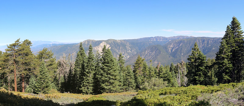
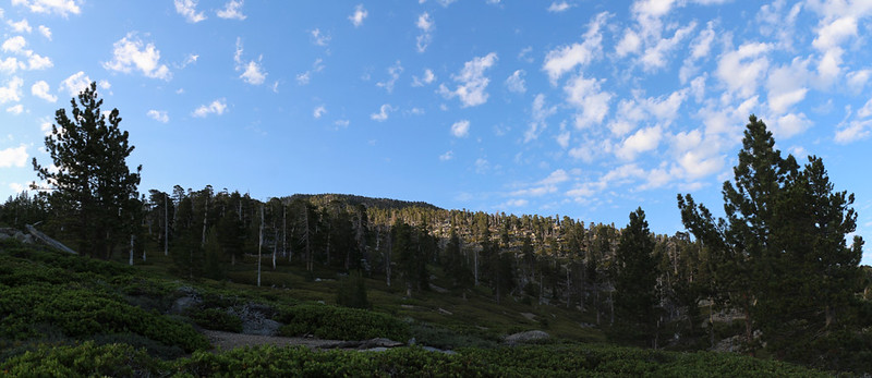
After six miles and 3500 feet of climbing, I made it to my destination: Limber Pine Bench. I’d been here twice before, and both times the weather had been quite breezy. And today was no exception. The campsite is situated on a prominent ridge that juts northwestward, and it is perfectly situated to give not only excellent views, but also to receive exceptional breezes. It being Friday, I was the only one there, so I had my pick of campsites. I chose the same one as last time, back in 2018, and set up my tent in the lee of a tall boulder.
It was noon by that time, so I grabbed my lunch and climbed up on the big boulder and ate it, with a tremendous view out over Los Angeles. Nice! This is the real reason people climb mountains, for the views, even more than the challenge. I also was able to get cell phone signal up there, and I sent some photos to Vicki and let her know I was OK. I also sent them to friends, to make them jealous. This is one of the other reasons for climbing mountains.


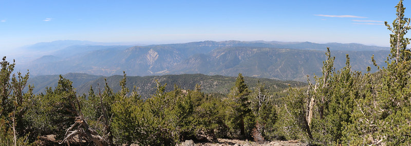
And that was when I realized that it was time to actually climb a mountain! The summit of San Bernardino Peak was another two and a half miles away, plus another 1400 feet of climbing. So I emptied my backpack of all the nonessential gear and continued onward for the summit. It felt great to be even lighter than ever, and I made good time. About a quarter mile above the camp was Limber Pine Springs, which I was happy to see was flowing well. I would be getting water from there, but not until later, on my way down the mountain. No point in lugging a gallon of water up to the top. After that, the trail made several long switchbacks until it reached Washington Monument, the Original Initial Point of SoCal. Baseline Avenue, down in Los Angeles, headed directly west from this point. It was hazy that afternoon, but I was able to see the road in the distance.


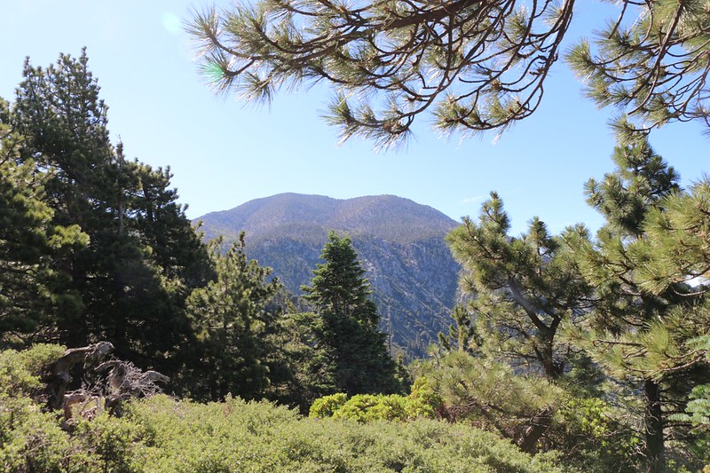
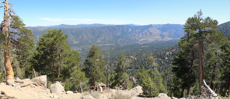
I continued uphill and was soon on the main ridge of the San Gorgonio Mountain Range. The famed “Nine Peaks” were along this ridge, which Vicki and I had bagged back in 2012. I was able to see in all directions from up there. I checked out San Gorgonio Mountain and San Jacinto Peak in the distance to the southeast.


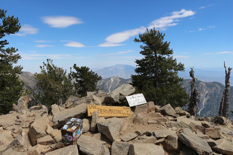
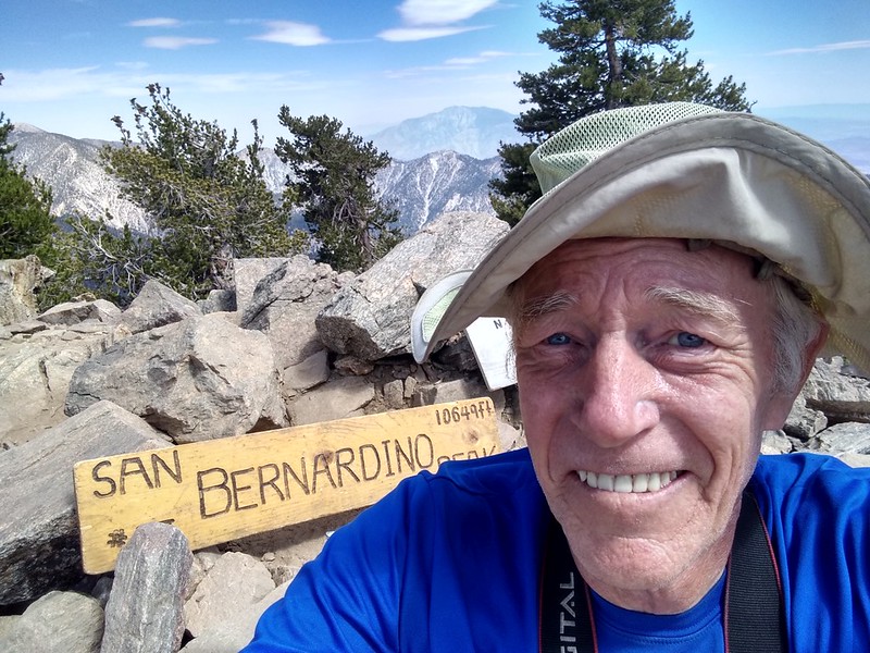
Eventually, I came in sight of San Bernardino Peak itself. The ridge trail (officially called the San Bernardino Peak Divide Trail) dropped down into a saddle, then climbed back up and traversed around the northern side of the peak. It didn’t actually reach the summit. But I wanted to. I found one of the “use” trails that branched off to the right. It headed, very steeply, directly to the top. So I started climbing it. And this was when I started to feel like the old man I truly am: That last piece of trail kicked my butt! I rested many times on the way, but I didn’t give up, and soon enough I was on the summit. I took the obligatory photos and even a selfie (since I didn’t have Vicki to help me this time) which I promptly sent out to everyone. And I have to admit that I felt pretty good about it. Climbing 5000 feet in a day is nothing to sneeze at, no matter how old you are!

I took a long break on the summit. Why? Because I deserved it. I had some snack and drank some more water. While sitting there, I heard the voices of kids nearby, so I got up to investigate. It was the group I’d met earlier, and it turned out that they were camping up on top of the peak. What a great spot to stay. It would be a memorable experience for all of them. In fact, they were probably sending out selfies to their friends, too! I spoke to one of the adult leaders and we talked about water availability along the Divide Trail, as they were continuing onward to the summit of San Gorgonio Mountain, the highest peak in Southern California. He hadn’t been there before, and was planning to get water at Dollar Lake, which meant an 800-foot down-and-up side trip. I recommended that he check out High Meadow Springs, which was very clean, unlike the stagnant lake. The springs had continued to run even during the draught of 2015, and it didn’t entail such a strenuous side trip. And if he missed the trail to the springs, then it was OK because Dollar Lake Saddle was further east, and they could always revert to the original plan. Exchanging knowledge is just one of the many things that makes Backpacking such a great endeavor: People sharing their tales and having a great time together in the wilderness.
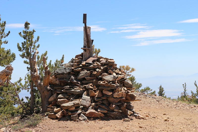
After that, it was time to get going, as the afternoon sun was getting lower in the west. I wished everyone luck, and headed back to camp. The air kept getting hazier in the distance as the day wore on, but I didn’t really care. It was great simply to be up here. I stopped to check out the excellent stone bench near the monument, but continued downward after resting for only a few minutes. Next stop: Limber Pine Springs. I filled up my gallon jug and made my way to camp.

As it turned out, I was still the only person camping at Limber Pine Bench, and I wasn’t complaining at all. The breeze was blowing pretty strong, but it wasn’t as bad as it could have been, and I was grateful. I changed into my warm, dry night clothing and then sat in the tent to eat my no-cook dinner. This wasn’t much of a meal, mostly junk food, in fact. Salty Cheeze-Its and potato chips, followed by Reese’s Peanut Butter Cups and Skittles for dessert. I drank a whole bunch of extra water because I felt a bit of a headache and I knew that I was dehydrated, as usual. Warm and fed, I got out my book and climbed back up on the big boulder to enjoy the sunset. It was good to be up in the mountains on a beautiful Summer Day. And I had a feeling that I’d be sleeping extra soundly that night.


Just after dark, while I was in my sleeping bag, reading in my tent using my headlamp, I heard some gravel crunching nearby. It was another camper, who had hiked in after they got off work Friday afternoon. He wanted to know where the spring was located. It’s so easy to describe that I was able to tell him without even getting out of the tent: Just head up the trail until you hear water, right where the trail makes the first big switchback. Can’t miss it. And I assume that he didn’t, as I fell asleep soon afterward.
I woke up early, before dawn, just like I always do at home. It was cold, and still a bit breezy, but I decided to get moving just the same. I knew that the trail was going to be jam-packed with hordes of Saturday dayhikers that morning, and I didn’t want to take any extra chances on catching Covid from one of them as we passed each other on the narrow trail. I packed up everything I could from inside the tent, then jumped out and put the tent away. I put my junk-food breakfast (two Pop-Tarts! Yum!) into my shirt pocket and donned my backpack. I was out of there! I passed by my unseen neighbors (they remained unseen as they were still sleeping), and I blasted down the trail with the wind at my back.

Not surprisingly, there were quite a few day-hikers that also got up before dawn, but I didn’t meet anyone until I was down near the John’s Meadow Trail. So far, so good! But it didn’t last. I met more and more hikers as I blasted down the trail. I was really moving. It had taken me four hours to climb, but less than two and a half hours to descend! I didn’t even need a break, and barely needed to carry any water, as the temperature never really rose by the time I arrived at the car at 9am. Fast! I felt pretty proud of myself, old man that I am.

I had been passing people by the score, and it sure did show when I reached the parking lot, which was crammed with cars. A couple of them almost looked like they were blocked in by others. I got to my car and threw in my pack, after breaking out some additional snack and my lunch for the day. I would eat that on the drive home. I saved my GPS tracks and texted Vicki that I was safe, and that I’d be home in three hours or so.
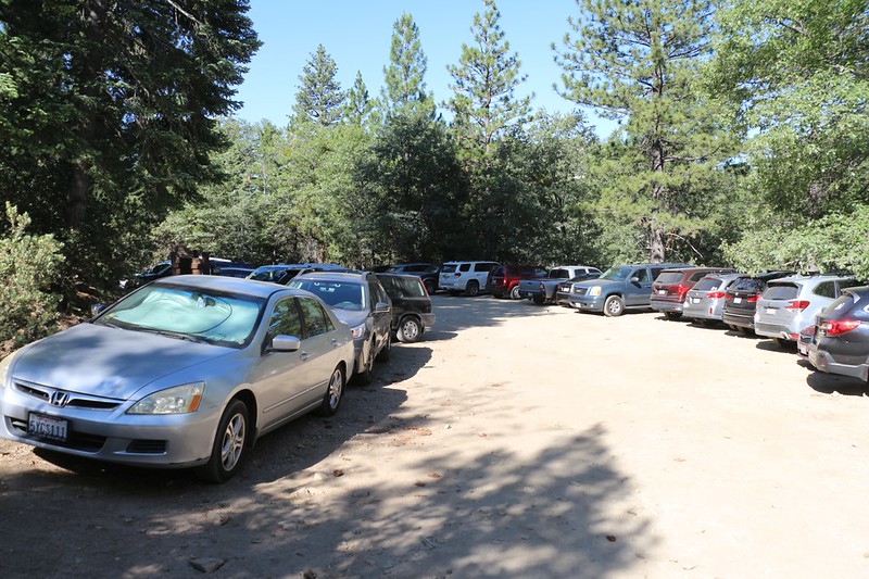
As I drove down the dirt road to the highway I saw that there were cars parked everywhere along the side. Wow! This was a busy place for dayhikers! But that was OK by me. At least they were getting out and getting some exercise, unlike so many others that were quarantining from Covid at home. And I was quite happy that I’d gotten in an extra camping trip this season. In two weeks Vicki and I would be heading north, once again, to the Sierra Nevada for yet another wonderful week-long backpacking trek. I could hardly wait! And I was already making more plans…
For a topographic map of the hike see my CalTopo Page
For LOTS more photos of the trek see my Flickr Page
