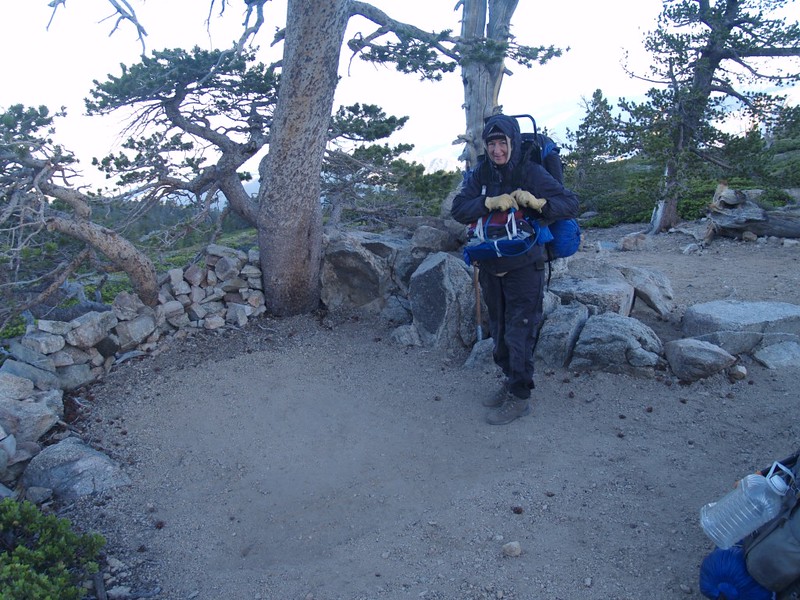
Vicki and I left San Diego at 3:30am and arrived at the San Bernardino Peak Trailhead in Angeles Oaks just after dawn, ready to begin a three-day, two-night, action-packed backpacking weekend in the San Gorgonio Wilderness.
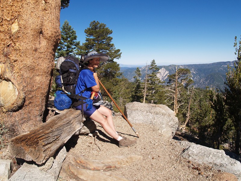
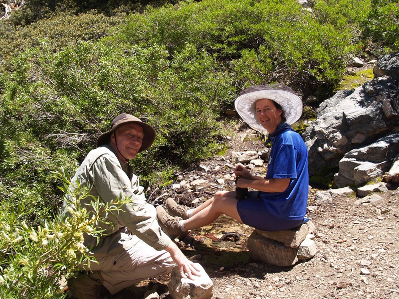
We needed some action right away, too, because the air temperature was in the mid-forties. Cold! I kept my coat on until the last possible second, then, when both of us were 99.9% ready, I chucked it into the trunk, locked the car, huffed my 50 pound pack onto my back, and started hiking up the trail, knowing that the uphill climb would generate plenty of heat. But wait! First, a photo-op of Vicki next to the trail sign. Then one of me. “How about both of us? Using the timer? If you don’t have that cute little tripod, maybe you could balance your camera on that rock over there?” she asked.
“No way! Please? I’m freezing!” I insisted, at which point I couldn’t take it anymore, and started hiking up the trail, my hands rammed into my armpits for warmth. But Vicki wasn’t cold; she’s smarter than me (sometimes), and was wearing several layers of clothing, just like all the backpacking guidebooks tell you. She was perfectly comfortable. It’s aggravating when the experts actually know what they’re talking about.

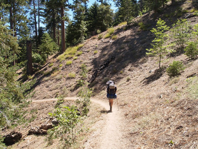
Climbing the switchbacks did the trick, and I warmed up fine, until I was just barely sweating. The trail was mostly in the shade, so it was really nice hiking weather. I just couldn’t stop. If I stopped I’d freeze; the breeze would chill my sweaty shirt and blow it against my skin. Brrr! So we didn’t stop, except when Vicki peeled off layer after layer. Soon she was in shorts, but by then the air was getting warmer, and, as we finally gained the top of the first ridge, the sun’s action began to really warm things up.


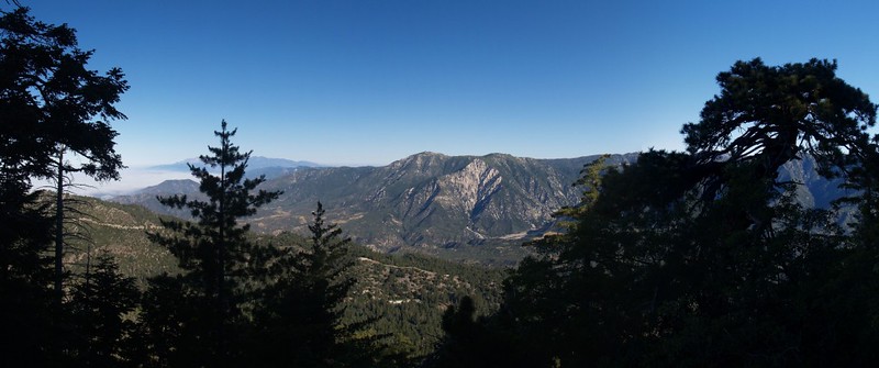

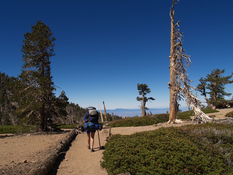
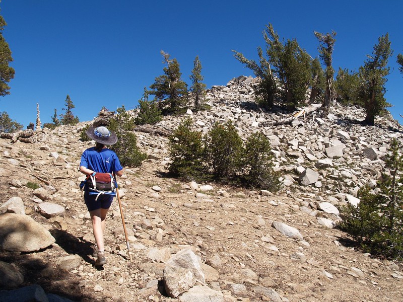
In the beginning, at elevation 6000 feet, the forest was oaks and pine, but as we gained the ridge, the oaks faded away and the pines dominated. Some of them were quite huge. The air smelled of pines. Once on the ridge, the forest thinned out, as there isn’t much water up there, and there were only occasional pines standing tall amidst a sea of chaparral. The trail wound through manzanita, chinquapin, and buckthorn plants, many of them six feet tall. When a pine was near, I’d stop for a micro-break in its cool shade. Ahhh. And this is how we hike: Vicki just keeps plodding onward, slowly but surely, while I stand in the shade and wait for her to get two-thirds of the way to the next shady patch, at which point I burst into action and blast across the sunny area into the shade again. The tortoise and the hare. Rinse and repeat. Which is why I have so many pictures of her from the rear as she hikes in the sun! When I’m in front, doing the “hare” trick, I feel like a rotten person, standing around waiting for her in a patch of shade, then the moment she finally catches up to me I hike rapidly away yet again before she can even say hello. So I mostly stay behind her. And I don’t mind the view…


Anyway, the ridge with the chaparral was long, but less steep. Eventually we reached the trail junction at 8300 feet elevation. Vicki was whupped. There would be no more uphill hiking for her that day. We turned right and headed downhill toward Columbine Camp. Our main goal at this point was getting the tent set up and letting Vicki take a nice nap. Action-wise, this plan was seriously lacking, but it’s the only one we had.

Video of Vicki crossing the Columbine Camp stream

It was noon when we got there, but it had been a long day already. Vicki took a quick nap almost instantly, inside the tent but without any comfy cushions. She didn’t care. Soon enough, she got up and cooked some ramen noodles while I got the sleeping pads inflated. We ate some lunch and retired to the tent to avoid the bugs. Both of us took another nap. Only our dreams were action-packed.
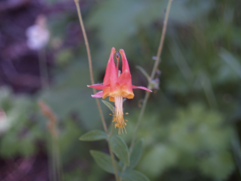
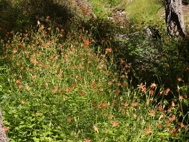
We eventually crawled out of the tent and checked out Columbine Camp. It was actually a really nice place: Lots of big trees, a stream running strong and loud, and there were tons of flowers. The flowers were mostly Columbines, entire fields of them near the stream, along with various gooseberry plants and another flowering plant with big leaves that looked edible but I’m not sure what it was. It was really pleasant to be camped next to a running stream in arid Southern California in July.

Columbine Camp stream video
Video of countless insects swirling above the stream

We had dinner and retired to the tent early. I had woken up at about one in the morning, so I was more than ready to crash. Still, that nap had helped, and I lay awake reading until dark, listening to the stream flowing strong.
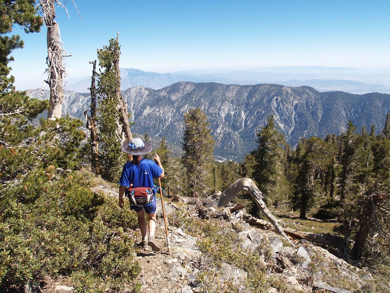
The next day was much busier: We ate breakfast, broke camp, and hiked up to the trail junction. Then we hung a right and continued upward toward our next destination, Limber Pine Bench. Along the way we were treated to many views toward the north and west. As an added plus, most of the hike was spent in relative shade, which kept Vicki cool and allowed her to reach the campground with energy to spare.


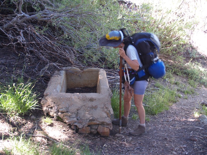
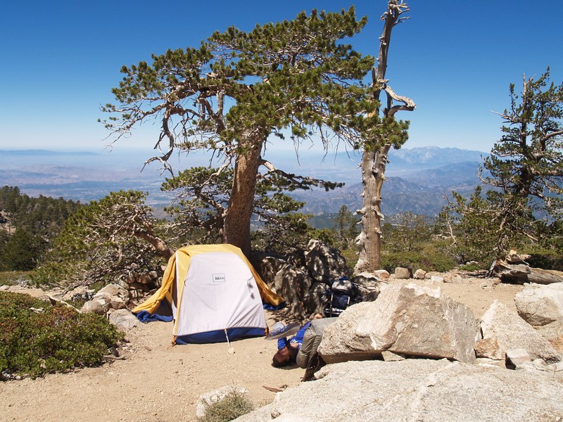
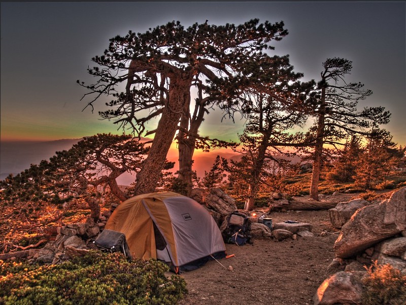
It was still morning when we made it to Limber Pine Bench. And it turned out to be situated on a ridge that was large and bench-like, so that there were plenty of places to set up a tent. And the views from there were truly fantastic! We set down our packs, then wandered around looking for the best site to pitch our tent. It was windy and gusty up there (and it stayed gusty until we left the next morning) so we wanted a spot with some shelter from the breeze. This wasn’t easy to find. Some of the best spots were already taken, so we had to back-track a bit, and settled for a spot that had both a tree and a rock wall as a windbreak. Previous campers had left a smooth area for the tent and piled all the rocks into a nice little wall. If you stood up next to it you’d never notice that it blocked any wind at all, but it had a significant effect down low, at tent level. It would have to do.

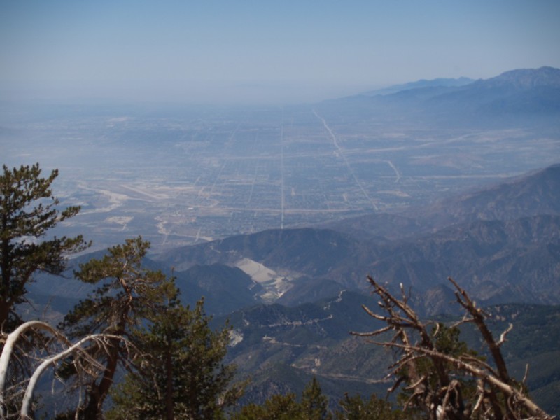
After setting up camp and taking a short nap, we grabbed our day-packs and hiked further up the mountain. We filtered some water from nearby Limber Pine Spring, then hiked onward. As expected, the views from this elevation were outstanding. Soon enough, we came upon Washington’s Monument, which was the site where the initial survey point was made for Los Angeles. While there, we met up with a group of land surveyors, who were visiting it as if it were almost a holy shrine. It was their packs we’d seen down below at the campground. They showed us how Baseline Road, far below us, headed west toward the ocean from here, never deviating from true west, thanks largely to Mr. Washington and his surveying expedition. They had to blaze trails up here where none existed, and lit fires on the spot at night to help the rest of the surveyors down below lay out Baseline Road. This was some interesting history.
Video of Limber Pine Bench Spring


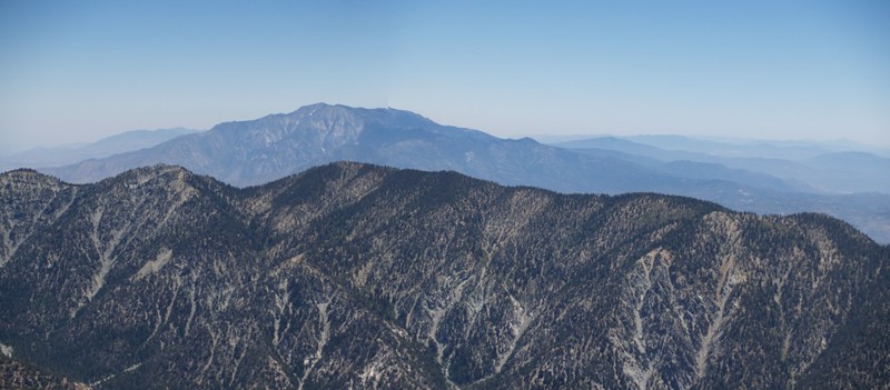

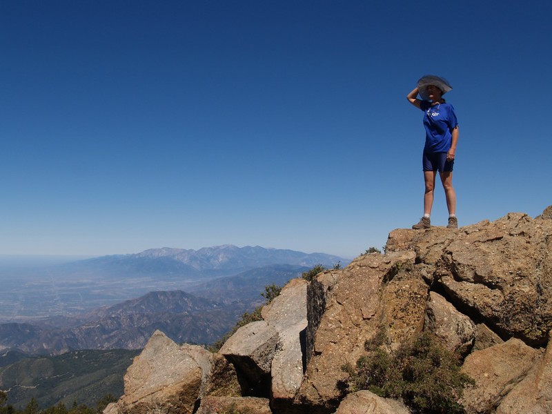
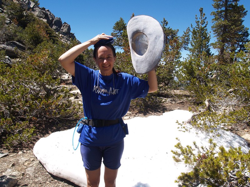
After that, it was time to bag some peaks! This was the sort of action we were looking for! Vicki was still full of pep, so we decided to bypass the summit of San Bernardino Peak and head directly for the top of its big brother, San Bernardino East Peak. At 10691 feet elevation, it was yet another of the nine peaks on this long ridge that were over 10,000 feet high. Along the way, we were able to see many of them stretching away east in front of us. We talked about doing all nine in a single hiking trip one of these years. It was getting hot as we hiked along the sunny ridgeline, and at one point we found a small patch of leftover winter snow which Vicki promptly investigated. She took a handful and wrapped it in her bandanna, then placed it on her head, underneath her hat. This provided much-needed cooling, and she was a happy camper afterwards.


East San Bernardino Peak panorama video
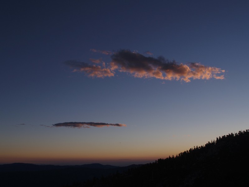
On the way back we also bagged San Bernardino Peak (elevation 10649 feet), then descended back to Limber Pine Spring. We filtered plenty of water, enough for both dinner and the next day’s hike, then headed back to camp, where we ate our freeze-dried meal and watched the sunset. There were no high clouds to spice up the sunset, but there was some interesting haze down below us, which looked pretty cool.


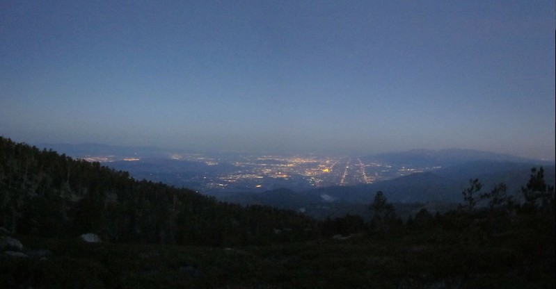
After waking up in the middle of the night from one of many wind gusts shaking the tent, we decided to go outside to check out the lights of San Bernardino and the L.A. basin. The view was really pretty, but the wind was too cold and gusty to stay out there very long.

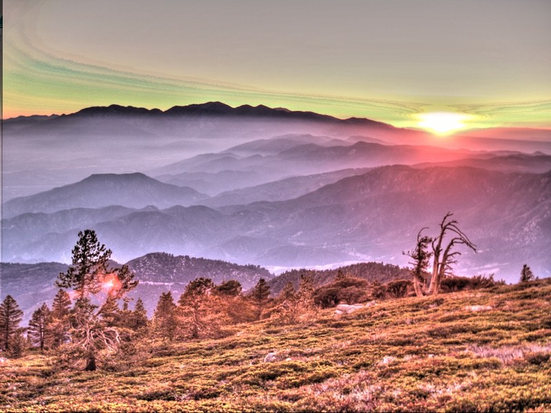
We woke up extra-early and went to the east side of the ridge and watched the sun rise. Very nice, but still a bit too windy, even in the lee of the ridge. We decided to pack up camp as quickly as possible and hike down the trail to a more sheltered spot for breakfast. And this plan worked perfectly, as we found a sunny spot with a nice view and little to no wind.

The rest of the hike back to the car was very pleasant. Plenty of sun, plenty of shade, just enough breeze, and a nice downhill trail. We blasted right along. Vicki was much cooler and happier heading downhill, and wasn’t even wishing for another snowbank. The air was clean and the woods were pristine. What more could you ask for?


Manzanita Flat panorama video


The day’s hike had really flown by. We were back at the car before noon, which amazed us. We decided to celebrate by having lunch at the Oaks Restaurant, not far from the trailhead in Angeles Oaks. I had a three-egg omelette and Vicki had a salad. And we both had ice cream for dessert! Now, that was the best action to take in order to end an excellent hiking trip!
To see the rest of this trip’s photos visit my Flickr Page.
You can view our gps tracks on a fully interactive topographic map on my CalTopo Page.
