On the second day of my PCT Section Hike from Kennedy Meadows to Walker Pass, I headed south from Manter Creek in the Domeland Wilderness to Chimney Creek in the Chimney Peak Wilderness, and then carried my water two more miles to make the following day shorter. All told, I hiked about fifteen miles and climbed over 2500 feet, for a solid day of hiking.
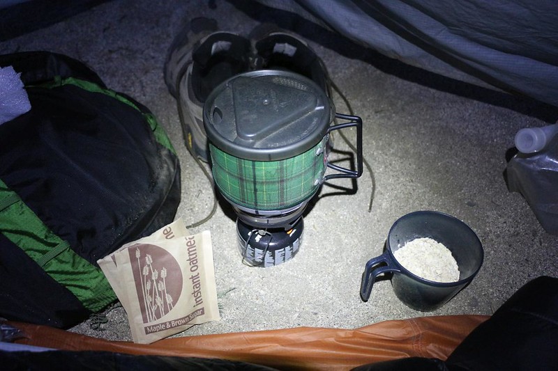
The day began when I noticed a bit of extra light on the wall of the tent (brighter than the full moon). I sat up in my sleeping bag, unzipped the door, and peered outside. There were no clouds and therefore zero sunrise potential, so I zipped it shut again. Time for breakfast! I boiled some water, made some oatmeal, and ate it while reading a book in the light of my headlamp. Then I hustled to get everything packed up. I was starting to get better at this solo hiking, but it still took me a bit longer than having two people.
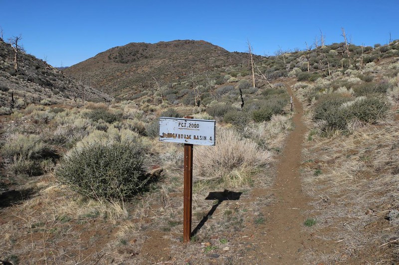
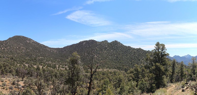
I was hiking by 7am, and the trail immediately began climbing up the Manter Creek Canyon. The elevation profile for the day’s hike looked like a mountain: 2100 feet uphill for 6 miles followed by 2500 feet downhill for another 6 miles. Not very steep at all, in other words. Relatively easy hiking, and I was happy to get the hard part over with while it was still cool. As always, the views got better as I climbed higher.


As I neared the high point, the trail crossed a dirt road that had recent tire tracks. These roads were relics of mining days from last century, and some of them had been maintained. Vicki and I had wondered if it would have been possible to cache some water up here beforehand. We would have camped up there if Vicki had been with me. But I didn’t need to, as I can hike more miles than she can manage, so we never tried. Too bad. I wished she were with me. She would have enjoyed these great views. I even saw some residual Winter snow on high peaks to the northwest, in Sequoia National Park.


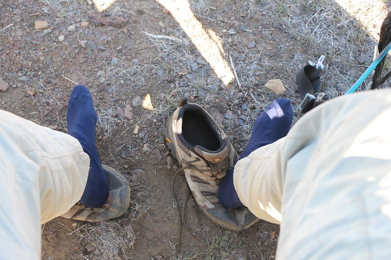
I took a big break at the top of the day’s climb. I let my sweaty outer socks dry in the sun and read my book for a while. I also ate my lunch, even though it was well before noon. I decided that I deserved it. And who was going to argue?
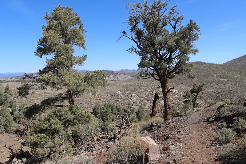
Thus far, this entire climb had been in the sun. A wildfire, many years before, had killed off nearly every pine tree. And without pinecones, no new trees could grow. Instead, it was all scrub and chaparral, with old dead tree trunks littering the hillsides. Pretty sad. As I crossed the top of the ridge, however, I noticed groves of trees to the south, where the fire hadn’t spread. There was shade in there! I hurried onward. Now my steps were downhill, and much faster. I had left the Domeland Wilderness behind.


The hike was uneventful on the way down to Chimney Creek. Chimney Peak, namesake of the Chimney Peak Wilderness, looked down upon the trail from the east. The only other landmark of note was Fox Mill Spring, which was situated next to a long-abandoned ore stamping mill. Those old mines up on top of the ridge must have transported the most likely rock down here for further extraction. There was even an old campsite across the way where the workers must have lived. It was a lonely spot, but the lure of gold can overcome many shortcomings. I checked out the old trough, whose fill-pipe was rusted or clogged, and took some of the cold, clear water from the spring itself and soaked my sweaty head. Aaaahhh! That was fine.


Two miles later, I saw the Chimney Creek Campground across the valley from the trail. The Guthook PCT App said that there was water back in there, about a mile up the road, but I wasn’t interested in hiking an extra two miles to get it. Not when Chimney Creek itself still had water, right next to the trail. I hurried down to collect some for me.

Once at the creek, I took off my pack and got out my one-gallon water bladder and filled it up. I met another PCT Thru-Hiker there, and we sat a while and traded stories. I let him know about the single person I’d seen yesterday, and the other four from this morning, all northbound. He knew who they were, and was hoping to meet them again in Kennedy Meadows, where most hikers take at least one “Zero Day” in civilization. Five people in one day was pretty meager, compared to the 25-plus I might meet if I had hiked a few weeks later, but it was still very early in the 2022 season. He, too, was thinking about leapfrogging the High Sierra (due the closed roads on the East Side) and coming back to do it in a month or so. That’s what I would have done. Missing it entirely, or suffering through it, made absolutely no sense, as the High Sierra was surely the ultimate highlight of the entire PCT.


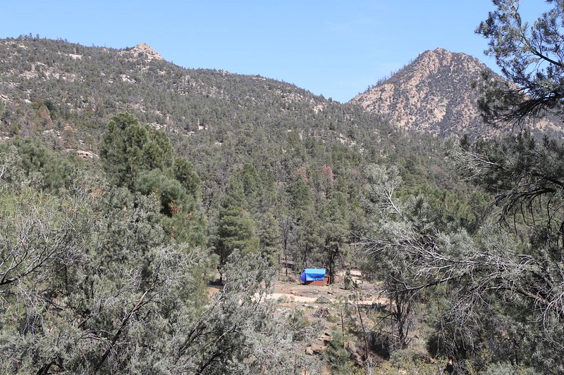
There were campsites along the creek near the dirt road, but it was still fairly early in the afternoon. If I camped there, my day would have been about thirteen miles total. And tomorrow’s hike was planned to be seventeen miles, which was a very long day for me. Once again, I consulted my Guthook App, and checked out the “hiker comments” on the trail just ahead of me. The next official camping spot was 4.6 miles away, which was much too far, and it was uphill, as well. But one comment on that location mentioned an unmarked campsite 2.4 miles further north. That would be 2.2 miles extra for me. And then I would have two fifteen mile days instead! I liked this plan, So I put on my pack and grabbed my gallon jug in one hand and hiked onward, hoping that the person on the app hadn’t lied or done bad math. But once I started up that hill I knew that I was committed.


As I hiked up the canyon to the south, the views got better. Lamont Meadow was down below. It looked like cattle country to me. But not up there on the PCT, where the two miles went slowly. I shifted the heavy jug from hand to hand and trudged on. I kept checking the app for my position, while my eyes were searching from side to side for the promised camping spot. I was getting rather tired. Unlike the trail-hardened thru-hikers, who regularly crank out twenty mile days, fifteen miles is a very solid day for me. My legs and feet were getting tired. And then, lo and behold, the promised spot appeared, exactly where it was supposed to be! Hooray!

I set down the heavy jug, and the even heavier backpack. Then I wandered around the area. There were several places for a tent, but some had more slope, and some had gopher holes, and others had anthills. I decided that a slope was the lesser of these evils, and set up the tent with my head uphill. I was tired enough that I didn’t think I’d even notice it during the night. Then I got the rest of my gear set up, and proceeded to make some salty noodles for dinner. Oh, yeah! That hit the spot. I texted Vicki with the InReach and let her know I was OK. My duty done, I got into my night clothing and hit the sleeping bag before the sun had even gone down. I don’t think I read my book for more than five minutes before I was nodding off. I’d worry about tomorrow when it arrived.
For a topographic map of the hike see my CalTopo Page
For LOTS more photos of the trek see my Flickr Page
 << Back to Day 1 Onward to Day 3 >>

