This was the first day of a solo backpacking trek on the Pacific Crest Trail, heading southbound out of Kennedy Meadows, initially paralleling the South Fork Kern River, then turning inland to camp at Manter Creek (eventually arriving in Walker Pass four days later). This is one of the driest sections of the PCT, and I hiked it during a dry year, but luckily it was early enough in the season that water turned out to be available.
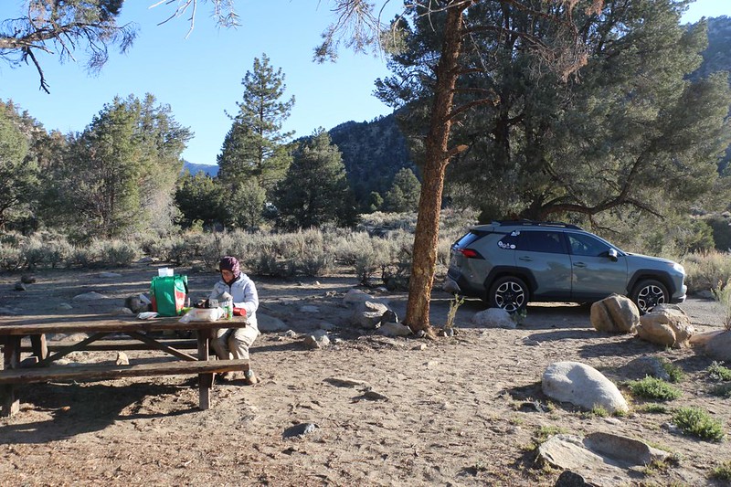
Vicki decided to be my “Support Team” for this hike. She didn’t think that she could make the big miles between water sources on this trek, so she volunteered to drive me to and from the start and end of the route. Thanks, Vicki! And that’s how the two of us ended up spending the night at the Kennedy Meadows Campground. The next morning, I hiked south on the PCT and poor Vicki had to drive home all alone. We were both a bit sad, but not entirely. Vicki avoided hiking on what might be termed a “boring” section of the Pacific Crest Trail, and I would be able to bag the final piece of the 115-mile-long “PCT CA Section G” within the southern Sierra Nevada Mountains. Why? Don’t ask why. It simply needed to get done. And it wasn’t all that boring, after all!

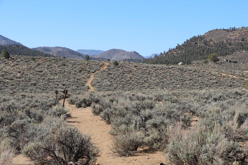
The first few miles of trail stayed within Kennedy Meadows itself. The “meadow” was less like a meadow than dry, rolling chaparral country, but that was OK with me. The air was cool enough that being exposed to the warm sun was desirable, and I was enjoying what could only be called Perfect Hiking Weather. The trail continued south, roughly following the South Fork Kern River, which, initially, remained quite a ways over on my right. But I knew it was there. It was where the trees grew.

The trail drew near to the river after crossing Sherman Pass Road, while the main valley began to narrow. There were a few houses on the east side, some right next to the trail, and each of them were on several acres of land. It seemed like a fine place to live, high enough in elevation to enjoy the full four seasons that much of California lacks. I took a lunch break along the riverside, and watched the slow-flowing water go by. It was Spring, and the snow was melting in the high mountains to the north, but in 2022 it didn’t look like there was going to be a big flooding event.


The day’s hike was about half finished by the time Kennedy Meadows was fully behind me. The river entered a narrow gorge, and the trail did, too. I had plenty of water, so I didn’t bother to get any, but it would have been easy to collect. There were sparse pines in this area, but the hillsides were mostly rocky, with granite boulders all around. Down by the river, the willows were just beginning to bud; they looked more like collections of skinny sticks than the wall of impenetrable green leaves that they would become during the Summertime.


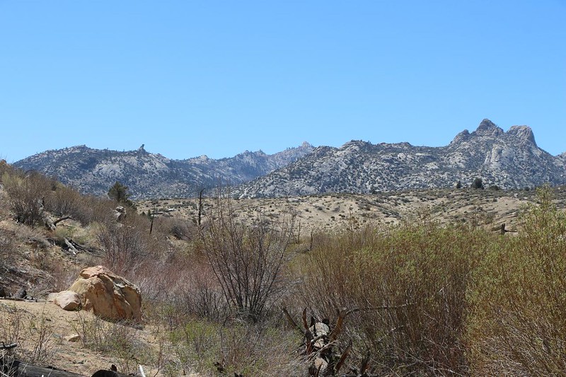
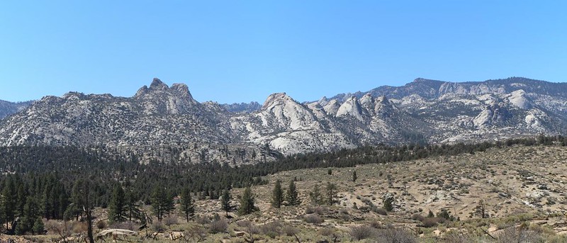
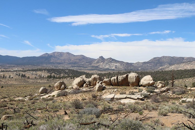
I enjoyed hiking in the gorge, but it didn’t last very long. Soon enough, the walls of the canyon opened up, and the river emerged into the Rockhouse Basin. “Rockhouse” sounds like a music venue, I know, but this one was all about granite, instead. It was also part of the Domeland Wilderness. As I hiked further, the trail rose out of the river bed, and the vista widened to take in the entire basin. The “domes” of the wilderness came into view, and they were truly awesome looking, reminiscent of Yosemite and other glaciated granite regions of the High Sierra to the north. Very cool.


The trail continued directly south, while the river headed further west. Soon, I was high above the main basin, skirting the hills to the east. The views stayed fine the entire time. And, as the afternoon progressed, the western breeze began to blow in earnest.


It was 3pm when I arrived at Manter Creek. As expected, the creek was flowing slowly, but there was enough clear water to collect a gallon for purifying. I had hiked eleven miles in six hours, on an almost-flat trail. Easy hiking.
Along the way, I only met a single northbound PCT Thru-Hiker, which was kind of sad. I had been hoping for more interactions with fellow backpackers, as I was hiking solo. But not that day. He stated that he was one of the first ones of the 2022 season that had started at the Mexican Border. He was planning to meet another fast hiker (trail name: Spear Chucker) at Kennedy Meadows, and the two of them were going to buddy-up for tackling the High Sierra section, which still had snow. Unfortunately, the roads leading into the mountains from the East Side were still closed for Winter, so how could they get a resupply of food? It didn’t look good. But I never found out if they made it, or if they leap-frogged the Sierra, intending to return later on.


I set up my tent in an LNT (Leave No Trace) spot that had seen plenty of visitors. It was sheltered from the wind in there, although the sun was still a bit too strong. I decided to hang out in a shady place nearby and read my book until the tent was shady, too. I sent a text back home via satellite using my InReach, to let everyone know I was OK. Standard procedure when hiking solo. A short while later I got a reply from Vicki, who had made it back home safely.

Later that day, as the sun began to set, I ate my dinner and changed clothing for the night. I expected it to get down into the upper thirties by morning, and was glad that I had plenty of insulation: a 35 degree down sleeping bag, down jacket. down pants, down hat, and even a pair of goose down socks! I felt like a poster-boy for the outdoor industry. Please don’t ask how expensive it was! Only ask how light it was to carry and how warm it was to wear. That’s the true measure of good gear, isn’t it?
The big moon rose into the sky after sunset, lighting up Rockhouse Basin. I checked out the map of tomorrow’s hike, then read my book for a while. I fell asleep to the sound of the breeze going by overhead, but after midnight the wind faded and everything was silent. It was a peaceful night in the Domeland Wilderness.
For a topographic map of the hike see my CalTopo Page
For LOTS more photos of the trek see my Flickr Page
Onward to Day 2 >> 

