On our third and final backpacking day, we hiked on the North Country Trail from our campsite at Beaver Creek to the famous Chapel Rock, passing Spray Falls and the Coves section of Pictured Rocks National Lakeshore, then continued uphill on the Chapel Falls Trail to the trailhead parking area. We then got a ride from our gracious friend, in order to retrieve our car at Hurricane River.
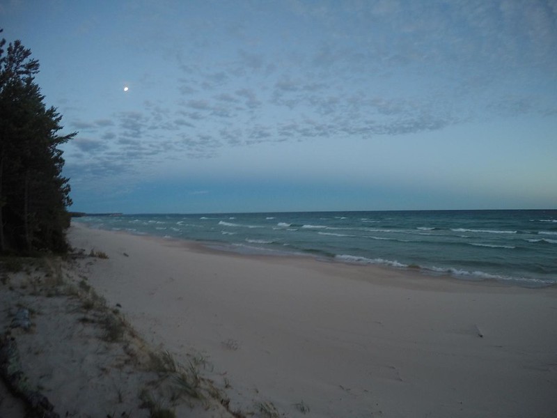
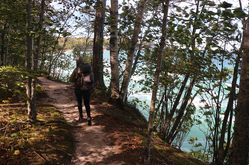
It was a ten mile hiking day, so Vicki insisted that we wake up early, in order to take some extra time to nurse her injured foot along the way. So we woke up in the dark, and left camp (very quietly) at first light, using our headlamps. We headed for the beach initially (the trail led there) and we noticed that the clouds were mostly gone, but wind and waves had not yet let up. It was cold and blustery once again. Oh well. We were used to it by now.

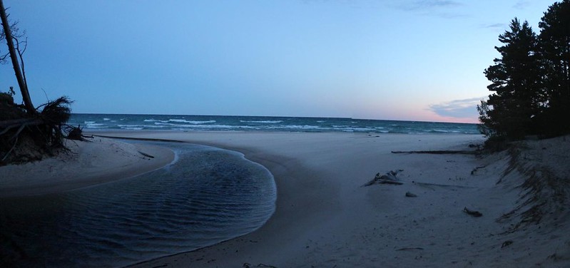

The trail followed along the shore of Lake Superior, just within the forest, and every so often there would be a short trail to the right that led to a viewpoint. We took advantage of most of these, as dawn over the lake was truly a sight to behold. It was beautiful, as you might expect, and we were the only hikers out there at that hour, which made it even better. We were also the slowest hikers out there, so we figured that we should enjoy the solitude while we had it. The others would catch up to us soon enough. Meanwhile, it was flat, easy hiking, and we made decent time.
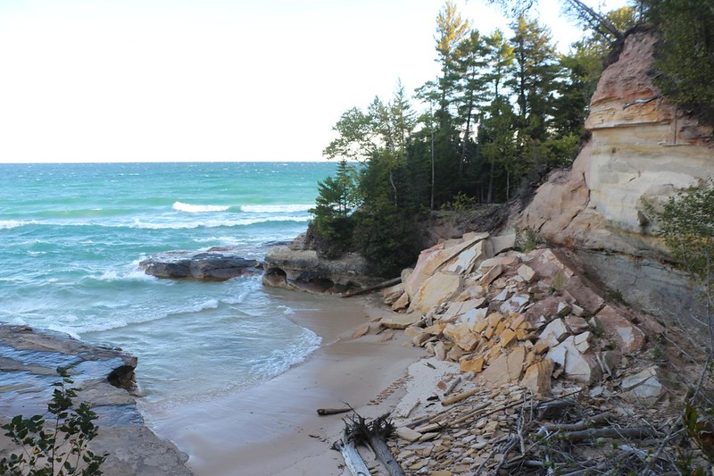
Eventually, after a couple of hours, we made it to the west end of Twelvemile Beach. Yes, it really was twelve miles long! And we knew that it was finished when the trail began to climb. Suddenly, there were sandstone cliffs in front of us, hidden within the forest. They looked suspiciously like the cliffs we’d seen from the tour boat a few days ago. These are what make “Pictured Rocks” the Pictured Rocks! So I took a bunch of pictures of them. Of course. But that’s what I always do. We also simply enjoyed them for what they were.


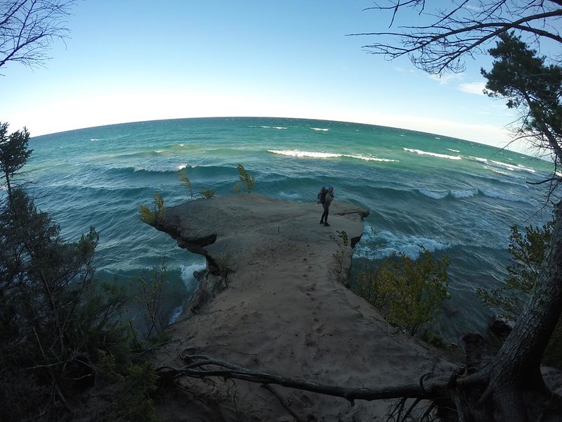
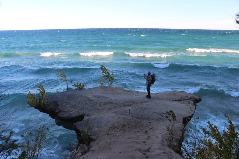
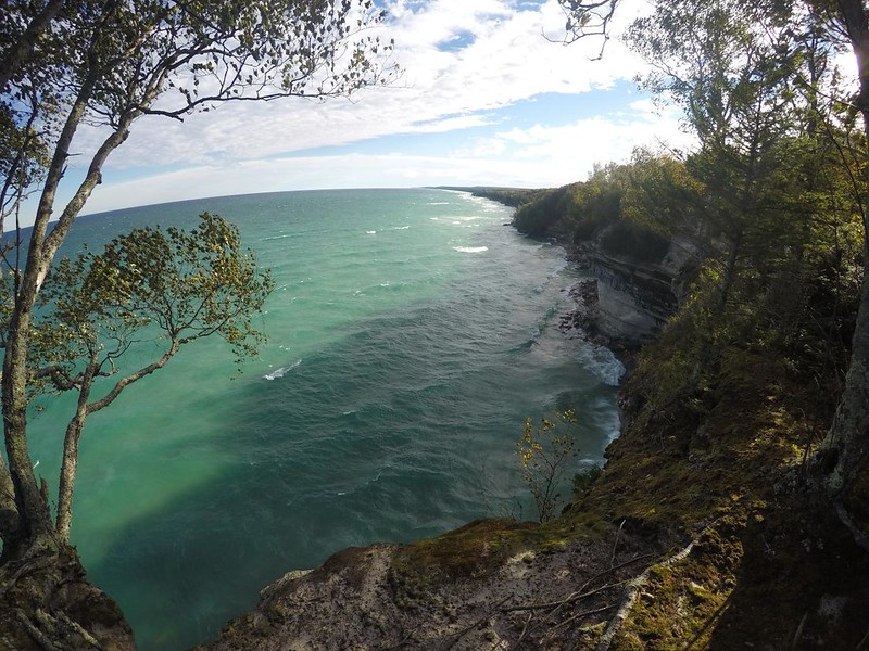
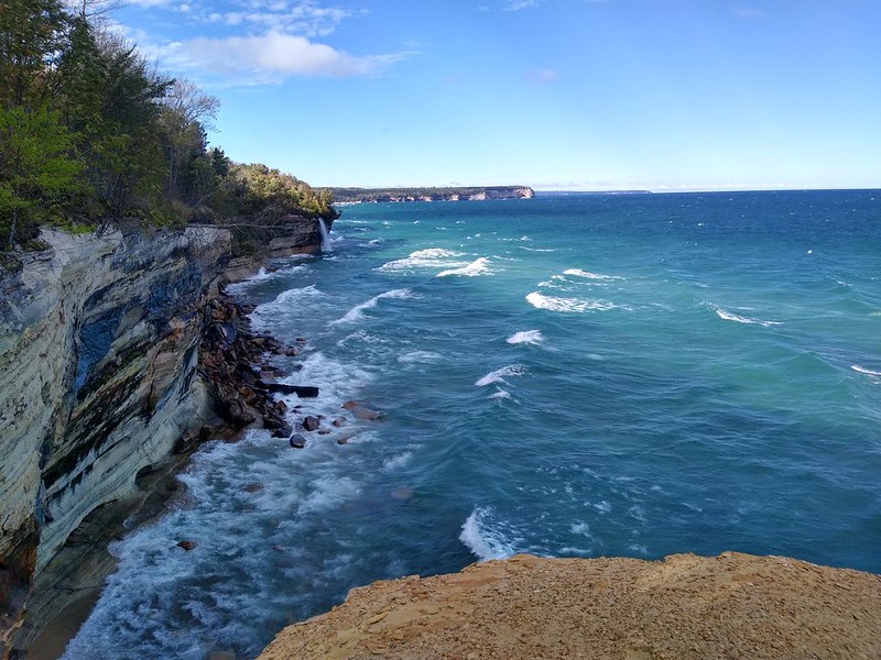
After that, the trail became a lot more fun. The cliffs were now directly on the shore of Lake Superior. And the trail climbed up and down along the top edge of the cliffs. This section was known as The Coves. There were many deep indentations in the coastline (forming small coves) and the big waves from the lake were pounding into them in a most spectacular fashion. You don’t want to know how many photos and videos I took of those wonderful waves. Unsurprisingly, I was glad not to be down there in the freezing water getting pounded on the rocks, and we took extra care of our footing as we hiked. They don’t put safety handrails out here in the wilderness! You’ve got to look out for yourself.
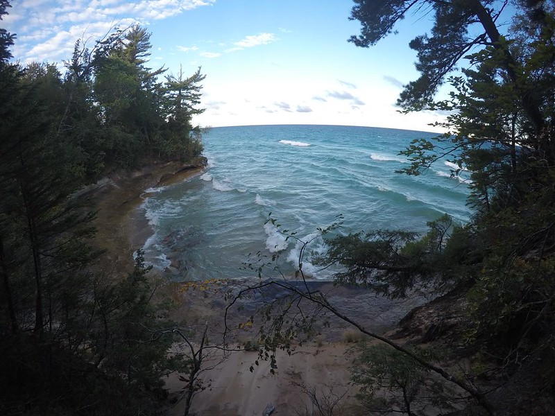


Even though we were warned not to do it, we couldn’t help but walk out onto some of the sandstone spits that overlooked the lake. We knew that they were almost always undercut, and could collapse at any moment. But that didn’t stop us. Especially when a good photo opportunity arose. Still, we tried to control ourselves and only stay in the central areas, far from the edges. Meanwhile, the wind and the waves kept booming in from the north.
The trail also traveled within the forest, but just barely. It rarely went deep enough to stop the wind, which seemed to be blowing much stronger than yesterday.


Meanwhile, the Coves section of the park continued on. We were truly enjoying ourselves along here. After the tame beach sections of the last two days, this area was seriously awesome and wild. And the weather made it seem even wilder. We were having a great time.


Eventually, we made it to Spray Falls, which was the furthest point east that the Pictured Rocks Boat Tour had travelled. We got to view it from the side, which was impressive to watch. The water poured off an overhanging cliff, arcing out and plunging into the lake below.
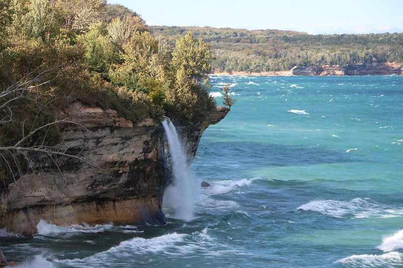
We hurried on, and soon arrived at the top of the falls, where the trail crossed Spray Creek. We put down our big packs and explored all around this area, trying to get a better viewpoint. Somehow, I ended up taking photos of the falls from the top of a seriously overhanging piece of cliff. Not that I could tell from up there. It wasn’t until I got home and looked at the photos that I realized how risky it was. Plus, I should have known that viewing waterfalls from up above is nearly always a waste of time. The best views are from below, or at a distance. But that never stops us once we’re standing next to one!
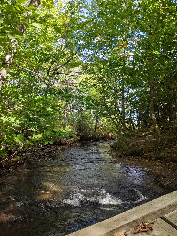
Video of Vicki laughing as she bounces on the broken wooden bridge over Spray Creek
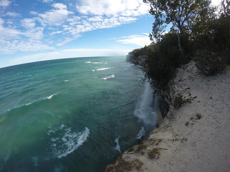
GoPro video of Spray Falls from the top of the cliffs
Video from just above Spray Falls as the offshore winds blew the water back up the cliff toward me

I noticed as we hiked along that there were no tour boats out on the lake that day. The large waves and strong winds would have made for a very distressing boat ride, not to mention dangerous. I thought of the hapless crew, and how nobody really wanted to mop up that much vomit. No thanks! And that made me glad that it was such a calm day when we took our tour.

The highlight of the day was when we arrived at Chapel Rock. This is one of the premier viewing spots within the park. Unlike Spray Falls, this spot was readily reachable by dayhikers, so there were a lot more tourists present when we arrived. It was a bit of a shock after only having rare meetings with backpackers the last few days. The good thing was that one of the them was able to take our photo together!
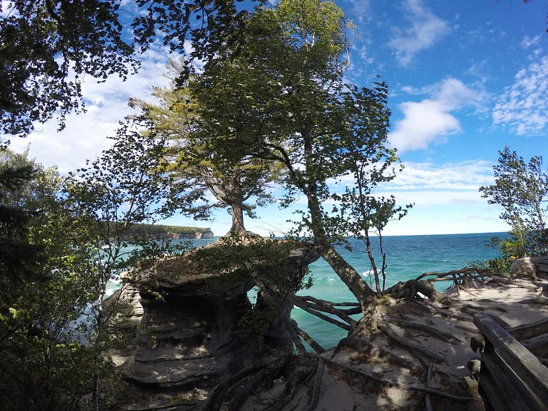


Chapel Rock was featured on the 2018 America the Beautiful National Park Quarter Dollar and it really is quite amazing. A white pine tree is growing on top of a sandstone pillar that was largely hollowed out by erosion, and two massive roots currently connect the tree to the mainland where it gets most of its water and minerals. The original sandstone that linked the pillar to the main cliffs had long since fallen into Lake Superior, making this site not only beautiful, but an amazing survival story, as well. Nature is awesome, as always.


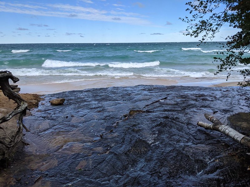
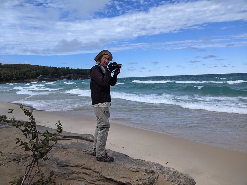
We continued on down the North Country Trail until it crossed Chapel Creek, then went out to Chapel Beach to check out the waves and wind. That chilly breeze had been blowing for three solid days! Impressive. And this was just a tiny taste of what winter might bring. I shuddered to think about it. We took a short break on the beach, as this was where we intended to head inland, leaving the NCT for an access trail.

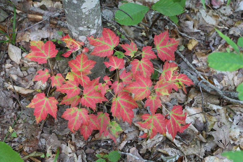
The Chapel Falls Trail headed uphill immediately, and Vicki was not amused. She isn’t a big fan of “UP” and didn’t want to listen to me when I said that it was only two hundred feet of climbing. It was still UP. And she was right, of course. Once we were in the forest, the wind was gone, and we had to stop for a break to cool our feet and eat some long-delayed lunch. That was what we really needed. We renewed our energy, and then hiked onward into the park’s exceptional maple forest.


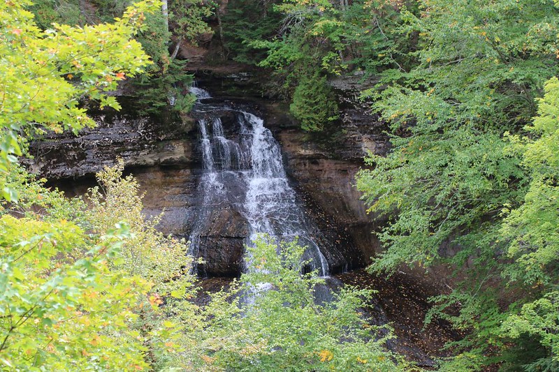
After a mile or so, we arrived at Chapel Falls. Sadly, it wasn’t flowing very strong in late 2021, which had been a very dry year. But it was still quite lovely. There were even more tourists here as it was considerably closer to the parking lot than Chapel Rock. But this didn’t bother us. We were simply happy to check out the falls and know that soon enough we would be back in civilization.

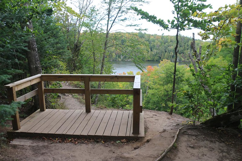
The trail continued south through the forest, not too far from Chapel Lake. Vicki was so tired (and her foot was so sore) that she didn’t even bother to go see the lake on the short side trail. She sent me to take some photos in her stead, while she continued hobbling onward. Poor Vicki. I caught up with her soon after, and we arrived at the trailhead together. Hooray! Our three-day backpacking trip was over!


All in all, we had backpacked 22 miles of the North Country Trail within the park, which was roughly half of the total mileage on the trail. Due to the popularity of the park, we weren’t able to secure additional backcountry camping spots heading further west. We figured to day-hike the rest of the trail. Luckily, our friend lived nearby, and that made it easy.

We didn’t have long to wait at the trailhead parking lot, as our friend was already there, waiting for us. Ooops! Our hiking pace had slowed significantly on that last bit of trail. But there was no real problem. We got a ride back to our car, and then we all headed into town to reap the benefits of civilization, like showers and tasty food. All in all, backpacking in the park had been a wonderful experience, and we were looking forward to checking out more of the park’s sandstone cliffs on our future hikes.
For a topographic map of the hike see my CalTopo Page
For LOTS more photos of the trek see my Flickr Page
 << Back to Day 4 Onward to Day 6 >>

