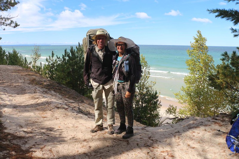
On our second day backpacking on the North Country Trail in Pictured Rocks National Lakeshore, we hiked from the Sevenmile Creek Campground to the Beaver Creek Campground, about six miles total, all of it within the Beaver Basin Wilderness, and we also visited Beaver Lake as a side hike before dinner. All in all, it was yet another easy day of hiking.
Our plan was to sleep late, and just take it easy all day, but for some reason Vicki woke up in the middle of the night and couldn’t get back to sleep. So she decided to wake me up, too! She got it into her head that she wanted to visit the beach right away, as the moon was completely full. I know it sounds weird, but I immediately agreed to this. I only need so many hours of sleep per night, and by mid-September the nights are way too long. So we put on our warm layers and headed out from camp using our headlamps, hoping not to wake the neighbors. And when we got to the beach, I realized that, yet again, when Vicki comes up with a crazy idea, it’s almost always a good one. It was beautiful out there! We took some photos with her phone, as it was good at night shots. Then we stood around for a while as the wind slowly froze us solid. Let’s just say that we hustled back to the tent fairly soon afterward, and got a few more hours of sleep underneath a warm sleeping bag.

Well, we slept a tiny bit late, I’ll admit. Then we started hiking. We only had six more easy miles to hike, much of it in the forest, but there weren’t any real hills to climb as we were paralleling Twelvemile Beach the entire way. We started the hike by visiting the beach first, and discovered that the cold northeast wind was still blowing strong, and the big waves were still rolling in. I timed them. They seemed to be arriving with a four second period, which is quite fast. Wind waves on the ocean are often closer to eight seconds apart. These were short and steep, and this agreed with stories I’d heard about Lake Superior having waves like that. It really does.


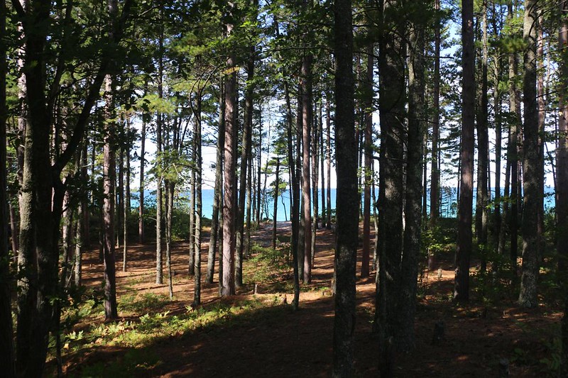
Hiking through the forest was much nicer. It was far less windy, and we really loved walking within the domain of the maple trees. Tall and stately, with low undergrowth, so you could see quite a distance between the vertical trunks. We learned that trees further away from the lake were already turning color for Autumn, but the ones near shore were taking longer. We wondered if this was due to increased moisture or lower temperature. Or both. This was one of those times when it would be useful to have a Personal Park Ranger on hand. Edit: I consulted a Ranger by email, and it’s increased moisture and higher temperature, as the lake spends all summer getting warmer than the average air over land in Autumn; it’s part of Lake Effect weather. We were close!


The trail came back toward the beach after a few miles, and we got to enjoy the brisk weather and waves. The trail was very sandy, which wasn’t surprising as the shoreline was essentially a low sand dune with trees growing in it. We slogged on, but continued smiling. It sure was pretty along there.


We arrived in camp around noon. Quite early! Hiking six miles on flat terrain will do that to you. So I set up the tent and we went inside for a nap. Why not? We were on vacation, after all.

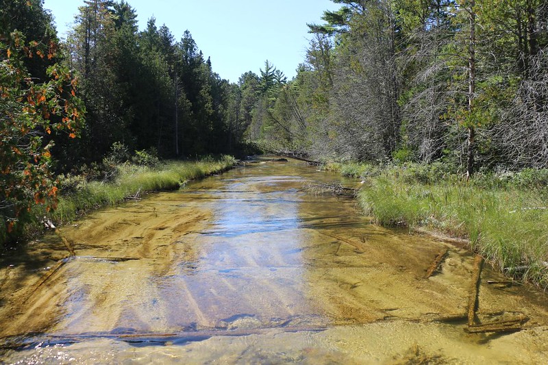
I eventually got bored and left Vicki to sleep in a bit longer. I went down to Beaver Creek and collected our usual two gallons of drinking water. I really liked the old-style wooden bridge across the creek, which was wide and shallow. Supposedly, the water in Lake Superior is quite pure, and I could have gotten our water from there. But not with those gigantic waves! I would have been drenched and hypothermic in no time at all.

When I got back to camp, Vicki was waking up. She was still cold, so we decided to have a hot lunch of ramen noodles, plus our usual tortilla sandwiches. A solid cupful of hot liquid really changed her attitude!

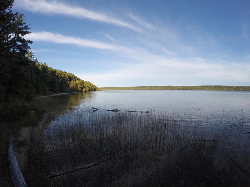
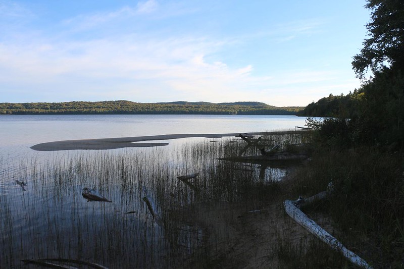
Later on that afternoon, we decided to take a short dayhike to check out Beaver Lake, which turned out to be quite large. It was the centerpiece of the Beaver Basin Wilderness, after all. And a worthy centerpiece it truly was! It looked like it would be a fun spot to kayak, or maybe even to fish. But we had no boat, and no fishing gear, so we simply had to sit up on the hillside and enjoy the view out over the water.
We came back to camp and ate some dinner, then headed back to Lake Superior to check out the views and the beach. I took a lot of photos and videos, as usual. Vicki had fun checking out all the different colored stones she found in the sand. Some of them reminded us of the cliffs we’d seen from the tour boat. I hadn’t been sure what to expect from Lake Superior, but a beautiful sandy beach wasn’t one of them! This was very nice. Now if only the water wasn’t so darned cold…


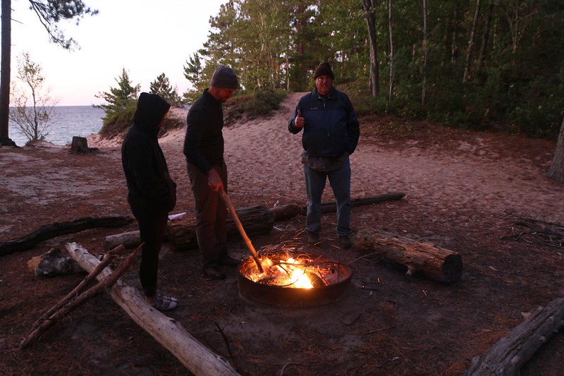
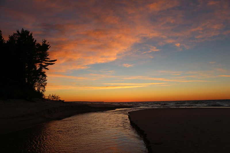
As sunset approached, we climbed up the hill and hung around the campfire ring with a few other backpackers. The wind was blowing off the lake, so we had to be careful of sparks and embers flying out of control. Despite the breeze, we still enjoyed the heat of the fire, and stayed there until the sun went down in a blaze of colorful clouds.
We headed to bed after that. It was a bit too cold to hang out into the night. Plus, we had a long, ten-mile hiking day planned for tomorrow. Vicki wanted to get up early, to get a head start, because she knew that her foot was going to give her trouble with that extra mileage. And I was OK with that. Long nights are too long, and I’d rather be hiking anyway.
For a topographic map of the hike see my CalTopo Page
For LOTS more photos of the trek see my Flickr Page
 << Back to Day 3 Onward to Day 5 >>

