On our second day hiking on the North Country Trail in Pictured Rocks National Lakeshore, we backpacked west from Hurricane River to the Sevenmile Creek Campground, hiking in both the forest and along the shore of Lake Superior, checking out Twelvemile Beach, for a total hike of six miles. Interestingly, the weather had changed, and a strong, cold northeast wind was raising large waves on the lake, which was quite exciting.
This was the first day of a three day backpacking trip that we had hastily planned a few days ago. But now we had our permits, so we left our friend’s house in the morning for Hurricane River. We would ask for a ride back to our car three days from now.

It was cold and blustery on the shore of Lake Superior when we walked down to the beach at Hurricane River. We were wearing our goretex raingear as windbreakers, and we were also wearing winter hats and gloves. And it had been so warm and calm a day or two ago! What a difference it was. Big waves were crashing on the beach. We were feeling the cold northerly breeze that was roughly the same temperature as the lake. In other words: Fifty Degrees, not a balmy seventy-plus. Brrr! But we were prepared for cold weather, and even rain, so on we hiked. We weren’t going to let a bit of chilly wind get in the way of our planned hike. Not at all.

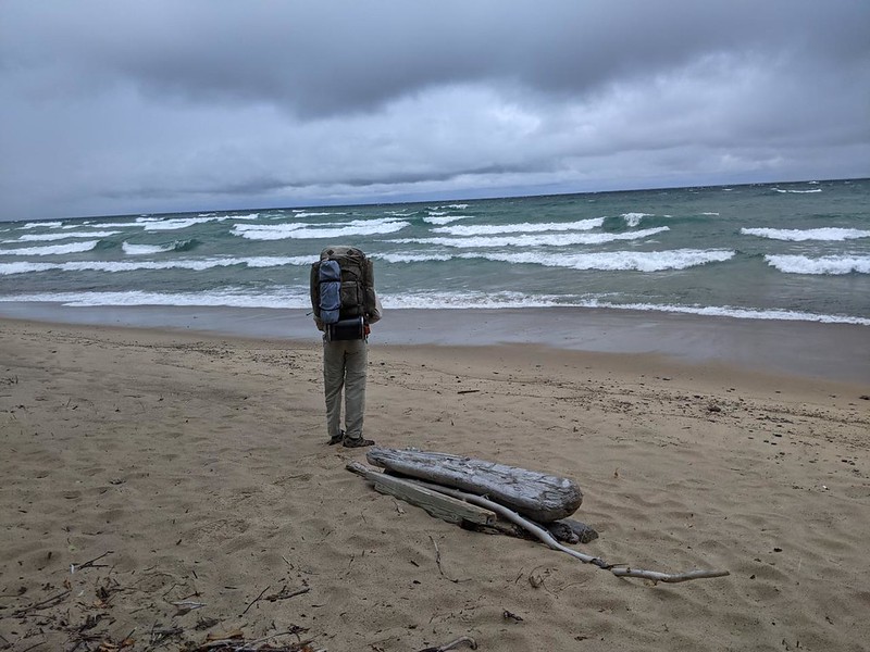
Luckily for us, the trail didn’t stay entirely on the coastline. The wind was strongest near the beach, but a lot weaker within the forest. We hiked along, and the terrain was relatively flat. This section of Lake Superior shoreline was called Twelvemile Beach, and it really was a beach that was roughly twelve miles long. Easy hiking, in other words.


Soon enough, we made it to the Twelvemile Beach Campground. This was a car and RV campground, not a backpacking version, and the North Country Trail went right down through the middle of it. It had to, because the road was the trail. It looked like a good spot to camp with ones family, and it wasn’t even full this late in the season. But that wasn’t part of our plan, so we hiked onward. Meanwhile, the wind blew cold and strong, and we kept our gloves and hats on.

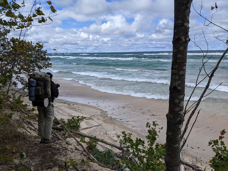
After the campground, the trail continued on, just above the beach, directly along the shore of the lake. The right sides of our faces began to feel cold and wind-burned. Especially our ears. Eventually, we decided to head inland a bit and took a long break for lunch behind a low rise. That was enough to take the pressure off. It was quite a relief!


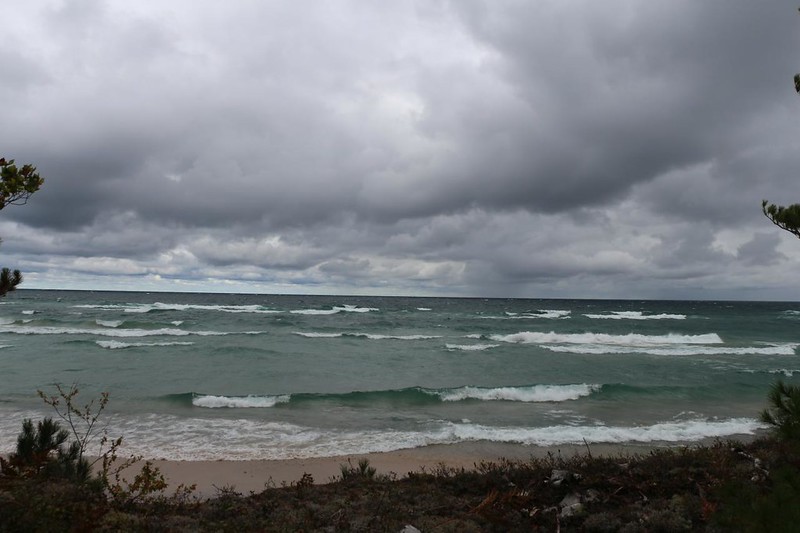
The cold front continued to blow through, and we hiked onward. We received a few spatters of raindrops from one particular cloud, and then the weather started breaking up a bit. Unfortunately, the wind never let up, and it may have gotten even stronger!

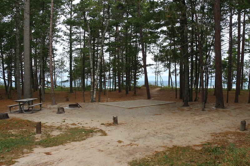
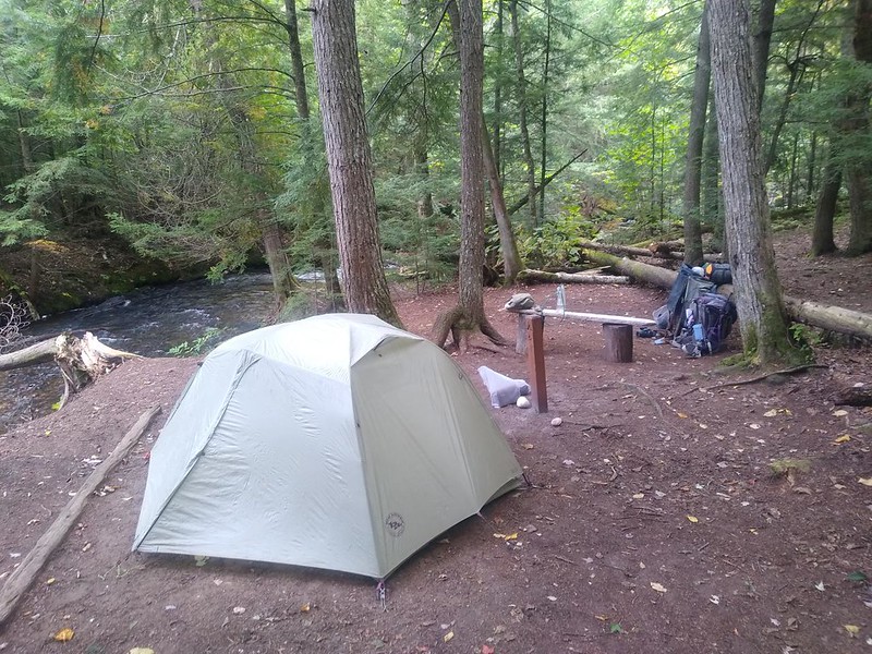
Before we knew it, we were at Sevenmile Creek, our destination. There was a group camp on the east side of the creek, but that wasn’t for us. We were in Campsite #5, according to our permit. So we crossed the creek on a nice new bridge and headed upstream to our spot. It was far back within the forest, and the wind was absent. We checked out the campground and discovered that there was a central bear-resistant food storage box, as well as a firepit with seating around it. Very nice. It reminded us of the backcountry campsites in Banff NP up in Canada, where the central fireplace gave campers an opportunity to meet each other and socialize, rather than the usual solitude. We decided to check it out later on.


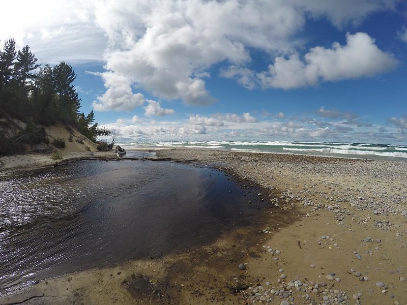
Later that afternoon, the clouds really began breaking up, and there were loads of puffy cumulus clouds dotting a deep blue sky over Lake Superior. Perfect photo conditions, in other words. So I took a ton of photos and videos. It was my duty, after all.


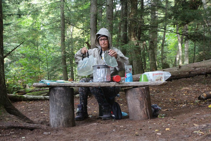
Hunger and cold drove us back to camp. Vicki whipped up some dinner, and we ate it happily, then hung out in the tent with our legs under the sleeping bag while we read our books. When evening came, we headed back down to the fire ring and had fun talking to our fellow backpackers. Good times.


We took one last walk out to the beach and enjoyed a chilly sunset. It was quite pretty with the clouds scudding by, and the waves crashing on the beach. Then we headed off to bed, but not before warming our chilly buns by the fire one last time!
For a topographic map of the hike see my CalTopo Page
For LOTS more photos of the trek see my Flickr Page
 << Back to Day 2 Onward to Day 4 >>

