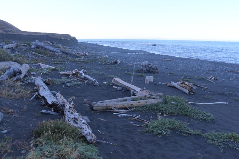
We woke up fairly early at Kinsey Creek after a restless night of random, gusty wind blasts. But at least the frequency moderated after midnight, so we woke up feeling fine. The sea was no longer covered in whitecaps, and the skies were clear. It looked like it was going to be another hot day, which was unusual weather on the Lost Coast Trail. We ate breakfast and packed up our gear, making sure that we didn’t lose any tent stakes in the deep soft sand. Then it was time to hike!
We had about four and a half miles to hike that day, so we weren’t too worried about rushing it. That’s just one advantage of spending an entire week hiking this 25 mile trail. The main advantage, of course, is spending even more time checking out (and relaxing on) a remote beach in California! We were loving it.
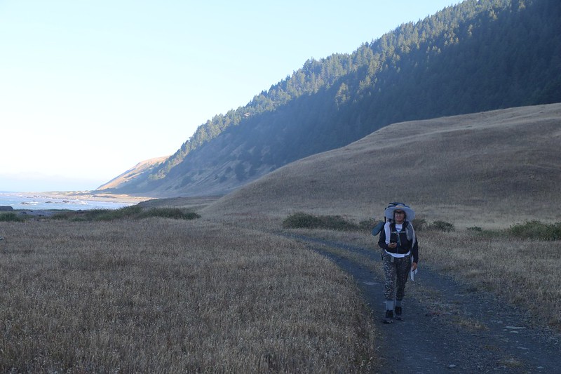
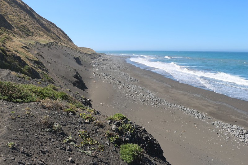
We decided to take the dirt road southbound from Kinsey Creek, rather than the soft sand along the beach. But we knew we’d be at the shoreline soon enough, as the road led to yet another private home. This inland trail is technically the official Lost Coast Trail, which we had been avoiding whenever possible thus far. We preferred the beach. But this road turned out to be easy hiking, and it was wide, with no poison oak. That was a big plus.

When we reached the property line we headed back down to the beach. This time, it turned out that someone was home, and they were just leaving in their truck. This building was very well maintained and upgraded. Having a good road to get there certainly helped.
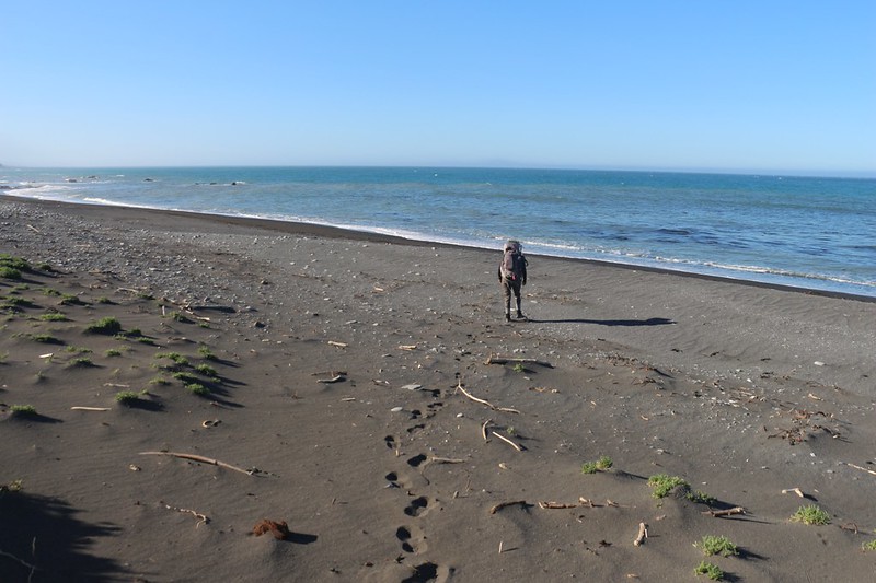
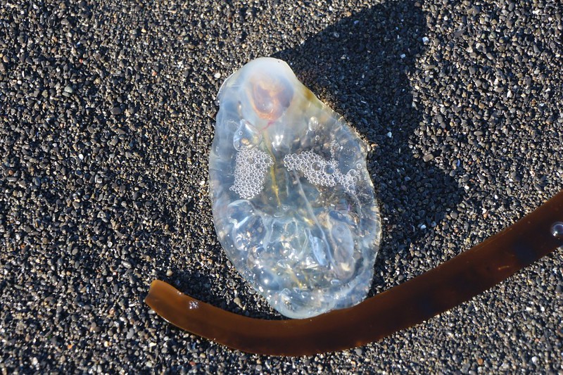
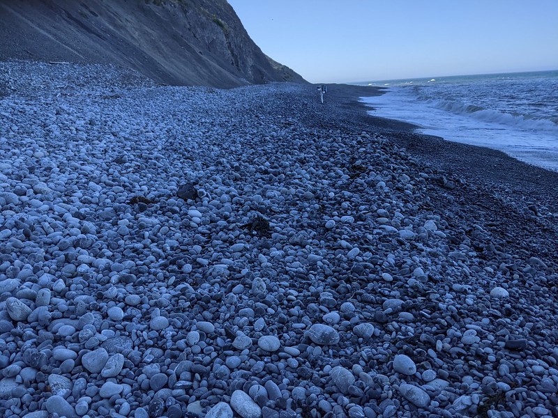
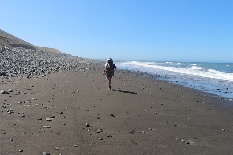
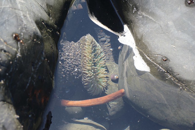
After the winds of the day before, all the footprints on the beach had drifted over and erased themselves. It was like hiking on new territory. It was still cool in the early morning, and we witnessed a phenomenal swarming of sand fleas (beach hoppers) that were feeding on anything organic that had washed up on the beach. I’m not sure, but they must’ve been a temporary local phenomenon, because we never saw any others the entire hike. We also discovered some strange clear jelly-ish invertebrate, but I didn’t know what to search for on google here at home in order to identify it. If anyone reads this and knows, please drop me an email or leave a comment. Is it an egg of a much larger animal? It was over six inches long.
Video of large Sand Fleas (Beach Hoppers, amphipods) that were all over the beach in the cool of the morning
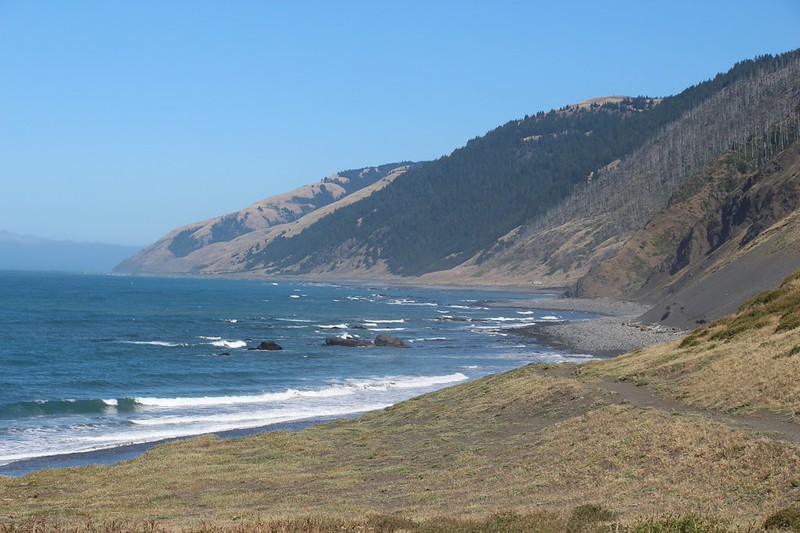
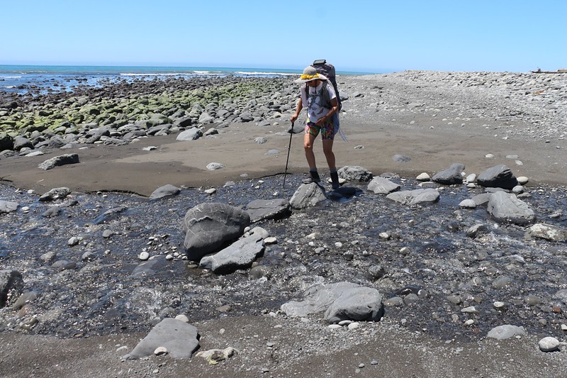
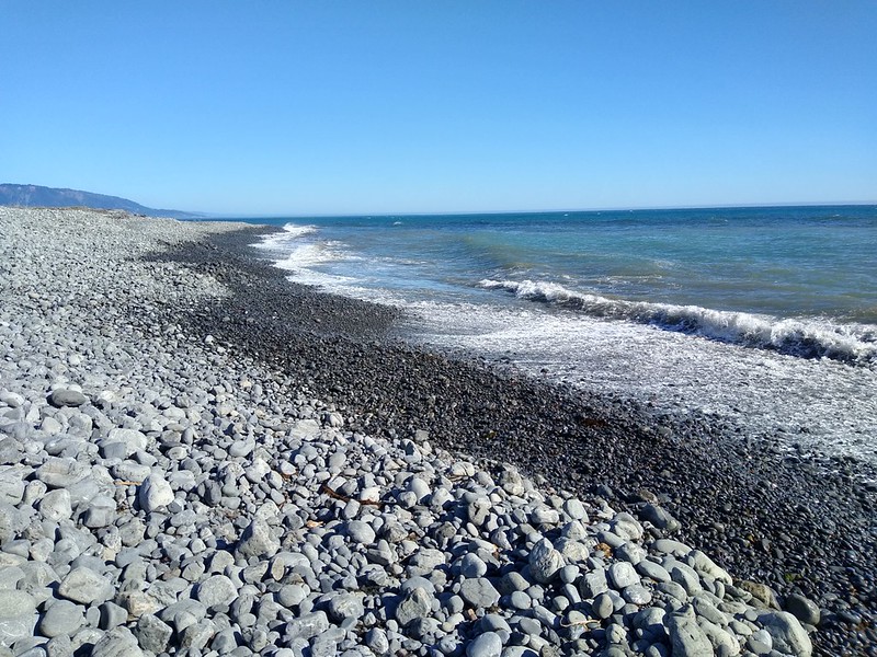
We enjoyed walking along the beach. It kept changing character. Sometimes it was smooth packed sand, sometimes loose gravel, other times fist-sized stones, and occasionally large rocks. Sometimes the slope was flat, and other times it was steep and difficult to traverse. Quite a variety of hiking surfaces.


Big Creek was the intermediate campground between Kinsey Creek and Big Flat Creek. On my map, it showed a trail that led inland along the creek to a labelled campsite, but we didn’t feel like walking in there. It was way too hot already, and our only hope of staying cool was to remain near the ocean. Now that I’m home I regret not checking it out more thoroughly while I was there. Oh well. Maybe next time.
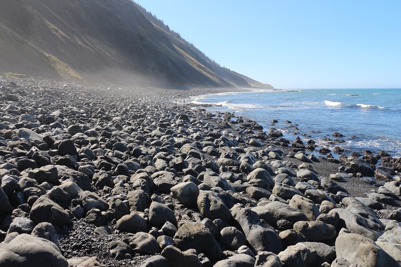
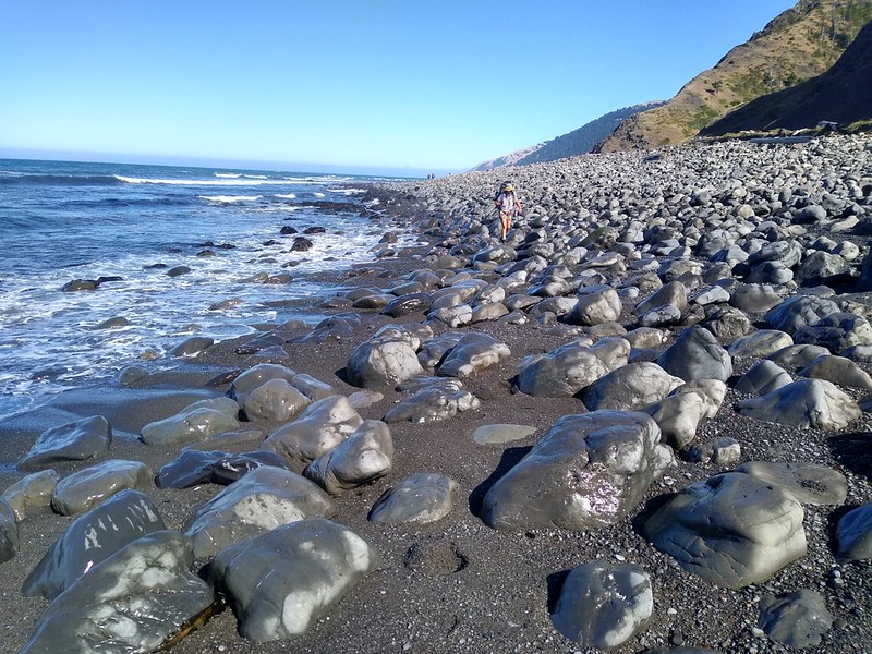
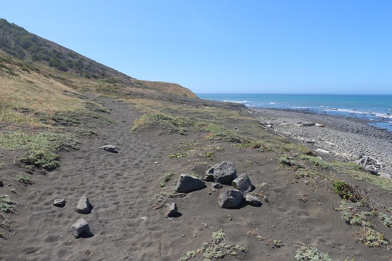
There were a lot of big boulders south of Big Creek, and they became tiresome. It got so bad that I decided that hiking on soft, slogging sand was preferable. That’s when I climbed up near the edge of the bluff and took to the official trail. The good part was that it climbed up high so that I got better views. The bad part was that it climbed up high. So I went back down to join Vicki, who had no interest in climbing at all. We listened as the surf rattled small stones, sending them clicking into one another. And we were hoping to find out later today about the larger rocks that we heard would be knocking loudly on the beach near Big Flat.

Panorama video of the waves breaking on a sandy beach
Just the same, the good views up higher called me. Or maybe my camera dragged me up there. Either way, I left Vicki down below and climbed up high on the main trail once again. And I wasn’t disappointed. I got some great views back north before I headed back down to join her again. Let’s be honest: It was really hot up there.
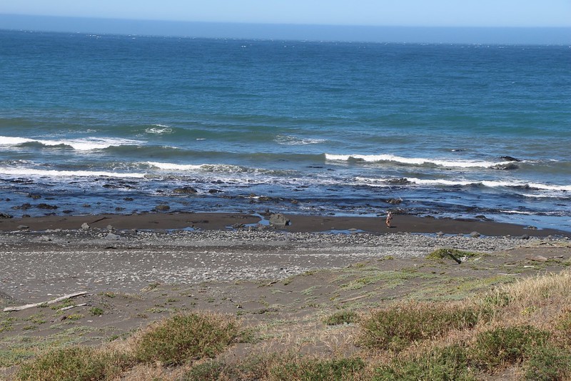
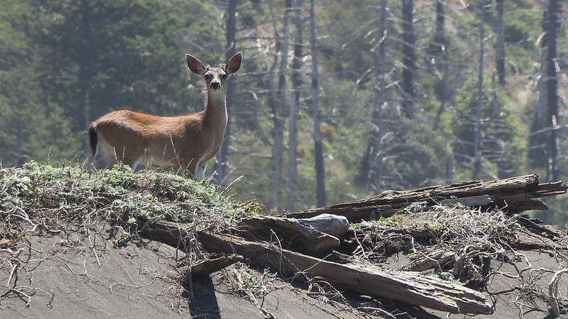
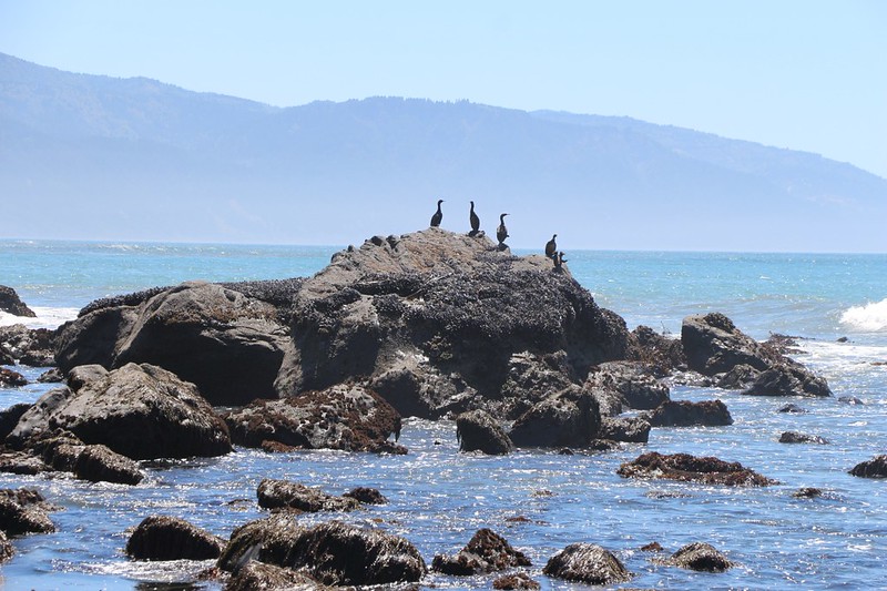
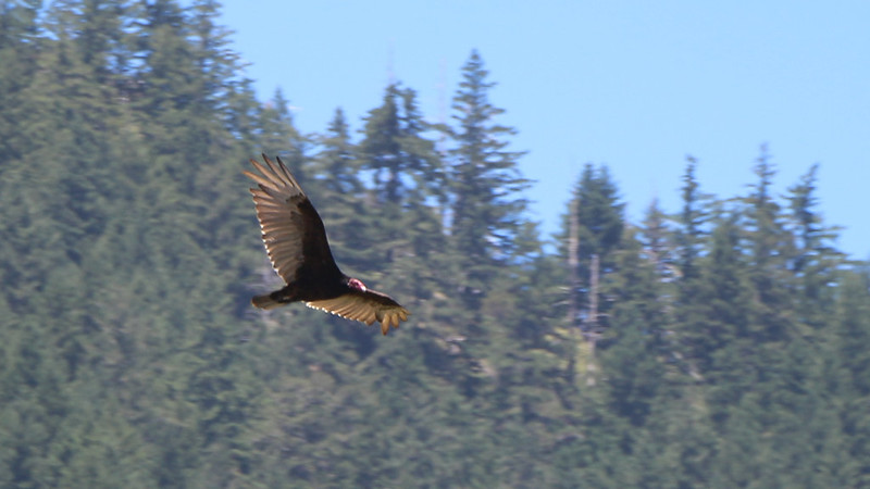
As we hiked along the shore, we came upon all sorts of marine life. The areas with tidepools really slowed us down, as we peered into the calmer depths. There were also deer, and seabirds roosting on rocks just offshore. And even a vulture flying by! We figured that he must be gorging himself on all the dead sea creatures that were constantly washing up on the beach.

Video of quiet tidepools at low tide as the waves were breaking further out on the coastal rocks


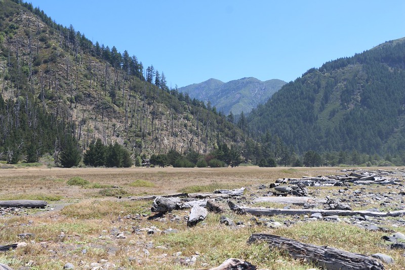
We neared the point at Big Flat around noon, and decided to have some lunch. We climbed up on the flat and found some campsites within rings of driftwood logs, and sat down and ate on one of them. I checked out the map on the GPS, and it showed an airstrip running north-south along the grassy plain. We also spied a large two-story house back near the hillside within some trees.
After a good long break, we decided to give the inland path another look-see, but discovered that it had far too much poison oak overgrowing the path for our liking. Vicki is hypersensitive to poison oak, so this was an absolute no-go. We turned around and headed back to the trusty beach. Then we continued south until we met up with Big Flat Creek.

On the south side of the creek the grassy plain was known as Miller Flat, and we’d heard that the best campsites were located there. So we headed for shade under some low trees and took off our backpacks in a decent campsite. Then we wandered all over Miller Flat looking for the best possible spot. As it turns out, we didn’t take the truly best spot, which was under a large spreading oak tree. Once again, we opted to camp near the beach and the surf. We were hiking the Lost Coast Trail, after all, not the Lost Forest Trail. Once a decision was made, Vicki took a well-deserved nap in the shade while I went out in the sun to set up the tent. Somebody had to do it.
A short while later Vicki woke up, feeling refreshed, and we headed for the campsite. Vicki wanted to do some laundry right away, so it could dry in the sun, and that was our first order of business.


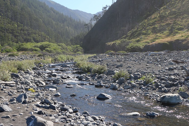
We hung out inside the tent in the shade for awhile, but it was still too hot in there, even with the extra sheet of cheap mylar space blanket under the tarp (yes, this really works!). There simply wasn’t enough breeze. This was frustrating, after the howling winds we had yesterday. So I got up and took some photos and videos of the waves, just to get closer to the cooler ocean. And, yes, the big rocks on the steep beach really did knock together in a wild percussive frenzy as the waves retreated, sucking away at the stones. Very cool. After that, we took a walk up Big Flat Creek and found a good spot to filter some fresh water. Then it was back to the tent again.
Video of waves breaking and the sound of large rocks knocking on the steep beach

But we couldn’t stay in the tent very long. The heat grew oppressive. Such unusual weather for the Lost Coast. But we couldn’t change it. So Vicki decided to take a dip in the creek. There was a fairly deep pool nearby, and she waded out into it, but it was much too cold, even with all this heat. Just the same, she got cooled off, and maybe even a bit cleaner. I was a wimp and merely washed my hair from the shore.


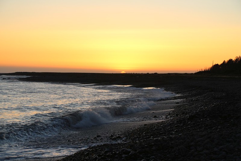
As the sun got lower in the northwest, the shadows grew longer and the air finally got cooler. I sat outside in the shade of my own backpack and read my book. Eventually, Vicki cooked up some tasty dinner, and we hung out some more, just listening to the surf and relaxing with our books. After a while, we got up and walked over to the beach. We watched the sun set while the waves repeatedly knocked the rocks down below us.
Afterwards, we headed off to bed and got out the map. Tomorrow was only going to require 3.4 miles of hiking. A super easy day. We hoped that the heat wave would finally break, but we weren’t taking any bets on it.
For a topographic map of the hike see my CalTopo Page
For LOTS more photos of the trek see my Flickr Page
 << Back to Day 3 Onward to Day 5 >>

