Day 3 Summary: Hike over Gem Pass (elevation 10477 feet), then head off-trail to the ledge above Waugh Lake.
Up at this elevation, 10600 feet, our beautiful summer day started out with frost on the tent. Brrr! But we got up early anyway, shivering with cold, because we knew we had to do quite a bit of bushwhacking later on. Our planned camping spot was somewhere high above Waugh Lake, and there were no trails leading to that area.
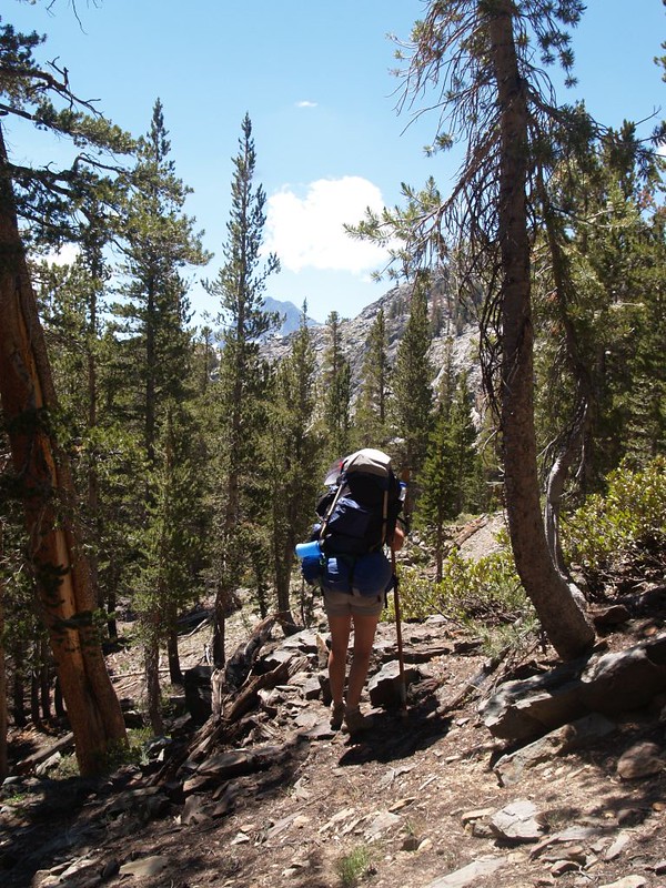
Why did we want to go there? Well, the answer was simple: To avoid losing another 1000-plus feet of elevation heading down to Gem Lake (already known to be mosquito-infested right then per reports from other hikers) only to have to immediately climb and regain it yet again on our way to the Pacific Crest Trail just south of Donohue Pass. Please understand that this was entirely Vicki’s plan. True, she hated the lack of air at high elevation but she hated climbing uphill to reach it even more. So she decided that we could leave the trail just after Gem Pass, and maintain elevation the whole way west to the PCT, staying at roughly 10000 feet the entire time. No wasteful downhill, no agonizing uphill, but plenty of unknown bushwhacking and adventure. At first I tried to argue against this madness. But then it dawned on me that this was something that I could only dream of doing. This was what the High Sierra is all about! A-bushwhacking we would go!

The day started out pretty badly, however. There was frost on the tent and it was cold down in that valley, with a chill breeze flowing downhill, directly from the snowy slopes above us. Since we had a big day planned, we couldn’t stay in bed, warm and cozy, but had to get up at the crack of dawn. We got dressed and went outside. Vicki started breakfast while I checked our laundry, which hadn’t finished drying the day before. And it didn’t dry overnight, not with frosty conditions. We weren’t looking forward to putting on damp clothing, but we eventually had to do it anyway.
But that wasn’t all. While I was deflating the new air mattresses, I accidentally pushed down against a sharp rock underneath the tent. That evil rock tore holes in the tent’s groundcloth, the tent’s floor, and, worst of all, my own air mattress! I stared at it in shock as all the air whooshed out in a mere moment. No! This couldn’t be true. Please let it be a dream, I thought. But it wasn’t a dream. I turned over the limp mattress and saw a large gash, over an inch long! And then I saw the damage to the tent, which was sad, but not as sad as the mattress. I was so sad that I was ready to hike back out to the car rather than sleep on the cold hard ground for the next seven days. I thought about trying to share a single mattress with Vicki, but it was bound to fail. That strategy might have worked in a single bed at home, but these things were only twenty inches wide. Barely room for one. And then I remembered that they came with a patch kit! So I got busy right away. This took top priority over everything. If I could fix it, we’d hike on, but if I couldn’t, we’d hike out. It would make or break the entire trip. And the repair turned out to be a saga of its own. My first attempt failed miserably, as I didn’t apply enough glue (never having done this before), so it dried out too soon and the patch didn’t stick well enough. I was ready to give up at that point, but then I got angry. This insolent patch wasn’t going to defy ME! So I gobbed on the glue and smeared it lavishly all over both the patch and the mattress. I applied the patch and smooshed it down, rubbing out any air bubbles that may have been trapped underneath. Then I put all my weight down on it and kept it there for a solid fifteen minutes. I got out my book and started reading it to pass the time. Then I inspected the patch. It seemed OK, but would it peel off along the edges? I was worried, so I got out my emergency electrical tape and used most of it covering the edges. I was satisfied at this point with how it looked, but would it hold air? I didn’t dare test it. The gobs of glue under there might still be wet. But it didn’t matter. I took a deep breath and decided to pack it away untested. We would hike on! And find out later whether it worked.
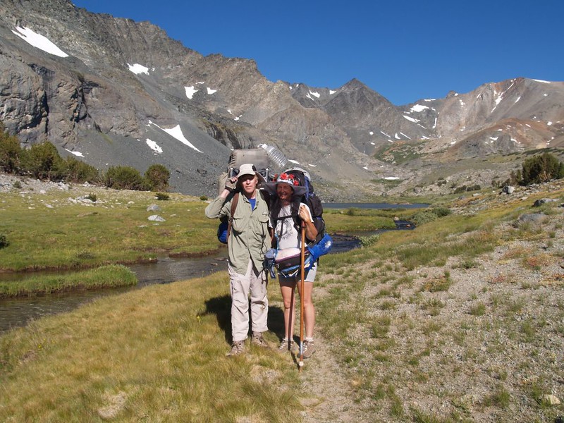
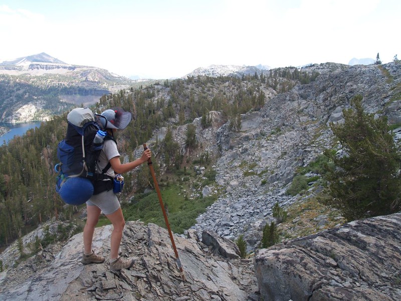
It was sunny by the time we got hiking. I did a pretty good job of forgetting the air mattress as we walked along the fisherman’s path near the shore of the lake. And, let’s face it, it’s hard to be sad when you’re surrounded by so much natural beauty. We met some backpackers who’d spent the night near the short stream between lakes 10610 and 10607, and one of them took a photo of us with Koip Peak in the background. Thanks!
Panorama video of Lake 10610

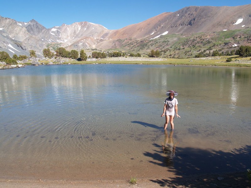
We continued onward, crossing the outlet from lake 10607, then climbed uphill out of the basin, where we discovered a fine view back toward the Alger Lakes. Yesterday, when doing the laundry, Vicki discovered how cold the lake water was, and didn’t dare to take a dip. Up on this rise, however, we discovered a smaller, shallow pond. Maybe this would do! It had no snowpack melting into it, much like the lake she swam in last August. Plus, it had a nice sandy bottom, not mystery-muck. So, she took off her shoes and waded out, but she only reached her ankles. It was way too cold!

After that, it was time to do some easy hiking. We mosied along past small ponds, and checked out beds of flowers. The view kept changing, as well. At first the trail went downhill, which was great, but then it went back uphill again, and Vicki started getting mad. Her entire plan for the day was based around the idea that we would stay at a constant elevation. I tried to tell her that this wasn’t realistic when you’re hiking in the mountains, but she didn’t want to hear me. I wisely shut my mouth, and took some pictures, instead. We passed a couple of even tinier ponds, but they looked muddy-bottomed, and Vicki gave up on the idea of getting clean, for now.

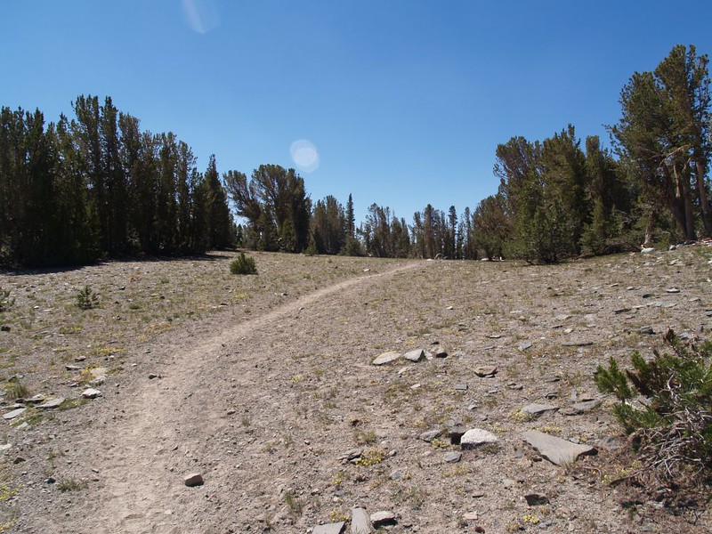
Eventually, we topped out at Gem Pass, at 10500 feet elevation. It was a very boring pass. It was broad and flat and had too many trees to allow for views. We took only a quick break for some snack and a cool-down, then shouldered our packs and began the descent toward Gem Lake. The lake itself was 1500 feet below us, but we wouldn’t go there. Our plan was to leave the trail at Crest Creek (named, presumably, for its position at the southern end of the Koip Crest). The trail crossed the creek at the 10000-foot line, so we still had to lose 500 feet of our hard-won elevation. As we dropped lower, we were finally rewarded with some new views to the southwest, toward Banner Peak and Mount Ritter, but they didn’t last long as we neared the larger trees growing by the creek.

Video of Crest Creek
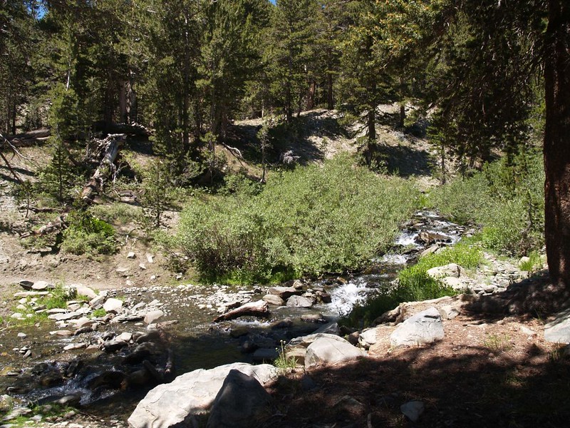
We took a longer break at the creek and got out the map. Cross-country travel requires preparation to avoid getting lost. Or, in Vicki’s case, to avoid excessive elevation gain. We planned to side-hill along at roughly the 10000-foot level, visiting two small lakes on the way to our final spot high above Waugh Lake. As is always true with such endeavors, we only had maps, topo-lines, and Google Earth to guide us when planning this. It was entirely possible that actuality of the upcoming terrain would make hiking extremely difficult or even dangerous, at least in spots. Most of it would probably be easy enough. And that’s pretty much what we discovered.
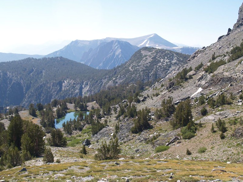
We made it to the first (unnamed) lake with no real issues. Our biggest problem was remembering to look down at the ground under our feet as the scenery was beautiful. Back at the creek, I had calibrated the compass on my GPS and it flawlessly lead us to the lake with only occasional checks to ascertain our progress.
We took a long lunch break at this lake, enjoying the sunny day and the peaceful water. Puffy cumulus clouds drifted by after forming over nearby peaks. We weren’t worried about late-afternoon thunderstorms. Not yet, at any rate. We couldn’t stop them anyway, so why ruin our appetites? Instead, we got out our books, found some comfy spots along the lakeshore, and relaxed. This was what summer vacation was all about!

Panorama video of the small lake we discovered on our cross-country hike

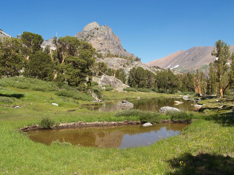
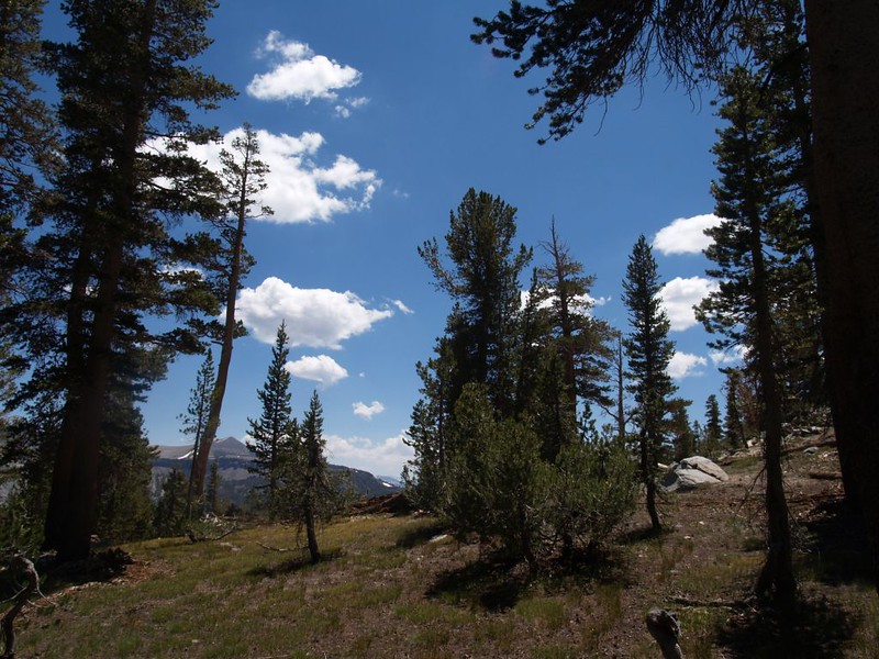
We packed up and began hiking, heading for the next lake. We were close to treeline at this altitude in the Sierra, so the views were often excellent. Trees typically grew in protected areas near water, and on land that wasn’t too steep. We headed south, trying to stay level, but there were steep sections with lots of loose rock in that direction. So we stayed above the loose rock, and gradually ascended a ridge. This was exactly what Vicki hated: We were hiking uphill! But this was also exactly what I had been worried about: That the actual terrain would prevent us from staying level. So we kept on trying to find a path down toward that second lake, and kept getting driven higher and higher.
Vicki finally had had enough. She made one last try at avoiding the uphill, and we discovered a bowl of steep, loose rockfall. Vicki insisted that we cross it. I insisted that it was too dangerous, that if a rock slipped underfoot one of us might get injured, and meanwhile we were miles and miles from help. Why couldn’t we just climb up and over this little bump on the map? True, we’d be missing the second lake, but after that short climb the rest of the day would be downhill. We hiked back and looked at the way up. It was seriously steep, all slabby granite. Vicki said that she couldn’t carry her pack up there. She didn’t have the air or the strength. We were at a stalemate.
So I asked her “Can you make it up there without your pack? I’ll carry it for you.” She looked at me like I was nuts. “I’ll try it with my own pack first. You wait here. I’ll go up and check it out, and see if it gets any worse up there. If it looks good I’ll leave my pack and come back down to get you.”


I was breathing heavily and my heart was pounding after the steep climb, but I wasn’t ready to stop. The slope immediately became easier and I could see the horizon not far ahead just above what the map said was Peak 10462. I put down my pack. This was the route. I decided that if I absolutely had to I’d even carry Vicki up here. That’s how nice it was.
So I went back down and talked to Vicki. She was extremely skeptical. She didn’t like the looks of that slope at all. So I picked up her pack and put it on. It wasn’t until I promised to hold her hand and help her the entire way up that she relented. And it wasn’t easy. We paused several times while she caught her breath. But it wasn’t as bad as she had thought, either. In fact, it was over before she knew it.
We both put on our packs and walked the last bit up to the top of the peak. And the views from there were glorious! There were huge peaks all around us, there were deep blue lakes below us, and there were dark clouds forming in the sky behind us. It looked like we might be in for some weather. But we didn’t care. This was great! I took tons of photos. We had some snack. I checked out the map and found the names of the dominant peaks to the south (Banner and Ritter).
Wandering around, I found a wooden-handled hammer lying on the ground! Well, so much for dreams of being Sierra Pioneers! This was incontrovertible evidence that we weren’t the first ones to summit this peak. But I should have known, anyway, as the peak was numbered. It meant that a surveyor probably came here long ago, to map the surrounding countryside. I looked at the hammer and hefted it. It was heavy! What kind of maniac would carry a hammer up here, way out in the middle of nowhere? But we’ll never know why. Normally, I consider it a duty to carry out litter that I find in the otherwise-pristine wilderness. But a hammer? It was far too heavy to carry for another week. And was it really litter? Maybe not. Technically it was a tool, and it was still in good shape. So I set it on top of the biggest boulder on the peak. Maybe a later adventurer would find it. And possibly be crazy enough to carry it back to civilization. Good luck with that!

360 degree Panorama video from Peak 10462


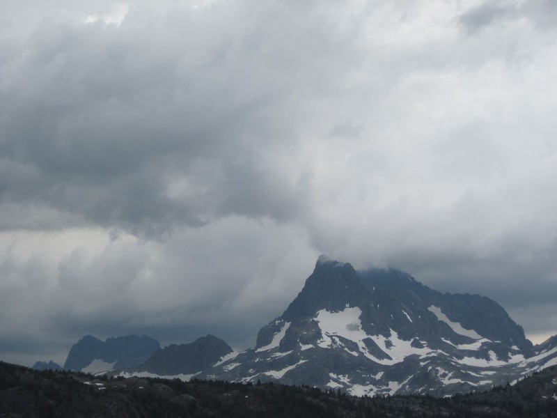
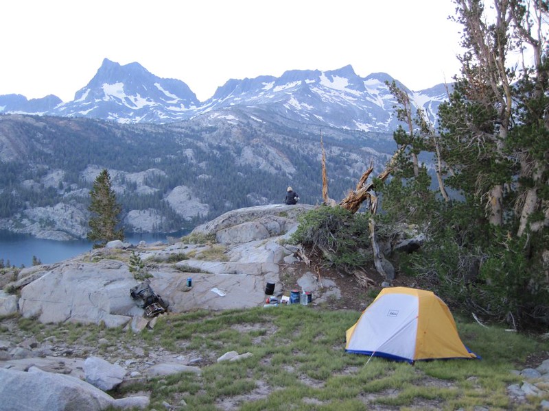
Nonetheless, the afternoon was getting on, and the nearby thunderhead was building. It was time to find a campsite. Of course, we could have camped on nearly any flat spot, but we (or at least I) wanted to have a nice view from camp. I didn’t care if we had to walk a half mile to get water, as long as I could see those excellent mountains while we ate dinner, and wake up to see the sun shining on them in the morning. This would take some extra time, but it would be worth it.
And it was! We wandered downhill, heading roughly west. I had created a waypoint in my GPS for the spot we hoped to camp near, but we knew that it might be impossible. So we kept our eyes peeled. There were plenty of trees in this area, so I consulted the GPS often, especially when the towering cumulonimbus thundercloud blotted out the sun. All was gray as we walked through the quiet forest. We found some small ponds, exactly where the GPS said they were, so we knew we’d have water, but we really didn’t want to drink from them. Too stagnant. And probably full of mosquito larvae. We kept on going, heading gradually downhill toward what we knew was a bare granite slope above Waugh Lake. We wanted to find a good spot at the top, if possible.


There was a bump on the topo map at the 10200 foot line. That was our best hope, as it had to get flat on top of a bump, at least theoretically. And it did! Sadly, it wasn’t a tent-worthy spot. So we headed downhill over rolling granite slabs, seeking a flat spot with a view of the lake. We spread apart, searching, staying within calling distance, trying to increase our odds. And it worked! I climbed over a rise and just below me was a tiny grassy dell not far from an excellent granite lookout point.
I called to Vicki “I think I found it!”
It only remained to check it out up close, to see if it was truly flat enough to sleep on, and whether there were any more tent-and-air-mattress-destroying rocks poking up through the grass. It wasn’t perfect, but it looked pretty good. The grass was a bit tufty and bumpy, but nothing an air mattress couldn’t handle. Also, there was just enough slope to drain any rain water that fell, but not enough to make sleeping uncomfortable. I looked at Vicki to see what she thought.
And then we heard the first boom of thunder! That settled it. I tore open my pack and got out the tent. We set it up in record time! And then we started huffing all of the clothing and sleeping gear inside as ominous booms of thunder rolled all around us, echoing off the valley walls across the way.


The air was getting cooler and a breeze had sprung up, harbingers of a coming deluge. We donned our Goretex raingear and stood up on our private granite outcropping, holding hands, looking all around us, waiting to see what would happen next. Would one of the many nearby thunderheads drift our way? Vicki was getting a bit nervous, as we were somewhat exposed out here, but thus far we hadn’t actually seen any lightning, and there were plenty of taller trees just behind us up the slope which made for far better targets.
And then it began to rain. It was just a sprinkle of tiny drops, but I’d been in thunderstorms before. They always start out small, but then build up to huge drops in no time at all, and sometimes you might get hail. I decided that, even though I was wearing excellent raingear, I didn’t really want to be wearing wet raingear. So I headed for the tent, put my nearly-empty backpack under the vestibule, and shut the door behind me.
I sat inside and listened to the rain hitting the tent. What an enjoyable feeling, to be warm and dry inside a cozy tent. Of course, it would have been much more romantic if Vicki had come inside along with me. What was she doing out there? I was just about to call her name when the entire tent lit up from a big flash of lightning.
“Woohoohoo!” I heard her shout. She was standing out there, exulting in the storm, having all that fun without me! This was intolerable! The thunder boomed, louder than ever before, as I made my way out of the tent. “Woohoohoo!” she shouted again.
Panorama video from our campsite showing the late afternoon thunderheads.

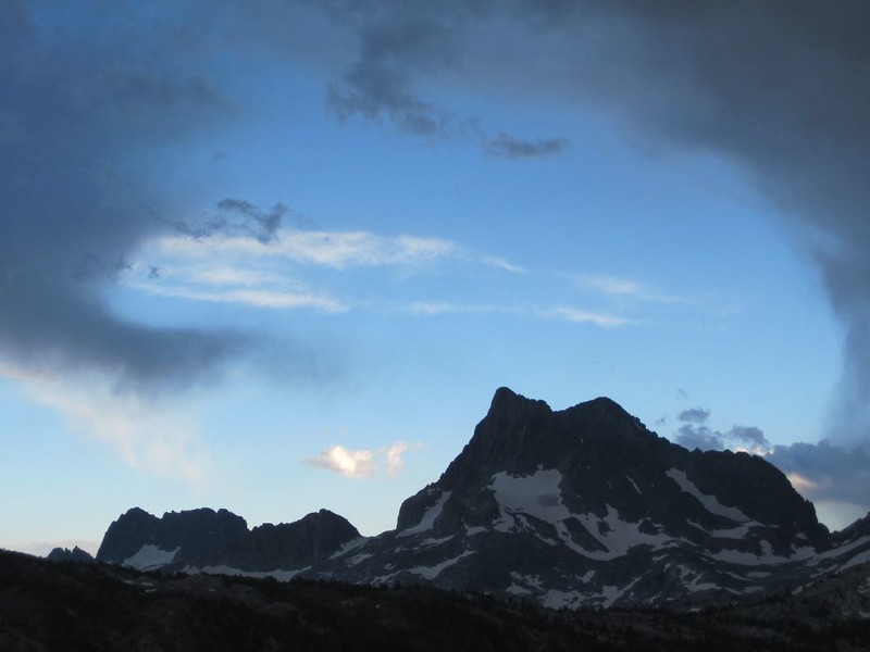
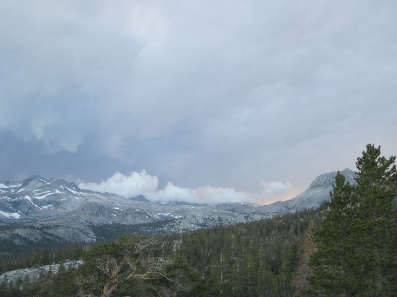
And, yes, it was, indeed, exciting. It was hard to know which way to turn, as we hoped to see yet another bolt. Just the same, it didn’t last all that long. Luckily for us, the nearby thunderhead drifted away, the rumbling diminished, and we never got much more than a sprinkle. All the enjoyment of a thunderstorm without the pesky deluge.
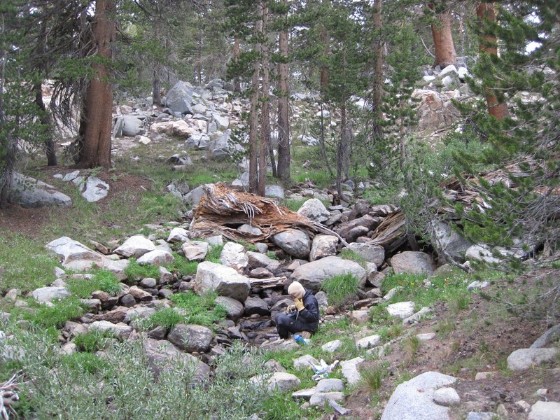
When we were sure the party was over. Vicki got out the water pump and we headed off to find some water. And not from that stagnant pond. We headed about a quarter-mile west where there was an intermittent stream showing on the map, Running water is better, when you can get it, and we got it just fine. There were a few mosquitoes down by the streambed, but with me waving my hands around I was able to keep them off her face. Just the same, she cut the filtering short, and only made enough for dinner and breakfast. We’d get more in the morning, when it ought to be cool enough to keep them quiescent. Then we headed back to camp for some dinner.
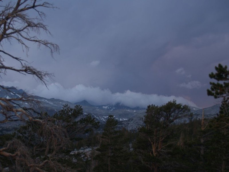
Back at camp, Vicki cooked up a freeze-dried meal while I wandered around taking photos from various angles and perspectives. The weather was constantly changing, and so did the lighting. It was obvious that the clouds were breaking up. The sun had finished generating all of those cumulonimbus clouds. For today at least. We’d worry about tomorrow when it came.
Sunset panorama video from camp. The clouds are slowly dissipating.

For more Day 3 photos and videos see my Flickr Page.
For an interactive topographic map including our GPS tracks see my CalTopo Page.
To see where this day’s geolocated photos are positioned see my Loca.lize.us page.


