On the third part of our Onion Valley Fishing trip, we backpacked up the Golden Trout Lake Trail, then took the northern spur trail to camp at the lower of the two northern lakes, and, using my new Tenkara Fly Fishing setup, I caught two Golden Trout and a Brook Trout, which Vicki promptly cooked and ate.
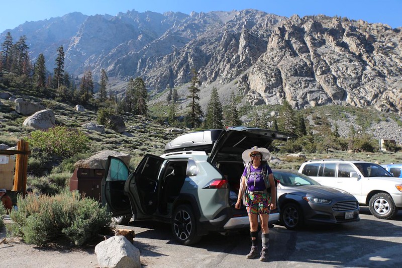
We woke up at 3am in the car at the trailhead and began getting ready to hike out in the cool of the pre-dawn darkness. We remembered what the Golden Trout Lake Trail was like: It was short and steep, and had major sections of sketchy scree. We backpacked up there last year, so I didn’t really need any photos of the early section this time, and Vicki wanted to avoid the overheating that happened last time. Plus, it’s kind of fun to hike in the dark, using only our headlamps. We got everything ready in record time, and were out on the trail by 4am.


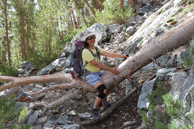
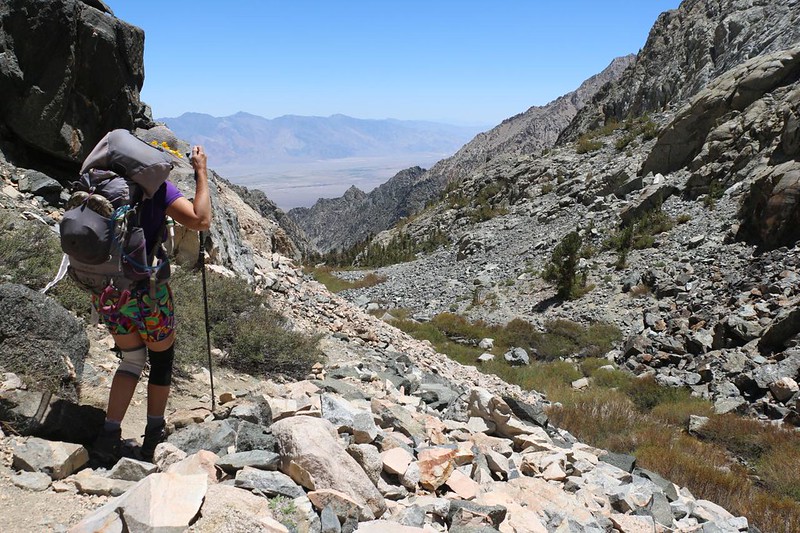
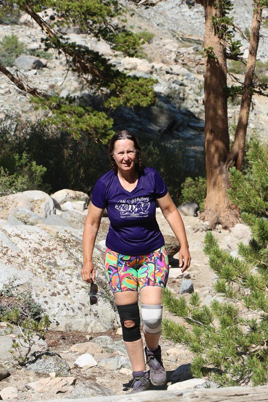
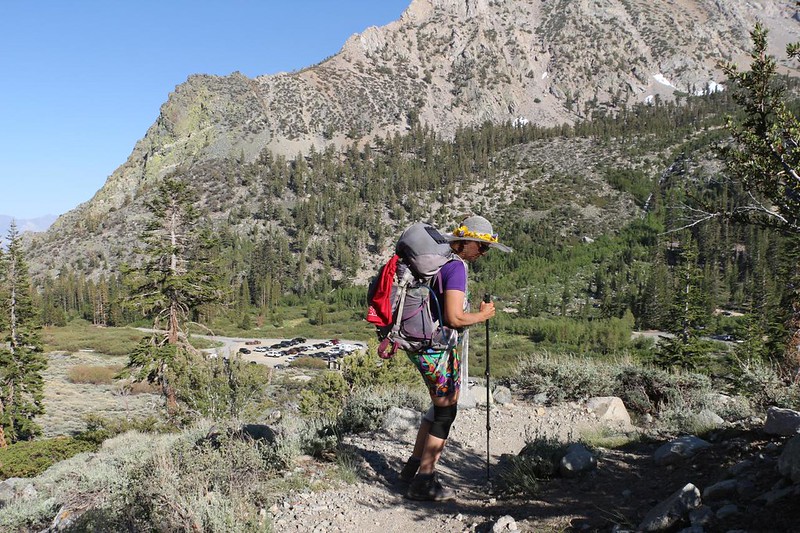
Our timing was perfect. We arrived at the worst of the scree sections just as dawn was breaking, which allowed us to see our trail options clearly. Why? Because there were a lot of trails! It was so steep and slippery that people had been trying to find new and better paths for years. As we climbed, we noted that the waterfall on the left wasn’t running very fast. It was similar to last year, which was also a low-snow year in the Sierra. But at least it was flowing. Meanwhile, Vicki took careful steps to avoid re-injuring her plantar fasciitis, and used her hiking stick (plus my hand) to surmount the trickier switchbacks.


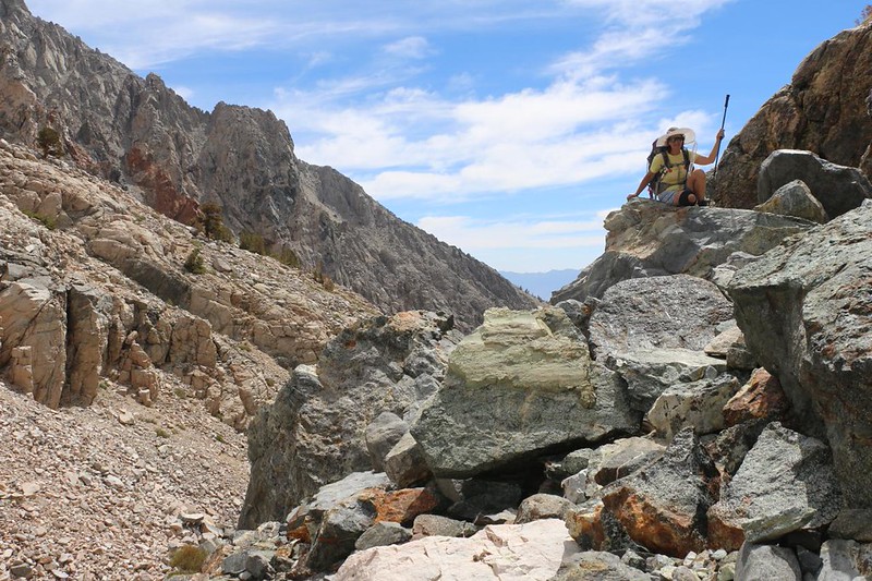
We arrived at the top of the first headwall cliff (the one with the waterfall) and breathed a sigh of relief. We had made it past the scree while still in the cool of the shade from Kearsarge Peak. This was worthy of a break. There were fine views from up there, looking down into Onion Valley, and also up at Peak 11955 to the west. There was at least one spot for a tent near the creek, so I asked Vicki how her foot was doing, in case she wanted to stop right here. I was in no rush, after all. This entire trip was meant to be pressure-free, to simply camp and fish wherever we wanted for as long as we wanted. This is one of the benefits of being retired, after all.

After a short nap, Vicki was ready to keep on hiking. This next section was exactly what she liked: Smooth solid slabs of grippy glaciated granite. The trail was still steep, of course, but that was fine as long as it didn’t slide out from underfoot. Plus, the views were great.


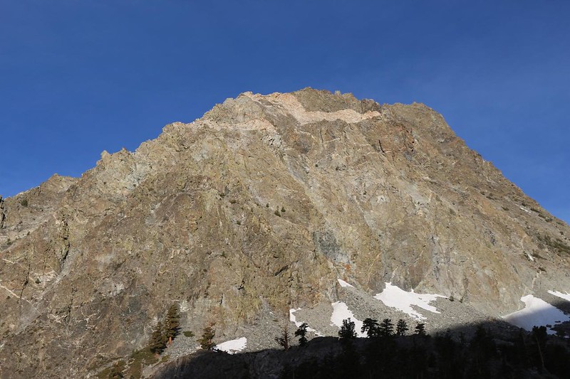
The trail stayed up on the headwall while the creek remained down below in a narrow canyon. We were in the sun now, but that was OK. Across the way to the east was Kearsarge Peak, and it had some stunning layers of red granite showing through the typical gray Sierra stone.

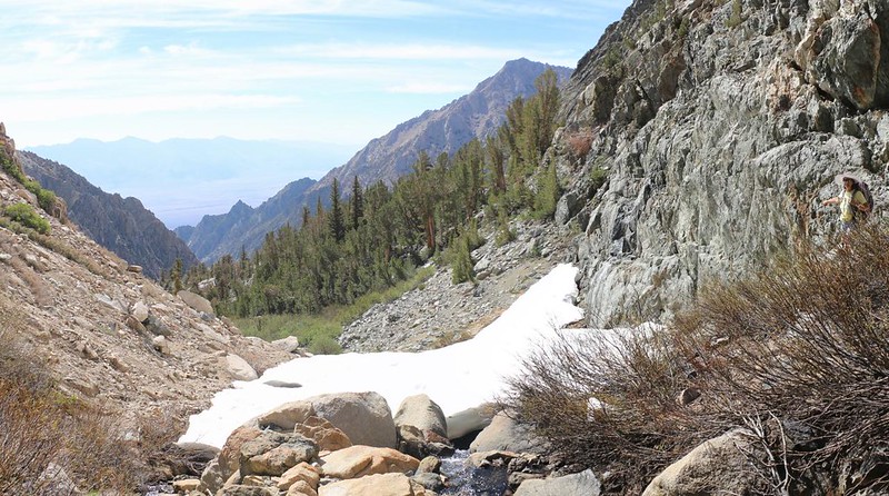
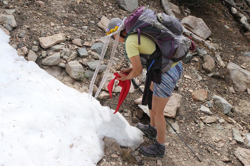
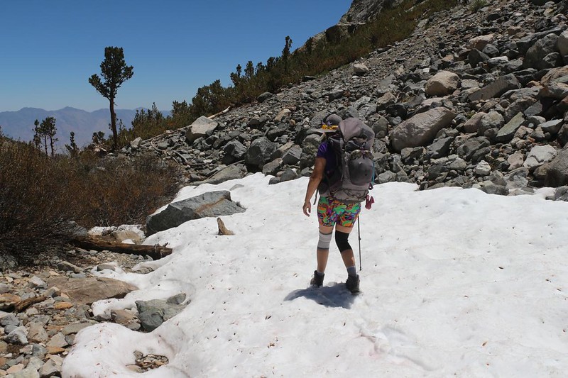
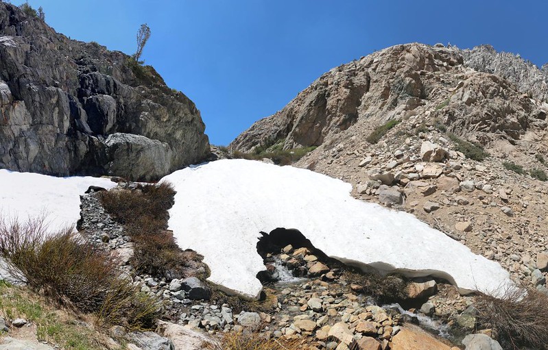
The trail met up with the creek at a narrowing of the canyon. And that was when we discovered the Snow Plug. It was a large, still-melting pile of snow that completely blocked the canyon! The creek could be seen running out beneath it. Luckily, there was an alternate path across the way, and Vicki groaned audibly when she spotted it: It was more of that pink scree stuff! She really hates it. But the snow on the left looked a bit too steep to attempt without extra traction, and she didn’t want to risk an injury. So we crossed the creek and made our way up the dreaded scree.

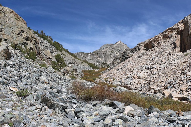
After that, we crossed back to the left side and continued into the upper canyon. Eventually, the trail seemed to disappear, to be replaced by huge blocks of talus. It looked like a major rockfall had obliterated the original trail. There were stone “ducks” down by the creek, enticing us to cross once again, and there was a visible path over there, through yet more of the dreaded pink scree. And this time Vicki flat-out refused. She decided that we could climb on the big talus, up and over the rockfall. So that’s what we did. And it turned out to be 4th-Class climbing! There was even a “crux” section, where, if you slipped, serious injury would have resulted. But Vicki didn’t care. When we got to the other side, there was even more rocky talus, and our pace slowed dramatically. I swore that we would take the scree on our way down.

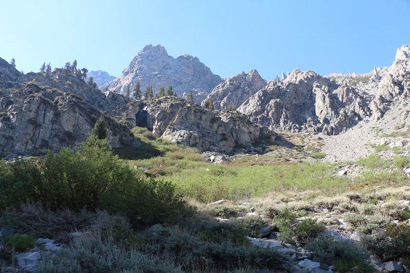
Eventually, we made it to the meadow at the confluence of the two branches of the canyon. We had camped here last year. To the left was the side canyon leading to Golden Trout Lake, and to the right was what the map called the “Golden Trout Lake North Spur Trail,” which led to two high lakes that we didn’t visit last time. Heading up there to go fishing was our main goal. But first, it was time for Vicki to take a serious nap. She’d done the tough work, getting all the way up here, and she deserved it. So I got out my book and started reading. After taking some photos and videos, of course.
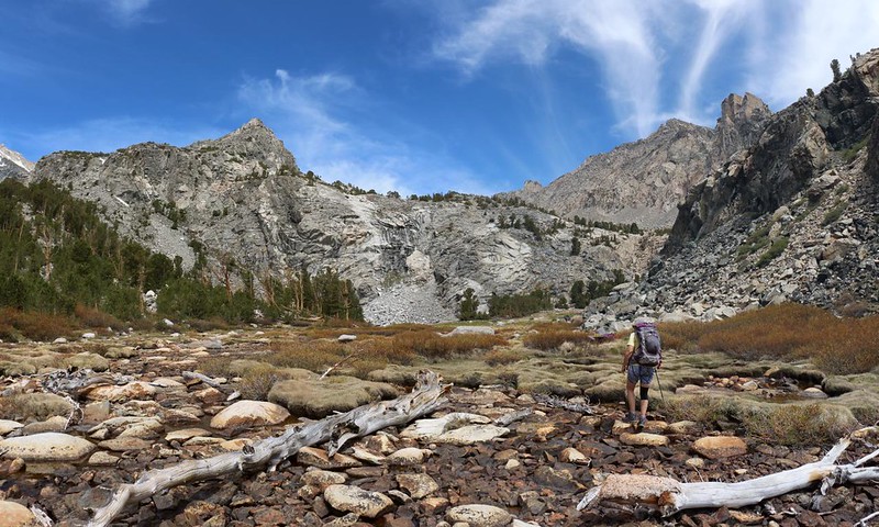

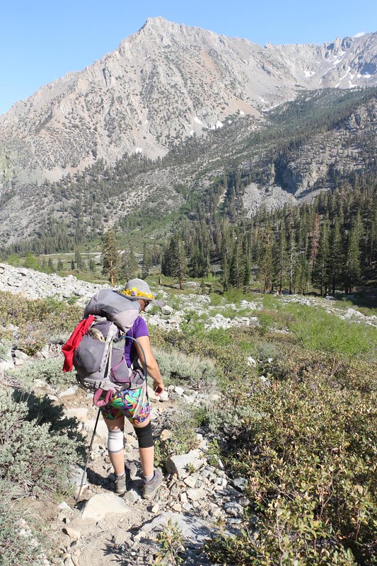
After her nap, Vicki felt refreshed, and decided that she wanted to continue up the northern spur. This part of the area was less heavily travelled, and there was a lot of fallen rock to climb over. But that was only because we didn’t find the actual trail until later. After that, it was steep hiking, of course, but at least the route-finding was minimal. One foot in front of the other, and we’d get there eventually.

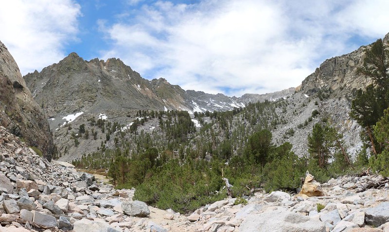

The trail got easier near the top of the narrow section, and then we knew that we were getting close to the lower lake. I told Vicki that we were almost there, but I’m not sure that she believed me. When it looked like the lake was in the basin just over the next rise, I asked her to go in front of me. She deserved the first sight of the lake, after struggling up this crazy trail.

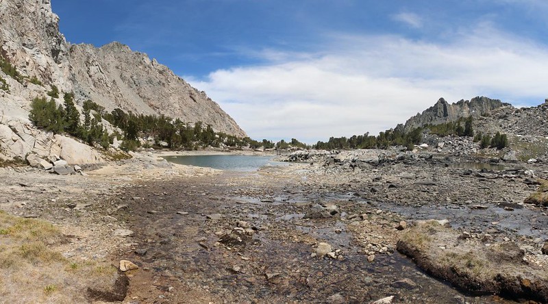
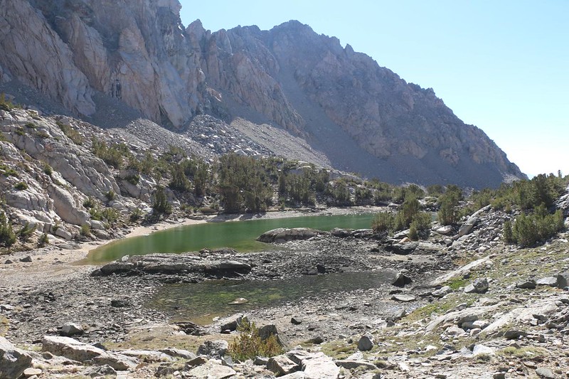
And there it was! This lake had no name and no elevation marker on the USGS topographic maps, but it was roughly 11,270 feet above sea level. This was the highest we’d been all week, and Vicki was still feeling the lack of oxygen. Sadly, the lake’s water level was low. It was similar to the way Golden Trout Lake had been last Summer. This part of the Sierra didn’t get enough snow over the Winter in either 2021 or 2022. It was also obvious that the lake had talus below it, which allowed what little water it received to seep away into the ground.


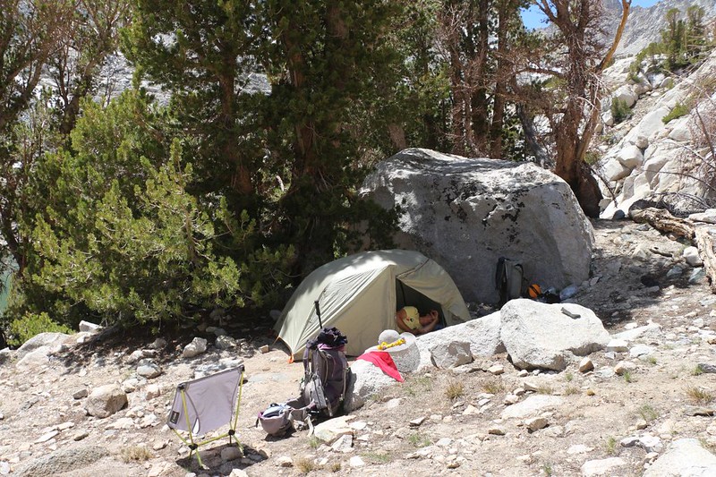
I asked Vicki if she wanted to head for the upper lake, but she declined. We could dayhike up there later. Meanwhile, she was beat. She sat down and rested while I hunted out a good campsite. There was one nice spot right next to the shore, but it was technically within 100 feet of the water, and therefore against the rules. I searched more, and found another spot up above the lake, and it even had a tree for afternoon shade. I called Vicki over to check it out, and she said that it was fine. I carried up the gear and we set up the tent, after which she crawled inside and promptly took a well-deserved nap.
While she slept, I collected water from the inlet creek, and treated it. Then I got out my fishing tackle and headed down to the lake. There were plenty of fish in the water, regardless of how low the level was. I walked slowly around the lake’s perimeter, casting my fly and watching the fish either run away from it, or come near to it and then turn away without fully exercising their curiosity or hunger. I tried and tried. And I got shut out completely. They simply weren’t biting, at least not at that time of day, or with that sort of fly. Vicki came down to watch, but it didn’t help my bad luck. I eventually put away the rod and decided to try near sunset, or early the next morning. If they were ever going to hit my line it would be at the traditional time of trout feeding.
After that, we ate dinner and read our books. I went down to the lake to try again, and still had no luck, even though the fish were rising to the surface all over. Except wherever I was casting. I decided that the fish didn’t like the fly. So I cut a brand new, longer “level line,” rather than bothering with the two pre-made lines I had been using. I attached a new length of tippet and tied on one of the smaller, barbless flies that came with my rod. The other flies I was using were the next size larger and had barbs; I bought them because I didn’t want to lose any fish. But this lake had me stumped, and if I could get one to bite on the smaller fly then I’d be happy, and I’d simply have to yank it all the way in to shore in one shot, before it could spit out the hook. And I got a couple of preliminary nibbles from some smaller fish in the shallows, so I felt a bit better, but I still didn’t catch anything. The sun went down behind the mountain to the west, and the air got extra cold. Vicki called me back to camp. It was too late to clean or cook a fish now anyway. So we got dressed in our night clothing and went to bed early.
The following morning I woke up at first light, and got dressed for cool weather. I grabbed my rod and set up the new line and fly. I aimed to catch me a fish! By hook or by crook, as they say.

At first, nothing much happened. I tried a few different spots near camp without luck, as I watched several fish almost hit the fly. I could see them while wearing my polarized glasses, so I knew exactly what was happening. Vicki called me in for breakfast, and I left the rod on shore. Afterward, we decided to dayhike to the upper lake. I fished as we walked slowly along the shore. Suddenly, I got a bite! I landed a small but beautiful fish, which looked like a Golden Trout. Whoo hoo! We were both excited. And then, not a minute later, I landed another one! Oh, yes. This new line and fly was the medicine I needed. We put them on the stringer line, and Vicki got out the cleaning bucket, which she filled half way with lake water. We put the fish in the water to keep them alive longer.


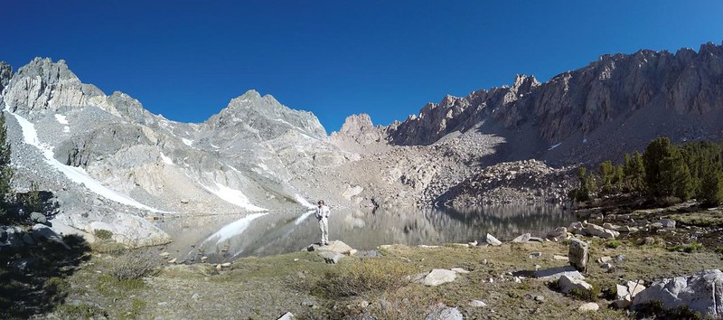
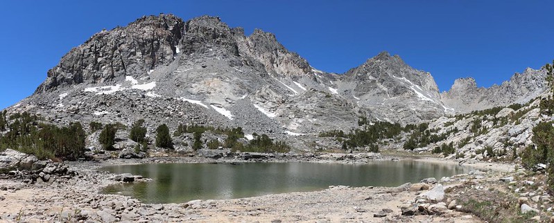
It was only a third of a mile to the upper lake, so we carried the fish on the trail with us. And it turned out that the upper lake was absolutely gorgeous! I was immediately impressed. This lake must have had a solid granite bottom, as it was totally full, and its outlet creek was flowing strong. There was still snow melting all around the basin. Dragon Peak was the dominant peak in this area, and (at least to us) it actually looked a bit like a dragon. We posed on the shore and took a whole lot of photos with several different cameras. This lake was beautiful!


After that, it was time to catch a fish! I had no intention of leaving without one, because that would make this the first lake that had defeated me. No thanks! I tried it standing on the rock we took photos from, but it was too shallow along there. So I crossed the outlet creek and headed over to a deeper shoreline area, one that was still in the shade of a pine tree. I noticed that there was also a nice campsite just back from shore, and wished once again that we had camped up here rather than at the lower lake. But I wished even harder to catch a fish.
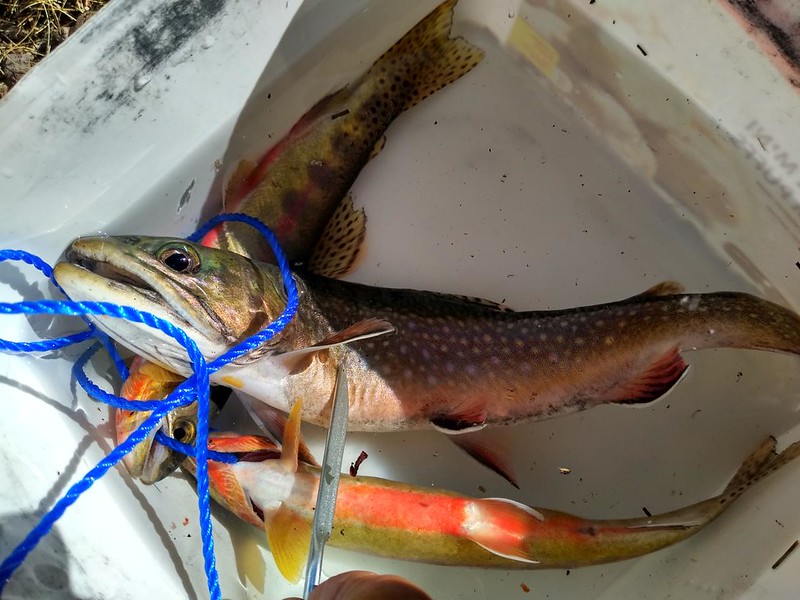
I stayed back a bit, so as not to scare the fish, then used the bow-and-arrow method to cast my fly. I got a hit within seconds! It shocked me enough that I tried to set the hook too soon, and I lost it. I cast it right back in the same spot, and Bang! it hit the fly again. This time I did it right, and the fish was pulled on shore in no time flat. It turned out to be a much larger Brook Trout. I removed the hook and was ready to get another one, when Vicki told me to stop. Three was plenty of fish for her to clean, cook, and eat. She gave fresh lake water to the fish in the bucket while I put away my tackle. And then we headed back down to camp.
On our way back down, we discovered that the lower lake had risen by almost a foot since yesterday, which was impressive. If the melting snow in the upper basin could last long enough, this poor lake might even get up to a decent level. But we probably wouldn’t find out.


Vicki hung out in camp and had fun cleaning and cooking the fish. One of the Goldens was female, and was full of Roe, which she saved. She actually ended up walking to the inlet stream to put the roe back into the water, hoping that a male Golden Trout might fertilize the eggs. Unlike Brook Trout, which can breed in lakes, the Goldens need a gravel stream bed with running water. That’s why the fishing regulations allow a higher “take” limit for small Brookies, which tend to out-compete the Goldens and Rainbows in many places. When she came back, she cooked the fish and ate them. She decided that she liked the taste of the Golden Trout the best.

While she was doing that, I packed up the camp. Our original plan was to head up the other side-canyon, to Golden Trout Lake itself, but Vicki nixed that idea. We had already been there, last year, and she was ready to head back home. I guess that, even for Vicki, there is such a thing as too many trout! The sun was out, and it was hot work packing up everything. In fact, it was practically lunchtime when we finally headed out of camp, so we declared that she had actually eaten the trout for Brunch. I was a bit sad at leaving, but I was also glad that we came here, and if there was ever going to be a next time we’d be sure to camp at the upper lake.

The first steep descent turned out to be much easier than Vicki expected. It helped that she was wearing both of her knee supports. We also stayed on the actual trail the entire time, unlike when we accidently did a bit of rockwhacking on the way up. Vicki’s knees and foot did fine.


Once we finished the north spur trail, I mentioned that there were only two spots where we could stop and camp, if she was having any trouble. One was here at the meadow where the two upper valleys joined, and the other was down below us, at the top of the waterfall. She said it was all good. So we headed into the narrow valley. This time we avoided the monster talus and took the yucky scree. It was a choice between two evils. At least when going downhill the scree would be finished faster.
The next big excitement, trail-wise, was the snow plug. It hadn’t changed much since yesterday. But this time we knew what to do: We would glissade down the western side, and avoid the nasty scree path. Vicki was all in favor of this. She walked right out onto the snow, sat down firmly on her butt, and began sliding. She didn’t even give me any warning, so that I could start a video! But I got my camera going as soon as I could. She used her shoes and hiking stick to self-arrest, and never got going uncontrollably fast. Her buns were wet and frozen afterward, but otherwise she was a very happy hiker. As for me, I used my heels to dig into the slope and walked down. I’m boring, I guess. But at least my pants were dry. Once I made it down, I got out my GoPro and took a video of the snow tunnel where the creek went under the snowbank. It didn’t look like you would be able to crawl upward under the snow, like I’ve seen beneath glaciers. Oh well.

The next part of the trail was Vicki’s favorite section, the slabby ridge above the valley’s lower headwall. It was still steep, and Vicki took her time, but the traction was fine, and there were no missteps. Life was good, we said, as we sat down for a break just above the waterfall next to the creek. This was the second spot where we could realistically camp. But Vicki could see our car down below in Onion Valley, and when a horse smells the stables, it has no intention of stopping for long. So, after a bit of snack, and after Vicki soaked her shirt in the cool creek water (for cooling), we put our packs back on and kept hiking.


There were so many trails through the bad scree section that we had some trouble deciding what to do. At first, we opted to stay over in the talus field and avoid the scree entirely. And this worked, to a degree. The talus doesn’t get used by anyone, so lots of the stones were loose, and shifted under our feet. It would be easy to take an injury there. Then Vicki decided that she wanted to try the area closer to the creek. So we traversed across some sketchy terrain and discovered that what we thought was a stable trail, was just as loose and miserable as going down the middle of it all. But it was too late now. We were committed. I have much better balance, so I scouted ahead and stabilized myself below Vicki, then offered her my hand. She only uses one hiking stick, so this extra support made a difference. Eventually, we made it down to the willows section, and the scree was finished. Hooray!

Naturally, the willows were full of mosquitos, and it was getting late in the afternoon. They came out to bite us with a vengeance. They may have been angry because we snuck past them in the dark yesterday. We thought about stopping to apply some DEET, but decided against it. We’d be eaten alive while we got it out! Hiking faster was our only hope, and that’s what we did. Luckily, we reached the junction with the main Kearsarge Pass Trail, and after that the slope of the trail was mellower, and much easier to hike at a rapid pace. And before we knew it we were at the car.
At that point, our week of fishing in Onion Valley was over. All we had to do now was get our car food out of the bear locker, and maybe change our shoes and socks, which surely needed it. It was half past 5pm, and we decided that we’d rather drive five hours and get home at midnight than sleep in the car here at the trailhead and drive to San Diego in the morning across the roasting hot desert. On our way out, we gave a ride to two PCT Thru-Hikers, and dropped them off in Independence, as they wanted to get to Bishop for their resupply. Then we continued south to Lone Pine and ate some dinner at a fast-food place. We were famished, and it felt good to eat some tasty burgers. I got the salty fries, but Vicki had Onion Valley Rings, instead!

It was a Friday night, and the traffic in L.A. was mostly gone by the time we arrived, so we shot right through without any major delays. On the way home, Vicki recounted all the trout we’d caught: A Rainbow in Whitney Portal, a Brookie in Robinson Lake, five more Brookies up at Flower Lake, two Goldens at the lower Golden Trout Lake, and a final Brookie at the higher lake. That made a total of ten trout. At this point, they were only costing about ten bucks each, and that wasn’t a bad price at all. Not once you realized that they were the freshest trout possible, caught in the pristinely pure waters of the High Sierra. It doesn’t get much better than that.
We decided that we’d have to try some more of this lazy-style backpacking in the future.
For a topographic map of the hike see my CalTopo Page
For LOTS more photos of the trek see my Flickr Page
 << Back to Part 2

