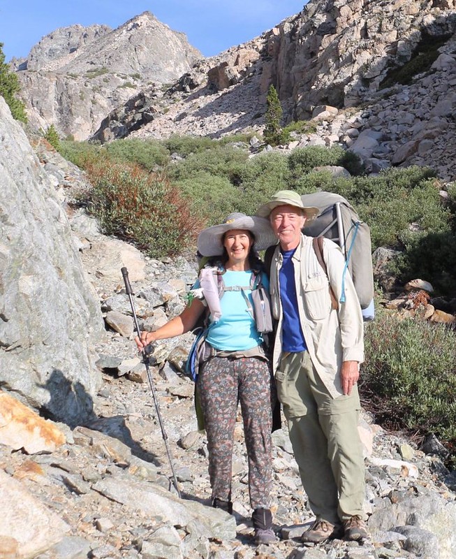
Vicki and I went on a three day backpacking trek in the Sierra Nevada, hiking up the Golden Trout Lakes Trail, out of Onion Valley. Along the way, we met another backpacker with her puppy, and hung out together for the duration. We also watched her go fly fishing in Golden Trout Lake. Vicki got to taste some of the freshest trout imaginable that day. And we made a new friend, too!
After we spent two nights acclimating to elevation in Horseshoe Meadows (at 10,000 feet) Vicki felt that her lungs were ready to challenge the short but steep Golden Trout Lakes Trail. Our plan was to start hiking in Onion Valley, at 9300 feet elevation, and try to find a campsite up above, in the valley between the two sets of lakes, at 10,900 feet. It was only a two mile hike. We figured that it would be fairly easy, but the 16% grade made it much tougher than we expected.

Day 1:
Initially, we hiked along the main Kearsarge Pass Trail. We’d been on it many times. It was wide and well travelled. In less than a half mile of climbing, we arrived at the Golden Trout Lakes Trail junction, and continued onward. The trail width narrowed significantly. It was obvious that very few people hiked on this path. Good! That’s exactly what we wanted. Peace and solitude in the wilderness.
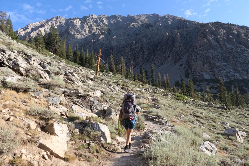

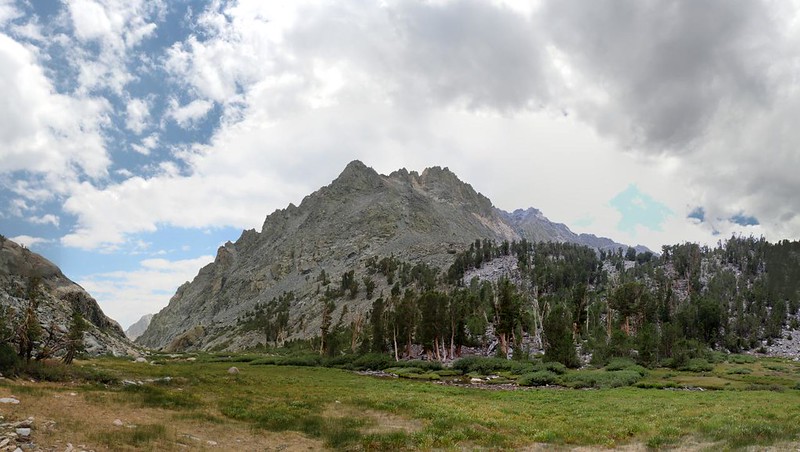
We continued uphill on the trail. We could see Kearsarge Peak ahead of us on the right, and as we climbed higher the views over Onion Valley got better, too. Soon, we came upon the waterfall that we’d seen so many times from down below in the parking lot. It looked like we were going to finally get close to it! Sadly, we discovered that the water flow was quite low this year. The falls were not very dramatic, and there was no roaring sound. Oh well. Even a wimpy waterfall is better than no waterfall at all.

Video of the waterfall, which was barely running in late July 2021

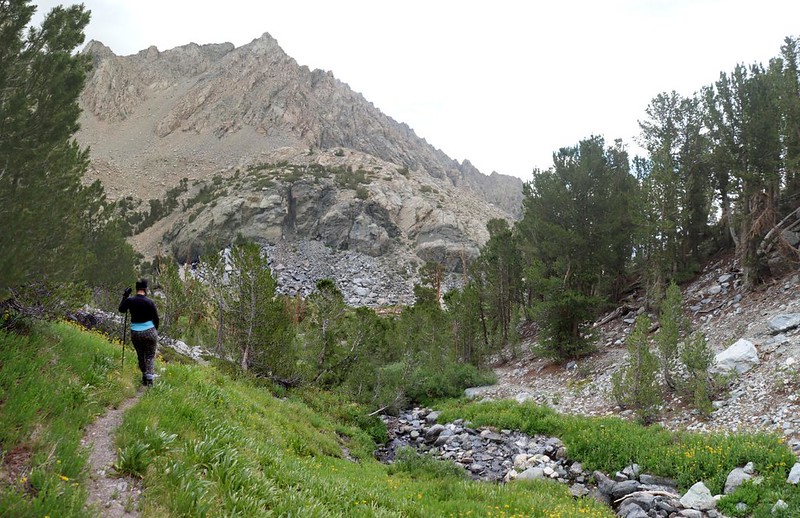
The trail got much steeper as it made its way around the cliff that the waterfall poured over. There was a lot of loose soil and rocks, and the main path was difficult to follow, as there were so many small use trails where other hikers had slid and skidded down. I checked the GPS and we were heading the right way. Basically, we needed to follow the Rule of Up. We paused frequently to catch our breath, as it was both steep and hot.
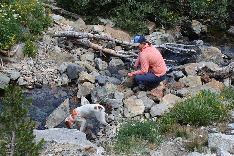
Vicki also wanted to get a closer look at the falls, so she put down her pack and bushwhacked into some willows along the creek. I sat down and waited. By the time she returned, another hiker and her puppy caught up with us. We introduced ourselves. Her name was Kat and the puppy was called Bryson. We were hiking at similarly slow speeds, so we walked along and talked together. And paused to catch our breath together.


All four of us took a break up above the falls. There were a couple of small tent sites there, but we didn’t want to stop just yet. We were only halfway there. We had another mile or so to go and then we’d be within striking distance of the lake. It turned out that Kat wasn’t sure where she wanted to camp, either. And none of us knew where the good spots were, anyway.

Kat turned out to be really nice, and we got along well together. Vicki and Kat had similar careers, so they talked away with each other. I simply took lots of photos, as usual, and enjoyed the scenery. That’s what I do.
Video of the creek flowing through the narrow valley

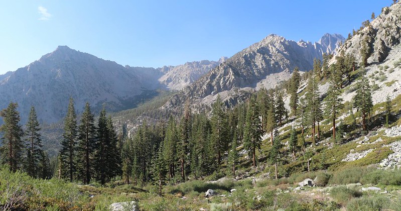
The valley narrowed and the trail got rocky. It crossed the creek a couple of times, and made its way over blocks of talus. Bryson started getting a bit tired from all the stony steps, so Kat gave him a doggy-back ride for a while.


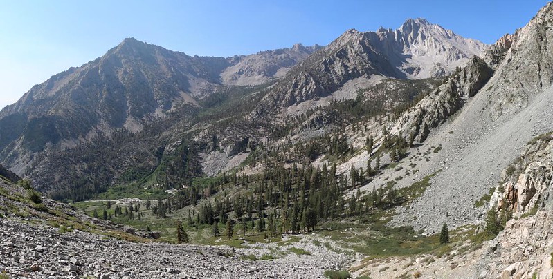
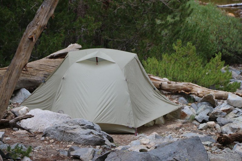
Eventually, of course, the trail arrived at the junction of the two lake-containing valleys. We discovered a flat, marshy area, with the creek slowly flowing down the center. I was hoping to find a camping spot around here, so that we could day-hike up to both sets of lakes tomorrow. Kat was of a similar mind, and we invited her to stay with us, if we could find a spot. Two spots, now. So I set down my pack in the first possible clearing I found, in a small grove of pines to the south. Then I headed around the marsh to the north to see if there was anything better. You never know, and it often pays to explore. But not this time.
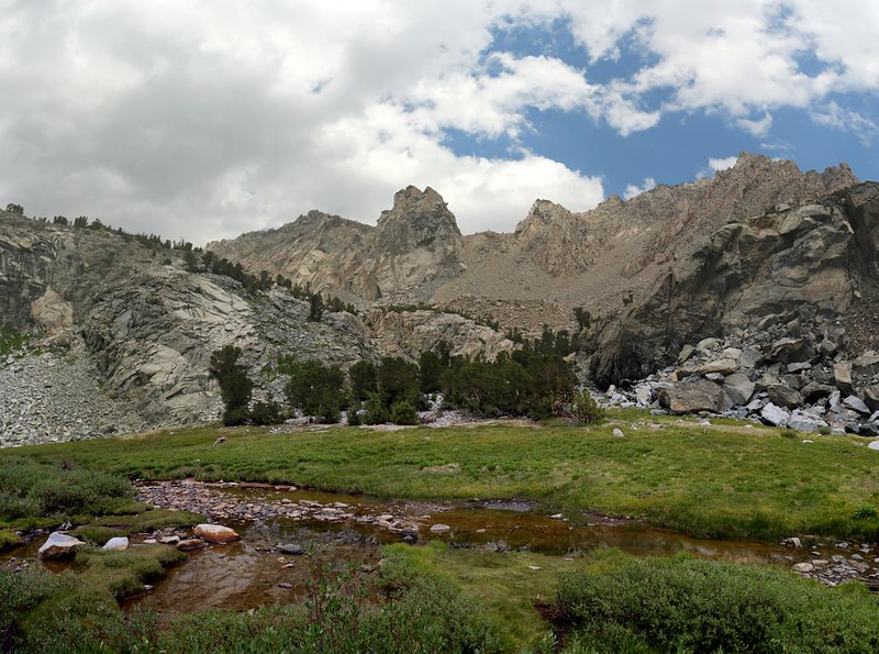
The first spot turned out to be the best choice, after all. Kat found another one close by. We busied ourselves with the usual chores in setting up camp. And we were just in time! A dark cloud drifted overhead, and rain began to sprinkle lightly, Vicki and I jumped into the tent with the rest of our gear, then continued setting up everything inside. It was nice to hear the rain tapping on the nylon while we were dry and warm. We read our books with our legs all cozy inside the sleeping bag. Nice.

After the rain was over, we came back out. I found the inlet creek to the marsh and collected our drinking water there, where it was flowing rapidly. I’ve had stagnant bog water before, and the taste is, well, rich. To say the least. Kat and Bryson came out and we cooked our dinners. The clouds dissipated and the sun came out for a last look at the meadow. Then it sank down behind the mountain ridge in the west and we were left in shadow.

The air got cool, and soon enough we decided to head into our tents where it was warm. All in all, it had been a tough, short hike to get up here. Two miles and 1700 feet of climbing, and it took us over five hours! Let’s face it: Vicki and I really are wimpy hikers, even if the air is a bit thin up there, near 11,000 feet elevation.
Day 2:
We woke up early the next morning, as always. That’s what happens when you go to sleep before sunset. I poked my head out of the tent door and noticed that there wasn’t any real sunrise going on, not down here in the valley, so I zipped the door shut. Then I burrowed back down into the sleeping bag. it was cold out there! But this extra coziness wasn’t destined to last. The sun might not hit our tent for hours, and we really wanted to check out all those lakes. So we got dressed, and went outside. Vicki cooked up an experimental breakfast, a lot like mac and cheese but with spaghetti noodles. It was pretty good! Usually we eat expensive freeze-dried meals, but we wanted to try a more economical alternative, for use on longer trips in the future.

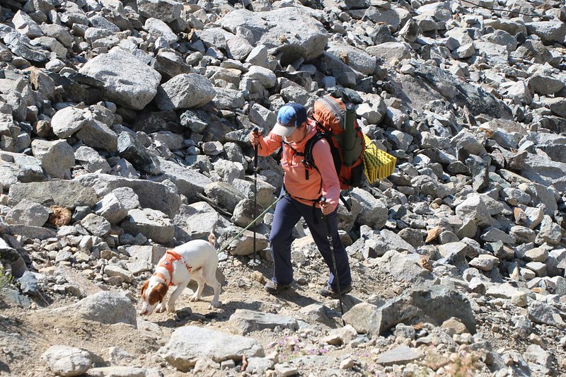
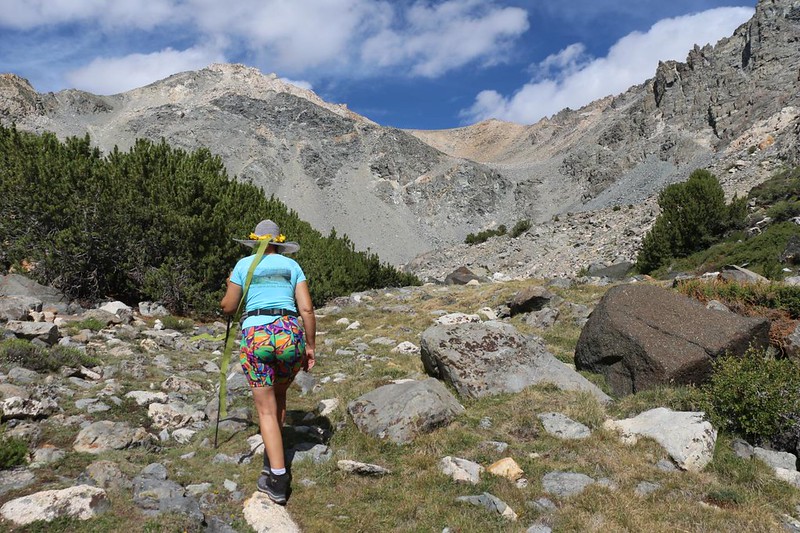
It was time to check out the lakes! We packed some water, lunch, and snacks into Vicki’s smaller pack, and I carried it as a daypack. Kat and Bryson left camp a short while before we did. She had a fly fishing rod and reel, and was excited to try it out. With a name like “Golden Trout Lake” it just had to be good! Vicki and I followed more slowly. The lake was 500 feet above us, and a bit over a half mile away. That’s almost a twenty percent grade! Even steeper than yesterday. But this time we didn’t have heavy packs to carry, which was nice.

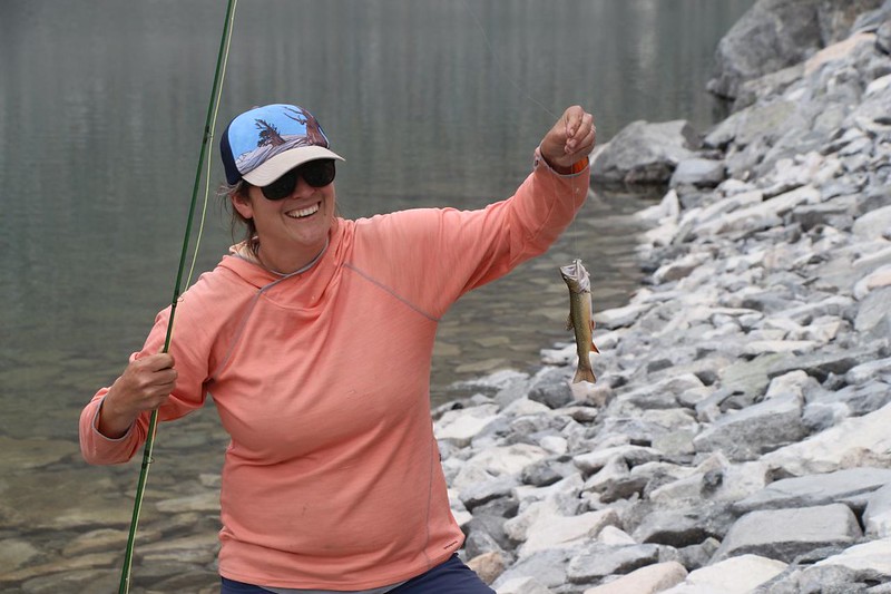
When we arrived at the lake, we noticed how low the water level was. It must’ve been down over ten feet from the high water marks along shore. The lake was obviously sinking down through the talus that was piled up where the outflow creek should be. We looked around and saw that Kat was already fishing. Bryson was a short distance away, with his leash looped around a heavy boulder, and he looked bored. No worries! Vicki cured that problem right away! At first he barked out a warning, but once he realized who we were he became super friendly, as usual.


We sat down and simply enjoyed the view. Mount Gould was across the way, and I tried to decide the best route to take in order to bag it. Which scree-filled chute would I hate the least? The one on the left or the one on the right? It was a toss-up. I also looked along the headwall to the south, to see if there was any reasonable way to get over it, for use as an alternate route to Kearsarge Pass. The answer: Not really. It looked like a whole lot of cliffs. Climbing over them with a big backpack would undoubtedly be dangerous. It would probably be easier to climb Mount Gould, then descend the south ridge to the pass. No, thanks.
Wise men call it Fishing, not Catching, but it still didn’t take long before Kat caught a Golden Trout. This was exciting! Goldens aren’t very large, as far as trout go, and up here in the high country it’s perfectly legal to take them at any size. Kat had plans for this one. Tasty plans! She got out her knife and cleaned the fish immediately, then brought out the stove and frying pan. Some oil, spices, and olives were added, and the trout was fried in almost no time at all. She shared some with Vicki (and a taste for Bryson), then went back and caught another. It, too, was fried within minutes. Nice! Fly fishing sure looked like fun. But trout eating was even better! And both were a great excuse for hiking up into the high country.

Unlike Bryson, I wasn’t tied to a rock, so I went exploring nearby. I found a good campsite up above the lake, and saw two tents set up in another spot. If we only had the energy yesterday, we could have made it here. But it was all good. If there ever is a next time, I’ll camp up here for sure.

After that, Vicki and I decided to head back down. It was already past noon. If we wanted to check out the other two lakes, high up in the northern valley, we’d have to hustle. As we descended, we noticed that the outflow creek suddenly sprang to life. It had been flowing underground all the way from the lake. Meanwhile, the cloud cover up above us was increasing significantly. Hiking in the cold rain isn’t much fun. We realized that we might not be making it up to the other lakes, and we were OK with that. We were on vacation, after all, so why worry?
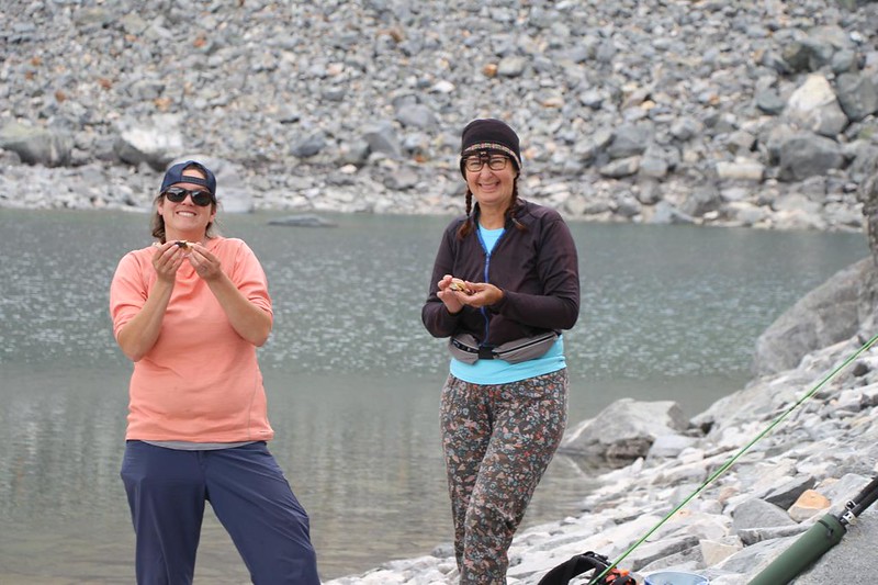
Once again, when we arrived back in camp in the early afternoon, the rain began sprinkling. We heard a boom of thunder somewhere in the distance to the north, and wondered if we might get some heavy rain or hail. Kat and Bryson arrived soon after. We all got in our tents to wait it out. We brought our lunch and snacks in with us, but Vicki didn’t want any crumbs in the tent, so I couldn’t eat yet. Oh well.
The rain clouds drifted away, and soon the four of us were hanging out in camp, just enjoying the day. We ate our lunch. After hearing from another group that the water levels were very low, Vicki decided that she didn’t feel like hiking up to the other lakes, so we basically just spent the afternoon reading, walking around, and talking with Kat. It had been a good day.
Day 3:
We woke up at first light. This was our final day. Our original plan had called for us to hike out, then meet my son and his friend down in Lone Pine, so that I could spend the next week backpacking with them, while Vicki helped us manage the car shuttling. The longer hike was too strenuous for her, she decided. But the proposed hike never ended up happening, as my son got some kind of flu and didn’t think he would be able to hike. Meanwhile, we still had to head back to the cars as we didn’t have any more food with us. Oh well. So we packed up everything and hiked out. Kat and Bryson did, too.


All in all, it was much easier to hike down that steep trail than up it, although we still had to take our time on the loose scree sections. Vicki put on her neoprene knee braces right from the start, as we knew what to expect. The narrow section of valley, which had been so hot and tedious to climb, went by like a breeze. No rests were needed, as the air was still cool. We listened to the creek babbling away below us as we hiked.
We took a short break at the top of the waterfall, mainly so we could take some photos of Onion Valley. Vicki removed a layer of clothing, as the sun was getting hot. I ate a few extra bites of snack in order to make myself feel better, so that I wouldn’t have to admit that I’d carried it all that way for no reason whatsoever.
Just ahead was the crazy scree section, and then the waterfall. Vicki and Kat used their hiking sticks to keep their balance, while I did a bit of enjoyable shoe-skiing on the steepest parts. This time the waterfall was thrusting out into the sunlight, which made me happy, photo-wise.


The last section of the trail was relatively easy, and nowhere near as steep. We hiked along rapidly. We merged onto the main Kearsarge Lakes Trail and continued down the final switchbacks to the parking lot. Our car was quite close to the trailhead, and Kat said her husband was waiting for her somewhere in the main parking area. I gave Kat one of my cards and asked her to email me, so that we could exchange photos when we got home. We also made general plans to get together again one day.

We put our gear into the car and prepared to descend into Civilization. It was only 10am, and we had all day to get home. I calculated that if we left now, we’d hit rush hour traffic in L.A., and so we decided to wait a bit longer. Therefore, our first order of business was to get some lunch. It was super-hot (100-plus degrees) down in Owens Valley, so we headed south to Lone Pine, then drove all the way up the long grade to Whitney Portal. We parked in the cool shade and walked over to the Portal Store. We ordered burgers and salty fries, which always taste great after a long hike in the wilderness. We really weren’t quite ready to leave the Sierra yet, and me most of all. My big hike had been cancelled! Maybe I could come up with something else to do. We ate, then checked out the creek and climbed uphill into the cascading section. It was fun.
Eventually, of course, it was time to head home. Down the hill we drove. We filled the tank with gas, and headed south into the roasting heat, the car’s air conditioner on full blast. In five hours we’d be home in San Diego, taking showers and sleeping in a comfy bed. This was something to look forward to.
The other thing we talked about was catching trout. Vicki was hooked on Fly Fishing! I told her that I’d have to do some research before I bought yet more gear, and she was OK with that. Now that we’re getting older and wimpier, perhaps we could begin the process of slowing down, hiking fewer miles, and stopping longer at some choice High Sierra Lakes. But that would have to happen next year, if at all. We already had too many trips planned for the rest of this year’s hiking season!
For a topographic map of the hike see my CalTopo Page
For LOTS more photos of the trek see my Flickr Page

