Day 4: I ascended Mount Whitney from Guitar Lake, with an exit at Whitney Portal
My Summit Day began in the dark, as so many of them do. Not that I wanted it that way. No. Not at all. As a photographer, hiking in the dark is self-defeating. Of course, I’ve been known to wake early and pack in the dark, but the hiking part almost always has enough light for photos. On this occasion, I was woken by other people. They had obviously camped down at Guitar Lake and were already hiking at 2am when they passed by my tent, speaking loudly in the night, little realizing that there were sleeping people nearby. So I forgave them. They probably intended to greet the dawn from the top of the mountain, which sounded romantic enough.
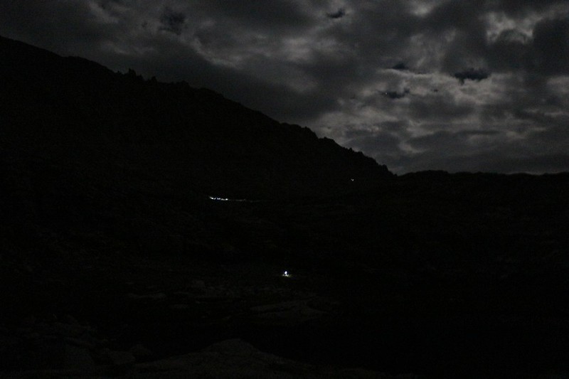
Meanwhile, I was wide awake. I decided to get dressed and go for a Call of Nature, and check out the weather. What I found were dozens of tiny headlamps all over the mountain. There were plenty down at Guitar Lake, too, where it appeared that a mass exodus was taking place. And there were several more toiling up the steep slope above me, zig-zagging on the switchbacks leading to Trail Crest. All of this was happening under a brilliant moon, shining through the thin layer of puffy cumulus clouds. It was quite beautiful, so I got out my camera and took a few shots, hoping that at least one of them might come out OK. After that, I went back to sleep. Midnight hiking was for the birds. Or was it the bats?
I slept well afterwards and woke at first light. I began getting ready inside the tent, but I also decided that waking Steph would be wise at this point. I only had yesterday to go by, but it seemed that she preferred to sleep in rather than get up at the crack of dawn. I stood outside and checked the weather. There were plenty of clouds already forming, so I knew that thunderstorms were likely that afternoon. We needed to get going or we could be in big trouble later on. I called her name and she responded. Then we both got busy packing our gear and eating breakfast. As I was leaving three days early, I had lots of extra food, so I ate an additional pop-tart to give myself an energy boost. Climbing 3000 feet at high elevation doesn’t happen by luck, you know.
We were on the trail just a bit after 7am, which wasn’t too bad. But it was also true that everyone else at both our tiny pond and Guitar Lake had already hiked out. We were the last ones, but we didn’t really care. We had the entire day before us! So off we went.
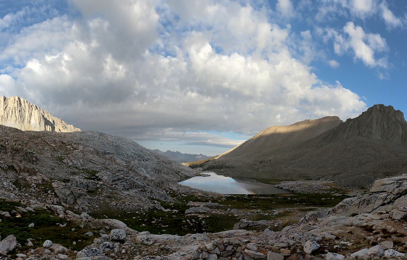
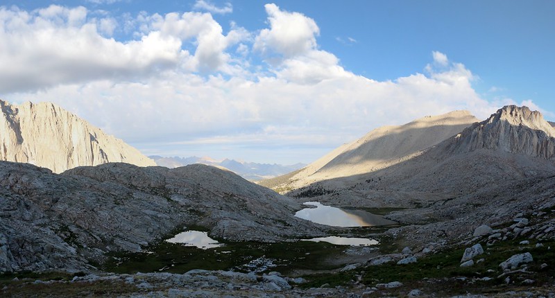
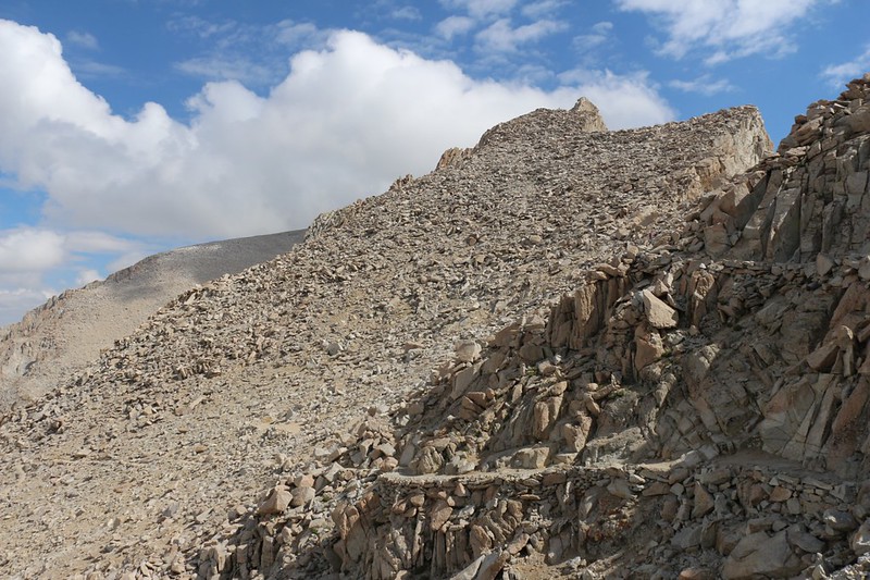
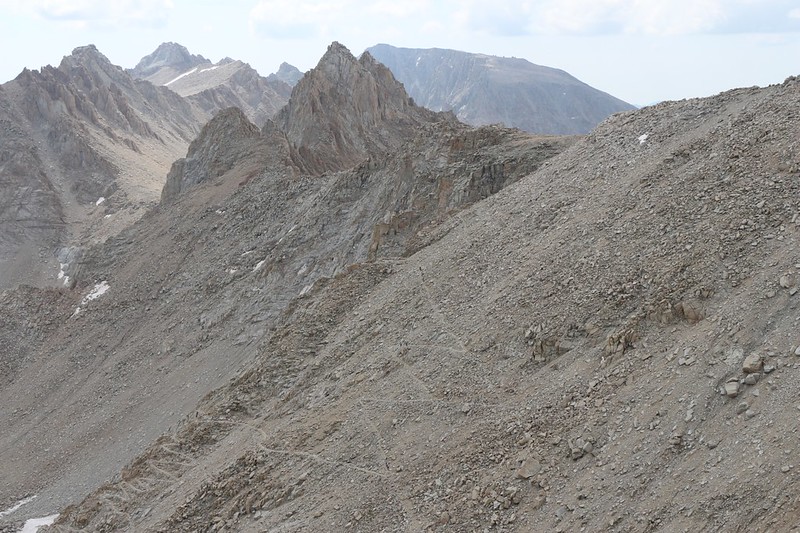
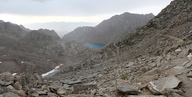
The trail started climbing immediately. We made pretty good time, although I admit that I stopped quite often to take more and more photos. We were both glad that we were on the shady side of the mountain, and hoped that we’d stay in the cool zone at least as far as Trail Crest, which was 2.5 miles away (and 1900 feet up).
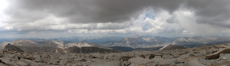
It was a well-built trail, but it was steep enough to make your heart pound and your breathing loud. The views were superb, and kept getting better the higher we climbed. I took way too many photos of Guitar Lake, but other peaks and lakes began to appear in time. And the puffy cumulus clouds made everything more picturesque.
GoPro panorama video from the switchbacks below Trail Crest
Panorama video looking down from the trail at 13000 feet elevation
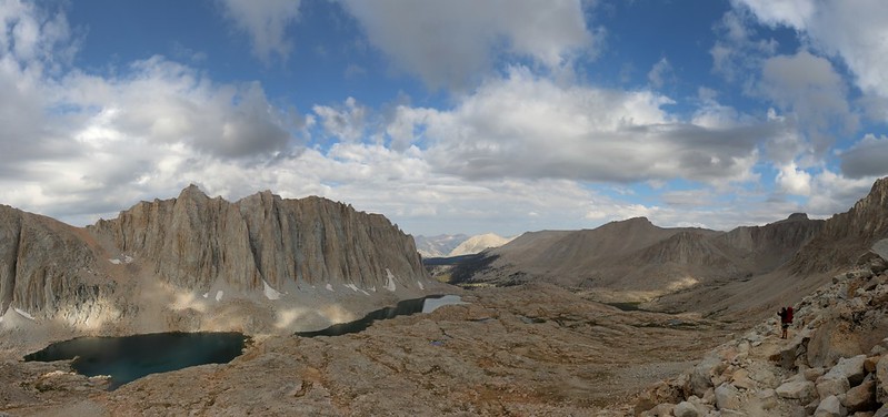
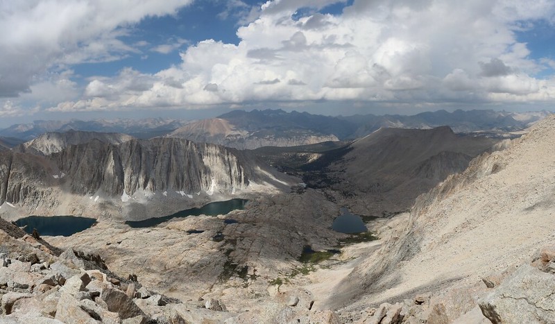
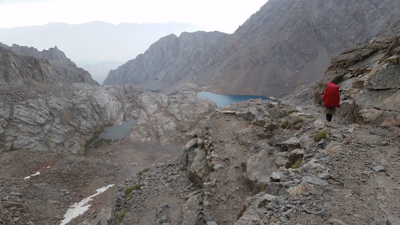
It was 9:45am by the time we reached Trail Crest. That averaged out to about one mile per hour, which wasn’t bad for a steep trail with full packs. And we were both feeling fine, more than ready to climb the additional 1100 feet to Whitney’s summit, which was 1.9 miles away. But not with full packs. This was the spot where the John Muir Trail intersected the main Mount Whitney Trail that came up the 97 switchbacks from Whitney Portal. We’d be descending that trail later on, but why carry everything to the summit just to carry it back here? Steph left her main pack behind, and only brought some essentials in the “brain” section of her pack. I unloaded most of the heavy stuff and stashed it under my waterproof pack cover, but I carried the backpack itself, which weighed next to nothing at that point. The ten essentials were all I really needed.

GoPro panorama video from Trail Crest, at 13,400 feet elevation
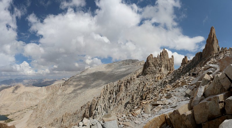
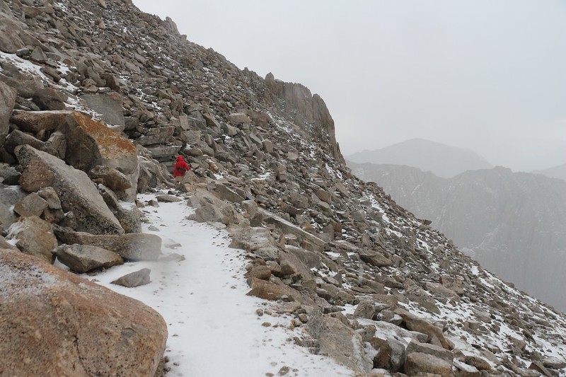
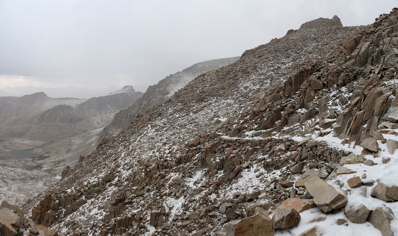
We began hiking, and the trail wasn’t very steep at all. Its main job was to traverse along just below Mount Muir and the other needles along the crest until it reached the main Whitney massif. There was even a small section that went downhill, amazingly enough, but on the whole it continued climbing, as you might expect.
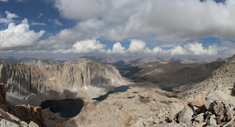
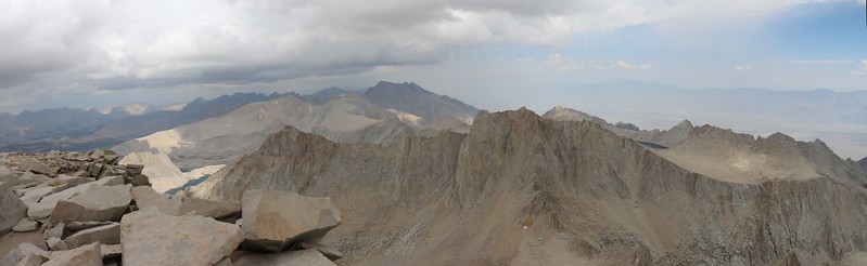
The views continued to be stunning, with visibility extending out many miles, so that distant peaks were clear and crisp. Perhaps the best part was that we were now so high up that we were just below the flat bottoms of the puffy cumulus clouds. It was as if we were in a vast room with a low ceiling, a ceiling that drifted slowly toward the northeast. Sometimes we were in shade, and sometimes in sun. Perfect hiking weather.
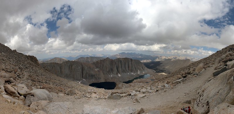
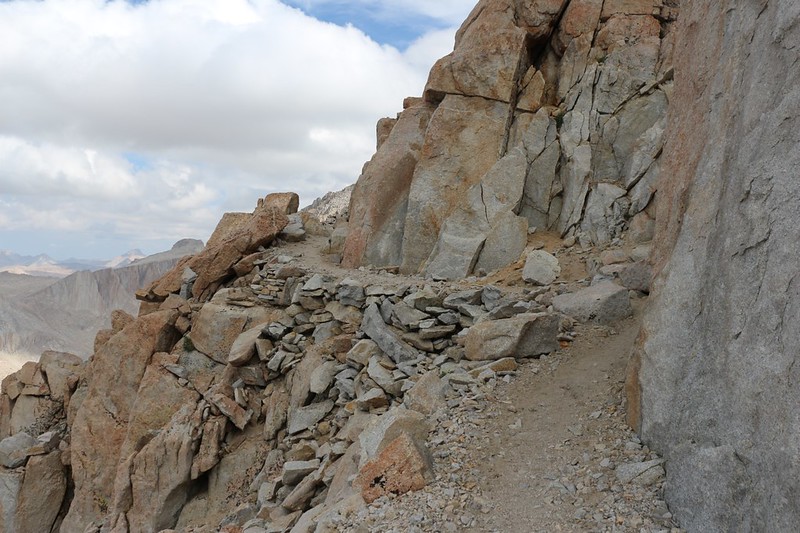
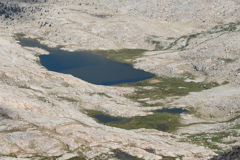
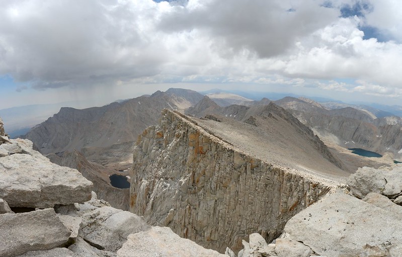
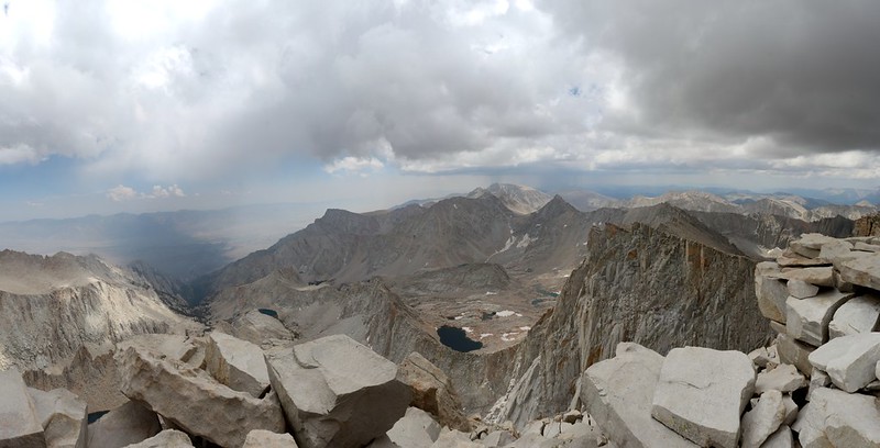
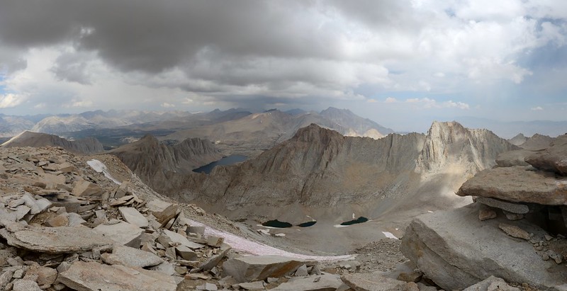
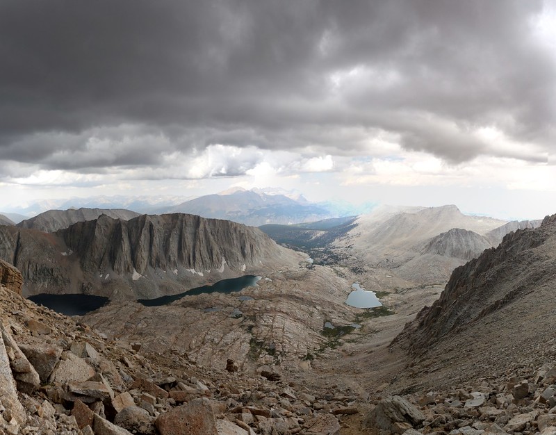
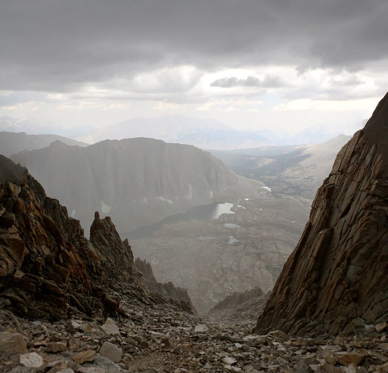
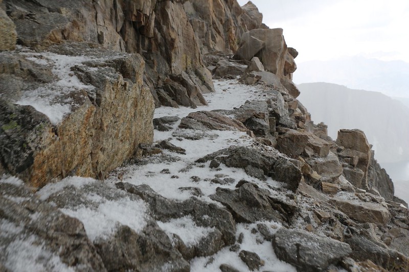
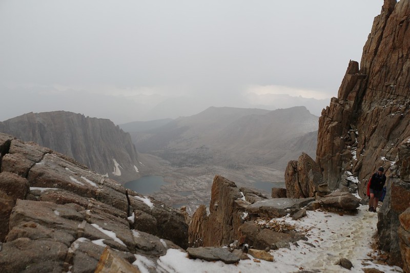
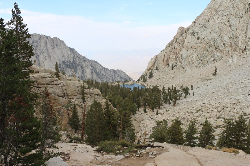
After we passed Mount Muir the trail stayed as high as possible so that it passed directly next to the deep troughs between the needles of the crest. This afforded us views to the east for the first time. We saw the main Whitney Trail as it descended the famed 97 switchbacks beneath Trail Crest, and were able to see several lakes far below us where Lone Pine Creek makes its way to Whitney Portal. It was a long way down.
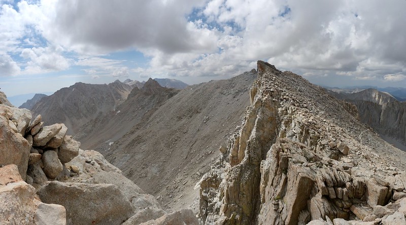
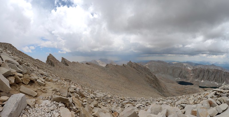
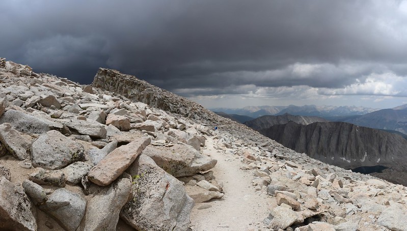
There were plenty of towers and needles along this route, and all of them had names. This mountain has quite a history, dating back over one hundred years, so this wasn’t surprising. The east side was cliff-like and steep, but the west side (where we were) was merely incredibly rocky and less steep. Without the trail it would have taken us hours to pick our way over the tumbled boulders.
There were a number of other hikers but it wasn’t as crowded as I expected. This may have been because everyone else had already left the summit, but that’s OK. The views were great and the weather was fine, except for one or two dark areas under some clouds in the far distance where it was obviously raining, the gray streaming virga lines showing beneath the puffy white cloudtops. As long as none of those stormy clouds headed our way we’d be fine. Meanwhile, we began hiking even faster, just in case. We didn’t want to miss bagging the summit due to lightning.


We reached the end of the long traverse and looked back toward Trail Crest. It was quite an impressive sight. We could also see Mount Langley, another fourteener, off to the south. There seemed to be some weather happening down there. But we still seemed to be in a good position over here. Hopefully it would drift off to the east, not north.
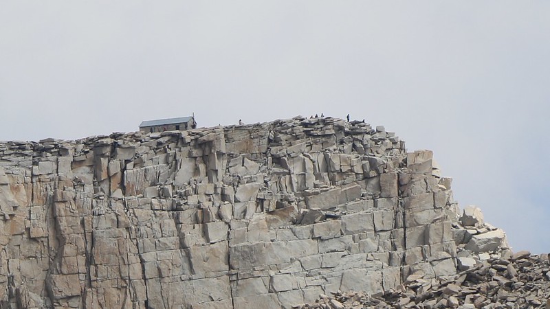
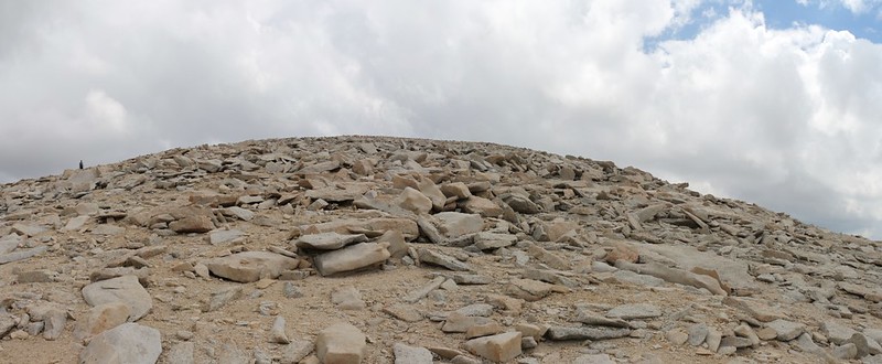
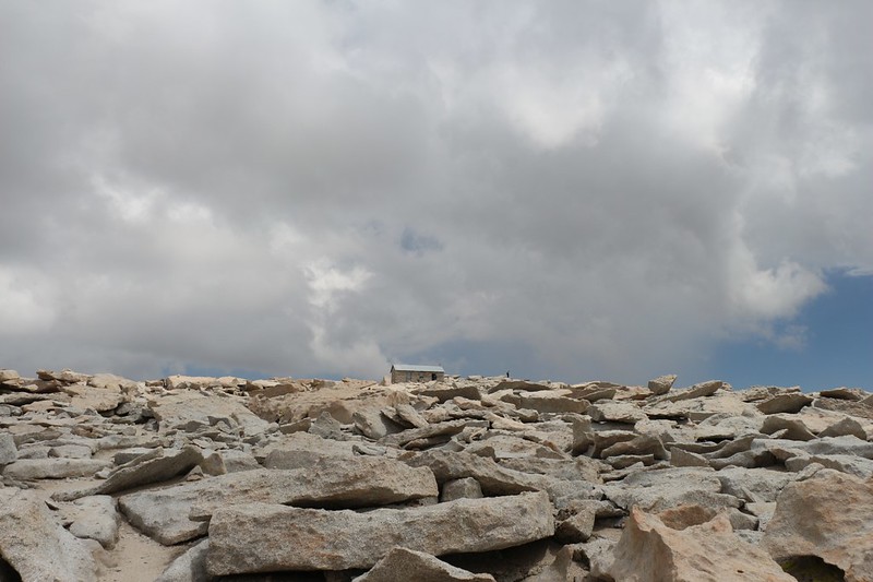
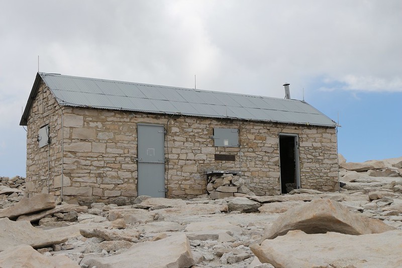
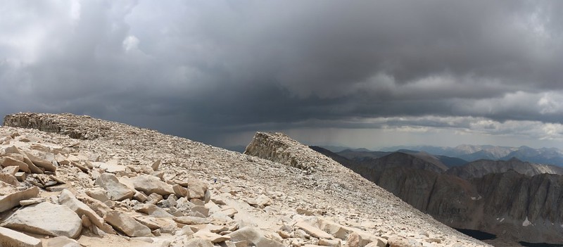
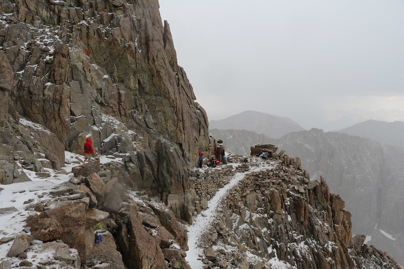
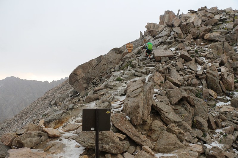
So we headed up the final section of trail toward the summit. The slope of the trail didn’t ease much at all. We continued climbing steadily. We kept looking up, hoping to see the top, but the mountain was rounded and deceptive. Eventually, of course, the famous summit hut came into view and we trudged on up the last bit of trail.

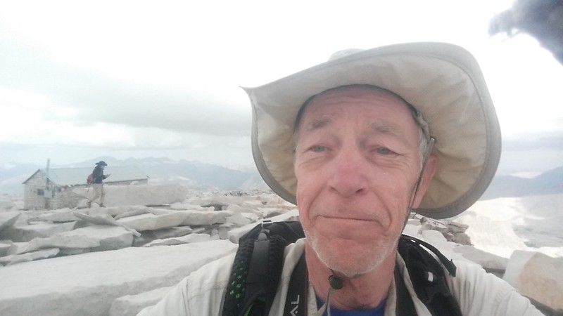
And then we were on the summit of Mount Whitney! Hooray! We walked over and checked out the summit hut, and signed our names in the summit register. Inside the hut were several more signs warning of the danger of lightning. It sounded serious, as people had been killed while sheltering inside. This happened over twenty years ago, and, after a lawsuit, the forest service had placed all of these warning signs. Not long after that, proper lightning rods and ground cables were installed on the structure, but nobody removed the signs, even though it’s probably the safest spot on the mountain right now. Still, no one really wants to test it, now do they?
Then we headed over to the eastern edge and took all of the requisite photos and videos. Including selfies. I checked my phone and I was able to receive a bit of cell signal, so I texted the family and some friends that I was up here, mostly to get them jealous, as they were all stuck at work. This is an important part of the Whitney Summit Experience.

GoPro panorama video from the summit

We noticed that there were some seriously dark clouds beginning to form near by, so we cut short our rest on the summit. We started heading down the trail at a much greater speed than usual. I didn’t need warning signs to know that being on top of the highest object in sight was rather dangerous if lightning was possible. But so far, there had been no sound of thunder whatsoever, so we figured that we might have a bit of extra time. And maybe if we were lucky the storm would drift away. At least I said that to Steph, who was looking a bit nervous. I decided not to repeat what I’d said to my Korean friends the day before: “Whitney is so big that it makes its own weather”.
Still, all this haste didn’t prevent us from stopping here and there and taking more photos and videos. These are excellent conditions for dramatic photos, provided you can get off the mountain alive afterwards to show them off. (Just a bit of hiking humor.)
GoPro panorama video looking north from near the top of Mount Whitney
All told, we had over over ten miles yet to hike and 6100 feet of elevation to descend. That’s a long way down by anyone’s definition, so we didn’t start running like maniacs along the trail. We needed to conserve our strength, stay well-hydrated and fed, and not have any accidents on the way. It was about 12:15pm when we left the summit, and in fifteen minutes we’d already hiked the first half mile. We’d come down off the main Whitney massif and were about to begin the long traverse to Trail Crest. There was still no thunder, but we could see a storm getting closer to us, coming up from the south. It didn’t help that we were walking directly toward it, but that’s what we had to do.
Then the sun came out. It was quite a contrast to the dark clouds in front of us. It really was spectacular-looking. And the traverse was easy hiking, downhill but not too steep, so we flew right along. The trail stayed just below the various needles and towers, but it still felt quite exposed, so we walked fast and didn’t stop for rests.
It was 1pm when we finished the easy traverse near Mount Muir. This was where the trail got a bit more technical, and the drop-offs to the right more pronounced. But we didn’t devote a whole lot of time to taking in the views. We only had a half mile left to Trail Crest, we were hiking fast, and we kept on thinking about those warning signs.
Finally, when it seemed like the sky couldn’t possibly get any darker, the thunder and lightning began.
We stopped and looked at each other. But we didn’t have many choices. Everywhere along the trail was equally dangerous, so we kept on hiking. What else could we do?
Video of Thunder and Lightning on the traverse south of Mount Whitney
Video of the hailstorm just getting started – We were hiking fast and I was breathing hard
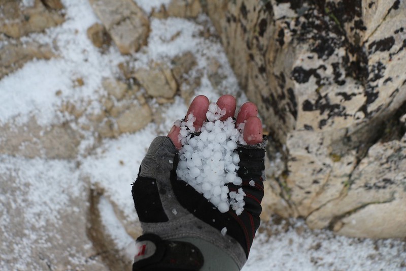
And within a minute it was hailing. Just a few hailstones at first, small ones that bopped off my hat and bounced down the steep slope to my right. But we knew that it was going to get worse. Probably quite rapidly. We stopped while Steph put on her rain jacket and wool leggings, as the air had gotten remarkably cold all of a sudden. In fact, it was so cold that the hailstones weren’t even melting. Did I stop and put on my raingear? No. I was an idiot. I just stood there with my cameras, one in each hand, taking photos and videos in every direction, hoping to catch some thunder sounds or, even better, an actual lightning bolt. Some insane part of my brain thought that this entire storm was amazingly awesome. But I didn’t tell Steph any of that. I wasn’t sure she’d understand.
Just as I predicted, within a minute the hail began coming down in earnest. It was powerful, and came down with staccato bursts and astounding waves of intensity. I was glad that I had my hat for protection, and was even gladder that the hailstones didn’t get much larger than a quarter inch in diameter. But there sure were an awful lot of them!
They were bouncing off the rocks in every direction, but eventually they began to collect on the trail itself, in the declivities and cracks between the small rocks beneath our feet. We hiked along with extra care, hoping not to slip. Incredibly, within ten minutes the trail was two inches deep in hailstones! There were white patches everywhere on the mountain. It was the end of July, and it looked like Winter! (This is the sort of thing that happens in the High Sierra, and you need to be prepared for it.)
Video of the hail pounding down and accumulating on the trail near Mount Muir

Video of the hail falling near Mount Muir
Video of thunder and hail on the hike to Trail Crest
Very long GoPro video as I hiked down the trail (the camera case dulls the sound except when hit by hailstones)
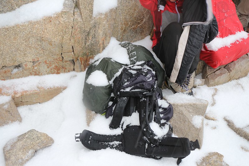
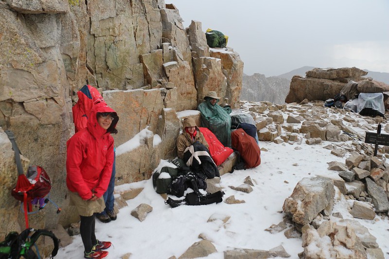
Sometime during that fifteen minutes of stormy hiking, the hail changed from cold and dry to cool and wet. A bit of rain became interspersed with the hailstones, which were now glistening with moisture, and, as a consequence, my clothes gradually grew quite soggy. And that’s why I was an idiot. Because I didn’t really notice it until it was too late, and by then I could see Trail Crest itself, just a few minutes away. This was a classic hypothermia situation, and I knew it. However, I also knew that I wouldn’t freeze as long as I kept on hiking fast. So that’s what I did.
When we arrived I immediately put down my pack, got out my raingear, and put it on. Better late than never, I reasoned. And it was: I felt better right away. It really took the edge off the cold breeze. Then Steph and I got our packs and gear back together, preparing for the next phase of the hike. While packing, we spoke with a man and his son, who had been sitting there, hunkering down under plastic ponchos.
“That was awesome!” I exclaimed. They all looked at me like I was nuts. “I mean, if you’re going to climb Mount Whitney, then being in a thunderstorm is the ultimate experience! It’s like icing on the cake!” I tried, I really did, but I don’t think my reasoning won me any followers.
They smiled for a photo, and then decided to join us on the big descent, as the hail had largely let up by then. There was still plenty of thunder rumbling all around us, and a light rain was falling, but it didn’t seem quite as dangerous to be out on the trail at this point. It was 1:30pm, and we had nine more miles to go.
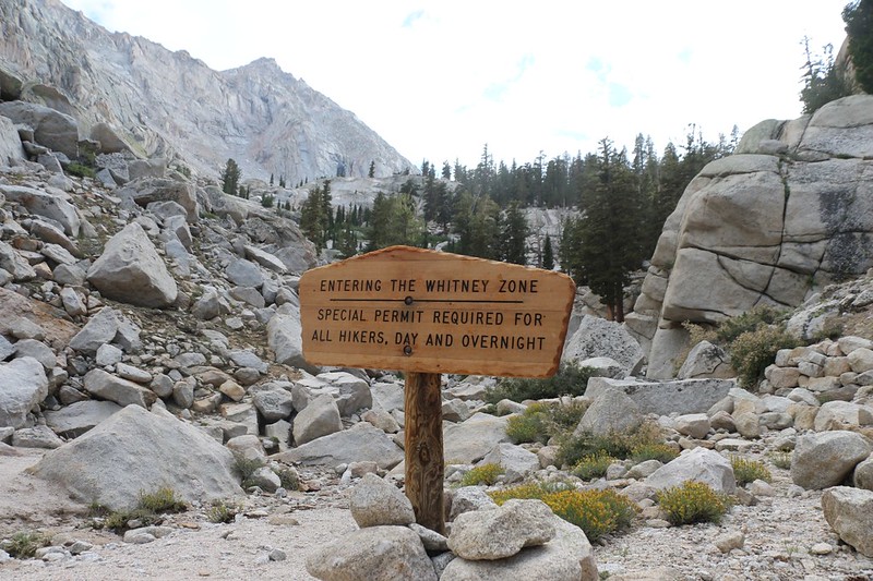
At this point we were no longer on the JMT, but were on the main Mount Whitney Trail. Interestingly, the first section headed uphill, not down. The junction where we left our gear wasn’t really the “true” Trail Crest, which was actually on the Whitney Trail where it crossed the line of the Sierra Crest (which defined two different watersheds). There was a wooden sign at that point announcing this fact, and it also was the point where we entered the official “Whitney Zone” on the east side, which required a special permit.
This was the spot where I could have bid Steph goodbye, and headed back down the west side, followed by a three day hike north to Onion Valley and my car. Steph had the extra permit spot because her original partner had left their hike early. When she’d spoken to the ranger yesterday about letting me use that empty spot on the permit he had told her: “Let your conscience be your guide.”
This was the moment of truth. And after spending half a day hiking with me (a known idiot who thought that being in a thunderstorm at 14,000 feet was a desirable experience) I thought it advisable to ask her “How’s your conscience doing?”
She laughed. And then she pointed onward, to the east. “Let’s get out of here.”
This was good advice. The rain was still sprinkling gently and the thunder was continuing with disturbing regularity. And there we were, soaking wet, on an exposed ridgetop.
Yes. it was time to descend the mythical 97 Switchbacks. So off we went. They were wet and covered with melting hailstones. But at least they headed down. And down, and down. At first I was worried about my footing, but the hailstones turned out to be less dangerous than I’d imagined. My secondary worry was that my feet might get soaked if I stepped in a deep enough puddle, so I kept an eye out for the high spots along the edges of the trail. I didn’t want my callouses getting soft, or I’d be sure to get a blister; downhill is never easy on the feet.
Video of thunder and hail. which still hadn’t stopped, but we decided to descend the trail anyway
We arrived at “Trail Camp” and saw a number of soggy-looking tents and people camped here and there, not far from a small lake. It was a dreary place under the gray sky. The rain had let up by then, but everything was wet. We stopped for a breather and turned around to look up at Whitney and the switchbacks. The storm was mostly done, but I didn’t trust it. “Now that we’re down I’ll bet it gives us one last rumble to let us know who’s boss.” We continued hiking and just as we reached the pond we heard a final boom echoing off the distant cliffs. We laughed, but we kept on moving, just in case.
It was 3pm and we still had six more miles (and 3700 feet) to go. So we went. Steph informed me that her knee had begun to swell. It had been a bit sore yesterday, but all this downhill was taking its toll. So we slowed our pace a bit, but not by much. Really it was all the rocky steps on the trail that slowed us down. A smoothly-sloping trail would have been welcome, but it wasn’t going to happen here. It was all rock. And knees really hate steps like that.
Video of Lone Pine Creek cascading down into Trailside Meadow
It was 5pm when we arrived in Outpost Camp. We’d been hiking at only one mile per hour on that miserable rocky trail. But at least we were still moving, and another hiker told us that the trail improved significantly below this point. We certainly hoped so. We decided to take an actual break at the campground, which seemed much more hospitable than Trail Camp, thanks to the presence of tall pine trees. There was also a beautiful waterfall there. A truly idyllic location.
I took off my pack and removed my raingear, as it was getting warmer (a bit of sunshine had appeared to lighten our day), and I was pleased to discover that my shirt and pants were completely dry underneath. That breathable goretex really works! I took my hat out of the pack’s back pocket and discovered that there were still a few hailstones frozen onto the brim. Proof that the thunderstorm hadn’t been a dream, after all. I took off my shoes and let my sweaty socks dry out. Cool, happy feet. And then I got out some food and ate, hoping to input enough energy to make it the next four miles. Steph, meanwhile, was completely out of food (as she had stayed a day longer than planned), so I gave her one of my extra bags of Reese’s Pieces. I had several days of food in my pack, essentially all of it junk food. This wasn’t her usual style, but the chocolate probably swayed her.
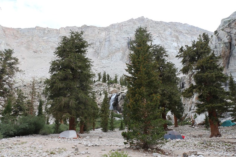
Video of the waterfall on Lone Pine Creek near Outpost Camp
We didn’t spend too long at Outpost Camp because it was starting to get late. We were way down in a canyon and shadows were lengthening. Also, I had my heart set on a “Portal Burger” from the Whitney Portal Store, and I wasn’t sure how late they were open. Plus, we might have to hitchhike down into Lone Pine, or find some other way to get back north to Onion Valley and my car. So down we hiked, and the trail was a bit less rocky, but only in places. There was still no shortage of steps that were killing Steph’s knee, and that slowed us down a bit, but not as much as you might think. I have a feeling that she was powering through the pain. But she didn’t complain at all.
We reached the side-trail to Lone Pine Lake and noticed the official “Whitney Zone” sign. I had made it through the dreaded Zone without being detected by any rangers! Hooray! Steph’s conscience was thereby relieved of any and all qualms, and we both felt better immediately. It also meant that we were getting closer to the portal. Unfortunately, it was still three more miles away.
Luckily, the trail began getting smoother. We quickened our pace and hiked onward without any rests. The trail crossed a few streams along the way, including the North Fork of Lone Pine Creek, where we saw the trail leading off to the Mountaineer’s Route. Maybe I’d try climbing that some other year, after I got more practice with crampons and ice ax. Meanwhile, our trail kept going down and down.

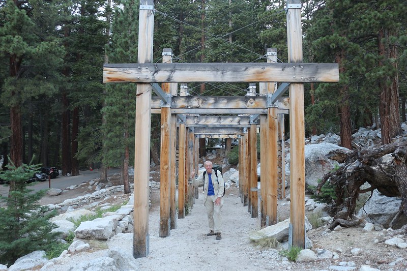
It was 7pm by the time we reached the official wooden gateway structure at the trailhead. I posed for a photo and then we hiked on over to the Whitney Portal Store. With great relief, we took off our heavy packs and set them down on a bench just outside the store. I checked my GPS. We had hiked fifteen miles in twelve hours, climbing 3200 feet and descending 6500 feet. That was a solid day’s hike! My legs were a bit tired and sore after all that downhill action, but my feet felt fine. Steph said that her knee was happier now that the pack was off.
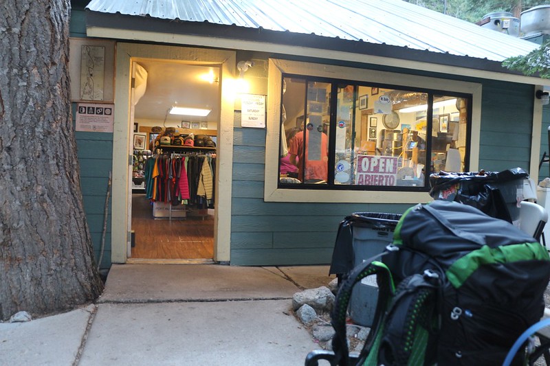
We headed into the store and discovered that we were about five minutes too late to get a Portal Burger. The kitchen was closed and the last burger of the night was sitting on the counter waiting for the person who ordered it to pick it up. I eyed it greedily, hoping against hope that he wouldn’t show up, but it wasn’t meant to be. Sigh. The aroma of hot french fries was the only part of the meal that I received. I wandered over and grabbed a bottle of soda. I also bought a Mount Whitney T-shirt for Vicki and a couple of embroidered patches for me. I went outside and drank my soda. I was seriously dehydrated and it tasted great. I told Steph that they also had beer for sale, which she hadn’t noticed, and she went back in to get some.
Now that we were here, we still didn’t have much of a plan for getting down to Lone Pine or back to my car. And there wasn’t any cell phone signal to call for a ride. So I went back into the store and spoke to Doug, the owner, about the location of the backpacker’s walk-in campground, which was our least-desirable option, because we’d have to stay in tents another night, and Steph might have to eat some of my junk food. Then I asked him about getting a shuttle to Onion Valley. And Doug was fantastic. He got on the landline and called several folks on his list, locals who made extra cash driving hikers up and down the Eastern Sierra. And one of them said he’d be there in an hour. Woo hoo! We were set, and would be sleeping in hotel rooms like civilized folk. Thanks, Doug! What a great guy, a true friend to hikers. I went out to read my book, while Steph stayed inside where it was warm, drinking her beer and chatting with Doug.
The shuttle was a bit late, but we were grateful just the same. It was about an hour’s drive to Onion Valley, where he dropped us off at the car. It was pitch dark by then. He’d given us good advice as to hotels and food to eat. So we loaded the car and headed back to Lone Pine. We ate at a Taco Truck, which served genuine Mexican food, then headed for the Dow Villa Motel. We each got a room in the quaint “historical” section of the motel. There weren’t any showers in those rooms, just shared bathrooms in the hallway, but I didn’t care about that. It was already 11pm, and the only thing I wanted to do was sleep. I texted Vicki to let her know that I was safely out of the wilderness, and went to bed.
The next morning I woke up and got ready early, as usual. I waited a while and read my book before knocking on Steph’s door. She wasn’t an early bird like me. But it turned out that she’d already made a reservation to get on a bus to Las Vegas (she was from Canada and her flight home left from Vegas), but she needed to get to Barstow first. This was part of yesterday’s plan, as Barstow wasn’t very far out of my way to San Diego, while it would have taken her three bus rides and a very long day to get from Lone Pine to Las Vegas. So all was well. We ate a hearty breakfast at the restaurant across the street and drove south on Route 395. A couple of hours later, I bid adieu to Steph, and drove the rest of the way home by myself.
I’d started the trip alone, and ended it alone, but along the way I’d met plenty of friendly people. Everyone on the trail was helpful, generous, and kind, which was the way that people should be everywhere. With the exception of a bout of malaise on the first day, a lack of footwear when crossing streams, and soggy clothes during a hailstorm, everything went really well. Thanks to the Inreach, I was able to keep in touch with home, and thanks to meeting great people on the trail I was able to keep myself from feeling lonely. I hiked hard, stayed busy, and had an exceptional time. Solo hiking wasn’t as daunting as I had feared it would be.
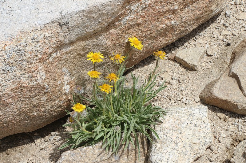
And the High Sierra are always beautiful.
For a topographic map of the hike see my CalTopo Page
For LOTS more photos of the trek see my Flickr Page
 << Back to Day 3
