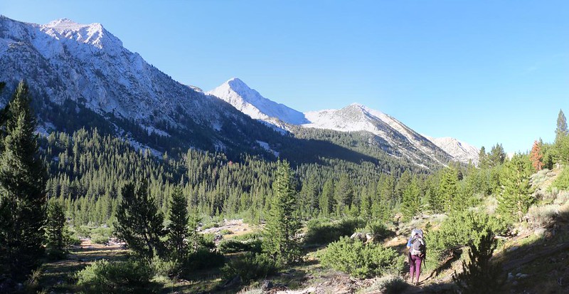
On the third day of our trek we hiked eleven miles down the Mono Creek Trail, beginning at Fourth Recess Lake and ending at the main John Muir Trail backcountry campsite, near the VVR trail junction to Lake Edison. It was a long hike, but the grade was mellow, except near the end when the trail climbed steeply, for a mile or so, up and over a ridge to the North Fork Mono Creek.
Yesterday, when we made the decision to camp at Fourth Recess Lake, we knew that today’s hike was only going to be longer. So we chose to apply our usual strategy: Wake up early and get as much hiking done in the cool of the morning as possible. And that’s exactly what we did. We packed up quietly, in the dark, and our neighbors didn’t even notice that we were gone. We took one last photo next to the lovely lake, then headed back to the main trail.

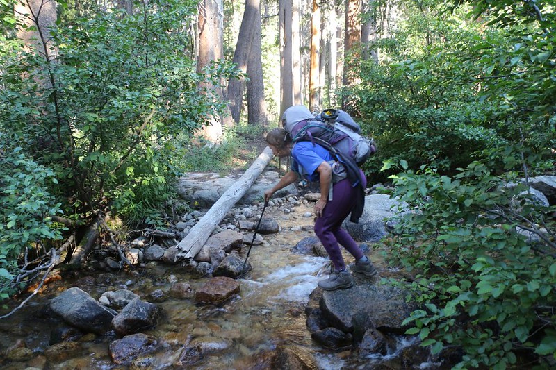
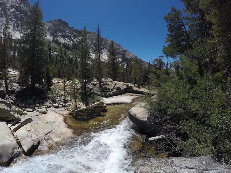
The Mono Creek Trail mainly stayed along the bottom of the valley, down within a pine forest, so there weren’t a lot of views. Occasionally, there would be a meadow, and then we could see the surrounding mountains, looming high above the canyon walls. Along the way, we crossed many side creeks entering from the north. Each one was a mild challenge to rock-hop across, as this trail wasn’t funded as well as the big trails like the PCT, which often have log bridges. Meanwhile, all that incoming water continued to swell the volume of Mono Creek itself.


After two miles, we crossed Hopkins Creek. This was where we almost camped the night before. There weren’t any obvious tent spots nearby, so we were even gladder to have stayed at Fourth Recess. But now we were back where we wanted to start originally, and had at least eight more miles to go. Onward!
After that, when the trail neared Mono Creek, we could see how large it had gotten since it’s humble beginnings, when we easily crossed Golden Creek that morning. We had absolutely no desire to attempt a crossing now! It was booming and cascading like mad. We tried to imagine it during the Spring melt, and were left awestruck.
The naming convention of the Mono Creek Valley side canyons wasn’t very imaginative: First, Second, Third, and Fourth Recess. Boring! But at least it was a rough gauge, a guide which informed us as to how far we had to hike before we reached the JMT. It turned out to be further than we liked. Eventually, the sun got high enough and hot enough that we decided to stop for an early lunch. Vicki also decided to take a nap, to recharge her glycogen.


We continued past Second Recess, where there were some hot and exposed meadows to cross. Vicki was keeping herself wet with her trusty spray mister, but it couldn’t compare to the cooling power of soaking her head and shirt in the icy waters of Mono Creek. Putting the icy, dripping shirt back on was quite a shock, but after that she was happy again.


I even joined in on the head-wetting fun as we neared the 8000 foot mark. It was significantly hotter down here than it had been back at Little Lakes Valley. And that’s yet another reason why I love the truly “High” Sierra. This “Middle Sierra” weather was roasting!

After First Recess, the uphill part of the day’s hike began. It was only a 300 foot ascent, but Vicki had been dreading it all day. And she was right! It was hot and dusty and dry, as we climbed out of the Mono Creek Valley, up and over a ridge, and back down into the North Fork Mono Creek Valley. This detour made no sense to us. Why did the trail builders do this? I imagined a deep, impassable gorge that the creek flowed through, thus precluding the trail, but I don’t really know for sure what happened. I think they simply wanted to link it to the existing John Muir Trail as easily (for them) as possible. Most of the trail designers out west owned horses, after all, and what’s 300 feet to a poor, tired horse? Nothing to worry about…


When we got to the top of the intervening ridge, Vicki was almost completely shot. She was a walking zombie. I found her a shady spot under a pine and helped her get settled in for a nice long nap. Then I got out my book, read a bit, and generally enjoyed the view out to the west. I couldn’t quite see Lake Thomas A. Edison from there, but I could see the big valley that contained it.
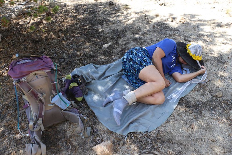

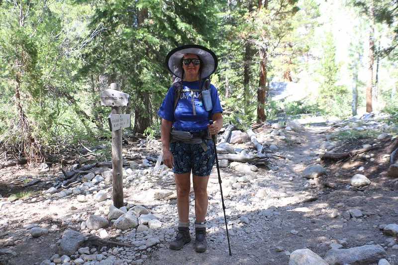
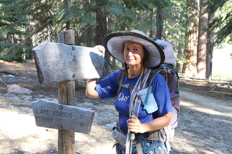
Eventually, Vicki woke up. She still wasn’t feeling great, as it had already been a long hot day, but she managed to pull out some residual energy from somewhere. I didn’t want to tell her that we still had almost two miles yet to hike, so I carefully worded it by saying that it wasn’t too far, and that it was all downhill from here. I also kept to easier goals, like the intersection with the PCT/JMT, which was right up ahead of us. This was the southernmost point that I had reached last year, when I hiked down from Mammoth Lakes over Silver Pass.
After that, there was a tough downhill section over rocky terrain that strained both of our knees, leading to the next minor goal, which would be when we crossed the North Fork of Mono Creek. Then the trail was easy hiking, all the way to the third minor goal: The junction with the High Sierra Pack Station Trail which led to VVR. We met several southbound JMT hikers that were heading that way to get their food resupply boxes.
After that, we were almost finished. One last goal! Vicki didn’t believe a word I said, of course. In her mind, the trail was endless. But I wasn’t lying. We walked over to the big bridge over Mono Creek, and crossed it. Just beyond that was the campground. Really, Vicki, we’re almost there!


We hiked into the campground and Vicki sat down to wait while I found a good spot. It didn’t take long. I left my pack there to claim it, and walked back to get Vicki. I carried her pack the last few feet, and she sat down again. I put up the tent myself, as she was totally whupped. By that time she began feeling better, and took a photo of my GPS display, which showed that she made almost eleven miles in twelve hours (naps included). She was going to send that to her brothers later on, when we got signal.


After that, I went down to the creek for water, then Vicki boiled up some of it for dinner. We didn’t hang around outside very long after that. Vicki just wanted to get into bed. Not surprisingly, after a big downhill, we had a 2000 foot climb to do first thing tomorrow morning! That’s the PCT for you, always up and down, ad infinitum. Vicki was dreading it. Once again, we would be waking up before dawn to make the ascent. Vicki was asleep almost immediately after lying down. It had been a long hiking day, but I enjoyed it just fine. And tomorrow we’d be hiking on the PCT! I was excited, as this next section was the last section of PCT that I had yet to hike in the High Sierra, and it was also my final section of the JMT! Oh yes, I said to myself. The next few days were going to be beautiful as well as fulfilling.
For a topographic map of the hike see my CalTopo Page
For LOTS more photos of the trek see my Flickr Page
 << Back to Day 2 Onward to Day 4 >>

