I decided to do a short dayhike to Lone Pine Lake mainly because I passed it by three years earlier, unseen, due to exhaustion after summitting Mount Whitney. That was when I also realized that the lake is NOT within the Whitney Zone, and therefore anyone could hike up to see it without a special permit. Back in 2018, as I begrudgingly hiked past, I vowed to come back again some day, to rectify this omission.
The day arrived in July 2021. I had a six-day backpacking trek planned, up near Bishop, and I wanted to spend a couple of days beforehand getting acclimated to elevation. So I left San Diego and drove north to Lone Pine, where I got my wilderness permit for the big trek. Then I headed up Whitney Portal Road to get in a bit of high-elevation excitement, and maybe even a tasty Portal Burger at the Whitney Portal Store when the hike was over. This was a plan I could get behind.
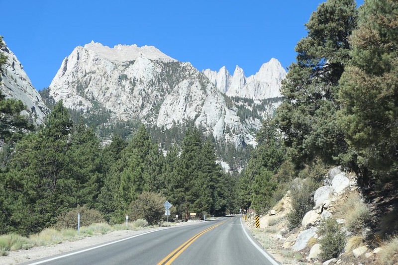
It was 100+ degrees down in the Owens Valley, but it was a comfortable 70 up at 8,300 feet elevation. I got out my daypack and made sure my water reservoir was full. I keep this pack pre-loaded with the Ten Essentials (a different set from the ones in my big backpack) so it didn’t take long to get ready. I fired up the GPS to record a track, and put it in the top pocket along with my lunch. Then I walked over to the trailhead and checked out all of the interpretive displays, plus the hanging scale for weighing your backpack. And then I started the long climb.


Along the way I came upon a Hiker Notice board with instructions on how to use a wag bag. I’d carried a wag bag last time, when I summitted Whitney from the west, but I hadn’t needed to use it. In fact, I had no idea how to use one. This display explained it well. It was sad to see that they had to remind people to actually carry it back out after use. Reminds me of the inconsiderate dog owners that bag the poop but leave the bag on the side of the trail for somebody else to clean up. Not very nice. Luckily, I saw no used bags on my hike, which was satisfying.

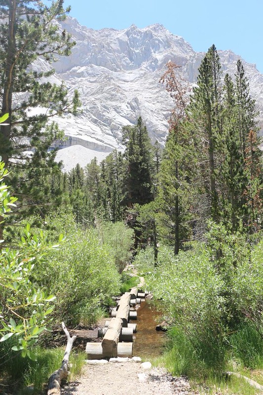
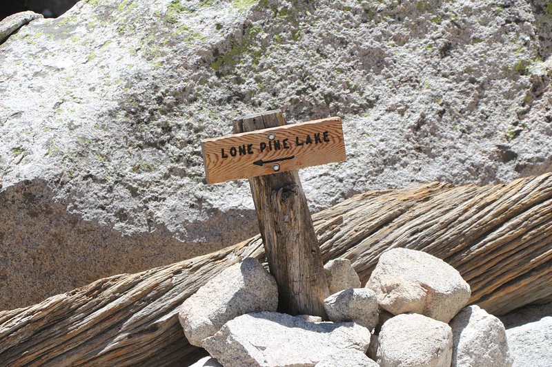
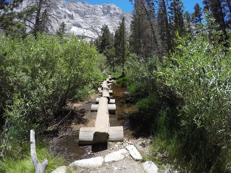
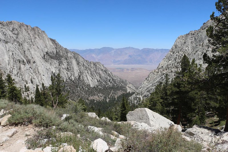
The total climb for the day was 1700 feet in about three miles, which is a solid day’s hike in my book. It took me about two hours to climb up to the top of the headwall, where I paused to look back down the valley. Then I crossed the log bridges to the spur trail that leads to Lone Pine Lake.

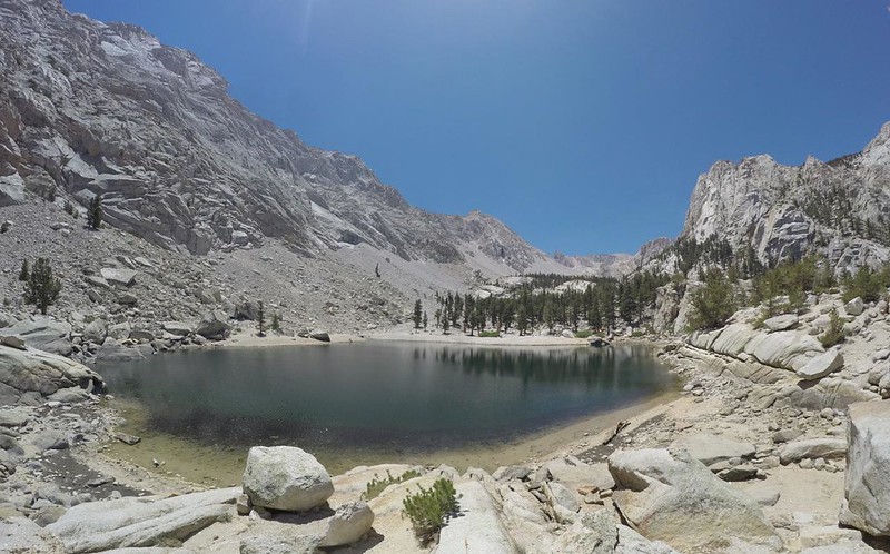
The lake was only a short distance downhill, set in a stony depression just below the edge of the headwall. This is typical of many High Sierra lakes, which were originally formed by the action of glaciers during the last ice age. There were a few other hikers present when I arrived, including a couple and their dogs who’d passed me on the way up. One of the dogs was swimming, but the other had no interest in the icy water.

Video from the west side of Lone Pine Lake with a Black Lab taking a swim in the icy water

The water level of the lake was quite low. The nearby snow had long since melted, and there hadn’t been enough of it during the previous Winter to fill the lake to capacity. The lake level looked like you’d expect it to be in late August of a typical year. I had also noticed the lack of blooming flowers and green grasses along the way up. It appeared that my upcoming trek was going to be far less colorful than I might have hoped. But that’s OK. It’s still the Sierra, and it’s still beautiful.
I headed around the lake to the east side. There was nobody over there, and I decided to eat my lunch in the shade of a pine just up from the shore. I had hoped to get a view of Mount Whitney from there, but Thor Peak (elevation 12306 feet) blocked it completely. I also heard that I might get cell signal up on the eastern ridge above the lake, but it didn’t work either – Lone Pine was hiding just behind the long northwest ridge of Mount Irvine. Oh well. I’d have to send out my selfie later on that day, to my friends who were stuck at work, to remind them that it was time to take a vacation.
GoPro video of Lone Pine Lake looking west


After that, it was time to head back down. My lunch hadn’t been all that satisfying, and I knew full well that there was a Portal Burger with my name on it waiting for me down below. The three miles of trail just ahead of me were pretty good, hiking wise. There were very few stone steps, and I knew that I would be able to cruise down fairly rapidly.

GoPro video as I crossed the log walk – it would’ve been more fun with more water in the creek.
I met a number of Whitney Day-hikers on the way down – these were folks that had started their climb around midnight. They seemed happy yet exhausted. I knew exactly how they felt, remembering the last time I came down this way. There were also people with big backpacks, who were planning to spend the night just above, within the Whitney Zone, at either Outpost Camp or Trail Camp. I wished them well, and hiked onward.


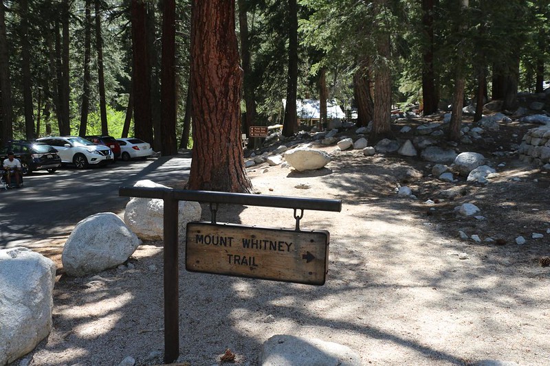
I arrived at the trailhead eventually, of course. I took a few more photos of the area, but I didn’t linger. The most important part of the hike was just up ahead: The Whitney Portal Store, and it’s famous Portal Burger. I went inside and shopped around. I bought three Mt Whitney T-shirts for my upcoming trip at the end of July with my son and his friend. We would be climbing from the west side, and I planned to whip out the shirts as a surprise up on the summit, so we could pose for a group photo. Heh heh. It would be worth carrying the extra weight just to see the looks on their faces!
And then I ordered my burger (with fries!) and waited outside for them to call me when it was ready.

I gladly carried my meal out to the table on the front porch and sat down to eat. I put a bunch of extra salt on the fries and ate them first. All of them. Cold fries are sad and useless; it’s as if their greasy, salty awesomeness utterly vanishes with the loss of their internal heat. By that point I was getting a bit full, so I only ate half of the burger. I wrapped it up in foil and put it in my pack. I decided to eat the rest later that evening, when I got to my campsite up in Horseshoe Meadows. As I was eating my fries, I thought about camping in the backpacker campground right there in Whitney Portal, but decided against it. Not only was Horseshoe Meadows 1700 feet higher (I was up here to get acclimated, after all), it also didn’t have a hundred or so boisterous, noisy hikers heading out at midnight to conquer mighty summits. I opted for peace and quiet and a good night’s sleep. Plus the other half of my Portal Burger!
For a topographic map of the hike see my CalTopo Page
For LOTS more photos of the trek see my Flickr Page
Up to the “Sierra Nevada” page

