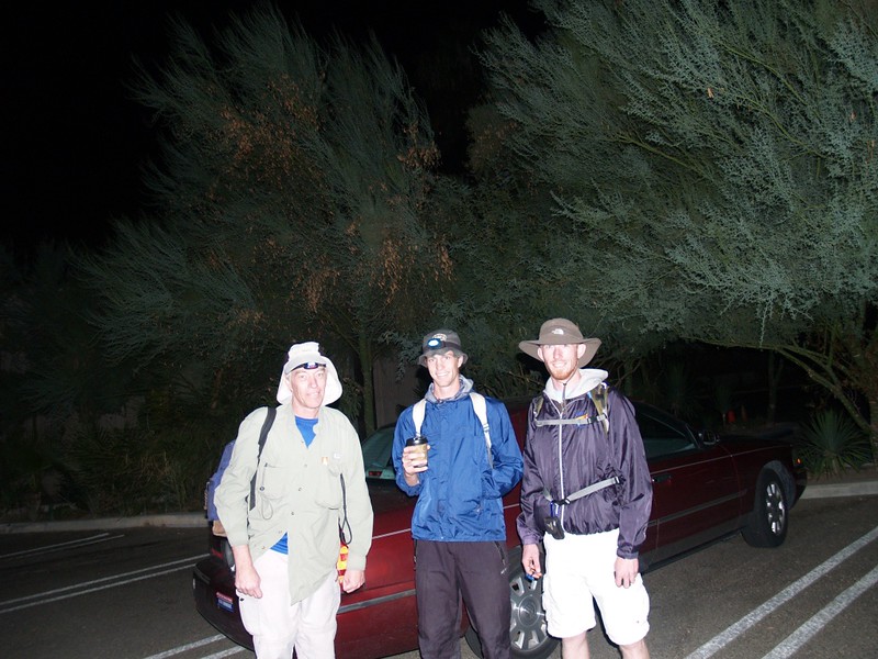
We left San Diego at 1:30am (over an hour late!) for Palm Springs and the infamous Skyline Trail. My son and his friend were the cause of the delay, and they must take full responsibility for the consequences!
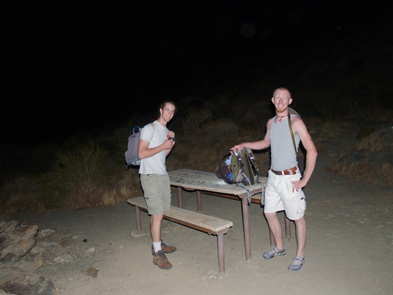
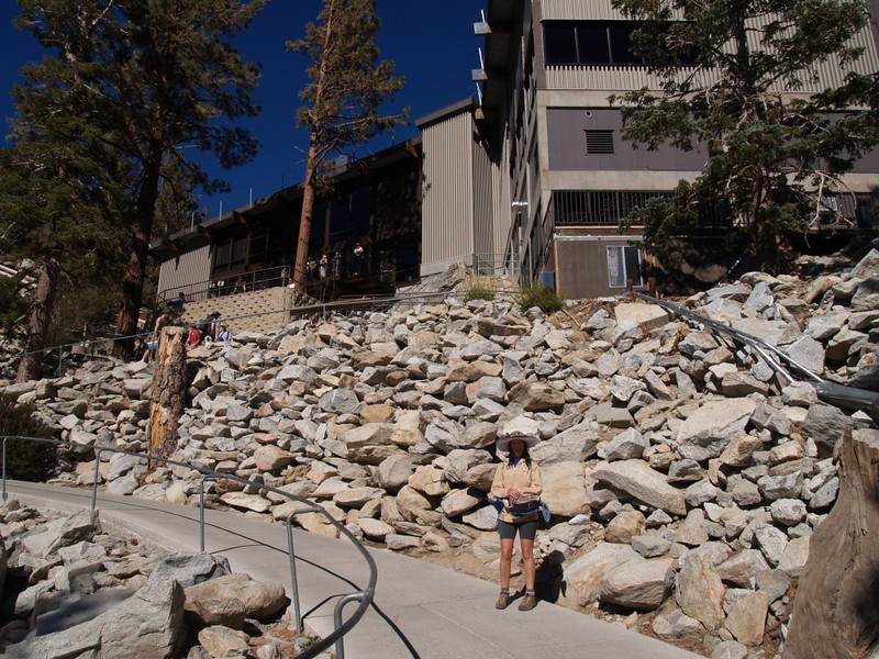
I came home from work Friday night, ate dinner, and got packed. I went to bed early, but I wasn’t very tired. I read in bed for an hour, then fell asleep. And hour later Vicki came to bed and woke me up. I started reading again, hoping to fall asleep. I got a little sleepy, so I turned out the light. I drifted in and out of sleep until 11:30, then got up and took a shower. Our original plan had been to leave punctually at 12am, but it was modified later on into a “One AM SHARP” departure. Naturally, this messed me up, and I woke up too early, as if it were still a midnight departure. And then the two young men delayed us even further, and we didn’t leave until 1:30! To add insult to injury, my son forgot his headlamp (for a night hike!) and, rather than turn the car around and wait while he tried to find it in his room, Vicki volunteered to let him use hers. Regardless, we were on our way, headed for a long day of hiking, and life was good again. Naturally, the youngsters slept like stones for the entire three hour ride, while I barely got a few winks of half-sleep; I’ve never liked sleeping in cars. I mostly read my book by headlamp, and watched the road going by. We got out of the car at the Palm Springs Art Museum parking lot, got our packs ready, and were finally hiking a bit past four AM, over an hour late!
Vicki drove off, headed for the Palm Springs Tram. She wasn’t crazy enough to voluntarily climb 8000 vertical feet in eight miles. Instead, she’d take the easy way up, and simply have an enjoyable day in the mountains, hiking around Long Valley and vicinity.
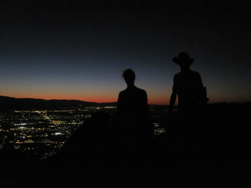
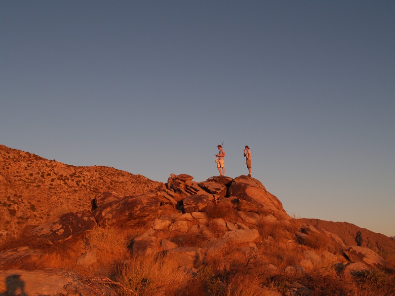
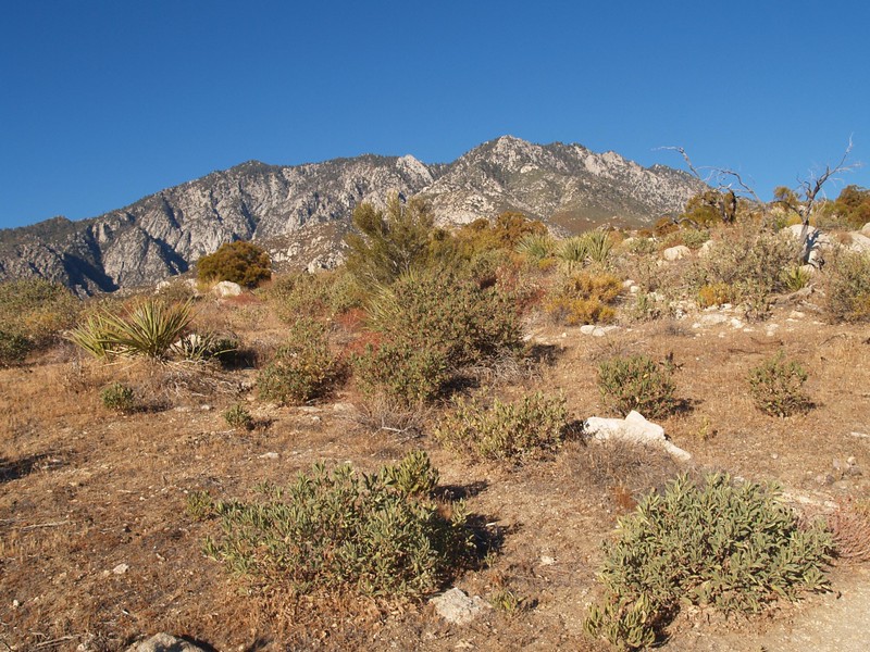
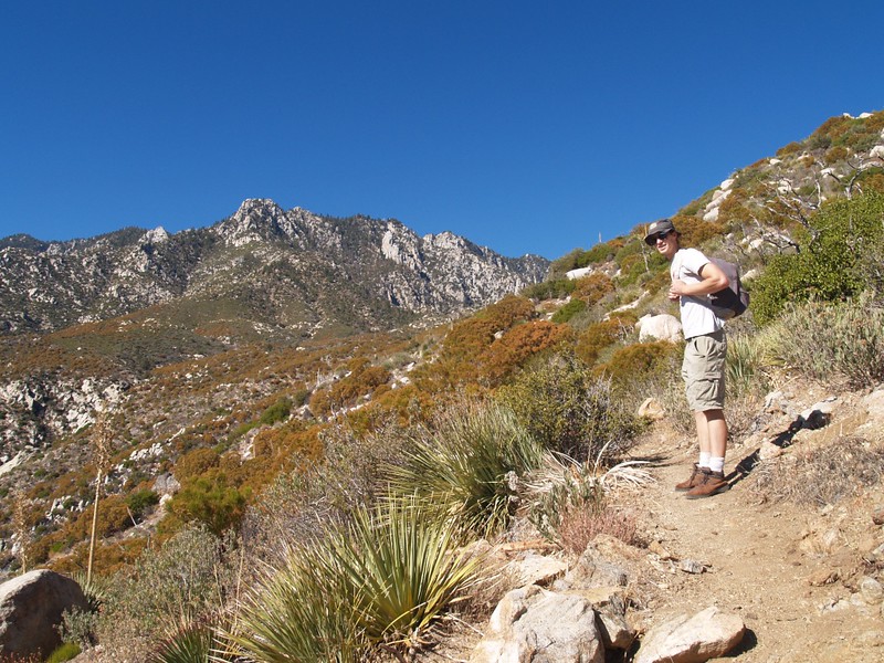
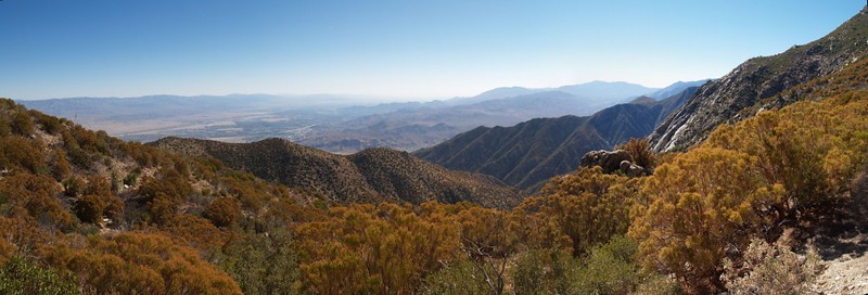
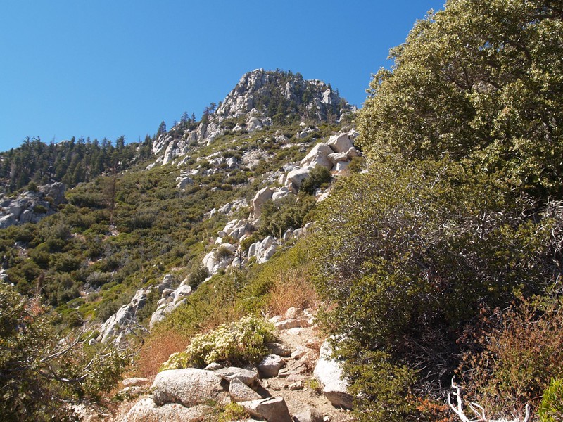
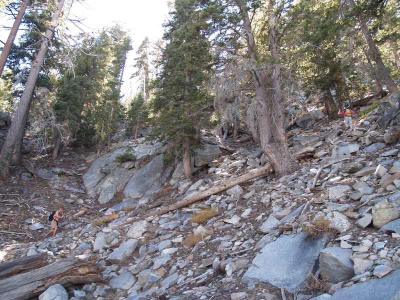
The crazy ones were wearing headlamps, trudging uphill on a non-officially-sanctioned and semi-haphazardly marked trail. And the trail wasn’t fooling around: It started out steep; it made sure you fully realized what you were getting into. We zig-zagged up and up, pausing every so often to watch the lights of the city, or the headlamps of other equally crazy hikers both ahead and behind us. It was the ones ahead of us that bothered me most, however, and I kept reminding the boys that we were over an hour late!
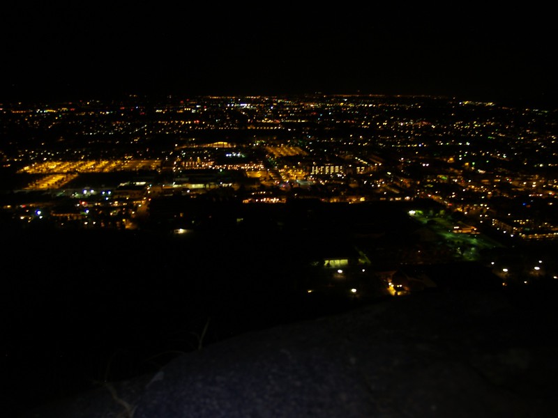
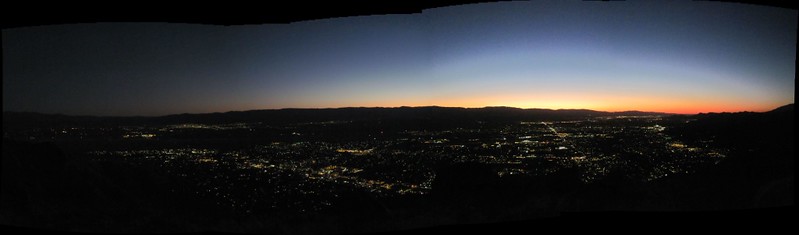
Panoramic video from the trail at dawn, looking out over the lights of Palm Springs
The original plan was that we would make it to about 4000 feet elevation by sunrise, but it wasn’t going to happen. When the first dim light crept over the horizon, we had only climbed to 2000 feet. This made us hike faster, because it was still cool out now, but it wouldn’t be soon. We popped out from behind a ridge just as the sun rose, making it to 3200 feet. We took a short break and enjoyed the scenery. I figured that we were roughly a third of the way up in three hours, making it a nine hour hike. Still, we didn’t do too badly for Skyline noobs, I thought, as I wasn’t expecting record times – in fact, anything less than twelve hours would be OK in my book, considering that I hadn’t really hiked at elevation for a month and a half. I like to think I’m in pretty good shape for my age, but I’m not in my twenties anymore, either. Not like those two twenty-somethings I was hiking with. The ones that made me over an hour late!

Video panorama looking out over Palm Springs at dawn
Meanwhile, more and more people kept passing us. A dozen or more passed us in the dark, and more would pass us as the day progressed. I had no choice but to admit that I was slow. I was seemingly unable to pass anyone, and I could tell that I was an anchor dragging behind the two boys. “Over an hour late” became my new mantra, and the lads were no longer hearing my voice at all.
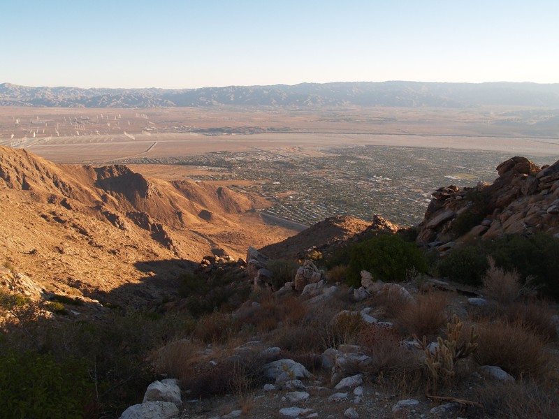

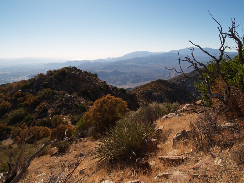
Of course, it wasn’t all doom and gloom; if anything, I was enjoying myself immensely. I met for the first time a couple of people I knew only through postings on an internet forum, Tina and Ellen, although no doubt there were other members passing me whose words I’d read and pictures I’d seen online. One of them was Doreen, who informed me that this was (I think) her 256th climb of Skyline! It was truly an honor to hike along with her. Some of her group, including (her son?) Jack took a steeper shortcut and she told me not to bother. Meanwhile, the two boys were already following Jack. I waved them on, and figured that we’d see each other soon enough. Doreen and Dave and I hiked on the main trail, and she told me that it wasn’t a race, and that enjoying the trail was what really mattered. And she was right! The views were continuously changing, yet continuously spectacular. The plants at this level were all desert-dwellers, but that was fine as I love the desert. And this was part of the Cactus To Clouds Trail, after all. I could complete the full “C2C” if I was willing to climb an extra five miles and 2000 feet to the peak of San Jacinto Mountain, which was definitely NOT going to happen today, especially not when one is over an hour late getting started.

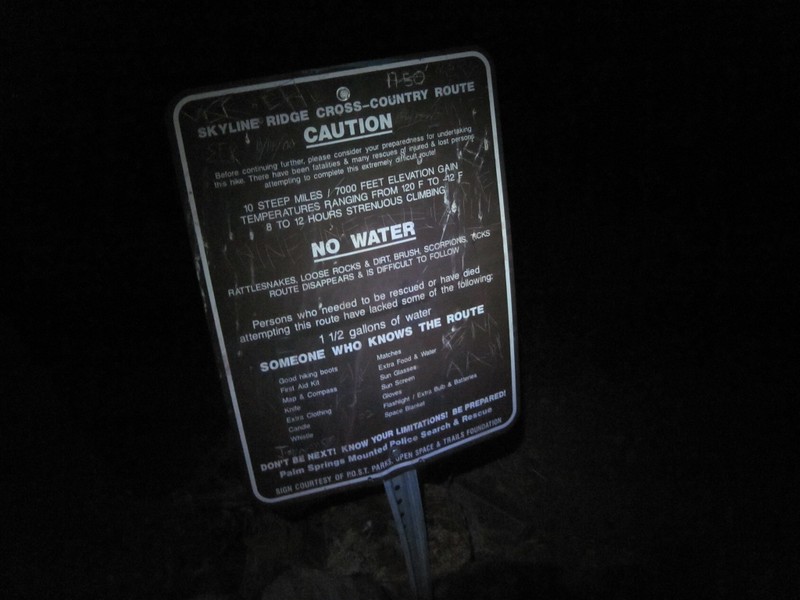
Initially, I had been very wary of bringing along my son’s friend. I didn’t know anything about his hiking abilities. I knew full well that this grueling trail had taken the lives of many hikers. It was deadly for many reasons, some of which are lack of ability, lack of water, heat exhaustion, dehydration, running out of time to reach the tram, ice in winter at the higher elevations, and just plain getting lost. I’d done my homework, I’d researched the trail, I knew what to expect, I was carrying over six liters of fluids, I had a map and gps with a known track loaded, and I had enough emergency clothing and food to survive the night if need be (I’d be cold and hungry but not starving and frozen). Death. The “D” Word. Don’t take it lightly. And I wasn’t. Meanwhile, here I was taking along an untested person on the trail. It was totally irresponsible of me. I had told my son about the trail, and told him to mention the “D” Word to his friend. My son informed me that this fellow was ready, and was a serious hiker, and that he might even be able to outhike HIM. And so it came to pass. He outhiked me completely. He stuck with Doreen’s Jack and disappeared up the trail. In other words, first he helped to make me over an hour late and then he ditched me completely! Argghh!
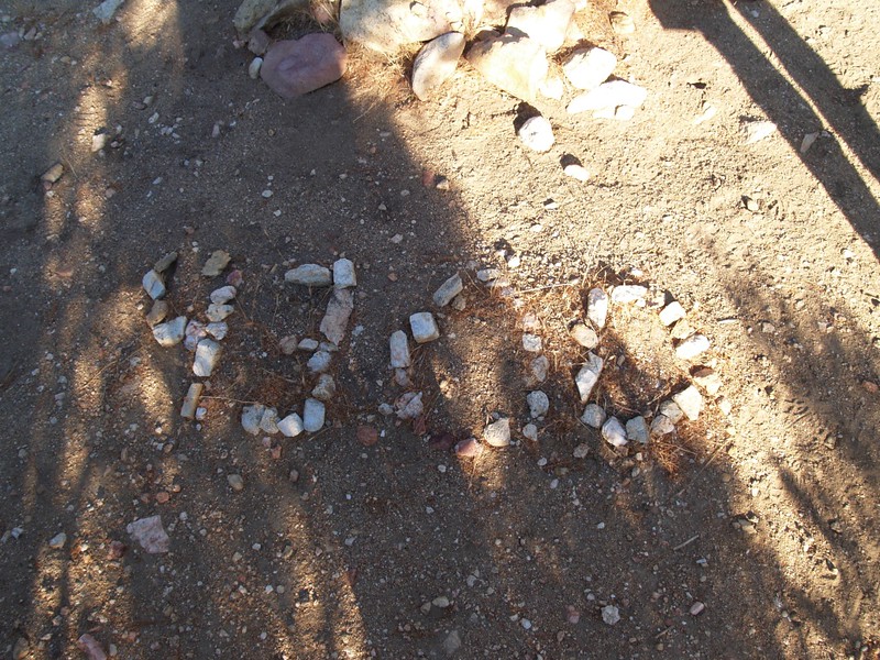
My dutiful son, however, waited for me after the shortcut. He and I and Doreen and Dave hiked on for a while. But soon enough they, too, passed us and headed on, just before we reached Doreen’s 4300 foot elevation marker, a bunch of white stones which spell out “4300” next to a cairn of rocks. This was the halfway point. Oh yes. I was halfway done and I was still feeling good, even if I WAS over an hour late.
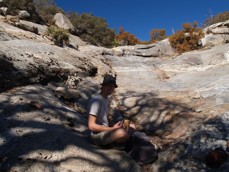
The trail went on, climbing the long ridgeline. It actually went downhill at one point, which was odd, but rather than make me mad at the trailmakers like these insane wastes of energy usually do, I liked it this time. I finally got to stretch my legs and stride for a bit. Nice! But the main grind uphill went on and on. We arrived at Flat Rock (elevation 5900) about 11 AM and had lunch with two other gents who we’d been swapping positions with all day. We kept thinking that maybe, just maybe, there would be ONE group of people that we could pass. But we kept leapfrogging with this pair. We all had lunch under the tree in the shade. One of the two was a Skyline regular, and the other was a Skyline virgin like us. We were well over halfway up the hill, true, but was it possible to be a halfway-virgin? This question remained unanswered. We all had a nice lunch, but I never learned their names. Just as we were getting ready to leave (I would have liked to have had a nap, but I couldn’t let this pair of potential “passees” pass us) a lone hiker arrived and joined the throng. All five of us headed off on this, the steeper and final third of the hike.


Panorama video

It was steeper, but the crest was now much, much closer. Earlier, it had seemed like the top was endlessly far away, but now it was merely a difficult yet attainable goal. Unfortunately, this was when I began to slow down even more. I would hike for a bit, then stop. I often took a picture while stopped, as taking too many pictures is one of my so-called “problems” when hiking. I’m a photo-junkie; I admit it (and I, personally, have no problem with it). But I’ve also found that taking a quick photo-pause is a great excuse for what I’m actually doing: Namely, resting. My son figured it out soon enough. He was getting tired of waiting for me. He’d spoken on the phone to his buddy just after Flat Rock, and found out that he and the other fast hikers were already getting drunk at the tram bar! Yes, the unknown, untested friend climbed the Skyline Trail in seven hours. And even now I think that if he hadn’t been stuck hiking with ME for the first few hours he would have finished sooner. In other words, I’m responsible for making him more than an hour late! And let’s not even talk about how late I’d made my son, who should, by all rights, have been sipping on a frosty one already. By the time we reached the first of the pine trees, the lure of the bar became too strong. My son broke free. I heard his voice from somewhere up above, saying “Dad, I’ll meet you up at the top!” “OK,” I replied. But I knew that the only top I’d meet him on was the top of a shiny bar. Besides, I’d have to catch him to stop him. Meanwhile, the grade was getting even steeper, so I kept on climbing.


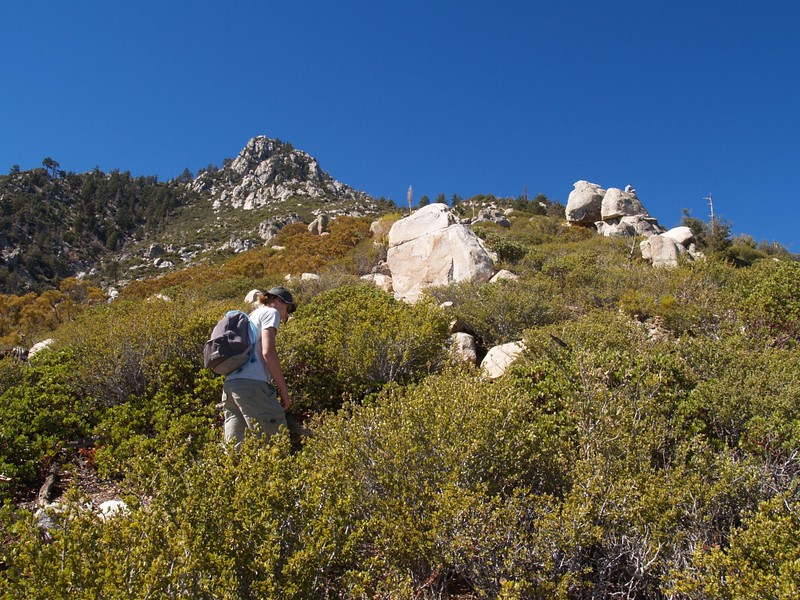

Here are the three most important things about the Skyline Trail: Elevation, Elevation, and Elevation. And I think it was the last “elevation” that got to me. I began to feel tired. Sleepy-tired. My legs were fine, no aches or pain, but my head wasn’t right. And I wasn’t sure why, as there were many possibilities. Maybe it was simply my lack of sleep the night before. Maybe it was those mysterious things called electrolytes. Or maybe I ran out of glycogen. Or was it dehydration? I wanted to fix the problem, but I didn’t know exactly what it was. So I had some more candy, and I ate some more salty chips, and I drank some more water. I even dug out a caffeine pill and swallowed it. None of them really worked. The only thing that really worked was the knowledge that there was only one way to get this hike over with: By gaining elevation.
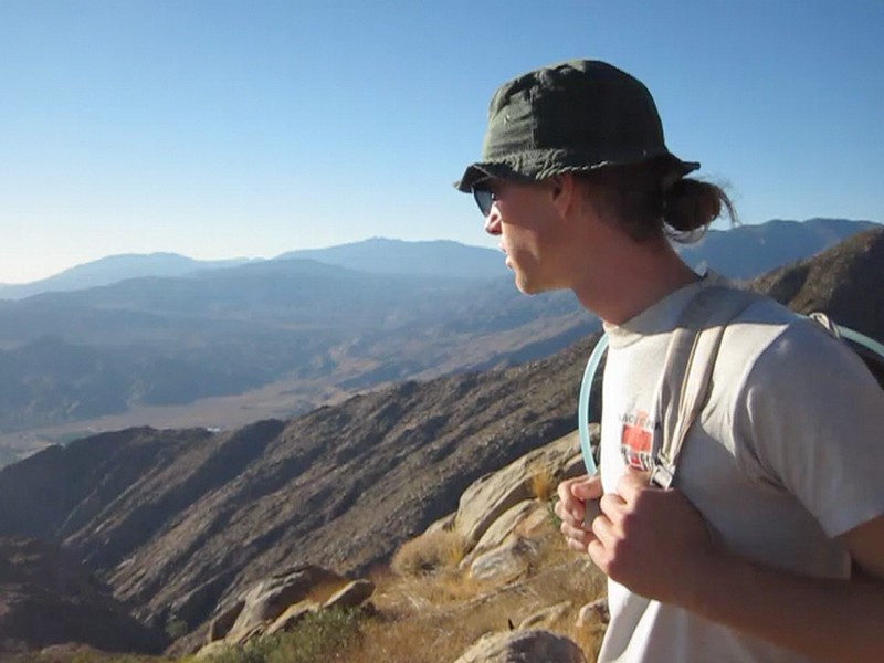
I ended up partnering with the lone hiker, whose name was Jack, as the two of us seemed to hike and rest in a similar manner. The nameless pair of hikers from lunch maintained an annoying lead of about a hundred feet in front of us. They hiked longer but also rested longer; it was merely our frequencies that differed . The competitor in me wanted to pass them, but at the same time I no longer really cared. Jack and I would catch up to them every so often. We talked about things and had a good time hiking together. Being slow and resting when you feel like it isn’t all that bad, you know. But I also pointed out the mathematical certainty that that every time you stop, your estimated time of arrival increases to infinity. This was enough to get us going again.
Panorama video from high up on the Skyline Trail
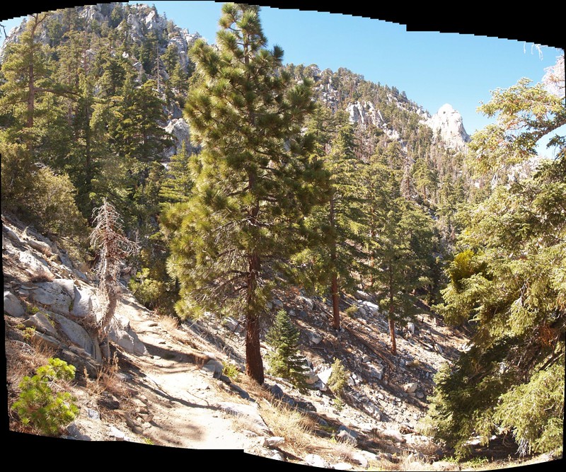
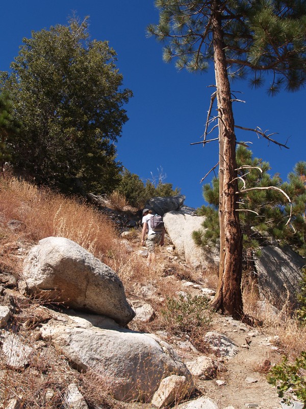
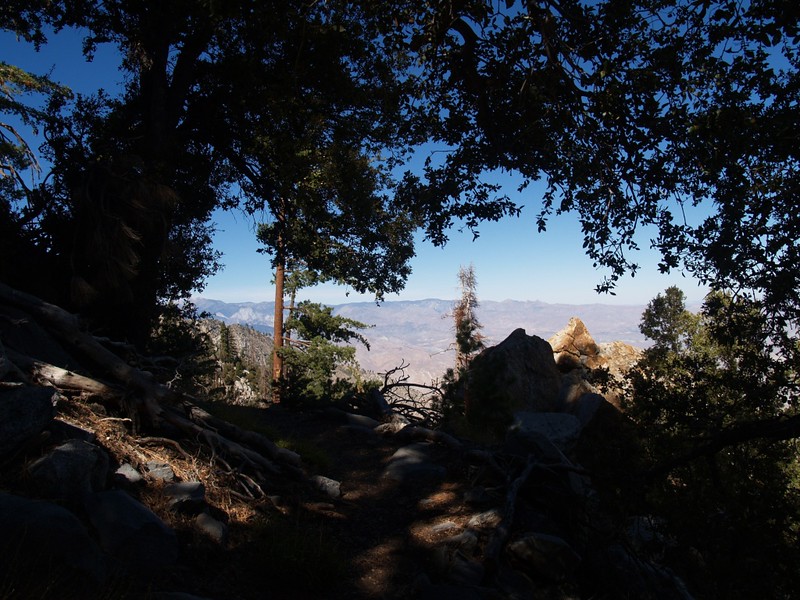
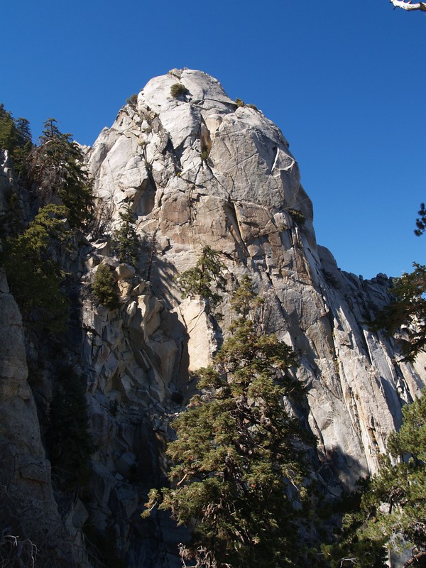
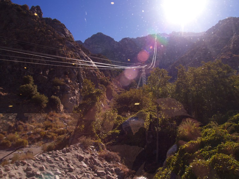
We headed into the “traverse” section of the trail, where we left the long ridge and headed across a steep couloir towards Coffman’s Crag, a huge domed rock that we’d been seeing since early morning. We could hear the motor of the tram droning on as it pulled the car up the cables to the top. It was much louder than you’d think on that little-visited side of the mountain. The traverse was easy at this time of year, but I could see why this was the tricky section when ice and snow were on the mountain. It was shaded and would stay icy long after the rest of the snow would be melted and gone. It was also extremely steep. The so-called “trail” was like a temporary scratch in the looser scree and boulders of the hillside. Also, people have taken many routes across it, so the trail is less defined along there. We had no actual trouble, as we knew we could always climb straight up if need be, but we wanted to find the “real” trail if we could. It was also a great excuse to stop and rest. Finally, we reached Coffman’s Crag, and had a short sit-down break. I sat down right on the trail, as the nameless pair had snagged the good seats, and Jack, well, I forget where he sat. My brain wasn’t doing all that well, you know… Still, I was beginning to feel a tiny bit better; maybe it was the all the stuff I’d swallowed that made the difference, or maybe it was simply knowing that I was almost finished.
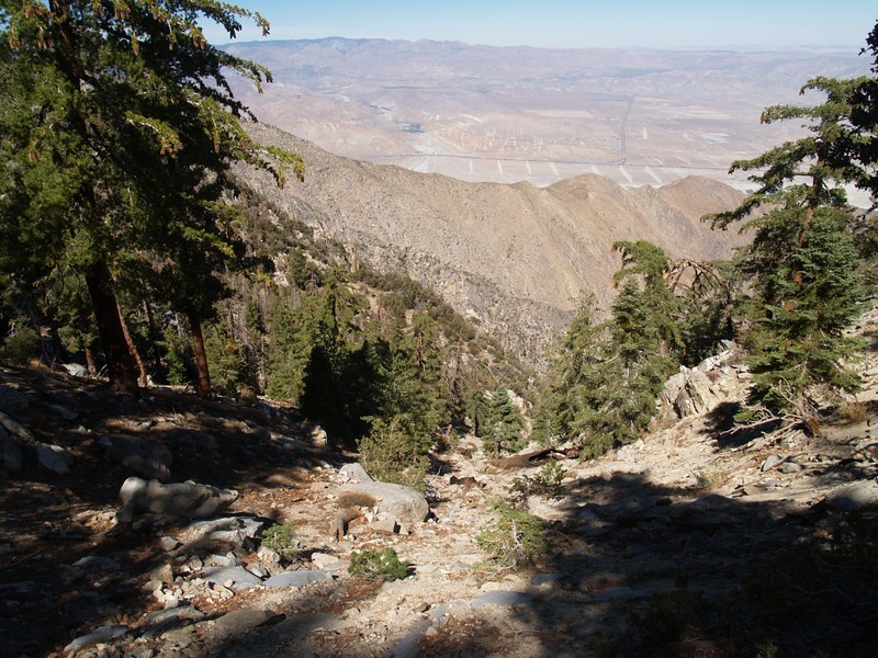
And then it was time for the final blast of elevation. Will Power was required. This last section was the steepest part of the entire trail. But what made it nice was that I could see some blue sky peeking through the trees up above. The top was truly in sight! The trail was incredibly steep, but we knew we simply had to power our way up, using brute force. As we hiked up the final few switchbacks, the top of Grubb’s Notch became more and more obvious, and then, miraculously, the grade flattened out, and we were on the top of the Skyline Trail! We did it! It felt great to be there. And my tiredness seemed to have vanished!


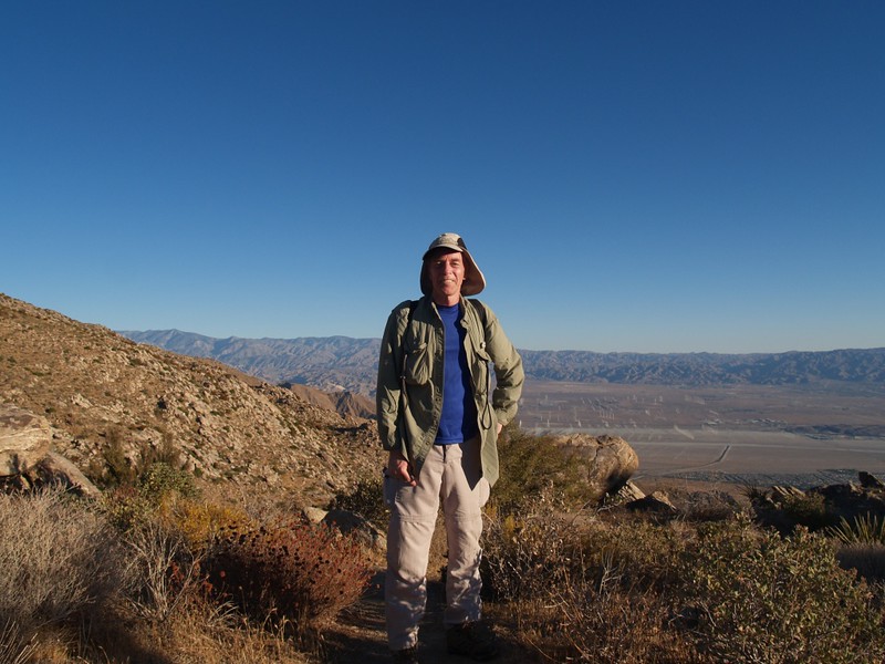
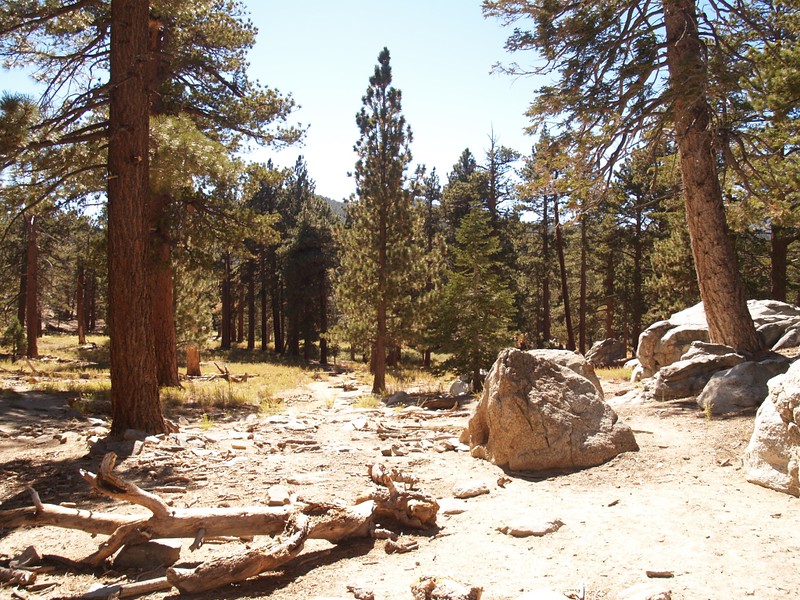
It was a little after 2 PM. It had been ten hours since I’d left the parking lot at the Art Museum. A long day of hiking. Unfortunately for my self-respect, the nameless ones made it to the top in front of Jack and I, darn them! I never DID manage to pass anyone the entire day. Still, even the slowest Skyline Hiker is tougher than any dozen average hikers. Or so I’d like to believe. And my legs weren’t even sore. In fact, they never really stiffened up or hurt at all the next day. Maybe I was in better shape than I thought, or maybe I simply lucked out. Whatever the cause, it was nice to hike along the flat area of Long Valley on the way to the upper tram station.
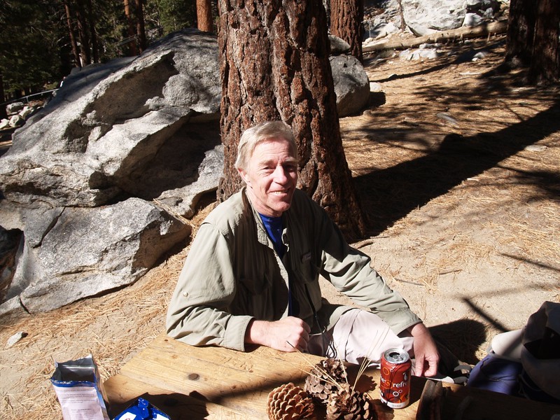
Up ahead I saw a familiar blue shirt topped with a white hat with flowers. It was Vicki. I waved and she waved back. She was waiting by a picnic table just below the tram, an amazing picnic table laden with goodies. She’d brought up a mini-cooler with soda and treats, and even had a tiny backpacking stove and a freeze-dried dinner in case I was hungry! Wow! I truly have the best wife in the world. And even though I was the slowest hiker on the Skyline Trail, she was still proud of me, whether I deserved it or not. I wasn’t particularly thirsty, but the cool soda tasted good. I also declined eating a hot meal; it was too soon after hiking. Instead she told me about her day, hiking along the rim of Long Valley on the Desert View Trail, which she’d never taken. We usually backpack to Round Valley, and have never bothered with that side of Long Valley. She had a fun time, hiked many miles, and enjoyed the great views.

Jack and I shook hands, and he headed off for the tram, while Vicki and I packed up to go. My son and his friend arrived just as we were ready to leave. They’d had enough fun at the bar, and their wallets were significantly lighter. I was expecting to dread the final climb up the cement switchbacks to the upper tram station, but I laughed when I saw them. THAT wasn’t a slope! It was practically FLAT! Calling those switchbacks a serious incline was pushing it, after that last climb up to Grubb’s Notch. I flew up the slope with ease, all my earlier tiredness forgotten. We descended on the tram to the car, I changed out of my sweaty shoes and socks, and we began the long drive back to San Diego. We were home in time to have a shower and some dinner, and the weekend was less than half over. Just the same, I went to sleep very early that night, and spent the night re-living the long hike up Skyline.
I thought about what a beautiful trail it was, and how it always provided a great view, whether in the night or the day. And how the hikers I’d met were all Good People and friendly. I also wondered if maybe, just maybe, there was someone else out there that day that took longer than I did to climb it. Eight miles in ten hours wasn’t exactly great, but it was good enough for me. For a first try, that is. Assuming that I’d ever be willing to climb it again. Indeed, while suffering through my weakness on the steep part after Flat Rock, I swore that I’d never endure this particular form of punishment again, but now that a few days have passed by, I’m beginning to want to try it out once more. However, I’ll need to train much harder beforehand. And maybe try out some of those cool things the trail runners use, like “gels” and “caps” and, oh, forget it! I can’t believe that I’m even thinking about climbing that crazy trail again. Maybe if I started out an hour or so earlier next time…
The rest of this trip’s photos and videos can be found on my Flickr Page.
A topographic map with my GPS track can be found on my Caltopo Page.
