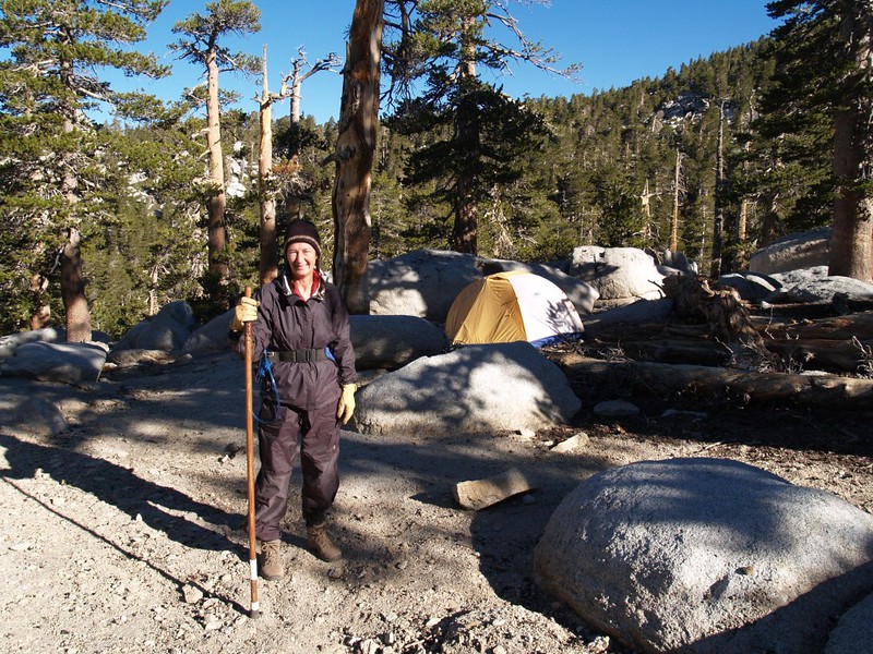
This trip to San Jacinto was planned primarily as a way for Vicki and I to get acclimated to high elevation prior to our summer trip to the Sierras the following week. Our goal was to camp as high as possible for as long as possible. So we chose to camp at Little Round Valley, elevation 9700 feet, for three nights.
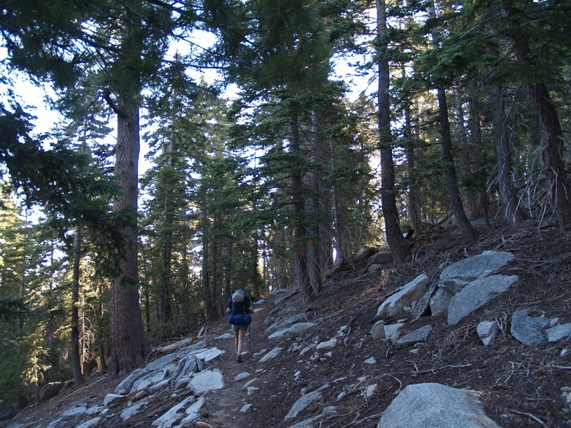
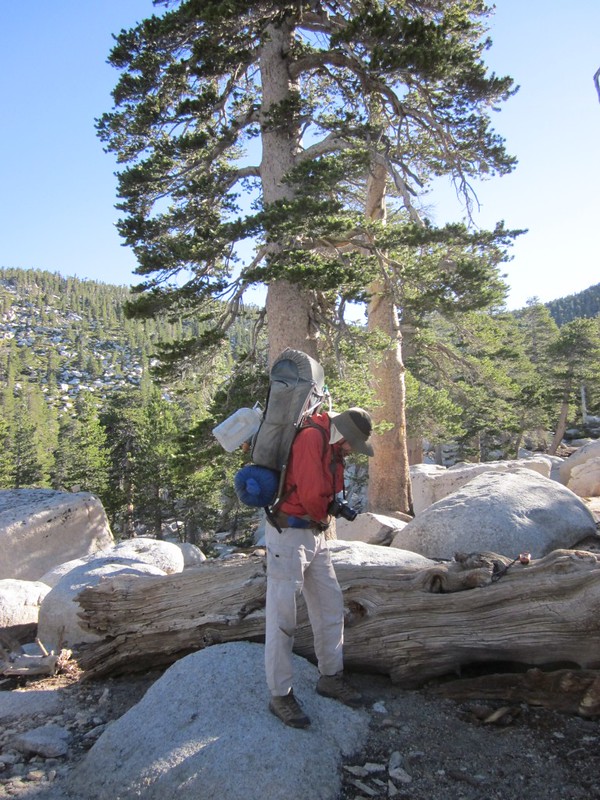
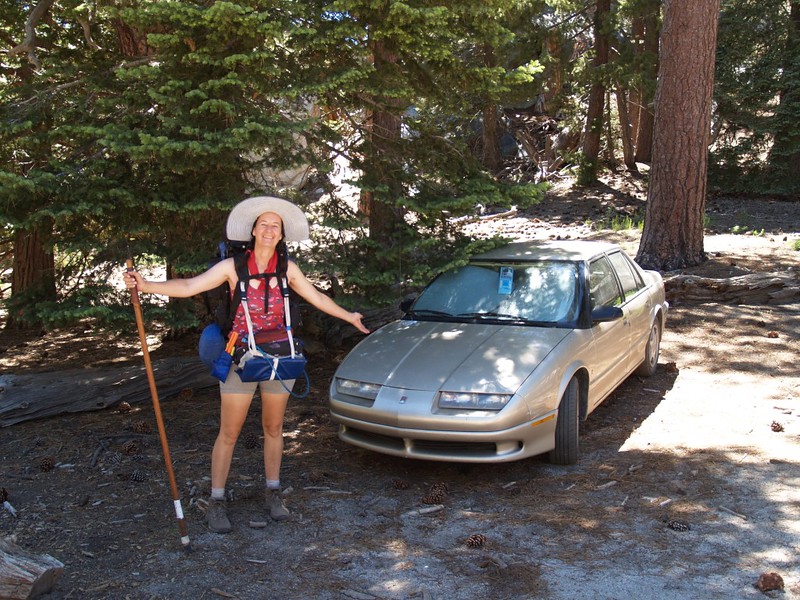
The first day began early. We left San Diego at 3:30 AM and arrived in Idyllwild just before dawn. We drove eight miles or so up Black Mountain Road (Forest Route 4S01), a winding dirt road that climbs from 5400 to 7700 feet, and arrived at the Fuller Ridge Trailhead at 6:30. It was cool out, but the morning sun shining obliquely through the trees promised a nice warm day ahead.

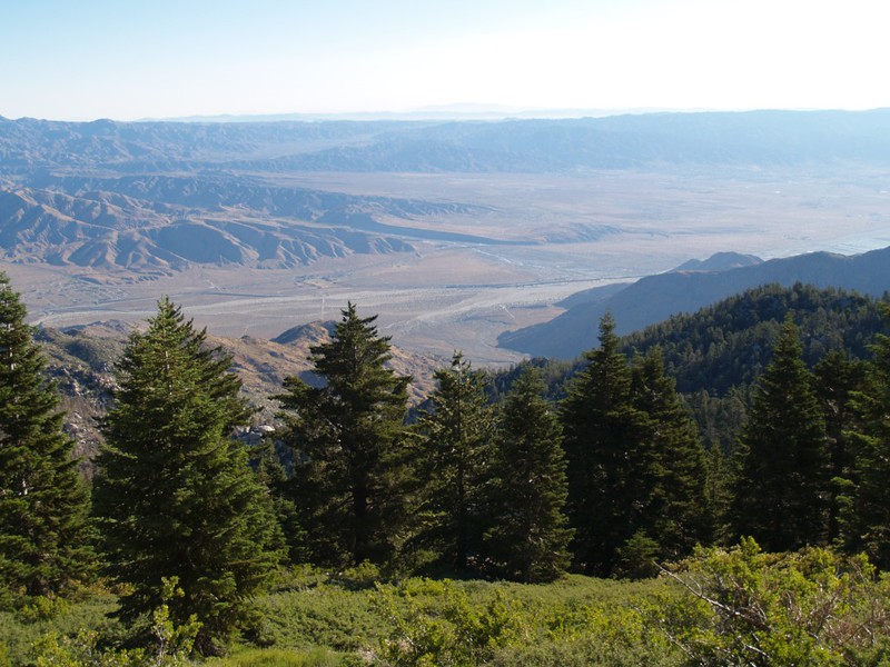
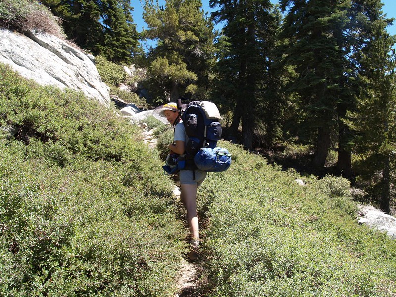
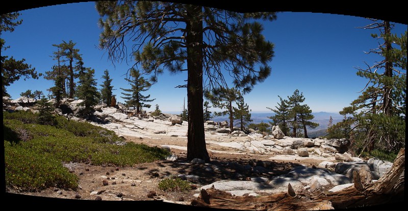
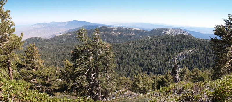
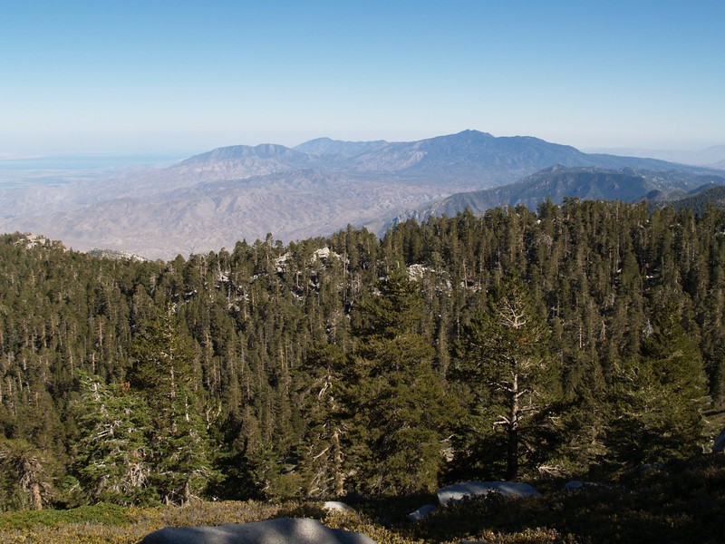
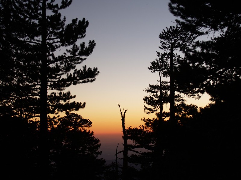
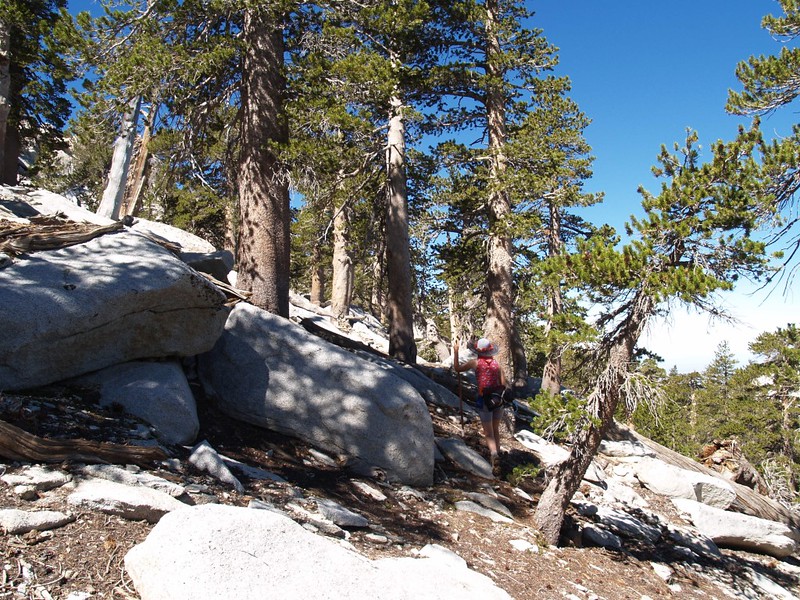
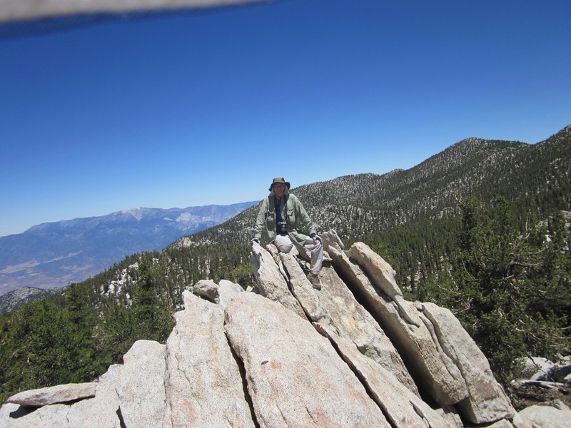
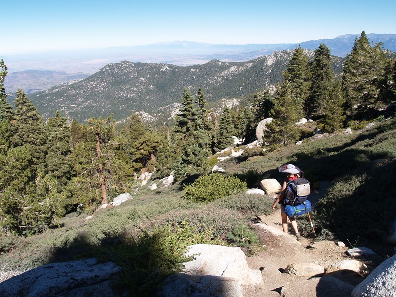
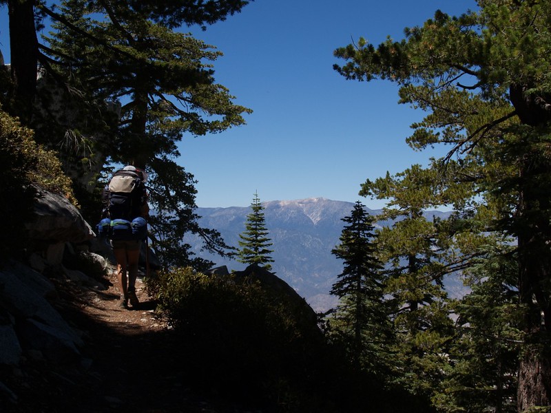
We put on our heavy backpacks and began hiking south on the Pacific Crest Trail (PCT) along Fuller Ridge. This ridge extends west-northwest from San Jacinto Peak, and the PCT alternates between the southern and northern sides of it, so we were treated with excellent views all around, from San Gorgonio Mountain to the north and the distant lakes near Hemet as well as Palomar Mountain to the southwest. It was beautiful hiking through the tall pines, breathing the fresh piney air (what little there was of it!), and then suddenly coming upon a rock outcropping with yet another stunning view. My finger was getting tired clicking on my camera’s shutter so often. (I really DO take too many pictures. But I refuse to quit. I can be stubborn that way.) The trail takes the high route, along the crest (which is how it got its name), so hiking the PCT provides one great vista after another. And we were on a particularly gorgeous section of it.
The trail along Fuller Ridge both gained and lost elevation, thus, it could be annoying for people whose primary goal is to climb San Jacinto Peak. But we were prepared for this mentally, so we weren’t brokenhearted each time we had to lose several hundred feet elevation that we’d so painstakingly gained previously. The views more than made up for it. Still, the trail gained elevation in the long run.


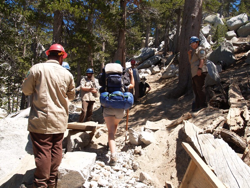
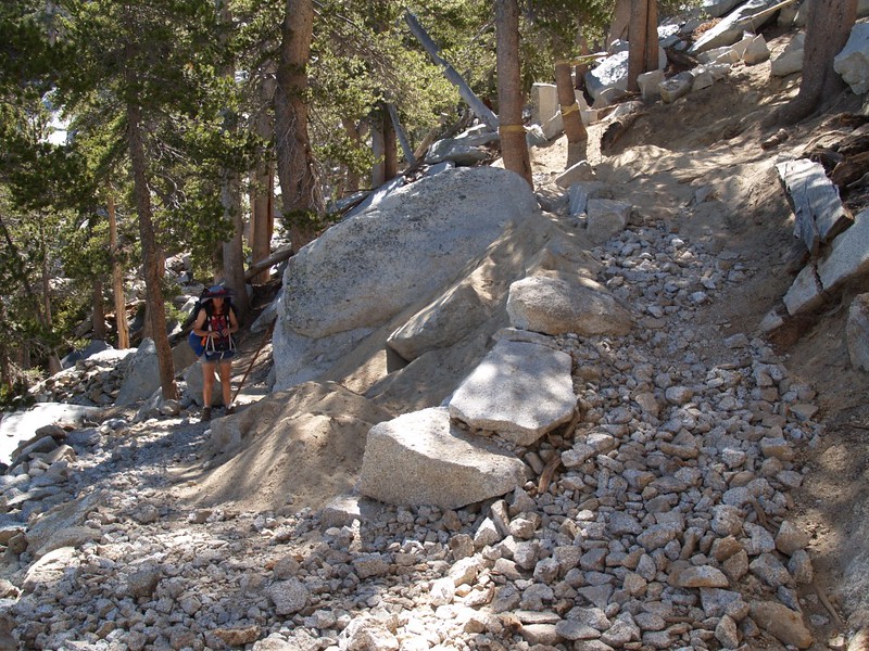
When we neared the intersection with the Deer Spings Trail, we came upon some trail being rebuilt by the CCC. We met their work crew near a stream where we stopped for lunch. They had rock drills, picks, sledge hammers, shovels, and large hand-cranked winches for moving huge stones. The work they were doing was impressive, and looks as though it will last for many, many years.
CCC working on the Fuller Ridge Trail stream crossing
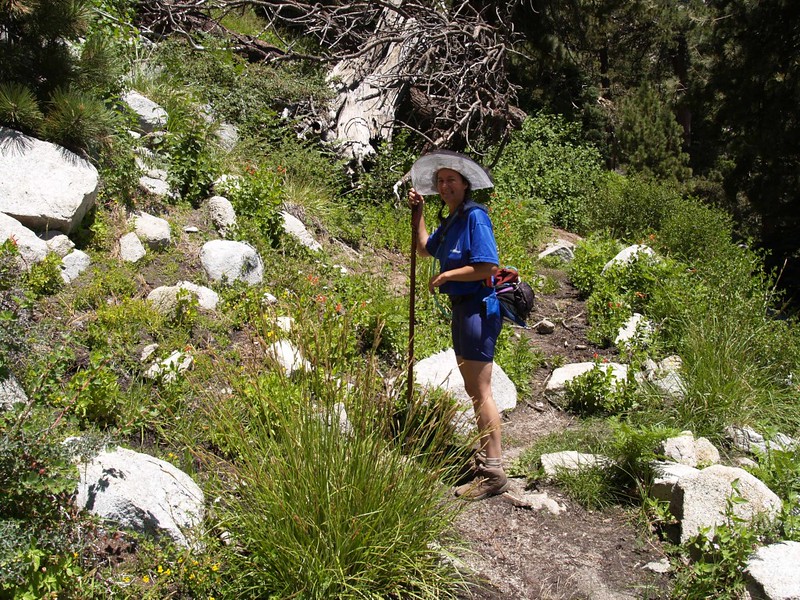
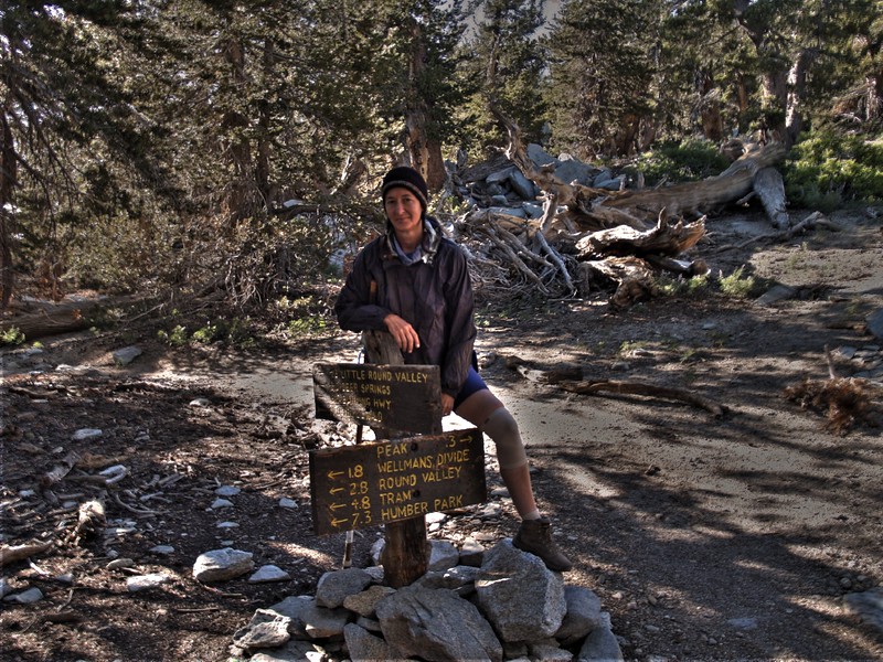
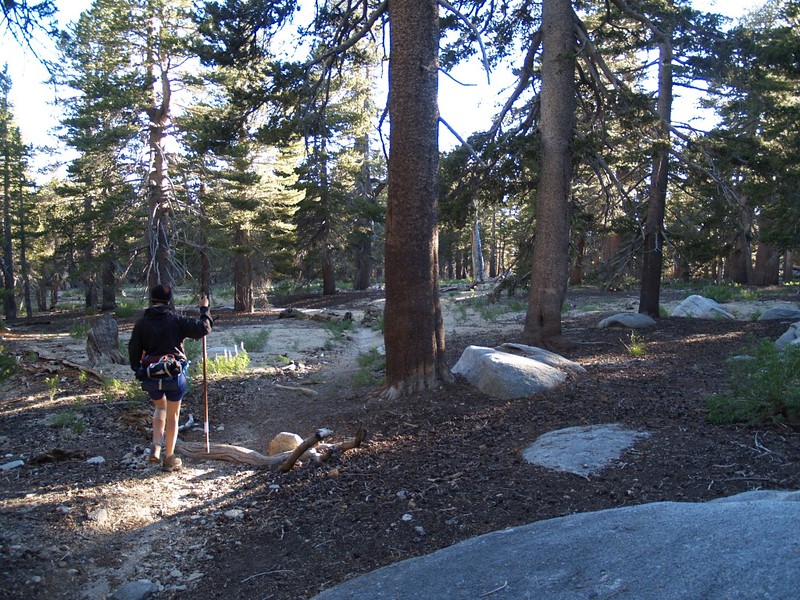
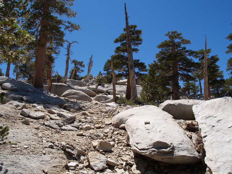
Once we intersected the Deer Springs trail we hung a left and seriously began to climb. There were several small streams flowing across the trail, and lots of lovely flowers. Vicki started to lose steam along this section, so we stopped and she took a nap on some nice soft granite. When she woke up she felt somewhat recharged, and we hiked the last stretch into Little Round Valley. We picked a nice campsite off to the left of the trail. I set up the tent and we both took a nice nap. We ate dinner, watched the sunset, then conked out completely. We’d hiked six miles and climbed, what with the ups and downs, over 2500 feet this first day.

Video of “Bed Spring” creek where it crosses the Deer Springs Trail


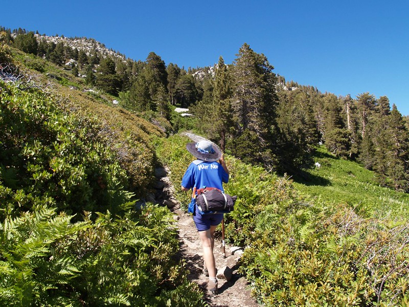
Our second day began late: It was cold! A chill, continuous breeze was heading down the valley. We left the tent at dawn to make breakfast, but we were frozen by the time we finished eating it, so we dove back into bed and shivered as we waited for the sun to rise over Folly Peak. We didn’t get going until 8:30 or so. Our plan for the day: Day-hike a twelve mile loop around the mountain, following the established trails. The low point would be 8000 feet and the high point 10500 feet. That’s right: Yet another 2500-foot day! With twice the mileage! But, thank goodness, without the heavy packs. We were in good shape, we knew we could do it, but, since were were starting late, we took our headlamps with us, just in case. We decided to do the loop counter-clockwise, so the final stretch would be downhill. Of course, the beginning was also downhill, and we blasted down the trail we’d so laboriously climbed the day before. But it was all good. The sun was shining in a deep blue sky, the air was crisp, and we were hiking fast.
Little Round Valley Stream


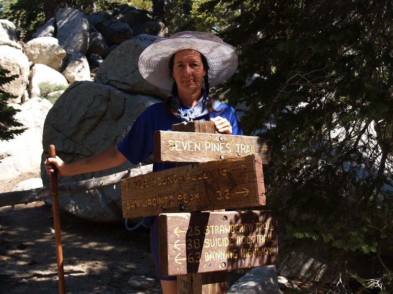
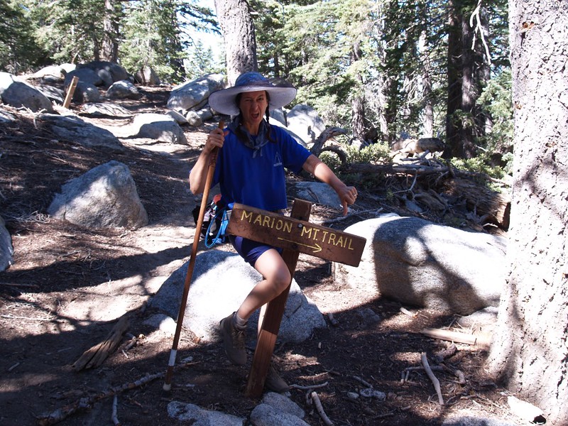
After 1.5 miles we were back at the PCT, and we continued hiking south. Shortly, we came to the main camp for the CCC crew at the Deer Springs Campground. The crew were living in lots of small tents, and they had several large tarps over the cooking and eating areas. They also had a black water hose heading up the stream above the trail crossing. We saw plenty of horse/mule droppings and other signs of stock-induced wear-and-tear along the trail, so we knew how all those heavy tools got up into the wilderness. Shortly afterward, we passed the junctions of the Seven Pines Trail and the Marion Mountain Trail. We’d never been on the Seven Pines Trail, but the Marion Mountain Trail was no longer Vicki’s friend: It was too steep on the way up, so she’d run out of breath too quickly, and it was too steep on the way down, so it would hurt her knees.

Video of the Deer Springs CCC Camp Stream on the Pacific Crest Trail
We headed on down the PCT toward Strawberry Junction, where the Deer Springs Trail headed off toward Idyllwild. Strawberry Camp was here, and it had a great view, but you’d have to hike a ways to find water (still, this was better than the alternative: plenty of water but no view). This was also the 8000 foot point, our lowest elevation of the day. We had 2500 feet to climb and many more miles to hike. Once we started up this way, there was no point in turning back. We felt good, so we continued east on the PCT.


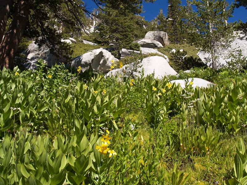
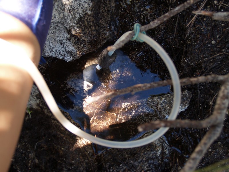
Soon we reached Strawberry Cienega (pronounced almost like See-You-Naked – this mnemonic gave rise to many jokes on our hike), a marshy spring along the trail. It didn’t have a lot of water flowing, but the plants and flowers were happy, growing and blooming like mad. Still, we were nearly out of water, so Vicki made herself a tiny rock-lined pool in the shade and allowed it to fill with spring water. Then she slowly pumped/filtered several liters for us to drink. It tasted just fine, if a little peaty.


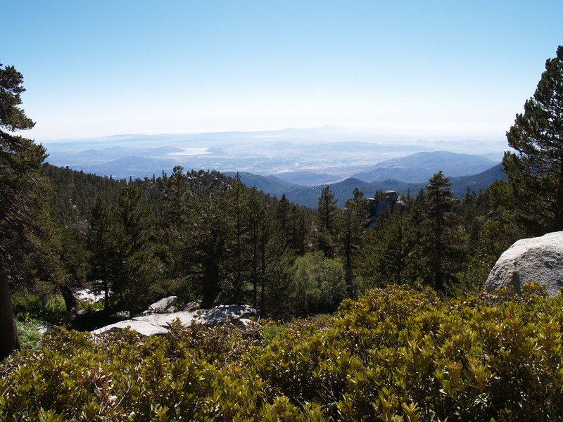
We continued on the PCT until the trail to Wellman Divide turned off to the left. (The PCT continued south, downhill toward Saddle Junction, and, eventually, the Mexican Border, but we didn’t take it.) This new section of trail headed north and was very pleasant in the afternoon, as the sun was getting behind a ridge and there was more shade. Soon we came to Wellmans Cienega (See-You-Naked) and it was positively gushing, by comparison to Strawberry. We could’ve filtered water here much more easily, but we no longer needed to. The afternoon was getting on and we realized that we had to keep hiking if we were going to make it back to the tent before sunset. Still, we weren’t so worried about it that we didn’t take a nice long break at Wellman Divide, one of the nicer viewpoints on the mountain. Here we met a number of folks hiking down from the peak to the Palm Springs Tramway. As usual, everyone we met was friendly and happy, and who wouldn’t be, hiking the high country on a beautiful summer day?


Video of the water dripping from Wellman Cienega


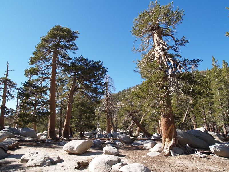
Now began the part of the hike that we’d traveled many times before. The only new thing about it was that we were hiking in the late afternoon, and, rather than being the usual sweaty. shadeless inferno, the trail was mostly in shadow! (Hiking uphill generates enough heat without adding the sun’s contribution.) This was turning out not to be the death-march we’d been expecting. When we got to the switchback near Miller peak, we continued straight, headed for Miller Saddle and its view to the north. There’s a nice little spot there, perfect for a small tent, with a fantastic view north toward San Gorgonio (to camp up there you’d have to carry all of your water, and keep a very low profile, as this is NOT a state-park-approved camping spot). This view completed our loop, as it were, by giving us views from the mountain in every direction as we circled it. Still, we had to continue climbing one last bit to the trail intersection at 10,500 feet, not far from the top of San Jacinto Peak. At this point, however, Vicki and I stopped and talked it over: We were getting tired, we’d been to the peak many times, and what we really wanted to do was eat dinner and sleep. Therefore we decided to bypass the top of San Jacinto and head downhill toward our camp in Little Round Valley. Call us wimps if you want; I don’t care.


And that’s exactly what we did. We hiked down the many switchbacks to Little Round Valley as the sun descended toward the horizon, bathing us in golden light. We were part of the alpenglow! We reached our tent just before the sun was ready to set. We cooked up some dinner and ate it in the dusky light, then hit the sack, and slept the sleep of the truly exhausted. It had been an excellent day.


On our third day, we wised up and didn’t bother getting out of the tent until the toasty sun beams hit it. It was nice to just lay around reading and snoozing, comfy and warm on our inflatable pads, inside our large double sleeping bag. Life was good, and we were on vacation. “Schedules” were for other, more foolish folk.
As it was Saturday, our plan for the day was to hike off-trail, far removed from the weekend hiking crowds, by bushwhacking our way to the summit of Marion Mountain, elevation 10362 feet. As with all bushwhacking, we weren’t sure what to expect: It might be easy walking, or it might be a fight. Luckily for us, it was easy this time.

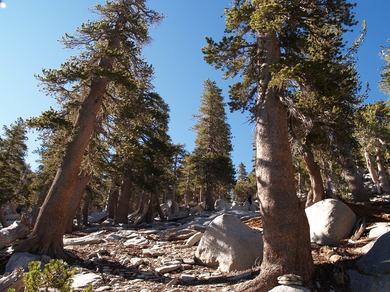
We hiked out of Little Round Valley up a broad drainage to the Newton Drury Peak saddle, where we paused to take both a compass and GPS bearing on Marion Mountain (while we still had it in view). We decided to ignore N-D Peak for now, and to hit it on the way back, if we had the energy left. Then we headed off through some really nice open forest, with a mellow descent into a wide valley, then up a gentle incline until we came upon a large flat plateau that could easily have camped an entire army. Along the way, we discovered a spring which was not on the map, the source of one of the streams which cross the main trail between Deer Springs and Little Round Valley.

Newton Drury Peak Saddle – video panorama


Hidden Spring Video
Video panorama of the broad plateau area we discovered
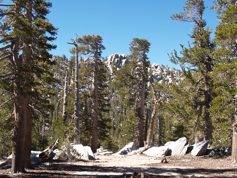
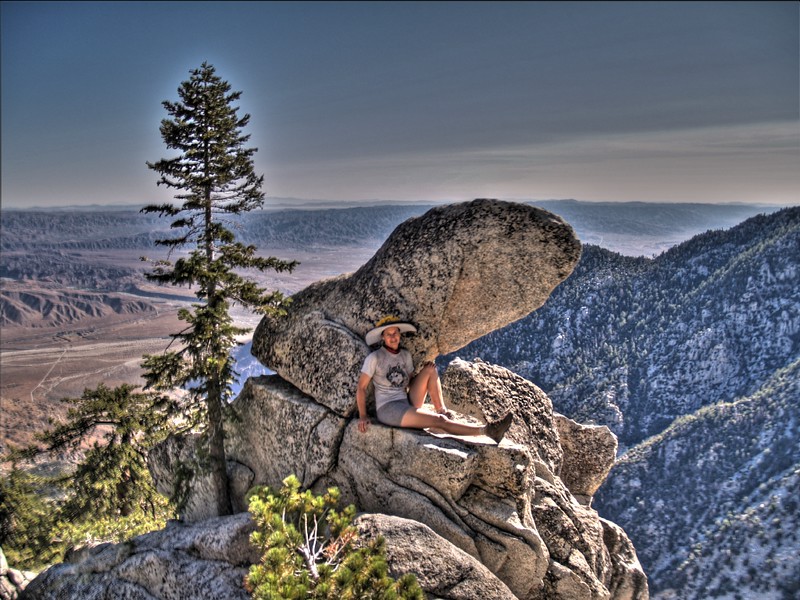
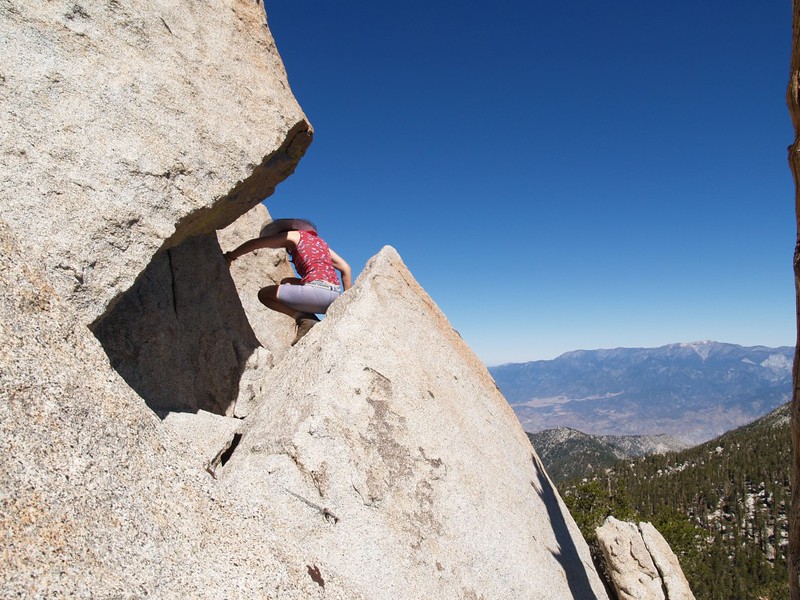
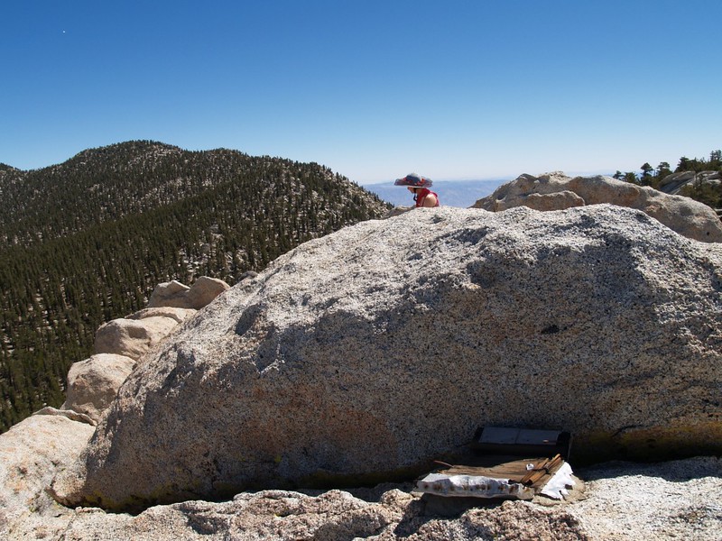
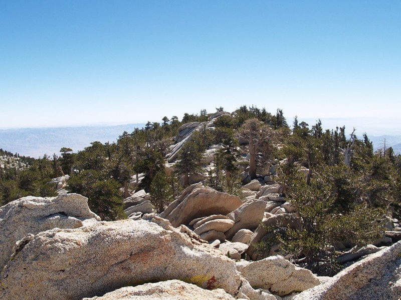
Then the real climb up Marion Mountain began. We were trying to get to the westernmost point of the summit ridge, which was supposedly the “true” (highest) summit. And it turned out that the bearings we took earlier were good ones, or that we were lucky, because we arrived exactly at the western summit block. The block, however, had to be climbed. It was composed of a series of rock slabs, angled steeply upwards, about twenty feet cubed. I had read that there was a crack between two the slabs that we had to climb, but we couldn’t find it at first. We eventually found a way up, and it was a tricky scramble. The view from the top was great! We could see Mt. Baldy, San Gorgonio, all of the local 10,000+ footers in the San Jacinto family, and many mountains and lakes to the south and west. It’s always a great day when you’re on a mountain top. I looked for the summit register, so we could sign the log book, but the register box was broken. All that was left of it was a chunk of old wood cemented to the rock on the summit block. I’m thinking that the ice of winter may have broken off the other five sides of the box, but it’s hard to say. Maybe someone will attach a new metal box like those on other mountains we’ve climbed.


Marion Mountain Summit video panorama
We looked along the summit ridge to the east, and, amazingly enough, it appeared that the eastern summit was above the horizon! But that would be impossible if the one I was on were the true summit, as I’d read online. So we decided to go to the other one, just in case I got it wrong. But first we had to downclimb the crack. It was a lot less fun climbing down, as we couldn’t see where our feet were going! I went down first, because my legs are longer, and then I helped guide Vicki’s feet to the proper footholds. Afterwards, she wondered why she’d ever been foolish enough to climb up that crazy crack, and swore that she’d never do it again. But I wondered: She’d certainly climbed up it fast enough! Anyway, we traversed along the ridge, and climbed the lower, middle peaklet, then continued on and climbed up the rocky top of the eastern summit. Once there, it was obvious that the western summit was ALSO above the horizon! Arrghh! I’m still not sure which one was truly higher, but I don’t care very much now, as I’ve been on top of both of them. The online topo maps show the eastern end as the summit, but summitpost.org insists that it’s the western one. Still, the remains of the register box makes me believe that the western block is the real deal.


We hiked back down to the little spring we’d discovered and had lunch. We also filtered some water, not that we really needed more, but because it was from “our” spring. Vicki took a nice long nap on a comfy granite slab while I read my book. It was turning out to be a nice, relaxing day.

Then we headed off to bag Newton Drury Peak, elevation 10160 feet. For some reason, Vicki was still sleepy by the time we got to the saddle, so she took another nap. And why not? We were on vacation. When she woke, we made the final push to the summit block, which was just high enough that it afforded nice views of the San Jacinto Crest above the small limber pines growing on the peak. We were trying to spot our tent from up there, but it was next to impossible to tell from that height and distance. We were also able to see most of San Gorgonio to the left of Folly’s ridge, and, further away, Mt. Baldy in the hazy distance. We stared long and hard at Marion Mountain, but we couldn’t decide which summit was the “true” summit. If someone ever goes up there to repair the register box, maybe they’ll bring an accurate carpenter’s level and do the proper sighting.


The hike back to Little Round Valley was easy, all downhill. The tent was in the sun when we got there, so taking yet another nap was going to be tough. Then Vicki pulled out her emergency space blanket and we stuck it under the tarp of the tent to fully block the sun. And it worked! It was warm in there, even with both doors wide open, but it wasn’t heatstroke hot. So we took our nap like properly lazy vacationers. Later in the afternoon we ate dinner and took our “constitutional” by walking all around the meadow of Little Round Valley. Very relaxing. We got back to camp and went into the tent to read our books, but that didn’t last long. We were fast asleep before sunset. It had been an excellent day.


The next morning, our fourth and final day, we woke up at the crack of dawn. It was cold, but we were done sleeping. Vicki made some breakfast while I packed up all the gear inside the tent. We found some shelter behind some boulders out of the continuous cold breeze and ate our breakfast with our wool hats and gloves on. Brrr! Unfortunately, the sun wouldn’t show over the top of Folly Peak for another hour or two. So we finished packing the tent and loaded up our packs. Time to go! We’d remove some layers of clothing later, on the trail, as the air warmed up. And that’s exactly what we did.


The hike back to the car was relatively uneventful. Being Sunday, we actually saw several groups of people, most of them day-hiking to the summit of San Jacinto. The CCC work crew had the day off, and many of their heavy tools were laying around near the work areas. No worries about someone wanting to steal a ten pound sledgehammer several miles from the nearest road. Thieves are too lazy to do that much work!

Video of the CCC stone yard

Cold Stream Head Dunking Video – With Brain Freeze!
Not far beyond the CCC work zone, I was in the lead when I heard a big booming sound behind me. Then I heard Vicki yell out the dreaded word “ROCK!”, a warning you never want to hear in the mountains. I scanned all around, but didn’t see anything. All I heard were gigantic booming and smashing sounds, lasting for nearly thirty seconds. It was heading down into the valley below us. Vicki, however, was able to see it. She told me that she saw a multi-ton, “refrigerator-sized” boulder bouncing, bounding, and launching itself outward over the treetops, crashing endlessly down the steeply-sloping mountainside. The woods were rather silent after that! Everything was waiting to see if anything further was going to happen. But it didn’t. Due to the terrain, it was highly unlikely that anyone was down below the trail in that area, so we did the only thing there was to do: We hiked on.


We followed the downs and ups of the Fuller Ridge Trail, and were glad that it was mostly “down” this time. Much like the hike in, the views in every direction were excellent. What a beautiful trail this is. We stopped for lunch on the north side, where the big trees are, enjoying a view of San Gorgonio across the way. We didn’t really want it to end, but the rest of the hike went by fairly quickly, and before we knew it were back at the trailhead parking lot.

We discovered that we had the only sedan amongst many trucks and SUVs, and felt better about our dirt-road driving skills. But we were less happy about our parking skills, as we had carefully parked in the shade, tucked well-under a pine tree, which, over the last four days, had shed an enormous quantity of sticky pine pollen. We could barely see out of the windows! It wasn’t sap, thank goodness, as the wiper-washer fluid cut through it easily enough, but we knew that the entire car was due for a good washing when we got home.
We drove off down the long dirt road into the heat of the low country. It was still early in the afternoon and we were headed south into the sun. It was a hot ride, but we kept ourselves busy thinking about what we had to do to get ourselves completely ready for our week-long hike in the Eastern Sierra Nevada. Thanks to this trip we were well acclimated to high elevation; now all we needed to do was get fully packed for the next one. Only three days away!
For even more pictures from our trip check out my Flickr Page.
For an Interactive Topographic Map of our hike (including the gps tracks) see my CalTopo Page.
