Day 1 of 4:
We left San Diego at 3am, thinking to arrive at the trailhead by dawn. About 20 miles from home I realized that I had forgotten the camping permit and went back to get it. So much for an early start. To avoid kicking myself, I repeated to myself that it was OK, because we were on vacation. And it was. This method really works!
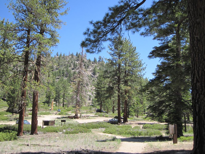
We pulled into the lot at the Fish Creek Trailhead about 7am, and got hiking by 7:30. It wasn’t exactly dawn, but it was still early, and the weather was beautiful. In the parking lot we met a solo hiker by the name of Kyle, who said that he had never climbed a mountain before or gone on a multi-day trip. He was pretty excited. We gave him some minor advice, as well as some encouragement, and his confidence level rose. He looked young, fit, and prepared, so no problem.
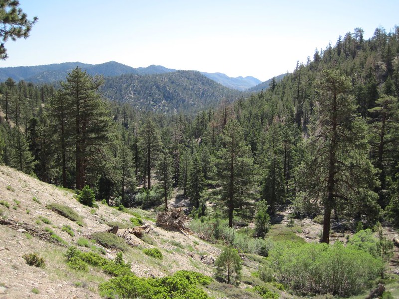
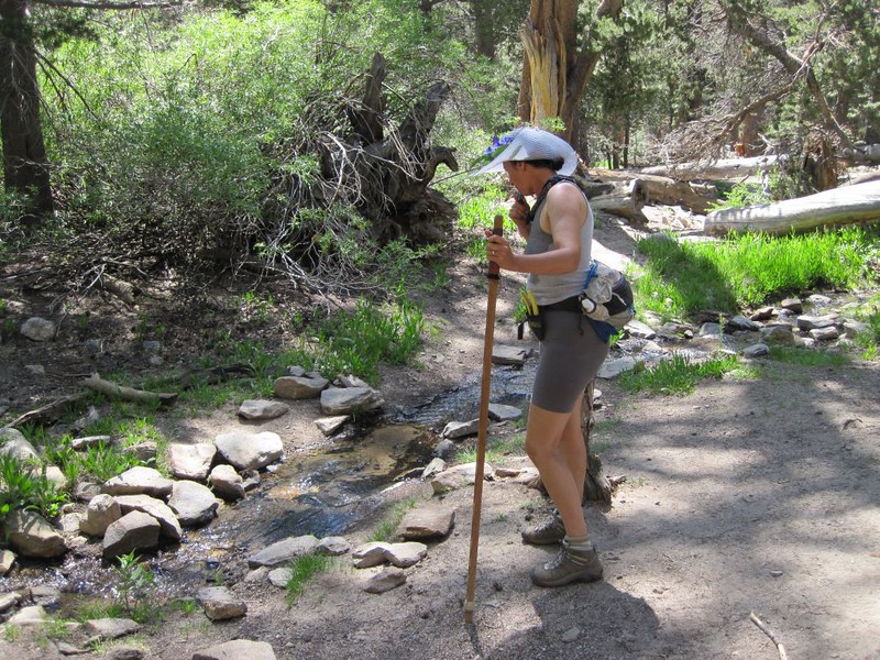
We hiked up past Fish Creek Camp, and found that the water was flowing well where the trail crossed the stream. Kyle was only able to get a permit to camp here, so he stopped to drop off his big backpack. We kept on climbing the switchbacks on the side of Grinnel Mountain (10284′) toward Fish Creek Saddle. Before we knew it, Kyle blasted past us, as we were hiking at our typically slow speed. Our style is that we rest when we feel like it, or when there’s a nice view and a breeze. It was getting hot on the trail, so we stopped for short breaks in shady spots.

On the way up, we met our son, who had spent the previous night on San Gorgonio peak with his friends. He passed me our trusty trail map (this was our plan). He is unique in the mountains as his backpack has a place to hold his guitar. They were racing down the trail to Fish Creek, as they had run out of water, and didn’t feel like drinking pink-colored snow while on the peak. I yelled after them not to have any wild parties at home while we were gone, but I don’t think they heard me. Oh well. But it was OK, because we were on vacation.
As we continued climbing, Kyle passed us on his way back down; he was also moving fast. We told him to have fun, and that we’d probably see him up on the San Gorgonio Summit tomorrow.
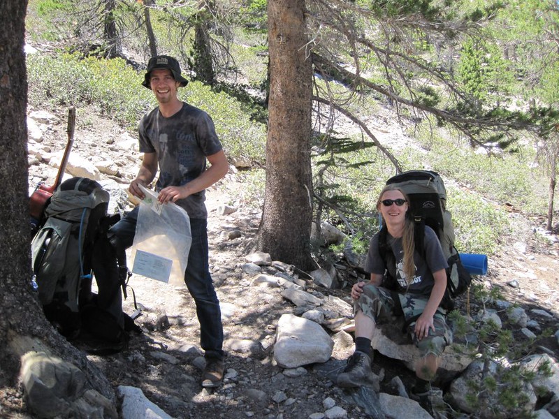
At Fish Creek Saddle we met a bunch of volunteer rangers (and one real one) who were checking permits, as this was a busy holiday weekend. They said that over 100 people were signed up to camp along the trail, but so far they’d only logged 36. Looked to be a lot of cancellations. I hope some folks weren’t denied a permit because of inconsiderate no-shows that didn’t call in to cancel theirs.
While I talked to the officials, Vicki took a nap in the shade to recharge her batteries; she wasn’t feeling all that well, probably due to a mild case of elevation sickness. This saddle was our highest hiking point of the day, so when she woke up she was happier. She knew that the hard part was finished.

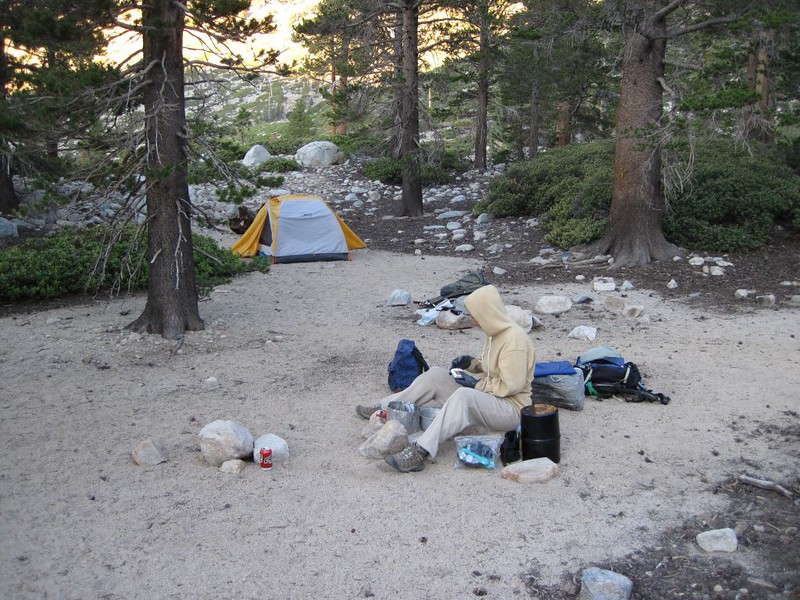
We hiked down to our campsite in Mineshaft Flat, losing about 800 feet of our hard-won elevation gain of 1800 feet at the saddle. Why not camp back at Fish Creek Saddle, you ask? Because the “flat” has great views out over North Fork Meadows, unlike the saddle which had too many trees and was far too busy. It also has an excellent spring close by. Needless to say, we’d been down here before, and we liked it.
We picked a sandy spot and set up the tent, then hiked down to the spring. The water was gushing right out of the ground, and it was ice cold! We filled every container we had, so that we could head out for San Gorgonio Peak first thing in the morning.


Video of Mineshaft Spring. Some of the best-tasting water ever!
There were quite a few people camping at Mineshaft Flat that night, including a couple of Boy Scout troops. Scouts can get a bit rowdy at times, but we were so exhausted that we fell asleep right after dinner and didn’t even hear them. It had been a very long day, and we wanted to get up at the crack of dawn.
Day 2:
We didn’t get that early start. We lay in the tent and waited for the sun to climb high enough to shine down into the valley and hit us. By the time we got up, everyone else in the campsite was long gone, and we had the place to ourselves. Nice! We knew that we had a hot hike in front of us, but we didn’t care. The heck with getting up early: We were on vacation!
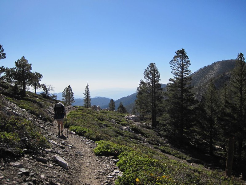
We got our day-packs ready and headed out on our 2300 foot climb to the peak. Ten miles round-trip.
We climbed back up that 800 feet and turned left on the Sky High Trail. There were small patches of snow in several chutes along the way. The trail crossed the snow but it was easy to walk on as the snow was already soft. Vicki used some of it to cool herself off by putting it in her hat and bandanna. Along the way, we met up with Kyle again, and hiked with him to the airplane wreck that straddles the trail. It was a C-47 (military DC-3) that crashed in 1951. Kyle told us that yesterday after the rangers left he hiked up to Fish Creek Saddle (again!) with his full backpack and camped there (illegally), hoping to see a comet in the northeast sky before dawn. He didn’t see it, sadly. The atmosphere was too hazy. We were too slow for him, so he blasted away to the peak.

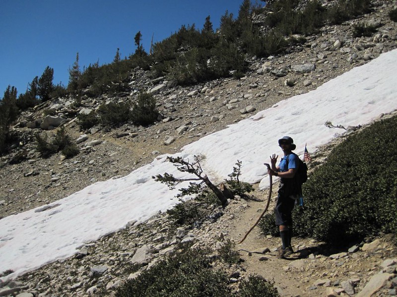


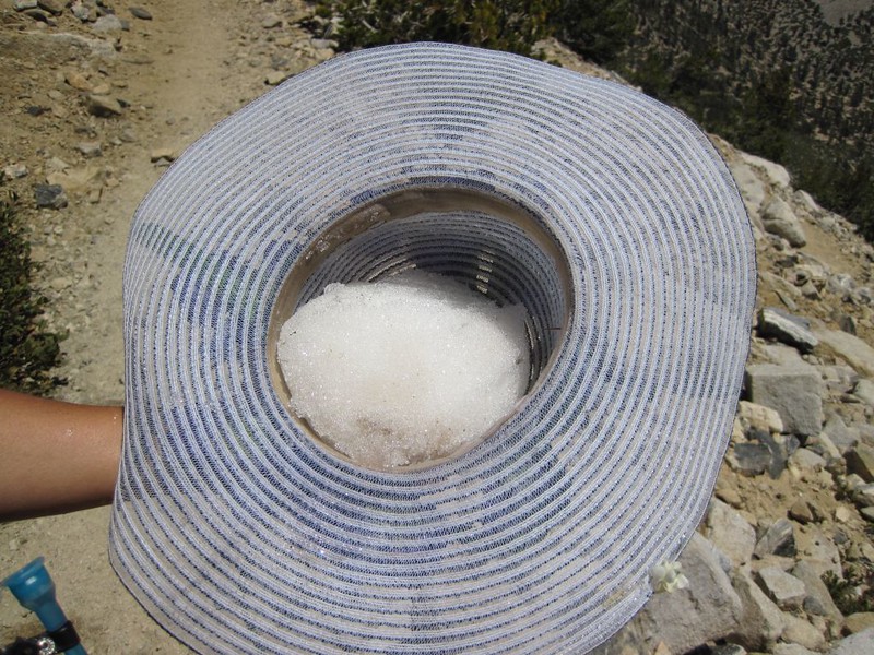
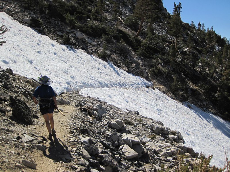
We had a nice hike on our own, crossing many patches of soft snow, switchbacking up and up. On the south side of the peak was the biggest patch of all. It was easy to cross, because it was so soft, but it appeared intimidating due to its slipperiness and exposure to a long slide downhill. So we crossed it slowly and carefully.
The trail continued around the mountain, steadily climbing. It joined with the Vivian Creek Trail and continued upward toward the rocky summit. We spied Kyle standing on top, waiting for us. This was his first ascent of a peak, so he was super excited, taking it all in. I guess if you’re going to pick a mountain for your first attempt, choosing the tallest one in Southern California is certainly a bold decision.


Video of the longest snow crossing on the trail


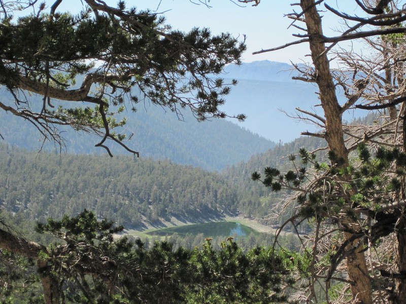
There were at at least 20 people on the peak when we got there. The air was a getting hazier as the day went on, but just the same the views were fantastic. We looked at San Jacinto Mountain across the way, thinking about our upcoming trip there in a few weeks. Another four-day trek in the wilderness. Oh yeah! Kyle was waiting on the peak for us; he said that he’d been there for an hour already. We really WERE slow! He also said that he was going to check out the spring at Mineshaft Flat on his way back to the saddle, so maybe we’d see him again. And then he was gone. He sure does blast out those miles!
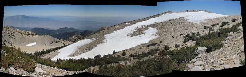
Vicki decided that a major nap was in order. She was exhausted! So we headed southwest from the summit to the “campgound” and found a rock ring to take a break in. Previous campers had made these enclosures, which served not only to break the wind but also provide a flat spot for a tent. Vicki was so tired she simply lay down on the sand and used her fanny pack for a pillow. So I got out my book and read for a while, and wandered around taking photos. The views were stunning up here at 11,500 feet elevation, and the sky was very blue.

On the way back, we took a cross-country shortcut to the Sky High Trail by heading straight south toward the Tarn rather than going all the way around. That saved at least a mile. This also bypassed the biggest patch of snow, the one we’d crossed earlier. Vicki put on her rainpants and glissaded (slid on her butt) down the snow patch, whooping with excitement the whole way. Like a lamer, I took a video of her having fun, and trudged my own way down. But that’s OK, I told myself; I was on vacation!
Video of Vicki glissading down the snow
We rejoined the trail and had an enjoyable hike, as it was all downhill. Just beyond the plane wreck, we decided that we’d BOTH slide down a huge couloir full of snow. It headed almost directly toward our campsite across the valley, and looked like an excellent shortcut. It was a major blast sliding down the mountain. What a rush! And to think that we were playing on snow in Southern California in July! Incredible but true.
Video of us glissading down the chute from the Sky High Trail

After that, we took off our rainpants and began hiking toward camp, walking on millions of loose rocks and small boulders that were piled haphazardly in long swaths. These were the remains of avalanches that had occurred in years past. The loose rocks would sometimes shift, making ones footing perilous. It seemed to take forever to get across the valley. Technically, travelling cross-country without a trail is known as bushwhacking. However, this was more like rock-whacking, and our main concern was avoiding getting whacked by the rocks! Our shortcut ended up taking quite a bit longer than we expected, but we didn’t really care: We were on vacation! The only sad part was that we didn’t get to see Kyle again; so we waved up the canyon and wished him good luck in the future, and that he bags many peaks.

When we reached the tent we discovered that we had the campground to ourselves, and it was very peaceful, like a proper wilderness experience. The holiday weekend was over, and the invading hordes had vanished. The sun went down behind the mountain and our valley was left in shadow. The air began cooling and we put on our night clothes. We walked a short distance and found a flat boulder with a view, perfect for eating our dinner in the wild. As we ate, we stared up at the mountain, laughing when we thought about the glissade down that long snow-filled chute. It had been an excellent day.
Day 3:
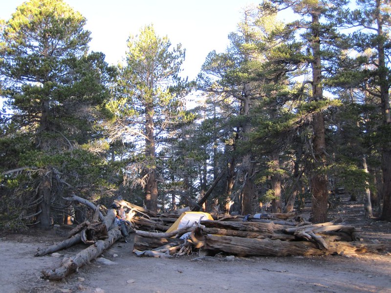
The next morning we woke to see several deer wandering around, and discovered what may have been old bearsign: vertical scratches on one of the trees with dried sap oozing out. We got some water at the spring, but didn’t hike much further downward into North Fork Meadows. Maybe next time. We were scheduled to spend another night down here in Mineshaft Flat, according to our wilderness permit, but we didn’t have a lot to do around here. We decided that it would be best if we broke the rules (just like Kyle did) and camp up at Fish Creek Saddle. That way we’d only have an easy downhill hike to the car tomorrow. Of course, it also meant climbing 800 feet and a mile or so today, but that wasn’t so bad, really. So we packed up everything and headed up the trail. It was a fine day for hiking. We made it to the saddle, and we set up our tent inside one of the crazy log enclosures that some maniacs built many years ago.

After some lunch and a short nap, we took a dayhike down to Dry Lake, which was quite wet, due to all the snow we had last winter. There was a momma duck and eight ducklings in the lake. A few small clouds materialized above the surrounding mountains and made for some nice scenery and photos. On the way back to camp we filtered water at Lodgepole Spring, which was like a lush oasis in the otherwise dry-for-summer canyon.
Video of the water flow from the spring


The views weren’t great at Fish Creek Saddle, but we didn’t care after seeing the beauty of the Dry Lake basin, so we went to bed early. Luckily for us, outlaws that we were, no rangers showed up to check our permits and send us back down the valley to Mineshaft Flat, and we spent the night in peace.
Day 4:
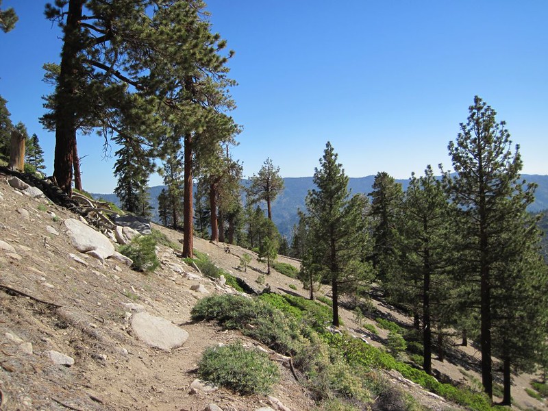
The next morning we woke up early to hike back out to the car. We ate a light breakfast and packed up our gear. Then we started hiking. Downhill all the way. We hiked much faster this time than the way up, when Vicki had been so overheated and exhausted. And it really is a nice trail, not too steep, and there were some lovely meadows to check out along the way. The air was crisp and fresh, and the blue sky clear of clouds. It was a beautiful day in the mountains.
We reached the car before noon, and enjoyed scenery along the long dirt road back downhill to civilization. The haze got thicker and uglier as we reached lower elevation. So much for crisp clean air and deep blue skies! Oh well, at least we avoided rush hour. And besides, we were on vacation!
For additional photos and videos check out my Flickr Album Page.
For an interactive topographic map showing our GPS tracks see my CalTopo Page.
