This was our final day on the trail, and it started out dark and cold. The windy front that had blown through the day before had left plenty of cold air in its wake, and we packed up as quickly as possible so we wouldn’t freeze. It was so cold that we left on our warm jackets and wore extra layers on our legs. We even wore our gloves and Winter caps. Unfortunately, as we weren’t cooking breakfast that morning, there was no hot coffee, so we were colder than ever, but it also made us get ready even faster. Our only real hope of staying warm was to get hiking!

It was particularly cold down in Beck Meadow, where an icy, continuous breeze was headed downhill, directly into our faces. We saw plenty of frost on the plants, and even some ice on a puddle. We kept the hoods of our jackets pulled tight, and kept our gloved hands stuffed in our pockets. But hiking uphill did the trick eventually, and we stayed warm. Except for the tips of our noses.
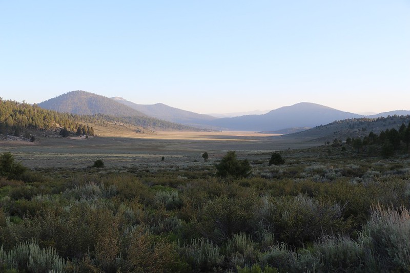


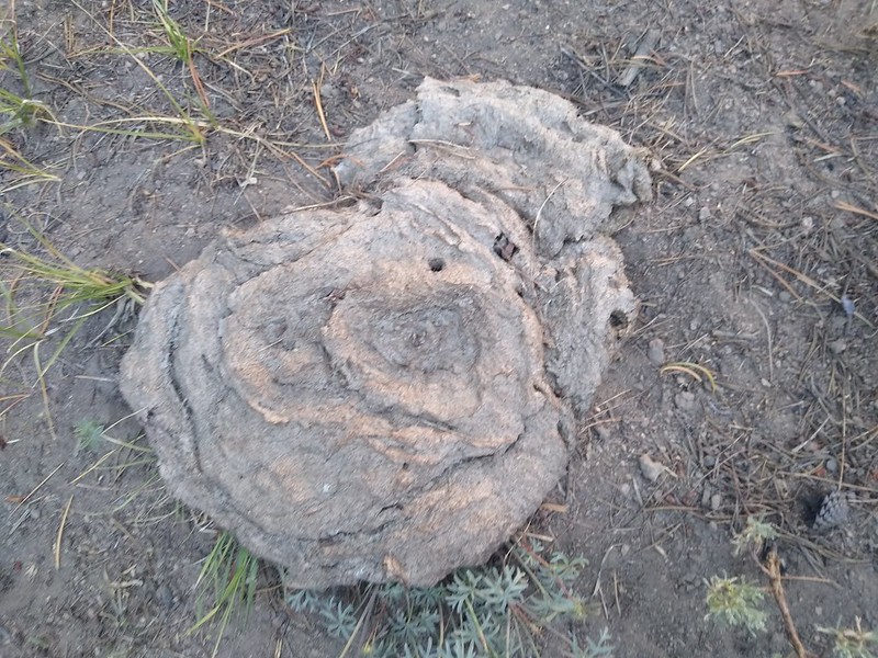
We only had about a mile to hike in Beck Meadow. It was easy, and barely uphill at all, so we made good time. We saw plenty of cow manure, but never saw a single cow. I read that the forest was trying to phase out some of the grazing in the Wilderness areas, but I’ll believe it when I see it. And we discovered the day before that the cows will walk wherever they want, and don’t care about wilderness boundary signs!

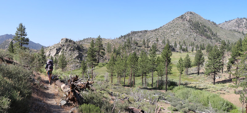
When we reached what I call “Crag Pass” (because Crag Peak is right next door, and Crag Creek heads south from there) we discovered a number of downed trees. It looked like they had all burned many years ago in a forest fire, but it had taken the strong winds of the day before to send a number of them to the ground. Directly across the trail, of course. We were the first to pass by since the event, and it fell to us to try to clear a bit of a path through the dead trees. We broke branches where needed, and dragged entire trees to one side when they weren’t too heavy. But most were very heavy, and often we had to find a roundabout route to avoid them. They went down like dominoes in that wind.


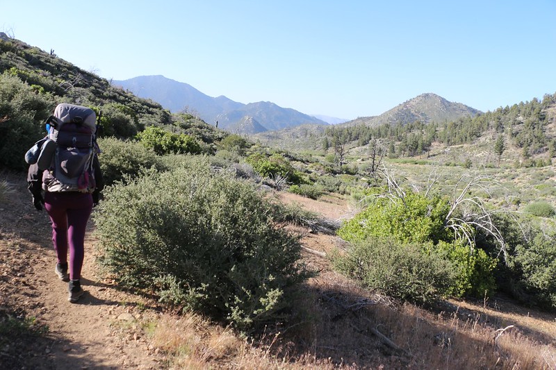
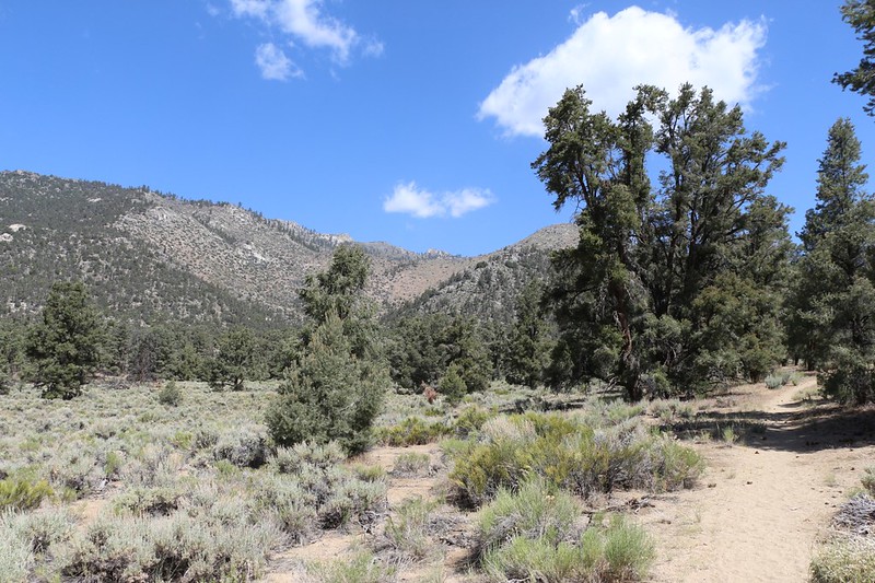
After the pass, it was going to be downhill all the way, for seven long, easy miles. Next stop: Clover Meadow, which was quite a ways down Crag Creek. It was very dry country in this canyon, with lots of scrubby chaparral. It was more like Southern California than the Sierra Nevada. It looked like the sort of place that was roasting hot all Summer long. And here we were, at the end of June and the beginning of Summer, with the weather expected to be in the upper 80’s down at 6000 feet elevation in Kennedy Meadows. The sooner we got there the better, as there didn’t look to be any sign of clouds in the sky or shade from a single tree. Meanwhile, of course, it was still freezing cold! But we knew that by noon the temperature would soar almost fifty degrees.
We made it to Clover Meadow, which was still a lush green. It looked very inviting. We also said hello to a single hiker who was sitting in the big camp at mile 710. It was mid-morning. Why wasn’t she hiking onward? Why did she stop here at all? It was only six miles from Kennedy Meadows. It made absolutely no sense. And we never found out the answers to any of these questions. But she certainly seemed comfortable enough. And being in the Sierra for an extended stay didn’t seem like the worst of fates. So we hiked on. Because we had places to go and tasty food to eat!
Soon we came to the crossing of Crag Creek. It was shallow but swampy at the ford, and hikers had thrown down logs and other debris to create makeshift steps so that they could nimbly cross it with dry boots. Also, there were plenty of dense willows down in the bottom of the creek, and it was only by main force that the trail was kept clear. Everywhere else was dry as a bone in this canyon, but those willows were living the California Dream!


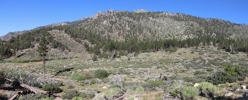
Crag Creek continued east, heading steeply into a canyon on its way to join the South Fork Kern River, but the Pacific Crest Trail had other plans. It headed south with a gentle grade, and we were pleased to note that there was a sparse pine forest along the trail. Shade at last! The temperature had already begun its inexorable rise, and Vicki was back to wearing her usual shorts, while keeping herself cool using the spray hose.

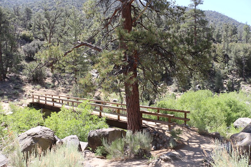
Next stop: The footbridge over the South Fork Kern River. Unlike the arched bridge of yesterday, this bridge was perfectly flat, built on top of two large steel I-beams. We decided that it was also the perfect place for an extended break. Even though it was a bit early, we got out our lunch and ate it right then, mostly so that we didn’t have to carry it an additional two miles to the car.
Video of me walking over the wooden bridge over the South Fork Kern River near Kennedy Meadows
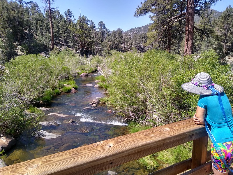
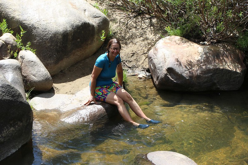
Vicki took an extra long boot-off break as well, and dipped her feet in the nice cool river. Aaahhh! We also met a family that had day-hiked in from the Kennedy Meadows Campground. Technically, the campground was closed due to Covid-19, mostly because the forest service didn’t feel like spending the money and/or driving all that way to maintain it. Luckily, the gate was wide open and people were camping there anyway. As that was what had allowed us to park at the trailhead, I wasn’t complaining.

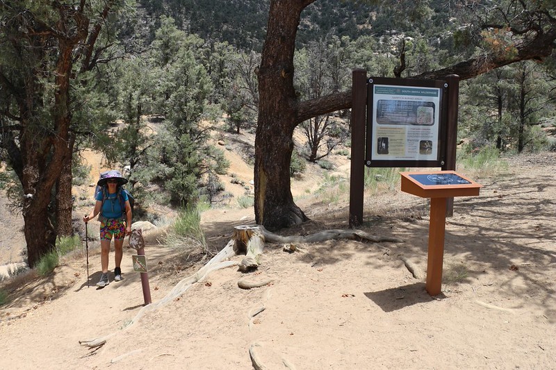
The family that we met at the bridge headed further upstream to play in the river, while we shouldered our packs one last time. Two more miles to go, and it was mostly flat by this point, now that we were in the bigger valley following a larger river. It was also getting quite warm, but luckily a few puffy cumulus clouds had returned to the sky so we got some occasional shade. And there were always a few trees to pause beneath. Just the same, the two miles took longer than we would have liked, and our feet started getting hot, but the miles went by quickly enough. We climbed up the final slope to the trailhead and made our way to the car.

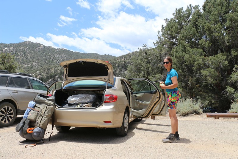
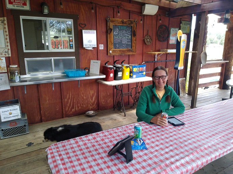
Civilization! We were back. And we were hungry. We changed into clean clothes (even though we, ourselves, were still filthy and stinky) and drove a mile or so to the Kennedy Meadows General Store. This store was well known in PCT-Circles as the last bastion of civilization for the next hundred miles or more. It was like the Gateway to the High Sierra. And it was well known that many businesses, especially restaurants, were suffering horribly due to the Covid-19 pandemic, and we wanted to be sure to support them financially while we were there. When asked, the owners admitted that there were a lot fewer hikers this year, but I was glad to hear that they felt confident on surviving as a business until next year, when, hopefully, things would return to normal. The first thing we bought was an ice cream, which Vicki had been craving, and after that we settled down for tasty burgers from the grill on the outdoor deck around back.

We stopped at Triple Crown Outfitters on the way back to Highway 395, and I bought a new inflatable ultralight pillow because mine had developed an annoying slow leak. The inflation would last a few hours, and by the time I woke with a sore neck I’d have to blow it up again. Annoying. I could’ve bought one online, but I wanted to support the gear store in Kennedy Meadows that so many PCT hikers depend on. After that, it was going to take us two hours and 92 miles of driving to get back to the other car in Horseshoe Meadows, which was more than double the 43 miles we’d hiked, but it sure was a whole lot faster than hiking for six days!
Interestingly, we still weren’t entirely sure whether Horseshoe Meadows Road was even open after being closed due to rockslide from the earthquake that happened six days before on our first day of hiking. As we drove along Highway 395, we tried to check the internet for information, but the only thing we could find were news articles about the closure. So we had no choice but to drive north and hope for the best. And the road was fine, with neither hint nor trace of a rockslide. Apparently, the reopening of a road had no newsworthiness whatsoever. But it was good news to us, and we were still happy to get back to the car.

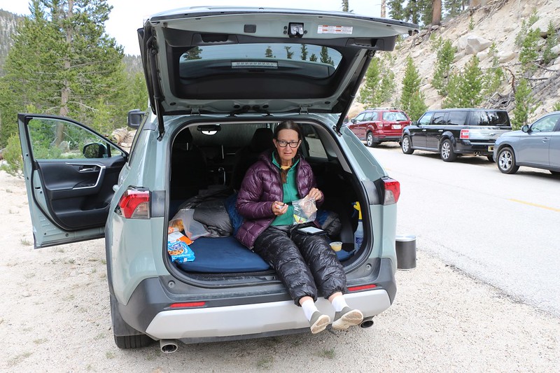
We knew full well that we were stinky and dirty and desperately needed a shower, but we also didn’t feel like driving another five hours that day to get back home in San Diego. So I hiked back up to the bear locker near the campground where I’d left our extra food, and we ate dinner next to the car. It had been almost 100 degrees down in Lone Pine, but it was quite cool up at 10,000 feet, and it felt great to fall asleep in the car under a warm goose down sleeping bag. It had been a long day of hiking and driving.
Once again, we woke up before dawn and got ready to head home. It was easy to pack up, as everything was already inside the two cars. Then we drove down to Lone Pine and bought some breakfast at a fast food place, put gas in the cars, and headed back home to San Diego.
As I drove, I thought about the trip. Did anything go wrong? Did we need to fix any gear? Not really. Aside from the leaky pillow, everything worked quite well. The hiking plan didn’t overtax our abilities. The most annoying part was that the Horseshoe Meadows Campground hadn’t been opened and we had to park a half mile down the road. Not exactly a deal breaker. On the plus side, thanks to Covid-19, we had the Pacific Crest Trail almost entirely to ourselves, as it was typically a superhighway of hikers. We got the campsites we wanted, and there was plenty of water. The views were excellent along the way, even though this section didn’t compare to the High Sierra section to the north. But that was OK, as we’d be hiking that up way in August. And perhaps the best thing of all was that Vicki finally admitted that Olancha Peak was possibly, just possibly, NOT boring. I waved up at Olancha Peak as we drove through the tiny town of Olancha, and thought about the views and the trail on the other side. Ah, yes! It was hard not to fall in love with the Sierra Nevada.
For a topographic map of the hike see my CalTopo Page
For LOTS more photos of the trek see my Flickr Page

